Well, I was going to continue writing up the second tilt of the Great South West Walk, but I’ve decided to take a break for a couple of posts and look at something a little different. How about a mind numbing riveting account of a longish day-hike in the Grampians across the Major Mitchell Plateau instead?
Now, you’ll find this walk in the ubiquitous Glenn ‘Guru of Good Times’ Tempest’s book, ‘Daywalks Around Victoria’. Essentially, the Major Mitchell Plateau walk is the best bits of a three day circuit, which just happens to be packed into one insane free-for-all day. The bare bones are the following statistics. 19.2 km long, rated as ‘difficult’ and suggested time of seven hours to complete. Mm… I’ll return to that later.
If you were attentive you would have noted the first paragraph included the word ‘longish’. I think my write-up for Langi Ghiran is the largest post I’ve ever done, but I don’t want to rest on my laurels, so I’ve decided to have a shot at the title and do a bigger one. This walk certainly deserves it.
Firstly, before we go anywhere near a set of boots, how about a quick quiz? See how you go with the following questions.
A) As the Imperial Guard broke under fire at the Battle of Waterloo, Napoleon was heard to say, “Je pensais qu’ils étaient un peu plus difficile que cela? La seule chose qui leur manque des sacs à main” (I thought they were a little tougher than that? The only thing they are lacking are handbags.)
B) My mother was an unmedicated schizophrenic who believed she was programmed by the Queen for lifetime of misery.
C) I’m so well-hung I buy my socks in threes.
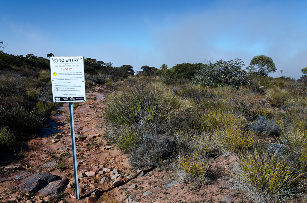
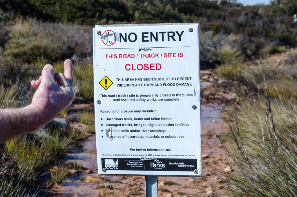
D) The Major Mitchell Plateau walk has been closed since January 2011 and will remain so until further notice.
E) Both B and D.
F) All of the above.
So, as you appear to be flummoxed and scratching your head I’ll give you the answer. It is of course, ‘F’ ‘E’. Yes, my mother was a complete loon and the walk is closed. Is there anything I walk on lately that happens to be open? This walk has been closed for so long that even the closed signs have fallen to the ground in disrepair. Soon you’ll find even they can’t be read due to flood damage.
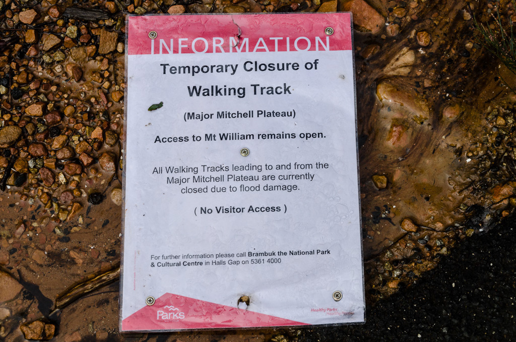
I believe the common definition of ‘temporary’ is ‘lasting for a limited period of time’. Is 18 months temporary? Seeing how the earth is 4.54 billion years old, I suppose Parks Victoria use the word ‘temporary’ by that method? So, if you do decide to wait for this walk to re-open, you’ll find it a lot easier, as you’d use your own personal jet-pack and not have to worry about your feet touching the ground.
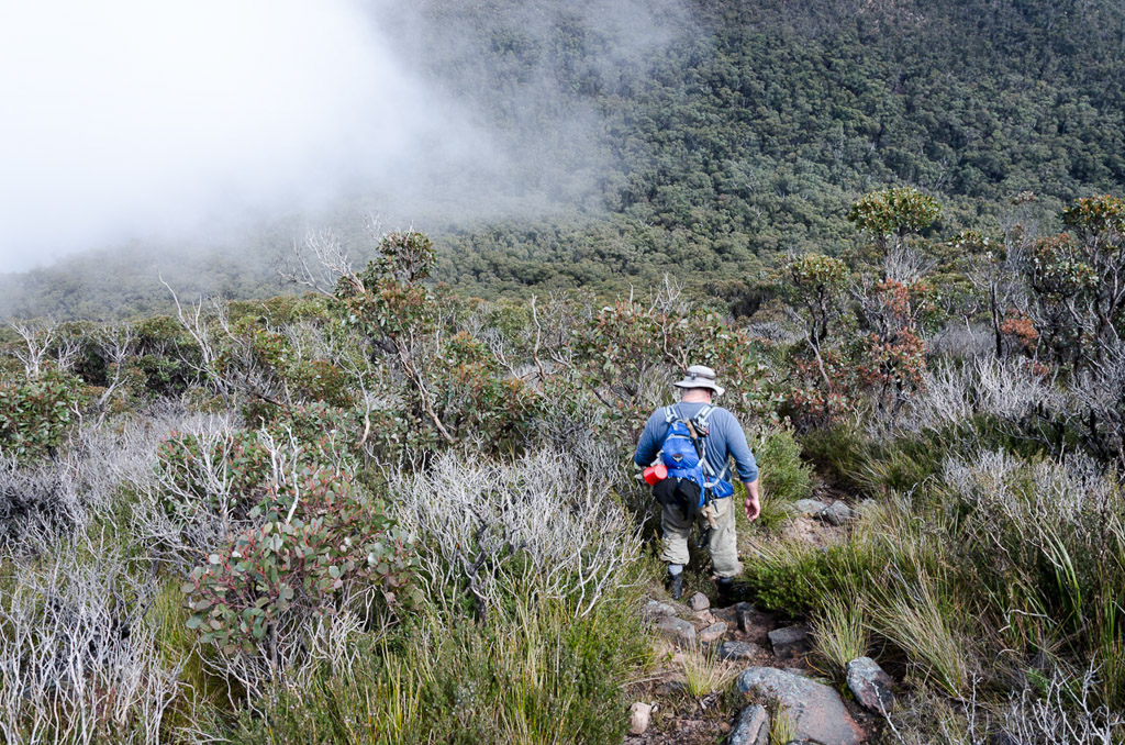
Anyway, so it’s shut, but that didn’t deter Smuffin who was wheeled out for this spring walk, although the date did cause a bit of angst, as it was actually the 1st of September. That’s Spring? Right? I informed him we didn’t have to worry about the weather, as winter was over, to which he replied, “Yeah, there’s such a difference in temperature eight hours after winter finished”. He’s pedantic about these things.
What else? This walk is not a circuit, so we were again utilising Lady Smuffin who was in charge of vehicle duties for dropping off and picking up at the end. Oh yeah, before getting to the walking part, we weren’t sure about water across the plateau, so we loaded up with plenty. I was carrying five litres, which ended up being overkill, as there were points where we were nearly drowning.
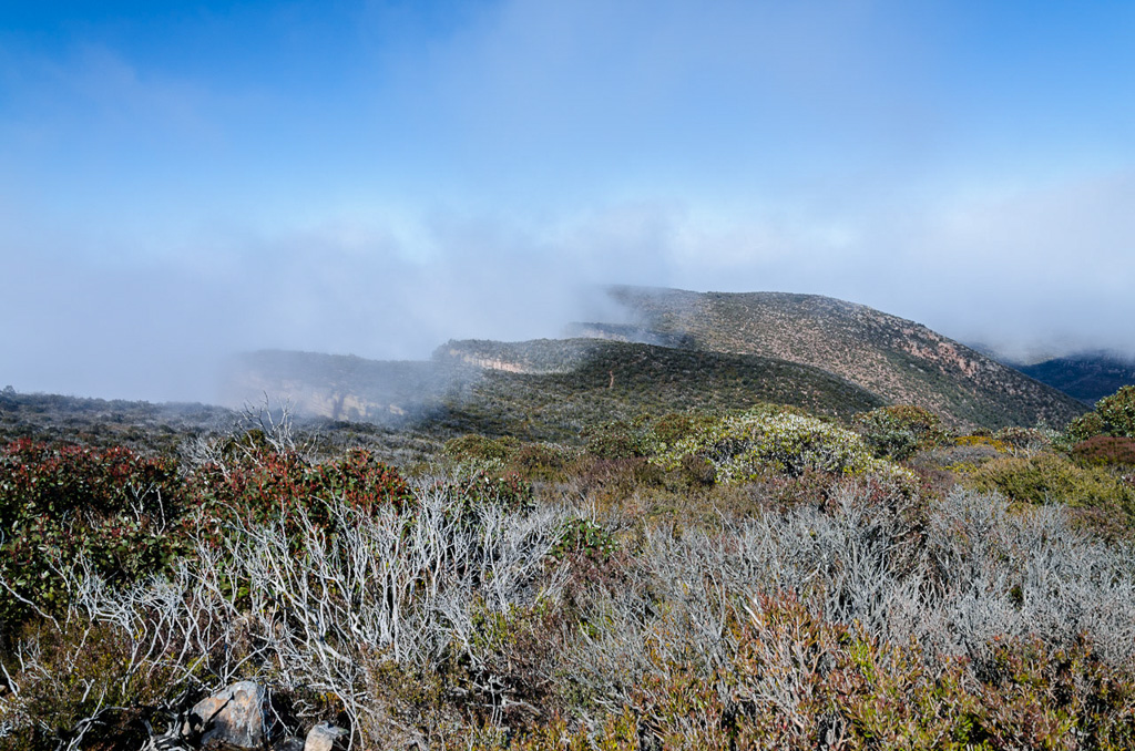
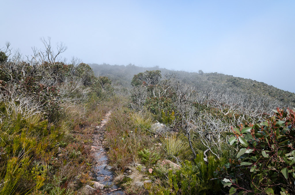
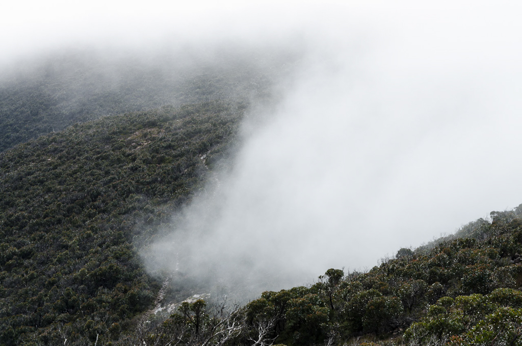
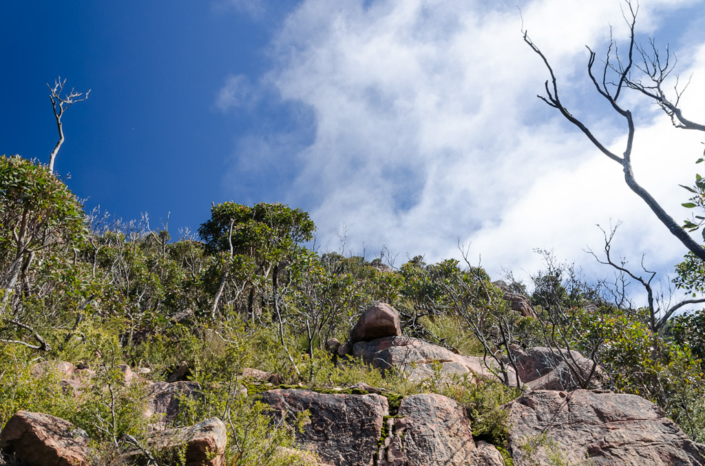
So, on a lovely spring day we were dropped off on the road to Mount William, which is the first interest of the day. The drop off point is certainly high enough to have clouds drifting by one minute…
…and bright sunshine the next.
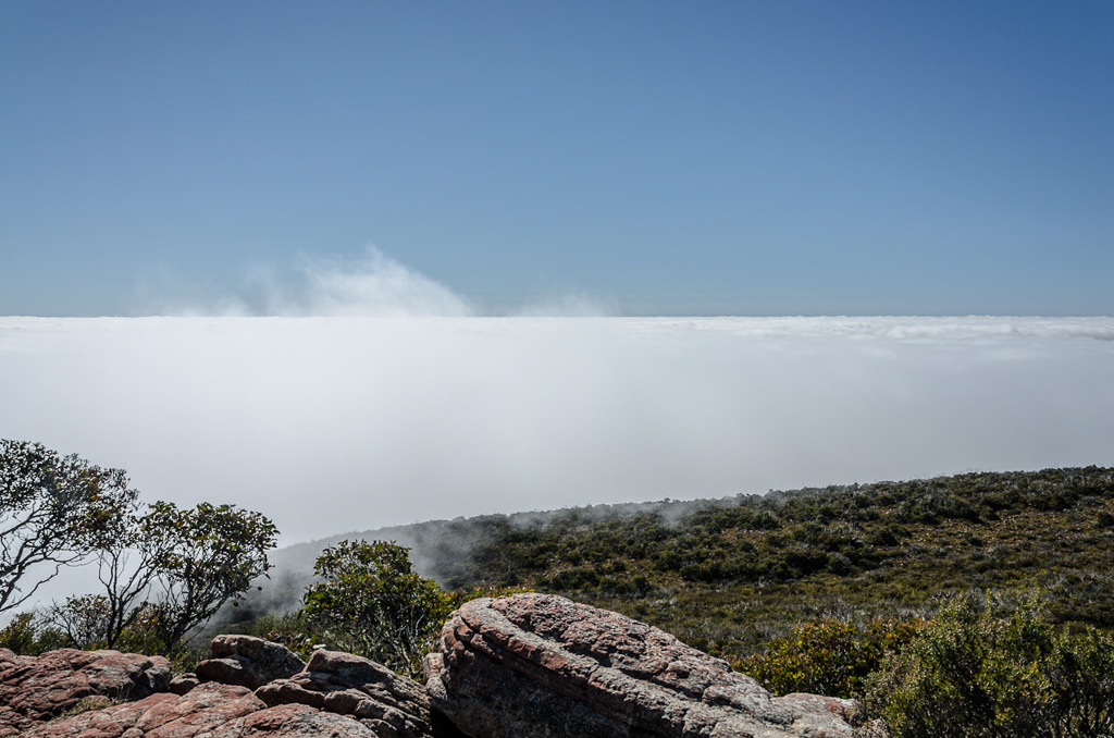
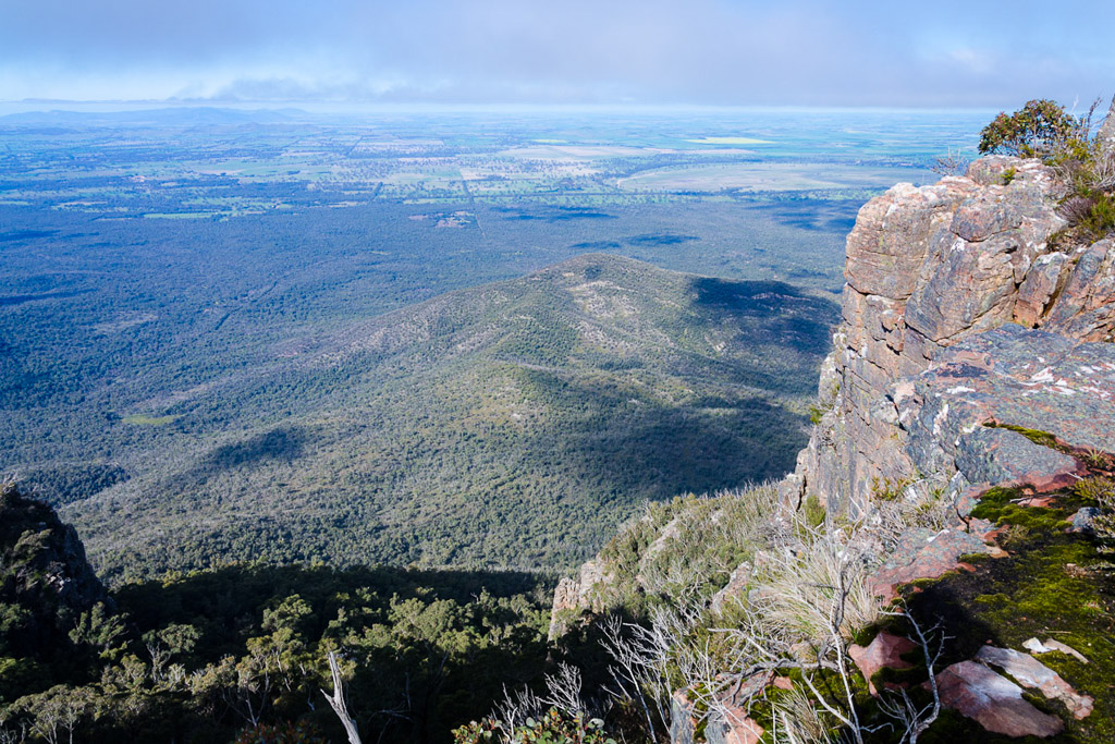
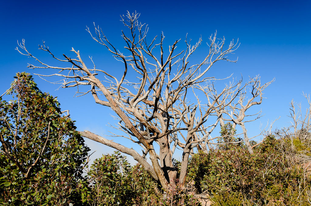
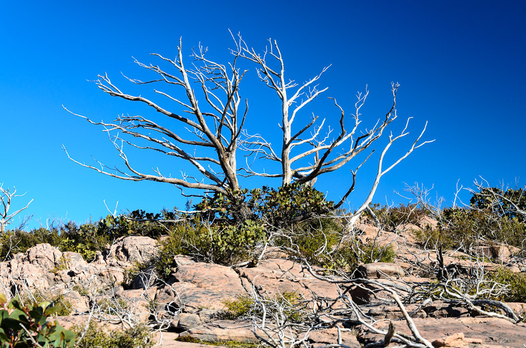
It’s actually a steepish stroll, but it’s very gentlemanly to be on a road leading to Mount William (1167m), which is the equal highest point of the Grampians. Ah yes, but don’t go there expecting a wondrous natural feeling on the summit. There’s the slight problem of this at the top.
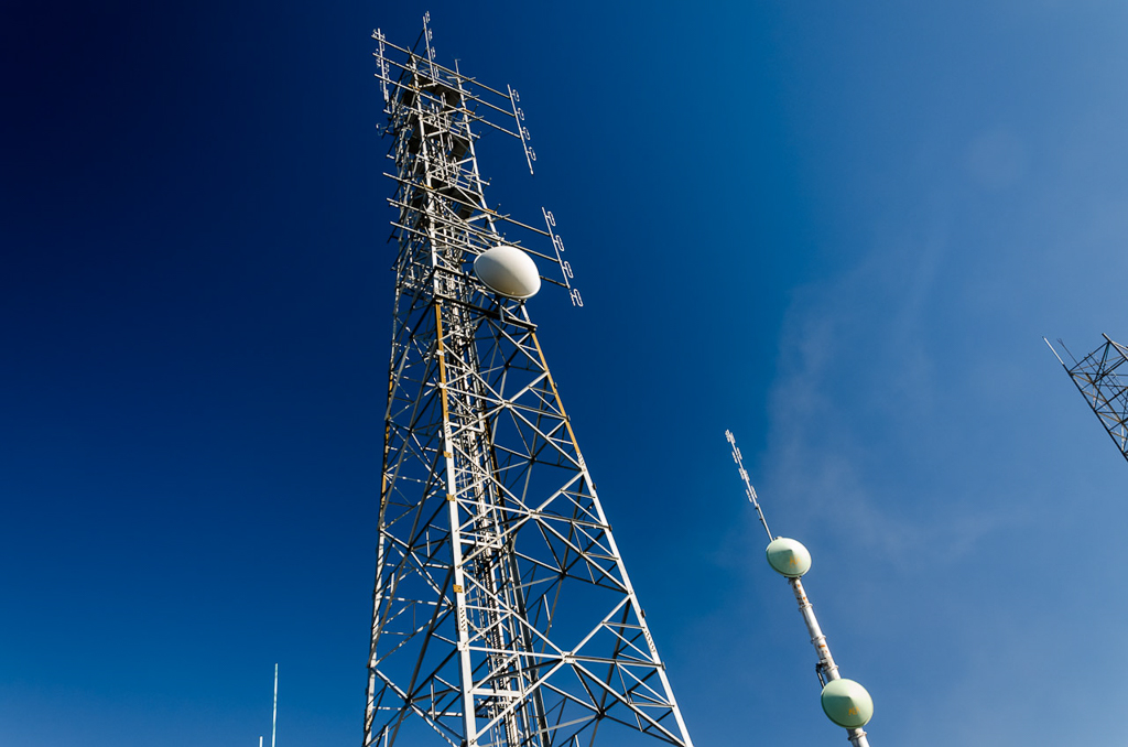
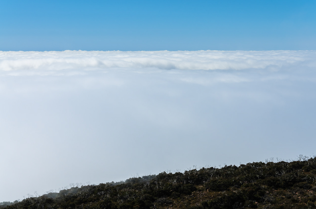
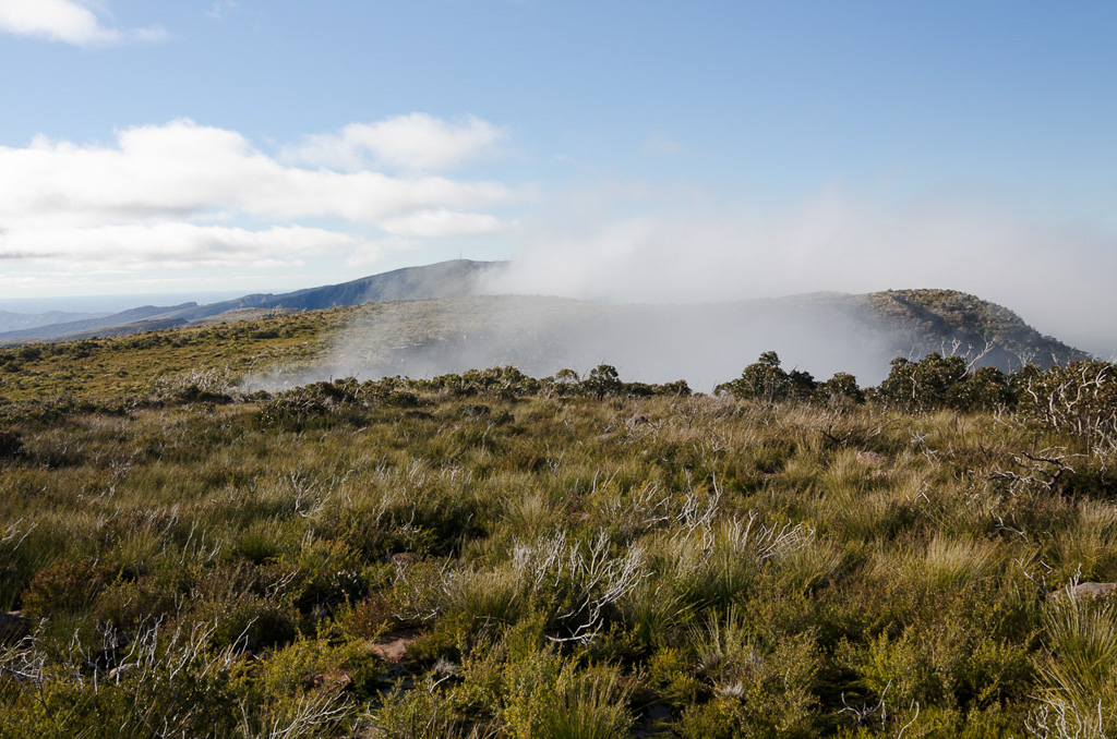
Sorry about the insane blue caused by the polarizer, but in my eyes the main problem is it’s not blue enough. Anyway, the summit does have the odd piece of equipment, but there are some nice views, although I’m not quite sure what I was looking at. I felt I needed a welder’s mask due the enormous glare caused by a solid layer of cloud below the summit. It was the view one would see from an aeroplane and did make for a spectacular sight (if you were there, as the photos look absurd).
See what I mean? What am I looking at?
Yeah, the light is ridiculous and I should have put the camera on the little used ‘atomic blast flash’ exposure setting. Here’s another look at whiteness.
Cloud layer below Mt William
This was the end of the road for the day and the proper walking would begin. We located the track okay, although Parks Victoria are pretty keen in not helping anyone find it. All of the information plaques appeared to have been removed, so we were lucky Smuffin utilised himself as the sign, indicating the direction of travel. Oh yeah, ignore the standard, ‘cock drawn on sign’ which is an old favourite.
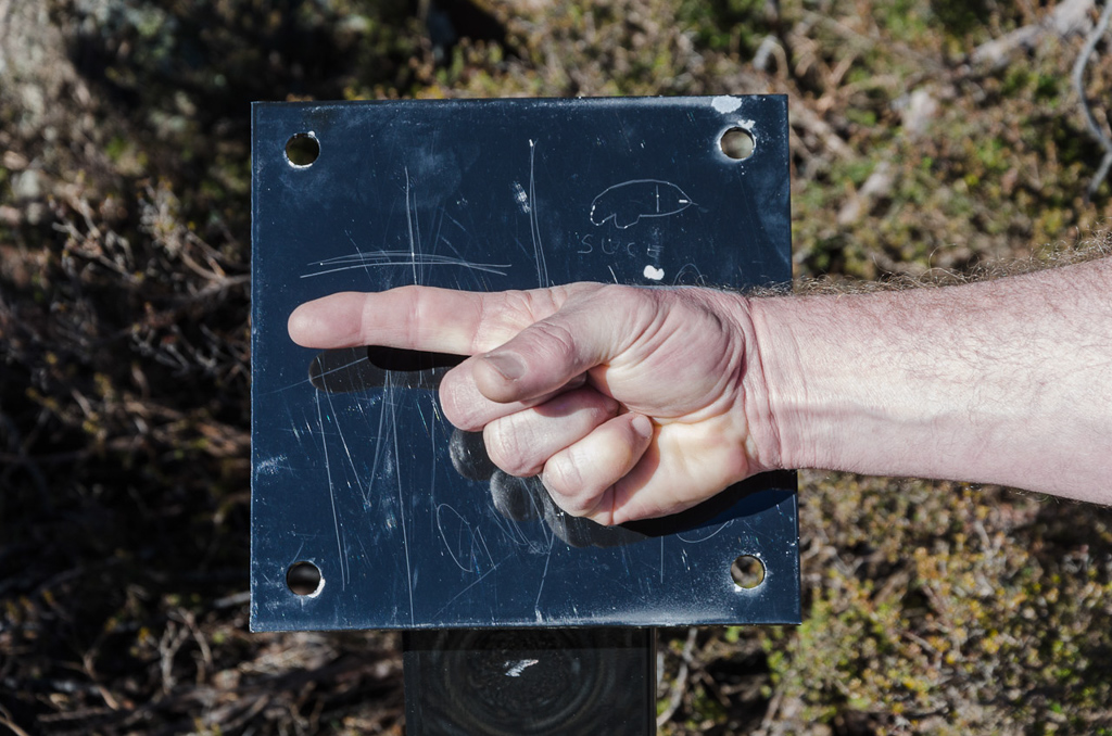
Follow the finger
Successfully finding the track means you’ve officially defeated the ‘no sign’ defences, but that’s not the end as of it, as you’ll come across some more warnings…
…and on the first day of the new season, Smuffin was feeling a little feisty.
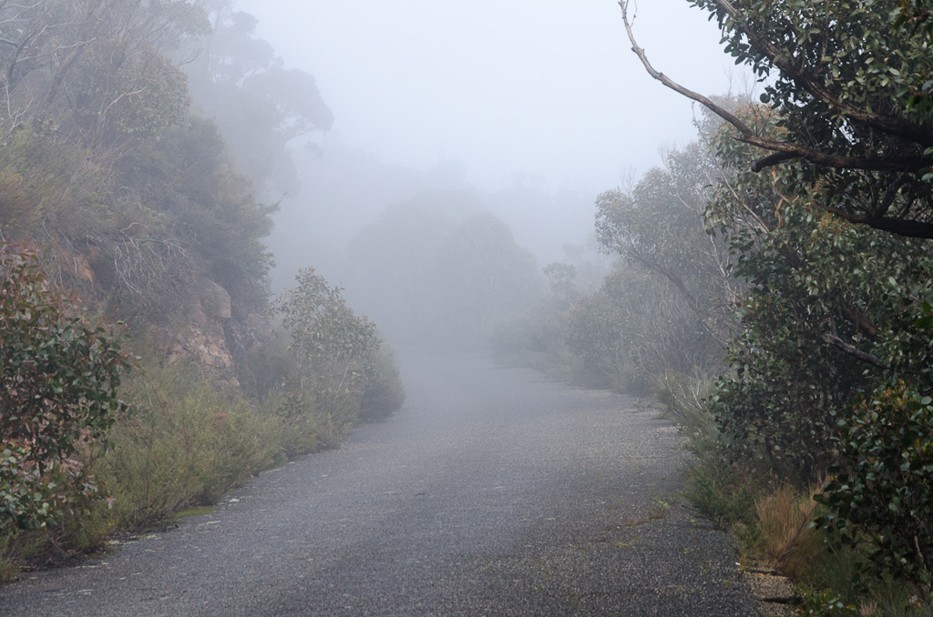
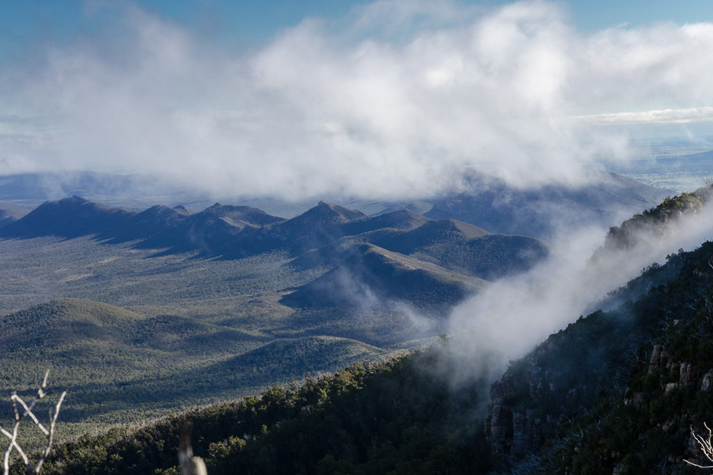
We strolled on, but not knowing what was ahead, I wondered what ‘required safety works’ needed to be done, which has caused the walk to be closed. Was there some sort of cataclysmic bear-pit filled with punji stakes that we’d have to negotiate? Was Tony Abbott out there frothing at the mouth and jabbing passersby with a pitchfork blaming the closed track on the carbon tax? These are the sort of things I was worried about. Being wild men though, we continued on and the clouds continued to roll through…
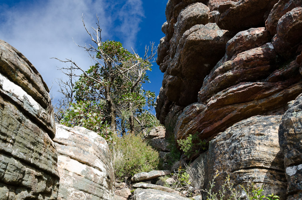
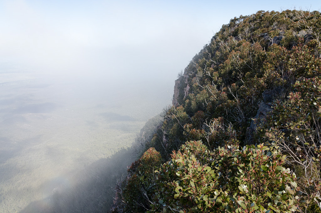
…from the cliffs next to us.
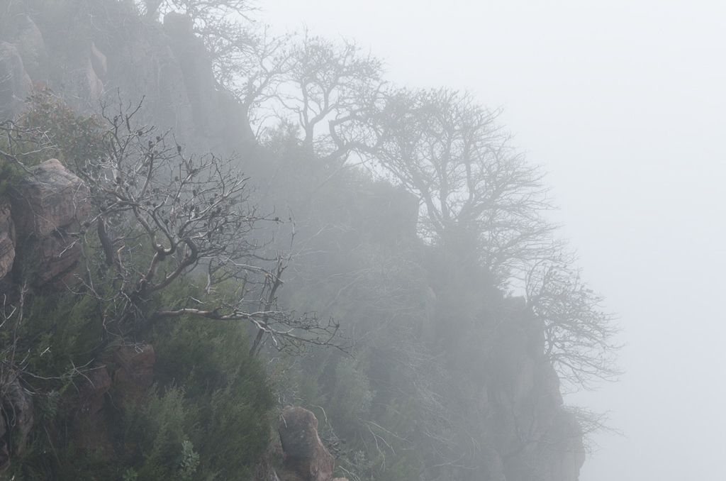
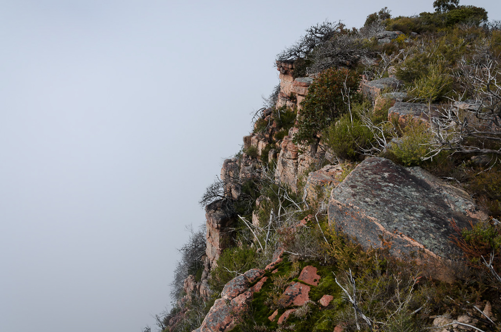
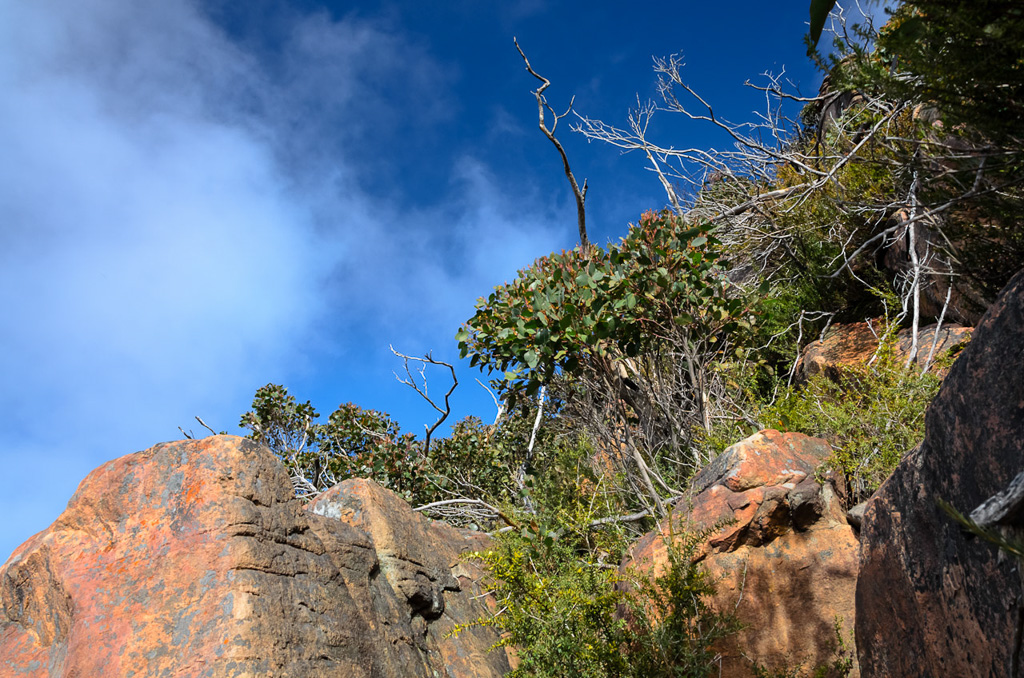
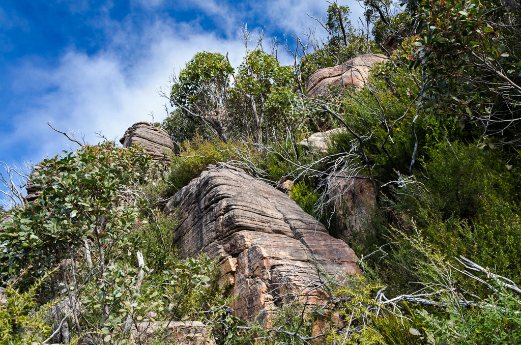
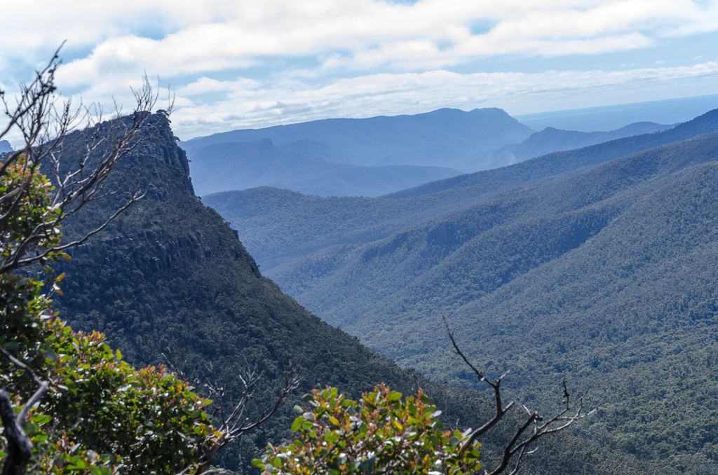
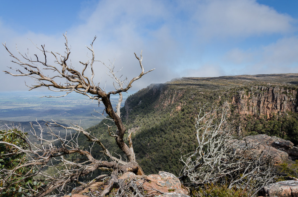
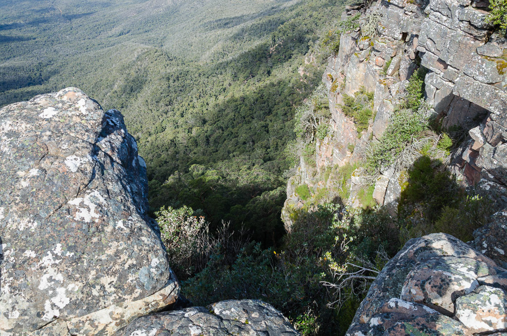
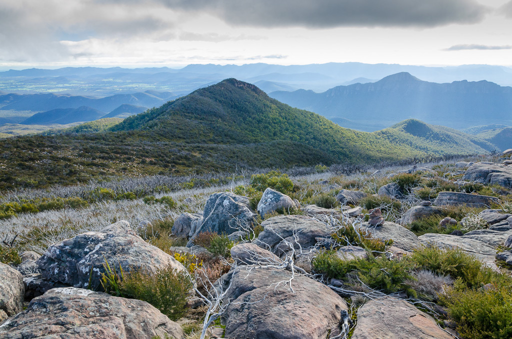
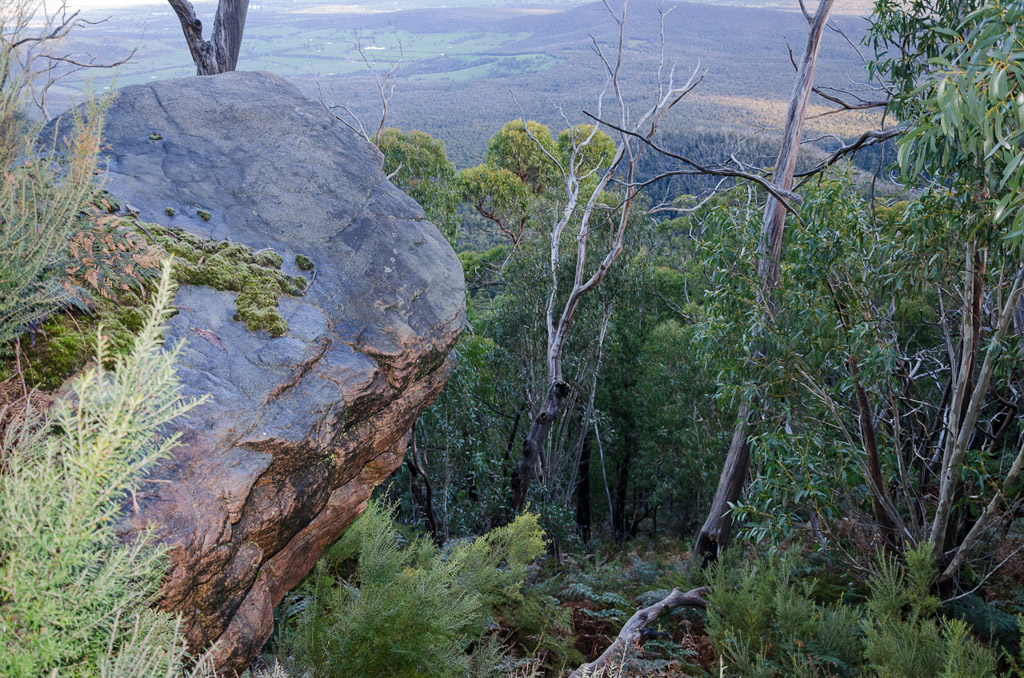
Even with the clouds obscuring things, the views through this section are fantastic. Standard Grampians fair of vertical cliffs by the dozen were along this walk. Not that we could see the ground very often at them.
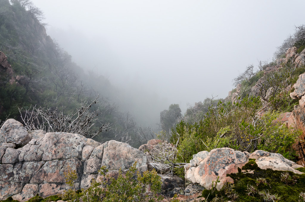
It’s a long way down. I think.
It was on one of these cliffs shrouded in clouds that Smuffin stopped at to have a look and as I approached to where he was standing I stumbled a little. I did manage to regain control instead of slamming into his back and hurling him into the abyss.
It was an ‘interesting’ moment and if he’d gone over, I informed him I’d completely lie at the subsequent coronial inquest by saying, “I’ve no idea what happened. One minute he was there and the next he was gone!” Upon hearing this Smuffin said, “Prick!” which means, “That’s okay Greg, I’d do the same”.
There’s something out there. Somewhere.
Actually, the photos don’t really give a sense of scale regarding these cliffs. The drops were long and vertical, not to mention slightly eerie with clouds floating past. Smuffin suggested putting something in the picture, such as my foot to create some scale. All it did though was give me the thought that trying to balance on one leg whilst taking a photo on the edge of an enormous cliff wasn’t the best idea. It was ludicrous, but I did it anyway.
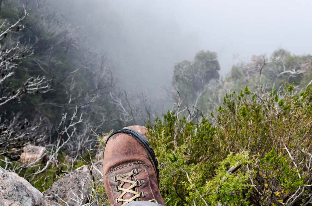
Does this make the sense of scale any easier…?
We survived that cliff viewing and now began an enormously steep descent into Boundary Gap.
Descending into Boundary Gap
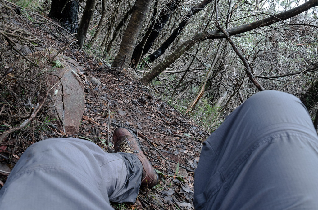
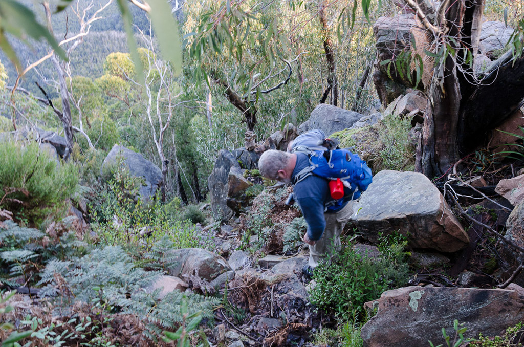
Do you want to know how steep? Well, it was vertical enough for me to forget about taking photos and concentrate on just hanging onto trees as we plummeted back into a forest. The track consisted of wet rocks and tree roots which left me pondering of not if, but when I’d take a spill.
It was slow going and a killer on the knees, but somehow we made it to the gap in one piece. Guess what? Well, as is the way, as soon as the track levelled off and having survived an hour of vertical descent I fell over.
Relaxing when walking can be dangerous, because when I do, I usually tumble. It’s always happened and this was no different. The fiasco way though, is to pause for a moment and take a picture from the point of impact.
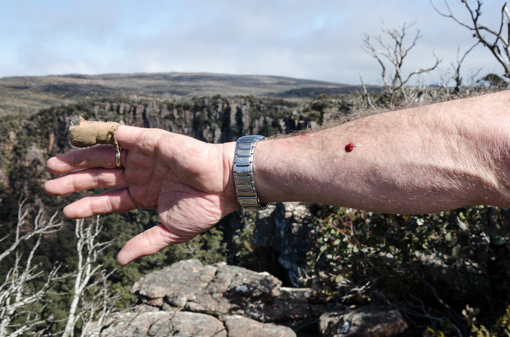
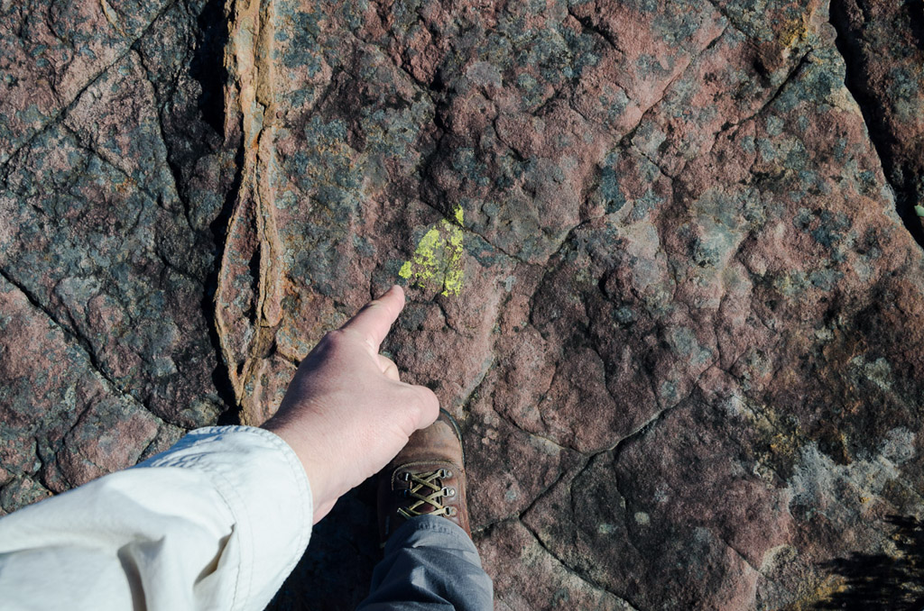
In a pathetic attempt to break my fall, my hand hit the ground pretty hard, but I was impressed to see that there was no blood. Only a bit of dirt.
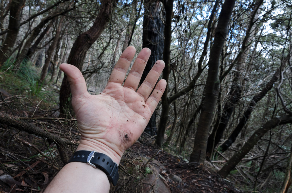
Still alive
We were now at Boundary Gap and it was a chance to relax with a sandwich before the next instalment, which looked like an equally insane steep climb to get out of the gap on the other side to reach the plateau.
In the upcoming section the walk notes mention,
“…you’ll need to scramble up a few small sandstone steps…”
I did wonder what that meant, as the top wasn’t visible from the forest, but we began to climb…
Yes, the camera is level
…and as the trees thinned out we could see a band of scrub and rocks to negotiate.
The clearer view also give us an opportunity to look back at where we had come. The forested hillside in this photo gives an indication of the steepness into Boundary Gap.
Looking back at the descent into Boundary Gap
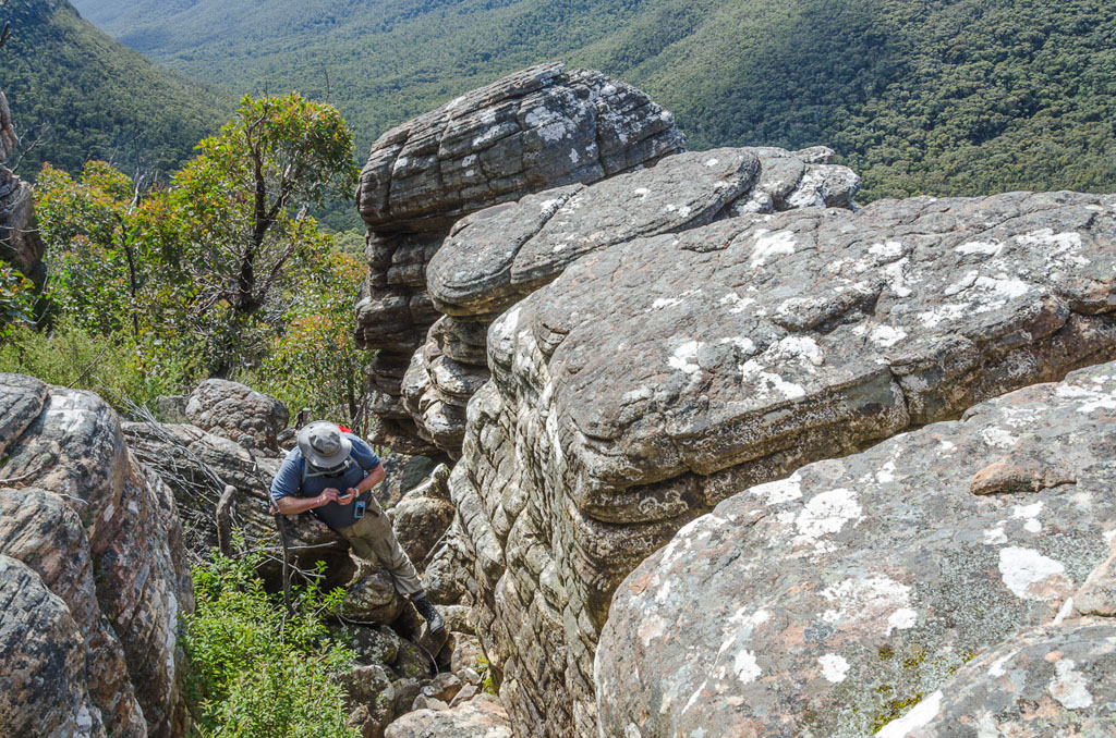
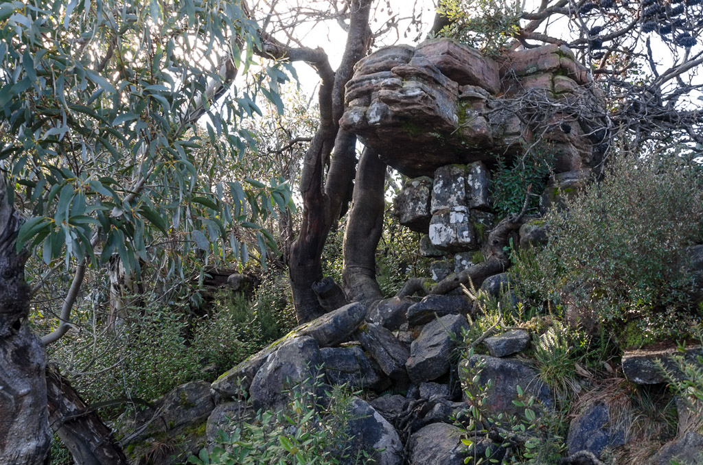
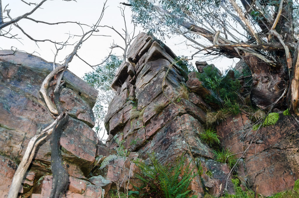
The rough track came to an end at a series of rocks and it was a matter of hauling ourselves up. The route was sort of clear cut, but we found it slow going negotiating the next section.
Looking up at the rocks to climb
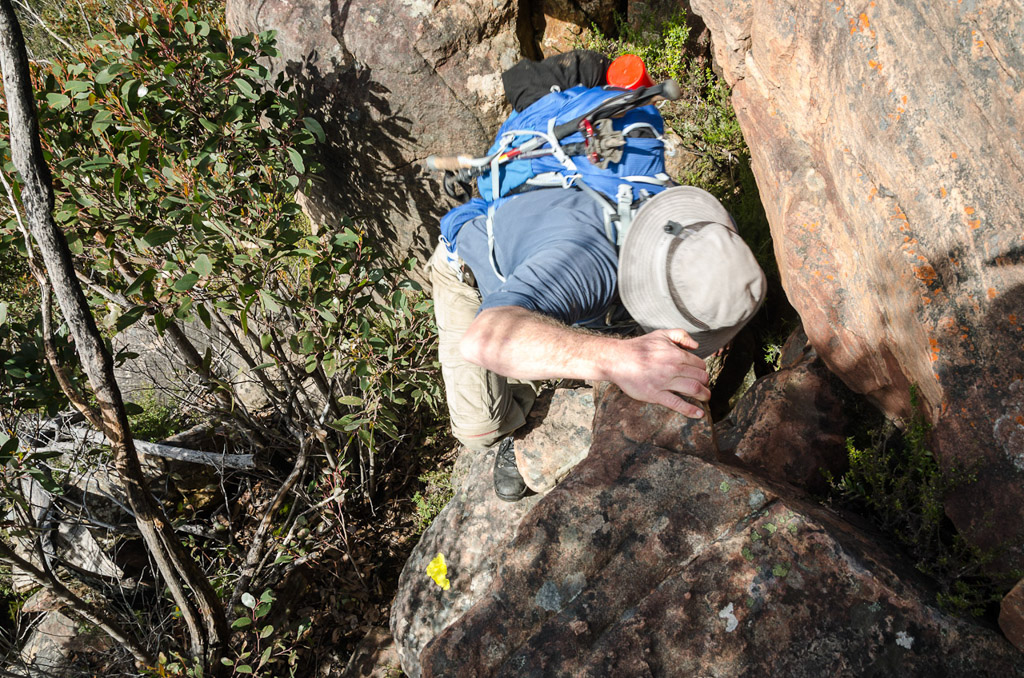
Part of the rock scramble to the top
Mind you, I was taking my time as the view was pretty spectacular.
Views to the west
Views to the east
I really wish I was doing this crap when I was lean and mean in my twenties instead of being fat and friendly in my forties. This took us quite a long time and at this point looking back, it felt absurd the towers on top of Mount William seemed so close.
There’s a reason for this though and that’s because they were. Somehow we’d spent half a day walking and only covered five km of the 19 we needed to walk. Was I concerned about the time taken? No, not really, as I thought once we’d reach the plateau again, we’d make it up pretty quickly. Oh yeah, take note of that last sentence.
The climbing continued, as we weaved around enormous rocks…
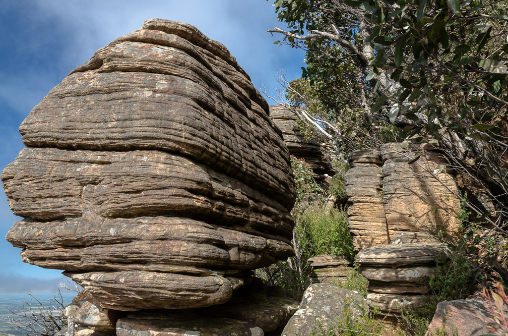
Head up through the middle
Looking back from the last photo
Finally the top was in sight.
Finally we dragged ourselves up and hit flat ground. Behind us was Boundary Gap and the major climbing of the day was done.
The rock scramble was a lot of fun and the only injury was a bit of blood on Smuffin. Then again, he’s bled on every walk I’ve been on, so it was no big deal.
Bleeding. Again.
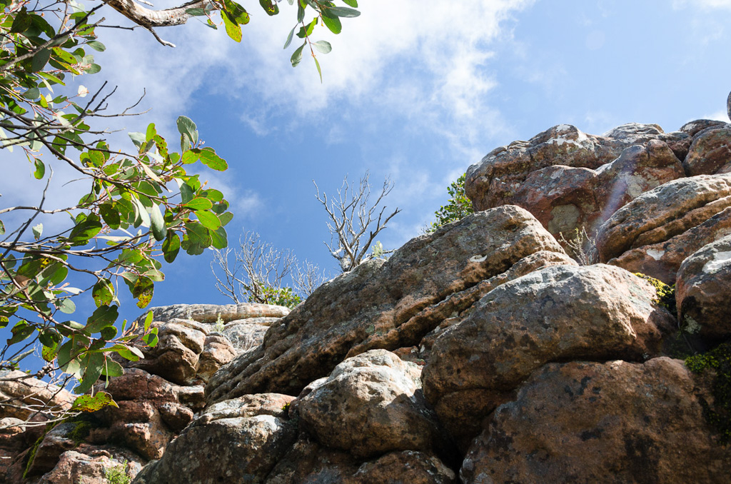
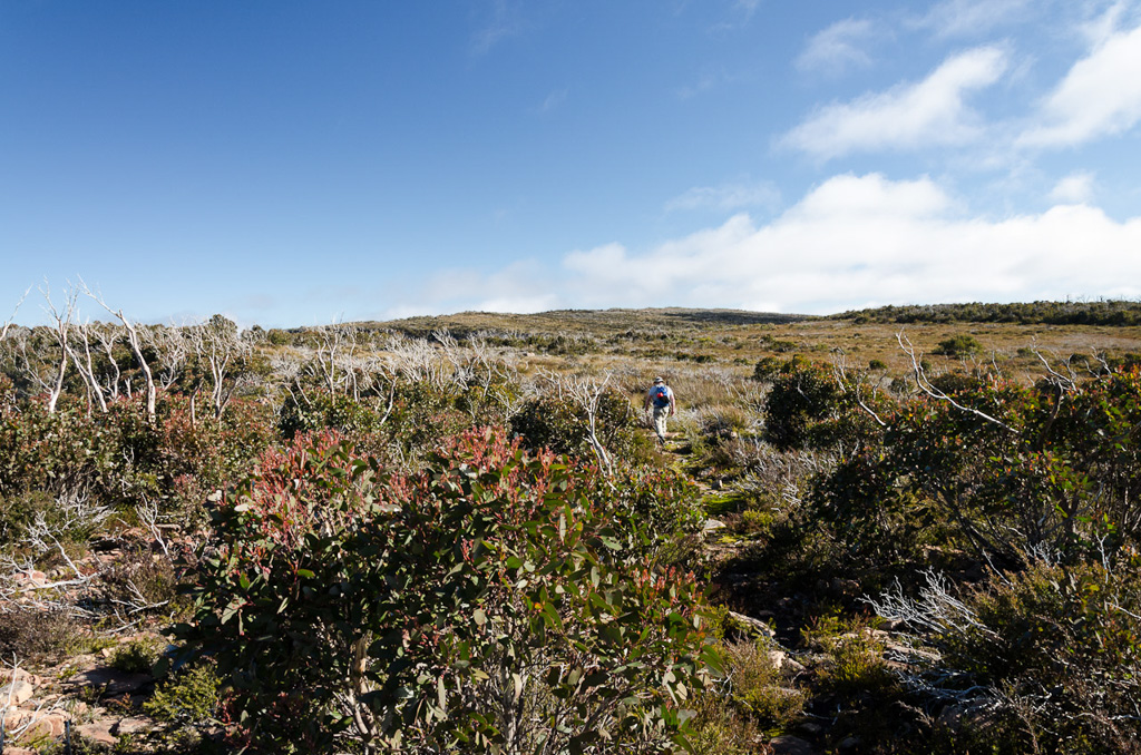
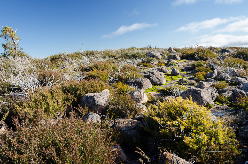
Upon reaching the plateau we had to make up some time. Fast walking was difficult for all sorts of reasons though. The freakishly good views weren’t helping and it was a shame we couldn’t stop for a while to take in the surroundings.
Actually, our pace didn’t really improve much throughout the day. Initially the route ahead is pretty clear, but track markings are minimal. There was this sloppily painted arrow which was one of the few we saw across the plateau.
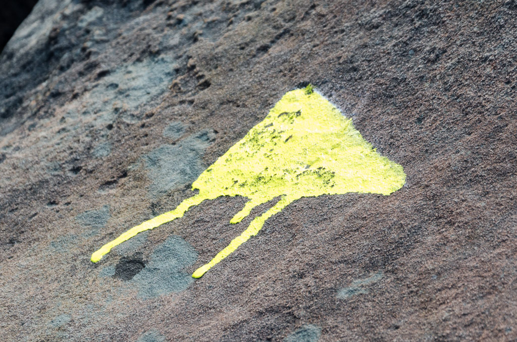
Don’t put so much on the brush
We continued on through sections like this…
…whilst diverting occasionally to look down cliffs.
The topographic map I was carrying details the Major Mitchell Plateau walk as a three day circuit. The ‘First Wannon hiker campsite’ is the first nights stop and we’d aimed to make it our lunch spot.
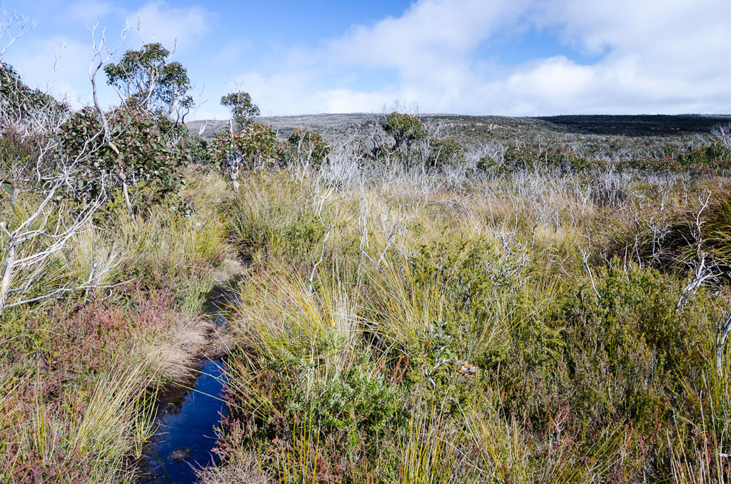
We descended down into the clearing and it would be a great spot to camp. What surprised me was the amount of water running through the creek nearby and if I knew it was that plentiful, I wouldn’t have lugged five litres for the day. It looked pretty clear as well.
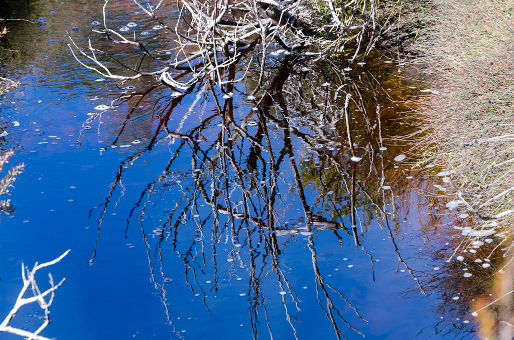
Water at First Wannon campsite
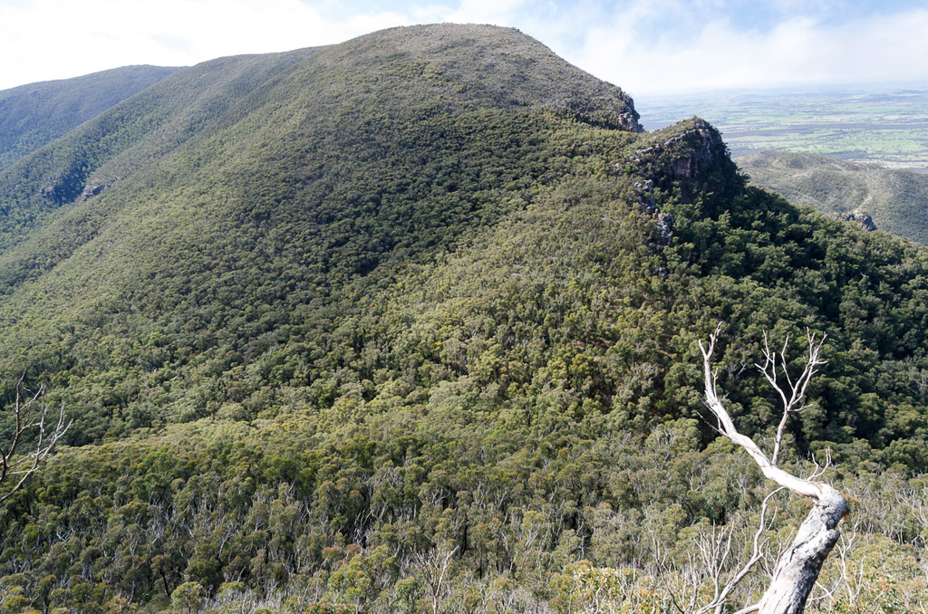
Unfortunately for us, the plan to take a reasonable break went out the window due to our slow pace. We stopped to eat a sandwich, before getting back into it with the next point of interest being the peak of Durd-Durd, which is identical in height to Mount William. 1167 metres.
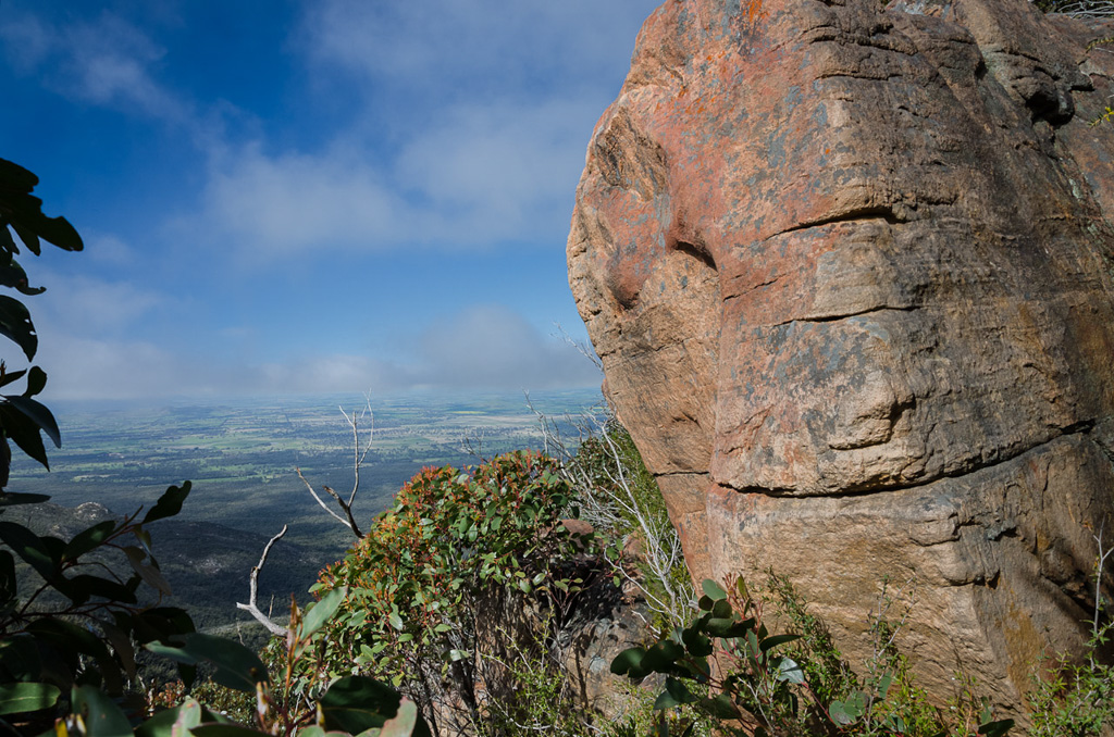
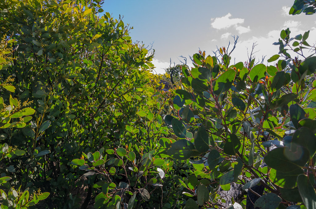
I should mention this now before I forget. If you’re doing this walk and happen to own a pair of gaiters I’d suggest wearing them. The entire plateau is covered with a particularly annoying plant that’s prickly as hell (sure, not the most technical description).
It seemed we were walking through this type of plant for hours and the end result was the front of my legs were covered in small cuts. Yeah, you’ll look more manly like I did without gaiters, but you’re legs won’t be shredded by the scrub. I definitely know what I’d do next time.
There’s a gradual climb out of the campsite area and any thought of making up time were gone, as the route ahead is not the clearest. I had the GPS download from the ‘Temple of Tempest’s’ website of Open Spaces Books to guide us. Mind you, it’s unlikely you’d get lost as one just has to follow the line of enormous cliffs to the east. If you fall over the cliffs then I suggest you’ve become lost. Not to mention dead.
The thing is the terrain didn’t allow our rickety ankles to pick up the pace. It’s all rocks and small scrub to push through with our eyes on small rock cairns placed by other punters to lead us on.
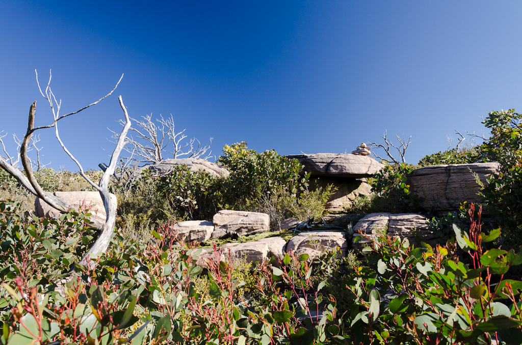
Head for the rock cairn
The other problem was the views and it’s a pity we had to keep pushing as it would have been nice to sit down for a while and take it all in.
We’d find sections of clear ground…
…before suddenly having to wade through trees chest deep.
How many times have I said the views were spectacular? I won’t even mention it any more and just saturate the place with photos.
At one point I was amazed to see a yellow track marker, as I don’t think we’d seen one for a few hours. I think if there’s only one every two hours then they’re probably not worth the trouble? It was such an exciting find, I made sure I recorded it.
We continued on, passing bare branched trees…
…along the rocky ground.
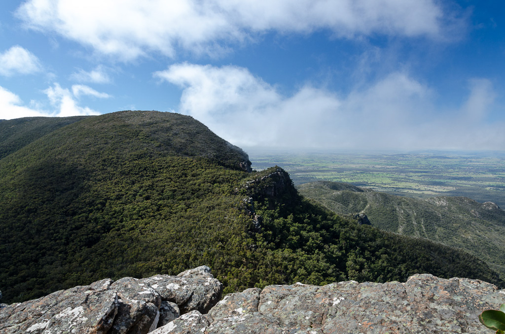
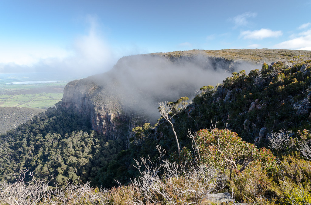
Covered in cloud, the Mount William and Serra Ranges looked spectacular.
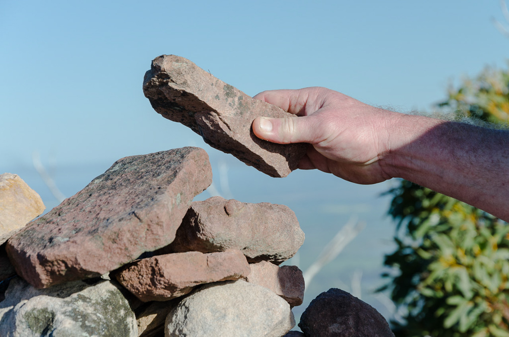
I was wondering if the summit of Durd-Durd would be obvious, as there was no particular peak standing out in front of us. Eventually we spotted a rock cairn which marked the spot…
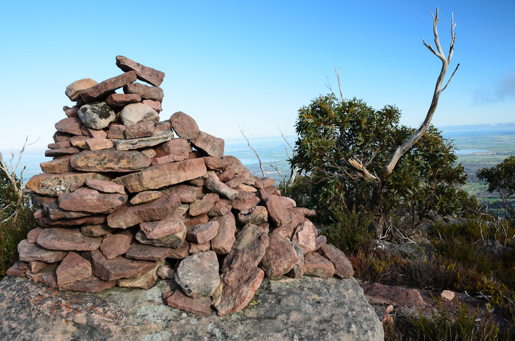
Durd-Durd
…to which Smuffin added another.
We were now at the equal highest point of the Grampians and it was an isolated place. The views were amazing in all directions, but frustratingly for us we couldn’t stop to enjoy them. It was now late in the day and believe it or not, but we’d only covered ten kilometres and had another nine to go.
We still had to negotiate Banksia Hill which sits a short distance past Durd-Durd, but what’s worse, it’s noted as,
“…descent on the other side, however, is very steep and some scrambling may be required…”
So, without even dropping packs we had a quick snack and kept walking with Banksia Hill now appearing before us and amongst a sea of rocks and trees it didn’t appear to be very appetizing.
Next stop: Banksia Hill
That descent mentioned in the notes is not the spot we wanted to be negotiating with fading light, so we were trying to move a little quicker, but it wasn’t really working.
Especially when Smuffin’s phone rang and he answered in case it was a call of urgency, but was greeted with someone in broken English saying, “Sir! Glad to speak you. Your computer has been infected and important to turn it off now and follow my instructions!!”
Smuffin was getting a little fired up by this call in the middle of the nowhere and replied with, “$#@% YOU, C$#^*****R, YOU $#@$%^%$*%^&**” There were more symbols, but I’m running out of keyboard and the diatribe was too long. The end result is Smuffin didn’t turn off his computer.
Remember that business about Banksia Hill not being very appetizing? Well, it was worse than that. There’s no real track and it’s a matter of clambering over boulders, pushing through trees and trying to climb at the same time. Frankly it’s a prick of spot to try and get over quickly. Light was low and if I could be bothered, photos were now being taken with a flash.
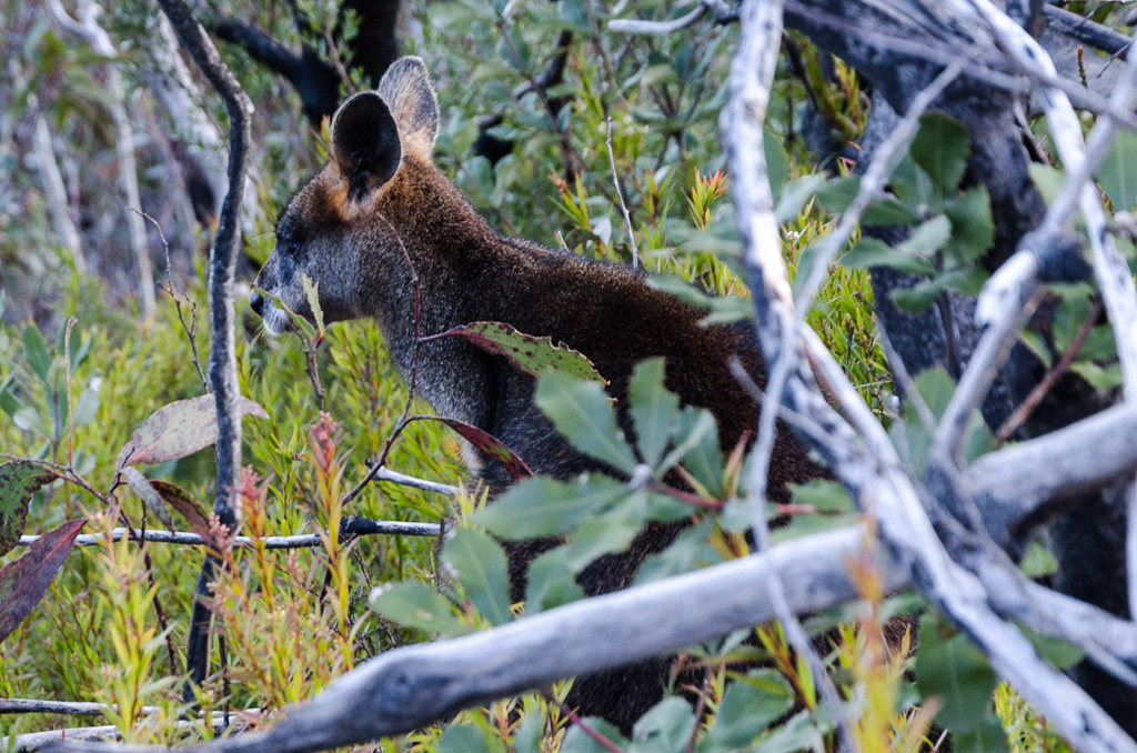
A wallaby stood silently nearby. I guess he was wondering what we were doing there. If he’d asked, I’d have said ‘no idea’.
If there was a track, we lost it through here and started to descend too quickly. We realised this when the ground began to drop alarmingly, so we headed back up and successfully found a rough track that follows the ridgeline down. Well, that was until it also vanishes and a freakishly steep section appears. How steep? Well, it felt like we were about to go down a chimney rather than a track.
I’m not sure how I was going to stay upright, so I elected to use the ‘on the arse’ method which for me was the only safe way down. If anything, it reminded me of the rock bands on the Helicopter Spur which I’d walked up earlier in the year.
On this section, going up would be hideous, but at least one isn’t about to plummet in a limb shredding fall which our descent felt like. Going down was easier on the lungs, but a lot higher in the petrified factor. I took a couple of photos with the flash to take my mind off the trauma.
Looking down…
…and back up.
In the end the chimney levelled off a little and for the first time in half a day, a regular path appeared which led us down to a large clearing below Banksia Hill. It was a relief and we looked back to see the hill bathed in the glow of the setting sun.
Our walk was done and the sunlight faded quickly which meant we had no option other than take a shortcut. We took the Stockyard Track which led to the Mafeking Picnic Ground, rather than the walks intended route to the Jimmy Creek Campground. This chopped off three kilometres, but even then it was dark with our headlamps on when we met up with Lady Smuffin again.
In summing up, I think it’s easily one of the best walks I’ve done. It had it all and the only pity was that it seemed too much to fit in for one day. The overnight hike method would allow one to sit back a bit and relax.
Oh yeah, the main problem with that though is the walk’s closed. It’s earmarked to be part of the long distance Grampians Peak Trail, but who knows when that’s meant to kick off. A few more years at least? A couple more billion? By the way, I mentioned earlier about the signs which indicated flood damage along the way and I guess I must have been asleep, as I didn’t see anything frightening.
Now, do you want to know the bare statistics, which I gleaned from GPS at the end of the day? Believe it or not, but 16.33 km took us 9 hours 18 minutes and we took the shortcut! We were only averaging 1.9 kms an hour and I think if one really wants to enjoy the freakish views then anything up to 10 hours might be a good figure.
Don’t forget I’m talking our pace, but I’m not sure how one gets up to three kms an hour on that terrain? What’s even sillier, is in a post on his blog, Glenn Tempest did the entire thing in six hours. I asked Smuffin where we went wrong and he let me know what the problem was when he found this picture. I think this explains everything.
Here’s Glenn after another hike.

Glenn Tempest

Looks great Greg, nice work. Would love to do this walk one day.
Smuffin is quite versatile isn't he, the rock scramble is all action.
Thanks! It has to be one of the most action packed day-walks I've done for a while. It'd be nice to return on a clear sunny day and camp instead of trying to knock the whole thing off in one hit. That would be my advice to anyone who was heading up there!
Anyway, the Smuffin is pretty agile and for someone afraid of heights, he didn't seem to have much trouble clambering on the edge of cliffs!
Walk the plateau ages ago over two days. Rained the whole time but we were above the clouds in glorious sunshine. Great hike.
Looks like a great trip for a trail run Greg….
Another amusing read and it brought back some good, but dusty memories of a two day trip on the plateau many years ago. I'll have to return one day.
Ian, you certainly had the right idea in taking the two days! If I get back there one day I'd do the same. It's a fantastic spot in calm weather. Judging by the vegetation it must be a pretty crazy place to be in Winter!
I'm not sure I'm familiar with the word 'run'! My return trip will be in half the time I think!
We were lucky with sunshine, but a coolish day. I reckon on that exposed plateau on a hot Summers day to be pretty brutal!
Sounds like a two dayer to me, especially to enjoy it properly. 9 hours for just over 10 miles, sounds like you encountered some pretty harsh terrain! I will omit the running and just stick to ambling 🙂
Yes, 9 hours for 10 miles makes it sound even worse than metric! We're not the fastest walkers, but even if I was I'd not want to do this walk much quicker. There's non-stop sights to see and to do it in a shorter time means you'd miss out on a bit. Oh yeah, give me two days with more ambling any time 🙂
Beautiful photos here, Greg, and a sky so blue I need to lie down now with a wet towel over my eyes. I can see why you rate this hike but yes, an overnighter next time, methinks. Did you see any other walkers on that "closed" track?
Thanks for that! Yeah, even I can see that the blue sky in that tower shot is a little over the top, but I figure that's the sky our eyes would see if it wasn't for the glare. Right?!
You'd find it okay for a day-walk, but speed has never been one of my strong points!
Oh yeah, I guess the advantage of these closed tracks is that there's no one around. No, we didn't see any one on this walk and when I come to think of it I can't remember the last time I came across a hiker on any walk…? It's pretty lonely fair on the trails down here…
I've only ever done the girly walk up Mt William! We found lots of 'closed temporarily' signs in the Grampians just under a year ago – but much as I'd like to blame Tony, I think the fault lies with Julia's policy of siphoning off all the spare cash to post-flood Brisbane at the expense of everyone else affected by climate changing weather events. Scary though it is I actually found myself agreeing with (gulp) Bob Katter's idea of setting up an emergency fund to assist ANY community, no matter how small, affected by natural disasters. Of course this admission means that my true identity can never be revealed!
Yeah, but I was huffing and puffing just doing that 'girly' walk up to Mount William! That road is quite steep! Either that or I've got to do some more training!
Well, Queensland really has been pounded storm-wise over the years hasn't it? Those floods and the two cyclones. Big bucks to get the place in order again.
Oh yeah, jumping on board the Bob Katter train is a big call! I fully understand you maintaining anonymity!!
i recently did 2 walks on the plateau. both days the weather was great and the plateau was on its best behavior, no snow! one day i walked from stockyard creek track down to the tourist rd (with a car shuffle).
here are some pics of what you missed out on on your walk.
http://www.panoramio.com/photo/88766326
another day i walked from mt william carpark out to the wannon creek campsite and back. the creek there was dry as a bone. if u thought boundary gap was tough going down once, try climbing back out of it after a trip to the campsite and back. and when you finally get back up, and u think the hard work is done, all those little up and downs at the start of the walk seem like everest heading back. needless to say, i was pretty stuffed by time i got back to mt william. next time, when kalymna track is opened again, i plan on doing the middle section of the plateau going up from kalymna, across the top, and back down stockyard track. i think it will be the best bit of all of it to be honest 🙂
Wannon Creek was dry as a bone? It shows how warm the summer was then, as it was flowing well on our walk in spring. No, I don't ever want to walk back up Boundary Gap! Yeah, that was steep and it would take me a decade to climb!
Yes, I think you're onto to something with a stroll up Kalymna track and then across the top. Mt William is pretty forgettable with those towers on top, so I wouldn't miss much there.
That whole area was closed when we did our walk, so it's always been a thought to do the entire loop from Sheep Hills car park. Maybe one day!
Thanks for dropping by and taking the time to comment!
there were 2 wedge tail eagles circling above me on the way back up boundary gap. since i was already praying for death due to the steep climb, that wasnt helping me. i felt like they where vultures and they knew i was almost done for , hehe.
im yet to do the sheep hills section. thought i would dump a bike at mt william carpark so i could roll back down the road. another good walk in that area is up the 7 dials 4wd track up to redman bluff. u pass barneys chimney and perch rock on the way. middleton peak is also a bit of a challenge. took nearly 2 hours to go just under 4km to the gap, then pick your way along the cliff to the peak. im trying to do a few of the bigger walks in the park before i get too old and fat, sadly, its a losing battle.
your blog of some of your adventures amuse me. hehehe. have fnu 🙂
Those birds are very attentive to the potential corpse scenario. When I fell down a boulder at Mt Langi Ghiran, I was lying on my back wondering if I'd broken every bone in my body and noticed an eagle hovering above my head! It certainly took my mind off the pain! Impressive creatures. I think I'd do anything to avoid climbing Boundary Gap and yes, the bike in the bushes is a good idea. I've got a friend who does that all the time. I should do likewise more often!
That's an interesting walk that you've mentioned. I might consult the map for that one. I'm a Grampians novice really. I'm hoping though, in the next three weeks to get up there for some more day walks or possibly an overnighter.
Well, the blog is here to entertain, even if I've got to go through a bit of pain!
I've just done most of the circuit; got dropped off at Mt William carpark, camped at First Wannon, then second night at Jimmy Creek, picked up at Sheep Hills. I had a moment… took what looked like the track off Banksia Hill, ended up in a VERY steep gully which I managed to climb out of, then followed the contour of the hill until I met the track again. Walking solo meant I was a bit concerned for a while there. Your photo of Banksia Hill in the sun is exactly what I saw, looking back with the biggest sense of relief!
It's a pretty awesome area though and First Wannon is a satisfying campsite, gentle valley, nice tent sites and a mountain stream, it doesn't get much better. Now that I've scoped it out this is definitely a walk to take a group on, though not with young kids.
Christian.
Ah yes, Banksia Hill! We came off the hill as well for a short distance. I saw what looked like a rough track, which ended up being incorrect, as it was just leading us down a vertical looking slope! Late in the day though and we were trying to move it along. If we had more time we'd have just followed the ridge line like we were supposed to! That section where the track plummets down what looks like a chimney was a lot of fun in hindsight. I'm sure you remember what I mean 🙂
It sounds like you did the walk how I'd like to do it. I wasn't sure what to expect and trying to cram it in as a daywalk spoiled it a bit. Constantly moving, when I would have liked some contemplation time. First Wannon is a fantastic looking campsite isn't it? I've got some time off late July, so I'm almost contemplating giving it another go, but talk about cold!
I loved the walk as well and I can't wait to get back there.
Thanks for dropping by and taking the time to comment!
Great description of the walk! Last week we took 20 teenagers on a school camp this walk, (we're from Adelaide), camping at First Wannon overnight. It was slow going all right, especially with 20kg packs with tents, cookers, sleeping bags etc on our backs. The views and terrain were stunning. There were some tired kids and teachers at the end of it for sure….
Looks like you had your hands full! Good idea to do it as an overnighter. I've been wanting to go back and do likewise, but things haven't worked out! Nice time to do it now as well, as there's plenty of water!
I reckon this could be one of my favourite two day hikes, but pity we did it in one!
Great for the kids to go across the plateau though. In hindsight, I hoped everyone loved it!
Thanks for your kind words and for dropping by…!
Great blog, Greg! I stumbled on it when looking for feedback on this walk, which we did on the weekend just past. Car parked at Jimmy Creek, got a lift to Sheep Hills, walked from there to First Wannon where we camped, then next day walked to Jimmy Creek. Managed it comfortably, but you're absolutely right, it would be good to have more time to take in the spectacular views – and all three of us were a bit unprepared for how vertical the going gets in places. In April, after a very hot summer, the vegetation was looking OK but no water to be seen anywhere.
Hi Melanie, I'm glad you've stumbled your way into here. It was handy looking at one of these older posts, as I just noticed how stuffed up the Garmin GPS file was! Garmin Connect have gone for a new look and it seems to have buggered up a lot of my uploaded files. Grrr…. I've fixed it now though, so if you looked at it, it'll now make a lot more sense 🙂
You did the right thing by camping at First Wannon. I wish we did likewise! Such a lovely walk across the plateau, it was a real bummer having to rush our way across. Yes, there was a handy climb at one point! Those always take me by surprise as usually walk notes gloss over such things 🙂
The stream at First Wannon was beautiful and full of water in spring. Stands to reason though, but it seems these days most walking is easier in spring with the water around. Come autumn, everything is dry as a chip!
Hope you found some other posts to your liking and thanks for taking the time to leave your comment.
Thanks for posting your report. We did the walk in two days finishing yesterday. Campsite at First Wannon in good shape and the descent and climb at Boundary Gap as testing as you mention. Nice construction of new track on the last bit before the Mt William carpark and all the section signs are now back in place. Only two other walkers encountered and the campsite all to ourselves. Water available and a brilliant north wind for the two days to keep the fog and mist at bay. This is one of the great experiences… do it!
Hey there, thanks for your update. I loved this walk, but really missed out with the 'do it in one day' routine! I loved and hated it in equal measure, as I didn't really have any time to soak in the place, constantly on the move and I can barely remember any time stopped! Would still like to get there and do it casually.
What you've said sounds great! I wondered if there was any water up at First Wannon, so it's a plus seeing how it's been so dry lately. I might have to pencil it in for another attempt, but the only time I might be able to really get back is in July and you know how the weather will be up the top around then!
Thanks for dropping by and I'm definitely putting this back on to my 'to do' list 🙂
Must rank as my favorite walk in the Grampians. I went from the Jimmy Creek end, while my partner went from the Mount William end which obviates the need for someone to drop you off. Just gorgeous scenery the whole way. Thanks to this blog I have learned to completely ignore the ubiquitous "track closed" sign and enjoy many fine walks in Victoria and elsewhere.
Hi Sandy, yes, it's a great walk! I always said I'd do it again, but two years later, I still haven't got around to it. There are always things that pop up 🙂 I'm looking forward to the day the Grampians gets the long distance walk which it's missing. Finally link up all of these places, but I haven't heard much about the Grampians Peak Trail lately, so who knows how that's going.
Oh yes, many a closed sign in Victorian walks. I've lost track of the ones I've seen and ignored! Usually at the end of it, I then wonder why something was closed. Oh well…
By the way, nice blog you have!