Check out the date of this walk. You may well ask, “What’s going on?” All I can say is it’s retro time. There’s a couple of reasons why I’m posting this a few centuries since I did the walk. One is I have a new computer, which means I’m looking at old photos and reminiscing as they upload in super quick time. The other is I was meant to walk last weekend, but instead I spent a lazy Sunday on the couch polishing my trousers. I have to write about something to keep the infernal blog ticking over and this will do.
Actually, it’s not before time, as even though this walk was only two years ago, it’s already a bit hazy in the brain. I think Alzheimer’s has kicked in a little early at my place. I can barely remember what happened last week, let alone this hike, so I thought it’s best to get it in print before I’m totally written off. By the way, I’m dreading the day when I go to work and suddenly realise I forgot to put my pants on.
Telegraph Saddle to Oberon Bay was the first day of a five day jaunt around the Wilsons Promontory southern circuit during winter. It was Ben’s first multi day hike and it was only a few days after I’d finished the Great Ocean Walk in Victoria. I vaguely remember being tired when I started and as it was the early days of getting back into hiking, I was carrying kilos upon kilos of crap we didn’t need! I’m not sure how I managed to lug my pack on this walk, as it’s burned into my brain that it weighed a ton.
Okay, the next couple of paragraphs are a complete bore if you’ve just come here to look at pretty photos, or you’re from somewhere like Venezuela and have no intention of visiting Victoria. I need to outline my initial plan though, don’t I?
The intention was to visit during winter, as Wilsons Prom can be an insanely popular spot in the warmer months. The area has every right to be well attended, as it’s a fantastic walk which we thoroughly enjoyed. Was there a plan?
Well, without too much detail, we were aiming to do a circuit and stay at most of the well known camping spots each night, plus one night at the isolated Wilsons Promontory lighthouse. Actually, that wasn’t the plan until I spoke to my lean, mean, hiking machine friend MK who set me straight. The instructions were simple. Stay at the lighthouse and on the first day to follow a route, which was different to what’s outlined by the Parks Victoria walking notes.
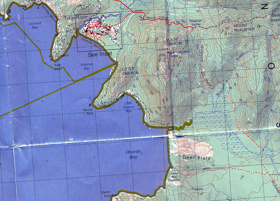
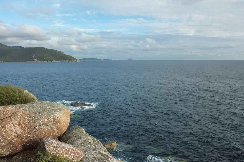
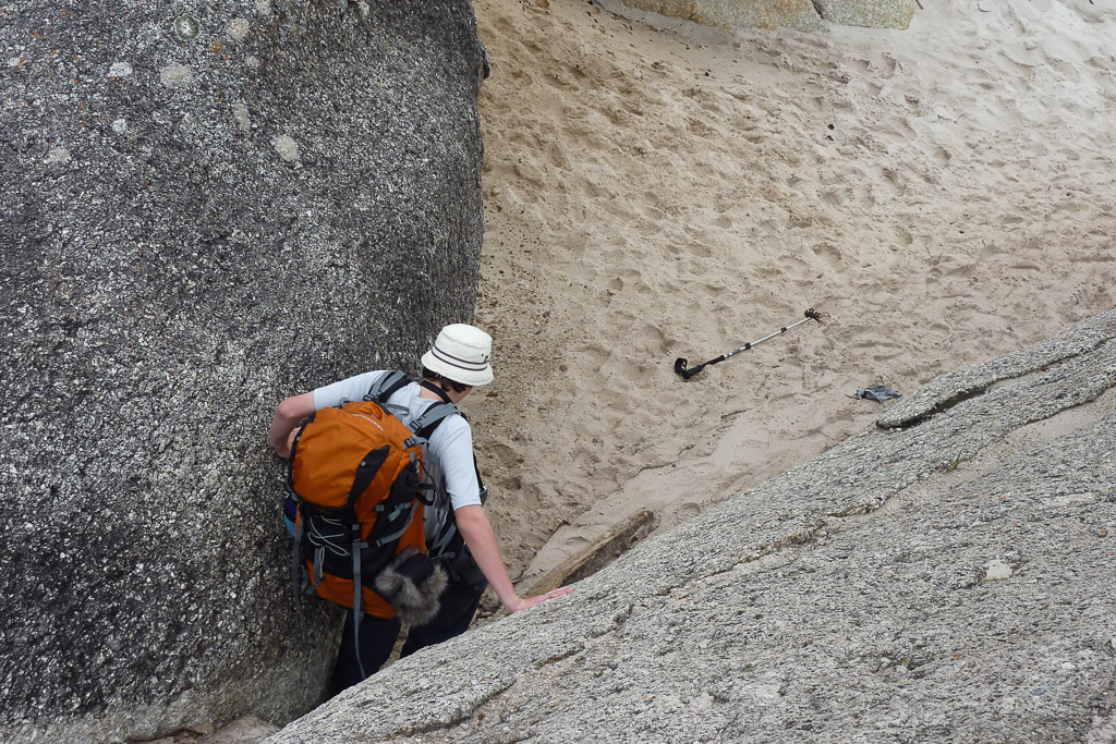
Right, look at the map above. Do you notice how wrecked it is? The damage is not important, so don’t worry about it and concentrate on other things the world’s worst scan shows. My initial plan was to camp at Oberon Bay on the first night by parking my car at Telegraph Saddle car park and walking on the Telegraph Saddle Track with a quick right hand turn to head to Oberon Bay whilst being inland the whole time.
MK quickly informed me I was deluded and the strict instructions were to leave our packs at the Tidal River Park’s Office and then park the car at Telegraph Saddle car park. We then walk on the road back to Tidal River, grab the packs and then follow the coast through Little Oberon Bay and then to Oberon Bay itself to camp. The map above shows the route if you fire up your portable Hubble telescope. MK of course was completely correct and the first day was a nice little walk along the coast without seeing anyone at all. This is a lot of writing. How about a photo?
Have you been on a multi day hike before and some sort of notable news happens whilst you’re out bush and you end up missing all of the hullabaloo? Well, this walk was one of those occasions, as we drove down early in the morning and the radio was announcing Michael Jackson ‘may’ have died. We got the unconfirmed information before we lost the radio station and ended up missing the whole deal.
It’s not the first time something like this has happened to me and one day I’ll be out bush and some killer virus will wipe out the human population and I’ll end up as some sort of beefy ‘Omega Man’. It would have its advantages though, as I could raid the hiking stores and end up with every item of top shelf equipment to prance around in.
I could wear multiple Suunto watches just because I could. Blogging would be difficult though being the only man alive, so I’d have to think how I’d get more followers. Hopefully there would still be the odd zombie around logging on to check out my blog before I hunt them down and lop off their heads (after they’ve read the blog of course. I need the page hits) If not, I’m sure I’d have plenty of time on my hands to work out the problem.
Anyway, we followed our instructions and dropped off the packs at Tidal River Parks Office with the aid of a forklift. We then drove up to Telegraph Saddle and parked the car and made sure we left a special post hike treat in the boot. Yep, a bag of ‘big softie’ marshmallows was going to be the post walk indulgence. On the walk back to Tidal River we passed a large section of the park, which had been burned in the 2009 summer bushfires. That summer had been hideously hot and the fires were large and deadly.
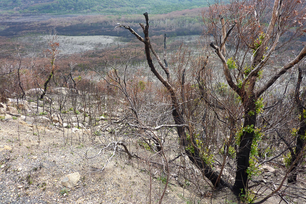
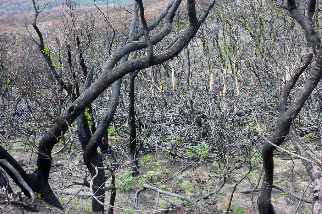
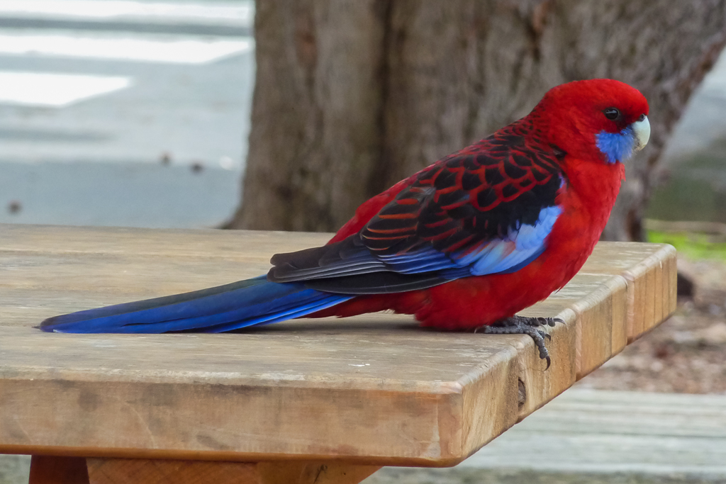
We were lucky though, as most of the burned areas were around Tidal River and we still had plenty of untouched bush to walk through over the next few days. The shop at Tidal River was also our last chance to have some hot chips before heading out. The area was swarming with Crimson Rosellas which were great to look at, until one tried to eat my ear off. I assume my ears look like hot chips.

Crimson Rosella
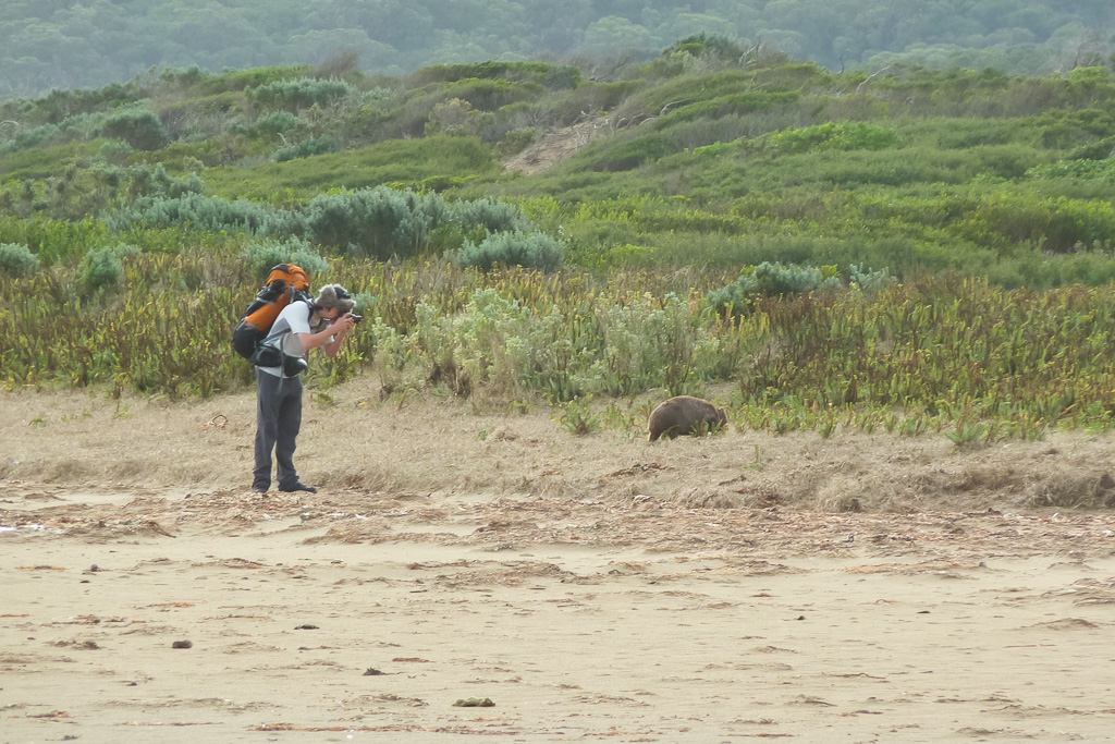
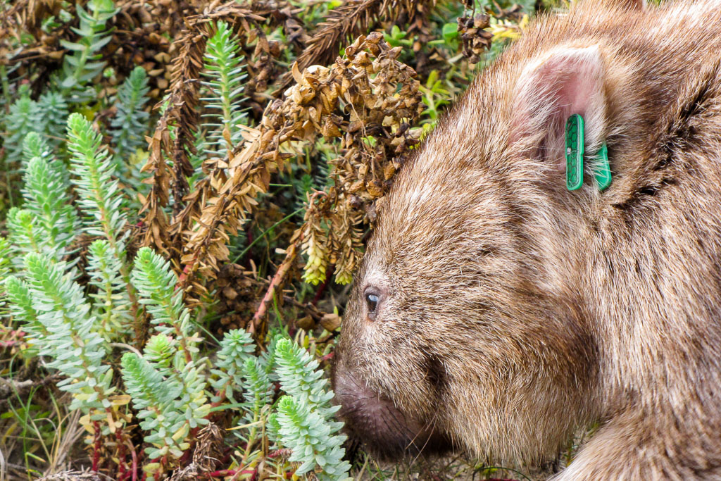
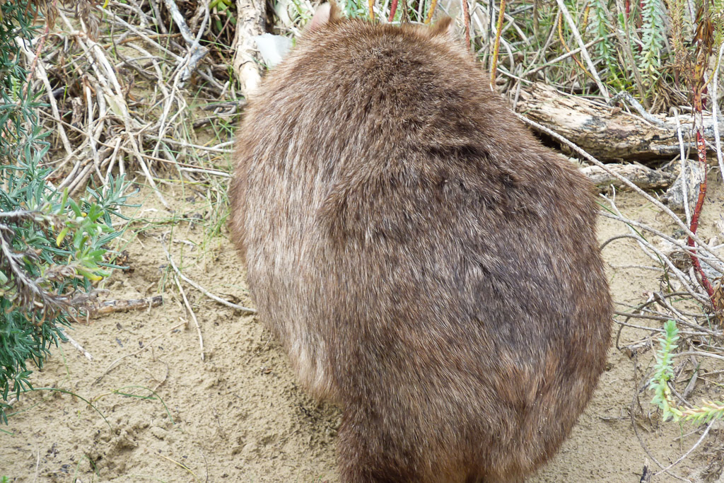
Upon picking up our packs with the aid of a Chinook helicopter we set off towards Norman Bay, which would be our first interest of the day. It wasn’t very far before we came across the deserted Norman Beach and it didn’t disappoint, as there was a wombat walking around the hide tide mark.
Being nocturnal, usually they’re quite hard to spot and I can’t say I’ve ever seen one strolling around a beach before. We tried to get a good photo of him, but as I closed in he took off into the bush and I couldn’t capture his face. Ben did manage to get a facial look, which is a lot better than what I managed.
Beach wombat action
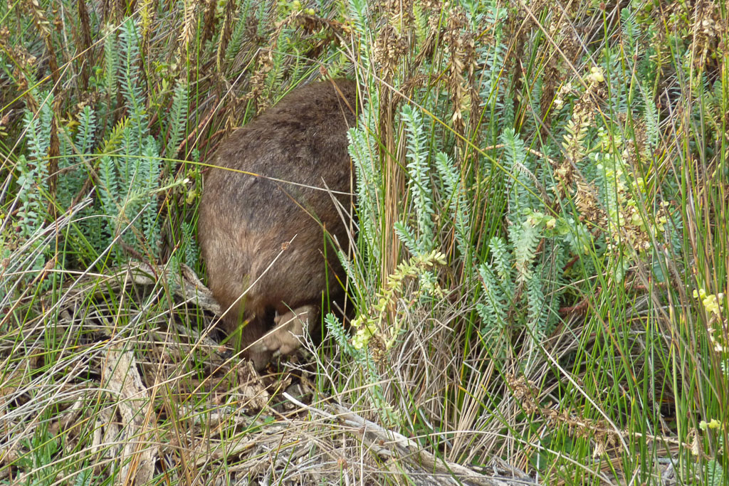
Come back!
Norman Bay
On we continued, rounding a headland until we came upon a turn off, which led to a lookout called Norman Point, that juts out into the ocean. What’s interesting is I don’t have one remotely good photo from this spot and after reviewing these pictures, I wonder what I was thinking. I was using my Panasonic Lumix, as I hadn’t graduated to the DSLR at that stage and the photos were certainly hit and miss. Here’s all I’ve got from this lookout.
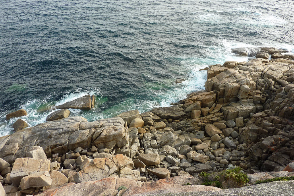
Rocks at Norman Point
I’m not sure what I was after in the photo above as there was actually a fantastic view of a vast expanse of ocean which I somehow neglected to capture. The next picture is about the best of the lot from this spot.
Coast view from Norman Point
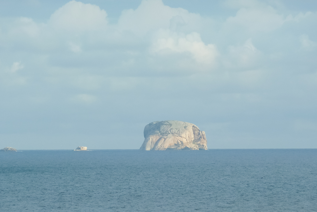
There’s some unusual looking rocky islands off shore and the next picture is part of the Glennie Group. I’m not sure which island it is though!
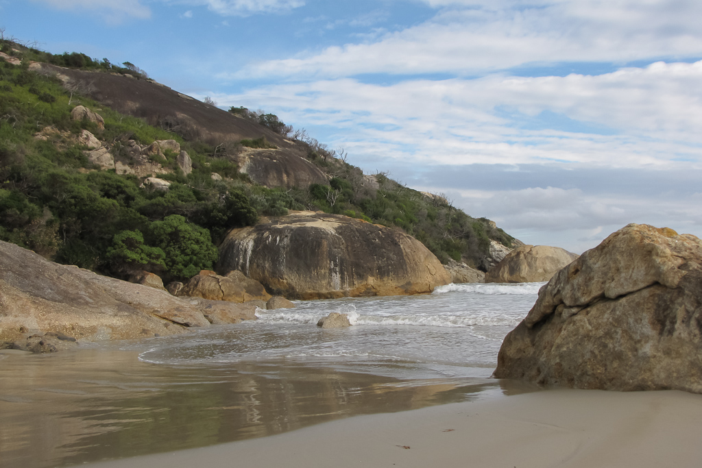
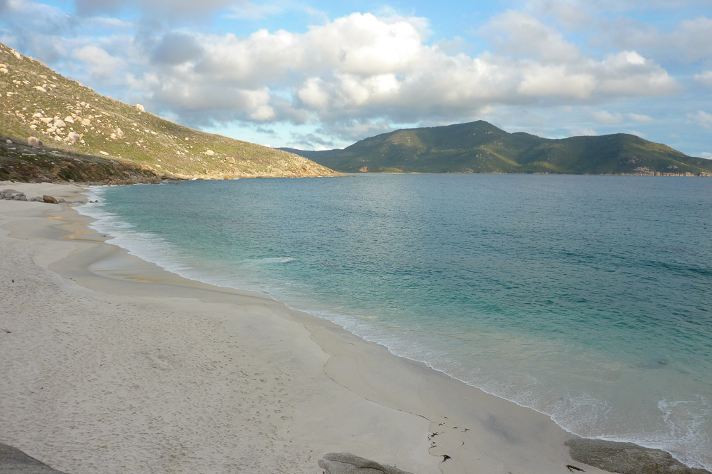
Well, that was done so on we walked with our next destination being Little Oberon Bay. The white sand of the beach and clear water looked inviting and I can imagine it would be a great place for a dip during the summer.
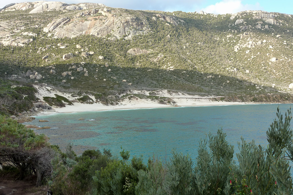
Little Oberon Bay
Getting closer…
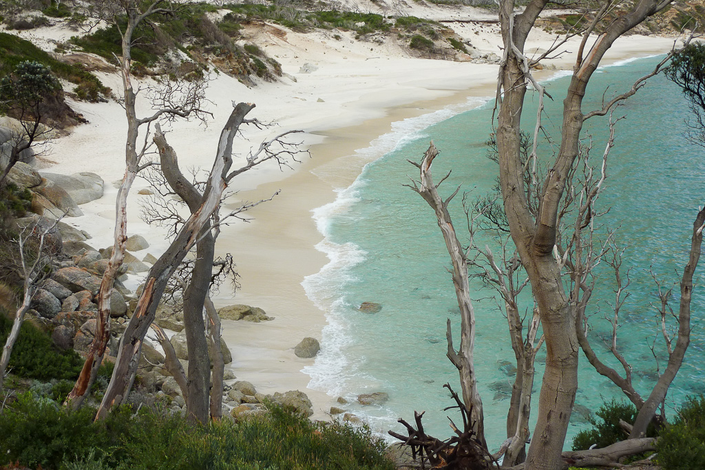
The track led down to the beach and I seem to remember a part that was a little tricky, where we had to squeeze through some rocks (maybe?!) to get to the sand. Where’s Ben when I need him?
What I do remember is it was a lovely spot. We took our time strolling along this section taking in the view.
Little Oberon Bay
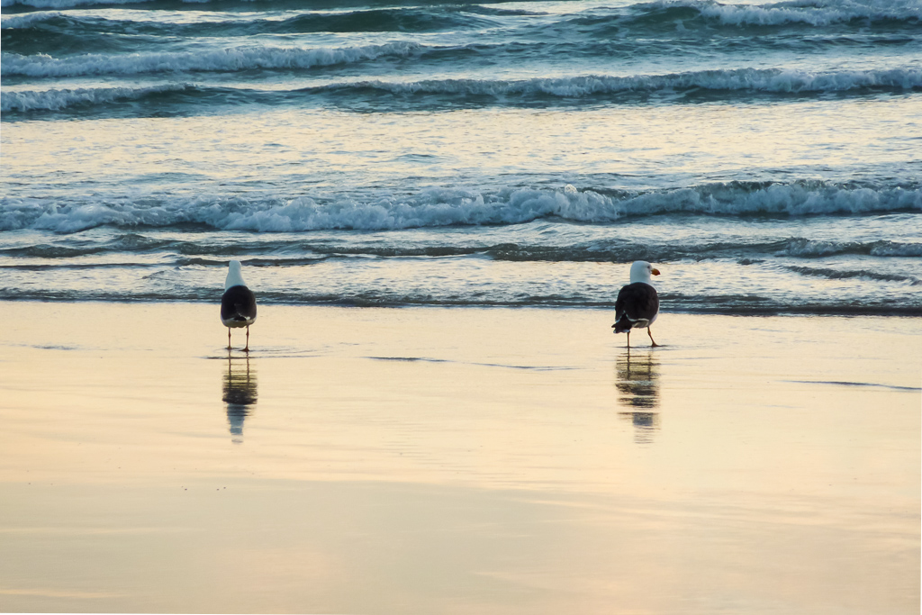
We were walking pretty slowly, which is always problematic in winter with the short day. As the sun began to dip in the sky, we had to pick up the pace a little in order to reach our campsite at Oberon Bay before it got dark.
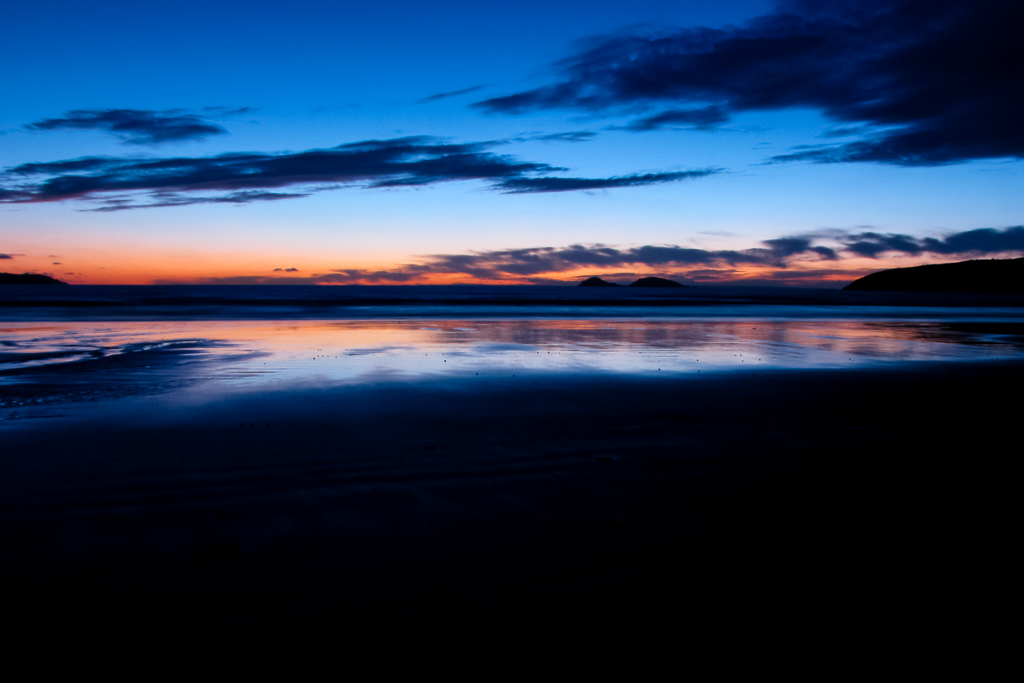
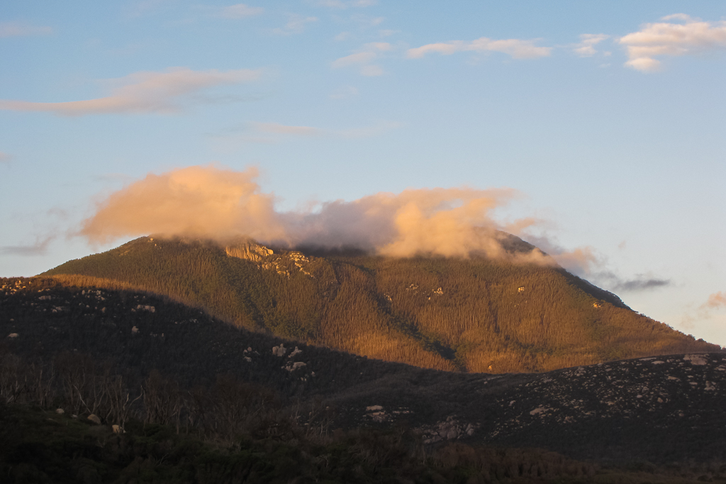
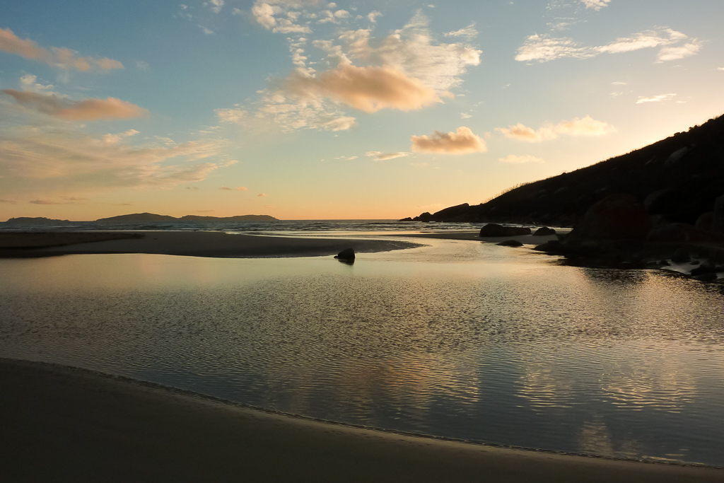
Clearing Little Oberon Bay, we walked around a small headland and then we could see our camping destination. Behind the beach, Mount Oberon was shrouded in cloud as we began to leg it.
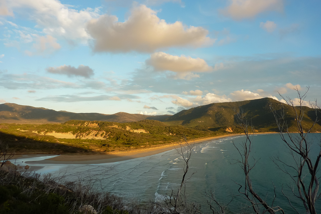
Oberon Bay
The sky was glowing from the low sun as we began the descent onto Oberon Bay beach. The campsite is at the far end of the beach and by the time we got close to it the sky was almost dark. Now’s the time for some freestyle photo action.
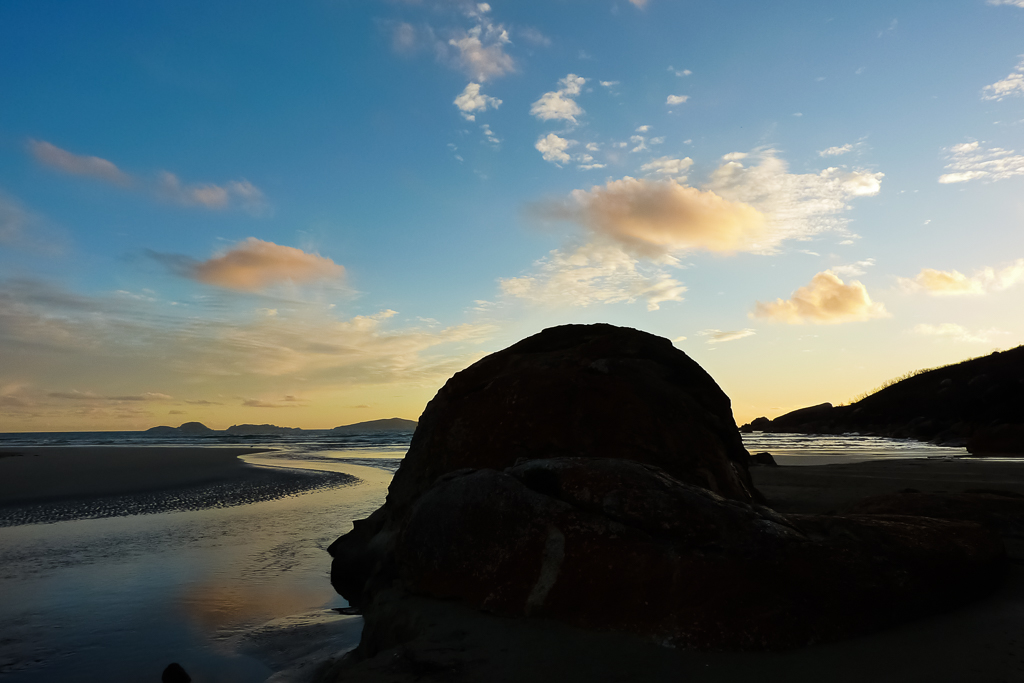
Now Ben began nailing some nice photos as the light faded. I’m not sure how he got these without a tripod. Did he have a tripod? I’ve no idea!”
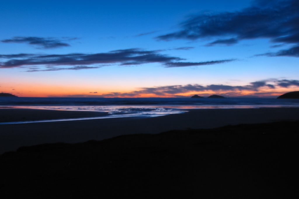
It was well and truly dark when we found our way off the beach and into the campsite area. It was deserted, which suited us fine, but setting up in the dark is never ideal. On this trip we were using a four season tent, which was insanely heavy at over 3 kg and ridiculously overbuilt for the conditions we were going to face on the coast. It’s a three pole dome that could quite easily withstand a carpet bombing from a B-52. Hiking lessons learned are always painful ones.
It was easy to set up though and then it was cooking time. Before leaving, I came across a number of those freeze dried meals by ‘Backpacker’s Pantry’ on sale. I snapped them up and was very interested in the one labelled as a lasagna. Essentially it’s just a matter of boiling some water and tipping it in the bag. How easy’s that to get a lasagna?
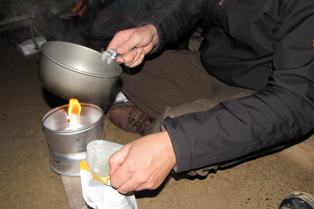
Oh yeah, it’s the Trangia! Fully retro!
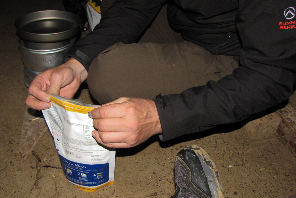
Seal the bag and wait 13 minutes.
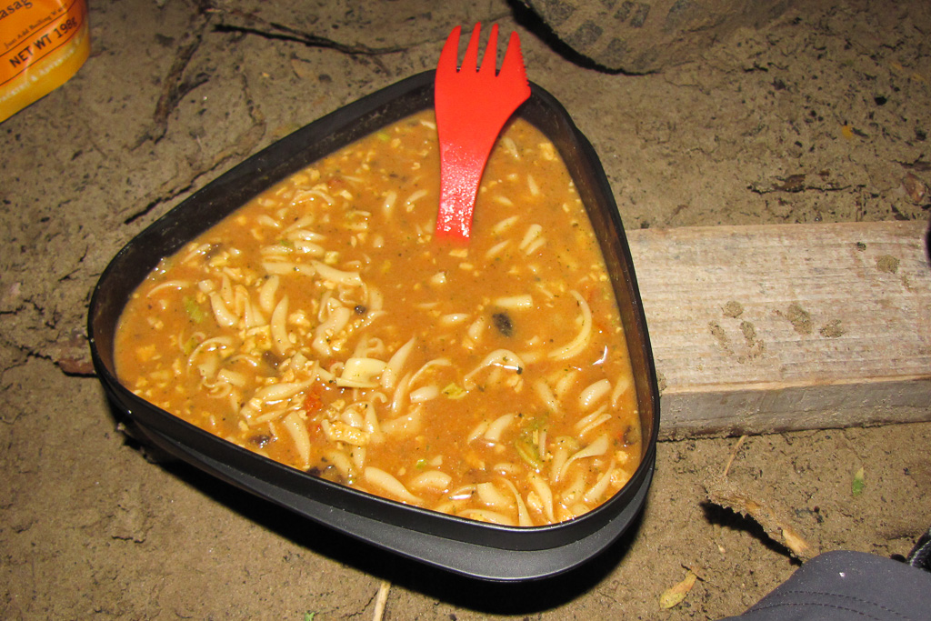
Voilà! Perfect lasagna! Um…
Okay, the full 13 minutes was spent waiting and then the lasagna was served. Well, I’m not sure what it was, but it was unlike any lasagna I’ve ever seen, unless there’s a rare ‘lasagna soup’ edition. What’s the conclusion? Well my friends, it was absolutely hideous and we had to psych each other up to eat it. If you want a laugh, remember this was the first night and I’d bought up big at the ‘Backpacker’s Pantry’ sale. We had tons of the crap to eat!
Anyway, that’s the first day over with. I’m not sure how far we walked, as it was pre-smart phone days. I was relying on an abacus and a home-made sundial during this walk, but I think the first day was about 10 km. I could be wrong though, which has been the problem during this entire post.
So, that’s the first retro post over and done with and I’ll add to this hike when I can. I can’t see myself writing the whole trip up in one hit, as just trying to remember it has given me a headache…

Nice post, Greg. I of course was thrilled to see a new episode of 'foreign animals' with the wombat. Looks cuddly. Cheers!
"Hiking Resource" type blog is all well and good, but I much prefer the personal experience, plus photos of wombats (! I am so jealous!!) and tales of photographic and gastronomic woe than statistics. You do well on the latter front 😀
I've certainly experienced the "missing big news while out on an overnight hike" thing, too. We drove home from a mere weekend overnighter to discover that many houses were flying the Australian flag at half mast. Wondering who had died, we learned a few days later that it was none other than Joh Bjelke-Peterson. I was flabberghasted that so many half-masted flags came out in support of him, though I suppose he must have had a fair amount of support as he was premier of Qld for decades.
Ugh, I've never tried those freeze dried hikers' meals and your experience does not incline me to do so. I have some awesome lightweight delicious hiking recipes, if you're interested 🙂 (quinoa, couscous, risotto, small penne form the carbs; "Surprise" (it's a brand) peas and corns plus dried mushrooms and sun-dried tomatoes form the veg and Chinese sausage (lap xuong) or dried shrimps or dried little fishies form the protein. Misc herbs, spcies and dried soup packets are the flavouring. Deelish)
Look forward to reading the rest of the trip notes. We'll probably do this one day!
Hmmm, don't worry about retro posts – I've made a blogging career out of them! And as for the post-apocalyptic Undead, I suspect there are already a lot of blogs out there with legions of zombie followers!
It was great to see a Trangia in action again! I still have two taking up shelf space here. Remember when hiking in Australia meant compulsory Trangias? They were indestructible – I met someone who'd driven a car over one and still used it.
As for that wombat, was she wearing a hair band? Very fetching.
ahhhh, a multi day hike…..can't wait for my boys to be old enough! I love coastal walks – should probably get off my ass and do more of them. I was on Bali when Lady Di was killed…..I didn't hear about it for a whole day and then only found out because the Balinese kept saying 'so sorry about ladidah' – I had no clue what they were talking about! thanks for the tip about avoiding 'just add water' lasagna. I imagine it tasted worse than it looked, and it looked pretty bad!
Hi Sonja, yes, we did get lucky with the wombat as they're usually a bit tricky to find! This one was so mellow he was worthy of a pat, but we restrained ourselves. Come to think of it this is one of the last ones I've seen on a walk!
Oanh, you shouldn't detail nice sounding food when I haven't had lunch yet! It sounds like you have sorted out the hiking food caper. Possible recipes headed my way?! I can rate them and link back to your blog if you want 🙂
Oh no, you missed Joh dying! Where were you when it happened? In Victoria? All I can remember down here was a shrug of the shoulders type of thing!
You must get to Wilsons Prom one day as it's still one of my favourite walks. Pity most of it is still shut from the floods earlier this year though! I've been tempted to try the northern section, but that's also closed. I did enjoy writing this entry, so hopefully I can do another one soon.
Goat, I like your retro posts! You also have some fine hikes in your résumé to continue to write whereas I'll be scraping the bottom of my hiking barrel!
The zombie followers rings a bell?! Oh yeah, how good is the Trangia! You're right though in that it's selling point is 'indestructible'. Very simple and very much weighs a ton 🙂 I did look at getting a smaller one a year ago, but the hiking store staff member said, "What are you doing? They're inefficient and obsolete compared to other things on the market." I woke up after that! I have a soft spot for mine, but I haven't used it for ages. Maybe handy for car camping?!
Yes, I was going to write that I didn't put a peg on the wombats ear! I think they're tagged by Parks Victoria as the wombats are known to get all beastly with the summer campers at Tidal River. People have fed them over the years, so the wombats have decided to take the matter into their own paws and bust into tents and knock off food. What's that saying? "Keep me wild".
Eloise, I think you'll enjoy your boys taking a multi day hike. Imagine how quiet your house would be?!
Ladidah?! Yeah, I wouldn't have had a clue about that either! With that one though I remember I was driving and the news was talking about how Dodi was killed and I was thinking to myself, "Wow, that's pretty big news!" Then the bloke kept talking and said Di had been killed as well. I almost drove off the road!
Yes, add water lasagna is officially crap! With the rehydrated meals I found one that's a risotto and I have to admit it's pretty good. There was a sale a few months back and I bought about 8 of them. I'm not sure if I could go on a week hike and have the same dish every night though!
If that's lasagna, I don't know what the hell I've been cooking!
That's it. Prepare for invasion..I'm coming to visit.
Now you post a wombat!?
Gorgeous, gorgeous photos.
Samantha, I think it your lasagna ends up looking like that then it's time to give up cooking! I don't think it's ever meant to be a soup. Also, there's more Backpacker's Pantry pain to come from this hike!
A wombat sighting in the wild is always a bonus! Unfortunately I don't have many more to come.
The photos are okay, but looking at them now I wish I had my DSLR with me. I guess there's always a chance to do it again just for photo purposes…
I long had plans to write up hiking recipes and post them to my blog, but then realised my 'recipe' was as already detailed above. That's it, you've got my secret already. Next overnight hike, perhaps, I will do a better job. If you have plans for an overnighter in the near future, I would happily consider making up a meal for you to take and review. Whether you link back to me or not can depend on whether you enjoyed the meal 🙂 A while ago, I thought I could make a business out of making hiking meals, then I changed my mind and stuck with being a lawyer…
I think we were hiking Fraser Island in Qld at the time of Joh's death; if not, then somewhere nearish Brisbane, most likely Springbrook or Frog Buttress. Not anywhere near Kingaroy, otherwise we would definitely have known what was going on. (Kingaroy being JBP's home town)
Probably by the time we get around to organising ourselves sufficiently, the whole Prom will either be all sorted post floods or all closed due to another intervening natural disaster.
🙂
Oanh, thanks for the food suggestions and the offer! I might take you up on that when I do another overnighter. You do realise I'm over a 100 kgs though? I need quantity 🙂 I guess being a lawyer is a more stable employment than a hiking food maker? Then again, it's a huge market if one can get a foot in the door.
Aha! That explains the Joh adoration if you were in Queensland at the time. He always struck me as an example of what too much hot sun up north can do to someone's brain!
I follow some Wilsons Prom thing on Twitter and I noticed this morning a few more spots have reopened. If you ever go, you must stay at the lighthouse! I've got to write up that entry as it's still one of the best places I've ever been in!