In theory, this was going to be a straightforward day. Firstly, I’d park at McFarlane Saddle. Walk across Wellington Plain via a side-trip to Mt Wellington. Then finish at Nyimba Camp, Tarli Karng for the night. The camp is high above Tarli Karng, so the lake visit would be the following day.
A simple plan? Sure, but with me you never know. You just know there might be some unusual mayhem, but we’ll get to those details in a little while.
Starting off, I’d arrived at Licola the previous evening. Not being familiar with the area, I elected to stay somewhere nice and low in elevation. One of the many campsites alongside the Wellington River was perfect. It was a cold night and only a couple of degrees in the morning, as I was greeted by a thick early morning mist. I packed up quite early and was on the road by 7.00 am as I began the drive to McFarlane Saddle.
After driving for a while, I’d risen above the surrounding mist. It suddenly turned tricky though, as I was facing a blindingly, eye-frying low sun.
Motoring along cautiously, I reached a spot called Bennison Lookout, which sits at about 1000 metres. I thought I might stop to have a perusal myself and it seemed I wasn’t the only one with that idea, as I could see a parked car up ahead. I stopped behind it, grabbed the camera and got out of the car.
As I did so, I had the crap scared out of me when some lunatic suddenly came running out of bushes. Running at close to the land speed record, he sprinted down the embankment next to the road and then stopped about two feet in front of me.
The morning had been idyllic until then, but the sudden arrival of some wild-eyed bloke who looked like he needed some food and a top up of medication made me jump a little. He looked at me whilst I said ‘G’day’ and he replied with a grunt, that sounded like the noise you get when you play a record backwards. He hopped in the car I’d stopped behind and then took off at a fair rate of speed. I made a note to myself, ‘first nut of the day’.
I might have been a bit harsh on him though, as I worked out he wasn’t disposing of a corpse at the top of the roadside embankment (I think), but was actually looking at the view into the surrounding valley, which was blocked by trees from where I was standing.
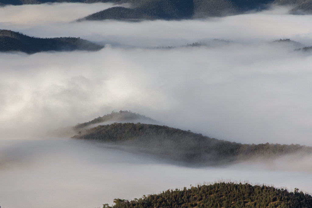
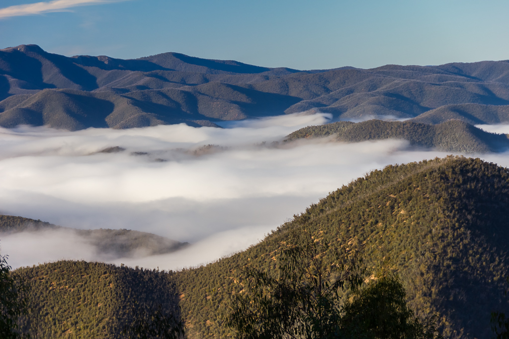
I too climbed up and saw it was a fantastic sight looking down on the tops of clouds in the valley below.
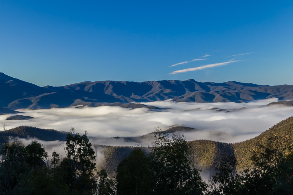
Clouds below Bennison lookout
I tried to photograph how great it looked, but the photos didn’t really come out how I wanted, so this is the best you’re going to get.
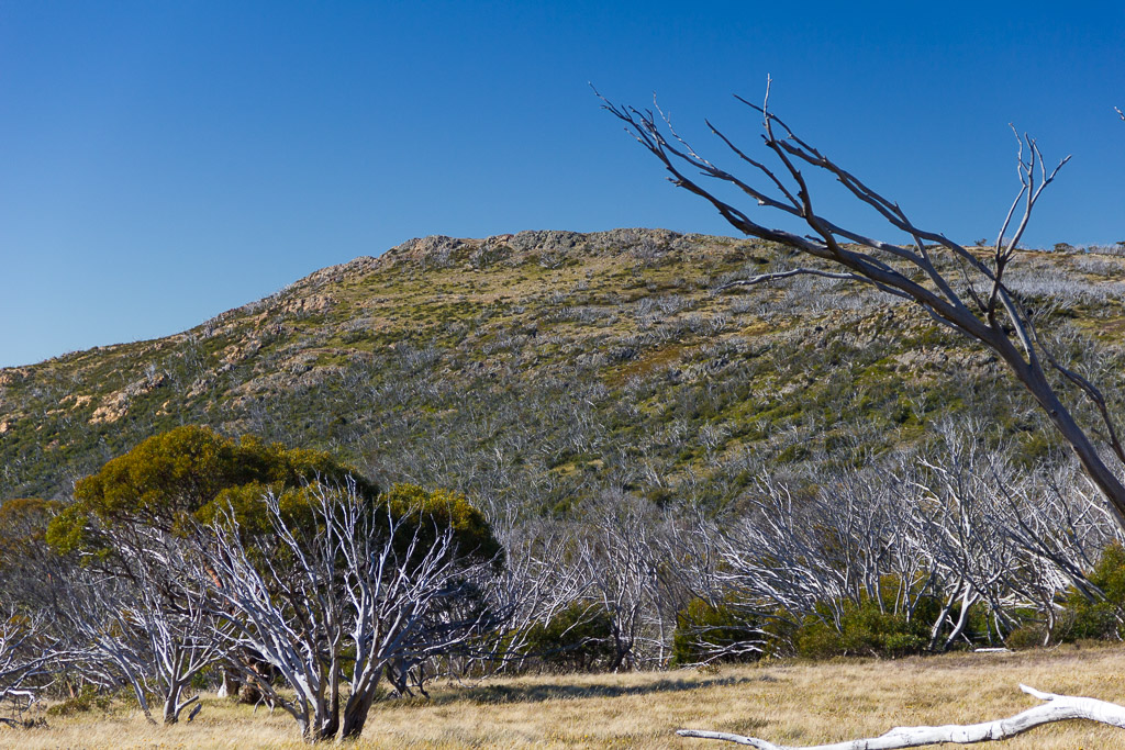
After a bit photo mania I headed off and continued the climb until I reached McFarlane Saddle. Upon arrival I was a little surprised to see an empty bus in the car park. I immediately thought, “Surely there isn’t a monstrous group of kids out there somewhere?” I checked the intentions book at the start of the track and guess what? Yes, of course there was. Twenty students according to their message and they were going exactly where I was, but were a day ahead. I wondered how I always seem to hit the track when a school group has as well!
Oh well, this was not really going to be a walk in the wilderness after all and it can’t really be expected as Tarli Karng is pretty popular.Then again, at the start of winter I didn’t think there would be anyone out and about.
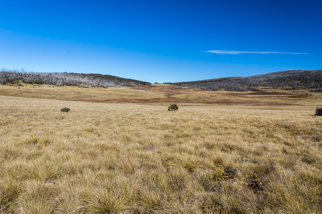
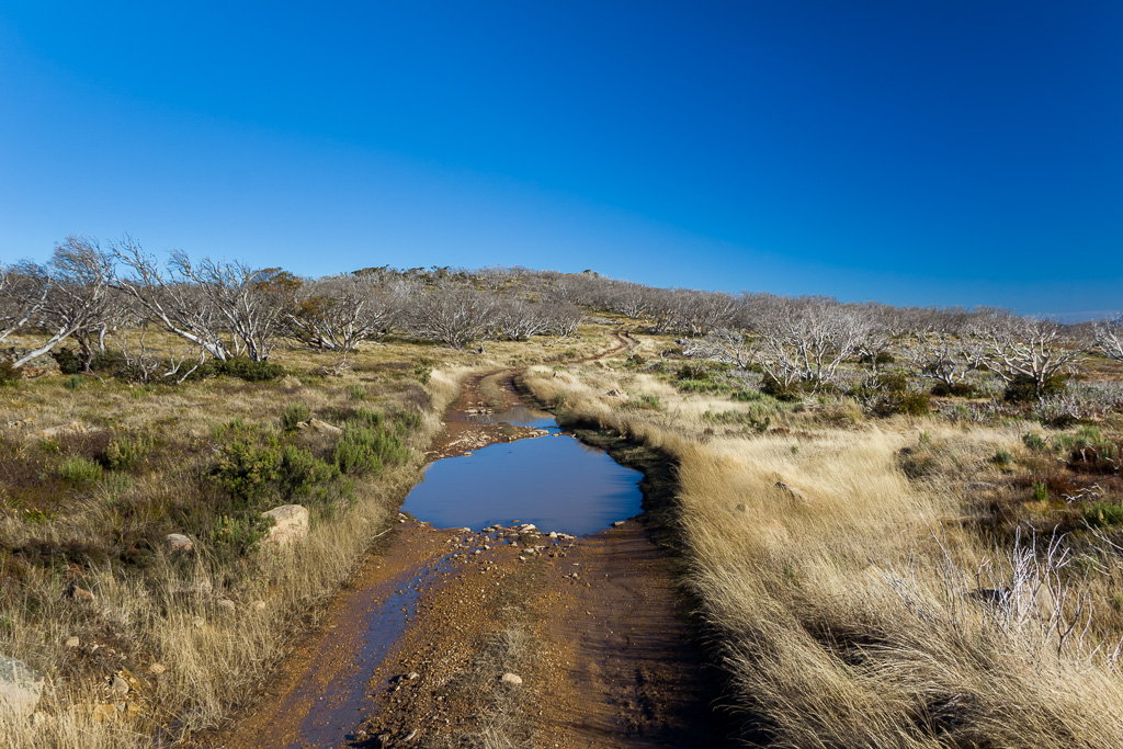
I got my stuff together and headed off. Entering Wellington Plain, the open and flat landscape made for some easy walking. It was pleasant in the sun, but I wouldn’t want to be there in summer, as there’s no shade at all for quite a few kilometres. Oh, conditions this clear can only mean one thing. The polariser. Prepare for all photos to be blasted with contrast, as I abused the polariser lens.
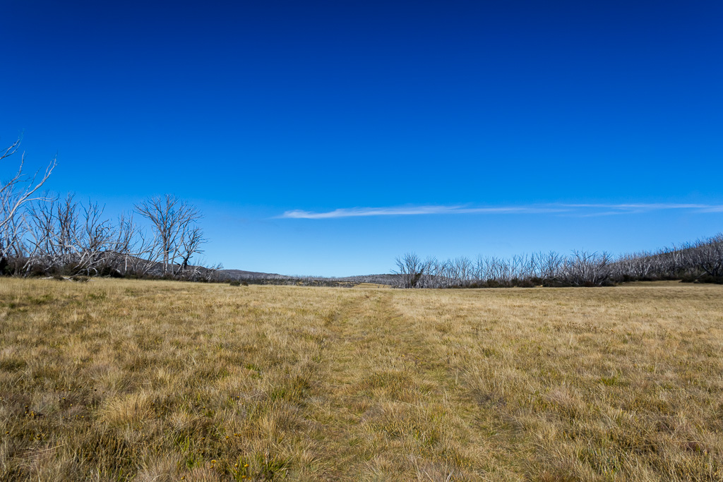
The start of walking on Wellington Plain
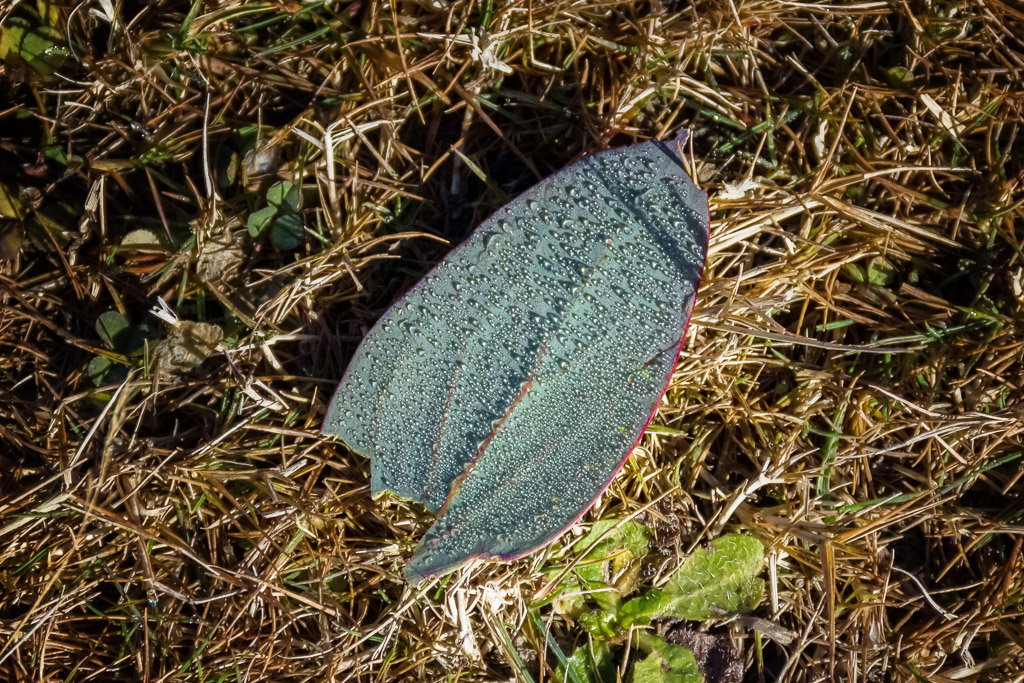
It was quite cold and there were signs of frost from the previous night, as some sections of grass were crunchy underfoot. I did see a nice leaf on the ground covered in water droplets, which I was always going to get a photo of to go with my leaf themed blog entries.
I was enjoying the leisurely stroll, when I came across the first point of interest. The ruins of Dunsmuir Hut. It’s certainly rated in the ‘ruins’ category and I don’t think it would be a place for shelter unless you’re insanely desperate.
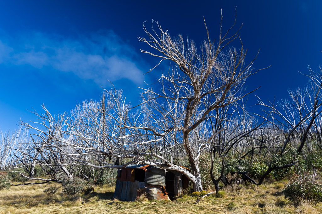
Dunsmuir Hut
There was an impressive tree above, and more or less in the hut, which was good for the odd photo or two.
I noticed signs of fire everywhere as well and I believe a lot of the area was burnt in the 2003 alpine bushfires? I think, as I can’t be bothered Googling right now, as I’m trying to prepare myself in explaining what happened next. As I continued on, I was admiring the open plain, thinking how fantastic it was compared to the previous week of stumbling over rocks on the Cathedral Range. At times, it’s nice to have something comfortable under foot.
Right now, I guess you might be starting to nod off, as you read this quite casual hiking report. I bet you’re saying to yourself, “When does he fall over? When does he break something? When does his belt break and he can’t keep his pants up, so has to hike for the next two days in his underpants? Does he wear underpants?” Yeah, well, I can’t give you constant excitement, but I can give you a write up of a bizarre ten minutes that occurred around about now.
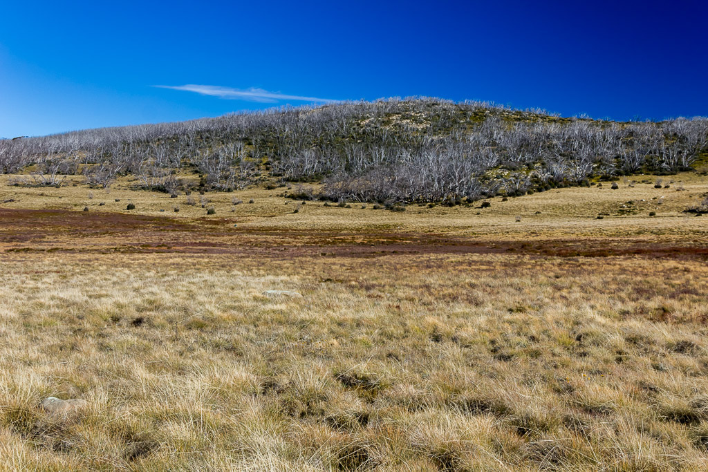
I was happily following an old vehicle track in the grass when I must have dozed off at the wheel, as suddenly the track vanished and everything got a little wet underfoot. I’d walked into a swamp. Swamp? Yes, a swamp. Not exactly chest deep water, but enough to start getting the feet wet and I stopped for a minute to work out what had happened. I found a couple of random rocks sitting in the open plain which were perfect to sit down on and re-calibrate my brain. I took some photos of the surrounding area as I did so.
Whilst taking the photo above, I noticed something to the left of the middle of the picture. At first I thought it was a rock, but it looked a little weird so I cranked up the telephoto for another look.
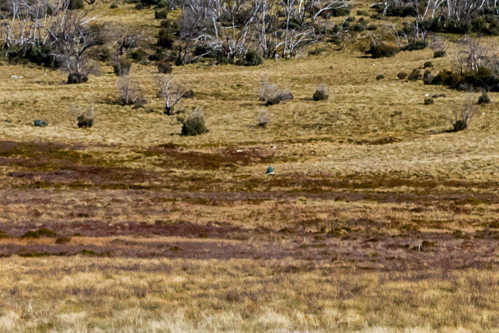
Hang on, it’s no rock. That’s some bloke sitting there! I was a little surprised to see someone and I wasn’t sure where he’d popped up from. What’s even sillier is when I previewed the picture on the camera by zooming it in, he appeared to be online. Is this the Wellington Plain internet cafe? It couldn’t be, but it looked like he was doing something on a laptop. What? You think I’m nuts? Okay, here’s an extreme crop of the above photo…
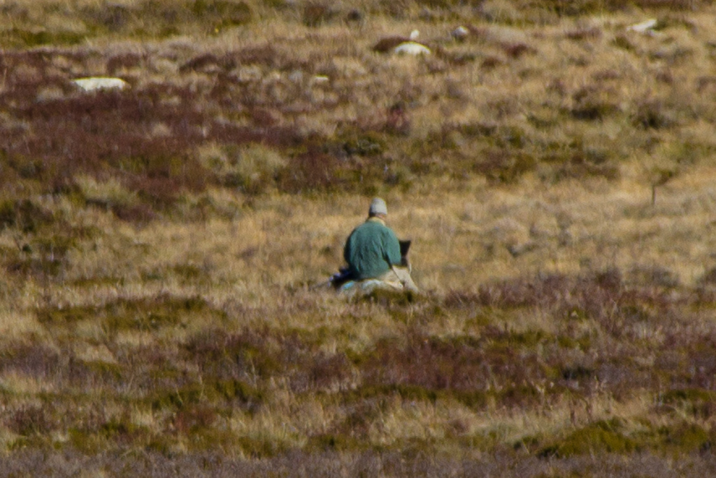
Man online in the wilderness
Well, I was scratching my head a little, but I had to work out why I was standing in a swamp on an area which is impossible to be ‘lost’ in. A quick consultation of the GPS revealed I’d wandered about 100 metres off course from the track, although I’m not really sure how it happened. Oh well, I had a few snacks before getting ready to head off.
I headed over to the correct path, which is near where the bloke was sitting, but as I got going he got up and began some sort of weird backtracking/sidetracking/appearing to avoid me technique. I was looking at him, as he now had his pack on and it appeared he had some bizarre contraption attached to the side of his pack.
When I say ‘bizarre’, I mean there was something pole-like, which reached over a metre above his head. I’ve seen weird things attached to packs over the years, but I don’t think I’ve seen a massive tube before. I was going to take a photo, but he appeared to be trying to distance himself from me, so I gave it a miss.
It was all a little strange, but I deduced he was a government agent keeping tabs on me with a portable satellite tracking unit. I didn’t come down in the last shower though, so there’s no tricking me, as I slipped on my hiking alfoil helmet which deflects any mind reading signals from the government.
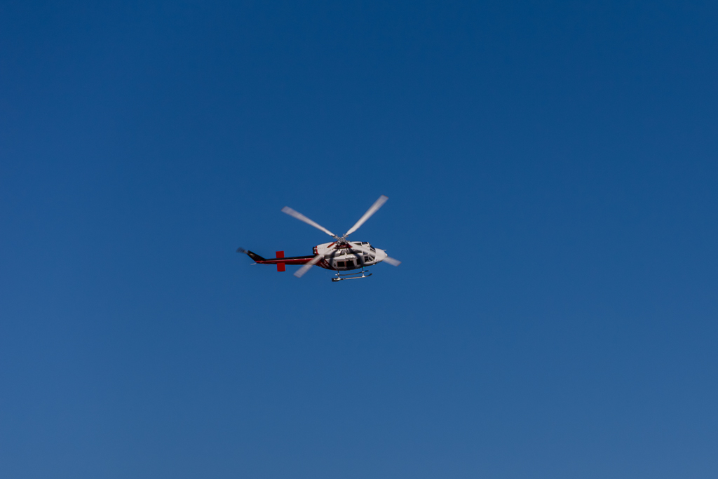
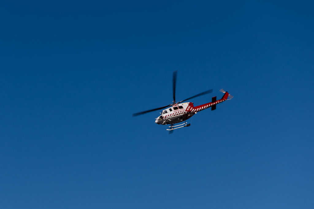
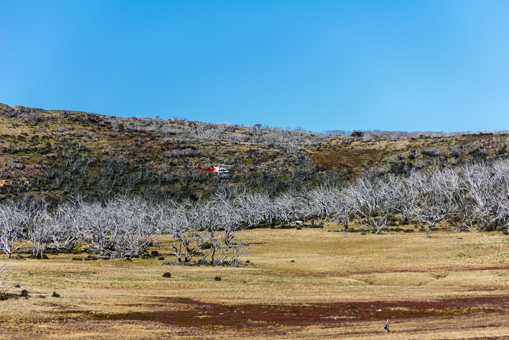
After this bloke it was only going to get weirder, wasn’t it? On cue I began to hear the approach of a helicopter. I was thinking to myself, “That sounds really low”, when it suddenly appeared, coming down the centre of the plain.
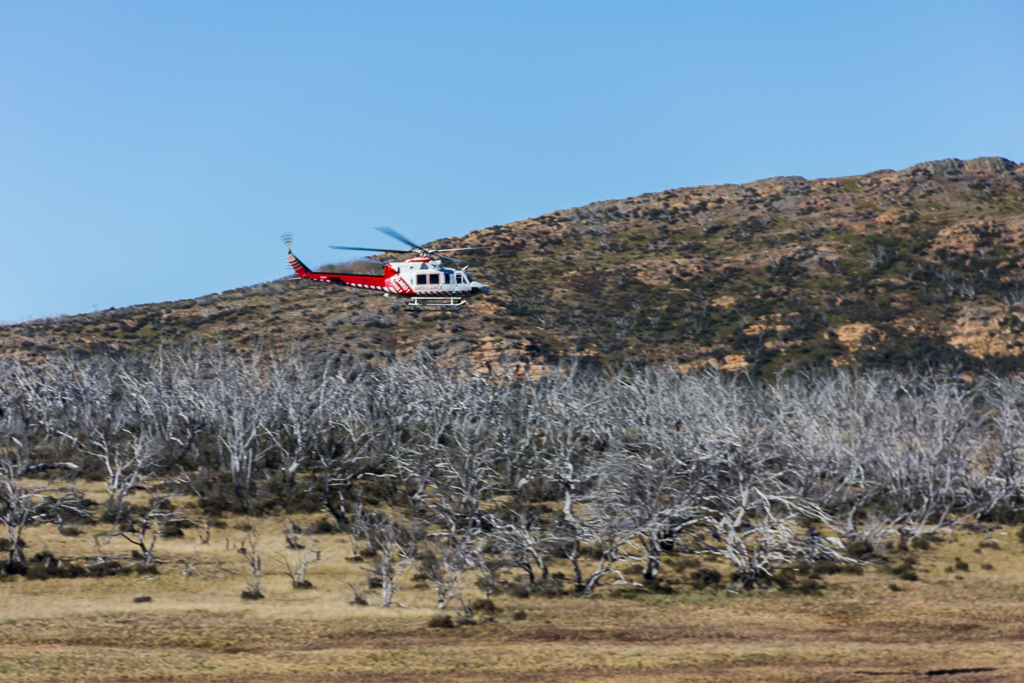
I was snapping away, when it suddenly began a steep bank towards me for no apparent reason. Was it the government after me? Had I slipped into an alternate reality and was now in ‘North by Northwest’?
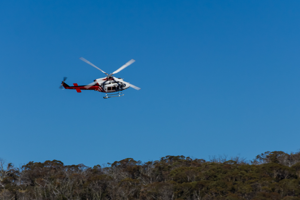
It flew over me, had a look and then banked away again. Phew, this hiking business can be exciting.
I was feeling a bit of anxiety as I hadn’t reached level 30, so the Stinger wasn’t unlocked which is a bummer, as I’ve been on the receiving end of the chopper gunner a bit too much lately. Oh, if you’ve never done any gaming, then none of the previous sentence will make any sense at all.
Completing its swooping circuit, the helicopter went back to what it was doing in the first place. Flying up the centre of the plain until it vanished behind trees.
Normal transmission resumed
Now, there’s one further item of interest in this saga. Remember the bloke with the pole? I bet you’re thinking I was just crapping on when I was describing the thing hanging off the side of his pack, which reached miles above his head? Well, I have something for you and suddenly we feel like we’re in the movie ‘Blow Up’.
After the trip, I was perusing the helicopter photos, when I spotted something at the bottom of the last image. I felt like David Hemmings, as lo and behold I’d inadvertently captured something. Yep, completely non-plussed by a helicopter whizzing over his head was the government pole man. Here, I’ll give you an extreme crop to help you out. Voilà.
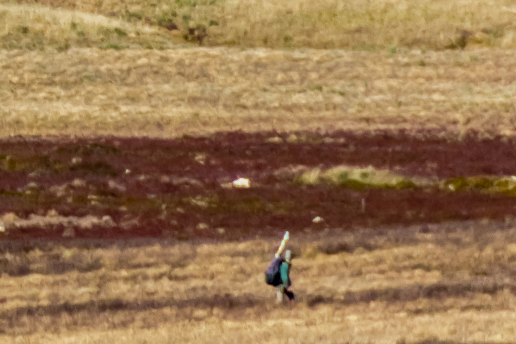
There he is!
Now apologise to Mr Fiasco, as he was clearly telling the truth about a bizarre looking tube that wouldn’t be ideal for hiking through overhanging vegetation. Swamps, man on laptop with super-sized tube and buzzing helicopters. This hiking life is stressful, but I haven’t lost my marbles as I was only joking he was a government agent. If I think seriously about it, by the way he was trying to avoid me, I’ve come to the conclusion he’s clearly an alien who was trying to communicate to his spaceship.
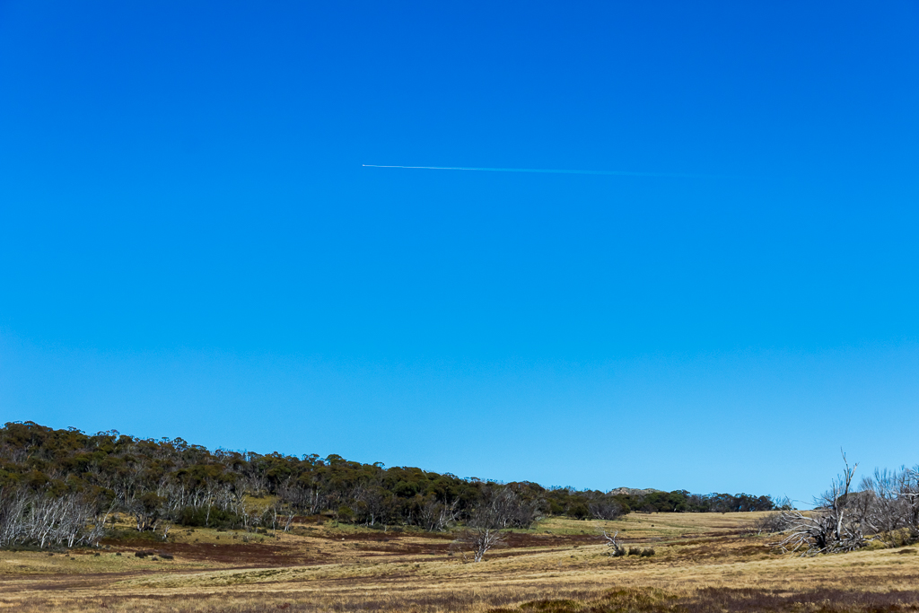
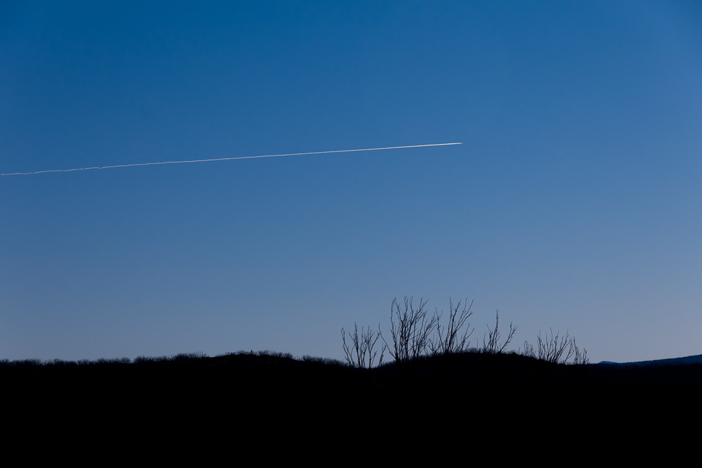
Whew, everything about this days hike is an anti-climax compared to that sequence of zany action, so I suggest you put your feet up and begin to relax after you’ve spent the last ten minutes on the edge of your seat. Oh yeah, did you think all aerial activity had ceased? Well, of course it hadn’t, as now constant jet contrails began to appear.
I was now back on the right path and pole man was also walking in my direction, although about 200 metres off the track. I looked over my shoulder now and again and I could see him for quite a while until I had another look and he was gone. Where to I don’t know, but I never saw him again and I guess he finally did get in touch with his spaceship. My next target was a turn off onto Moroka Gap walking track which would take me to the top of Mt Wellington.
Mount Wellington
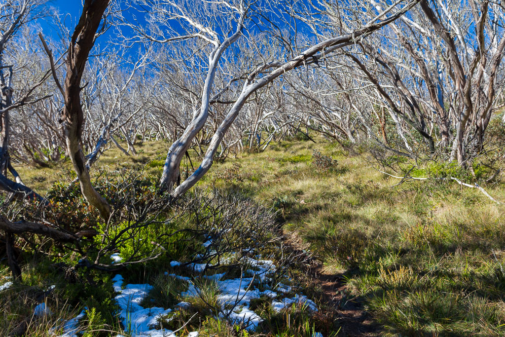
It’s an easy hill to climb though, so don’t get too fired up about peak bagging points and wondering where the prayer flags are. In fact a 4WD track goes right over the top of the summit, so anyone with bloated buns can drive up there whilst relaxing in air-conditioned comfort as the summit is bagged from within a car. I found the track soon enough and turned off with a gentle climb uphill passing patches of early season snow on the way.
Moroka Gap walking track
Once I left the line of trees I reached the intersection of Mount Wellington Track and dumped my pack, so I could easily stroll up the last kilometre or so in comfort. It was a casual walk uphill and I soon reached the 1634 metre summit of Mount Wellington. Actually, I couldn’t really miss it, as there’s a mammoth rock cairn on top.
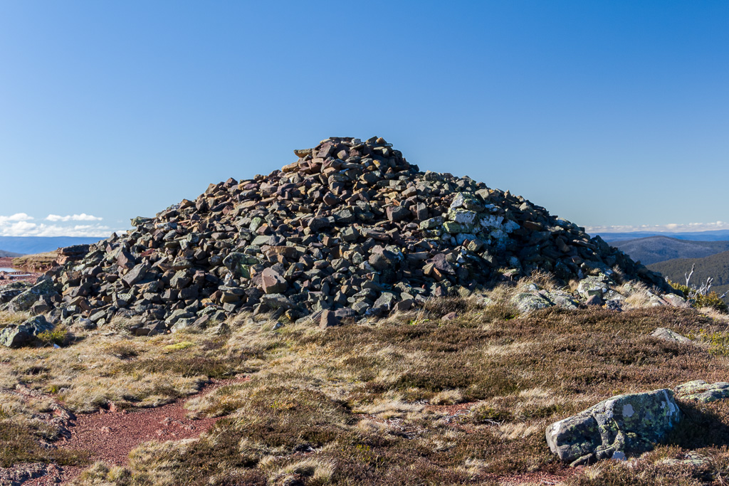
This wouldn’t be the top would it?
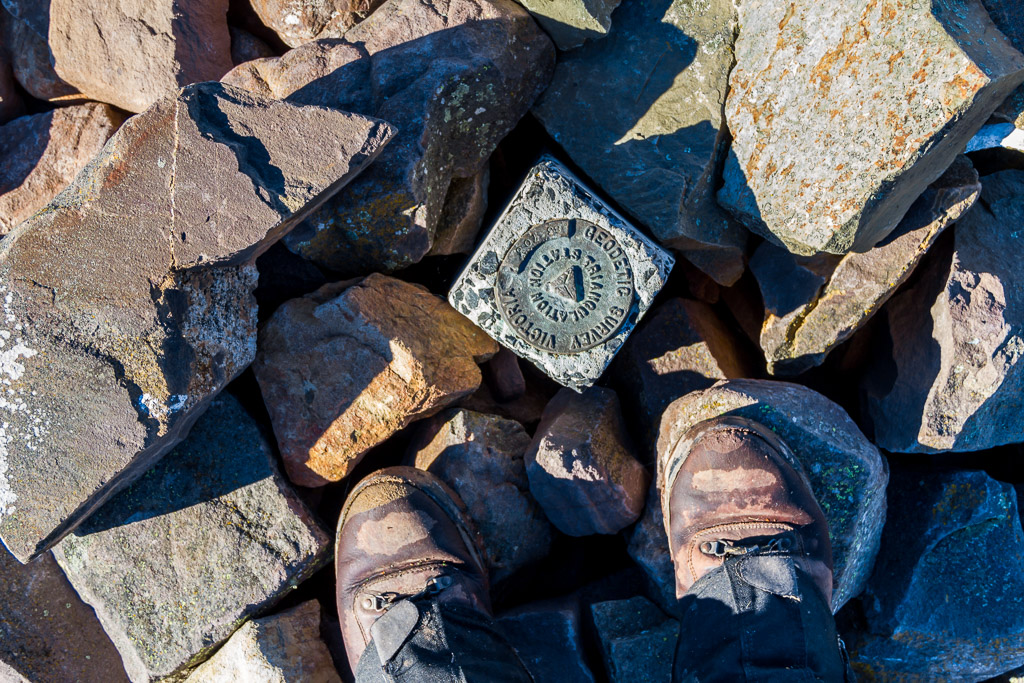
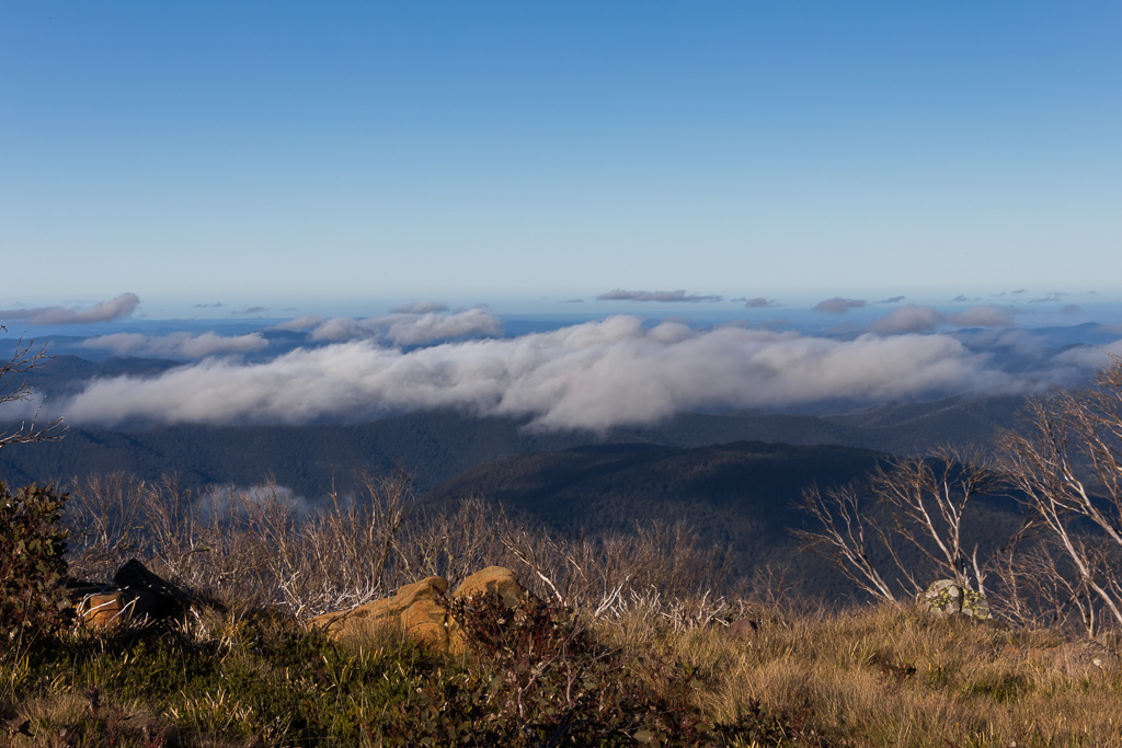
What should one do when confronted with a huge rock cairn? Well, climb to the top of it of course, which I duly did. As I did so, I noticed a survey marker buried in the rocks. Finding a soft rock, I sat down to enjoy the view as the clear day certainly wasn’t going to disappoint.
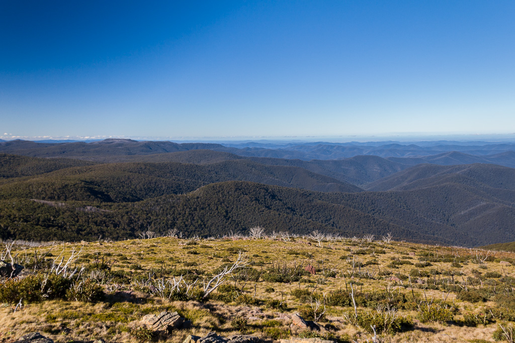
View from Mt Wellington
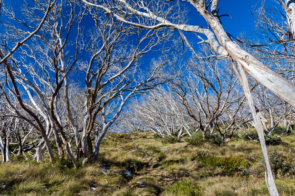
All good things have to come to an end though, so I trotted off back down the hill to retrieve my pack. My next objective was to Millers Hut, which was about five kilometres away. I remained on Mount Wellington Track and the road made for comfortable walking.
Mount Wellington Track
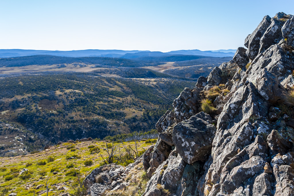
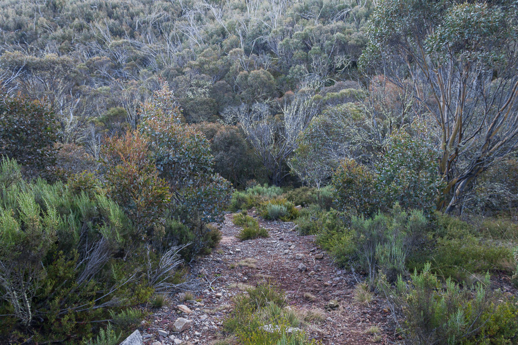
There were some interesting things along the way to keep me awake. Lines of rocks near the road looked quite intriguing. I wondered what the view was like behind them, but I preferred to find a gap to sneak through, rather than having to go scrambling.
After walking for a few more kilometres I did come across a gap within the rocks, so I thought I should go up and check it out.
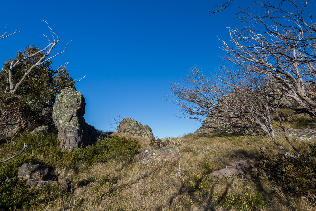
Through the gap…
…and the view on the other side
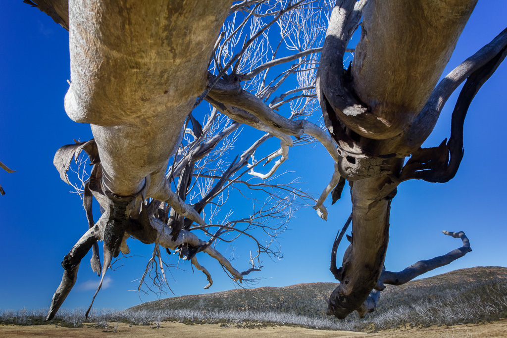
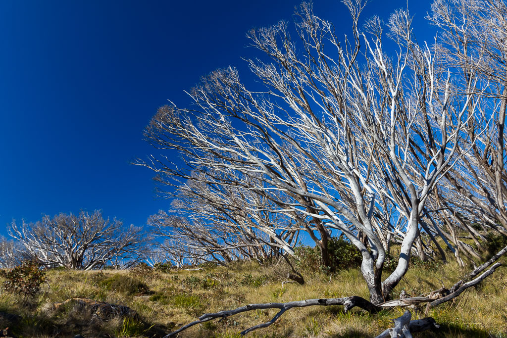
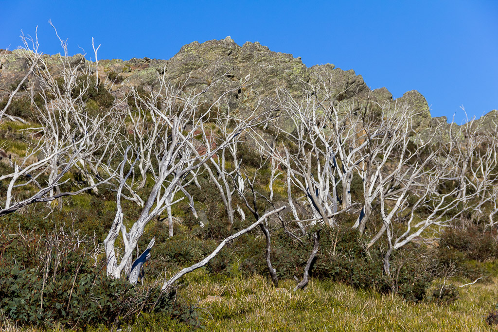
That was all quite nice, but by this stage it was 4 pm and sun was getting low. I sped up, as I wanted to reach Nyimba Camp and be set up whilst it was still daylight. As I made my way down a solid descent, the glow of the sun was really bringing out the colours on the snow gums along the way.
Continuing on, I eventually reached Millers Hut. I’m sure it would have been great in its heyday, but it didn’t seem a place to hang out in now. There appeared to be a bit of rubbish around and it was pretty uninviting, so after a brief visit I continued on.
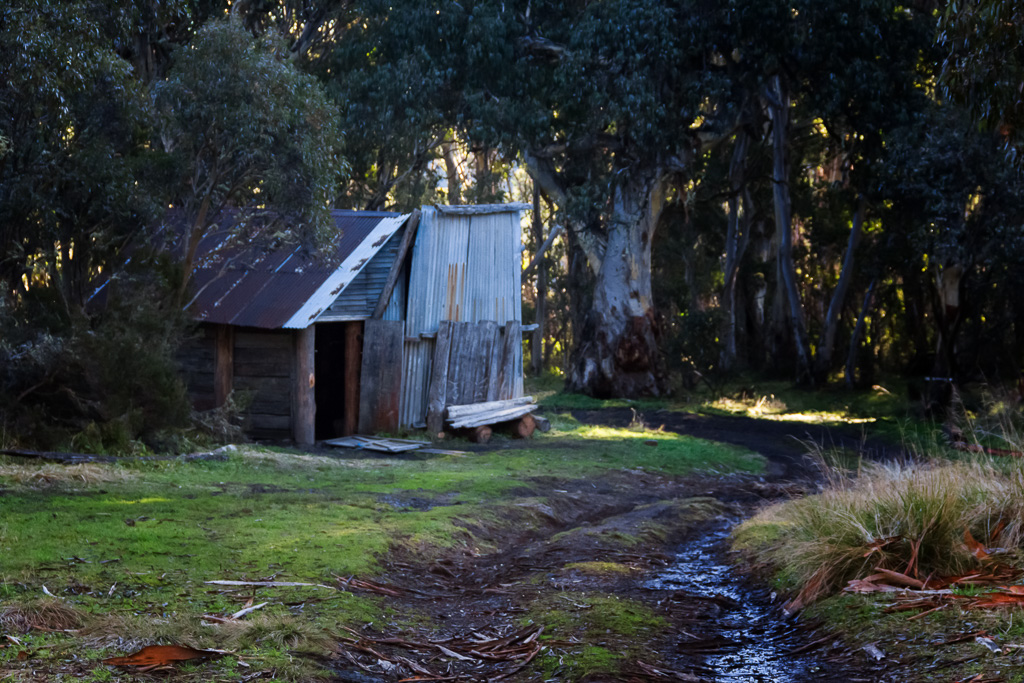
Millers Hut
I now had about two kilometres to go until reaching Nyimba Camp. I began to stroll down Millers Hut Track, which dropped steeply downhill…
Descending Millers Hut Track
…until it reached Nigothoruk Creek.
Nigothoruk Creek
The creek was a bonus, as I got to fill up my water bottle which had run dry. It seemed fresh, so I took a punt by not treating it. It’s an Alpine area, so it should be okay, shouldn’t it?!
With a refill done, I checked my walk notes and they said the track, ‘…climbs a little…’. Well, at the end of the day I found it climbed quite steeply and it wasn’t something I was expecting. I trudged up and finally found Nyimba Camp. It was around 5.30 pm, so light was fading fast. I found a spot which seemed okay and began to set up.
A short distance away was the sound of a billion kids who’d come from the bus I’d seen earlier in the day. I’d put my tent up well away from them, but only when done did I realise I was about 10 feet from a wombat hole, which was dug in under a tree. Oh well, hopefully no furry beasts would come and visit me during the night looking for food. I did make sure the food was well and truly secured though, just to play it safe.
Nyimba Camp has a comfort station as well and it wasn’t hard to find, due to the kids who seemed to be in love with it. I think Parks should install a revolving door, as it was receiving a fair amount of action. I was too scared to go over there due to the fear of what I might find.
Anyway, it was off to bed for the night as the temperature dropped and I reflected on the day. I had walked 15.31 kilometres and the total elevation climbed for the day was leisurely 310 metres.
Now it was time to put the iPod on and listen to ‘Crystal’ by New Order which was perfect at the end of a days hiking. How about one more contrail for the road…?

Bahaaha what a crazy creepy man. I love coming across those kinds of people cuz its gets you guessing weird things as to what they are doing. I enjoyed the read.
Thanks for dropping by! I'd actually forgotten about that bloke, so thanks for reminding me! Yeah, who knows what he was up to and for the life of me I've no idea where he was going as he was miles from the track, not to mention where he spent the night. Just another one of those mysteries out bush!
I spent a lot of time up there in my youth. Your photos are magic, especially the gums and their colours, the story very entertaining, thanks! Peter B.
Hey Peter. Thanks for taking the time to comment. This post is always topical when groups of people have to be rescued up there! I had perfect weather for my trip, but I can imagine that open plain would be pretty gnarly if a storm front came through. It's a beautiful area which I'd like to get to again some day, but there seems to be too many walks and not enough time 🙂
Thanks for your nice comments about the photos. Setting sun on the gums is always guaranteed to bring out the vibrant colours!
Another entertaining read, thanks Greg. There's actually a few of us heading up that way on the weekend. We'll keep a sharp eye out for crazy folk, and pack our alfoil anti-government mind reading device hats (thanks for that tip too btw). Cheers, Greg.
Thanks! Upon seeing your comment, I went and re-read this post. I'd certainly write it a bit different now, as I noticed some nasty grammar problems!
This was an entertaining day though and really I should update the post, as a year late I got an email from the helicopter pilot. He was going to a job, but decided to circle as that bloke with the pole in his pack caught his eye! Then after checking out pole-man he said he suddenly saw me and wondered what was going on with all these people wandering around, so he checked me out as well 🙂 It was a pretty weird 10 minutes!
I've no idea what that bloke was up to or where he went. He wandered in a different direction to the track. I assume his gear was some sort of surveying thing. Or for contacting aliens 🙂
Have fun up there! I was hoping to get up there this weekend as well, but my back has gone into creaky mode, so I'm having a quiet December instead. A good time to go, as I'd hate to be on those Wellington Plains on a boiling hot summers day. No shade anywhere. Not my idea of fun 🙂
Thanks again!
The guy with the pole was most likely an Amateur Radio Operator, a hobby which existed before the Internet (and mobile phones), and the pole was his antenna. There is nothing to worry about, next time feel free to ask about his setup as he may be talking from another ham radio opeator from the other side of the world. I too normally carry my ham radio gear just knowing that if something happens, I can always rely on my radio as we all know mobile reception is not always great in remote areas, but you can always communicate using radio waves (and importantly for free). If you are interested, feel free to join any radio club in your city. Greetings from Ham radio operator.
Yeah, in hindsight I had an idea he was a radio operator. I actually headed towards him with the idea to have a chat, but he went out of his way to avoid me 🙂 I gave up after two attempts to get closer to him. The pole was unlike an antenna I could think of though? It was large and cylindrical. My army days of being a radio operator consisted of lugging radios, which most of the time had whip antennas, or the HF radios had antennas we'd have to prepare if stopping and needing to use it. Then again, I'm talking about the crap we were using and it was all 1960's technology 🙂
That's a good point about being in a radio club. Now and again I get the urge to want to send and receive morse again. You never know, I might take it up again 🙂
Hi Greg,
Your account of your trip out there is entertaining. I go out there every February. 🙂 . The weather can be spooky and foggy , terribly unpleasant , cold and raining or clear and sunny .Generally Late Summer /Early Autumn is the best bet for good weather at Nyimba campsite on the Wellington High plains and Lake Tali Karng.
I was lucky with the weather on my trip. End of May and with clear skies for the couple of days. I don’t think I’d be a fan of being there in summer, as the Wellington Plains would be a nightmare on a hot day 🙂
Hi. The chance of it snowing and becoming hard to see at all increases on the Wellington plains from Mid April onwards .I find it is always cooler up there even in Feb. and Swimming in the Lake is just fab on a sunny day in Feb. or March.
Yeah, it does get iffy up there as Winter approaches. Mind you, I did my walk right at the end of May and had clear blue skies for both days. All depends if you get lucky 🙂
Interesting regarding the chopper. I was out there March 2015 and was “buzzed” by a similar looking whirly bird. Wellington Plain must be a flight path from Gipplsand to northern Victoria. Good yarn.
Really? Wow, that’s pretty bizarre! I think I mentioned in another comment in this post somewhere that I got an email a few years later from the pilot that buzzed me. Quite informative! Essentially he said he spotted people in spots he didn’t expect (antenna man and me) and decided to have a quick look. I think it was the weirdest half hour I’ve had in hiking. Desolate and then bout of bizarre action I couldn’t have imagined 🙂
You’re right though. It must be a regular flight path along there. In my case the pilot was called out, but the job was cancelled and he was just heading home. Made for a good post though 🙂
Thanks for taking the time to comment.
What a wonderful surprise to come across such a great write up of a trip to Tarli Karng. My first trip to the lake was in 1962 as a thirteen year old, with a group of older scouts. Of course there was an interesting incident when we got lost using the Mt Margret track, which was blazed. There had been a bush fire earlier in the year and the blazes were hard to find. Pausing on the top of a gully which dropped down to a river we heard hoses coming from behind us. Three arrived and their riders said nothing to us at all, just walked on through our group of seven. With no comment either way the atmosphere became a little tense/spooky. Looking back I now presume they were cattlemen who ‘owned’ the area and didn’t have to speak to young kids from the city. As they proceeded down the gully one of them removed his hat to expose a Mohican haircut, remember this was 1962, this added to the atmosphere and left us a little anxious as we were well out of our comfort zone and they had rifles in their saddle holsters. We proceeded to ‘unlose’ ourselves and eventually made it to the Lake via Echo Point. We spent two great days exploring the lake and taking some memorable slides, camping was difficult as it was September and the lake was well and truly full, there were no amenities there then. I have returned to Tarli Karng on several occasions over the years and have never ceased to be inspired by its tranquility, beauty and sheer grandeur. My connection to the place is how I understand our first Australians connection to country. .
Thanks for taking the time to write your expansive reply! That’s quite an experience. I enjoyed reading it. Thanks.