As you can see by the photo above, it was interesting walking through the Never Never. First though, let’s go back to the beginning of the day.
It was a great night spent at Lake Meston Hut. A nice fire going had dried out the clothing and it was hard getting out of bed on a freezing cold morning. Now there was a big day ahead of us. Our aim was to reach Kia Ora Hut on the Overland Track, but firstly to get there we needed to cross untracked ground called Never, Never.
I wasn’t too perturbed though, as I had maps, a GPS reading and walking notes. The concept seemed easy. River on the left and we’re not lost. I thought, how easy is this hiking business?
We didn’t get going until 10.00 am, which was a bit of a tactical error considering what happened at the end of the day. In hindsight, this is one day where we needed all of the daylight we could get. We set out in fine, cold weather, heading for Junction Lake Hut. The walking was pretty easy and we were taking our time due to the many frozen puddles along the way, which made for great photo opportunities.
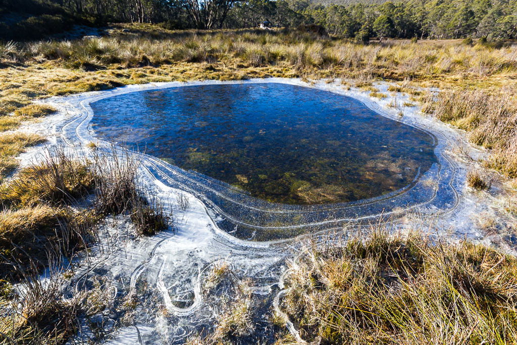
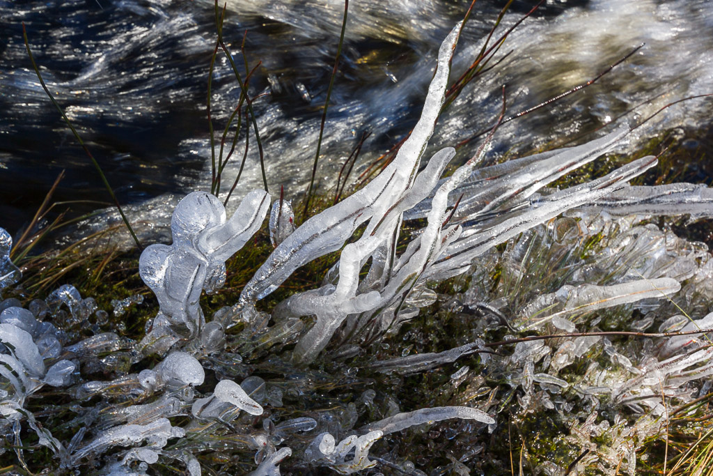
There were quite a few small streams where the splashing water had frozen on the surrounding grass. Stop for a photo? Well, of course we did.
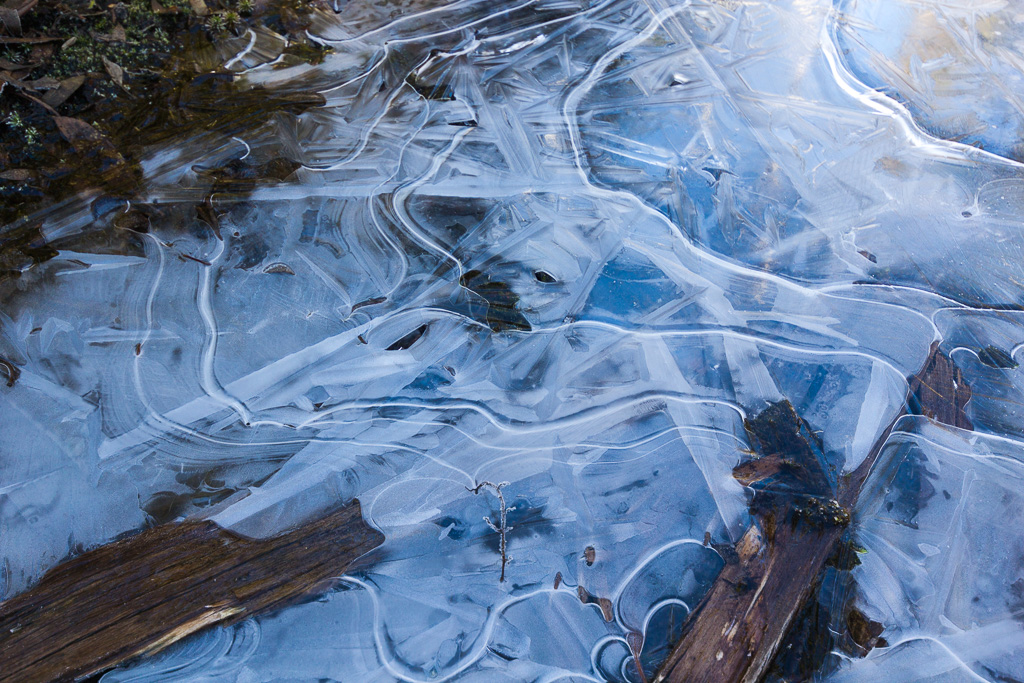
I was interested in seeing Junction Lake Hut, plus it seemed like a good spot for a break and snack. I should have taken more attention to the rough track and pads though, as one we were following came to a dead end. On the wide grassy plain, we commenced walking around looking for where it might restart.
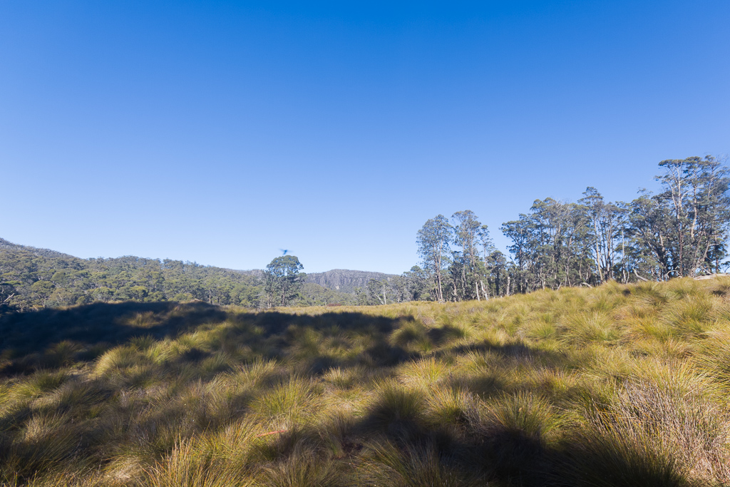
The track is here somewhere. Maybe.
Well, okay, we didn’t find it and it felt like we were walking in circles. It probably looked embarrassing on the GPS read-out, but after stumbling about, including a nice, solid fall by myself in which I cut my forearm, we found the hut. Again it was great and very similar to Lake Meston Hut with bunk beds and an open fireplace.
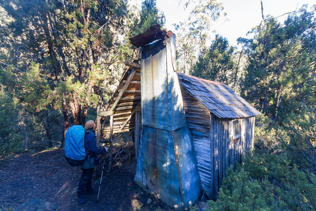
Junction Lake Hut
It was time to put the feet up for a little while and also a chance for Ben to bandage a leech bite on his arm that had a good blood flow coming out of it. By now it was early afternoon and I checked the intentions book within the hut. I was a little disturbed to read that someone a few days earlier had tried to walk across the Never Never, but the Mersey River was too swollen and too hard to cross. I had the GPS reading for the location of a log that can be used to cross the river. I was hoping the bloke who turned back just didn’t know where this log was, as I wasn’t in a ‘turn back’ mood at this point.
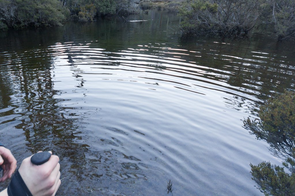
It was a perfectly clear, chilly winters day and Junction Lake looked fantastic with its smooth surface and quality reflections.
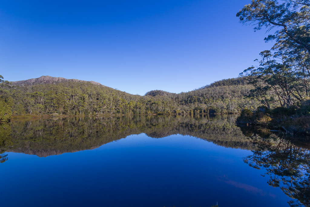
Junction Lake
Now, it was time to head into the untracked section of the Never Never. We came across a Parks intention book within a box and filled it in, whilst noting that the book was brand new and there was only one other entry in it. Okay, this place is rarely walked in winter, that’s for sure. A bit more walking and we found ourselves in scrubby forest. The direction wasn’t clear, but with the Mersey River to our left we stumbled around until we found a rough pad again.
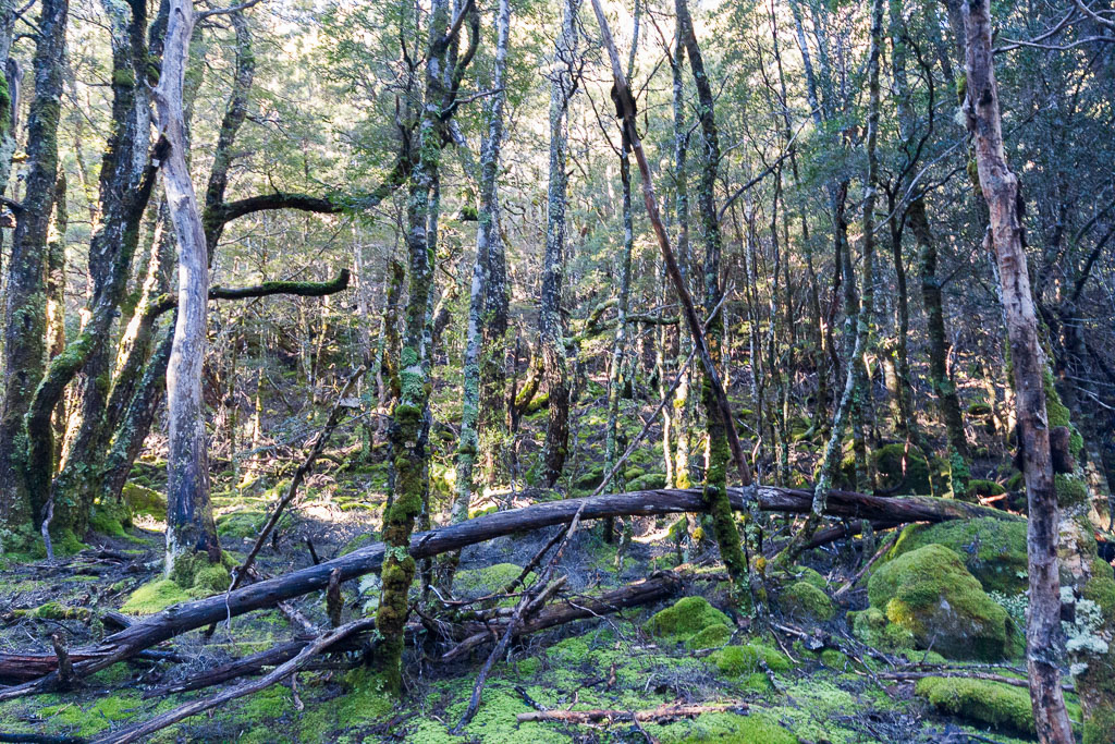
Forest in the Never Never
In this section of forest we came across an orange track marker and began to think things were going to be a bit of a cruise. Actually, that was the one and only track marker we saw for the rest of the Never Never!
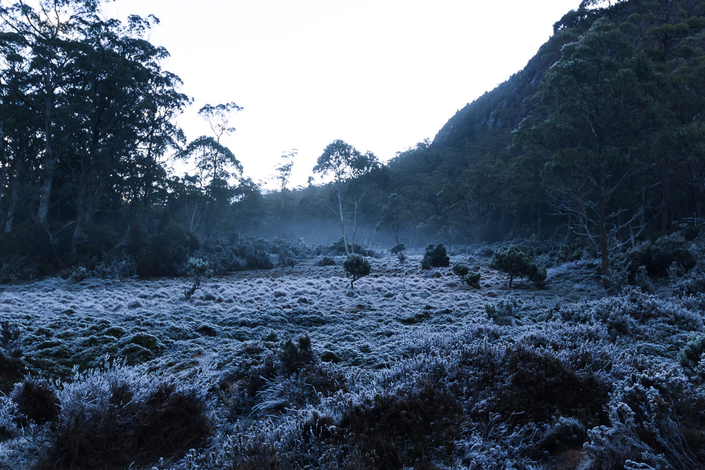
We exited the forest onto grassy plains that made for some pretty tricky walking. What looked like a solid surface would actually give way, and the only way to make some headway and not sink into the ground was go for the odd ‘sprint’. This sort of worked, but it made for some heavy work on the lungs. Any area still in shade was covered in frosty, frozen grass.
Progressing along, we soon found out that trying to keep near the river was a mistake. We bashed our way through some annoying scrub and promptly exited into a vast section of water. The river was swollen and it covered all of the ground we intended to follow. It didn’t help that we were hemmed by bush on one side, so there was no choice, but to walk through the water which was up to knee deep in places.
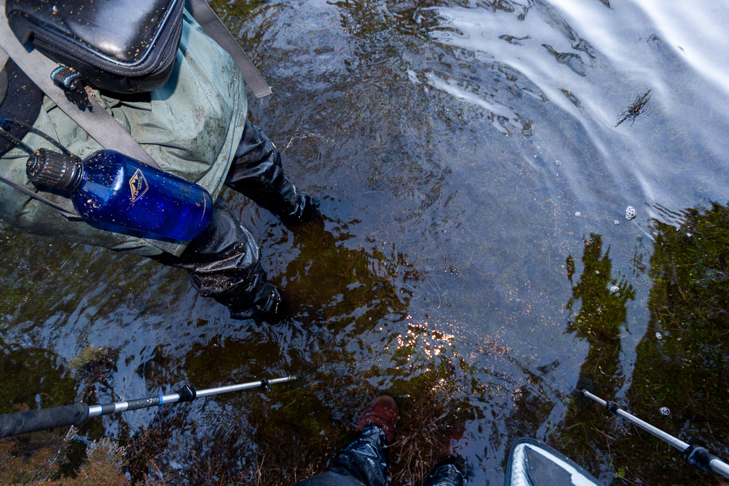
Um… This isn’t ideal walking terrain
This was disappointing as my boots were now feeling slightly ‘damp’. Seeing this expanse of water was making me worried now about how to cross the river, but it was a matter of pressing on to where the log was and hoping for the best.
It was funny at first, but the good times were rapidly diminishing with boots full of water and sections of trees that were insanely difficult to walk through. It seemed every tree branch would reach out and snag the pack sending me off balance. At one point I was on hands and knees and I was sure I was moving faster like this than walking. I have never fallen over so much in one day. Ever! I counted at least 10 solid falls, but Ben was happy to correct me and say it was 13 times. At one point I fell over and landed with my legs above me in a tree. It’s hard standing up again with a pack on when the feet three feet in the air.
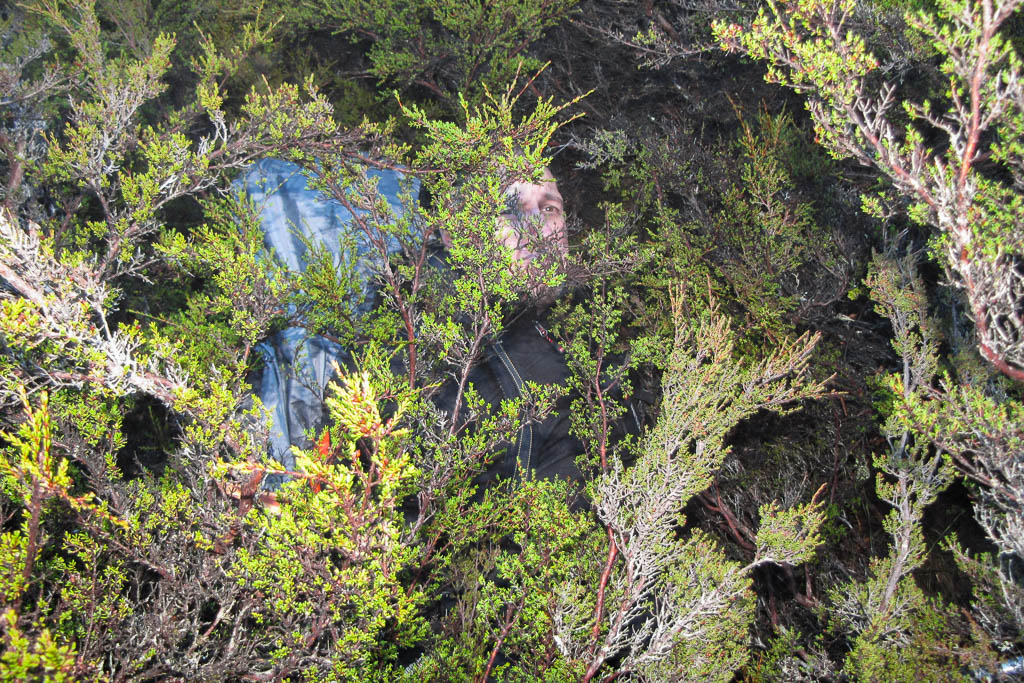
Standard position of the day. Flat on my back in a tree.
Ben helped me up, but as I did so I fell forward and cleaned him up. Now we were both lying at odd angles in the bushes.
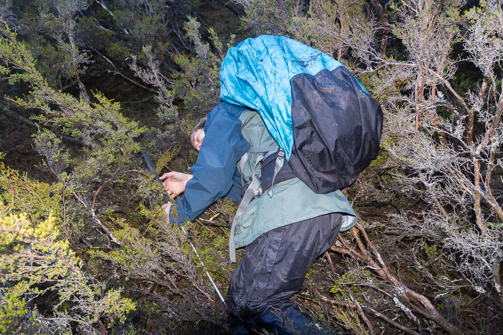
Oops… I knocked him over as well
Gee, this hiking is fun isn’t it? If it wasn’t trees snagging us, it was the soft ground where a foot would vanish in perfectly solid looking ground up to the knee. It was slow going and already the sun was getting low in the sky. Early darkness was a worry, so it became a matter of bring on the bloody log!
We reached the position on the GPS where the log should be and we were certainly glad to see it was still there. It was above the water, which was also a bonus. The water looked quite deep and was fast moving, so I didn’t want to fall off the log. It was covered in branches and wet and there’s no way I could cross it on my feet and survive.
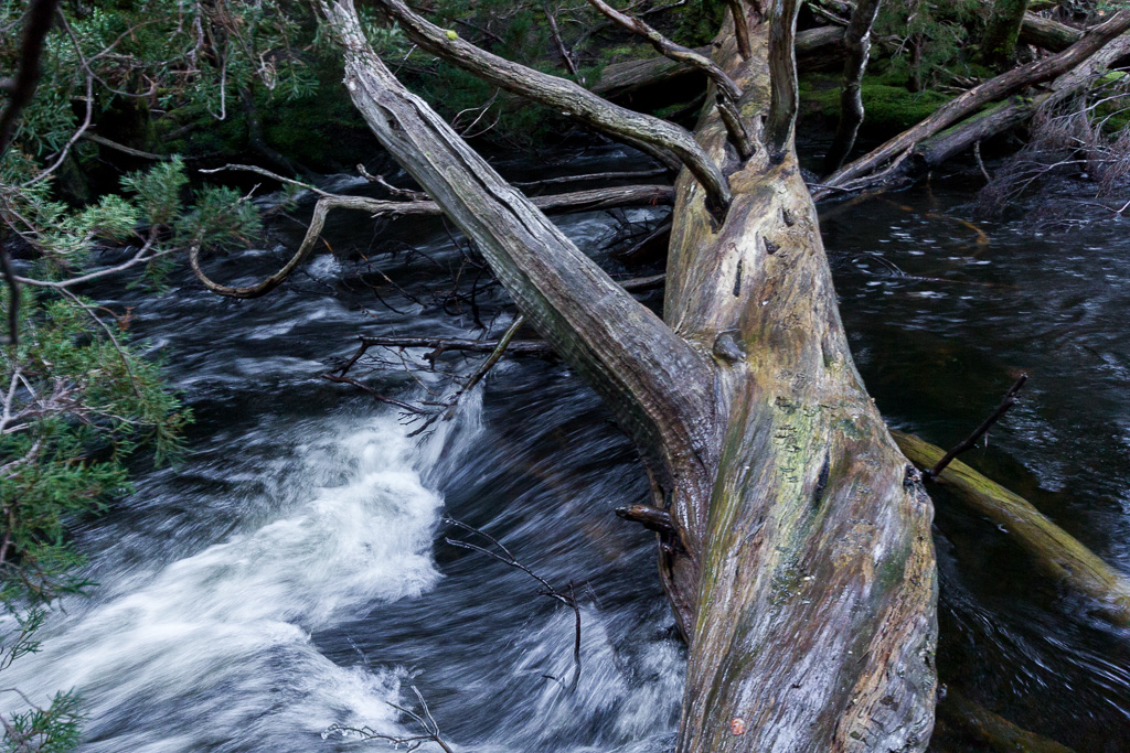
Log crossing over the Mersey River
I elected to go for a straddle approach, which was ‘slightly’ gymnast like, as I had to do special leg swings around the branches, as if I was on a pommel horse. I made it to the other side and I was impressed to arrive with my testicles still attached as well. Ben was next and he used the same method, but decided to show off by getting across with the walking pole in his mouth. Full marks for originality.
Now safely across the river we were thinking it should be a bit of a cruise to our destination of Hartnett Falls track. This track would lead us to the Overland Track, but by now the light had faded and it was hard to pick anything out. On went the headlamps, but they’re no substitute for natural light when looking for a rough track. Again we were belting through trees and not really finding any opening to get moving properly.
Apparently there are the remains of McCoys Hut along there. Sure, it may be there somewhere, but we didn’t see it! In the pitch black I probably walked right through it. I was lucky to have the Hartnett Falls track on my GPS from walking on the Overland Track the previous year.
At one point it was telling me the track was only 100 metres away. Surrounded by towering scrub and going nowhere fast I asked Ben if we should just be he-men and go straight for the track. Ben was of the opinion that we were he-men, so I ploughed on. I walked about three steps into a tree that appeared to grab hold of me and throw me back where I came from. I was now lying at a weird angle on the ground with a feeling that the tree was telling me, “No short cuts for you!”
So, we headed back to near the river and found it no easier. We must have sounded like two wild animals groaning and cursing with trees shaking all around us as we stumbled on. After some more bashing we reached a point where the GPS indicated that the Hartnett Falls track was only 8 metres away and that seemed barely believable as the scrub blocked any vision. In the end I placed total faith in the GPS and went mental, belting through trees until suddenly I fell into a piece of open ground. It was the track. I was on my knees with my hands pointed to the sky saying, “I’ve found the track you beautiful bastard!” It was an emotional moment.
Now we were off, powering up Hartnett Track in the dark and I was glad to see the signpost for the Overland Track. Ben was feeling delirious at this stage and had to stop for a snack. It gave me a chance to clear a few leeches off my arms and re-arrange what felt like 25 kg of bark that was down my back between my shirt and pack. This was causing some quality scratching and made me long for a nice hot shower.
We continued until we reached Du Cane Hut. Although this is just an emergency hut, it was the end of the road for us for the night. It was 8.00 pm and we were both wasted. We were both a little spun out mentally by the last few hours and found it hard to sleep whilst reliving the trauma. It had been 17 km of madness and mayhem on the short winters day from Lake Meston Hut to meet Du Cane Hut via Never Never, Tasmania. We weren’t at the spot I’d intended in the morning, but at least we’d made it to the Overland Track in one piece.
Now it was time to get some rest. Firstly though, I needed to listen to a bit of music and ‘Colony’ by Joy Division was the perfect song to unwind with…
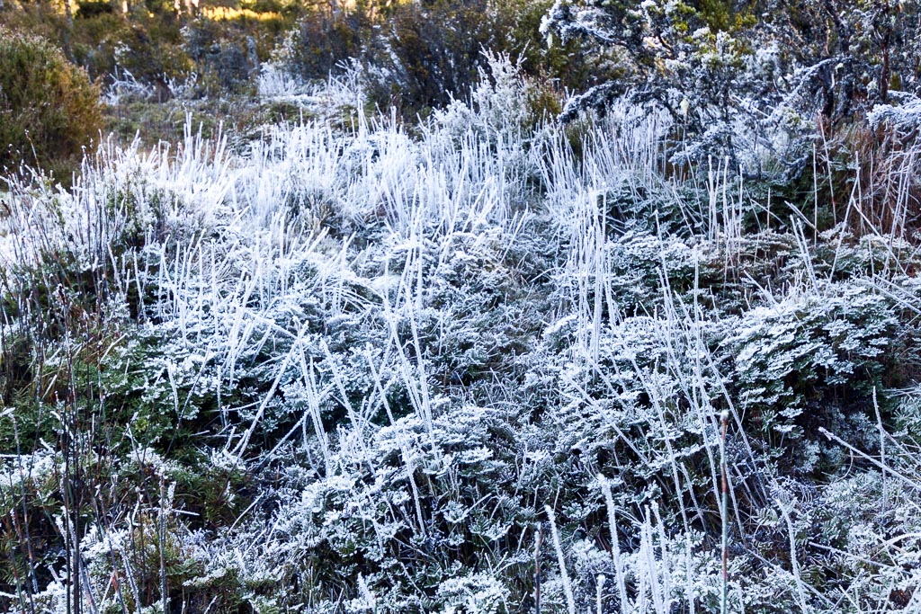
Frozen grass in the Never Never

I can't believe I am the first to comment! Good reason to have a GPS. What are you using now?
Hi JM. Yes, it only took three years to get a comment on this post! I did write this in the early days though, where barely any of the posts were read. Now I reckon these older ones just disappear into the blog and most people stick to the more recent ones!
Yes, it was one of those daft moments where we were never actually 'lost', as we could always follow the river. It was the short winter day (our fault for setting off at 10 am!)and the underestimating how long it would take to cover the five or so kms across the Never Never. Oh well, in hindsight it doesn't seem bad now. Mind you I'm sitting on the couch now and not bashing through bush in the dark 🙂
I'm using the Garmin Etrex 30 and quite happy with it. Hopefully I never need it in the future, as much as I needed it on this day!
Thanks for dropping by!
What are the GPS co-ords for this log!?
You're in luck if you need a GPX file, as I only found it the other day. The route is now on the blog via Garmin Connect. If you need the file, by all means send an email. If not, enjoy!
oh Greg and Ben, I feel your pain!!! I too found the Never Never to be one of the toughest, scrubbiest and most draining days I've ever done. There must be a few logs over the river, because I distinctly remember mine being dark bark with no branches at all, and mostly underwater, which meant I crossed arm-over-arm with my lower body submerged alongside. I was so glad to be out of there that I cried from utter relief when I reached Bert Nicholls hut.
Its great that you have blogged about it, helps people to prepare for it. When I went, there was nothing except for Chapman's brief account in his book, a whole 2 sentences. I suppose that's the great thing about blogging and sharing your experiences, and always entertaining to read, so thank you 🙂
Hi Jo. Aha! Another Never Never victim! Connoisseurs of Tassie bush reckon it's a stroll, but maybe it is if you're used to it. Ben and I well and truly underestimated the time it would take to go the shortish distance. Stuck in those bushes in the dark was not my greatest walking highlight 🙂
Wow, I reckon you were on a totally different crossing? Not sure, but I do know the one we crossed on has been washed away now. A pity, as although awkward with those bloody branch stumps on it, at least the whole thing was way above the water. Then again, if I fell off, it would have been a longer fall 🙂 Not sure if it was the same log you found, but in its current submerged state?
Kia Ora was our aim at the start of the day, but we didn't get anywhere near it! I'm glad to hear other people have suffered, as it then doesn't make me out to be a total chump 🙂
Yes, not many have read this particular post, so I'm not sure if anyone has taken on board our adventure! We also had the same Chapman notes and it felt like he was taking the piss a bit. We expected to race across. I guess the main thing that stuffed us was the short winter day. Getting dark at 5 was a bummer. Maybe we wouldn't have had so much angst with the long daylight 🙂
Thanks for dropping by. Nice comments like yours are always appreciated!
Im loving reading your posts, but I really do need to get outside and do something.
I can't believe you are so blasé about the leeches. I'm pretty sure they carried me through the never never. It was drier when I went through (so much so I cant really remember how I crossed the river, but maybe that is my brain cataract closing in). It was hard but with the longer days we made it to Kia Ora and then out to Pelion etc. I remember turning up at the hut looking like a wild man of Borneo with all these incredibly clean people that had been walking the Overland track (and the smell of deodorant). I cant even keep clean walking down the footpath at home.
Thanks again for taking the time to write this up.
cheers
John
Hi John, glad you came back for some more!
This was a shocker of a day. It was written in the early days of the blog, when I kept things shorter. If this happened now, the post would be three times as long!
Yeah, winter in the Never Never was not the greatest idea, but like I've said everywhere else, I underestimated the time it would take. Apparently the tree crossing in the picture has gone, so I've no idea where the best spot is now. I'm sure other trees would be there.
If I ever went back, I'd stay high and only hit the river when the time came to cross. We stayed too close to it, which is where all our soaking wet problems started! I was stuck in a tree in the dark wondering how I was going to get out of a complete balls up. I think the stress of it all also chewed up my energy, so there's no way I could have progressed past Du Cane Hut! Powering onto Pelion is a pretty good effort, no matter you had the longer day! Not in a million years could I make it that far.
I get a bit dirty myself, as generally I fall over along the way! Not to mention there's always a bit of blood spilling out. I can't seem to do a long hike these days without some sort of skin laceration 🙂
Leeches? No, I hate them as well! If you want a killer leech photo, check out this gore-fest in this Great South West Walk post! http://www.hikingfiasco.com/2012/06/day-one-cubbys-camp-to-cut-out-camp.html
Thanks again for dropping by!
Four years later. That tree looks a lot like the one I climbed over in March 2014! I guess they all look similar. I’ve got a photo somewhere! It was at the Junction Lake end of the Never Never. I’m enjoying reading your report. Reliving the full experience by playing the music you’ve listed along the way. Seems like you like your electronic sound. I always take some music with me on my hikes. I’ve been through the Never Never twice, once each way but never never in winter! I remember a lot of bare sections which were relatively dry when we went through. I imagine that these were the areas you were wading through! I love those huts. Meston and Junction! A little like rolling up at the Hilton! Heading back that way (To the Walls) next year. Going to walk in from Lake Ada, East of Mt Jerusalem, camp around Lake Ball and Dixons Kingdom for two nights and then spend a couple of days heading up Bernes Valley back to Lake Ada. Taking it easy and doing a bit of fishing along the way. A sensational piece of Australia!
Hi Greg, we’re planning a walk through the Never Never in December. There was mention of a GPX file you found (although that was five years ago!). Any chance I could obtain a copy if its status is still “found”?
Thanks,
Julian.
Yeah, I think that tree in my pic has gone now? I could be wrong, but I’m sure it’s been replaced with another along there somewhere! This hike in 2010 was so long ago now. I was considering doing a ten year winter re-enactment in 2020. This time though, I’ll make sure not to sleep in and start walking early in the day 🙂
Yeah, I still have the file someplace. It’s nearly 10 years old though, although other than the log crossing, I can’t imagine much has changed along there! Feel free to email me if you’re after the file and I’ll dig it out.
Gday Greg…I am looking at doing this in a weeks time! can you please send me GPX file/s location of log bridge please
No problem. Hopefully the walk went to plan!
Thanks Greg for the GPX file !!! It saved my bacon!! The tree bridge is still there !(I can send you a pic if you want) and I see where you went the wrong turn on the last bit before Harnett Falls but to do this in winter is mad!!! There IS a track all the way BUt at times it was faint….got on and off the track a bit….and lost it in a really thick bushy section (about 70 metres “lost it”) but found it again!!
Greg love your blog and hilarious adventures accompanied with beautiful photographs.
I’d love a copy of your Junction Lake to Overland Track GPS or GPX file please, if you still have this.
Cheers Jess
It’s been a while, so I can’t really remember what happened after the tree crossing. I remember it being night and after that it was all a bit of a blur 🙂
Thanks! Yeah, I have the gpx file still. Send me an email and I should be able to dig it up.
jessparrishatgmaildotcom
Many thanks – was looking for a route out of WoJ without having to backtrack
Jess 🙂
Heading back to the Never Never this Sunday 28th Feb from Harnett to Junction Lake. Good to hear the log is still there although we are considering wading across above Harnett Falls, and walking along the other side. Anyone know what the track is like on that side?
Thanks for your track notes. I’m heading Junction to Du Cane via Never Never in a couple weeks. Could you please send me GPX file? Cheers, Kate
Yeah, no problem. I have it somewhere on the computer. Send me an email and I’ll pass it on. Thanks!
Kate . You will find on the GAIA app that the track has been uploaded. When I did it in Feb this year (yeh…hard to believe its the same year) it wasnt on then.
Hi Greg. It would be amazing to grab the GPX file. We are planning a trip in Dec/Jan which will be warmer, but I am sure potentially just as hairy as your trip haha. liamwebb0 at gmail dot com! PS those icy puddle photos were amazing.
No problem.