I must admit, I’ve consulted my psychiatrist before attempting this post and after an extensive session in his western suburbs Stalinist era office, lying on his found-it-in-a-hard-rubbish-collection couch, he only agreed to let me write it under the following conditions.
Seated at home on the computer, I’m now tapping this out, whilst surrounded by a four man team of burly individuals in white jackets. One is holding what looks like a bondage device, but I believe is actually a strait-jacket, another is holding an enormous bug catcher, the third has an oversized rolling pin and the other must be there for comedy purposes, as he’s wearing leather chaps with his white jacket, and nothing else.
How did this all come about? Well, my friends, the reason is this particular day involving a direct tilt on the Viking, Alpine National Park has caused many sleepless nights since. It’s also reduced my walking output to roughly around zero. Before getting into it though, I’ve a disclaimer. This post will be a monster, which I’m not sure someone who can crap on as much as me can contain. I make no apologies, as it will contain all the horror and will only be written once and never discussed again.
The Viking. Is there a more perplexingly-named mountain in the high country? I think not. Okay, on the same map sits Son of a Bitch. Yes, that’s right. Not even Mount Son of a Bitch, but plain ol’ Son of a Bitch. I guess it’s a logical name though, as it sits on the end of Son of a Bitch Spur?
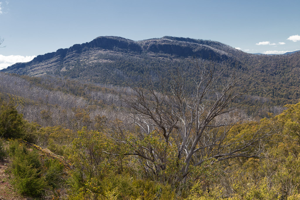
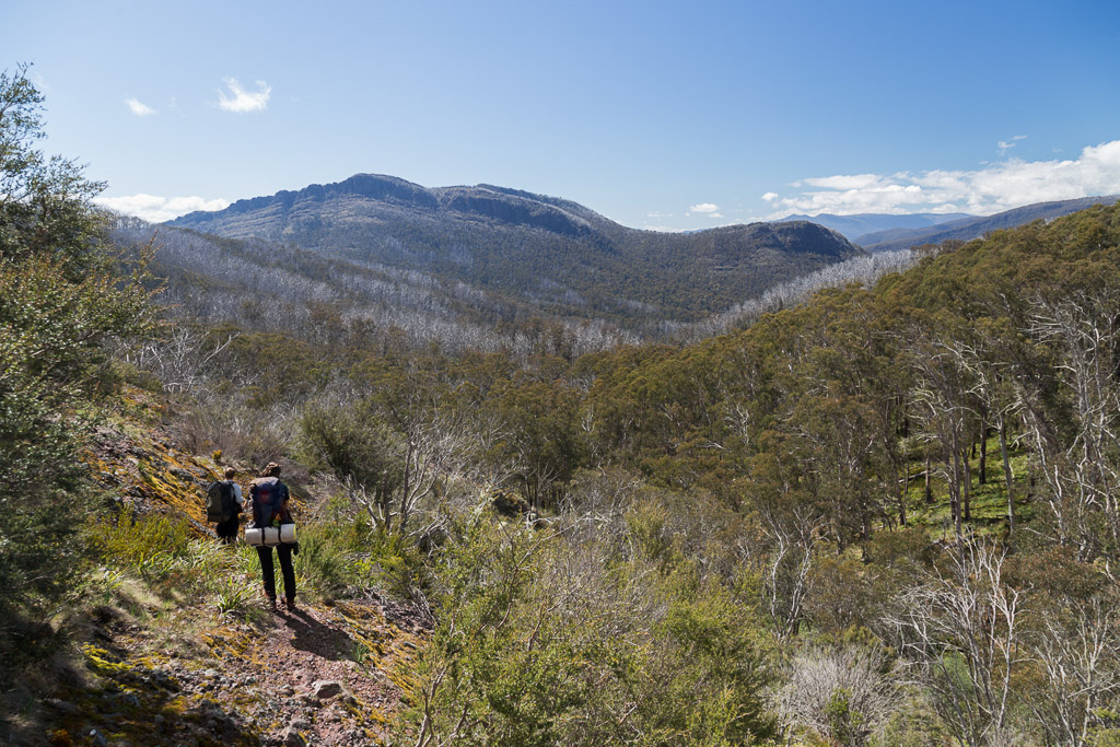
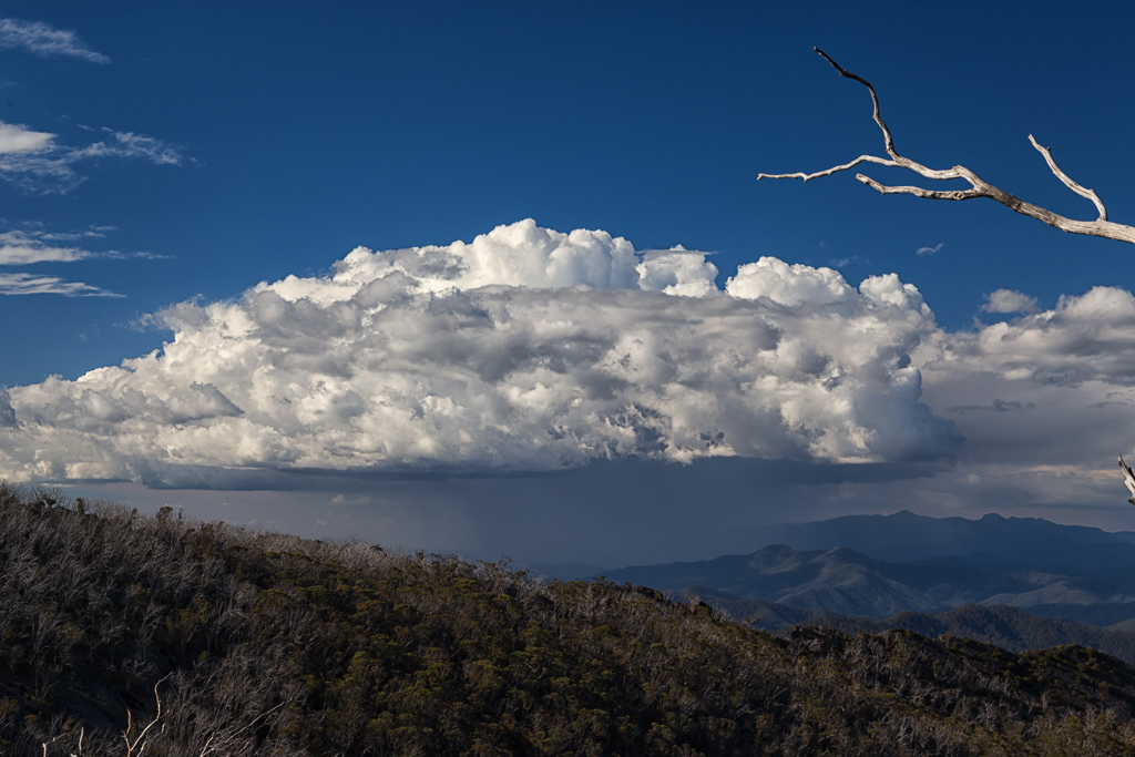
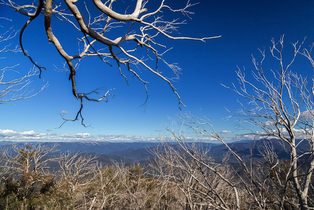
Anyway, at 1519 metres, the Viking is not particularly high, but its tucked-away location means it dominates the surrounding landscape. During this entire three day walk, it’s jagged, and what appears insurmountable rock wall, is in view nearly the entire time. I must admit, gazing at it from the Crosscut Saw, I felt a bit of dread, as I knew it wouldn’t give up its summit easily or more importantly, painlessly.
So, if you’ve come here cold, without knowing where this fits into the scheme of things, I’ll give you a quick update. The Viking Circuit, ideally is a more comfortable four day walk, but unfortunately had to be fast-tracked into a three dayer, due to my companions. MK and the General, only having three days to get it done. They didn’t mind though, as they’re fit as crap, whereas I’m more of a plodder. I’ve never come across something I can’t do, but I tend to end up with a face similar in colour to a strawberry-beetroot combo. Medically, this is usually caused by an exertion driven heart eruption.
What does this post entail? Well, it describes an attempt to stroll from Catherine Saddle to the heights of the Viking and then a plummet down to the Wonnangatta River in a day. What could possibly go wrong? Mm…
Okay, there’s your intro done. Remember the end of the last post? My idyllic description in poetry of the peaceful evening at Catherine Saddle? Let me elaborate on that night. There I was in the early hours of the morning appreciating some solitude, occasionally interrupted by what sounded like an owl in the distance. Suddenly there were multiple explosions from inside my tent. No, not from inside my trousers silly, but from the Thermarest Neoair mattress I was lying on.
Yep, I’d fallen victim to the ‘baffle burst’, similar to what I’d experienced with an Exped mat years ago. Do you want to see what I mean?
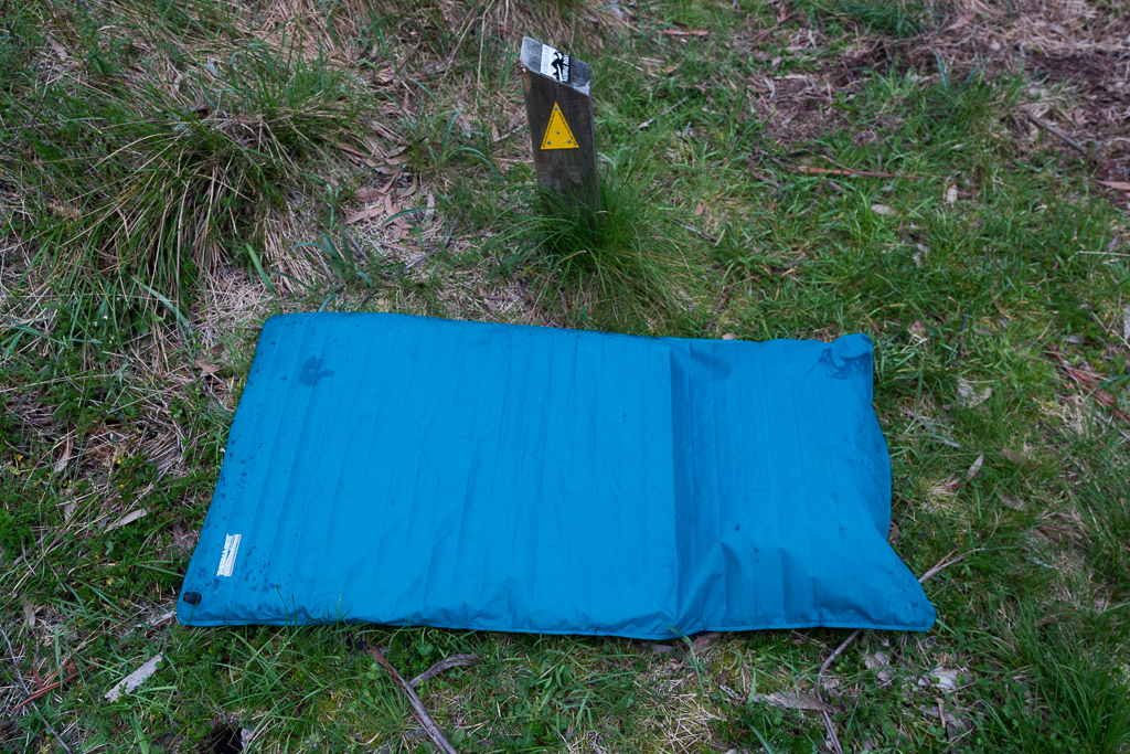
It’s not meant to have a built-in pillow.
Any minor movement caused an addition detonation, so I ended up deflating it and going for the more or less, lying on the ground method. Not ideal, but my eardrums appreciated it. Lightweight inflating mats don’t seem to last, but I guess I got a few years out of this one, so I can’t complain.
After a restless sleep, the morning brought another problem. Water. Remember in the last post, how the General went to find water, but came back with none, even though he could hear it? A little weird, but water was essential for this day to get off the ground, so MK and I took off down the overgrown Speculation Road to find some. After 500 metres wandering downhill, a dripping wet, ferny gully, was reached. A bit of fossicking about in the ferns and we successfully collected gallons, before trudging back to camp. Mm… Not so hard after all.
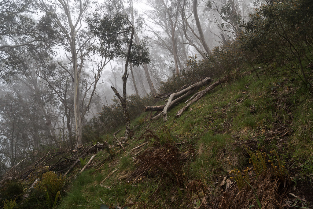
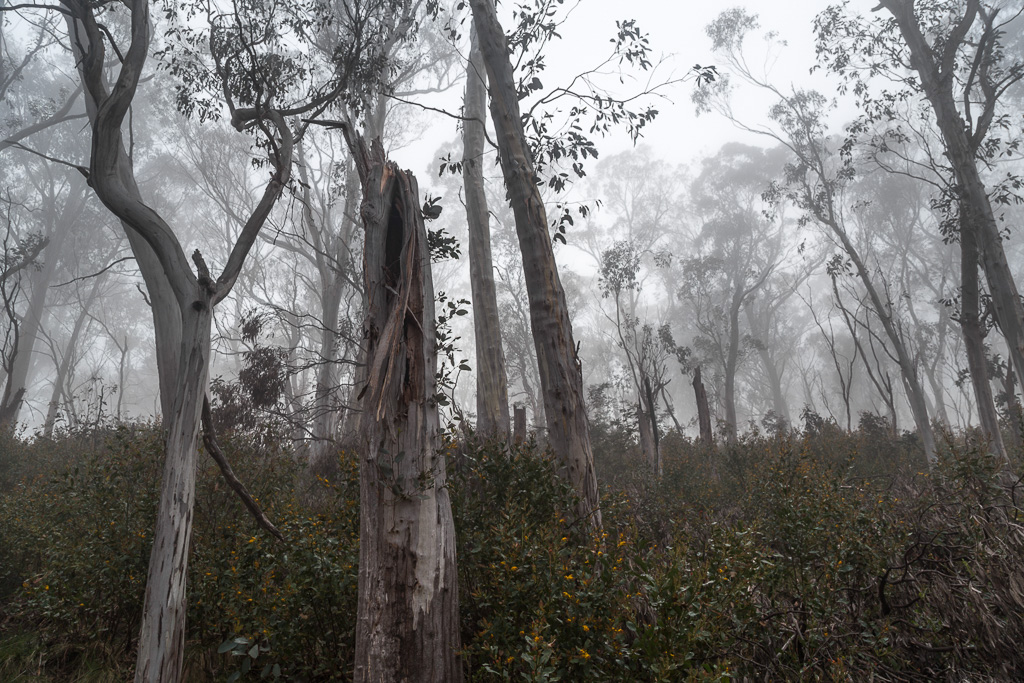
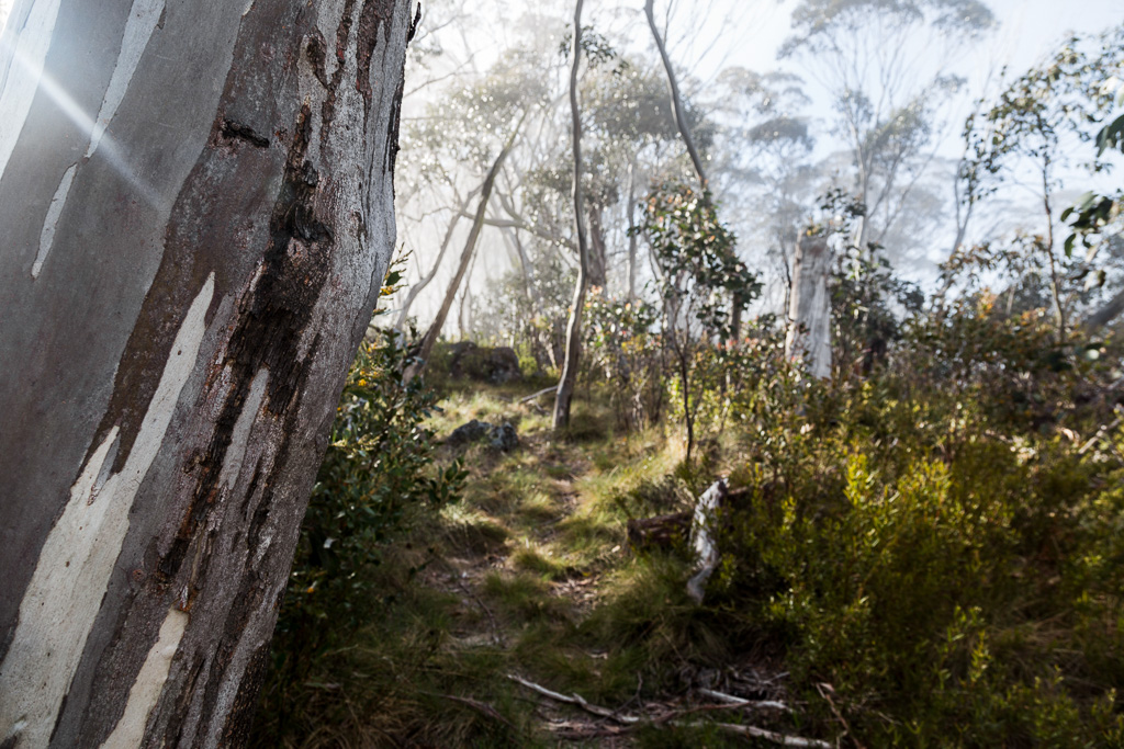
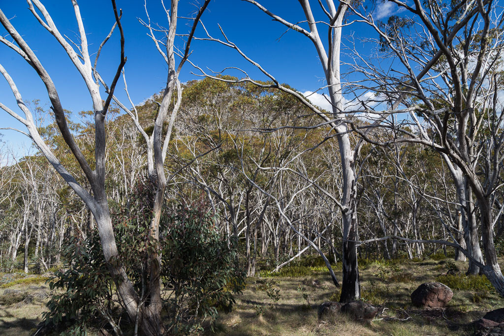
I guess that’s the easy stuff over and done with. Now the walking bit. Catherine Saddle was cloaked in the traditional alpine morning mist, but with no wind around it was always going to burn off into a clear day. What was the first target? How about walking three feet from the saddle and immediately climbing? Yep, the disappointingly named Mount Despair was the first cab off the rank. I do like a bit of a warm-up before hill climbing, but at least I’ve got the “Don’t rush me! I’m taking photos!!”, as an excuse to stop every five feet. It was a misty affair on the ascent…
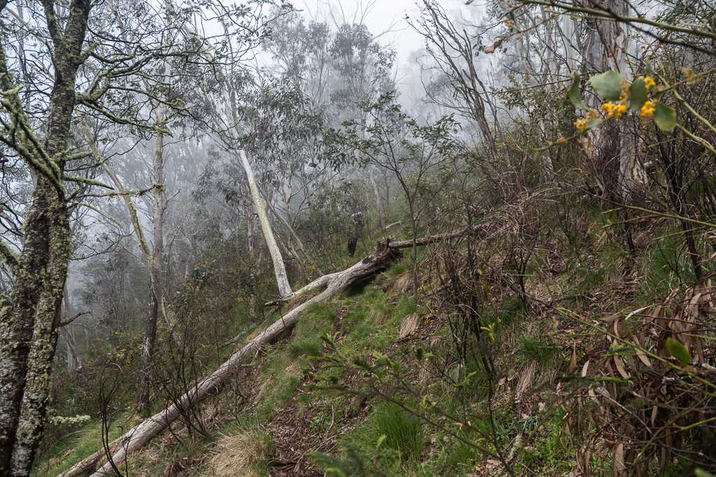
…with the quite sharp rise…
…leaving me feeling a bit of despair. Funny about that?
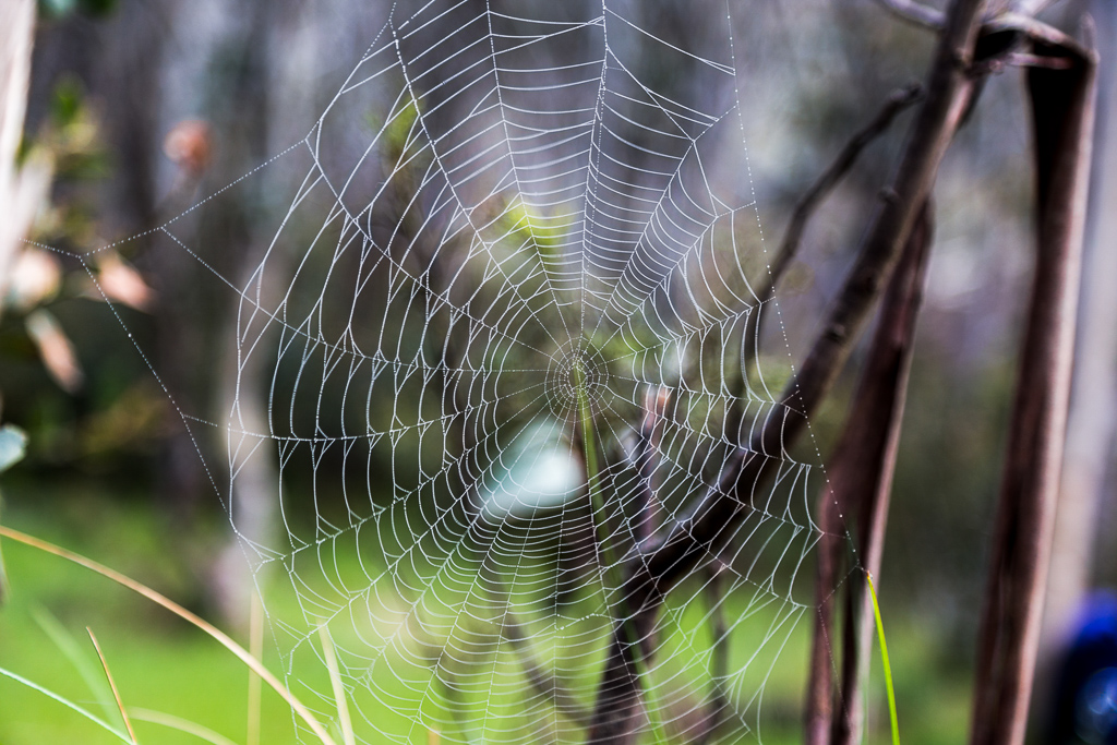
There’s one thing about the early mornings in the alpine area and it’s the traditional cobweb. These particular variety seem to have quite large gaps in the web. Wouldn’t bugs escape easily, or are they designed to capture something larger? Then again, maybe by the early morning, the spider has gone to bed for a well-earned snooze and the web has stretched? So many questions and no time to ponder.
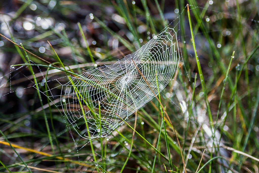
There was a smaller version lying at ground level…
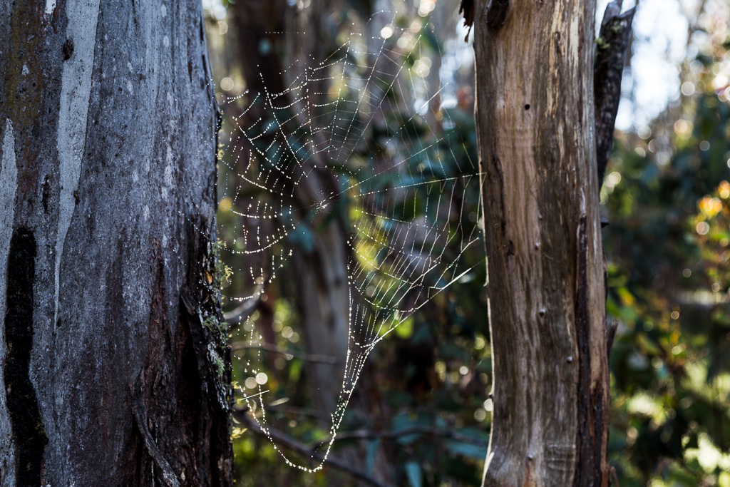
…and another which had been put out of commision by a passing pterodactyl.
I soon worked out why this hill is called what it is. I thought I’d reached the top, as it levels off, but suddenly it sneaks up on you, by heading up again. I’d have been the world’s worst ‘ye olde’ surveyor, as I’d have called this one, Mount Prick.
It certainly didn’t take long for the mist to clear either, with sunlight beaming through…
…as the top was reached.
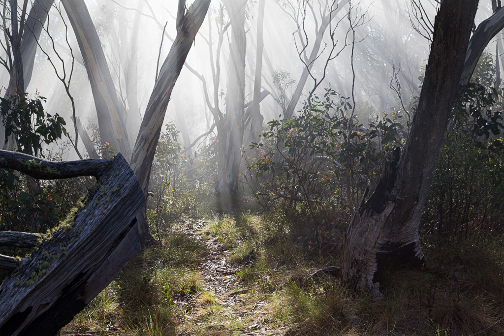
Well, that’s one hill for the day out of the way. A steep descent into a grassy area followed. Is it only me, or is it unfortunate to suddenly descend after climbing, knowing the height previously gained and now lost, will only mean another ascent in a short time? Oh, it’s only me.
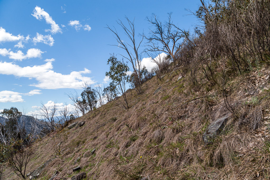
The moody early morning mist was well and truly gone and now an ominously clear sky with the associated big, blazing orb was beginning to cook me. Sweat was flowing, yet it was still early. Regarding this, I must admit I was feeling a bit of dread, deep within my trousers, as I only had 4.5 litres of water to get me through this anticipated long day.
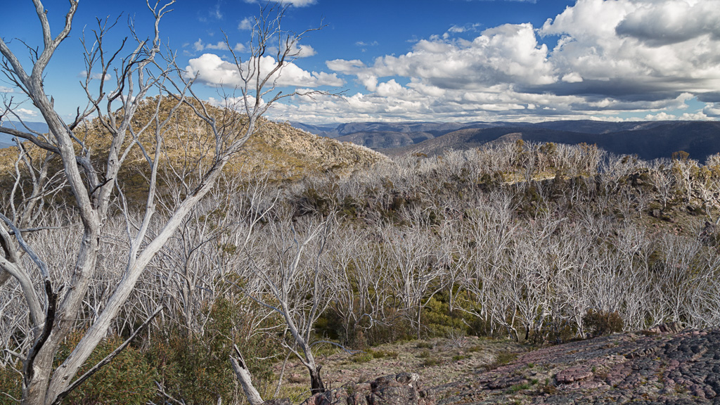
Mind you, there were some nice sights to take the mind off things. An open area gave a nice view of the Razor…
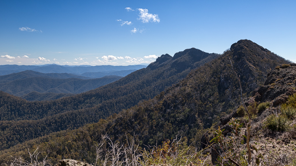
…and this was the same spot, which gave the valley view from an earlier post.
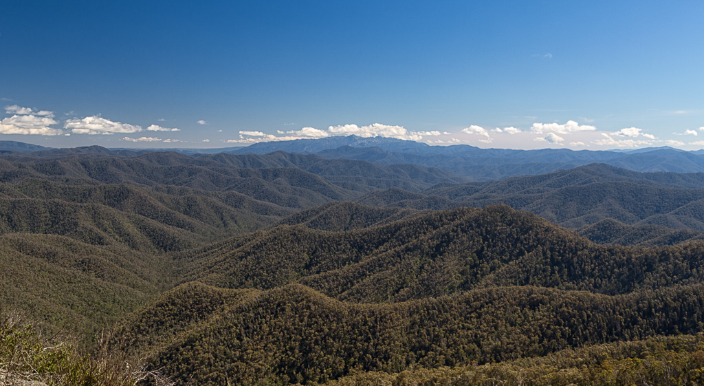
By the way. What’s the mountain in the centre far distance? It was high, as clouds were across its tops and it seemed to have large rock walls on its face. I took a wild guess and surmised it was Mount Buffalo. Then again, I’m probably extremely wrong.
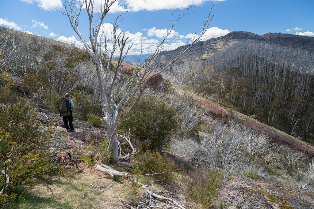
Where next? Well, the notes on my map certainly didn’t inspire me, including phrases such as, “…long and tiring…indistinct and scrubby…the walking slow and tedious…try not to venture too far from the crest…caused by other confused walkers and will lead to dead-ends…” Okay, can I have some new notes? These ones aren’t really talking things up.
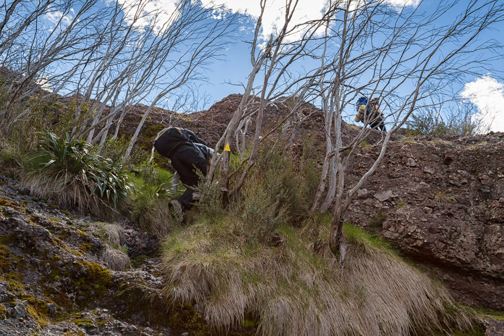
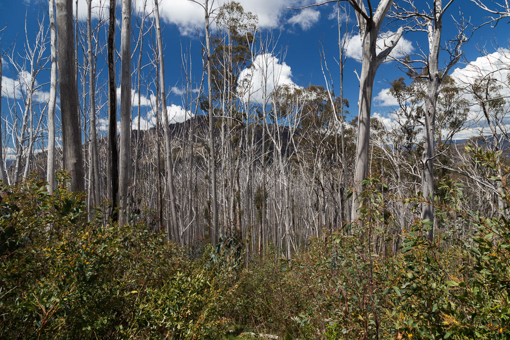
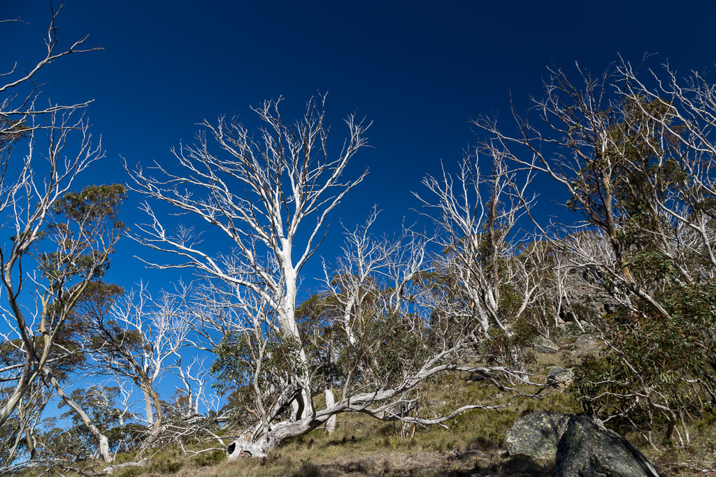
In the limited online stuff I’d found, this section between Mount Prick Despair and Viking Saddle, has a bit of a reputation. Along the Australian Alpine Walking Track (AAWT), passing through The Razor – Viking Wilderness Area (damn, include another vowel somewhere and you’d have the acronym TRAVWA). Track markers are meant to be intermittent, but most of all, bushfire regrowth from the alpine blazes a few years back, has meant some tough terrain to negotiate.
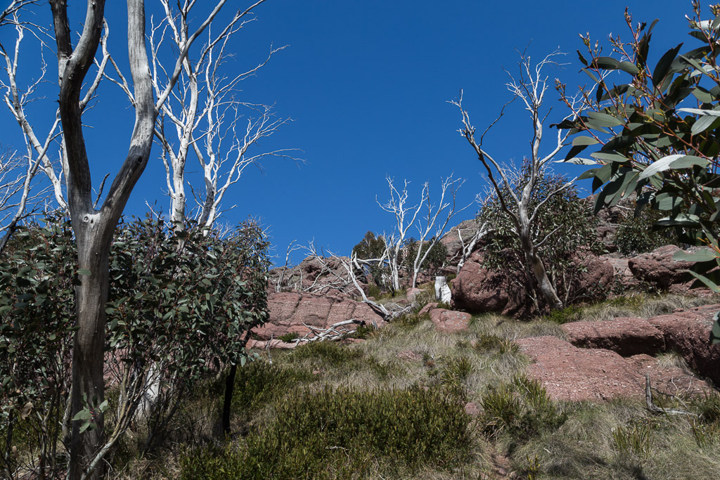
Mm… Potential pitfalls ahead and the terrain had changed a little. Hemmed in against large rock slabs, with a bit of loose scree underfoot, meant I’d slipped into concentration mode…
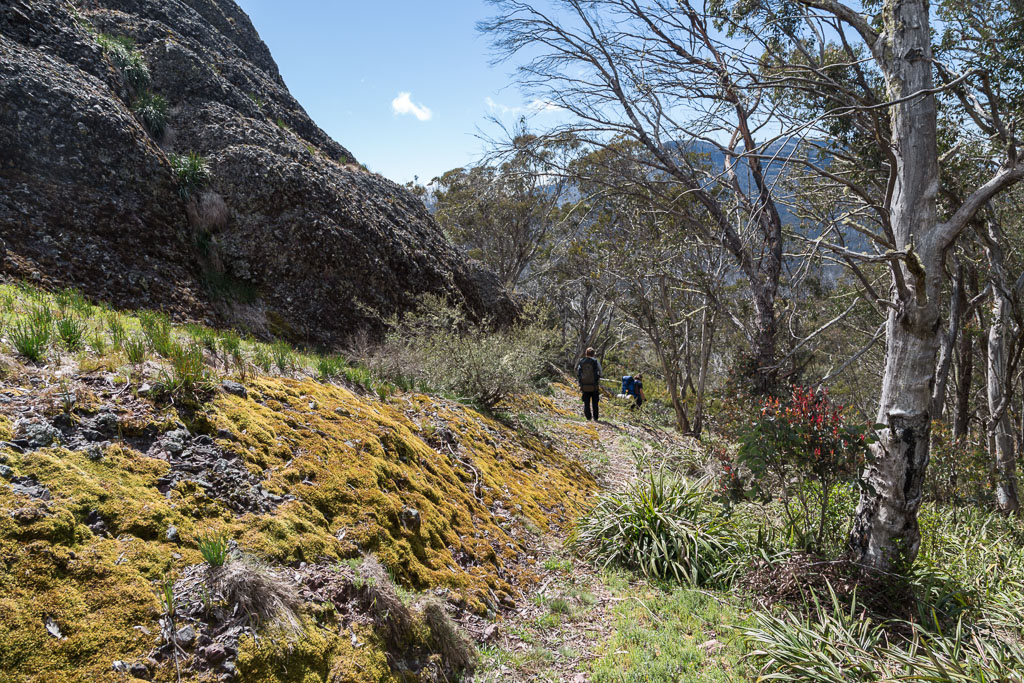
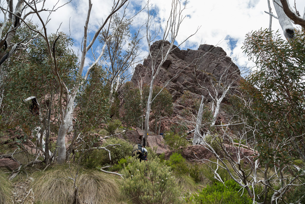
…whilst the Viking remained front and centre the entire time.
There was no real path, but with plenty of boot marks from previous punters, the way ahead was quite clear. Unusually as well, there seemed to be plenty of track markers. I thought there were to be none in this Wilderness Area? I guess there’s a trade-off? Enough people walk it and a visible track has been left, so why not include a few markers? There’s always an argument for what’s right, but the main thing concerning me, was I was starting to suck down the water like a complete bastard and to make it to the end of the day, I was already slipping into conservation mode.
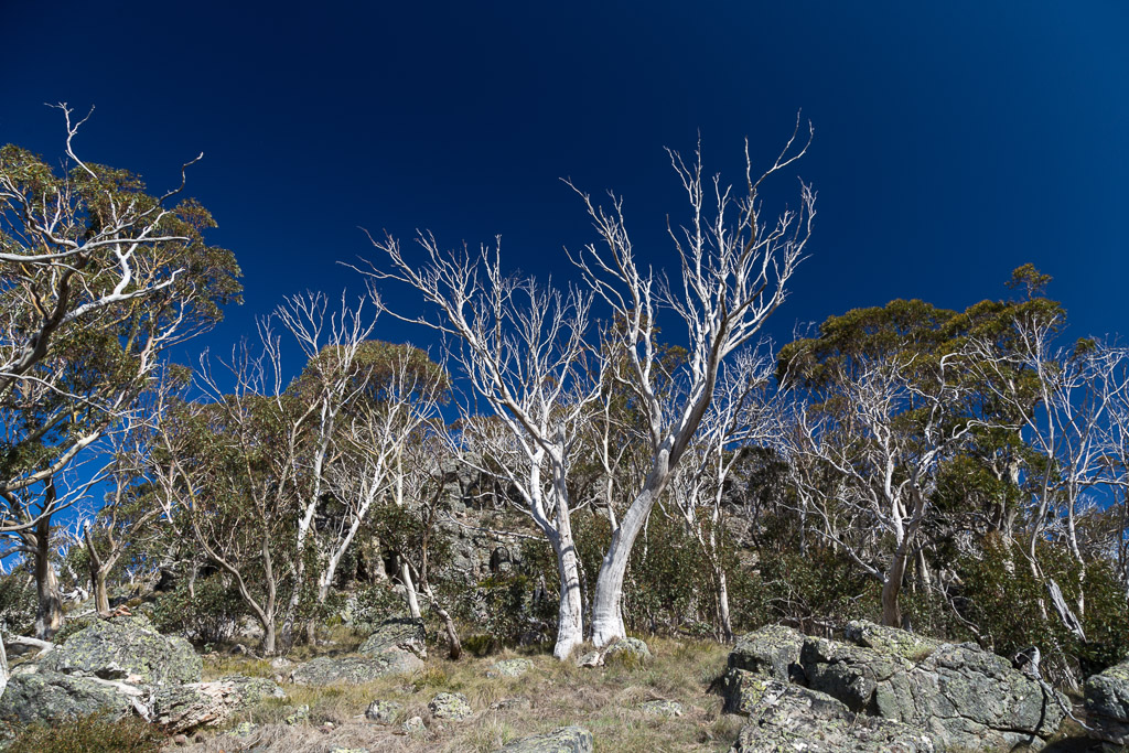
Continuing on, passing rock slabs and fallen trees…
…to pop out into clearer ground with the nemesis never far from view…
…and then the occasional steep climb to keep the legs working.
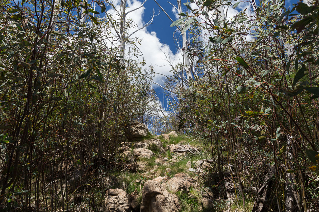
We were aiming for a cairn, which signals a turn-off for a visit to the Razor and secondly, indicates where the track suddenly makes a southeast turn towards the Viking. I must admit, there was no concern about finding this, as it sits in a large, open rocky area. Straight ahead…
Did you notice the markers in the previous photos? There was the odd occasion where things didn’t look right, but after stopping for a minute, we’d quickly spot a yellow triangle tucked away somewhere, which would point us in the right direction.
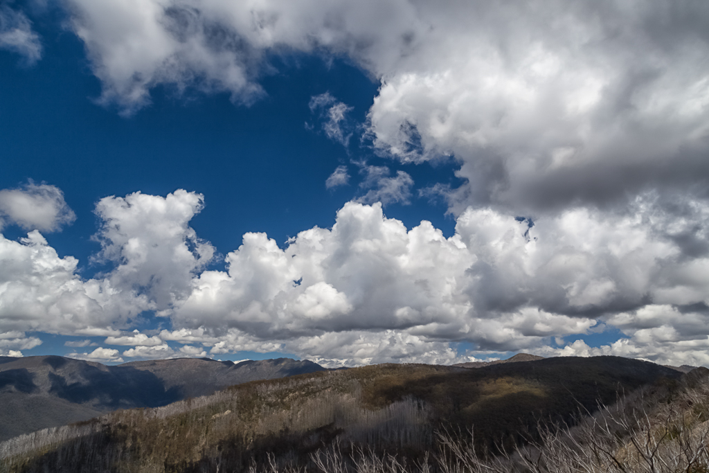
Reaching the cairn, I decided to drop the pack and lie back on the red rock and rest. My over-energetic companions took off to investigate the Razor, whilst I lay spread eagled and took in the sights. There were some nice clouds passing by to record from my peaceful reclined position…
It was so relaxing, I reckon I could have laid there all day. Forever. In fact, if my companions hadn’t come back, I’d still be there and you wouldn’t be reading this. Unfortunately though, you are reading this and they did come back, I did stand up and commenced putting one foot in front of the other again. Next stop was the Viking Saddle and a bit of a scree-slippery slope was negotiated…
…before my notes said, “…the track rises over a knoll…”. I’ve always had never ending amusement, by how the nondescript always catches me off guard. Fully expecting to be standing in Viking Saddle within minutes, I didn’t expect many dramas with this ‘knoll’.
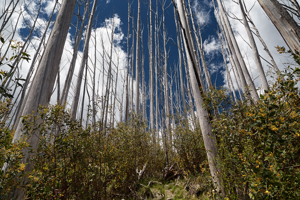
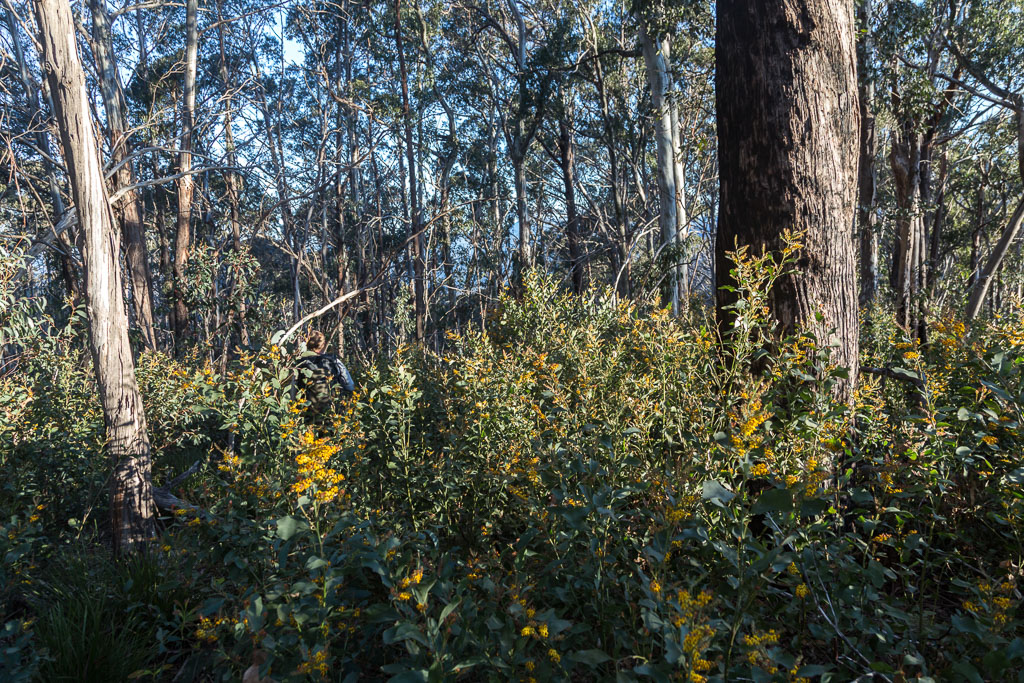
Once down amongst the saplings of bushfire regrowth, the sun seemed to be baking and breeze was non-existent. It felt like I was sucking air through cotton-wool, but any attempt to speed up and escape didn’t go to plan. Plenty of fallen trees lay in wait…
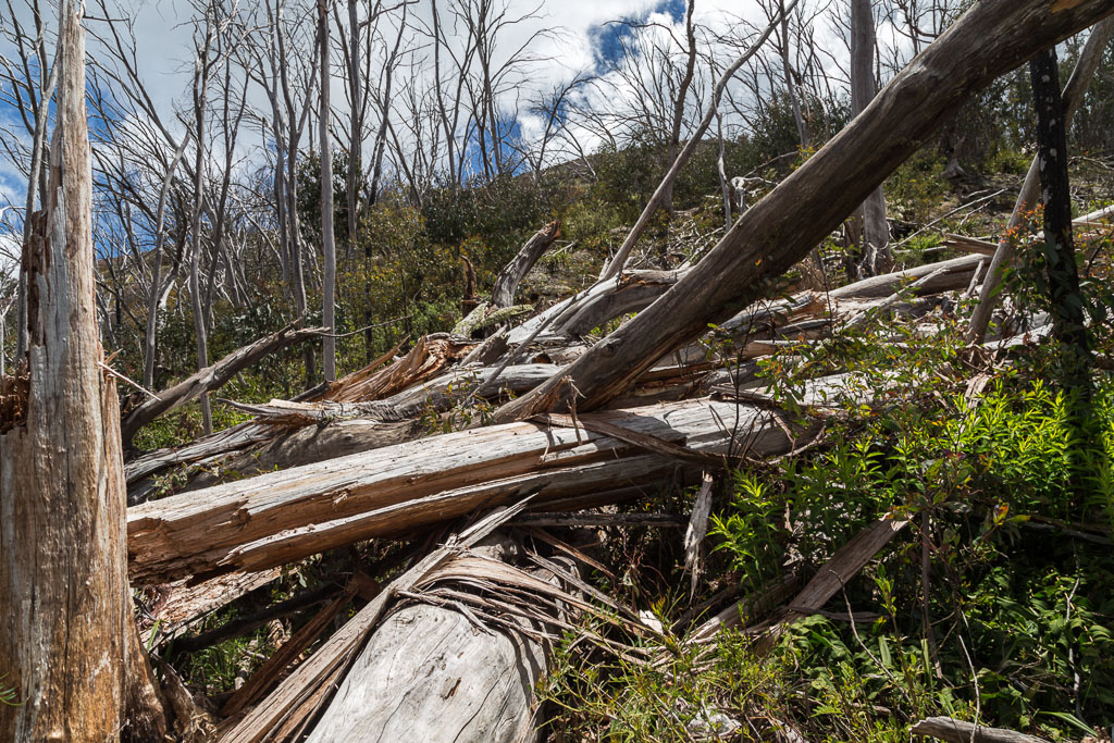
…and the track made no fancy attempt to circumnavigate the hill. Instead it went for the ‘straight over the top’ method…
…whilst the Viking appeared larger through the trees.
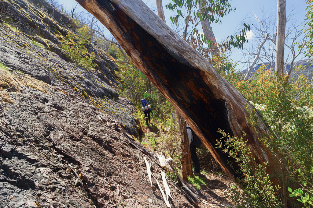
Finally a descent down to Viking Saddle began, but it was a pretty wild affair. Sure it had been cleared, but loose soil and the rocks meant I was bracing my creaky knees at all times. The sun continued to sizzle in the breezeless conditions…
…before I came to this fallen tree.
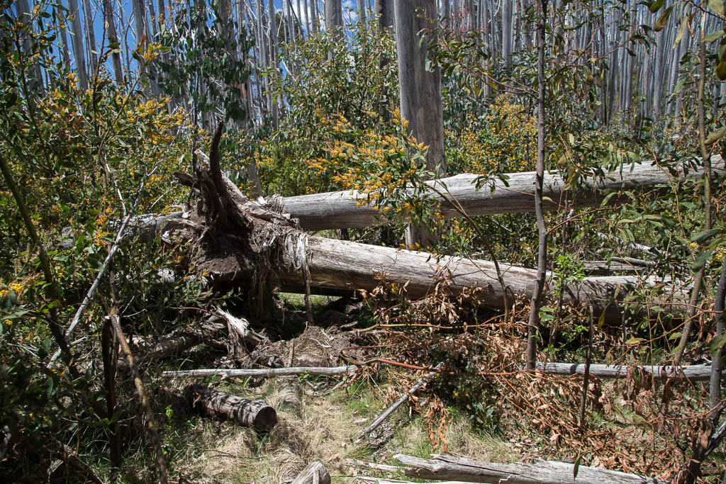
It doesn’t look too bad, does it? Well, it shouldn’t be, but somehow whilst clambering over the middle of the two trunks, my right leg slipped between both, delivering a bone crunching belt to my right knee, levering off some skin at the same time. That’s always disappointing.
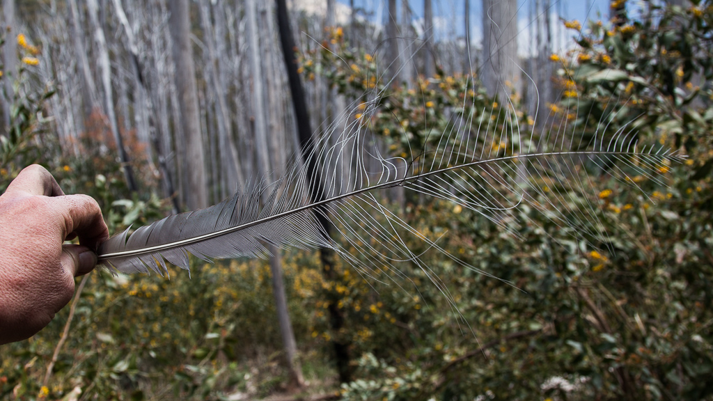
I continued the downhill ramble with a bit of a hobble, now uttering audible profanities about this knoll. At least there was the odd feather to peruse to break up the obscenities. Here’s what looks like a fucking lyrebird feather. Oh sorry, I got caught up reliving the moment. Let’s do that again. Here’s what looks like a lyrebird feather. That’s better to read, isn’t it?
Finally I reached the open clearing of Viking Saddle and promptly collapsed on the ground in a large, sweating heap. The flat, grassy area may have looked parched, but it was welcome to lie down for a minute. Well, until, “OH MY FUCKING GOD, WHAT’S THAT???!!” Yes, somehow after approximately 15 seconds of flopping on the ground, something bit me on the stomach. What could this painful thing be? Lifting up my shirt revealed a bull ant casually strolling across my guts.
That bastard caused the most annoying itch on my stomach for about two weeks. Later, when I related the story to the Smuffin and described how unlucky I was, he came back with the standard ‘fat boy’ response, “Well, what do you expect? It’s a big enough target.” Grrr…
If doing the walk in four days, then the Viking Saddle would make a logical stop, but the joint seemed way too dry for my liking. Apparently if you want to go walking downhill for a few thousand kilometres you’ll find something wet, but that never turns me on at the end of a day strolling. No, we had a snack and kitted up, as now the Viking had to be knocked off.
I must say, I was feeling decidedly average due to the amount I’d sweated during the morning. Yet again I was on an alpine walk, with the mantra, “You never know the weather up there! It could snow in any season!!” ringing in my ears, but instead finding myself walking on the surface of the sun. My warm, alpine gear unused in my pack and acting as ballast. It reminded me of a trip to Mount Feathertop a few years ago. There I was in heavy pack and full kit, surrounded by people in runners and shorts. You think I would have learned something by now, wouldn’t you? Unless the forecast is hideous, don’t take heavy shit up into the hills in summer. Definitely grrr².
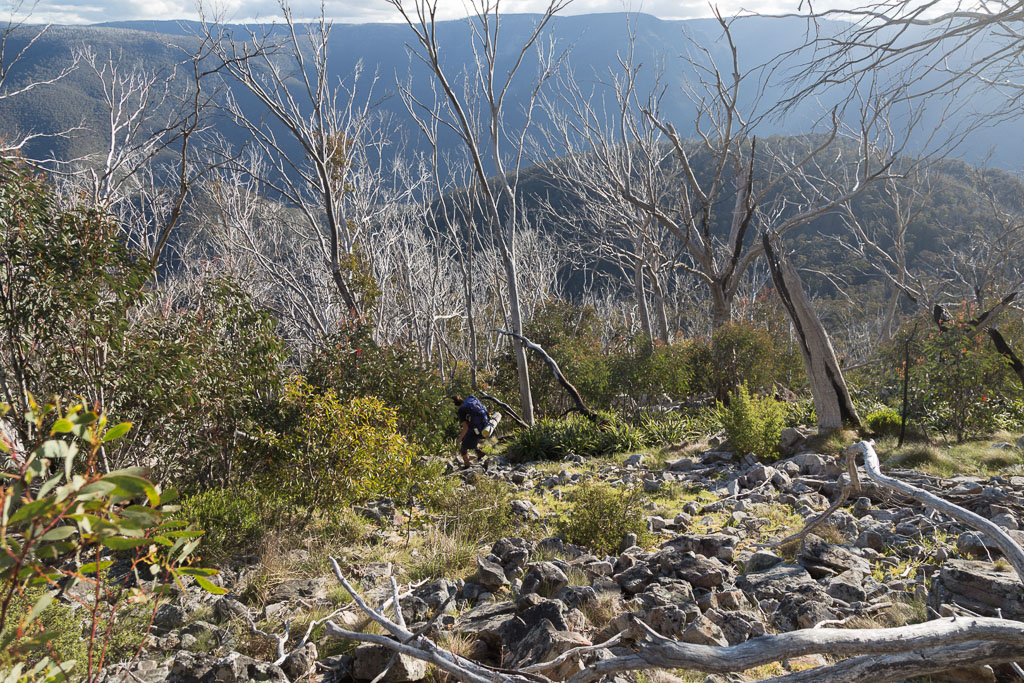
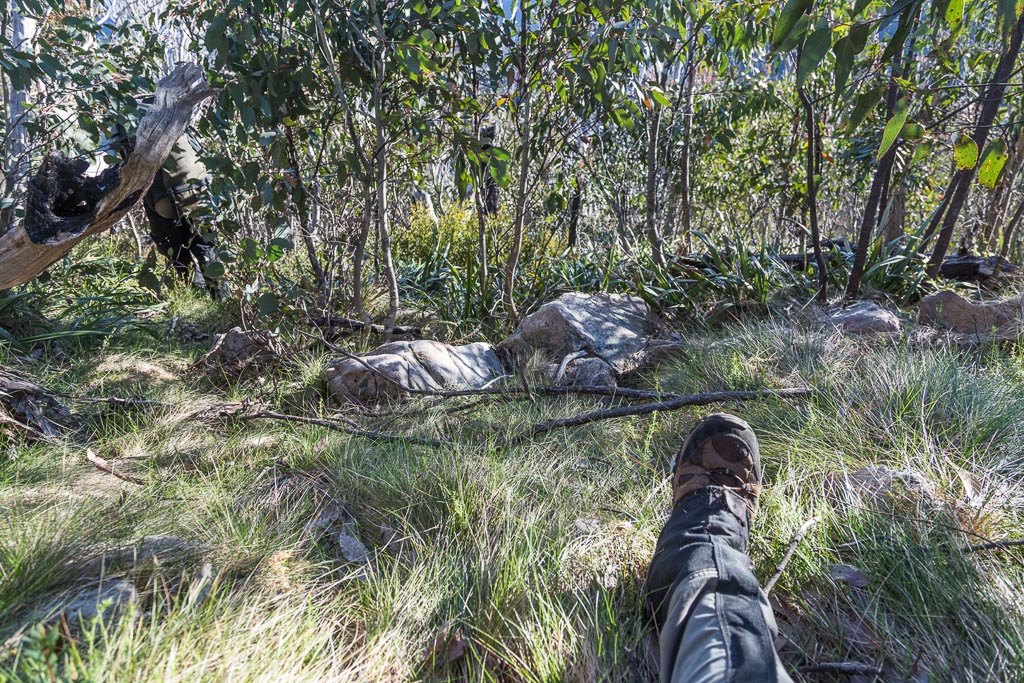
Now the Viking. The track left the clearing and was quickly swallowed up into tall bushfire regrowth saplings, making it a stifling atmosphere. It was around this time I felt myself officially beginning to crack and the litres I’d sweated had to be the problem. Beyond fatigued, it’s here on the climb I had to stop and sit down for a while on a fallen tree to take stock. It’s where this photo was taken…
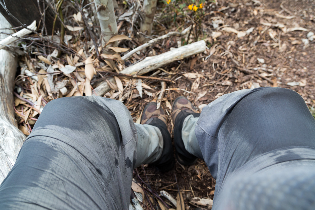
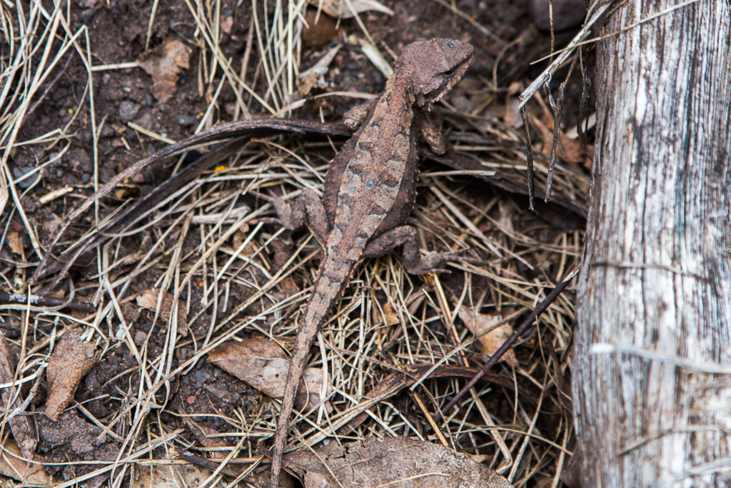
By looking at the photo above, my PTSD has just kicked in. Lucky I’ve got a fistfull of Valium to get me through to the end of the post. Staring at the ground in despair does have some advantages, as I spotted this well-camouflaged lizard.
Finally, I summoned some mojo and continued up. Things were a lot better once out of the tree-line and some oxygen could be breathed. It’s kinda steep though…

…with the open slopes to one side.
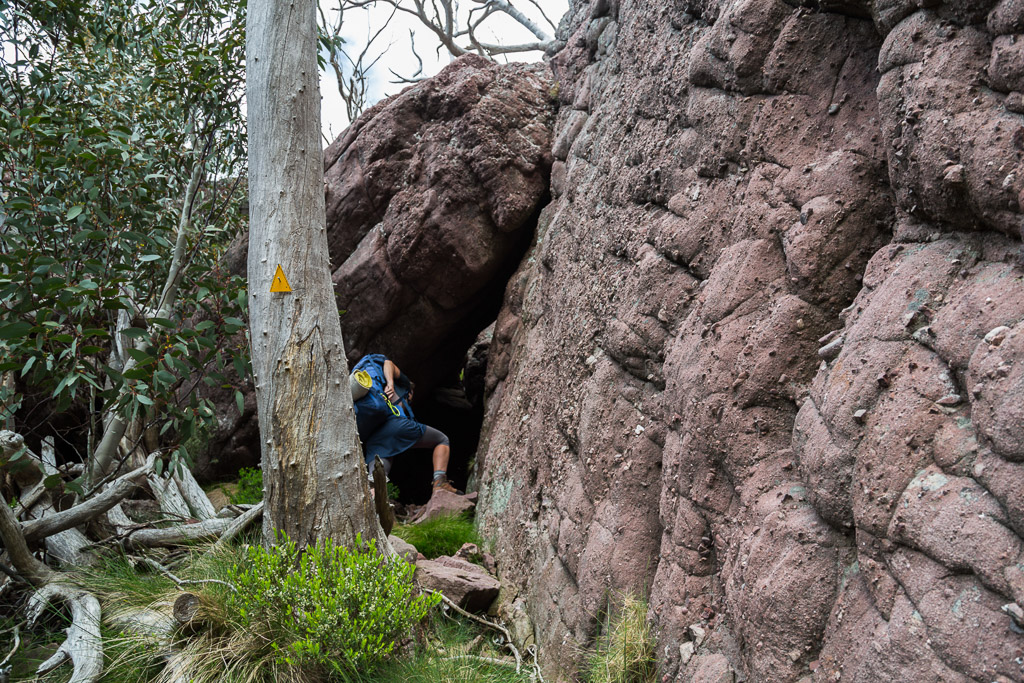
The Viking does have one notorious section. A rocky gully is at first climbed…
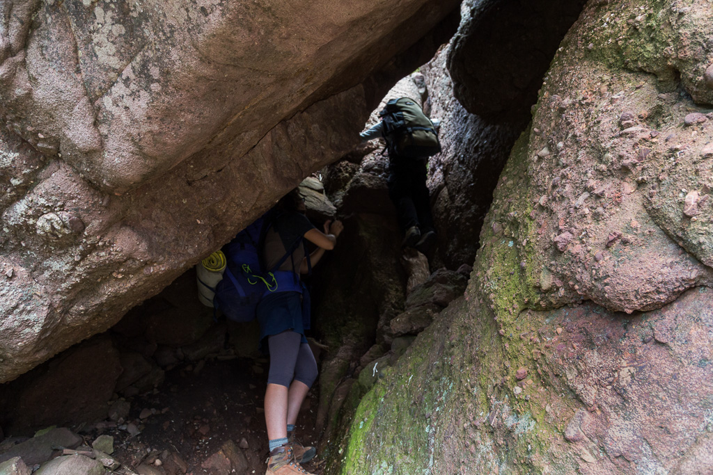
…before reaching an almost vertical chimney between rocks. Id read about this, but yet again, the online info was a little scratchy. There was talk of having to pack-haul, so MK came equipped with some rope. Apparently, some thoughtful punter had once tied a rope to assist the climb, but since the fires, it’s long gone.
The tricky ascent was easy to find. Just keep following those arrows.
I must admit though, I had an impression the chimney was right at the top of the Viking. That’s not the case, as there’s still another 800 metres or so before the top. It also didn’t seem worthy of taking the packs off either, as firstly the General went up in rapid-fire time…
…and then the world’s largest man ascended.
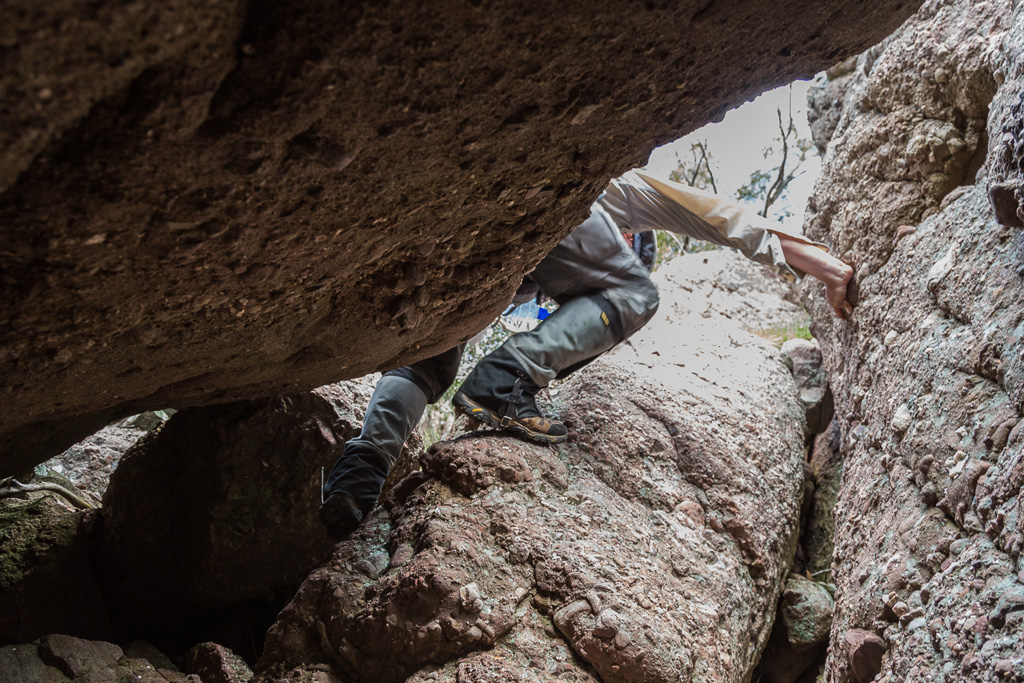
It was a little tricky and the General gave me a helping hand, but I thought the whole thing was a bit of an anti-climax. I’d pondered this clamber on many occasion before this trip and really, it’s not too hard. Then again, if wet, it might be a different story trying to get a foothold. Anyway, that was done, so on we continued, with up being the overall theme.

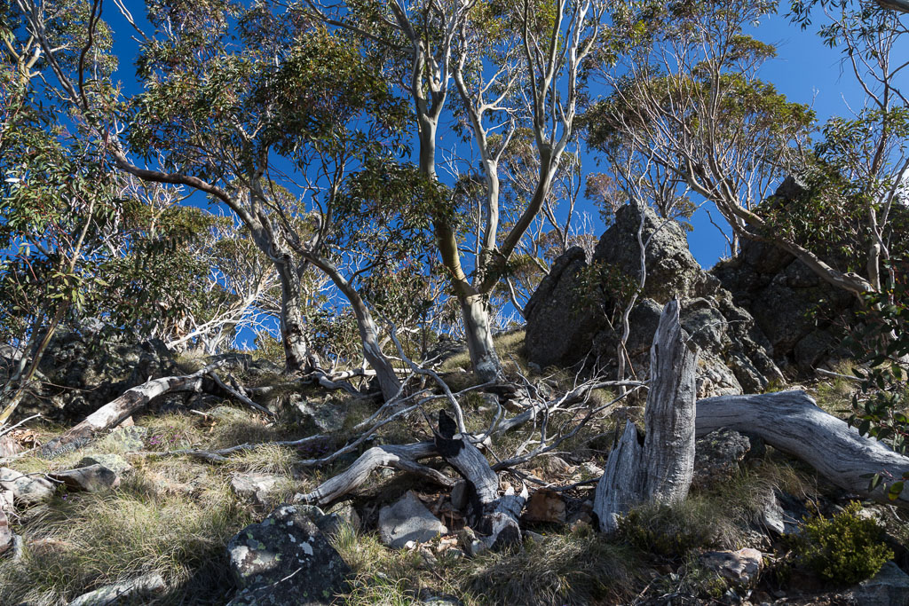
Actually, the ascent after the perceived chimney nemesis was a bit of a ball breaker. A lot of rocks and branches to negotiate…
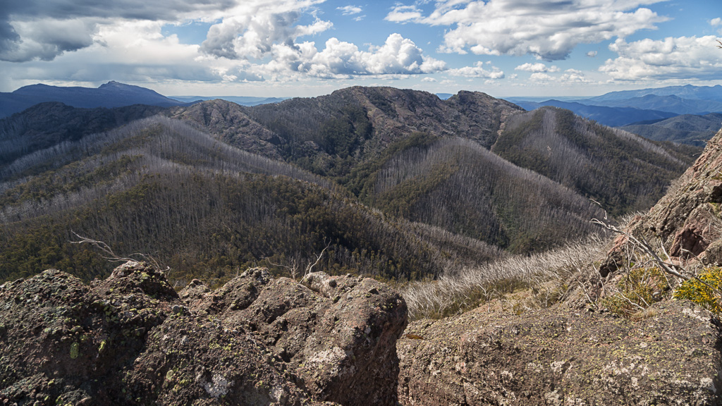
…but, if turning around from the rubble, there were some nice views of ground previously covered.
The rocky walls of the Viking were off to one side of the climbing gully…
…but the way ahead was still clear with arrows leading the way.
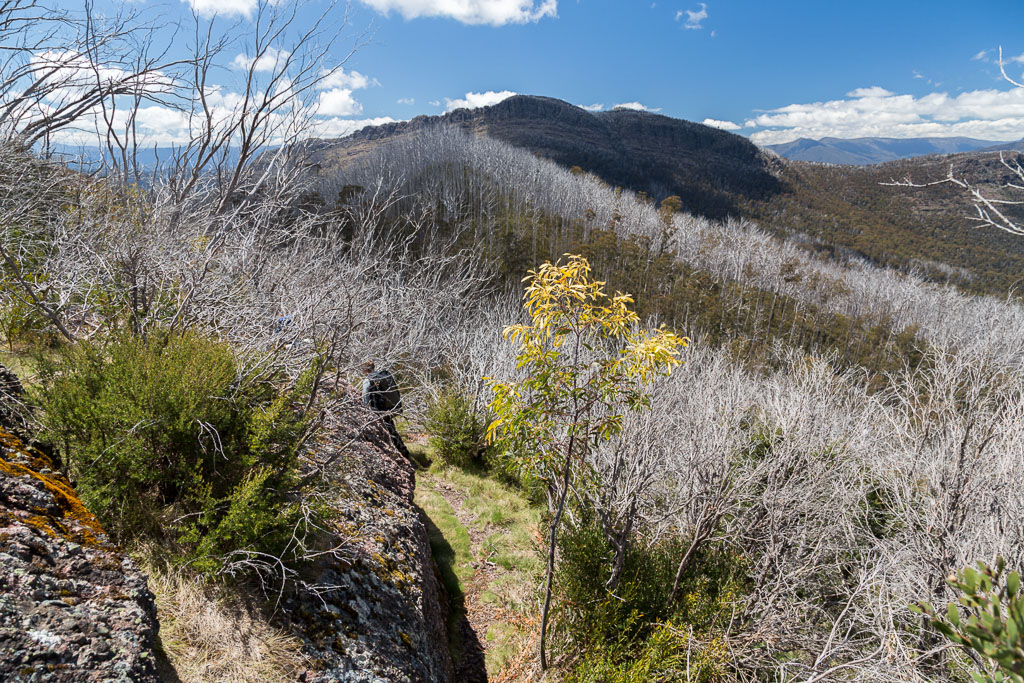
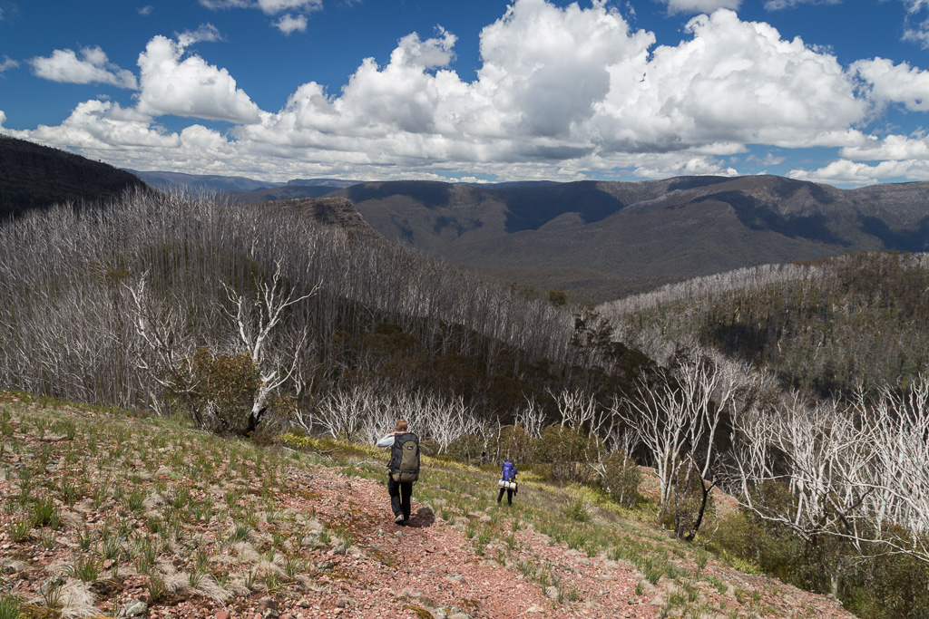
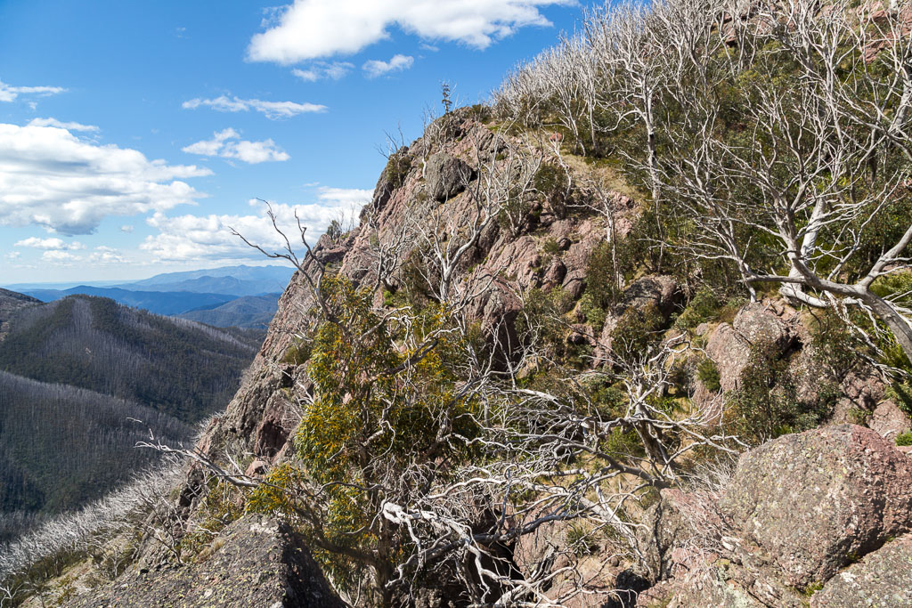
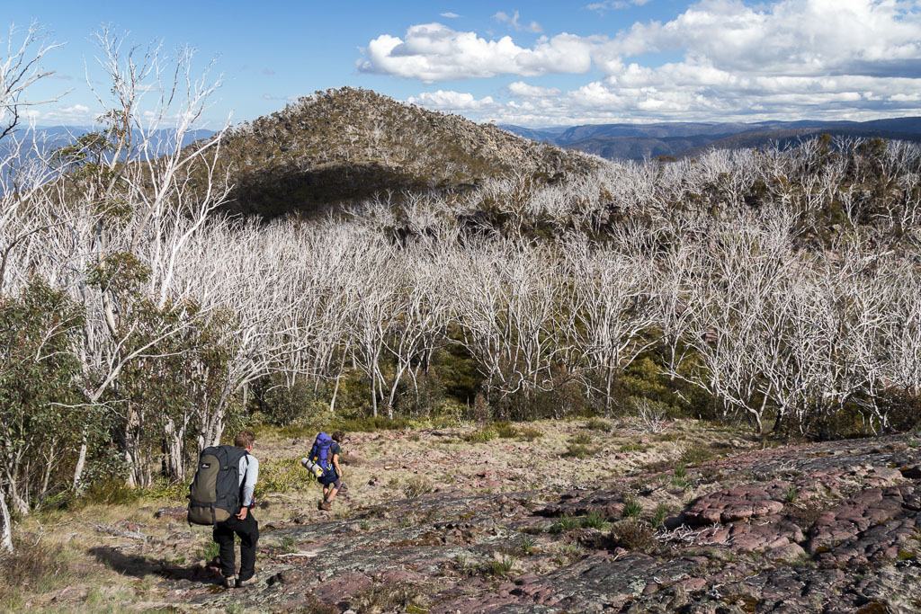
The only trouble is, we were meant to stop following them, as they continue to send one down the AAWT. We of course, had to look for an exit, as the South Viking was our next target, before beginning the unmarked, descending spur to Wonnangatta River. The thing is, where the bloody hell were we? The Viking is no traditional peak, with rocks and gullies going off in all directions. In the end, after a bit of pottering around, we found the South Viking…
View of South Viking from the Viking
…and began the stroll down into a large grassy saddle between the two peaks. Actually, did I even make it to the top of the Viking? I’ve no idea, as the ‘three days not four’ walk meant we had to speed up a little. It’s a pity, as I’d liked to have pottered around a bit more, rather than watching the time. I’ve heard of people camping up near the top of the Viking and I can imagine if you’ve got the water, it’d be pretty epic. Finding flat ground for the tent might be even more epic, but I’m sure there’s something around. There’s definitely plenty in the saddle and it’s quite a nice protected spot…
…as we left the Viking behind.
You know what? At this stage I was knackered and the South Viking is not really what I wanted. It’s not high, but with my leaden legs, it felt slightly Everest-like…
The other two scampered and soon vanished into the distance. I brought up the rear and the only thing keeping me going was how much I could abuse a polarizer. I aimed to make the sky so blue, your eyeballs would seize up when looking at it.
I’m telling you, don’t blame me, blame the lunatic who invented such a thing. If there’s some sort of camera equipment to be abused, then rest assured, I’ll take it to the next level. I almost succeeded in making the sky black.
The slowest ascent of the South Viking in recorded history was just about complete…
…before just like the previous day, a rogue cloud passed by with an occasional crump of thunder. I almost begged this cloud to park itself over my head and dump gallons of rain onto my head, and if I was really lucky a lightning bolt would collect my bonce and put me out of my misery.
I was still alive though. There’s just no luck in this world. The cloud was moving on and the weather in our direction of travel was clear.
Amidst my praying for a high-voltage death, something a little more realistic was about to happen. Strolling across the rocky top of the South Viking, I was stumbling away when I stepped on a couple of small rocks, which sat a few inches from the ground. What just so happened to be between these two rocks? Well, a snake of course and I only noticed it as I stomped the size 48 down.
As I proceeded to crap my daks, I felt it slide against the sole of my boot. I really thought it would spin around and give it his best shot, but instead, he just sped up into the grass. I do wear gaiters and I guess they give some snake protection, but I’d rather not test the theory. In my absolute pant-dumping fare, I fired off one photo as the slitherer vanished into the grass. What you get is an out of focus photo, which kind of sums up my picture taking ability at that moment.
No, it’s not your glasses. There is an out of focus snake between the rocks.
I must say, the only snake I saw for the entire hike and I just so happened to step on it. Anyway, with the excitement over, there was a new problem. How do we get down to the the river? We knew a spur had to be followed and it took a bit of pottering around before we found some cairns and started to descend.

Then again, I reckon we missed a few cairns on the way, but we continued heading down.
Guess what though? This was the start of an insanely frustrating time. It’s one of those places where you can’t really get lost, just keep going downhill and you’ll hit the river sooner or later, but we were pressed for time. The sun was getting low and the rocky, grassy terrain was sending me slipping and sliding, before generally face-planting. Here’s one photo of me enjoying lying on the ground, contemplating the location of my left leg, which I believe is jammed half-way up my arse at this point.
MissingLeg.com
In our walk notes, the time suggested from Viking Saddle to the Wonnangatta River is four to six hours. Have a guess how long it took us? I’ll give you an answer at the end. Just remember the four to six bit.
Heading down, we ran off a compass MK had and the GPS, which was flopping around my neck. By now though, I was out of water and had hit an extremely well constructed wall. There was also some freestyle blubbering, so the General, who appeared to have just got out of bed, as that’s how fresh he looked, thought it best to take the GPS.
I’ve no idea what happened next, as I’ve tried to eliminate it from my memory bank with extreme electro-shock therapy. Keep in mind the next photo is the last one I took for the day at 6.12 pm. It’s when we first started entering some head-high regrowth.
Making up words from this point on is fully acceptable, as the bush became a little thicker, a little zanier, a little muthafuckin’ annoyingna. We stumbled around, descending all the time, falling over here and there, before light began to fade. Twilight became just plain darkness and luckily for us there was a full moon. About a kilometre from the river it was pitch black, thick saplings blocked our path and walking in the dark is always tricky. Especially on a steep slope, covered in rocks and fallen trees. I had one epic fall, where somehow I fell sideways and wasn’t able to protect myself, as my arms had stopped functioning. Luckily for me, I broke my fall with the side of my head.
We ended up walking in circles before the General called a halt in the proceedings and by utilising his rank, guided us down to near the river. Somehow, we popped out into an opening with a postage stamp-sized piece of ground to set-up out tents in.
I kid you not, but it was easily the most destroyed my body had felt, well, since the last time I walked with MK. Do you see a theme here?
Now for some comedy. Remember the photo taken at 6.12 pm? Guess what time I fell to the ground at the conclusion of this day? It’s more than worthy of a drum roll, complete with cymbal crash…
Yes, it was 10.50 pm. Did you see that? Okay, just in case you didn’t, here it is again, 10.50 PM. Oh yeah, remember the four to six hour suggested time from Viking Saddle to the Wonnangatta River? How about 10 hours?!
My evolution, what a complete ball breaker. The laughs continue if you ever saw the GPS track. 16 km? Sure, no worries. How about 16 hours?!
I have the gpx track if anyone wants it, but I suggest you don’t, as a closer inspection will show some truly bizarre behaviour near the river. It’s a crazed track, which thick bush and no light causes.
How about that then? Surely you’ve read enough. If you’ve made it to the end, give yourself a pat on the back and an extra potato cake with your fish and chips. I guess it hasn’t been all bad, as the blokes surrounding me in white coats have long gone to sleep. Anyway, I’m done and a double appointment with my psychiatrist may be on the cards this week.
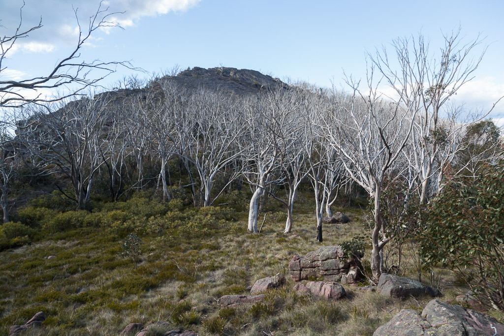
What’s next? Oh yeah, where’s the Valium gone? It’s the Zeka Spur Track…

Another great post. Parks put the track markers back a few years ago, with assistance from John Chapman. I think we only took about 3 false tracks. Water at Viking Saddle is a pain, but a lot less than walking for another 10 hours (I think it took us less than 8). At the bottom of the spur I kept telling myself to keep to the centre because that is what the track notes said, and still ended up off to the right with a steep drop into the river and a scrubby walk down to the campsite.
Excellent, had tears running down my cheeks.
What could go wrong going up Zeka, hey….
Yes, I did read about John Chapman helping out with the markers. There certainly were more than I expected. Mind you, I wasn't complaining! A couple of times we found some head-scratching moments, but there was always a marker somewhere near these spots. I guess it took a bit of fun out of it, by taking the odd false trail and ending up at a dead end?!
Talk about underestimating the time from Viking Saddle! I reckon stuff like that always happens when I'm tired and done for the day. If we had time and daylight, it wouldn't have been the balls up it ended up being! The time got eaten up in the dark, due to falling over and having to move so slow on that steep slope, not knowing what was underfoot. Not something I'd want to repeat, especially having no water as well. Maybe one day I'll go back and do it from Viking Saddle instead! You definitely had the best idea 🙂
Thanks! My pain always seems to make good entertainment 🙂
Zeka?? Mm… I'm contemplating how I'm going to write up the next one. Either long winded or really quick, so I don't have to relive it again 🙂
Ah, the NeoAir. Never tried one but they had their defenders and their fierce detractors among thru-hikers on the PCT. Sometimes you pay in undesirable ways for that legendary lightness.
This looks like a killer hike in more ways than one – the place names sound like rides in a theme park! Beautiful photos too, glad you survived to share them.
Great read, I can relate, but won't say how yet as I'm still blogging my AAWT end to end in 28 days on Oz4adventure.blogspot.com I actually remember the very places you took some of your photos, I was also travelling in the opposite direction. Neo-Air still intact!
I appreciate there aren't too many options to choose from under the heading 'Event Type' when saving your GPS record, but in this case in particular it's such a pity there's no 'Self Flagellation' or 'Torture' or even 'Fiasco' option to choose.
Looking forward to the next post.
: )
It wasn't much fun when we walked backwards and forwards several times until we eventually realised the track was a scramble up through the rocks. I've heard that a few groups, after losing the track, have tried dropping into the Wonnangatta, which is something they won't be trying again.
This area is the setting for Tomorrow, When the War Began series of books. The movie was filmed elsewhere.
Yeah, although I was saying the odd false trail/dead end could be fun, I'm saying that from hindsight. In reality I'd be going off my rocker! Just about everything I do looks better in hindsight 🙂 Don't forget, if something stupid happens, I ponder "That'll be alright for the blog". It changes my outlooks on things!
Oh, dropping down to the Wonnangatta? I can only imagine the horror of such a decision!
I actually like the torso only version of the NeoAir. I reckon it's the most used of any mat I've ever had! It doesn't bother me having my feet off a mat and it makes the thing so light! It lasted well over 2 years, so I can't complain, as I have legendary bad luck with inflatable mattresses!
I'll say this now about the hike, but I'll be repeating it in the next post as an overview. I can't seem to remember a kilometre of so of casual flat ground. It all seemed to be climbing or steep descending! Certainly a walk that keeps you awake 🙂
Hey there, I was just checking out your blog about the AAWT last night! Interesting read, as you were left to finish it solo. Good work! I dream of doing it one day, but time is always the worry, as I reckon I'd need at least 40 days at my sloth speed.
Yeah, it's funny how walkers tend to see similar things, as I've seen a few other photos online, which are taken from more or less the identical spot where I took mine!
I'll keep an eye on your blog, as I'll be interested to see how it all panned out. I assume you survived, unless your stunt double has written this comment…? 🙂
Hi Dayna, I have thought about Garmin Connect before and wondered how much fun it'd be if I could come up with own 'event type'! I'd essentially go to a BDSM 101 manual and just pluck names out of that 🙂
Another ripping post there, must be a laugh for your buddies! 😉 Look forward to the next chapter in your adventure.
Thanks Daniel! I'm not sure my companions have read these posts? They're too busy out exercising 🙂 About two days after this walk, when I could still barely move, MK rode to Sorrento and back from Melbourne. A lazy 200 km ride on the bike to loosen up the legs 🙂 Wish I had that fitness again!
Next chapter? Mm… It'll be a grim one, I'm afraid…
What exactly was it that slid against the sole of your boot after you crapped your daks upon seeing the snake?
It was the snake. I stepped on it. The thing is, it went between a couple of small rocks and as I stepped on the rocks, I felt it taking off on the bottom of my boot. Just as I put my foot down I realised what I was stepping on and crapped myself! Luckily those rocks were there, otherwise I would have put my full force straight on the bugger. I'm not entirely sure, but I don't think he would have enjoyed my weight on his back.
Me and my partner completed the viking hike earlier this year we also came out at the wrong spot at the wonnangatta about 100metres to far right of the actual track after spending a considerable amount of time correcting that awquard stuff up we followed the zeka track before turning of at the old zeka track.. this was horrible in 6km we battled marsh and storm wrecked forest were you literally were climbing threw the tree tops of a fallen forest. Not to mention the land of the spiky shrubs! We made the mistake of wearing shoe cover gators instead of leg gators! Arrived at the howitt carpark looking like we had faught bears and escape threw a mud pit.
I think we would take on the rest of the zeka track instead of the “shortcut” if we were to do it again. Super pretty and amazing experience. SUPER hard work though.
Your blogs are really inspiring and are great fun to read thankyou 🙂
Oh, I’m glad to hear I’m not the only one who thought the ‘shortcut’ off Zeka Spur was a shocker. I felt like I spent two hours constantly hurdling fallen trees! The novelty soon wore off after about 10 minutes of doing that 🙂 I’ve read about the alternative route back up, rather than the Zeka Track. I reckon if I ever go back, I’ll give that a go. I found it a really hard walk as well. It didn’t help that my companions only had 3 days to do it. If I ever do it again, I’ll be taking the full four days! Thanks for dropping by and leaving a comment. Always appreciated! It does remind me though that I should pull my finger out and start posting again 🙂
Gday mate….now how did I come across this! can you pleasesend me the GPX on this one….looking to POSSIBLY do this weekend!! Marty
No worries. Send me an email and I should be able to dig up the file some place.