I guess it’s time for a day hike? The walk in this post is one I’ve wanted to do for the past few months. Mt Dandenong Circuit Walk, Dandenongs Ranges National Park. At 18 km, it’s a solid day out, but it always sounded like a nice stroll. Sure, being on the other side of town and the subsequent driving to get there always makes me feel a little suicidal. If I was going to go through some driving pain, then I think it’s best to share it, so I managed to drag Anon along.
You’ll find this walk in the Glenn Tempest book ‘Daywalks Around Victoria’ (where else?!) and I’m slowly working my way through the walks in this book. He doesn’t make things easy though as Open Spaces Books are pumping out new hiking books regularly. What’s he trying to do? Kill me? Anyway, the Dandenong Ranges National Park is a nice place to go walking, but you must be prepared to share it with millions of others, as the whole area is pretty popular on weekends.
We’d attempted this hike a couple of months back, but ended up getting into the hills too late in the day, so we abandoned and elected to do the 1000 steps walk instead. What’s that walk? Well, simply put, it’s a stack of steps up a hillside and there are memorial plaques along the way giving a write up on the Kokoda campaign in World War Two.
You might be asking, “What’s the 1000 Steps walk like?” Well, I don’t have any photos at all as I think the walk should be renamed the ‘1000 people’. It was like rush-hour and I was glad to get it over and done with. It might be okay mid-week, mid-winter, mid-night time and mid-hailstorm. Only then would the crowds be a little reduced and I can’t say I’m interested in returning to rub shoulders with half of Melbourne on a walk again.
This time we allowed ourselves plenty of time to finish the walk, although this was the first day in which daylight savings had finished.
The walk begins in Olinda and the first port of call was the nearest bakery. The only problem with this method is all the prices in the Dandenong Ranges seem to be geared to slugging the tourist. I guess my mistake was to order a small, home-made apple pie, which cost a lazy $10. Although I was now destitute and I’d have to skip a few meals during the week, at least I had a snack for the walk.
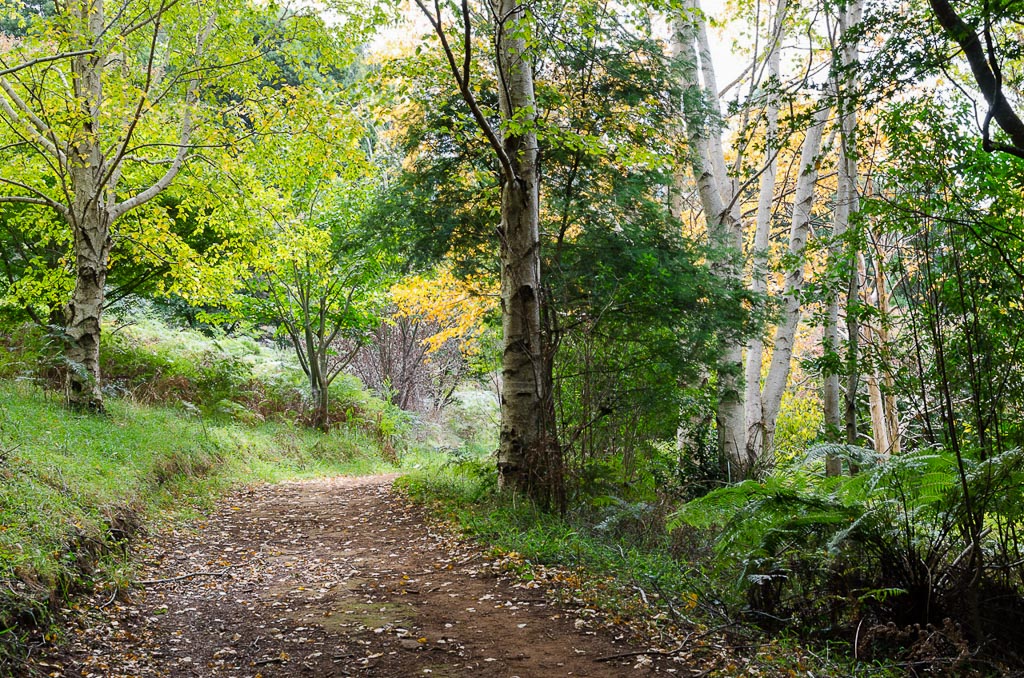
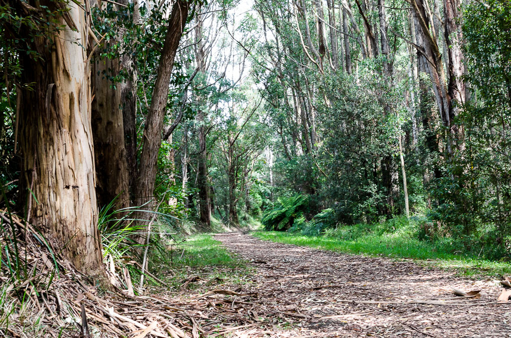
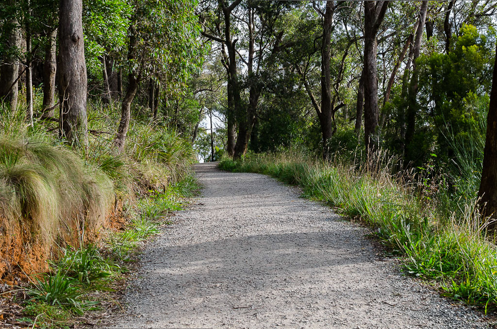
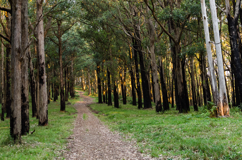
So, with the wallet lighter we were off on the well formed Rock Track. In fact nearly all the tracks for the day were wide and provided easy walking.
Rock Track
A few weeks back, I was introduced to what at first glance, appears to be a completely daft topic on Wikipedia titled, ‘Buffalo buffalo Buffalo buffalo buffalo buffalo Buffalo buffalo’. It’s a grammatical mind-bender, but Anon decided to weigh in with an alternative, where the word ‘buffalo’ is substituted with ‘badger’.
I think the first 30 minutes of the walk were spent analysing the word ‘badger’. It’s just about perfect. There’s a town called ‘Badger’, to annoy someone could be to ‘badger’ them, but the only thing that trips it up is that unlike ‘buffalo’, more than one ‘badger’ would be ‘badgers’ I believe. Mm… Blast.
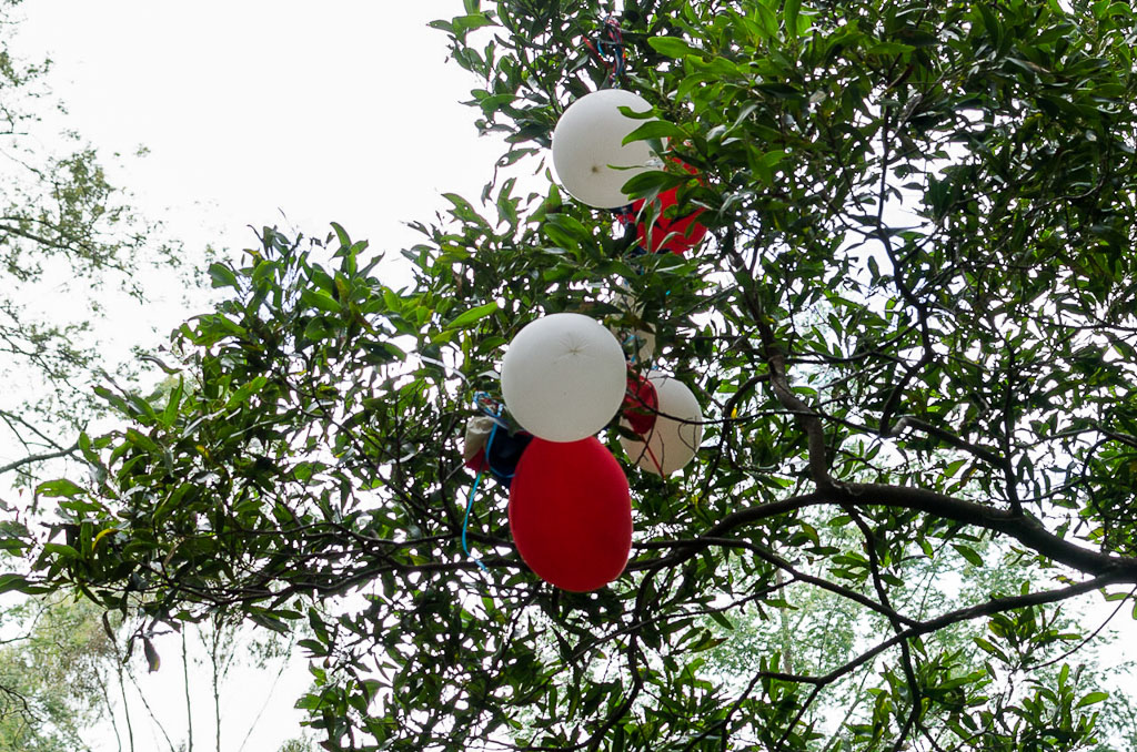
Whilst the word ‘badger’ was being dissected we almost missed a group of balloons stuck in a tree. Not really the greatest sight to see and no doubt they’ll end up in Port Phillip Bay at some point in which a toll will be taken on the wildlife there.
I was feeling a little risqué when it came to photographs for this walk. Instead of taking an 18-105mm zoom lens, I decided to just make do with a 35mm F1.8 prime on the camera. This can be a little restrictive and intimidating, as I’d be forced to move around for any composition. It’s pretty easy work with a zoom, but with the 35mm not being wide angle I’d have my work cut out a little. Oh well, that’s the sort of first-world wild man I can be.
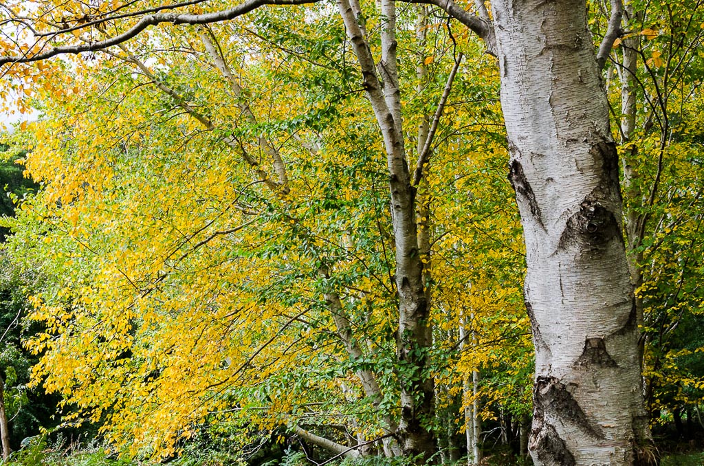
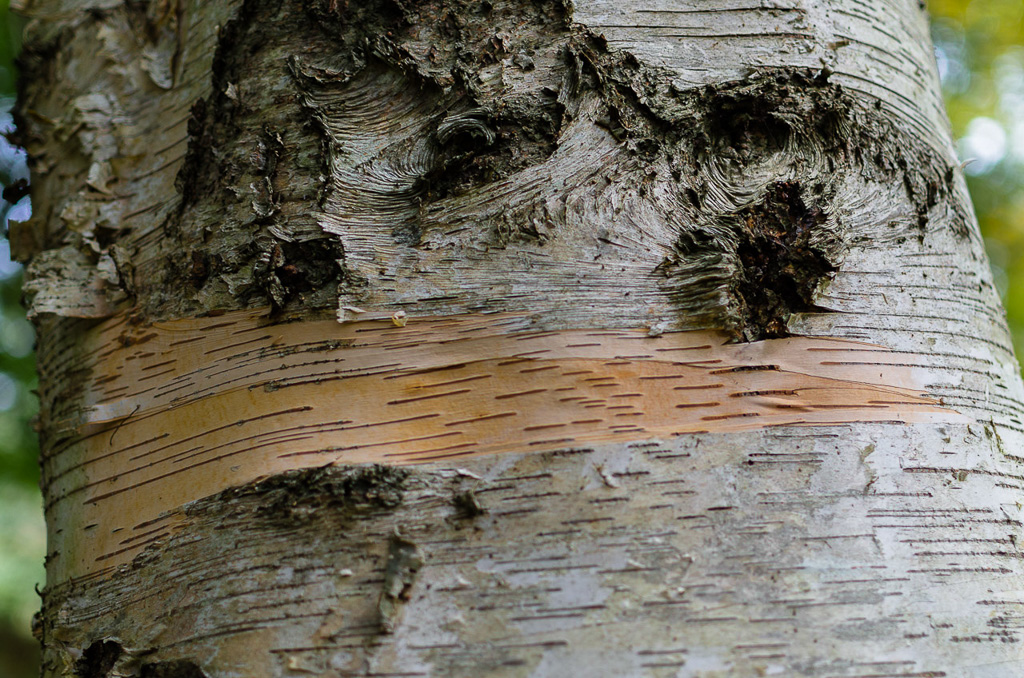
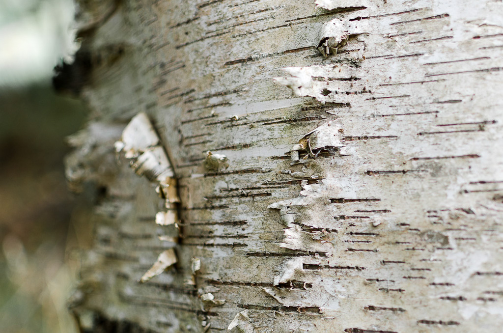
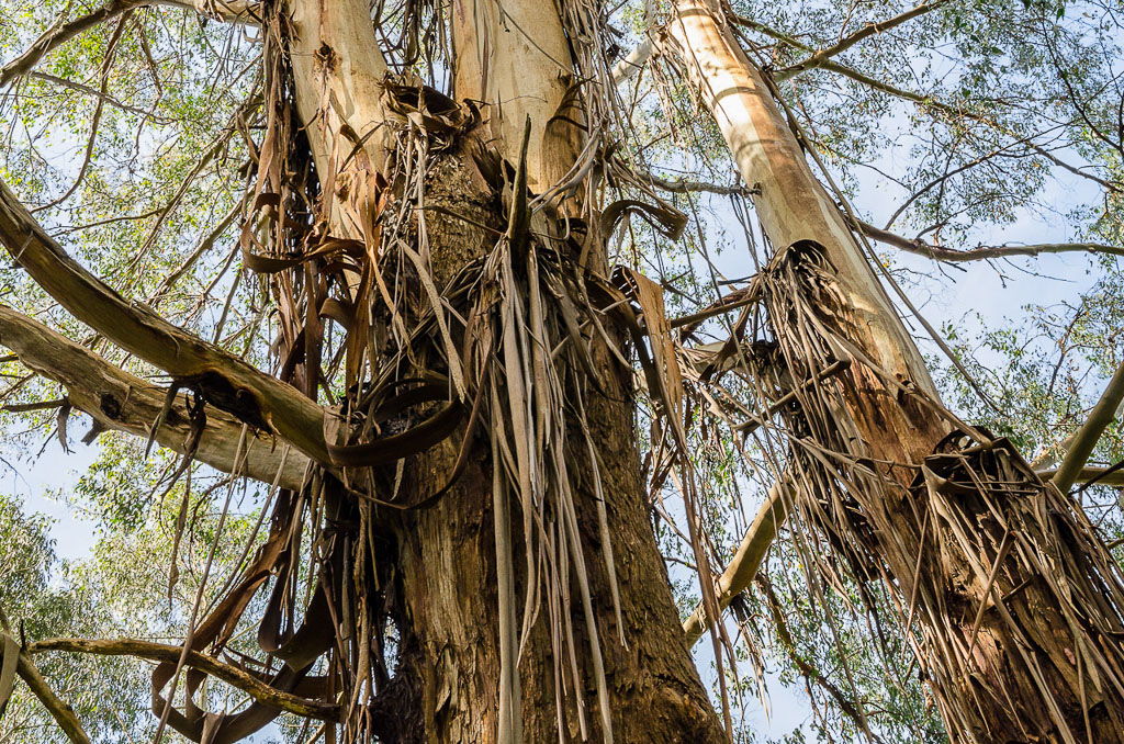
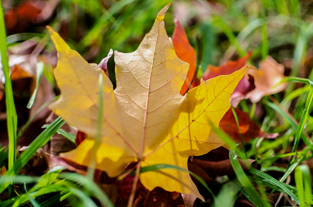
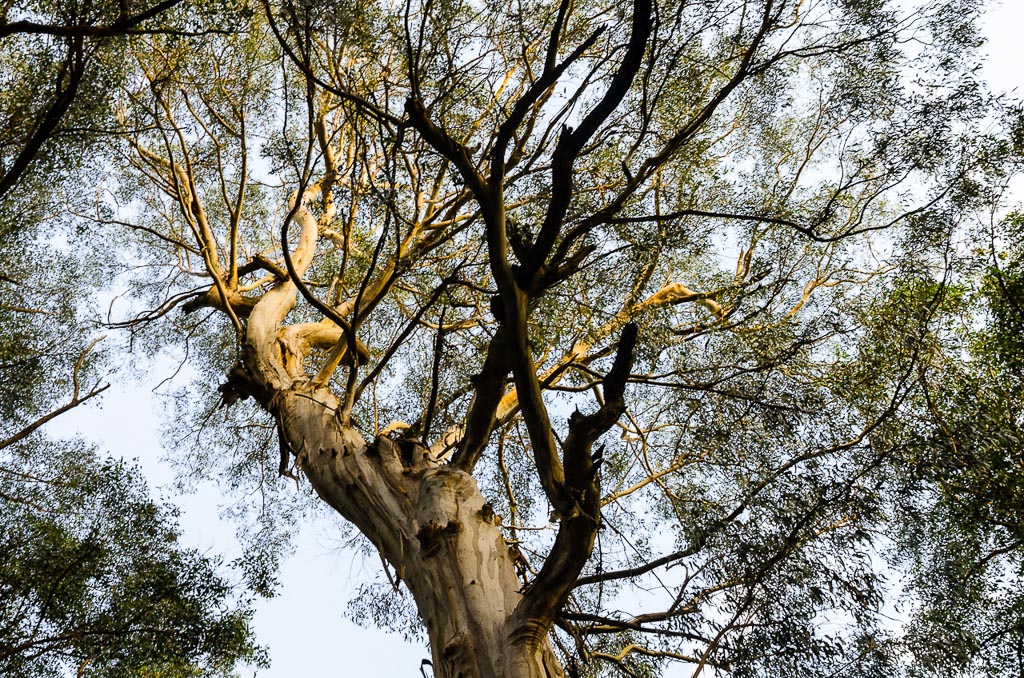
It was easy going to the first place of interest being the R.J. Hamer Arboretum, which is an area of colourful Japanese maple and silver birch trees. It was my first chance at having to move around in order to capture the scene, but having a wide-angle makes photographing trees so much easier. I was bending backwards until my hair was touching my heels, lying on the ground and stepping through the bush to get some sort of decent shot.
Whew. This is hard work. Just as in the Judas Priest song, ‘Hot Bokeh’, a big advantage of the F1.8 is I was starting to get some depth of field blur happening in the pictures.
Bringing Back the Balls to Bokeh – Lordi
Let There Be Bokeh – AC/DC
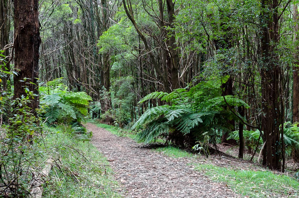
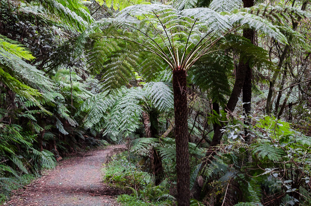
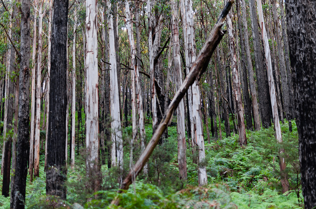
We continued on making good time, but it’s always a worry when it seems as if the first hour is spent going downhill. Surely there’s a pay off later for this casual descending? It was all pretty much standard Dandenong Ranges fare which is beautiful tall trees and plenty of ferns.
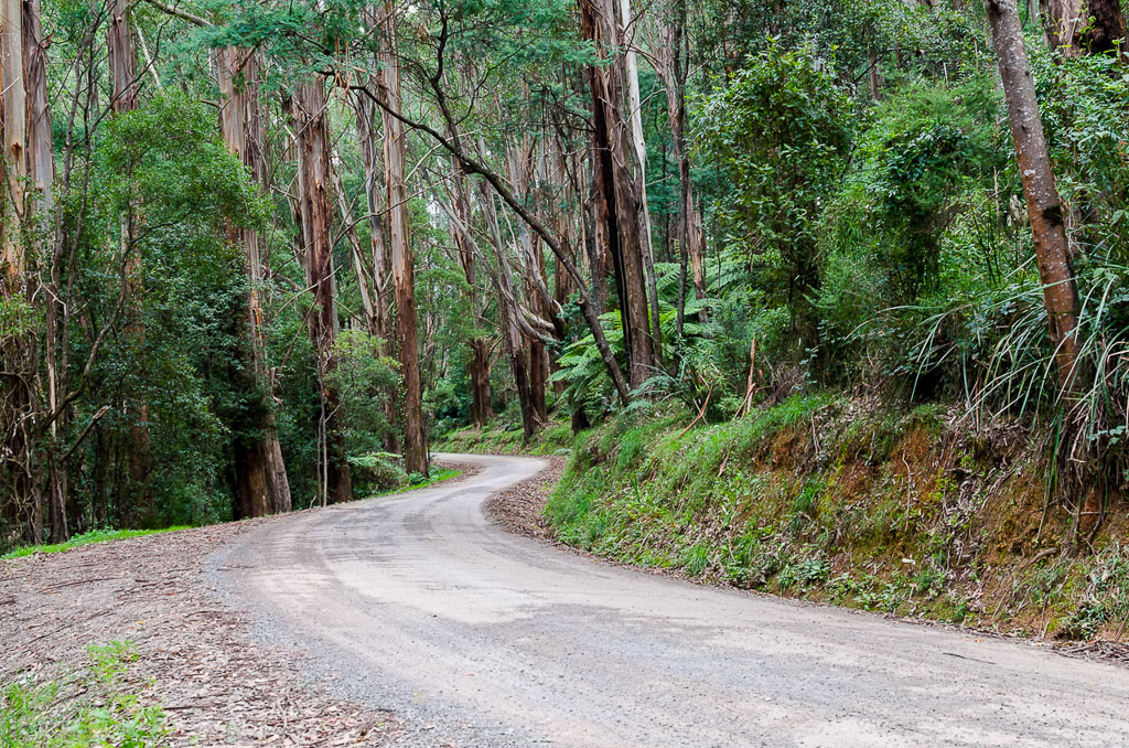
Mathias Track
Do you see what’s going on the photo above? I was forced to resort to extreme measures for that photo by actually lying on the ground. I can do this, but with my creaky knees it takes me as long to get up as a supertanker takes to stop in the ocean. What sort of analogy is that? Well, it’s the best I can come up with right now. The trouble is I’m writing this before 6 pm. After six is when my better analogies are written.

Cites on Flame with Bokeh – Blue Öyster Cult
We slowly strolled up Mathias Track passing a feather on the ground which had me lying in the dirt again to photograph it.

Lying on the ground isn’t too bad as one gets to see the surrounding trees from a new angle.
You know what else was brought to my attention last week? Ben informed me the words ‘hot dog’ don’t make sense. He went into quite a detailed description of how a ‘sausage roll’ should be the name of what a ‘hot dog’ sausage is now. Why? Well, it’s a sausage that goes into a roll. My question was, “Okay, if that’s the case, what do you call a sausage roll now?” Ben answered confidently, “The names should just be swapped. The hot dog is no more a hot dog than a sausage roll”. See what I have to deal with?
Back to the walk. We reached Falls Road which is followed a short distance to guess where? Yes, Olinda Falls of course.
Falls Road
We wandered down to Doreys Bridge, which took us by surprise as it’s not really a bridge at all. Okay, it sort of is as the road goes over a huge concrete pipe which water flows through. There’s no traditional looking bridge though. Actually, this is getting too difficult to describe, so I’ll just show you a picture instead.
Doreys Bridge
See what I mean? If you didn’t hear the water you would think you’ve missed it. Now, the stroll to Olinda Falls is a side-trip from here. Anon wasn’t very enthused about doing any side-trips, but I have a problem with that.
The falls were in the walk notes and if I don’t do everything as described in the notes, then I can’t classify the hike as completed. Without the falls, the walk will be filed as a ‘Did Not Finish’ (DNF) which means I might as well have not done the walk at all. I’d also have to come back and re-do it for the sake of completion. Yes, I’m aware it’s a mental condition, but that’s the way it goes, so we were off on a fern covered track to the falls.
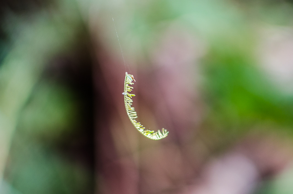
There were plenty of sights to see on the way which forced me to enable F1.8 on the camera. Firstly there was a reasonable group of fungi…

…then a small fern leaf swinging by a cobweb in the breeze…
Raised on Bokeh – Elvis Presley
…and a curled up fern frond.

The fungi kept coming as well which is not surprising as this section was a closed in fern-fest. The whole area was damp and I could imagine it would remain that way even in warm weather.

Now, I wasn’t expecting these falls would stop the world from turning, as the notes say, …”don’t expect anything too dramatic…” and upon reaching them I realised those words were quite prophetic. They really are an extremely casual looking falls. Actually, is there a required drop for something to be named a waterfall? I would think there has to be some sort of rule as Olinda Falls just struck me as a largish rock with water pouring over it. Mind you the largish rock is about my height.
It didn’t help there were at least 20 people yelling, screaming, videotaping, taking clothes off (yes, seriously) and running around, as if they’d just stumbled across the Niagara Falls. Anyway, this was a hit-run mission due to the racket and I’d have better photos if the people taking their clothes off didn’t get in the way.
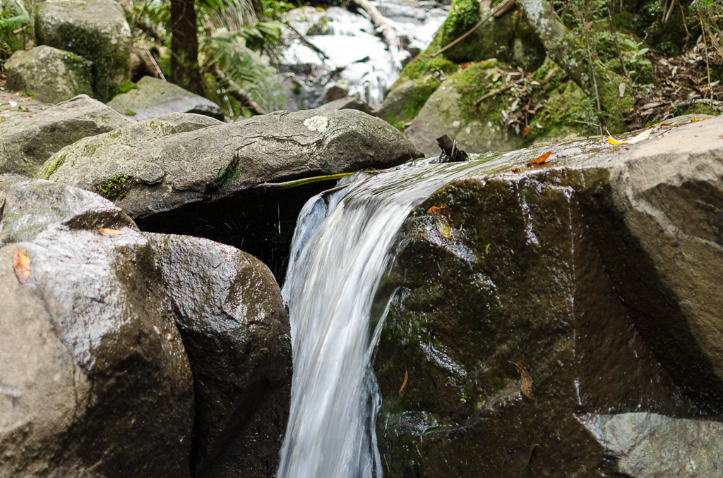
Olinda Falls (The top of the falls are at my eye level)
There will be no half naked people flashing skin in this blog as it’s ‘family friendly’ and I can’t afford to upset my readers. I mean, only last week I said ‘fuck’ in a tweet on Twitter and immediately lost two followers. Egads! Criminy! Jumping Jehoshaphat!
So, we left Piss Poor Olinda Falls and made our way to one of the highlights of the trip I was looking forward to. Yes, there’s a picnic ground nearby and it was a chance to eat the $10 diamond encrusted apple pie. You know what’s stupid though? I took about 300 photos on this days walk, but do you think I bothered to take a picture of the pie? I’ve no idea what I was thinking, other than inhaling the pie as if I hadn’t eaten in months. By the time I thought about a photo I was only surrounded by the detritus of pastry munching, which was an empty paper bag and dozens of crumbs.
There was a trade off to having this apple pie though, as then broke the GPS. What? Yes, somehow in showing off my incredible athleticism, I leapt to my feet and the cord of the GPS which was around my neck, became caught on the slats of the picnic table. As I accelerated to near supersonic speed upwards the table wedged GPS just snapped off the mount to the neck strap. Is this possible? Did Garmin just go head to head with an apple pie and lost?
So, I was left with a cord around my neck and a GPS lying on the ground. Grrr… In order to save the day I had to utilise some of my ‘Bear Greggz’ skills and rethreaded the neck strap to the back cover of the GPS. It’s not perfect, but at least it’s sort of how it used to look.
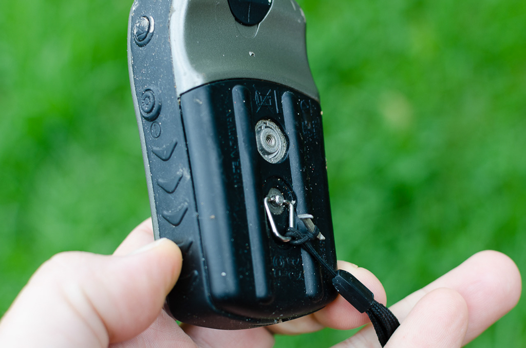
Rethreaded strap
It was time to head off and return to Doreys Bridge with the next section being a long slow climb up Mechanics Track. This was probably the only uneven path for the day as it weaved amongst ferns.
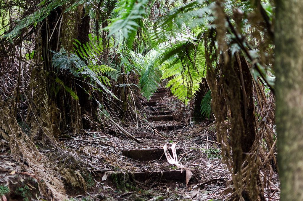
Mechanics Track
This damp forest was perfect fungi territory…

Disco Nights (Bokeh-Freak) – GQ
…and for spare car parts. Car parts?
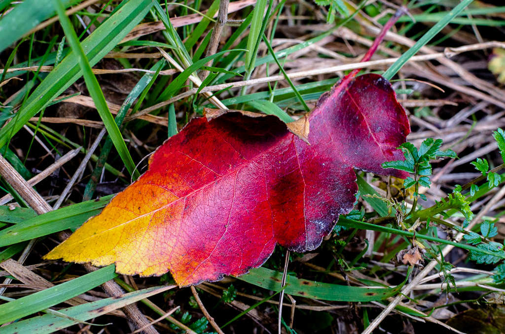
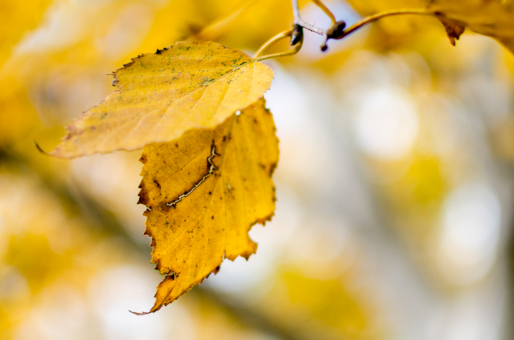
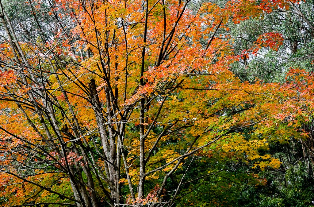
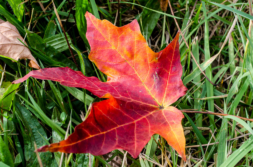
Okay, I had better get moving as I’ve just noticed this post in which not a lot happened is getting massive. The next target was Mount Dandenong itself which is the highest point of the range at 633 metres. Before getting there though we passed through Mount Dandenong Arboretum which was full of colourful trees and fallen leaves.

Bokeh – Primal Scream
Not to mention flowers.

There was a shortish climb to the top of Mount Dandenong which usually has nice views of Melbourne. On this day though, the sky was white with cloud and glare which reduced visibility through the haze. So, I didn’t take any photos at the top and also the fact there had to be about two hundred people around didn’t help. The place was going nuts with barbecues and functions and about the only picture I took was of this statue in one of the gardens.

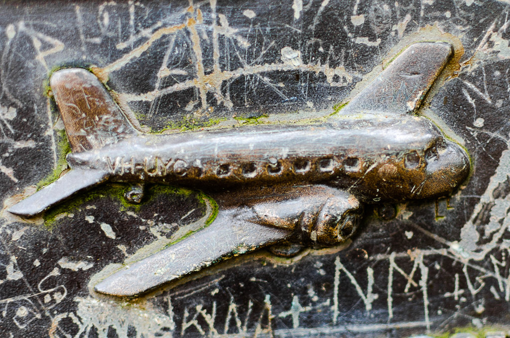
This walk was over half way now and we were quite keen to escape the hordes on top of the mountain. The next track to walk on took us to the ‘Kyeema Memorial’. What’s that? Well, I didn’t know what it was and had never visited it before, but in 1938 a DC-2 plane called the ‘Kyeema’ flew into the side of Mount Dandenong in bad weather, killing 18 people. The appropriately called Kyeema Track led to the spot, as it hugged the side of Mount Dandenong.
There were some nice views here, but with the glare it was an exposure nightmare. I spent about 20 minutes on Lightroom trying to resurrect this picture from a complete white-out. It’s not perfect, but you should see the original untouched image!
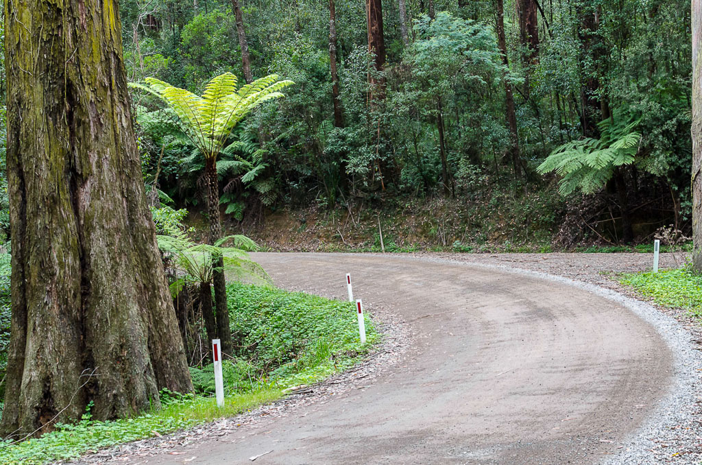
The track from now until the end of the walk was generally nice and wide which made for comfortable strolling.
We reached the Kyeema Memorial, which consisted of a plaque and information board. I was going to take some pictures here, but unfortunately three of the stupidest people in the history of mankind were there. One insisted in sitting on top of the memorial and wouldn’t budge for the ten minutes we spent there whilst uttering crap. There was stuff like, “Whoa! Dude! Look at the size of that ant!!” and then a convoluted conversation, which consisted of, “Why would it crash here, when this isn’t the top?”
In the short time I listened to these bozos I could feel my brain turning into blancmange. In the end I managed to take a photo of a small plane symbol on the memorial, but it’s a pity the whole thing has been scratched and engraved by a million dickheads over the years.
Oh well, it was nice to see the memorial, but unfortunately that’s the problem of walking in areas that are insanely popular.
On we continued whilst passing a massive television tower. The Dandenongs are actually full of transmission towers and the one we passed happened to be the biggest at 204 metres.
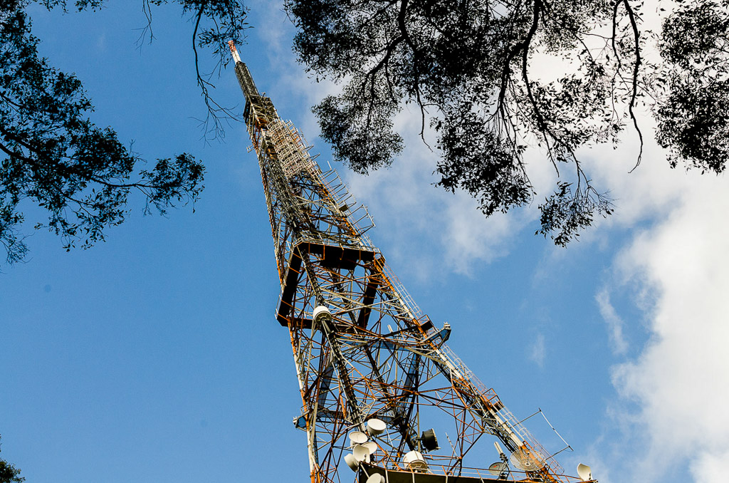
We didn’t spend long at the barbed wire fenced compound of the huge tower. There was a quick descent down into a fern lined path again which was ringed with some enormous trees.
We were well and truly on the home straight now until we came across this.
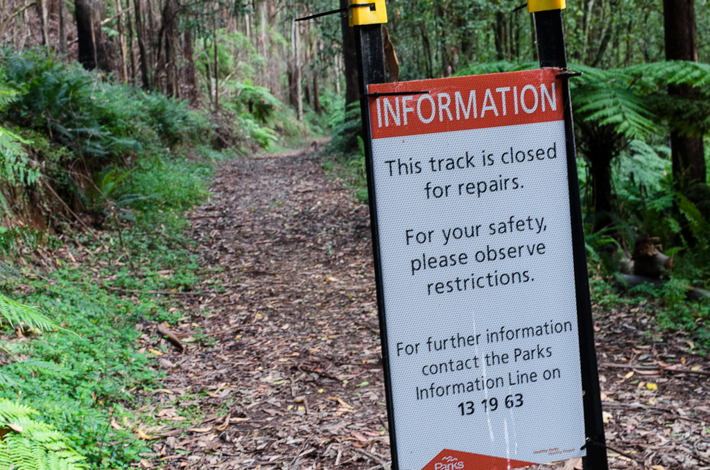
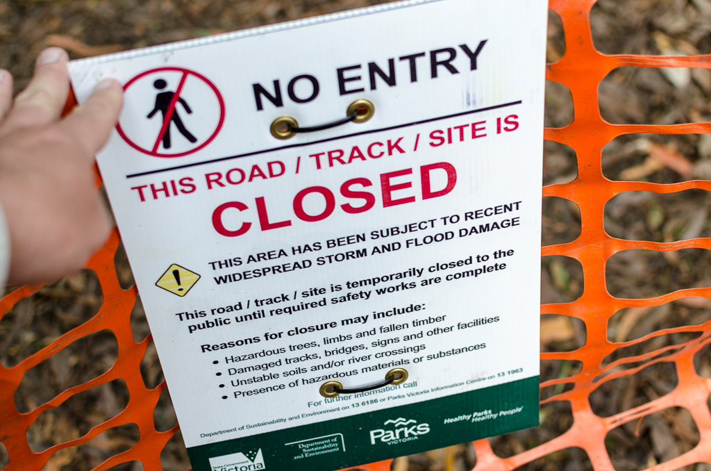
This just happened to be exactly where we needed to go, so I looked at the sign for about 0.5 of a second and walked around it. It seems every walk I go on I come across a sign like this and if I obey every one I’ll never get any strolling done. I was interested to see what the problem was and after a kilometre or so we came across a section of the track which had been washed away.
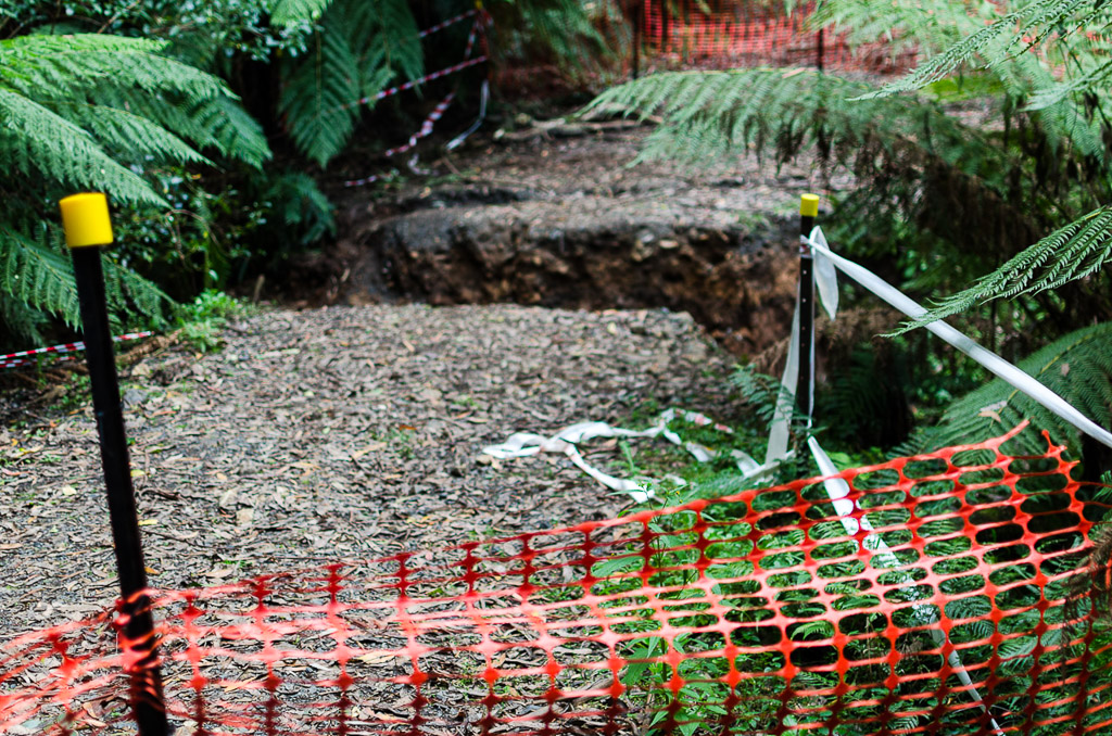
Guess how long it took to negotiate the hole? How does 20 seconds grab you? We stepped down into the hole and walked up the side before continuing on although there was a toll in doing this. I got some dirt on a couple of my fingers.
It was getting a bit late in the day now and with the light a little dim we were rushing along. There was a few more hills to come with one lined by trees…
…before coming to the final track for the day. The setting sun was putting a nice glow through the trees and this happened to be the largest hill for the day. It was about 500 metres long and after a day of walking I was suddenly feeling a little stuffed.
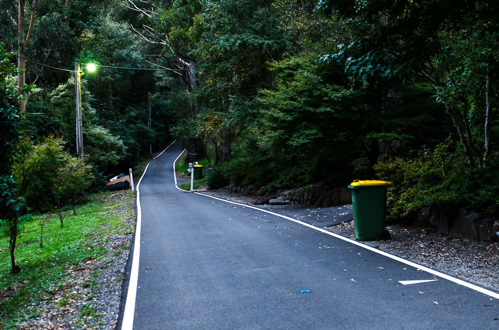
We slowly chugged up to the top where a residential street appeared and it was only a few hundred metres more to the car. Oh yeah, by the way it was bin night (recyclable).
A short stroll on this road and we were back at the car, just as it was getting dark, which was pretty good timing in the end. So, another walk done and it was quite nice.
The only thing that bugs me about the Dandenong Ranges is their popularity, which I admit is my problem and not others. We saw a lot of people during the day and you know what else was a little annoying? The constant sound of motorbikes, both road and trail bikes. I barely saw any, but the noise was more or less constant all day. An infernal buzzing sound reverberating of the hills around us. I’ve no idea where they were, but they were out there somewhere.
There you go. A 17 km walk with total elevation climbed of 548 metres. It’s a bit more strenuous than the coastal walks I’ve done lately, but still not too hard. What about the pictures? Well, using only a prime lens can be hard work, but that was the idea.
It also gave me a chance to get some bokeh going. Did I mention the word ‘bokeh’ earlier at all? I think I did. I might give it a go on my next walk, but hopefully next time it’s clear and sunny as even my prime lens has a nice, new polarizer that’s waiting to be abused. Okay, until next time…

Hi Greg. How does the law work in Victoria with respect to track and park closures, incidentally? I mean, I know there are sometimes extremely good reasons for not going into places (fire danger, maybe allowing for some vegetation regeneration, etc), but I do find it a bit annoying when someone tells me I can't go somewhere because I might trip over a fallen tree… and without telling me about the tree, or because a track's slipped away slightly. It'd be nice if I were trusted to make a decision about my own safety on my own.
I know that in NZ, which I'm more used to, the law guarantees public access to public land before much else, and the Department of Conservation can't legally close an area without an awful lot of paperwork and signatures and justifications. (Much of the law doesn't even talk to 'tracks', and it gets a bit confusing when you start to ask what a track actually is.) Facilities like bridges can be closed, but there's nothing to stop people crossing a river on their own. It doesn't mean that the odd ranger won't put up a sign saying 'track closed', but it does mean you can usually ignore it. I know several people who've had arguments with independent rangers for exactly these reasons. There are often verbose signs around the place that strongly recommend against doing things, though. 🙂
But if a Victorian park ranger goes on strike and locks a gate, is it still strictly legal here to hop over the fence with a bouncy pogo stick? Or is that something you could be charged for?
Hi Mike. Thanks for you comment and a bit of an idea how this closed track business works over your way. It certainly sounds like you have a more flexible and reasonable approach to closures over there. You know what though? I've no idea what it means here!!
I've wondered what a 'track closed' sign means and the consequences of ignoring it. I assume it's a summary offence, but I'll be stuffed if I can find online what the actual offence and act or regulation that comes under. So, I've emailed Parks Victoria with that question, but I'm still waiting for a response! Hopefully someone there can shed some light on that.
Yeah, I know what you mean. If a place has been closed because of some huge event like bushfire or extensive flooding then I understand what's going on. Just wandering along and coming across a 'track closed to flood damage' when every track for the previous 15 kms has been fine makes me wonder. On this walk there was damage, but it was so piddly regarding getting around it that my hunch was correct.
Why is it the case that things get closed? I guess in simple terms it just comes down to liability. Yeah, everyone with half a brain can negotiate a small ditch, but all it takes is some bonehead to go tumbling and if Parks Vic had known about the damage, but didn't bother to close the track then I guess they're in big trouble. I'm guessing though and hopefully someone with more knowledge about this can inform me. I have walked on closed tracks, but I always think to myself that I'll continue walking, but be prepared to turn around if it's a major problem. So far I haven't found anything that has taken me more than a minute to negotiate. What does that mean for me? Well, I guess I'm committing all sorts of offences! It's hard though when tracks I've wanted to walk on have been closed for over 12 months. Mind you, they haven't been closed for a major event like the flooding which happened at Wilsons Prom or the Grampians. Stuff just gets closed for months on end sometimes!
Anyway, thanks for taking the time for such an expansive comment. I'll await a reply from Parks Vic and hopefully I can clear something up which I've wondered about for a while! I'll post back here if/when I find out…
I actually thought on my first scroll through the pictures pre-reading that they were some of your best yet! So maybe don't retire that prime just yet. But I'm a sucker for autumnal Northern Hemisphere foliage so that might have helped. By chance today I actually detached my sweet baby credit-card-destroying 1.8 lens (it practically lives on the camera now) and used the pancake for half the day – yes, another wide angle. It was great fun. They do make you work a bit harder but I think that's part of their charm.
The Dandenongs look great! Well, they always do, except maybe post-bushfire. I haven't been there yet, but those crowds turn me off. As you say, though, maybe mid-winter…
You know, I wanted to surprise you with some good news re badger(s). I'm sure I've heard 'badger' used for multiple badger(s). But a quick check turned up this:
http://www.wordhippo.com/what-is/the-plural-of/badger.html
Yes, the internet to the rescue again. My fave part is the attached link "What is the singular of badgers?" Huh?! I mean, if you are THAT stupid, would you really be able to use a computer?
So, was the $10 apple pie any good?
……..I am now craving apple pie by the way! I always seem to be craving food and/or cups of tea after reading your blogs! 🙂
Thanks! I definitely had to put more work in with that lens and I wasn't able to capture a whole tree in a shot. I reckon if that lens was a 20mm it would be a bit handier, but it's good enough. Oh yeah, the main advantage is that I've got the F1.8 bokeh sitting on the launch pad ready to go! It's tough substituting the word 'rock' in songs for bokeh though. I actually Googled 'songs with rock in their title' and the one thing I learnt is that AC/DC seem to have the most! I guess their modus operandi is to sing about rock and balls, not necessarily in that order.
Dandenongs are lovely, but due to their popularity I think a revisit might only be in mid-winter. Lack of tree colour then though I guess. Ben and I did do the 1000 Steps walk once in winter during pouring rain and we only saw about two or three people, so it is possible I guess.
Now, I just checked out the badger link. Blast! It was so close! I also clicked on 'what's the singular of badgers'. Did you have a look? It's badger if you were wondering!
Hi Tennille! Well, I can say the apple pie was pretty good, but so it should have been for the wallet draining cost! I did cop a bit of stick when I was buying it as I was informed that it should be heated. They were actually adamant that it should be warm! I didn't know the apple pie rules were so strict!
I do mention tucker a bit don't I? I promise next time to actually take a photo for a change of any food I buy 🙂
Hehe. They'll probably tell you that if they say something's closed then it means it's closed. I wouldn't be too surprised if that were the case… the other day I was told off for crossing the street within 20 metres of a pedestrian crossing (the red guy was flashing). 🙂 I tried to quickly browse the legislation for park closing laws but at this point I haven't found quite where to look. I might have another look later and will post something if I find it. I'm guessing that as Vic used to charge for park entry, there must still be mechanisms that let the authorities keep people out of places for any number of reasons other than not paying the $0 entry fee.
I don't live in NZ any more (presently at least), but I've found it interesting to see the slight differences. I don't know if either's better or worse, and it might be that with more people for the most accessible areas here it makes some sense to keep people out at times when they're more vulnerable. But closing for safety? 🙂 You're probably right about the liability thing, and it's an inflating thing too because as soon as you start closing things that might be unsafe it's implicitly suggesting that places are safe if they're open, so there's less incentive to open them.
NZ had a major accident on the conservation estate back in the 90s (platform collapsed killing 14 people, which I wrote about), and it was basically because the government department responsible was a total mess at the time it was built. Now they're much more strict with regulations any time something's built or maintained, and if there's no money to assess or repair something, it might just be removed at high expense so it's no longer a liability. That sort of thing is really annoying and arguably bureaucratically stupid in some instances, but they managed to keep that paranoia limited to the facilities and it's still completely legal to enter public land on your own terms, fortunately, with a few specific exceptions. I think there'd be a massive uproar if that right were removed, but it could still happen some day.
Awesome tour Greg — I'm so happy you took your 35mm — great shots. Back in bokeh by AC/DC? 🙂
Good job on the GPS. I'd pay to see the video of that. Have a great day!!
Great photos, Greg. I have done a couple of the day walks in that area – very pleasant, but not particularly private.
…and please tell me that $10 included a coffee!
Hi Mike. I was holding off a reply as I was waiting for a reply from Parks Vic. Guess what? Yep, I haven't had one yet! I'd like to think they'll reply, but maybe it's a little too tricky for them. I might send an email to Glenn Tempest. He seems to be all over this stuff seeing how he walks for a job 🙂
The more I think about it, it's always about the liability. I'm not sure what the answer is? There's a walk to Kalimna Falls on my blog which I did over 12 months ago. It was closed then and I've periodically kept checking it on the Parks Vic website and it's always closed! Having walked it when it was shut, I know what the problem is on the track and it's a bridge that's damaged. It can be negotiated though, but I guess they just don't have the money? If something is shut for over a year I just start to think it will never reopen.
By the same token, I can't work Parks Vic out sometimes. There's a couple of walks that I've looked at before, but according to Glenn Tempest (Mt Richmond/Mt Beckworth) on his Open Spaces Books website, they've being abandoned and totally overgrown yet those same tracks are listed at Parks Vic don't remotely mention that. Surely that's a safety problem right there?
Who knows? I do appreciate your articulate response! Lots of problems ahead I think when it comes to funding…
Hi Nancy! Thanks for dropping by. Yes, nothing beats a nice prime lens and that Nikon 35mm packs a bit of a punch for its cost. It's cheap, but fantastic. Oh yeah, lugging the camera around whilst walking is a lot easier with the stubby prime on instead of the zoom 🙂
Haven't you heard of the 'Back in Bokeh' song? It's in their catalogue somewhere I'm sure 🙂
The GPS is great, but infuriating at the same time. I'd like to totally master it, but I'm still at the basic level I'm afraid. Working out how to upload is new discovery!
Oh yeah, thanks for your photo border info. I took your advice and went for the simple blogger template complete with photo borders 🙂
Hi Andrew! Yeah, the Dandenongs are nice, but I think one just has to visit and expect to see a lot of people. Thinking otherwise will just leave you disappointed 🙂 Actually, the main annoyance wasn't the people, but the constant sound of motorbikes. It was an incessant noise all day…
$10 and a coffee? Are you nuts? No, that was pie only! Imagine the price with a coffee! I would have ended up walking out the shop without a shirt on 🙂
A wonderful walk in a beautiful part area, as a boy scout many years ago I did several walks in the Dandenongs, probably did not recognise the beauty in those days and a there was a lot less traffic etc. My guess a pie was about 20 cents and I did not drink coffee. I use my Garmin with Base Camp which works nicely on a Mac. We have a very good friend living in Sassafras and it is always a joy to visit them and listen to the birds and just enjoy the serenity (to quote a favourite film of mine). BTW I love my Oly 45 mm prime and am keen on getting a 20 mm prime (probably the panny) I have moved away from zooms, never really used them much.
Now I want warm apple pie!
I'm actually surprised that you aren't doing a food blog too! 🙂
Looks like a beautiful place for a walk! And that is the most intelligent thing I can say right now!
Hey there. A food blog as well would be the death of me! I eat too much as it is 🙂 Oh yeah, I barely have time to keep this one running let alone another!
Hi Roger. Yes, I don't think you can call yourself a walker in Melbourne if haven't explored the Dandenongs 🙂 20 cents an apple pie? That's pretty impressive! Then again I remember when a can of Coca-Cola was 12 cents and the uproar when it jumped to 15 cents in one hit! Three cent increase!!
I am coming to grips with the Garmin GPS with constant use. I love the Garmin Connect page in keeping all of my walks grouped together. Are you a movie buff as well? I'm a movie tragic I'm afraid!
I think you'll love a 20 mm prime for your coastal shots. I would like something similar or even down to something like a 16 mm, Yes, zooms are handy for the odd bird in a tree etc, but they can be restrictive as none of them are really fast enough. Okay, there are some fast ones, but they cost over $2000 in most cases! I'm sticking to the 35 mm for my next few walks to see how I go…
Hi Sonja! Yes, it is a nice area and I've neglected it a bit. I should do a couple more walks up there, but there's so many to do! One can't do them all. By the way, I think your comment was pretty intelligent!
Hi Greg. Yeah I followed one of Glenn's walks a little while back in Yarra Ranges National Park, which was completely overgrown for part of it. That was fine as far as I was concerned but I agree that if the bar is set so high as it seems to be in many places, then surely letting people go into overgrown places at all can't be meeting it. That sucks about things being closed for more than a year because of a single broken bridge. I think I take that sort of thing a little personally because to me it seems that tracks wouldn't even exist if people didn't make them, and I don't really know when a specific part of the government somehow inherited that responsibility that suddenly meant nobody who's unauthorised has a right to go anywhere except on a pre-made track. Oh well.
Anyway, I've flipped through Victorian State Law (as a non-expert and someone who has virtually no experience with Victorian Law), and the most relevant act I've found so far is the Safety on Public Land Act 2004.
It basically states in Part 2 Section 4 that "The Secretary" (as defined by the Conservation, Forests and Lands Act 1987 — basically someone like Parks Victoria or DSE, I think) can declare "Public Safety Zones", which are zones that might be for all or any of conservation of flora or fauna, protection of soil/water, protection of natural/cultural/historic values, public recreational activities, scientific research or education purposes, fire ops, timber harvesting, maintenance of public safety, or "any other prescribed purpose".
So, in essence, they can make up whatever reason they like. There's a later clause that says if it's declared specifically for timber harvesting, it's not allowed to last longer than 12 months.
For a declaration to be valid (under this specific act), it has to appear in the Government Gazette, which is basically a government newspaper that nobody reads (NZ has a similar one), but you should at least be able to visit the Gazette Search Page and run an advanced search for everything declared under the Safety On Public Land Act, and see all the publications. The most recent declaration by the Department of Sustainability and Environment seems to've been declared in Gazette G26 from 30th June 2011, and includes a 54 page list (42 lines per page) of areas specified by south-west lat/long and north-east lat-long, along with a list of prohibited activities that include things like "entering".
There's also a requirement that a notice be displayed on or near the site, which is immediately followed by a clause stating that if there's no notice displayed then it doesn't affect the liability of any person for contravention of the Act.
Part 3 Section 13 then states that if you carry out an activity which is not authorised in a public safety zone, like entering it when it's against the rules, the penalty is "20 penalty units". Ain't government great? 🙂
That's just the first bit of legislation I stumbled upon which allows bits of the government to close access to public land. There are likely others, and maybe something else that makes it really easy for Parks Victoria to just stick up a Closed sign whenever they feel like doing so. But I'd still like to find out some day what legislation they actually use to do this.
I use the work 'basically' far too much.
Hi Mike! Hey, what can I say? You're officially my 'go to' man when I need some legal research! You've gone beyond the call of duty regarding finding an answer to this.
I was hoping Parks Vic would reply, but alas not yet. I was told by a fellow government worker that I should write a letter, as bureaucracy loves a written letter! I'm pretty suspicious though!
It's funny when I think about these things. When I was in the army we always walked off tracks, up and down hills and through scrub without a thought. Now, I love a track and if I hear something is overgrown I'm a little deterred. Twenty years ago it was the norm and it didn't bother me. I guess I've got softer as I've got older 🙂
Thanks for those links and I'll have a proper perusal in the next few days. Hopefully I can come back with a decent answer instead of my standard, "I've no idea!"
Oh yeah, I used to be a heavy user of 'basically'. I weaned myself off it and replaced it with 'essentially'. That's my new 'basically'!
Don't check on my account. I was originally just curious in case you knew, but I'm happy to browse the legislation in my own time if and when I can be bothered. Letters were all the rage 20 years ago when everyone owned stamps, printers and envelopes, but they're quite frustrating to work with today and I guess that's the idea. Where did you email? I checked out Parks Vic website and they have a form for "giving feedback", but that's about it. The closest seems to be their Freedom-of-Information submission form, for which they charge ~$20 to submit. Heh, screw that. The way the organisation presents itself reminds me of my 3 month effort of trying to get a you-didn't-meet-your-monthly-targets-again refund out of MetroTrains. 🙂
Hey Mike. I've resorted to the heavy artillery by asking Glenn Tempest if he can shed some light on this track closure business. He apparently was already looking into the very same thing, so hopefully he can come up with a definitive answer to what it all means.
I sent the email to 'info@parks.vic.gov.au'. That's the only email address I could find on their website, but I've got no doubt it is not the correct place to send it. Some more options could be good though. I did see the 'feedback' form, but that seemed even more remote than their email address! Maybe that might get some sort of response.
Yeah, it's a funny organisation, but I've got the feeling they're very cash strapped right now. There's nothing I've seen with the current state government which makes me think they're going to be the greatest friends to the outdoors. I'm a burnt out cynic though.
Oh and I do like tracks, too. I just like to know that I'm able to leave them, especially since there are often so many unofficial tracks and side-tracks all over that go to interesting places. Cheers.
Greg,
If any money seeking clown wouldn't roam important National and State Parks in search of a sueing opportunity, tracks would be left in their most natural state and to every individuals judgement for safety. But these mongrels have formed Victoria's Rules and Regulations and it's them to blame not Parks Victoria. This is a stupid side-effect of Law forming under a monarchy, where court decisions are most prevelant. In a republic, a fixed law in a constitution has to be changed after debate in Parliament, far more difficult to abuse by money seeking clowns. It is time for change…
Regards
Victor C. Pankouken
Tenille,
Considered, if YOU could provide the culinary section of this blog ? Maybe some easy hike recipes ?
Regards
Victor C. Pankouken
Andrew,
Try it the other way round: $ 10 for a coffee and begging for a free apple pie. It works at some shops in the Dandenongs on "Seniors Tuesday". The pies have been originally baked on Saturday, kept on the Warmer 24/7 and given away on Tuesday.
Regards
Victor C. Pankouken
Greg,
Agree on the intelligence. You have to know how to operate a PC to get on this blog…
Regards
Victor C. Pankouken