Well, here we go with another day walk extravaganza which is a certified ball breaker. In order to get to grips of writing about it, I needed a few days of therapy whilst lying in a dark room on a chesterfield couch.
That’s better. Now, in a million previous posts I’ve used the track notes from Glenn Tempest’s book ‘Daywalks Around Melbourne’. Guess what? He’s written another book and he’s gone crazy with the title, as this one is called, ‘Daywalks Around Victoria’. Yeah! I’m over writing his name, so for the rest of this post he’ll be known by his initials ‘Gee Tee’. Now, I do like a new hiking book, but I noticed in this latest one the pain ante has been raised a little. There’s some solid looking day walks in there, which I’m quite keen to try.
Mt Buller via West Ridge seemed a nice one to start off with. At 19 km and 1200 mt of elevation to get through, it has plenty of potential agony in one day. The book suggests the hike will take seven hours, so it’s definitely one for the warmer months with daylight saving.
I think the pain of this walk should be shared and who else to bring along than Ianosivich who has been appearing in a few of my hikes lately. They’ve all been disasters, but thoroughly entertaining nonetheless. Actually, he prefers to be known by his signature cooking dish, which he wants to patent as the ‘Smuffin’. Fair enough, as the Smuffin is a fantastic meal and it’s not a bad name to have as a hiker either. Now, what was the plan?
The plan was fairly vague to the point there was none whatsoever. We had a week of studying the weather forecast and typically Melbourne has had nice sunny weekdays, but come the weekend it’s apocalyptic wind and rain.
Mt Buller is 1805 metres, so it’s not to be taken too lightly regarding the weather it can dish up at the summit. Our forecast was a maximum of 15° C and a late change with possible thunderstorms. Mm…is that bad on an exposed mountain? Does lightning hurt? I figured we should at least bring raincoats as a minimum.
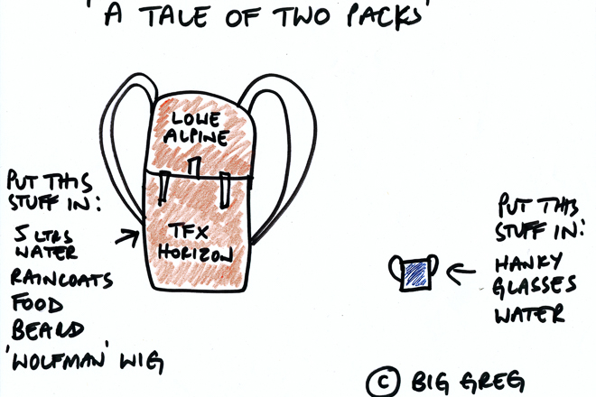
I’ve been trying to come to grips with carrying a lot of water on these walks lately. A full days walking up a mountain in which there’s no water along the way, meant I planned to carry five litres. I’m playing around with different backpacks lately, yet the only one that seems comfortable with a ton of water in it, is my Lowe Alpine TFX Horizon (superceded of course). It’s complete overkill though, as it’s a 65 litre pack, but it seems to sit so nicely, it was again my pack of choice for this walk.
I headed up early on Saturday morning to pick up Smuffin and he revealed his pack for the day. He was quite traumatised by the pack weight he lugged up Mt Difficult in the previous posts. So, he went for the complete ultralight opposite and wheeled out something that looked like a postage stamp.
Remember the technical pack drawing I did here? Due to literally thousands upon thousands of requests (none) readers wanting more drawings I’ve included another one. This took me about 2.5 seconds to complete, which was marginally longer than the first one.
Actually, Anon who doesn’t exist, but who was on the Mt Difficult hike thought the first drawing was sourced online, as it looked ‘kind of funky’. In dismay I’ve decided that due to potential ‘funky demand’, I need to put a copyright on my drawings from now on.
Gee Tee has come up with a very handy idea on his website. He’s sharing the GPS files for the walks from his latest book. It’s surprising no one else has done it before, as it’s a winner of an idea. Even better is they seamlessly upload to my Garmin GPS, so we were well prepared in the map department for the day.
With Smuffin onboard we headed to our starting point for the day, which was a car park just outside the small town of Sawmill Settlement. First things first though, we needed to stop somewhere along the way in order for Smuffin to buy his lunch for the walk.
Yea (remember to say it really loud as if you’re excited) seemed as good a place to stop and I couldn’t help being drawn to the local bakery. I’m not sure what happened, but I walked out with a potato pie and Smuffin went for the ‘healthy’ option of the Cornish pasty. Little did I know, but potato power would be required later in the day.
Whilst we spent some time in the main street of Yea inhaling our food, I noticed a mobility scooter heading our way. At a distance it looked like an able bodied bloke who was younger than me (under 23). After deciding it was some bloke who just couldn’t be stuffed walking any more, the scooter got a little closer to reveal someone who was at least 155 years old and missing a leg at the hip. The result of this observation is I’ve spent over $400 this week on two new pairs of glasses.
With the pastries done we continued on to our starting point, although there was always going to be a surprise. Smuffin forgot to buy his lunch, but I did bring enough trail mix for a battalion and a super-sized roll with Portuguese chicken and Jarlsberg cheese in it. I think we had enough to survive the day and if not, I had fat reserves to last approximately eight years without food.
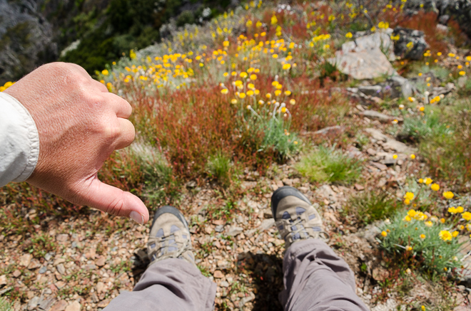
The start of the walk is a little depressing, as it’s only at a height of 598 metres. Seeing how the target was 1805 metres we had a lot of uphill walking to do. At this stage the weather was sunny and warm, which made for a bit of standard polarizer action.
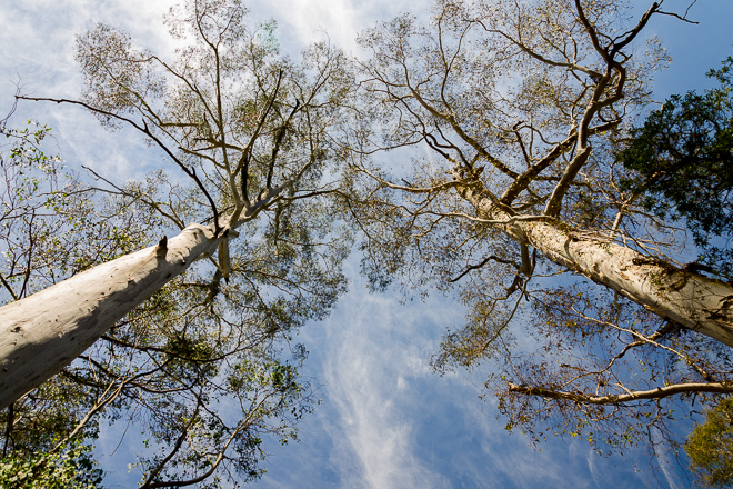
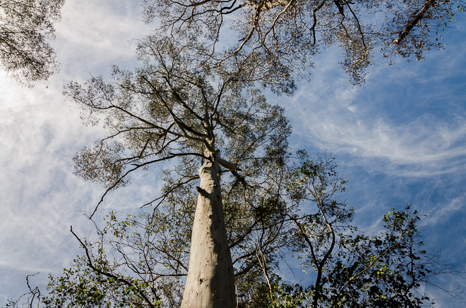
Well, I guess it’s time to get climbing and what better way to warm up than a 5 km road bash? We strolled up the steady incline of Doughty Road at a casual pace and in the heat I was sweating within seven seconds of starting. A road wander is not ideal, but at least it was quiet with no cars sighted.
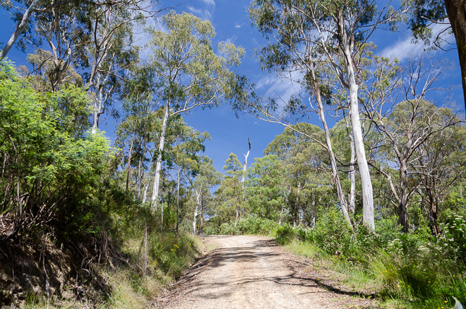
Doughty Road
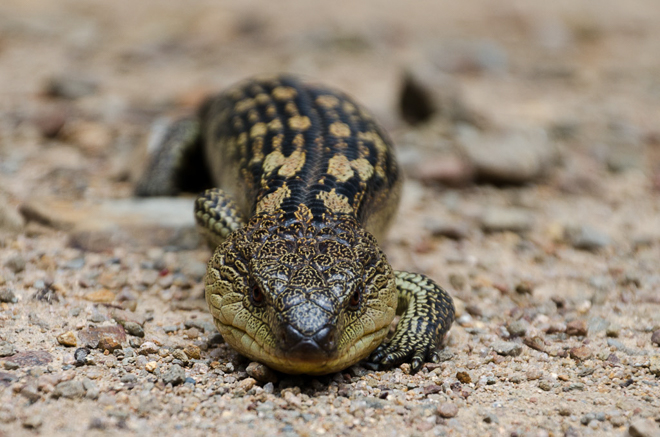
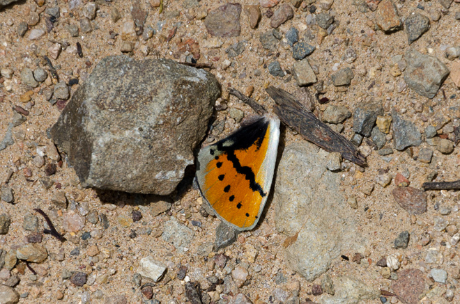
Our first interest of the day was a lizard relaxing in the middle of the road. Well, it was pushing relaxation to a new level, as it didn’t move no matter how close we got to it.
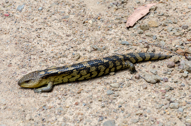
Smuffin wasn’t impressed with my photographic technique so he grabbed the camera for a different angle. Getting low to the ground was always going to make the best photo, but with my shot knees I tend to stand completely upright as if I’m impaled on a broomstick. I don’t do bending over too well at all, but being a multiple camera wanker whilst hiking, I stood back to record the Smuffin method.
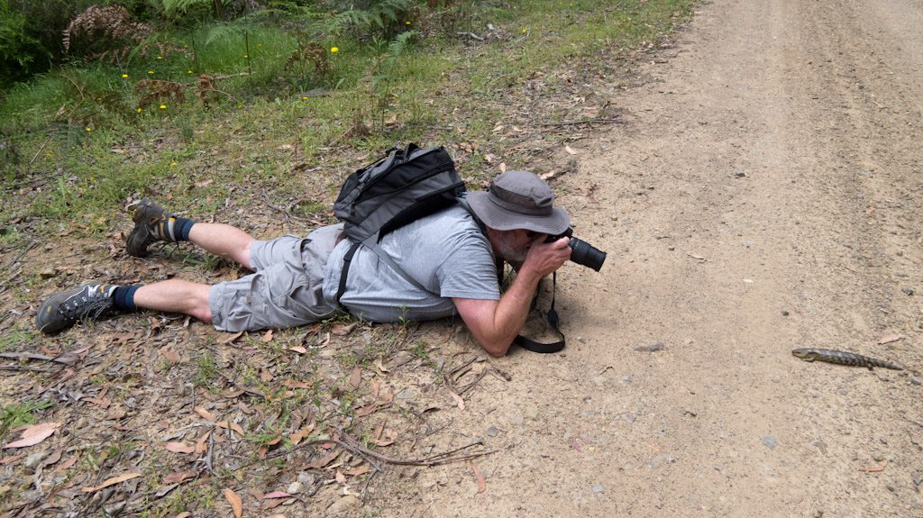
Guess what? All the gravel munching was definitely worth it.
© Smuffin
What else was going on? Well, not much, as the road wasn’t dishing up many highlights other than my polarizer being abused.

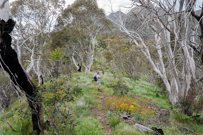
If you don’t realise by now, roadside walking does absolutely nothing for me and I was glad when we reached an unmarked turn off. This sent us uphill on a narrow track and the start of the West Ridge Trail.
I’d spent the previous couple of hours on the road looking at my feet, so it was nice to feel like the actual real hiking was about to start. There’s a steepish climb immediately off the road, but sometimes I don’t mind that sort of thing as elevation can be gained quickly (within reason of course!).
Gee Tee’s GPS reading actually came in handy as somehow we overshot a fork in the path. We were happily walking along enjoying going downhill. A quick look at the GPS and I could see we were headed the wrong way. The backtracking added about 400 metres to our walk, but we were now on the correct route. Don’t be too harsh on us, as the turn off was obscured by trees.
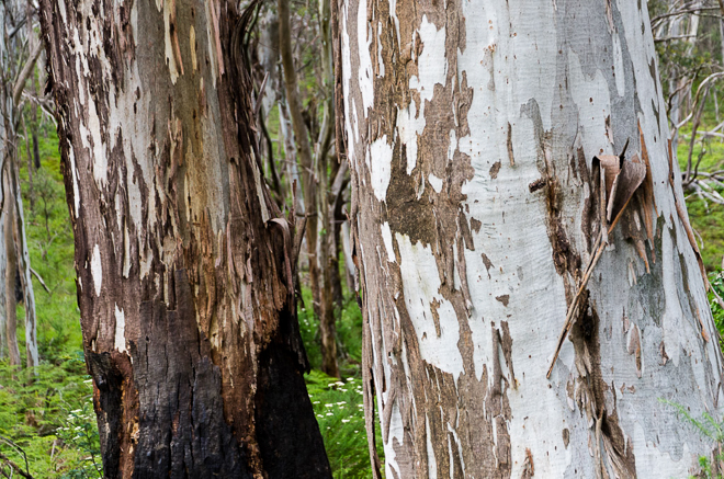
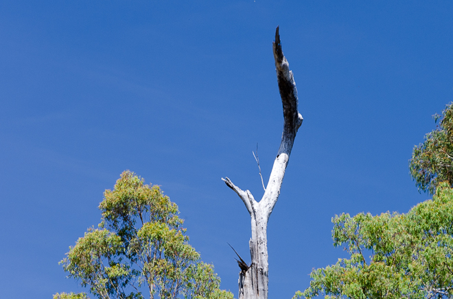
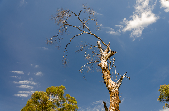
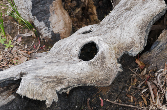
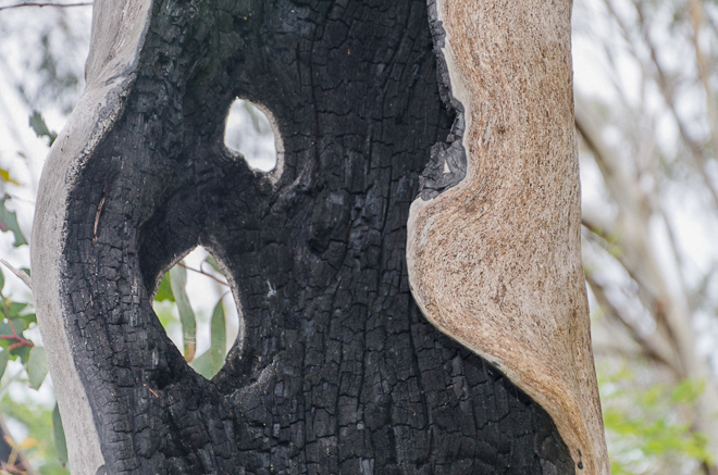
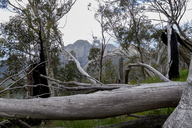
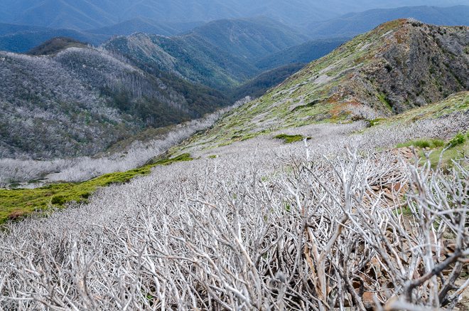
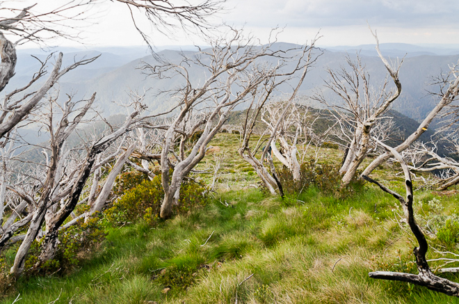
There was a bit of change in the weather from this point on as clouds rolled in blocking the sun. No good for the polarizer, but it did make the walking more comfortable as I had been cooking in the sun. I still hadn’t seen Mt Buller as we climbed steadily, so my attention was on the trees around us, including many burned ones.
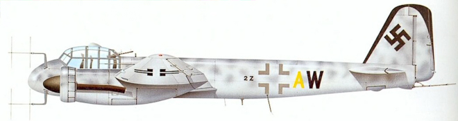
It was during this walking I spotted an interesting feather on the side of the track. I assume it was from an owl? I was about to Google it, but I’ve lost my Google mojo at this moment. Maybe someone else can enlighten me with some feather identification?
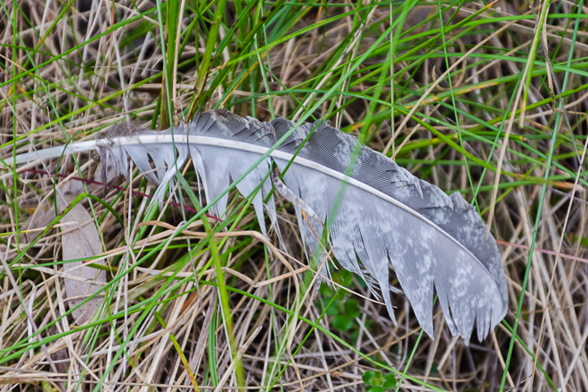
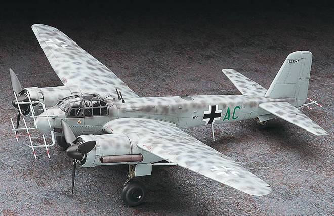
I like the markings on it and it reminded me of the night fighter camouflage markings on a Junkers Ju 88 G-6, which is a bit like this.
Okay, it’s all a bit obscure, both in what I think about whilst hiking and also what goes through my head when I’m typing. Whilst on the colour schemes, there are better examples of the similarity between the feather and the camouflage if I could only find them online.
Do you realise about 99% of stuff on the internet is a complete mish-mash of crap? Oh, not this post of course (I think). Anyway, all I entered was ‘German night fighter camouflage’ and in the process lost an hour of my life looking at completely irrelevant stuff. If you really want to know, the picture above is a 1/72 scale model made by Hasegawa.

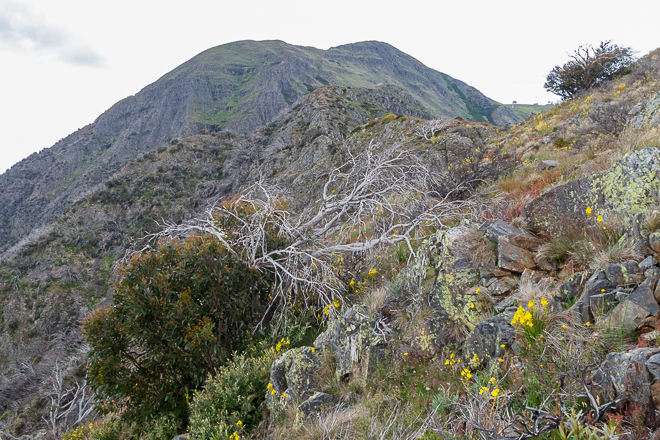
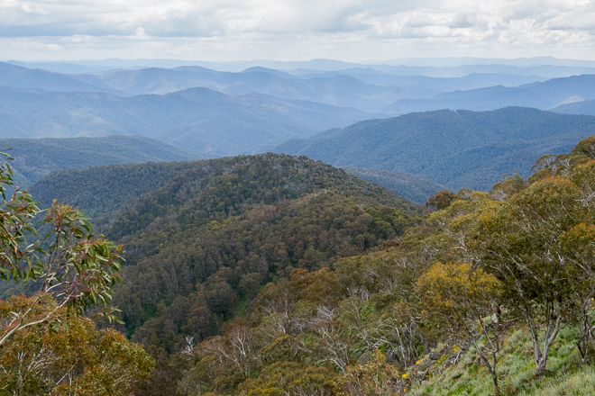
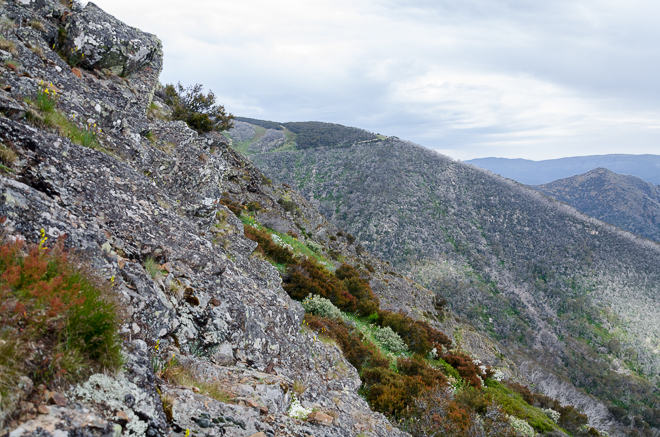
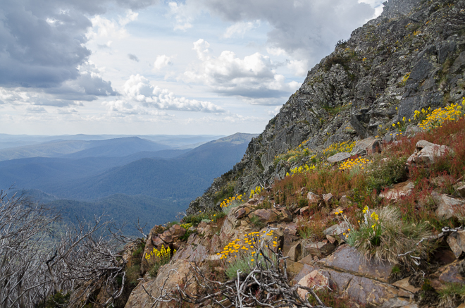
As we continued climbing, I finally got my first clear view of Mt Buller at a distance between some trees.
Mm… Let me have a closer look at that..
Oh
Well, from a distance it was looking like a beast of a climb. My only previous trip to the area was to do some skiing and I certainly don’t remember that west face of the mountain plummeting down almost vertically. It may be the most flamin’ mongrel of a black run known to mankind. In the nearest vicinity anyway.
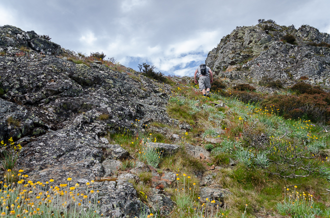
The bush was also starting to open out a little as we ascended a round shaped hill called, guess what? Yep, ‘Round Hill’. Those blokes in the ‘ye olde’ days certainly didn’t push themselves when it came to naming hilltops.
For the next few hours, we had some ‘entertainment’. The days target was constantly in sight and its looming size began to look uglier all the time. I was trying to get my head around the distance to go, as it seemed to be only a few kilometres away, but we still had over 400 metres to climb. Um.. is there some steep stuff coming up soon?
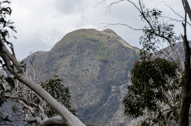
Mt Buller from Round Hill
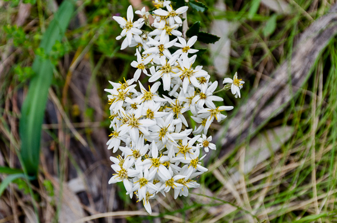
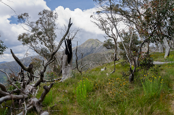
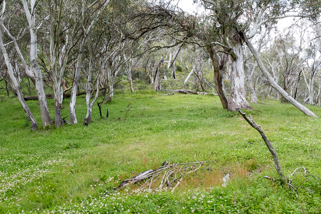
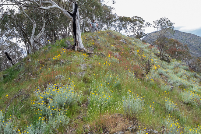
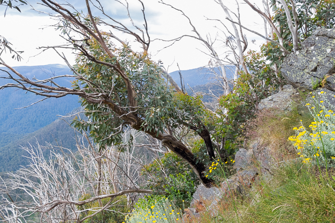
As we cleared Round Hill the track descended slightly, which is always a little disappointing. “What? I’ve just climbed this and you’re sending me down again?” It was well worth it though, as we entered a grassy meadow. It seemed out of place, compared to what we’d walked through beforehand. In fact, I liked it so much, it was the fondest part of the day for me.
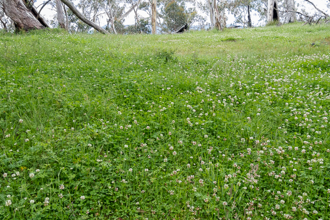
It would be a great spot to camp, if only there was some water around. At 1400 metres though, I’d think it would be doubtful on the ridge.
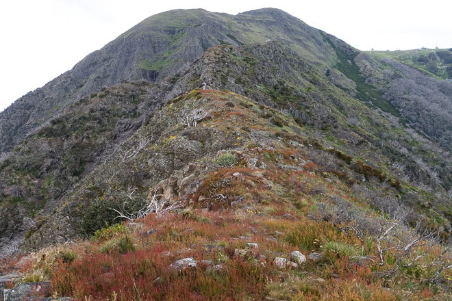
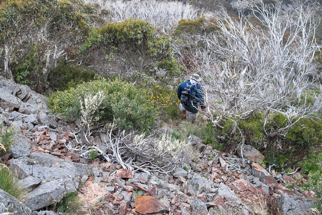
The fun had to end though, as we left the meadow behind and suddenly were faced with what looked like a wall. There was no wall of course, but a very steep hill, which was the first part of some certified ball busting to come.
The trees began to thin out and the ridge became narrow with long drops on either side. They weren’t vertical, but if you fell I reckon you’d build up some speed rolling down. I wouldn’t say you’d hit terminal velocity, but it would be close.
It was about this point that Smuffin let in on a little secret. I was wondering why he was face down on rocks climbing, as if he was leopard crawling and trying to sneak up on the enemy. He replied, “I’m scared of heights”. Huh?
The way ahead was only going to get steeper and exposed with many an opportunity to plummet down the mountainside. He said he’d told me before, but I certainly didn’t remember. I guess I should have checked before dragging him up an 1800 metre mountain?
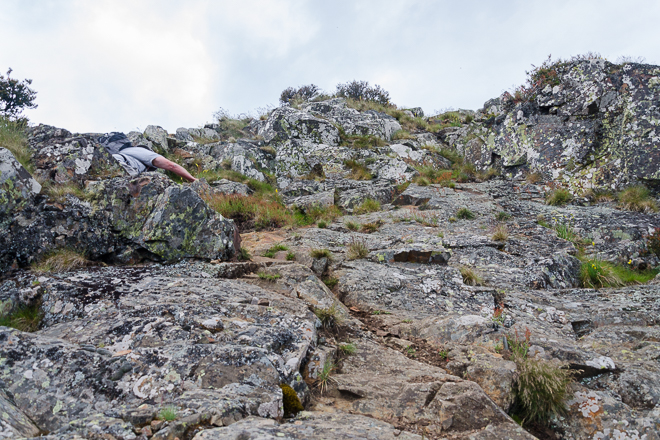
Oh well, all I can say is the climbing is not technical enough to require ropes, but in parts the rocks are loose and I made sure my footing was secure before inching up.
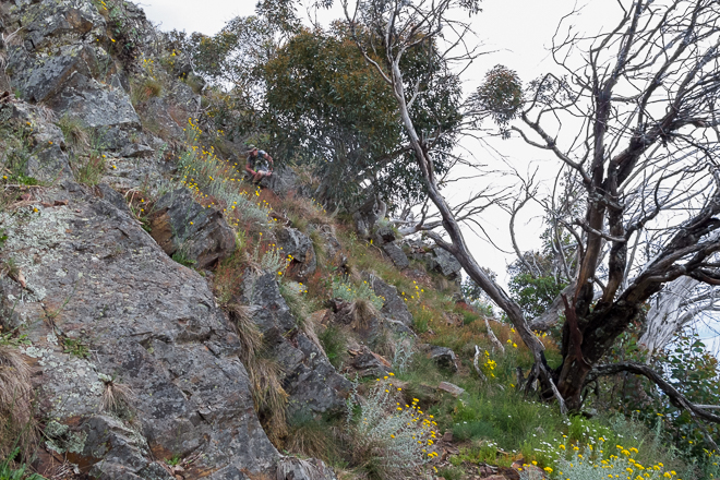
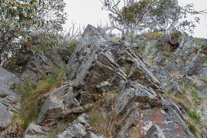
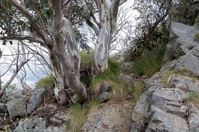
Gnarled snow gums were all around us and they were handy for a bit of leverage when climbing. Only 30 minutes earlier I was wondering when the steep climbing would begin. Now upon finding it, I began to wheeze like an old locomotive.
As the official ‘photographer’ for the hike it was my job to stop often and take shots of hills and valleys around us, as we began to dramatically gain height. The best bit of my job is I’m forced to stop every 30 seconds for a photo. It’s got nothing to do with the fact my lungs are actually hanging out my mouth from effort.
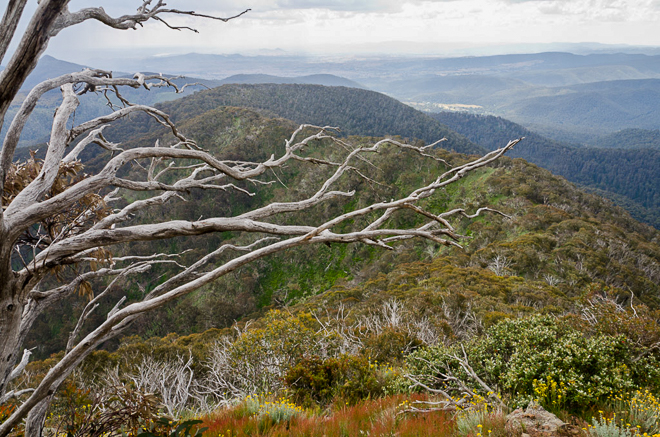
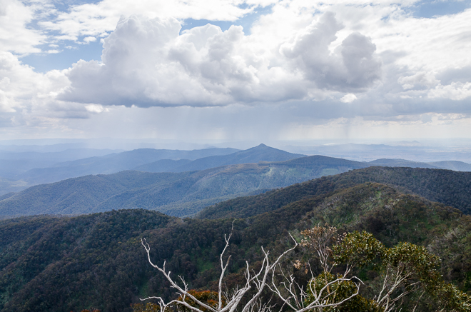
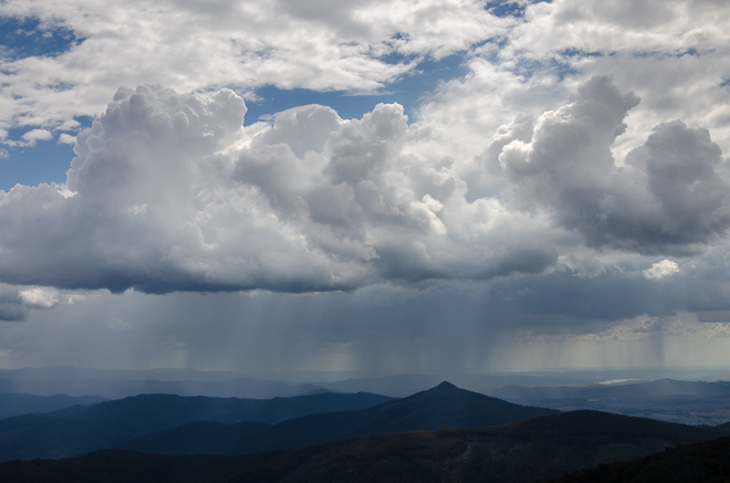
It certainly was a fantastic view, but I was a little perturbed to see showers in the surrounding hills. It wasn’t the greatest time for rain to hit us whilst we were exposed on the ridge. It was hard to tell which way the weather was headed, as there wasn’t a breath of wind in the air. Luckily though, the sun was hidden, otherwise the walk would have hit purgatory stage.
The best thing that happened though was the ridge entered a series of peaks and saddles, which gave us a chance to get our breath back. It also gave Smuffin a chance to relax from the height dilemma as the ridge had widened a little.
Mt Buller was still dead ahead, but it seemed as if we were stuck at an eternal distance away from it. We’d go up and down a little peak and look ahead to see the mountain didn’t appear any closer. There was also another thought creeping into our minds, as our progress became very slow.
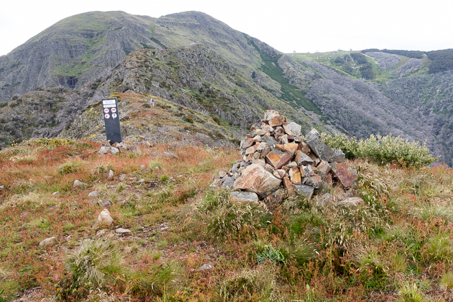
Rock cairn on west ridge
Mt Buller dead ahead
What’s a common theme of my walks? It should be easy, but to give you a hint. It’s daylight. Well, that was a hell of a hint, but you know what I mean. Gee Tee in his track notes has the walk at seven hours duration. I’m a self-confessed slow walker and I thought I could add a couple of hours to the total. Somehow it had taken us seven hours already and we weren’t at the bloody top yet! There was still a 10 km descent to come, which was looking a little ugly regarding daylight.
I’ve been stuck in these positions before and always carry a headlamp on all my walks. I told Smuffin to bring his and at this point I asked him about it. He replied, “No I didn’t bring it. I thought you were joking.”
Mm… It’s not the greatest thought about coming down a mountain in the dark with only one headlamp. It was time to press on, if we could only up the pace a little.
The trouble is any attempt to speed up, just meant I was beginning to hit the wall a little harder. This is all I can say about it all.
Do you know what else was making this final push to the top worse? Believe it or not, but ants. Every time I stopped for a breather and stared at the ground, it was a sea of movement. So much so that only a brief rest was enough for a million ants to be climbing over my shoes and then up my pants.
I said to Smuffin, “What’s with these bloody ants?” to which he replied, “They’re motivation ants.” That summed them up, as stopping was more annoying than walking uphill. Every minute or so, I’d have to sweep dozens of ants of my legs as I trudged on.
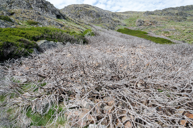
These photos are starting to look the same aren’t they? The eternal mountain continued until we were at the base of the final push. It was an interesting spot besides being slightly vertical, as there was a vast swathe of dead bush, which from a distance looked like scree. I’m not sure what wiped the plants out, but it did look a little strange.
Smuffin applied the power and I last saw him disappear up ahead. Usually when I climb a substantial hill I feel a little jubilation, but I didn’t really get it once I reached the top of Mt Buller. It was a matter of, “Okay, I’m up. Let’s have a quick bite to eat and get out of here”.
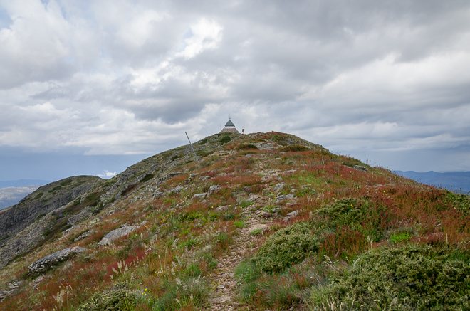
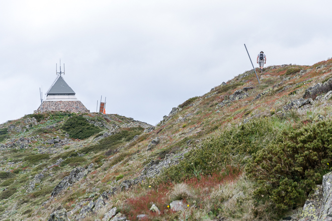
Approaching Mt Buller fire tower
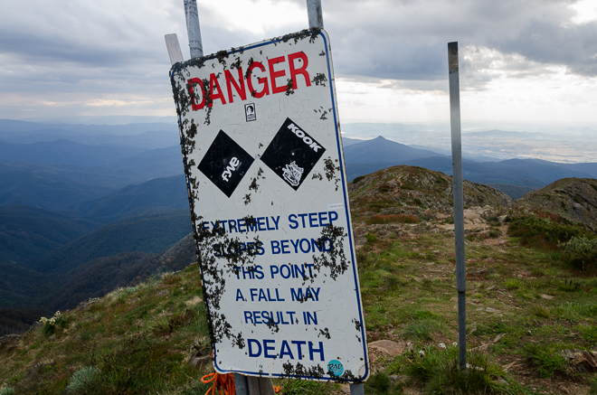
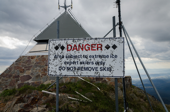
The rain had held off even though the sky was pretty dark, but that was also because it was getting absurdly late. Gee Tee writes about having lunch on the summit, which technically we were doing, but it was 6 pm!
Even better, for the entire climb there’d been no wind at all, yet as soon as we reached the top a freezing gale kicked in. I did have the raincoats, which was a bonus in order to cut out the wind chill and we found a spot to eat next to a closed ski lift for some shelter.
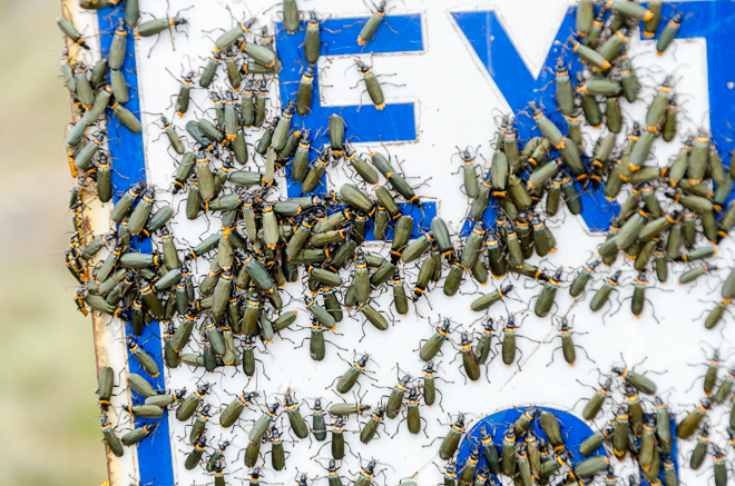
One interesting thing is the place was besieged by what I think are technically known as ‘green bugs’. I’m the laziest Googler ever. If I don’t find something in a couple of minutes I’ll give up. Anyway, I just happened to sit amongst a few thousand, as they were in unavoidable clumps wherever I looked. Even on the signs.
Smuffin actually had a couple of options at this stage and they were as follows,
A) Walk down the ridge line back to the car.
B) Walk to the nearby ski lodge and stay the night.
C) Ring for a taxi.
D) Suicide.
I certainly was liking every option, other than the walking down one. The trouble is I have some sort of masochistic streak, telling me I needed to continue on. Downhill sections I dislike more than anything though, as it creates a bit of knee pain, yet I elected to stick to the original plan.
We really had to get going, as it was past 6.30 pm and some heavy showers began to sweep in. It really was cold, but as a bonus I had a Wolfman wig with me ,which I began to use as a beanie. It’s an interesting look, but it doesn’t remotely look wolf-like. It’s more like my hairdo from about 1979.
So, that was it then for Mt Buller as we began to head downhill on the untracked McLaughlan Shoulder. In hindsight it wasn’t too bad, but at the time it was pretty annoying, as we were trying to go as fast as we can.
The trouble is it was hard to pick up any speed, as it seemed every footstep was on a rock that moved or loose branches that shifted. I had a couple of ‘moments’, where I was twisting my ankles in unusual directions. Photos from this point also dropped off, as showers swept in and I put the camera away.

Descending McLaughlin Shoulder
We reached a rock band, which was no real problem if we had time up our sleeve, but we stomped and crashed down it hoping not to fall over as we did so.
There’s a bit of comedy as well. A few extremely token track markers are attached to trees here and there. Actually, in the whole descent I think I saw three and I’m not really sure what the point of them are? I certainly wouldn’t want to be relying on them to work out where to go. It you do, you’ll be disappointed.
There was always going to be a minor disaster wasn’t there? It came as I was headed down and I felt the side of my pack and realised my trekking poles were no longer strapped to the sides. I have no idea why I fall for the, ‘strap stuff to the outside of the pack’ system, as I’ve lost things in the past doing just such a thing.
I had a brief expletive tirade, whilst shaking my fist at the sky. Smuffin had pulled out all the stops and had disappeared ahead, so I couldn’t tell him what had happened. The bonus was I had the GPS, so I could follow my track back uphill for a little search. The main thing is though, I didn’t want to walk uphill again, but I dropped my pack and went for a little sprint back across the loose rocks.
I wasn’t sure how far I was going to go, but the poles are too good to give up without some sort of effort. I chugged on for about 150 metres and finally found them sitting together. Whew! During this fiasco I could hear faint shouting from Smuffin down below, but with the wind howling he didn’t hear me yelling back.
It was a complete pain, but I made my way down and told him what had happened. It certainly was getting a bit grim on the light front, whilst we stopped for second to get our stuff together and to make matters worse I somehow swallowed a bug which caused me to dry heave like a lunatic. In fact I was practically performing a power-spew, but Smuffin seemed more concerned with the upcoming darkness, rather than the fact I’d stopped breathing a couple of times. I think I drank a litre of water trying to clear my throat before heading off.
How much fun is this without pictures? You’re going to have to keep reading without the photo stimulation. Is this possible? Anyway, our next target was a turn off, which would take us off the unmarked section and hopefully onto some easier walking. Gee Tee describes this section as ‘easy and enjoyable’. Well, it might be if you’re not trying to descend like Carl Lewis and there’s some actual light to see all of the loose rocks and branches.
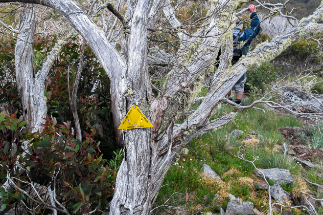
We were looking for the Klingsporn Track which would take us all the way back down the mountain. What do you think two idiots would call such a track? It’s pretty obvious, as we were soon calling it the ‘King Porn’ track.
In the end we were so stuffed it just became the plain old ‘porn track’. Just to make it even more stupid, the track starts at ‘Thank Christ Corner’. I’m not sure what’s going on with the names. In fact, here’s a rubbish photo, which was my last for the day at our turn off. I don’t expect you to be able to read it, as I’ve just uploaded it in order to break up the print a little!
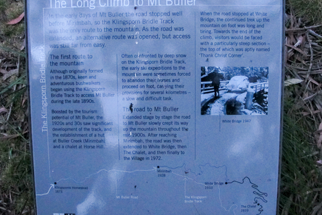
Information sign at Thank Christ Corner
We’d reached the ‘porn track’ and were now well on our way to the finish. The trouble is it rapidly became dark as we re-entered forest. This wasn’t too much of a problem for me, as I had the headlamp.
Smuffin didn’t though, but somehow he took off ahead at a good speed and was soon disappearing into the inky blackness, with no light whatsoever to guide him. I’m not really sure what he was able to see, and it’s one of life’s mysteries how he negotiated fallen trees and rocks without killing himself. I guess it’s feasible that he’s actually Riddick and I didn’t even know it.

Riddick. AKA Smuffin.
I really do have to finish this post pronto, but to wrap up we reached the road and finally made it to the car. My knees were absolutely shot from the long descent and I could hardly move. It’s annoying having my joints give out way before my lungs do.
Now, remember the the anticipated seven hour walk which we started at 11 am? I’d like to announce we finished at 10.30 pm and it almost took us 12 HOURS (random capital letters to signify mental illness). Now, I’m a pretty slow walker, but I didn’t think the time would blow out by nearly five hours. Gee Tee must be the world’s fittest man or either he packed too much of that ‘special baccy’ in his hookah when he wrote up the walk.
According to the GPS, the statistics for the day indicate 22.47 km (13.96 miles) and total elevation gained being 1482 metres (4862 feet).
Actually, I like imperial more, as it appears I climbed even higher. What’s interesting is for the first time I can remember, the Garmin was out a fair bit on the summit of Mt Buller. The height is 1805 metres, but my GPS was telling me 1775 metres. Hang on, I’ve been ripped off!
What can I say to end this epic adventure? Actually, this may be my largest post ever and my next entry will be about blogging in general with a mention of the conundrum of the super-sized post.
Well, the only thing I can suggest to anyone looking to do this walk is it may take a little longer than the notes suggest. I do take a lot of photos along the way, but I didn’t think five hours would be due to picture taking.
The final kilometre to Mt Buller itself along the west ridge, is slow going and we lost some time there. It’s not technical, but it’s tricky enough to want to be careful when scrambling over some loose rock. Good weather is essential as it’s exposed and narrow in parts and I guess not being scared of heights is also handy to have?! Oh yeah, I took five litres of water and drank four on a coolish day, so I’d hate to be there if it’s hot. Food wise I think a bit of ‘Yea pie-power’ pulled me through. I think that’s more than enough, but as a footnote maybe this camouflage resembles the feather a little better…

Greg, sounds like a long walk, I don't think I have climbed the west side of Buller. Great photos which depict the scenery and the plant life exactly as I remember it. Glad you found your poles and it is always a dilemma whether to go back or not. Ahh bakeries nothing more need to said. Looking forward to to your next post.
Hey Roger, some things don't change too much down here! I think it would be a nicer walk to do it in Spring when there's still a little bit of snow around as it would be spectacular. A suitably ridiculous epic would be to have a crack with snowshoes on in Winter. One would want to know what they're doing up that West Ridge though!
After a 100 metres of walking uphill I was contemplating coming back the next day for the poles. I don't think I could live with myself if I just gave up on them for another hiker to find! I'm so stingy I even returned to a walk once to find my hat which I'd lost the previous day 🙂
Thanks for the comment and may the New Year bring lots of new trips!
An epic day hike and an equally epic blog post, Greg! Very enjoyable reading and nice pictures too. 11:00 does seem a little…LATE to be setting off, though, doesn't it? I know – in this country it's a trek in itself just getting to the trailhead.
No telling what ordeals – I mean ADVENTURES – you're going to get yourself into with that new G.T. tome.
Thanks Goat! It was a 450 km round trip in the car doing this hike from my place, so I wasn't being too slack (I think?!) I sleep like rubbish, but I can't do early starts which seems all a bit weird.
Not sure where the new GT book is going to take me. I've already pencilled in a potentially nastier day hike in the next few weeks!
I am not sure how I stumbled into your blog but I did, and i stayed awhile to gather inspiration to tackle some more of Victoria's terrain.
The west ridge of buller was our first ever hike. We did it from trailhead carpark return in 6 hours. That was the good part. The bad was we took 2 litres of water on a 33 deg day between us. Not good.
On our day trip we were on the exposed steep ridge line you talked about when one of those fully enclosed engineless gliders buzzed us. AMAZING.
Ah, yes, you were probably wise in doing the walk as you've mentioned. A lot shorter, but the water business would have been traumatic! Everyone experiences that at some point and makes sure it never happens again! I always take a lot more water than I ever end up using.
I guess you could return and do the full circuit?! This was a massive day hike for me and I can't see myself ever going back to do it again!
Wow, I love a glider and you were lucky to be buzzed by one of them! I can't say I've ever been so lucky.
Thanks for dropping by and taking the time to comment, as it's always appreciated!
Hi Greg.With an early start and a car shuttle , leaving a car at the trail head car park , you can ascend the West ridge and descend via the 4 Mile spur track down to the Howqua River. That interests me.
Yeah, that makes sense. Unfortunately the car shuffle is the nemesis for the solo walker! 🙂
I loved this. We are heading there Friday and thanks for all of the tips. I think someone is picking us up so we have a “crew” and potentially a guide.
I’ve been away, so missed your comment. Hopefully it didn’t take you 12 hours like our effort! 🙂
Hey Mr Fiasco (as referred to by a notable hiker on the bushwalk forum). This is my first comment, but I think I’ve read every fiasco. It is just about the only thing that makes me actually LoL. Congratulations. I’ve have done several hikes that you have written about, duly encouraged by your survival and subsequent post, so thanks. I intend to do the Mt Buller traverse in winter (July) with an overnight at round hill. Depending on snow depth I may take a rope to help with descent; one sure would have been comforting on the Diamantina spur last winter…
Thanks for being a loyal reader! Mm… Mt Buller in winter would be quite interesting. I can imagine west ridge would have some icy moments? Way outside my level of comfort anyway 🙂 Diamantina Spur sucked in summer, so I can only imagine how much pain was involved during winter! Good luck with Mt Buller. Hopefully it all goes to plan.
Daughter and I hiked up Buller North Ridge yesterday direct from Mirimbah . No track . 1000 m in only 2.5 km . Rock scrambling last part of ridge . A little hairy . Thick scrub most of the way. Ended up being too late to descend via West ridge .
Mm… Sounds like a hard day. Good for a story at a later date? You may have some Buller PTSD though, as 1000 m in 2.5 km sounds a bit bonkers 🙂
Well I did have a crack at the West ridge a couple of weeks ago midweek when there was 55cm snow across the summit and on the ground down as far as where the forest road becomes walking track.
Due to an early morning commitment I also only managed to start walking at 11am, but chose to drive as far up the forest road as possible in the classic less-than-ideal low slung Japanese car. In this case a corolla. Not recommend as there are some muddy sections on that road that grazed the underbody and plenty of branches that needed shifting.
I lost traction a few times and spun a wheel in the air just trying to turn around to park due to the extreme camber on the road.
However the walking was fantastic and it was a perfect day. In semi smuffin style I was in shorts and long sleeved base layer all day, but with gaiters.
The going was steep but technically easy until the rocky ridge line as you guessed. After the official park marker post is the steep summit ascent and I got stuck trying to find a suitable route where on the lee side of the ridge the snow was over 100cm deep lying on top of scrub and was regularly up to my thighs. I made 150m in 1 hr. It was a case of kicking a step into the snow 5 times to be able to put weight on it to take each step, then eventually discovering that the rock underneath was slanted and the next possible foot step was at chest height. I backed out of 3 different attempts. Eventually I settled on the direct rocky ridge and chipped away enough snow and ice with my walking poles to be able to get finger holds on the rocks and get up. Crampons would have been nice for that bit.
After that it was flat enough to put my snow shoes on and apart from it being steep and sometimes scrubby underfoot I zig zagged up the side. I bet in the summer there is a nice little path and one can see where to put your feet.
After a brief stop at the summit I zoomed down through the resort to the villiage.
It took me 5 hrs to get to the village in total. There wasn’t really a stop for lunch to speak of. Thank heavens for scroggin!
Happily I had anticipated not having sufficient daylight to attempt the “untracked” return, and I had also read the comment by Damien above, so I opted to pay for the bus to take me back to sawmill.
After finding a quiet corner of Mt Buller villiage to get my stove going for some dinner, the bus departed on schedule a little after sunset and duly dropped me at sawmill settlement. Then it was only another 6km up the forest track to the car.
Like you I only had one head torch, but unlike you, there was only one of me!
I opted for this route option as I figured that it’s pretty hard to get lost on a forest road even in the dark and after another 90 minutes my car reflectors appeared.
It took me 25 minutes to drive the 6km back out as I couldn’t allow the car to build up much speed or it had a tendency to slide sideways when I did need to brake. Fun times.
The car wash at Mansfield is open 24hrs so I was able to wash the mud out of the brake rotors and from the underside before the 3hr drive back to these western suburbs of Melbourne.
Thanks for your inspiration
Thanks for your extensive reply! It sounds like an epic of a day. Without the hindrance of snow etc, ours was mild in comparison!