What’s the go with this hike? Fairly simple really. My aim was to tackle the Cathedral Range Circuit. I’d climb up Sugarloaf Peak, walk the Razorback Track and then camp at the Farmyard for the night.
One part of the trip that appealed was the Cathedral Range State Park isn’t too far out of Melbourne. At least I wouldn’t have to drive for hours to get to the start. During my early morning drive, I did notice in the temperature was only 2 °C in the suburbs. This did give me a slight warning the walk may be officially ‘brisk’. Around 9.30 am, I arrived at my starting point. Cooks Mill carpark.
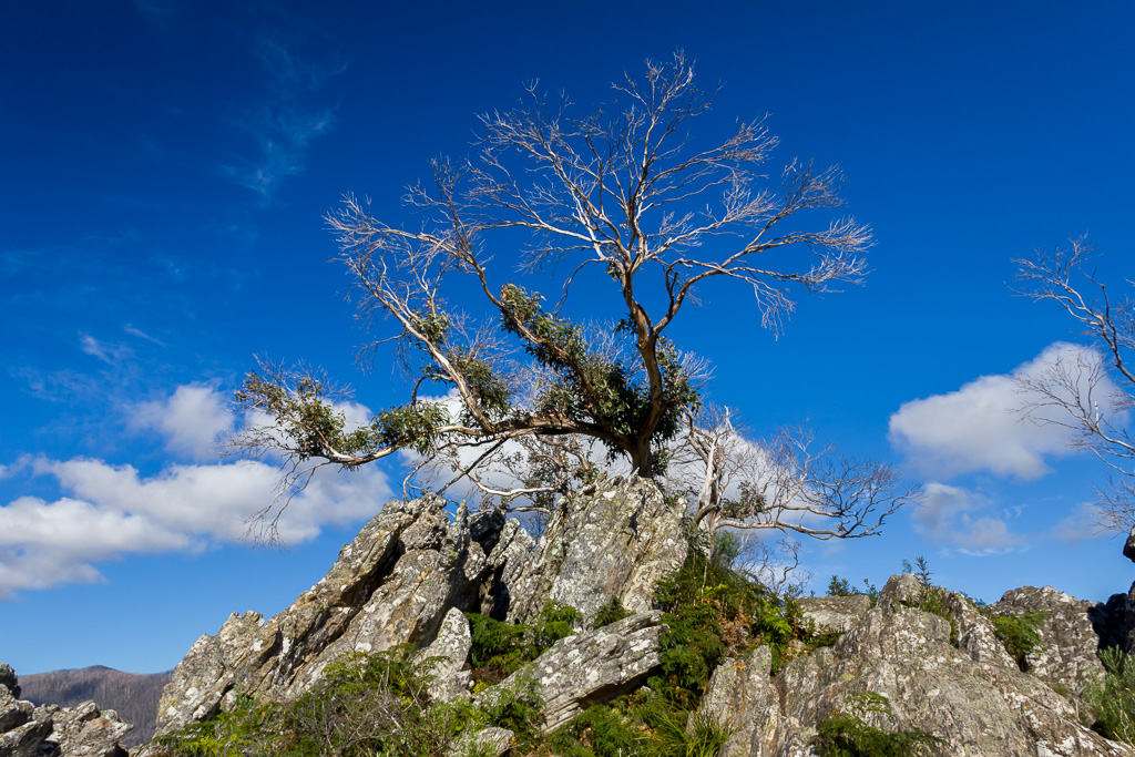
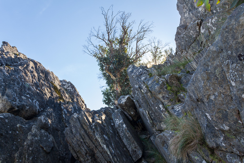
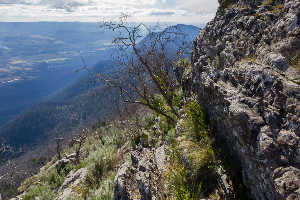
I had my first indication it might be a tough day when I looked at the range itself. A narrow, rocky ridgeline with steep cliffs, informing me it’s potentially an ankle twisting paradise.
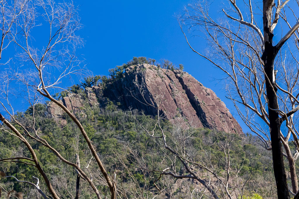
North Jawbone
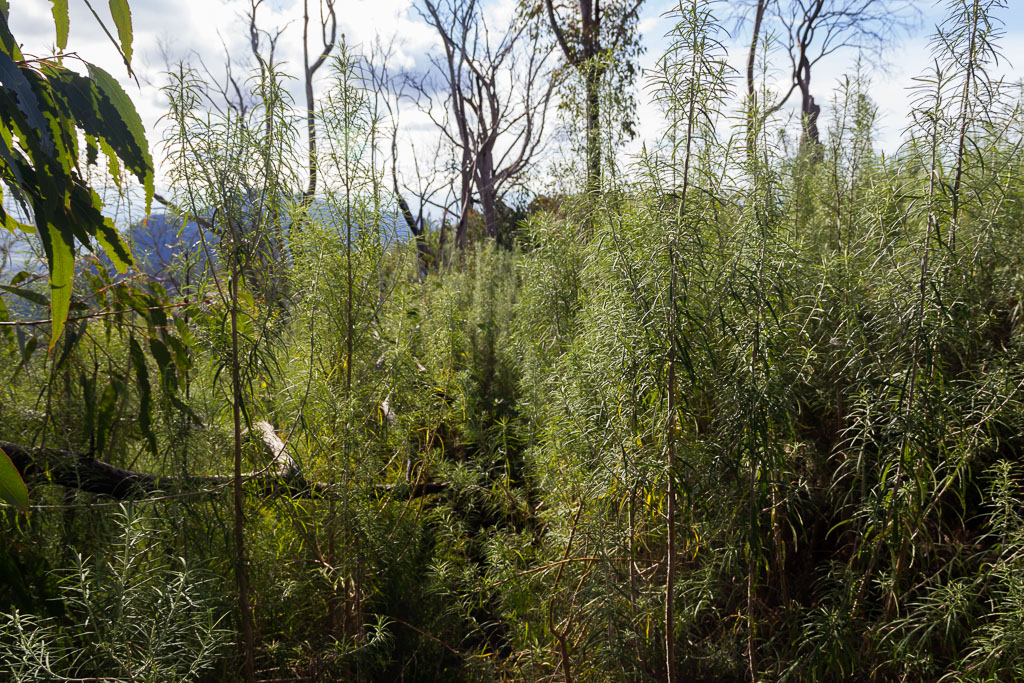
It was something to ponder, as I donned the pack and began to stroll up a path called St Bernards Track. Slowly I climbed for a few kilometres until reaching Cerberus Road. This was where I had to go ‘road-walking’ for about four kilometres. According to my notes, this road wander isn’t meant to be too bad.
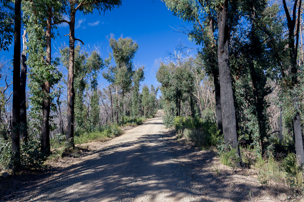
Cerberus Road
When it comes to hiking though, each to their own. If you have never been in the Australian bush before, then you might find the road quite nice. It was cold, but with blue skies and lovely fresh air, it was an opportunity to see the re-growth from the fires, which burnt 92% of the park a few years ago.
Yeah, okay, that’s enough talking it up. I have experiences from my time in the Army that are burnt into my brain and they happen to include plenty of ‘roadside walking in the bush’ memories. We seemed to do it a lot for the reason of, well, because we could. What’s worse was there never seemed to be any point. We didn’t go anywhere in particular, but it was just walking for the hell of it. This has tainted my view of things like this, so ignore me as it’s probably the result of a mental condition!
I found the stroll up Cerberus Road mind numbingly boring. Don’t forget, in my last post I mentioned how MK warned me about this road slog, so I had plenty of time to ponder this and her advice was ringing in my ears.
Okay, I admit, that doesn’t make sense as informed me via text, so I guess I mean it was ringing in my eyeballs. It’s a steady climb all the way complete with three cars passing me at different intervals that left me with a cloud of dust to chew on. Besides that tasty experience, I began looking for the smallest things to keep my interest and finding an ANZAC Day badge lying on the ground was handy for something to look at. Why it was sitting in the middle of the road, I’ve no idea.
![]()
It was one of those steady climbs. Not steep, but no down bits to give the legs a break. By the time I reached Sugarloaf Saddle, I’d worked up quite a sweat even on such a cold day. This spot is where the road’s left behind and I start heading up to the ridgeline. Sugarloaf Peak, the highest point of the Cathedral Range at 920 metres, was in my sight.
For some reason there seem to be a million Mt Sugarloaf’s in the country. Yep, it’s another one and after all the incline roadside walking, the top of the mountain was only about another 200 metres or so in elevation.
I briefly stopped at the brand new Sugarloaf Saddle facilities, which obviously have been built after the bushfires. There’s now a lovely comfort station, shelter and a water tank that came in handy for a refill before heading into the trees.
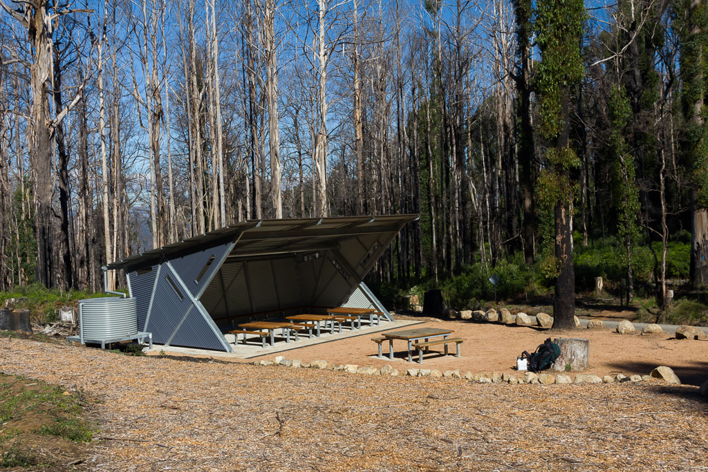
New shelter at Sugarloaf Saddle
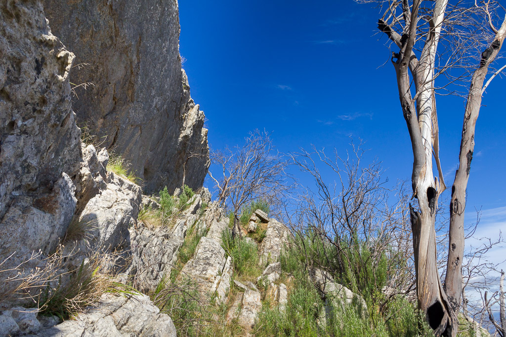
There’s two options to ascend to Sugarloaf Peak. The Canyon Track or the Cave Wells Track, but the latter is not advised for people carrying a pack. I guess that counted me out, although I was tempted to give it a go, just because they told me not to. I stuck to the advice though and headed up the Canyon Track, which is fairly standard at first. A few steps cut out of rock here and there before coming to sections of scrambling.
Now, I know walk gradings such as easy, moderate and hard. I noticed on the sign at the start though, another grading had been introduced. ‘Very hard’. Can there be more? Maybe something past that? How about, ‘Ball busting?’
Maybe it’s a little too spicy. Okay then, I reckon I’ve got one. ‘Bonkers’. This was the word to describe the section to the top, which would’ve been bearable if I didn’t have a pack full of gear putting me off balance. It’s hard to describe, but remember, I’m viewing this as an older bloke and not a 20 something with nimble knees, who’d wonder what the fuss was. I guess some before and after photos will help to explain this final piece of scrambling.
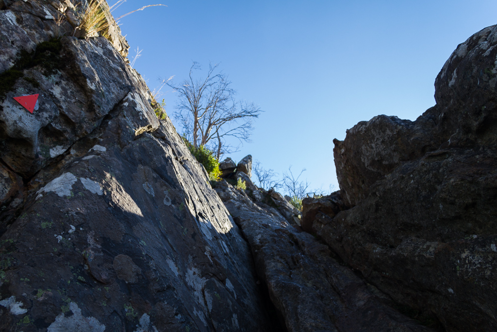
Okay, just follow the arrow
Looking back from the previous photo
I became aware the trekking poles should have been put away before the rock scrambling business, as they’d now become a hindrance. At times, I thought I was fairly close to the top, so I kept hold of them and thought I’d stow them away once the peak was reached. In the meantime, I’d leave them hanging off my wrists, as I needed my hands for pulling up on the rocks. Here’s a few more ‘before and after’ shots.
The arrow on the tree says this is the way
Looking back after another few minutes of scrambling
I wasn’t as close to the top as I thought though, as the tricky climbing continued.
Mm… Another arrow on the tree ahead
Looking back and although this bit looks the easiest, it took a while
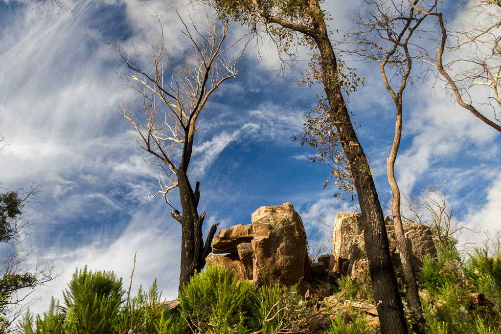
Finally, I was thankful to clamber up the final few rocks and find nothing left, so I assumed the top was reached. It was time to dump the pack, sit down and suck in some oxygen.
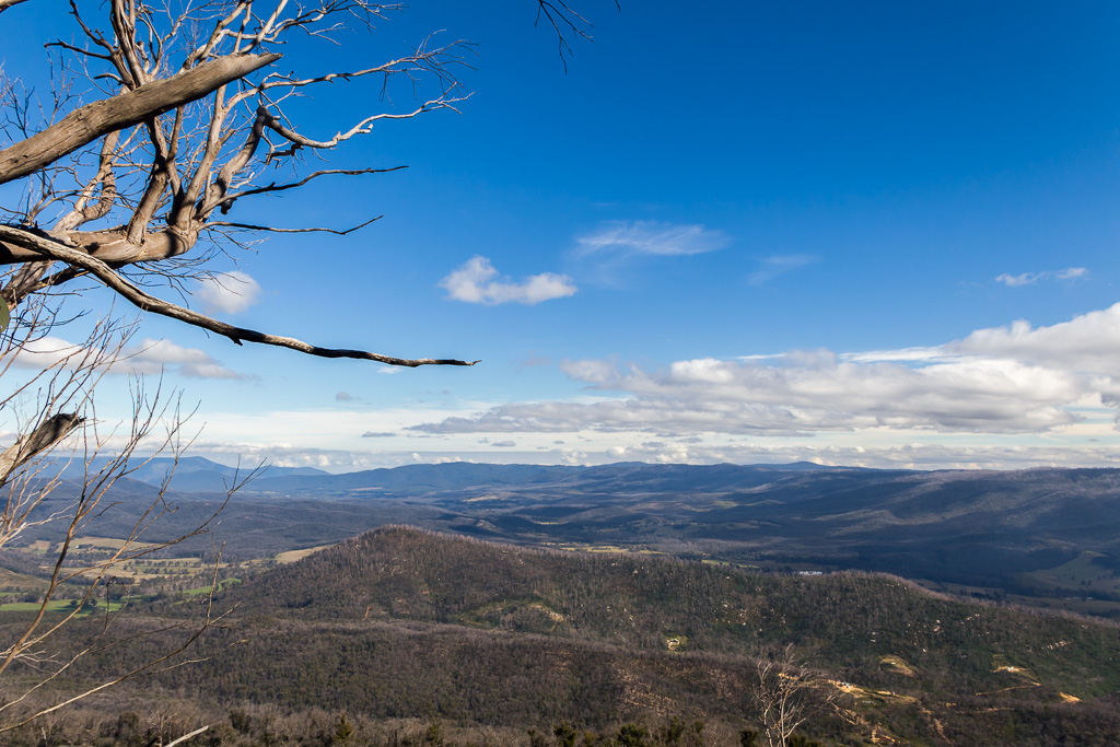
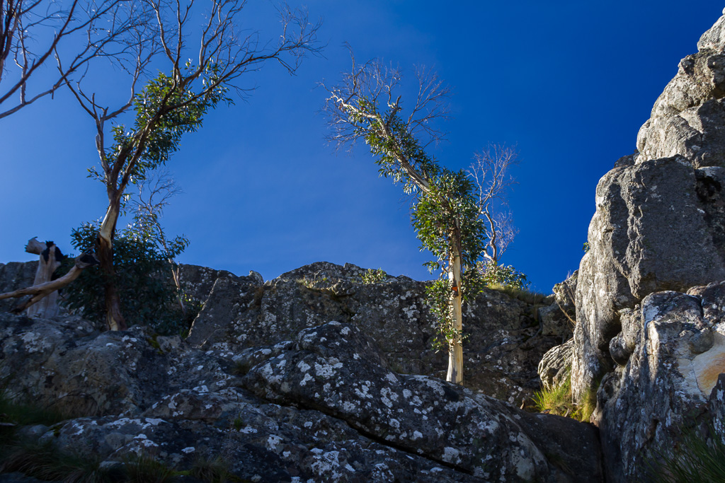
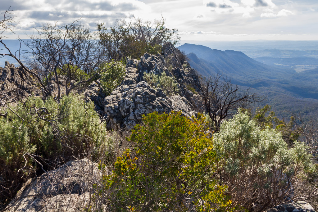
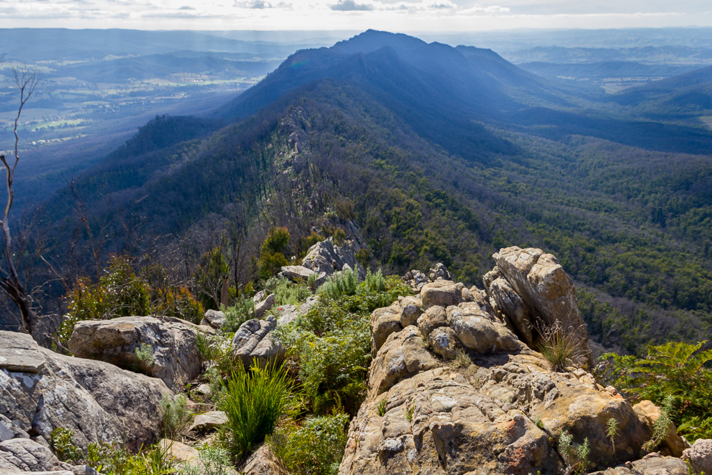
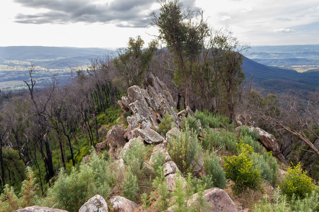
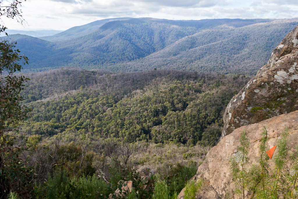
The top of Sugarloaf Peak is a rocky and scrubby affair and it’s not the nicest looking hill to be on, but there were some fantastic views in all directions, with the sky staying nice and clear.
View from Sugarloaf Peak
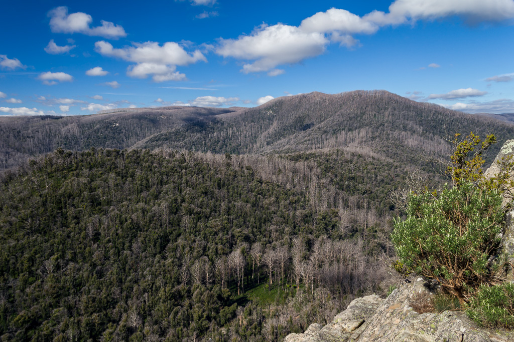
The way ahead, pity the sun was a little bright for the photo
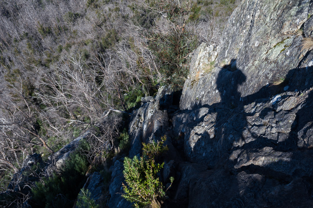
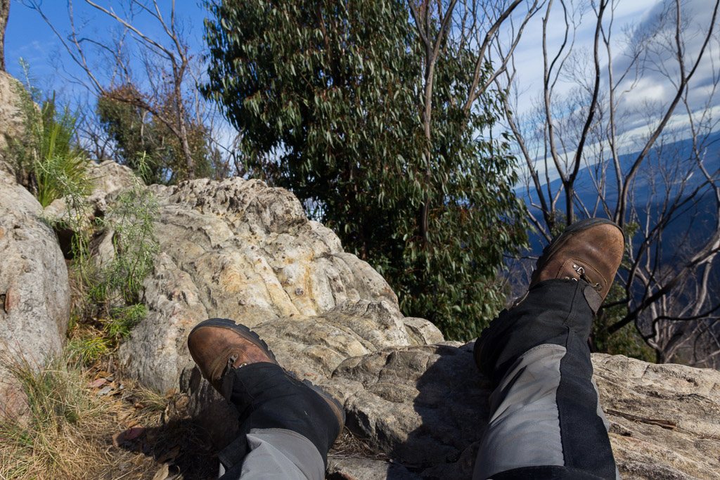
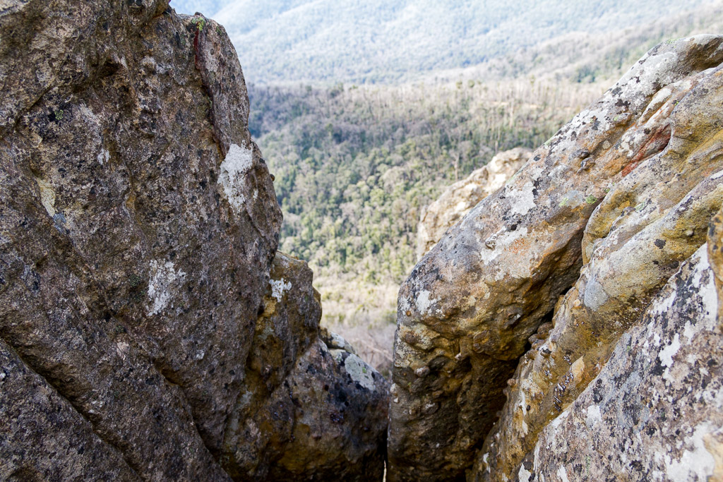
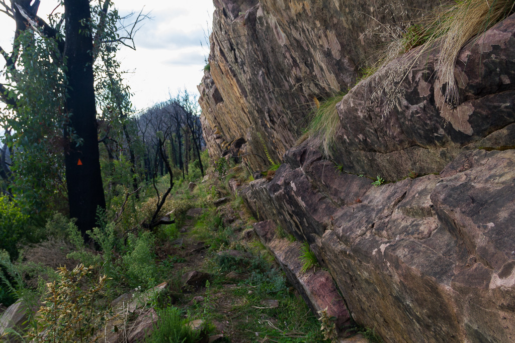
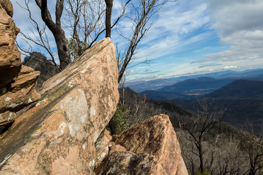
It was a thoroughly mental climb and I was aware of my knees starting to ache. Continuing on, I looked ahead at what was to come. The ridgeline’s called ‘The Razorback’, which is a fairly apt name and at first glance, it’s hard to see where the roughest of paths is.
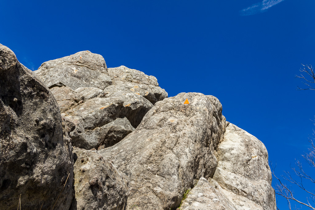
Luckily for me there was a bonus, as the area had been recently remarked with bright orange triangles. Once I started moving, I was always able to pick out one ahead, so it was a matter of hanging on and inching ahead. It’s definitely slow going though and for a walk that requires balance, I’m not the best bloke for the job. It didn’t help with the pack and no matter how careful I was stepping through rocks and scrub, I had my first fall of the day.
I’m not sure what caused it, but I do remember going for the ‘face first’ approach. It’s amazing how quickly the brain thinks, as I saw a flash of sandy rock in front of me and my brain was telling me, “Hey, big boy, you do not want to be chewing on that rock”.
This thought registered, so in a freakish manoeuvre I managed to spin in mid-air with legs outstretched and land more or less on my back with my pack breaking the fall. Upon touchdown, I lay there for a moment wondering if I was dead or at least in one piece. Plus, I needed to capture my reclined surroundings. The world looks different when lying on my back and I could see some nice clouds overhead, which I hadn’t noticed whilst walking.
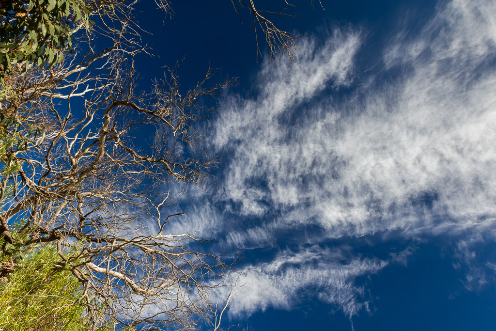
See? The sky looks alright whilst I’m lying on my back
Oh, I just looked at the last photo and I’m sorry I might have freaked you out. You may have just thrown your Corn Flakes in the air and screamed, “Oh my god! His leg got ripped off!” Don’t panic though.
Look, it’s still there. I just had to retrieve my left ankle from behind my right ear. I love this hiking caper. After about five minutes I dusted myself off and finally gave the trekking poles the arse. They were part of the reason I fell, so I put them away and went with the ‘rock grabbing’ technique for the time being. The way ahead was pretty rough and ready and it was amazing how slow I was going, as the GPS was telling me I was averaging 1.3 km/h. Wow, so speedy.
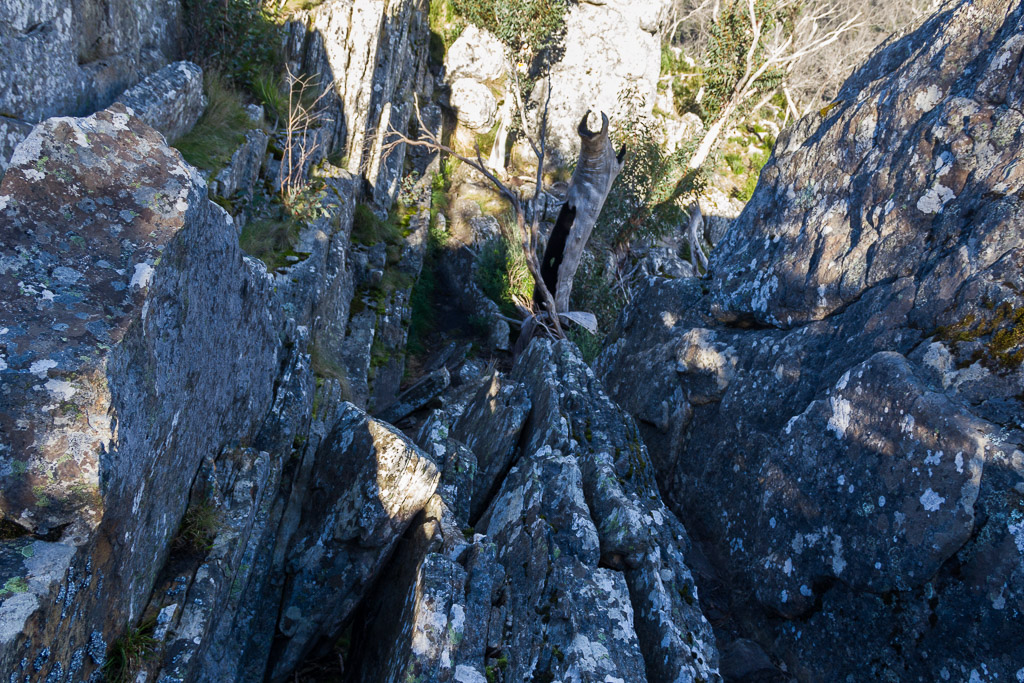
Razorback Track
There’s plenty of burnt trees along the way, which I made a habit of bumping into and I had to grab the odd one to pull myself along. I usually wear a long sleeved shirt that’s cream coloured and on this occasion it ended up fairly blackened with soot.
As a warning to all you fashion conscious hikers out there, I suggest the lighter coloured shirt is not ideal if you are planning to do this walk. The same theory applies to eating spaghetti bolognese with a white shirt on, as that’s also truly reserved for the real thrill seekers out there.
As I stumbled along there wasn’t much else to do other than fall over again. Unlike the last frivolity filled affair, this one was a bit nastier. I had to descend a series of rocks by placing my feet at weird angles with the hope I’d keep a firm footing until I cleared the obstacle. The firm footing bit I neglected though and of course I fell, but this time it involved a bit of tumbling.
On my previous fall I was impressed how the brain snapped to attention and avoided a rock chewing experience. This time the brain was thinking a little differently and it was telling me,
“Hey muscles, this is not the place to fall, as there’s a vertical drop not too far away and if you don’t stop tumbling, then you’ll be descending in mid air at a terminal velocity speed, with the chance of a soft landing being quite minimal. As in none”.
I’m not sure how exactly I stopped, as it felt like a was in a washing machine during the spin cycle and I didn’t end up nicely on my back like last time. It was a sort of ‘limbs in all directions’ method and I had the feeling I looked like a spider who has just been beaten hard with a large shoe.
The camera was clanging off rocks, swearing was fast, furious and florid, before a final torso thudding impact that registered 7.5 on the Richter Scale. I’d came to rest upon a ledge and was well aware only a metre away was a vertical 10 metre drop. It truly was the ‘Great Fiasco Escape’.
I rolled onto my back, took the pack off and lay there for a while taking it all in. During this mental debrief, I became aware I must have squashed some fingers at one point as one hand was quite numb. It was a chance to take a few more ‘on the back’ photos though.
I fell near that arrow somewhere
Yeah, from the arrow to the rock below it and a bit more
Oh, there was a certain familiarity about the conclusion.
I was hoping the numb fingers was a temporary thing, but other than the hand tingling, there didn’t appear to be any other damage. My knee was sore, as I must have twisted it somewhere, but I wasn’t too bothered, as it’s always sore anyway.
Unbelievably, even the camera survived, as it had well and truly being bashed against the rocks on the way down. I lay there looking it over and somehow it appeared to be working fine. I thought it would be a write-off.
Actually, after writing this I’ve started to get a few flashbacks, so I might dim the lights, lie down on the chesterfield couch with my smoking jacket on and leave the computer to upload some pictures, whilst I recover mentally to continue the story.
Whew, that’s better. I was now more than certain that every descending footstep should be perfectly solid before continuing, as the weight on my back kept throwing me off balance, but this ‘solid footstep’ approach meant I was now going even slower. Yeah, I know, it’s hard to believe isn’t it? It was worth it though, as I only had one pair of underpants with me and I couldn’t afford any more freestyle crapping action.
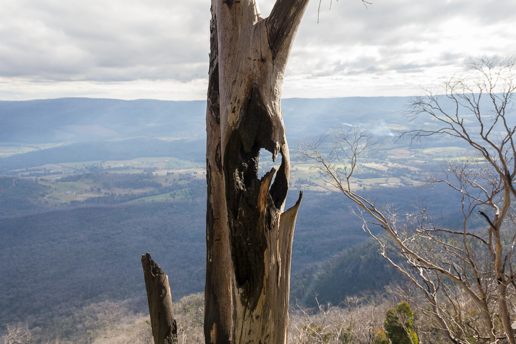
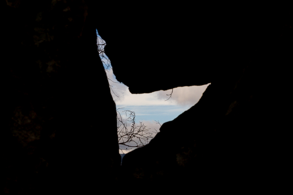
My destination for the day was a sheltered campsite called the Farmyard. It sits between two prominent peaks of the range being South Jawbone and guess what the name of the other one is? Well, of course it’s North Jawbone. This peak naming business must have been hard work in the ‘ye olde’ days.
I didn’t have far to walk in distance, but I was looking forward to the section in my notes stating,
“…eventually the trail becomes much easier…”
The ankle-twisting rock negotiation had worn me down, but it wasn’t all bad. Some of these were handy for a bit of arty, camera wanker photo taking opportunities.
On occasions, I came across sections of heavy regrowth that swallowed the track, but the way ahead was still quite obvious and these areas were better for me, as there were less rocks to clamber over.
Wandering through the regrowth
It’s unusual for me to be caught out in fading light. Well, it only seems to happen on about 98% of my walks and this wasn’t part of the 2%. The sun was getting low in the sky and I finally noticed the walking was becoming a little easier. Any more of the rock clambering business and there’s a chance I’d still be up there, with my skeleton being found covered in cobwebs in a few hundred years.
Walking without my trekking poles certainly meant my knees copped it stupid. I was aching a fair bit when I reached a forest section that began to descend. It was an indication the Farmyard was getting close.
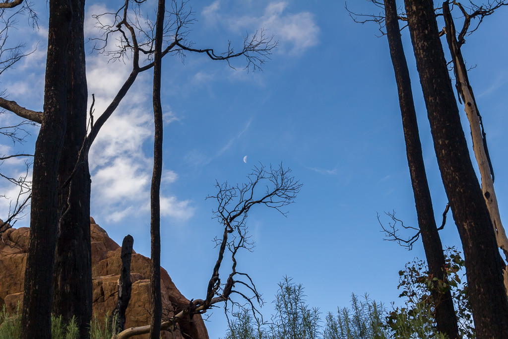
The moon had risen and as a certified moon nut, I had no choice but to stop and take a few more pictures. I also wished we had a few more moons. You know, a bit like Jupiter. Actually, I mentioned this to someone once and instead of them being in awe at the idea, they said, “What would happen to the tides? It would be chaos.” Yeah okay, ease up with spoiling my fantasy!
As I descended, I finally exited the trees and came across a large open space with a sign confirming I was at the Farmyard. Light was now dim, so I went about putting up the tent straight away.
I also wished I’d brought my titanium, hiking banana lounge with me, so I could lay back and let the muscles relax, as they were aching. There was a real chill in the late afternoon air, which wasn’t helping the throbbing joints either.
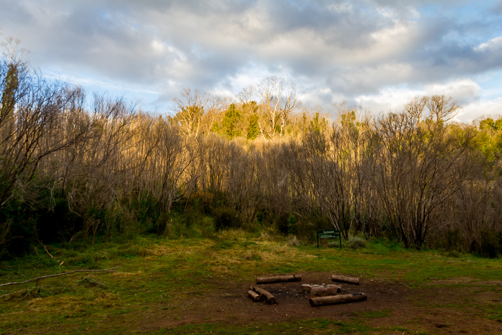
The Farmyard. Finally.
It was nice thinking about getting into the sleeping bag for some warmth, but first it was time to have something to eat, which was washed down with a chai-latte and some anti-inflammatory drugs. A perfect combination.
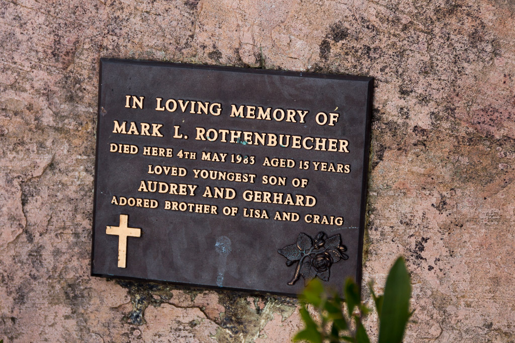
It was also time to reflect on a zany day with one close call. What could have gone wrong in my tumble was reinforced when I’d later passed a memorial along a lonely stretch of the ridgeline.
The final wash up? The walking distance had being short, as I’d only covered 8.37 km for the day. I guess five of those were on Cereberus Road? Total elevation climbed for the day was 672 metres.
The Razorback had slowed me unbelievably and I wish I’d done this when I was fighting fit at 25 years of age, instead of dealing with the creaking joints I have now.
Okay, a few more photos and I’m out of here.
Remember, stick to the right of the arrow

Hey 🙂 This looks like a great walk, great pics once again, love the views from the top of Sugarloaf Peak. Sorry to hear your polarizer was scratched, but better a dent in your leans than a dent in your head:p
Joanne
Thanks for the comment Joanne! Well, it was an experience and I'm thinking a full face helmet may come in handy when I repeat this walk 🙂 The walk is also written up in Glenn Tempests 'Daywalks Around Melbourne' and it might be a better bet to do it that way, rather than lugging a heavy pack all the way round…
Maybe a full face helmet will make visibility worse and you will end up face first in a gully somewere lol, id stick to flat terrain and full body armour :p
Sorry to see day 2 was cut short on this walk, Rain and cloud does dampen the mood when the view is just a grey mess, Sunny old Melbourne sure has the nicest weather for outdoor activities!
Joanne
Yes, Joanne, I think it's getting a bit too close to winter to be trying all of these walks in the hills! I'm checking the forecast diligently and I think I may be able to sneak this walk in within the next week (or not!)
We did this yesterday and really enjoyed it. The memorial you speak of refers to (after some research) a young 15yr old boy, who fell a short distance and hit his head.
The group he was with was a small school group – one of his co-students had just previously fallen 1 metre, and was unharmed. While teachers were attending to the boy, the previously mentioned 15yr old fell and died due to his head injuries.
It's the first time I've looked at this post in a couple of years at least. I recollect quite a crazy day. I should get back there, if only to walk up the new track, rather than road bash like I had to on this occasion. Plus, I'd have a lighter pack and some more knowledge!
Thanks for doing the research. It's certainly tricky terrain and I'm thankful in all my falls, I've never clouted my head. Gone close though. I still remember the second of the falls I had on this day to be the scariest I've ever had. For a split second I thought I was going over the edge to a ledge which sat quite a few metres below. It would have been ugly.
I seem to always learn something on a walk though, and on this one I realised trekking poles just get in the way on terrain like this. I've barely used them since, as I prefer my hands to be free, which was part of the problem why I tumbled.
Hi Greg,
So glad I didn't read this before we did the walk yesterday or we wouldn't have!
We walked it the opposite direction, starting from Jawbone Carpark. Our first attempt a couple of years ago from the Saddle Carpark was aborted when we couldn't get up that tricky section near the top of Sugarloaf – definitely easier coming down!
I dunno how you managed with a full backpack. We were only carrying day packs and they occasionally scraped passing rocks & trees.
: )
Hi Dayna. This post is a blast from the past! Hopefully I haven't put too many people off the trip 🙂
Okay, your route probably makes more sense once you slog up to the Jawbone? When I did this, I of course had to do the slightly inclining road before tackling Sugarloaf. It would be a lot easier coming the other way!
Like most Cathedrals things, I was surprised by the climb and struggled a bit with the pack. It was this trip also, which made me stop using trekking poles on that sort of terrain. My killer fall was due to the stinkin' sticks getting in the way!
I must get up there again one day…