I was going to write this post a few weeks ago, but there was a slight problem. I didn’t have a clue how to do it. Somehow I’ve got to describe not one, or two, but a combination of three separate trips to this little mound overlooking Halls Gap.
Guess what? I abandoned the idea of one monumental post, because if I tried to fit in everything I wanted to crap on about, it wouldn’t be finished until next summer. Instead, how’s this for insanity? This tiny walk is going to have three separate entries to cover each visit. In the history of outdoor writing, never will there be so much written about such a puny walk.
If you know the area, you may wonder how this is possible, considering the track is PG rated and little kids run up and back from the peak in the matter of an hour or so. Sure there’s a short scramble up some rocks at the top, but even small kids can make it quite easily. If not, you just pick the kid up (they’re small remember) and hurl them to the summit. Then again, if they’ve been playing up during the climb, you could hurl them off the summit instead? As you can see, there are a few options.
Anyway, the theme is this. If a walk can be over-thought and the simplest stroll turned into some sort of Lord of the Flies saga fuelled by Viagra, then I’m the man for the job. Oh, plus it’s way more entertaining for this infernal blog. You’ve no idea how many walks I’ve done where nothing has happened and I figured, ‘what’s the point of writing about it then?’ Not on this occasion. Each trip is full of pain, both physical and mental. Mainly due to the people I met on the way.
Before I get into it, I should (as if you’ve got a choice) quickly bring you up to date about what’s been happening lately. I’ve started a bit of a fitness campaign and have even set up a home gym, which is minimalist in style. Here’s an overview. Actually, this is all of it.
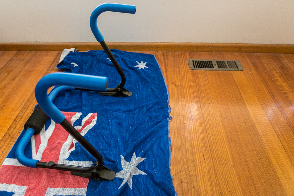
State of the art home gymnasium
Sure, you might think there’s something missing. Such as some equipment. Don’t worry, I’m working on it though. By the way, I should mention that’s a towel on the floor and not an actual flag. The reason I say this is I’ve had it since the 1980’s when I was in the army and believe it or not, but one day after a shower at work, I was walking across the unit compound with it tied around my waist. Suddenly there was a bellowing voice from our Captain (who I won’t name, as he was a bit of a knob). “AAARRRGGGHHHH… What are you doing….?!”
Feeling confused, I asked him what was wrong and after some intense towel examination by the Captain, he finally said, “Oh, I thought it was a flag”. Now, I’m not sure about you, but I don’t think flags have the greatest absorption factor for drying after a shower. I knew this, but how come he didn’t? He was getting paid three times as much as me and if there was a war, he’d have led us into battle. Clearly, we had no chance of surviving.
Oh, back to the gym. It’s open to visitors and the only cost is a BYO lemon tart. More than one is preferable. Sure, I probably need a bench press for you to get a proper work out, but I’ve got an equivalent to compare the pain of some heavy sets on the bench. Upon arrival I’ll give you a complimentary kick in the nuts, which replicates the agony of heavy training. As you can see, it’s thrill a minute at ‘Fiasco Fitness’.
Anyway, unfortunately I’ve got to get back to the walking. Where do I start? I guess it makes sense to begin with the first trip (how’s that for an amazing system of writing?) which was last November. This was the day before the Cathedral Rock tilt. Even that has a kicker in it, as I had absolutely no intention of climbing Boronia Peak.
No, I had the day to myself in the Grampians, so the night before I decided I’d wander up to the Fortress as a day walk. Mm.. The only trouble is the intimidatingly named Fortress sits on the Victoria Range, which is a bit of a travel from Halls Gap.
I figured consulting some local knowledge would be the best way for finding a route to the start. In preparation for all the wisdom I’d receive, I laid out a map of the area and rang the Brambuk Centre, as I was sure they would be full of answers.
I spoke to a very friendly person and under their instructions, mapped out the entire route I’d need to drive in the morning. It was all falling into place, so I went to bed in my leather shorts feeling confident about the following day.
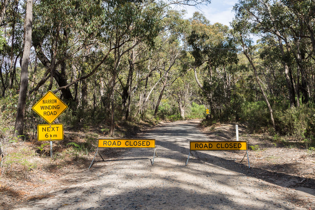
Now, you don’t need to be a brain to work out something went wrong. ‘How’s he heading to the Fortress, but the post is about Boronia Peak?’ That’s easy, because in the morning, I drove out of Halls Gap and followed a series of winding roads in laborious fashion. Stuck behind sloth-mobiles, I seemed to be driving for ages and not getting very far at all. Eventually, I turned off and followed a dirt road as per my local knowledge instructions. Guess what?
I’m not even joking
I launched into a tirade of profanity that lasted for about a minute, before coming to my senses. Actually, this only came about as I’d said every swear word I knew and repeating the same vulgarities lost their impact. Looking at the map again, I figured too much time had been eaten out of the day, so I promptly abandoned my Fortress tilt.
Still, with an afternoon free, I figured Boronia Peak would do and there you have it. This is how it all came about. I slowly retraced my route back to Halls Gap. The usual spot to park and begin climbing is at the end of Tandara Road, but this would’ve made the entire walk only about 6 km. Surely I could add a few more miles to the mix, so I drove to my nemesis, the Brambuk Dubious Information Centre and left the car there. Sure, it was only a few extra kilometres, but at least it was something.
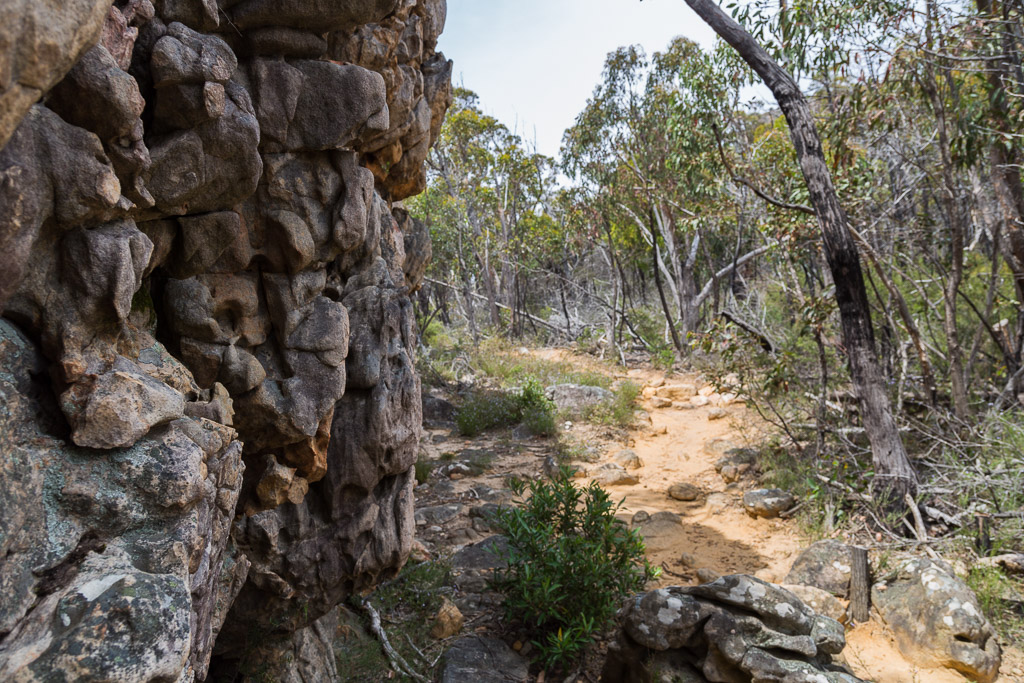
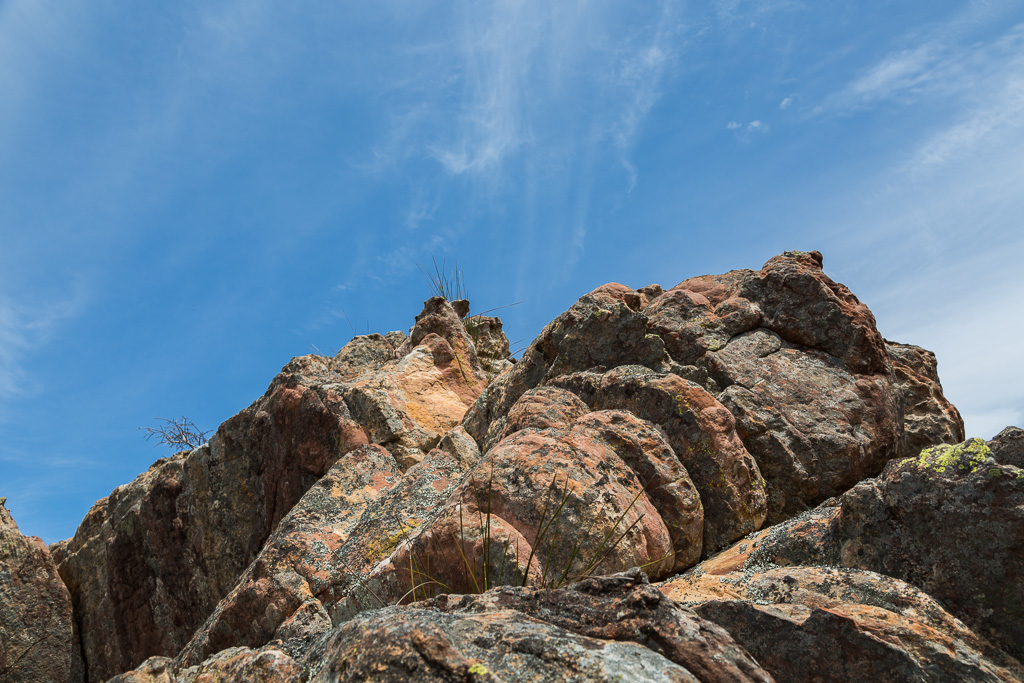
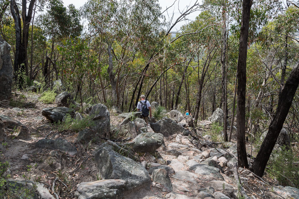
Beginning to walk, I noticed the Mount William Range looming over Halls Gap is quite imposing. Trees, rocks and cliffs are the order of the day and after a short piece of flat strolling, I began to follow the path as it began to rise on a very gentrified track.
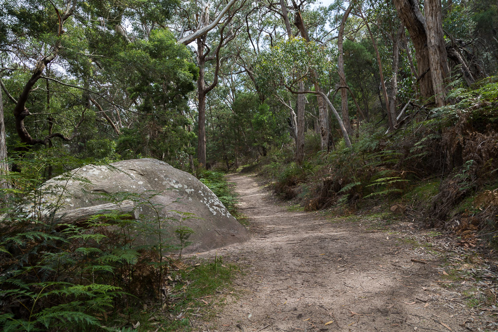
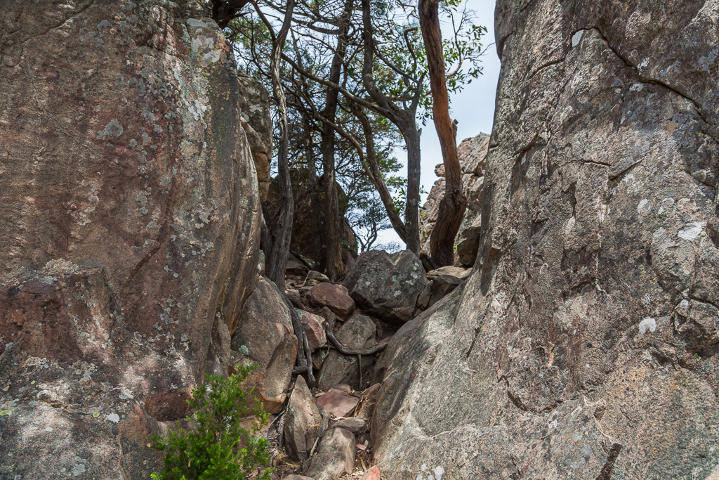
Actually, amongst the trees on the lower slopes, the heat was stifling, so I was looking forward to gaining some height in order to breathe. As the path crossed the occasional rocks…
…a largish rock wall was reached.
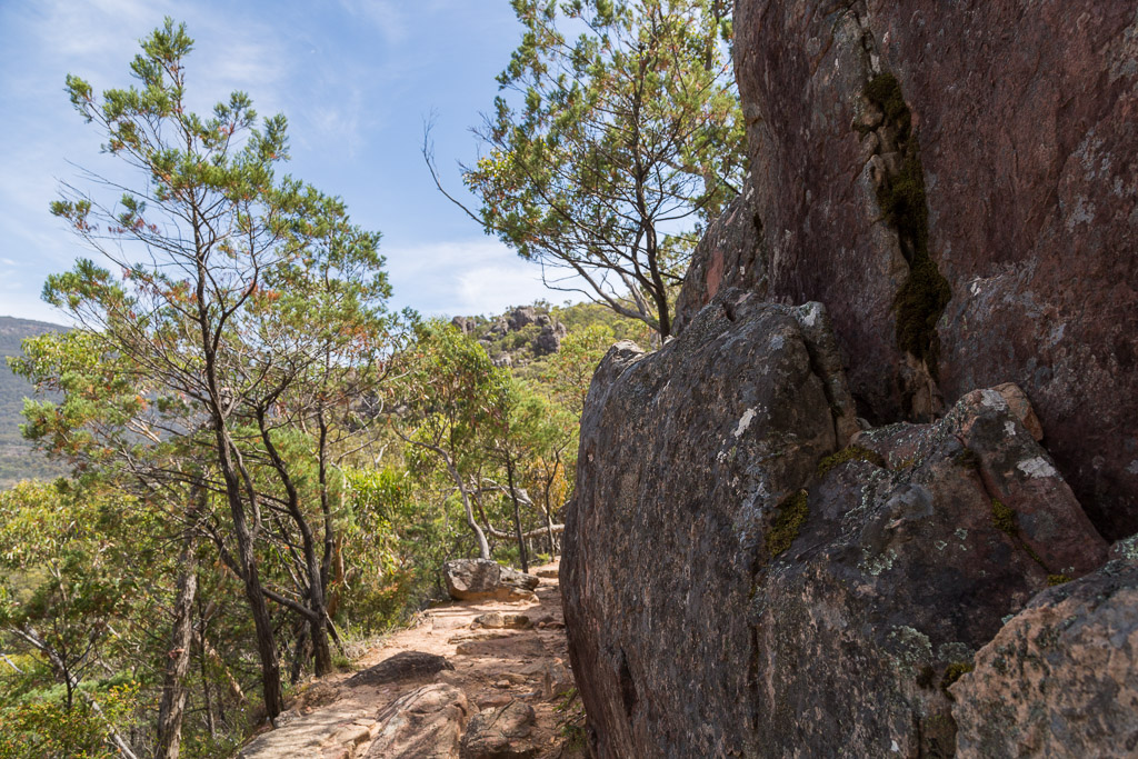
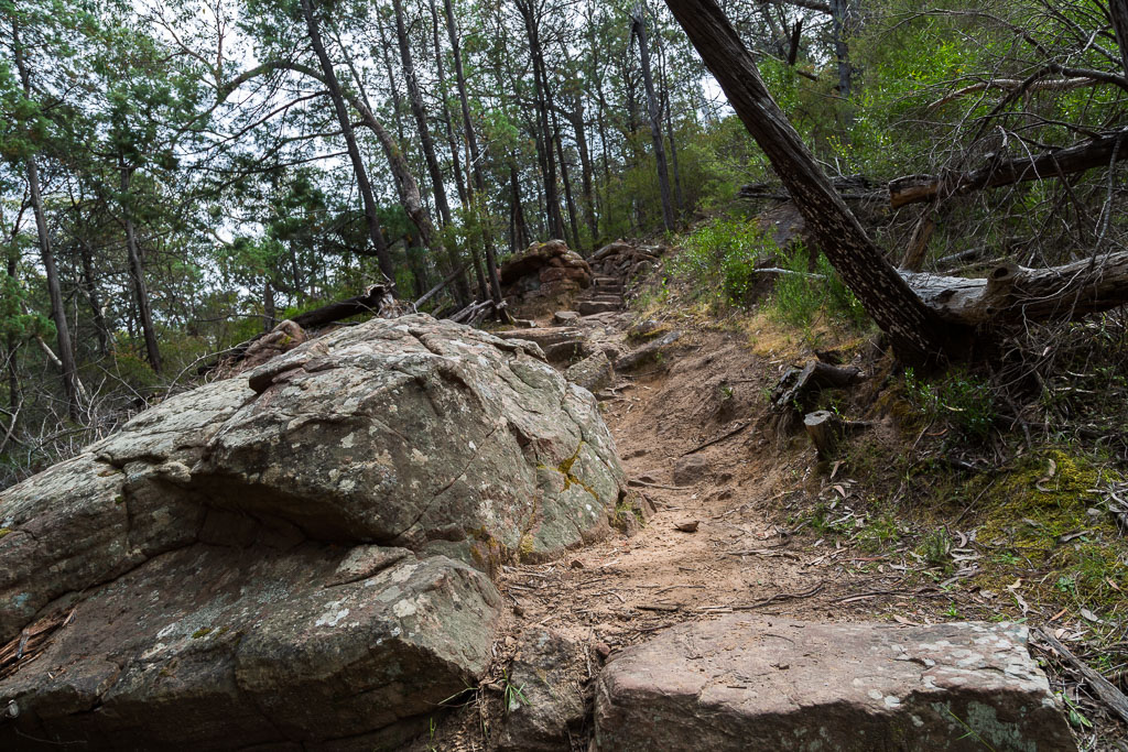
After this, the trees thinned out, but now I was in the sun, so sweat production was in full swing. Wandering on, the rocks continued…
…and I followed a potentially ankle twisting section of path…
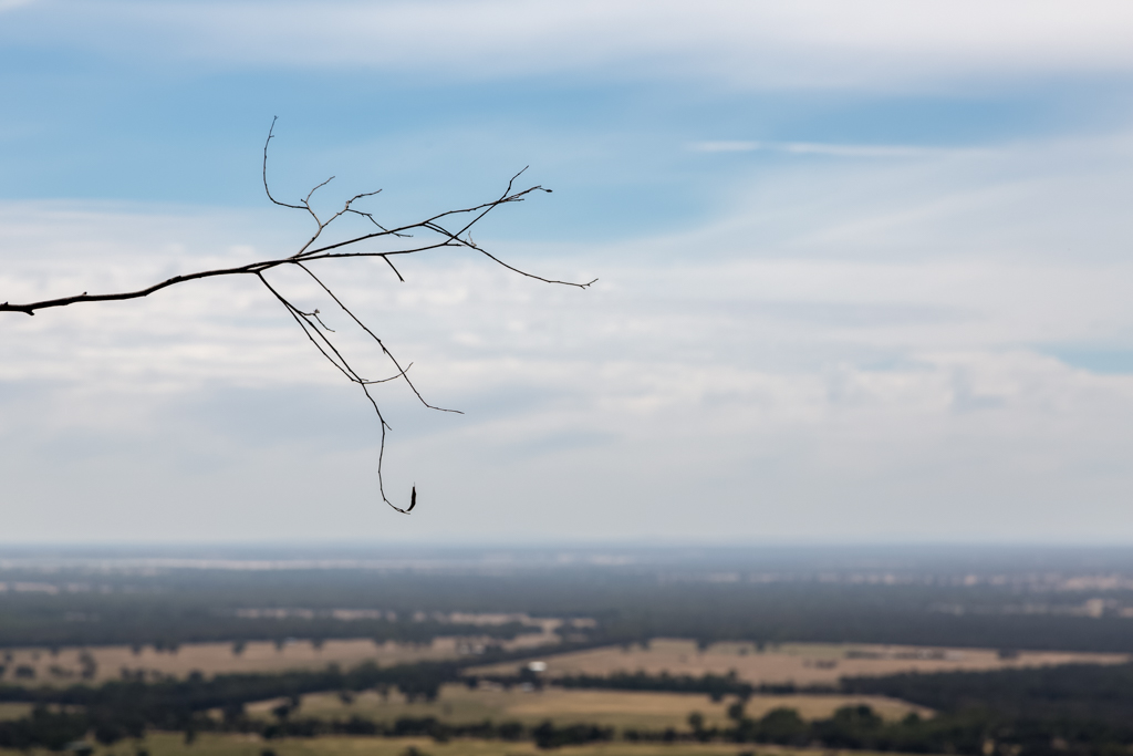
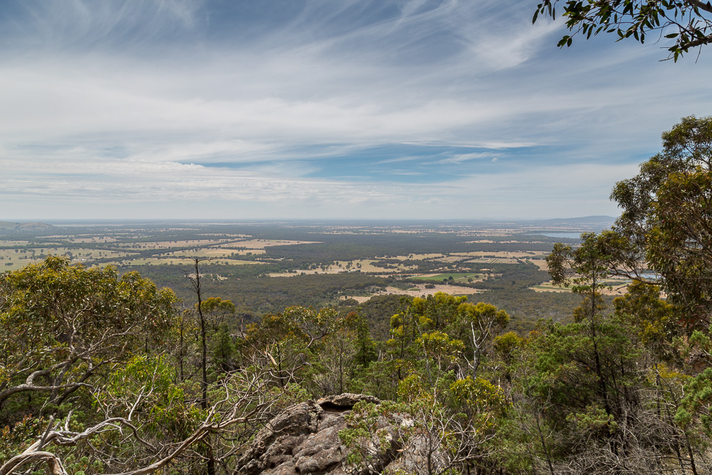
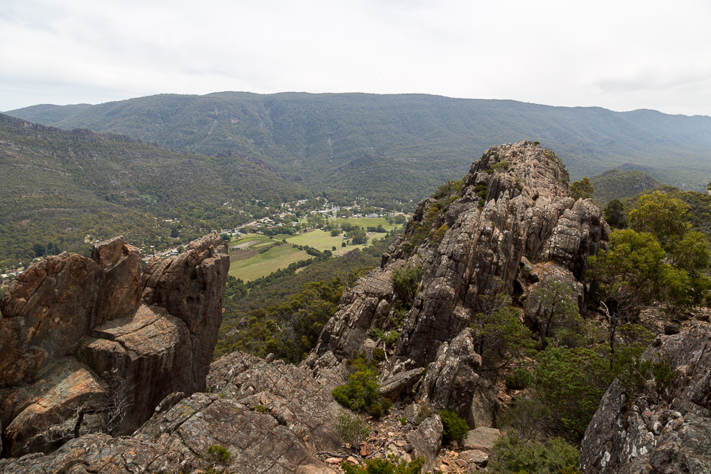
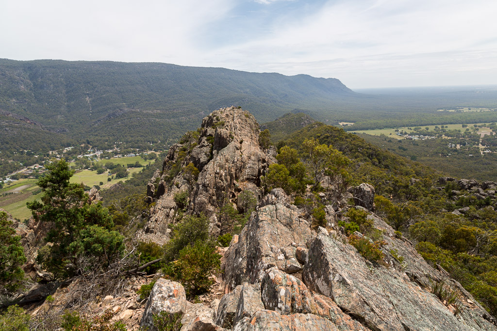
…before reaching the top of a rise. At this point the track switched from the west side of the range to the east. Easily, it was the best thing to happen for the day, as suddenly I was met with a great view and a cool breeze that whistled through my toupee.
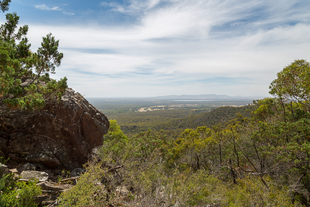
It’s interesting to look at an expansive landscape of open fields and try to imagine how it would have looked 200 years ago. I assume trees for as far as the eye could see? Great, except for one small problem. The path I was standing on wouldn’t have been built and I’d have been bush-bashing like a bastard. Mm…
Anyway, with such an open view, it was an opportunity to slip into camera wanker mode with a, ‘focus on the branch, whilst the background is blurry’ type of shot.
The track continued uphill and it’s pretty easy walking. Well, it is if you’re mean and lean, instead of my standard fat and friendly. The breeze was helpful, but my sweat rating was still nudging eleven.
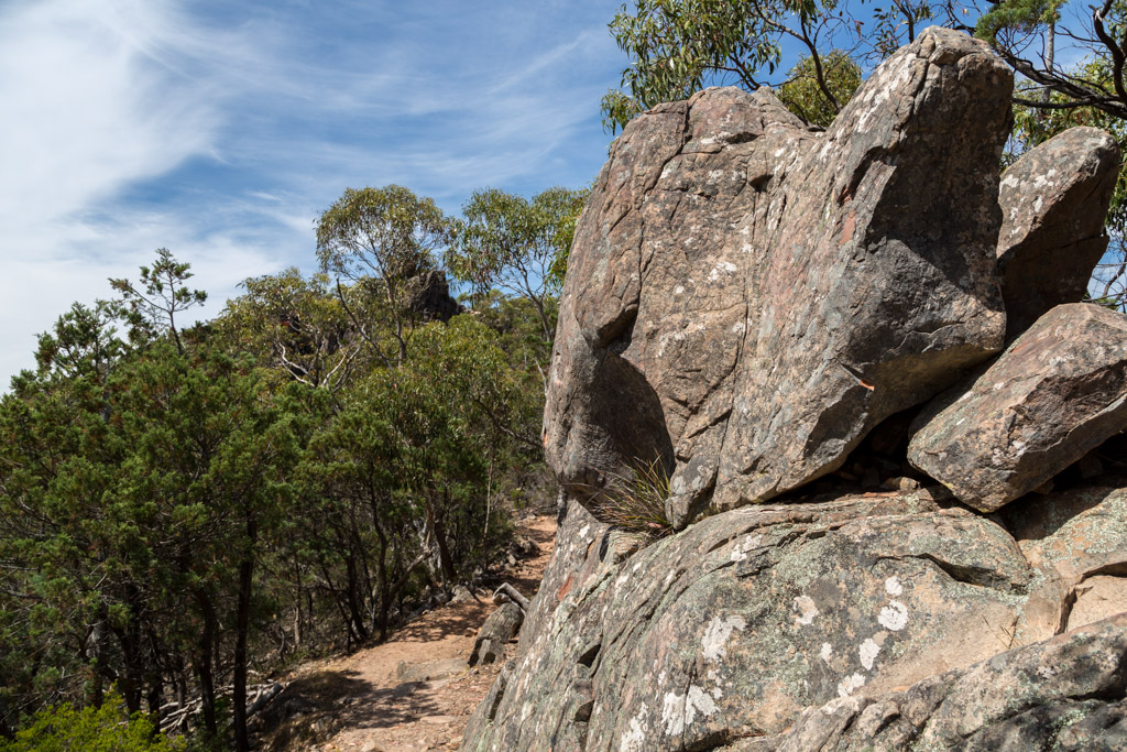
Wandering up past another impressive rock wall…
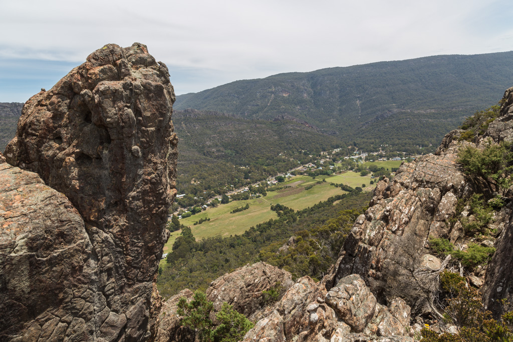
…I reached an impromptu lookout. I think anyone who’s ever followed this path has stopped here for a break, as there’s a boulder perfectly positioned to sit on. I was struggling a bit with one of those washed out, white cloud skies, so the next photo doesn’t do the view justice. Don’t worry, I’ve got better pictures from the same point when I walked up the next two times, so I’ll show you then. See how much you’ve got to look forward to? Hello? Is there anyone still there or have you logged off due to boredom?
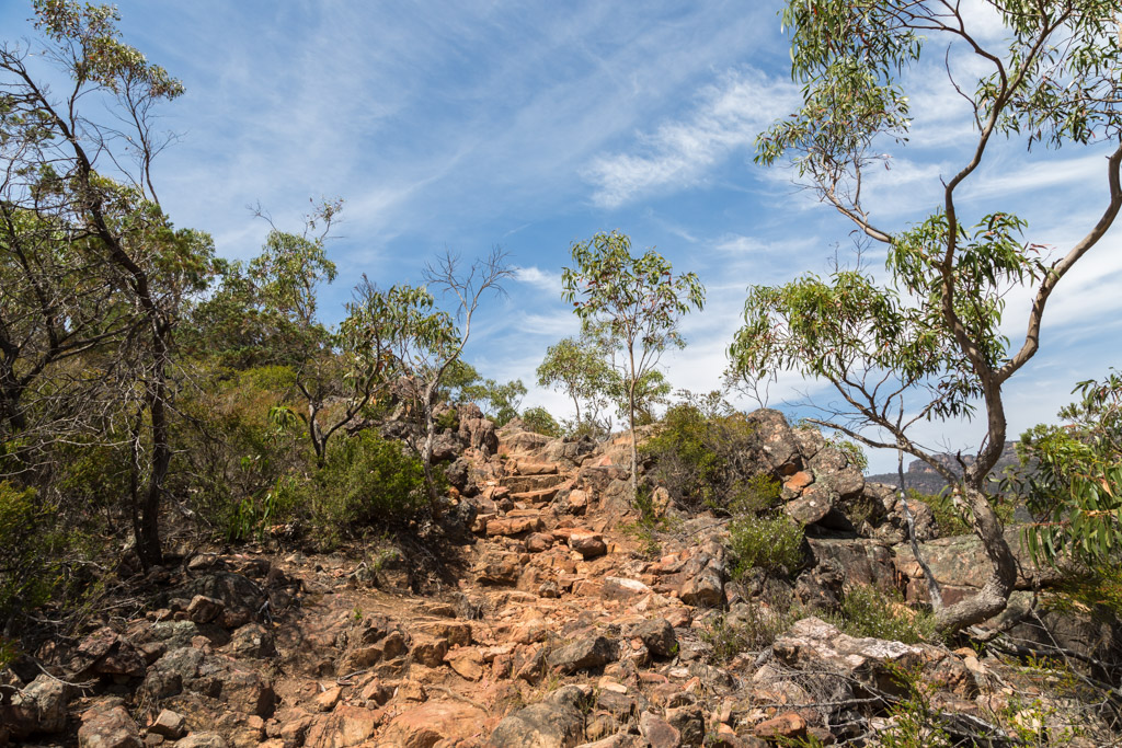
After a ten minute break, I continued on and there was little climbing left. Just below the top of the range though, is where things became interesting. I reached this rocky gully…
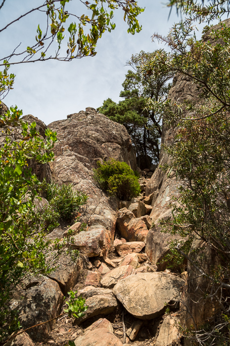
…and followed it up until I reached the top.
Now, this is where I think way too hard about information that’s been given to me. A Halls Gap local informed me there was a difficult scramble to reach the very top. I was standing in the gap that’s in the previous photo and wondered, ‘Where’s the top? Left or right?’
The right didn’t appear to be remotely difficult, plus it didn’t seem the highest point, because when I looked left, I could see the range clearly higher than where I was standing. Oh yeah, you know where I’m going with this story. I gave the right the arse (actually, in politics, you should do the same. Do you realise there’s never been a funny right-wing comedian in the history of mankind?) and headed left.
Now I was getting confused, as I knew there was meant to be a marker on top of Boronia Peak and for the life of me I couldn’t see one. I scrambled up some rocks to my left and looked back towards the gully. Oh, do you know what’s also in the next photo? That’s actually Boronia Peak.
In the direction I was walking though, I was faced with this…
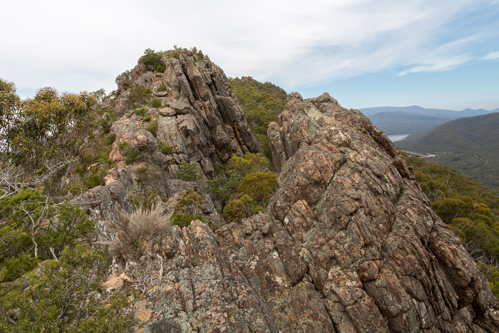
…which left me saying to myself, ‘Wow, that bloke was right! There really is a difficult scramble to the top!’
I climbed to the top of this rocky part of the ridge and looked back. There was certainly a great view…
…but with no marker to be seen anywhere, I decided to give up. I had no idea what was going on, so my normal approach when hopelessly lost is sit down and have something to eat. I guess ‘lost’ isn’t really accurate, as I could actually see my car in the car park down below.
Anyway, I took in the sights and knowing what I know now, I spent my time looking at Boronia Peak, whilst actually sitting above it. Huh?
Again, over-thinking brought me undone, as I thought the peak would be at the highest point along that part of the range. Then again, Smuffin had an answer to this question. “It’s a typo by the cartographer. It’s meant to be spelt Boronia Peek”.
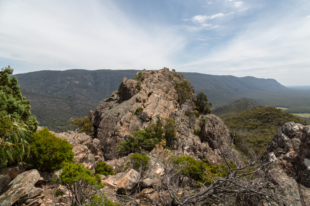
Anyway, during my lunch stop, I looked ahead at the range to my side and in particular, a distinctly higher point, which was about 500 metres away…
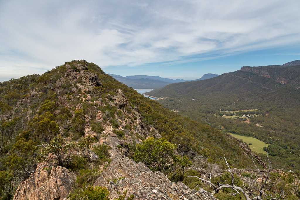
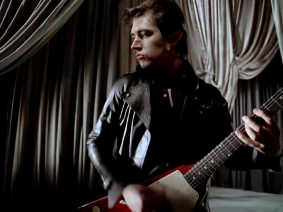
…and began to wonder how cool it would be to come back and climb it. Okay, when I say cool, I mean in a hiking sense and not something that’s actually really cool. Like Chris Spedding in full leather playing a Flying V guitar.
Yep, on my return visit I’d come properly equipped with long pants, gaiters and get to the top of that craggy rise.
Now post-food, it was just a matter or retracing my steps with the occasional rocky photo opportunity.
Reaching the narrow gully, I was soon motoring down. It’s amazing how great gravity is when you’re built like a Yeti, as I reached the track in record time. After a a few hours of not seeing anyone at all, I was a little surprised when I suddenly saw a couple descending ahead of me. Where had they come from? Well, I didn’t know the answer at the time, but it’s quite obvious where they’d been. Obviously they’d gone to the actual Boronia Peak, instead of my half-baked method.
The thing is, the bloke ahead was walking very slowly, as I caught up to him in record speed. If I can catch someone, then they really are moving at a glacial pace.
I thought I should fly past him, so as I approached from behind, I decided to announce my presence with a hearty ‘G’day’. As I bellowed out, he turned around and looked me. Guess what happened? Was it…?
A) He said ‘hello’ back.
B) He said nothing and increased his speed.
C) He said ‘Hi sweet pants, would you like to tongue the sweat from my buns?’
D) He said ‘I thought the Elephant Man died a few centuries back?’
If you guessed ‘B’, then you’re right. He stared at me and began motoring along, so I couldn’t get past. Huh? I know the outdoors are full of social misfits, but even I was surprised by this one. Why would he do that? I’ve no idea, but I didn’t feel like playing the, ‘I’m faster than you’ game, so I decided to sit down for an extended break and let him get far ahead. I took a photo, as he moved on.
After about 15 minutes of lounging around on a boulder, I continued down, as inconsistent speed walking man (ISWM) was long out of sight. You just know what happened next though, don’t you?
In hardly any time at all, suddenly I saw the bloke ahead again. I’m not sure if he was actually employed by the government for the purposes of annoying me, but as I rapidly approached from behind, he again sped up. Okay. What did I do next?
A) Picked up a rock and hurled into the back of his head.
B) Ankle-tapped him so he tripped and then I pushed him down the steep hill.
C) Found another boulder to lie on and had a longer rest.
D) Decided things were competitive, so I overtook him.
Oh yeah, you just know it was ‘D’. Long dormant competitive mojo was unleashed, as I drew shoulder to shoulder with this bloke and then allowed gravity to take hold of my 120 kg and forge ahead of him. You should have been there. It was a wild scene.
Finally free of ISWM, I was soon on the lower slopes of Boronia Peak. Unfortunately though, I saw something on the side of the track, which necessitated an extended stop. A large lizard was pottering around in the grass, so I waited for him to be in a clearer position for a photo.
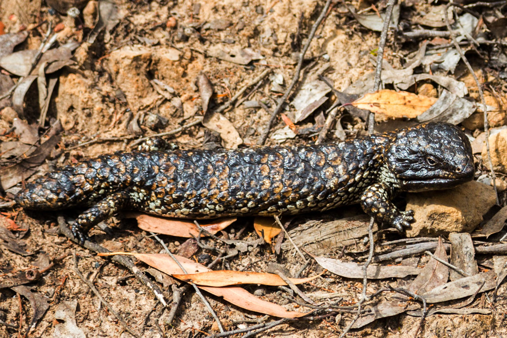
My waiting paid off, but ISWM and his partner caught up to me during my down-time. They also took some photos and I discovered something. They didn’t speak English. Mm… Maybe my hearty ‘G’day’ is actually similar to, ‘Come here, I’m going to pop off your head, shrink it and then wear it as a necklace around my neck’ in their language?
I’ve no idea, but I guess it made for an entertaining descent. Anyway, soon I was at the bottom and the walk was done. Oh, clearly it was a failure, as I hadn’t officially stood next to the metal marker on the peak. Rather, I had the less impressive claim of ‘almost on Boronia Peak’. Not quite as newsworthy. At that time though, I still had no idea where this magical post was.
Yeah okay, 99% of people probably climb up there and find the right spot, but I’m sure others have been perplexed over the years. I’m just the first bloke to ever admit it.
What’s next? Well, it’s Boronia Peak again. This time with protective clothing to deal with the rocks and scrub. How do you think it went? Mm… Do you think it’ll contain any of these things?
A) Full of the same photos, taken from the same locations.
B) A minimum of 3000 words of waffle.
C) A fall containing full cartwheel.
D) Destruction of treasured equipment.
E) No more of these stinkin’ multiple choice quizzes, as they’re getting dull.
F) All of the above.
Sorry, no spoilers. Until next time…

Had a similar experience on top of Boronia Peak, except I met a very pleasant Victorian couple (as is from the state, not the era) and we chatted on the way down
While you may not have enjoyed the forced detours, break-neck rocky climbing, sweat-fest and not reaching the required spot, it made for a very entertaining read. Classic fiasco style! I particularly liked the unleashing of your “long dormant competitive mojo” and the final discovery that they couldn’t speak English…
It’s interesting and kind of funny about the Australian flag. It seems we can sit on a flag-patterned towel and dry all our intimate bits with it because it’s just a towel, but if we did it to a real flag it would be another matter!
I reckon Greg in full leather would make for an interesting hiking experiment, especially in the tropical north! Dying is probably not a best way to attain the “cool” factor though. 🙂
We used to call those skinks, “shingle-backs” or “bog-eyes” out west. Not sure the origin of the “bog-eye.” Maybe it looked like a long bog with eyes?? They were great for freaking out unsuspecting foreign visitors. I really like them.
Anyway, great narrative and pics as usual. Looking forward to part 2. 🙂
Hmm reminds me of the old Officer with a map reasoning.
Still you seem to have had a lot of fun up there.
You did well. Found the top and got to have a pleasant chat with a couple on the way down 🙂 I seemed to have a different experience, but then again, language may have been the barrier. I didn’t find that out until I got to the bottom of the hill!
My competitive streak was in my cricket days. It’s amazing how much I detested an opposing team. None of this back-slapping, good natured sporting business between teams. No. I hated them 🙂 Way more mellow these days!
About the flag/towel thing. Completely true! No idea what the distinction is? Same pattern, so why should the material make a difference? He couldn’t care less when he realised the ‘flag’ was soft and fluffy 🙂
That lizard was enormous. I assume it was a blue-tongue, but that’s the name I give any lizard that’s big! He was about 12 inches long.
Oh yeah, part 2. I need additional photos before I start that one.
I’m not sure I had ‘fun’? I know I’m glad to have done it and have no intention of going back. Mind you, I’m considering what’s in the next post 🙂
Hi Greg,
I stumbled over your blog while google searching for “wells cave trek” after taking a group there over Easter. I am SO glad they hadn’t read your entry regarding it beforehand! 3 quite fit, small build females, and 3 males all 100kg + and upwards of 6ft. Fun, hey. We all loved it, even though there were many swear words, two sets of torn shorts, one tumble (which surprised me) and complaints about potential broken ribs when confronted with the cave (that my 125kg, 6ft 2 husband just HAD to get through, regardless of how much he had so suck in)! Reading your entry was like flashing back to one of the funniest hikes of all time, and now I am enjoying reading through all your experiences! You’re an excellent, hilarious and very sarcastic writer and I LOVE it.
Keep up the good work!
Oh, Wells Cave is one of my all time favourite short walks! Quite an action packed wander! If I remember correctly I got stuck in the cave and broke my glasses getting out and then on the descent slipped and almost sent my nads out my throat? Something like that 🙂 Glad you enjoy the blog! It keeps me entertained and I’m glad others enjoy it as well 🙂 Thanks again!
Yes, type of blue tongue, there are 6 species in Australia.
‘Type of blue tongue’ is all I need for an identification. Not one to be too technical!