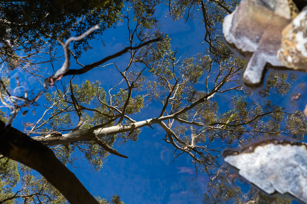
How do you feel when you look at the photo above? Have your eyes flamed out? It’s understandable, as it might be the best reflection image in the history of mankind.
Photographically, it’s hard to top the last post, so I won’t even bother trying to replicate those heady heights. This’ll be a more gritty affair, which has all the standard events in this blog. Pain, sweat and frequent thoughts, which have absolutely nothing to do with walking.
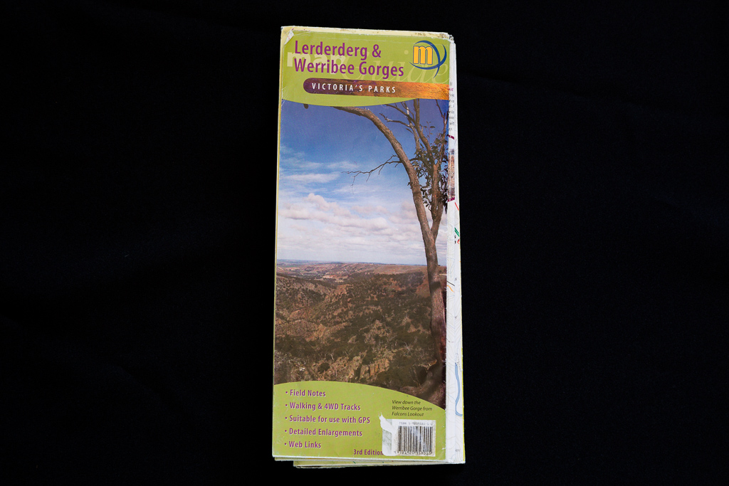
I’d get right into it, but what seems a common occurrence lately is I’ve got to go into a lengthy description before I even get to the ‘action’. Firstly, I found this wander in GT’s book, ‘Melbourne’s Western Gorges’ and he titles it ‘Sardine and Clear Water Creeks’. Secondly I thought he was bonkers for one reason and that’s the name.
The attentive reader will know I’ve already got a post from a walk I did a few years back in Lerderderg State Park called ‘Clearwater Creek’. That’s another of GT’s walks. Are they in the same place? Can there really be two creeks close by, where the only difference is their names are separated? No, of course not.
It left me scratching my head and I managed to solve the problem. The old 2013 post is incorrectly titled. That walk didn’t follow Clearwater Creek at all, but instead Watties Creek. The reason being is there’s no such thing as Clearwater Creek.
Bloody hell. How could the infamous GT balls up the locations? There’s a simple reason and unfortunately it’s because he used the official map of the area and I just happen to have the same one. Here it is here.
This map labels Watties Creek as Clearwater Creek and so the confusion begins. There used to be a pdf map on the Parks Victoria website of Lerderderg State Park and I’ve got a printed copy where the creeks are correctly named. Here it is, complete with my wanders highlighted.
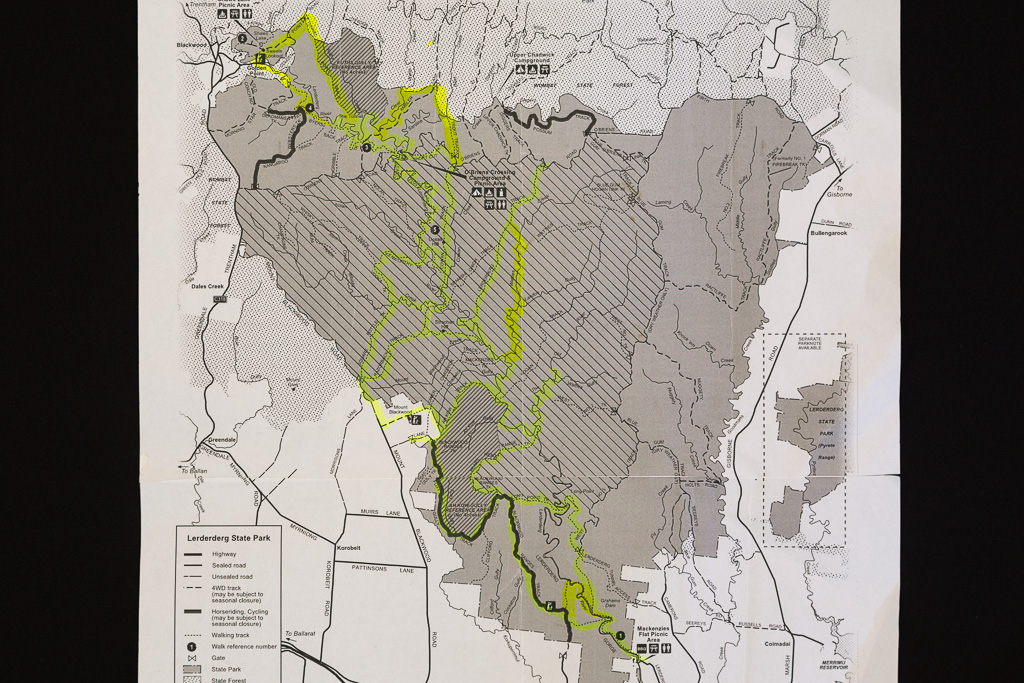
Did you notice in the last paragraph how I used the word ‘used’? Having a look at the Parks Vic website for Lerderderg, they’ve dispensed with the map above and gone for a beautiful, colourful number. I’d give you a link to it, but without fail, Parks Vic’s links are dead in a year and I can’t be stuffed going back through the blog to amend them time after time.
Anyway, if you do look at it, you’ll see one difference. Unlike my shabby, printed copy, the latest, easy on the eye map, doesn’t contain the names of the various creeks. It’s fine if you’re wandering on the tracks, but I’m not sure why they’d take away the creek names?
Maybe it’s a world wide conspiracy by the Illuminati to force you to buy the topographical map? The one with the errors in it? Anyway, I guess it’ll do, as the hills are all in the right spot, but I always think maps should have more information in them than less.
Phew. I think the intro is done. If you’re still awake, give yourself a pat on the back, as you’ve done way better than me. I wrote everything above about three weeks ago and was so bored, I put it in the draft box and decided to do other things, such as sorting out my matchbox collection. You think I’m joking?
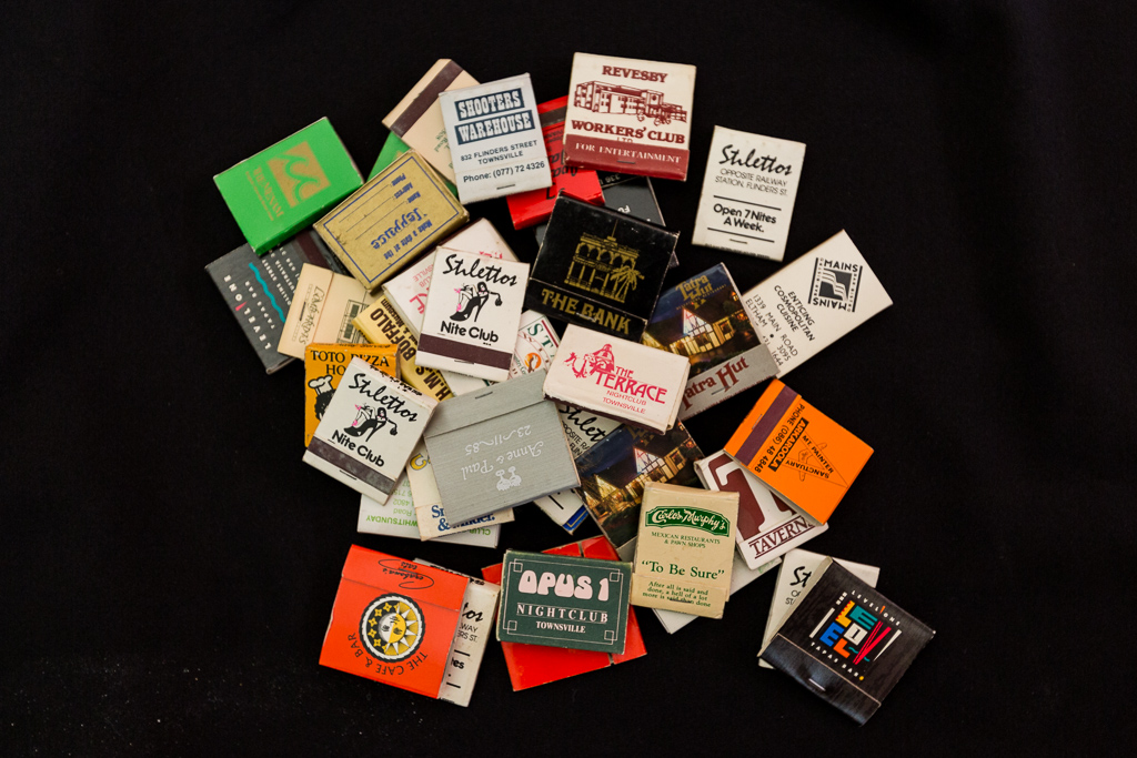
Your eagle eyes may notice one frequent matchbox and that’s for the long defunct ‘Stilettos Nite Club’ in Townsville. It used to be the go-to place for the military back in the 1980’s and really, it could have its own post. How about a DJ surrounded by heavy-duty Plexiglas because if he put on an unpopular song, he’d have a hundred drinks thrown at him?
The only venue I’ve been where if there was a fight, the bouncers wouldn’t break it up, but instead would put the lights on, so you could see who was hitting you. When it was over, they’d turn them off again and everyone would start grooving around the vanquished brawlers.
Instead of someone being thrown out for falling asleep whilst drunk, a bloke was carried in unconscious and then he slept inside before awaking some hours later and commenced drinking again.
How about when a grenade simulator detonated one of the thrones in the Gents? Hey, the more I think about it, the more I’ve formulated a new post.
Oh, hiking? Sorry, I forgot that’s what this entry’s meant to be about. I did this walk a year ago on a stinkin’ hot day and it was a few days after Christmas. It was always going to be problematic, as I’d had way too many roast spuds for Christmas lunch and they’d morphed into solid lumps of blubber in my guts, so this wander was never going to go well.
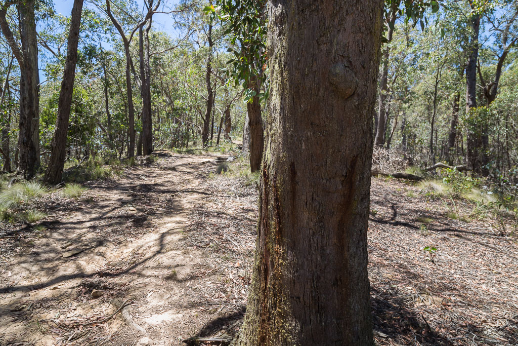
What was a little aggravating is I already knew part of the route from previous trips. Firstly, I was aware as soon as I got out the car, I had a horribly steep hill to start off with, before the legs had warmed up after the drive.
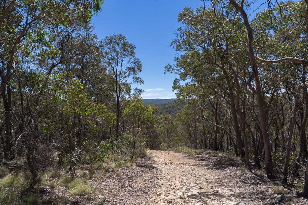
I parked at O’Briens Crossing next to Lerderderg River and it was standard summer fare. Dozens of people with stereos pumping, barbeques sizzling and arteries hardening. It’s definitely not my sort of scene, so after quickly getting my stuff together, I was off and not racing to the initial climb.
The opening salvo really sucks and I knew this as I’d walked down it on the East Walk a few years back. At the time I noted how horrible it was on the knees due to its steepness. I never know what’s worse. Steep down is bad on the joints and steep up is nasty to the lungs. Mm… Can I have a compromise? How about ‘flat’ as a suggestion?
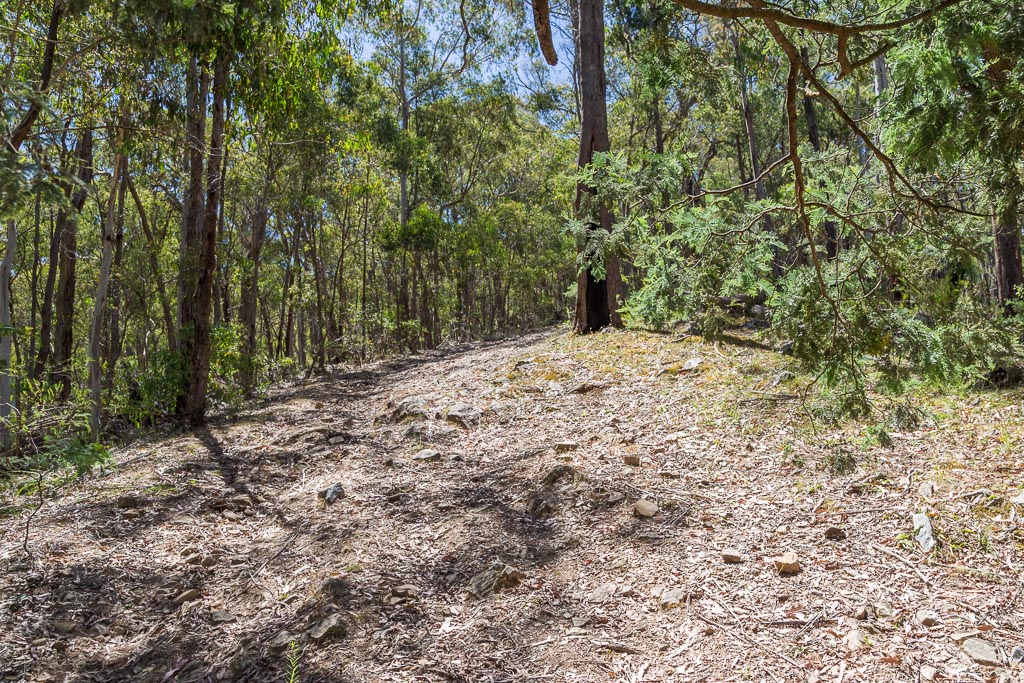
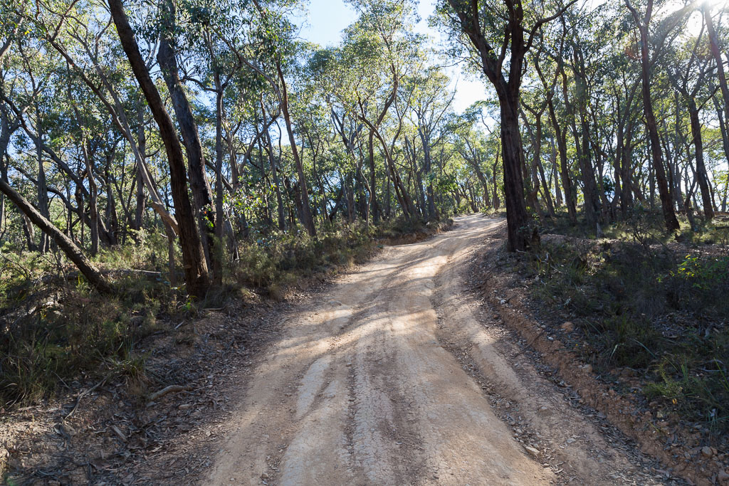
Crossing Lerderderg River I followed O’Briens Road for a short section before coming to a wall called Short Cut Track. Yes, it is a short cut, but I wondered if following the road would be a lot nicer? Longer, but less nasty? Anyway, I decided to abide by the notes and take on the ‘short cut’.
Short Cut Track
I must admit, I reckon I’d only gone about ten feet on the steady incline when the Christmas Day spuds decided to bite. Instead of digesting, it felt like they’d moved to my hips instead. I don’t know if you’ve ever heard of ‘potato hips’, but I can assure you it’s a condition. The result is I was moving like an elephant who’d put on weight and was now a laughing stock to other elephants.
I was moving insanely slow and the short cut didn’t appear to be getting any shorter, so I contemplated a name change to this ribbon of dirt. How about ‘Shit House Track’? Maybe a bit risqué, but definitely a more apt title.
With the sun beating down, I’d entered into levels of sweating where I was concerned I’d turn into a puddle and end up washing down into Lerderderg River. It was lucky I was wearing sunglasses, as the liquid on my exposed skin was in danger of blinding me.
The time is Sweat O’Clock
So what’s my approach when facing such rubbish? That’s easy. I think of anything other than walking. The movie ‘Secretary’ came to mind. Wouldn’t that film have been so much better if the roles were reversed? Why are the men always the dominant ones in those type of movies? For once I wish they made a film where the men were getting the bejesus beat out of them by women who showed no mercy. It would be a lot more fun and enjoyable. Well, for me anyway.
I guess it took me about a decade, but finally I dragged my potato encased body to the top of the hill and re-met O’Briens Road. I was certainly glad to be on flat-ish ground and after a short wander, passing this moss covered sign…
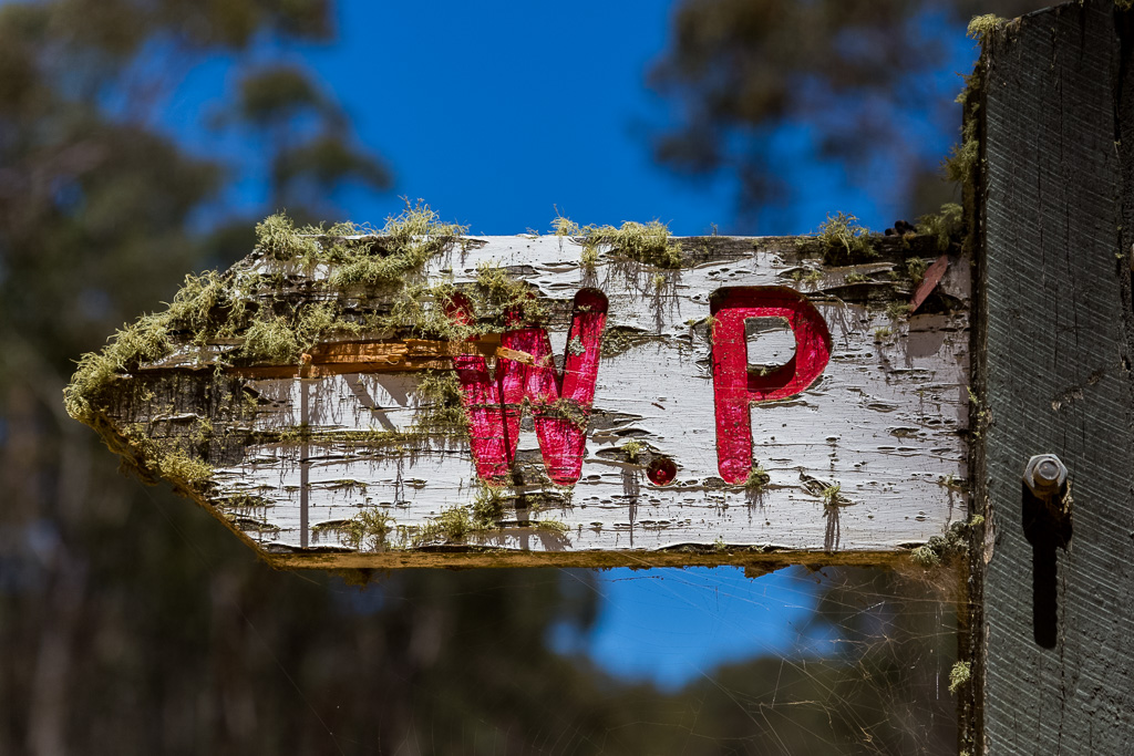
…I turned down Trout Track with its own notice.
Oh, I know you’re pondering one thing. Running your long fingernails through your hair for both the orgasmic scalp massage and also as it’s the standard process when wondering about something. Why is a dusty path, high above any substantial water called Trout Track? I’ve no idea, but maybe it’s got nothing to do with the fish? Is it possible the track was built by someone with a name like Bob Trout? I’m not sure, but the odd fish references don’t end there.
I was strolling along, enjoying the relative flatness of walking, when up ahead, it appeared the track vanished into thin air.
It was one of those wonderful bushwalking moments. The realisation that all the height previously gained through sweat and profanity is lost instantly, as the track began a wild descent. Even worse was my awareness I’d have to claw back that lost altitude immediately after descending. Oh well. At least I had some things to look at on the way down.
For one fleeting moment I thought I’d found D.B. Cooper’s parachute. Sure, it was unlikely, as he leapt into the dark, way back in 1972 and you’d think his parachute would have deteriorated by now. Plus there was another small problem. I wasn’t in Oregon.
I must admit, concentration was required on the way down, as the ‘track’ was officially gnarly. Deep ruts were like Sirens of the land, calling out to vulnerable walkers in order to twist their ankles, so I gingerly inched my way down…
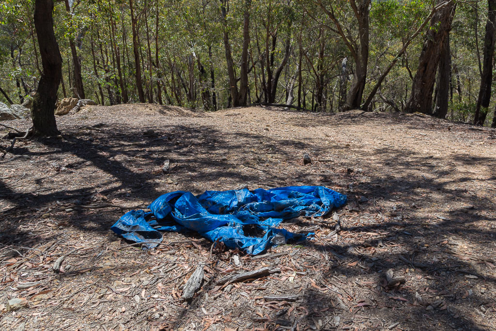
…before finally reaching the bottom. Guess where I was? You remember a short time ago my fish pondering or were you so bored you slipped into a coma? If you’re still awake, you’ll be pleased to know I followed Trout Track down to Sardine Creek. Huh? Were those ye olde blokes who named the area taking the piss? Could there really have been sardines in this rough and ready creek within Lerderderg State Park? The fish that John West would’ve had absolutely no hesitation in rejecting?
I guess the same thing could apply as before. The possibility there was a Bob Trout could also mean the small waterway wasn’t named after the fish at all. Maybe someone like Steve Sardine used to live there? Don’t dismiss this idea so readily, as at some point someone did spend some time down there. Look. Here’s his house.
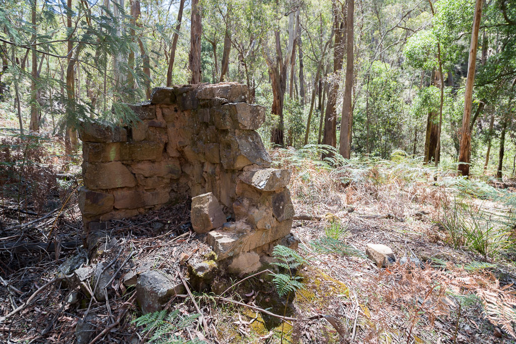
Okay, it needs a bit of a spruce up, but clearly it was a solid building once. It had bricks and everything.
The creek wasn’t exactly inviting…
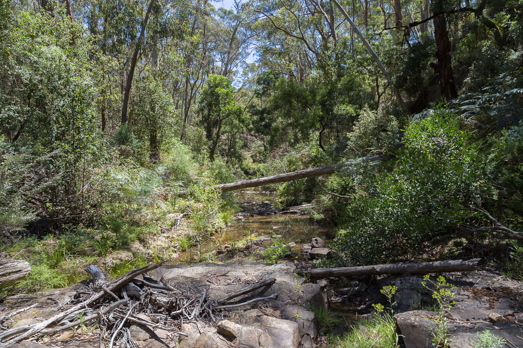
Sardine Creek
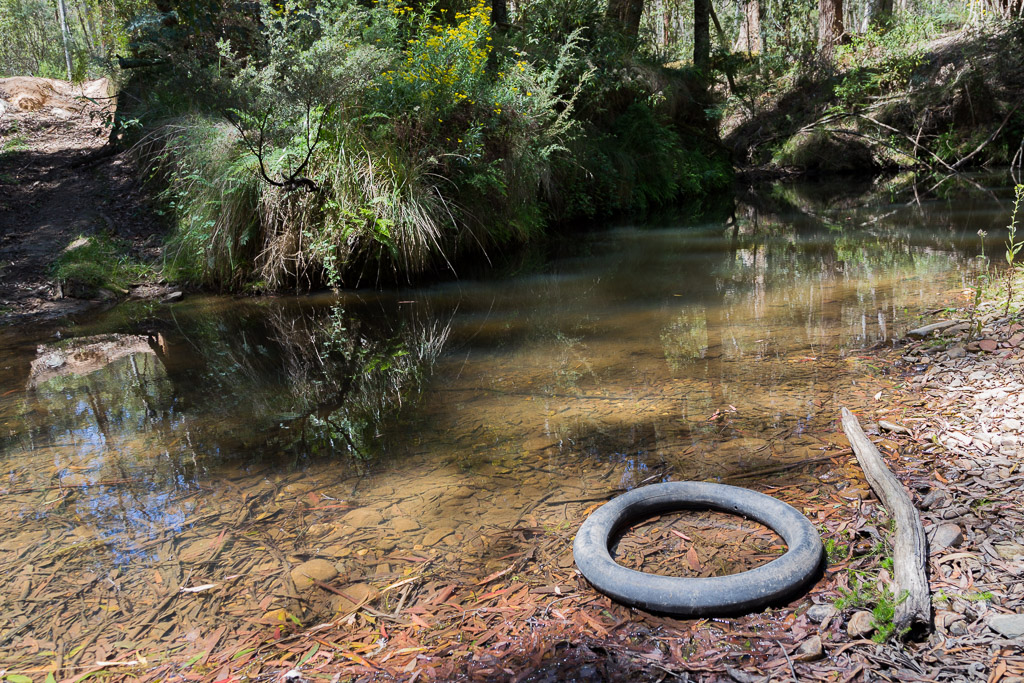
…but at least it had some water in it. That’s not all. There was even an inner tyre tube available, so you could sit in it and enjoy the tranquil expanse of water whilst drinking your gin and tonic. Okay, the water was only six inches deep and the inner tube wasn’t much bigger than a headband, but sometimes you can’t have it all.
This is all very good, but Sardine Creek was only a fleeting visit, as my main aim was Clear Water Creek,. Unfortunately, in order to get there, I’d have to climb a rather steep hill. Yep, essentially I had to replicate the climb a little earlier up Short Cut Track. What’s disappointing is this one had more of a ‘wall’ look to it than the previous ascent.
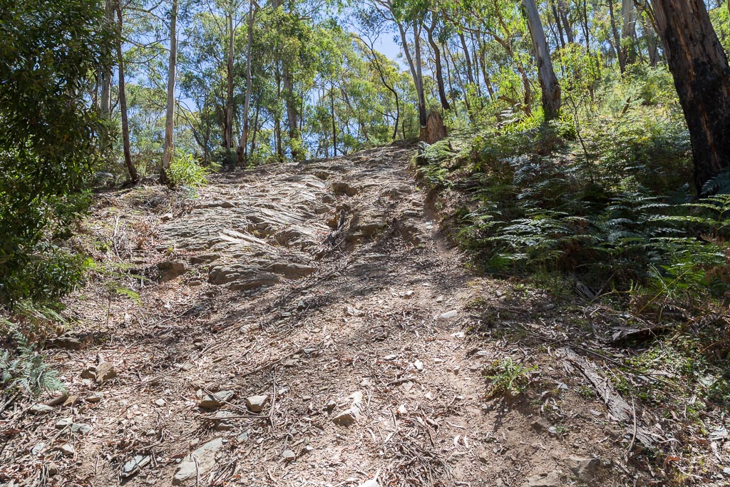
Heading up, I’ll happily admit that at no time was I feeling enthralled with this walk. I was only a third of a way into it and mentally, I’d proclaimed it sucked. There wasn’t much joy on offer, as I slogged up the initial climb, looking back as I did so…
…before scanning ahead at the continual rise.
I must say, behind me the track looked like a cliff, as it suddenly vanished due to steepness…
…but luckily for me, I’d already climbed that part. Pity about what was to come though.
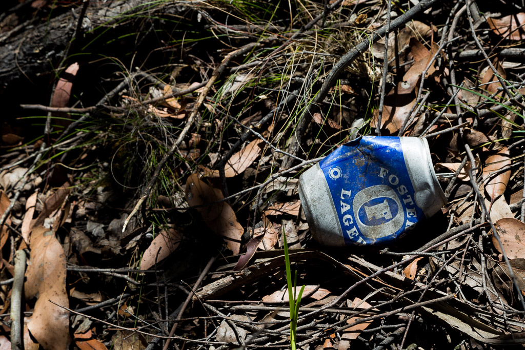
Luckily for me, I had some things to look at as I slowly chipped away at the rise. How about a Fosters beer can? When was the last time you saw someone holding one of these? Mid 1975? An amazing find.
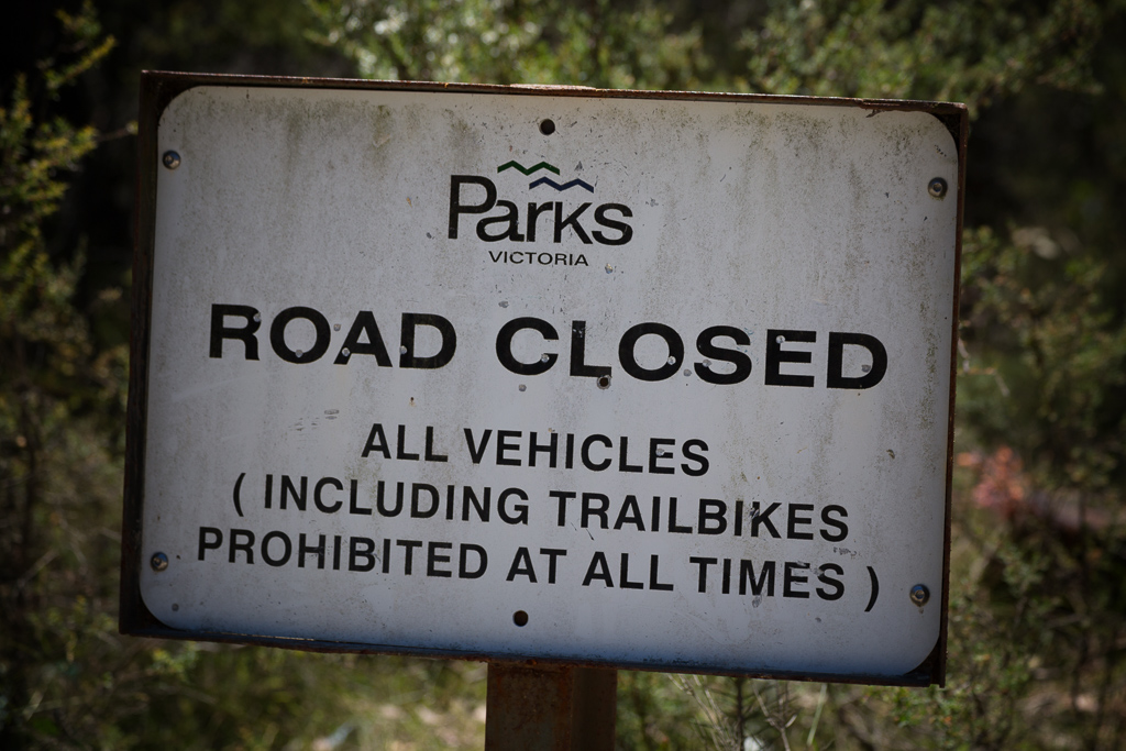
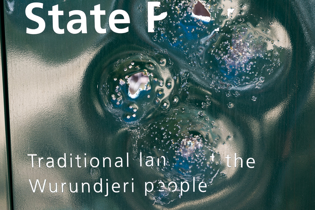
There was more to see as well. Clearing the hill, a similar sign as before was displayed. This one wasn’t well received by visitors though, as it had been extensively ventilated by a responsible gun owner.
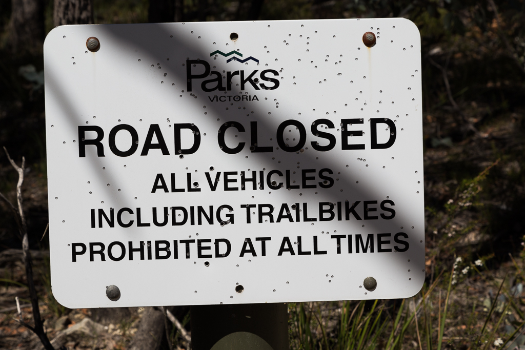
Oh, a bit of bird-shot wasn’t enough for some. The big ammo was pulled out for another sign. The result was the fixed object was suitably blasted. Responsibly of course.
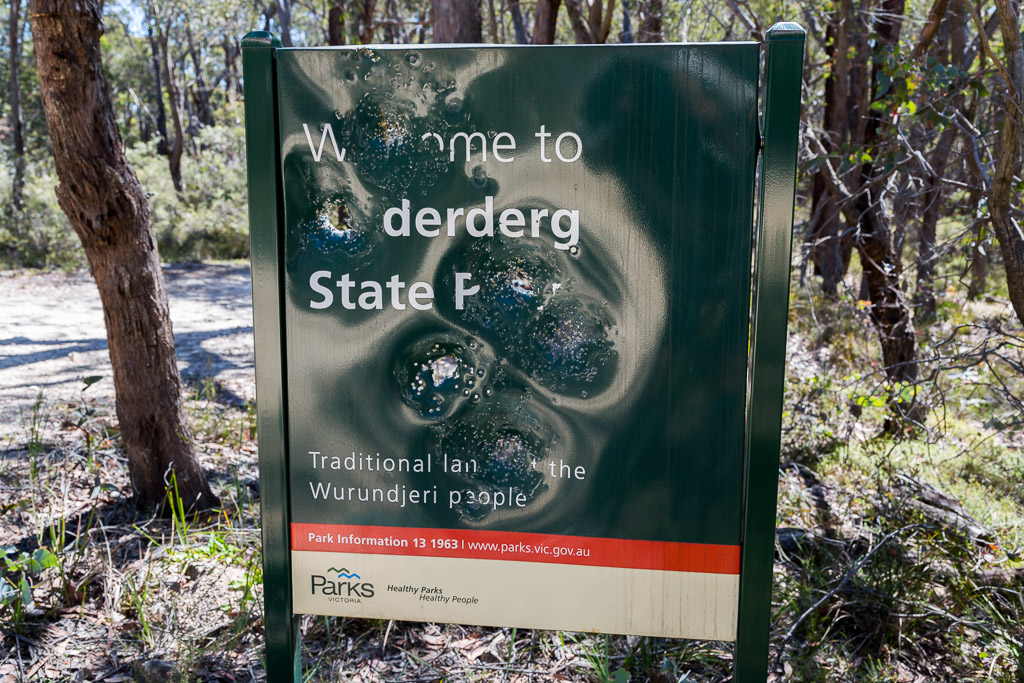
I guess this wasn’t new for the Wurundjeri people? Go back a few hundred years, take away the sign and replace it with the Wurundjeri and it might be a similar result?
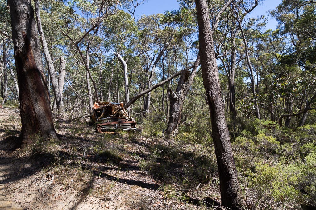
I guess the sights weren’t too bad. A heap of rust from the past also made its appearance.
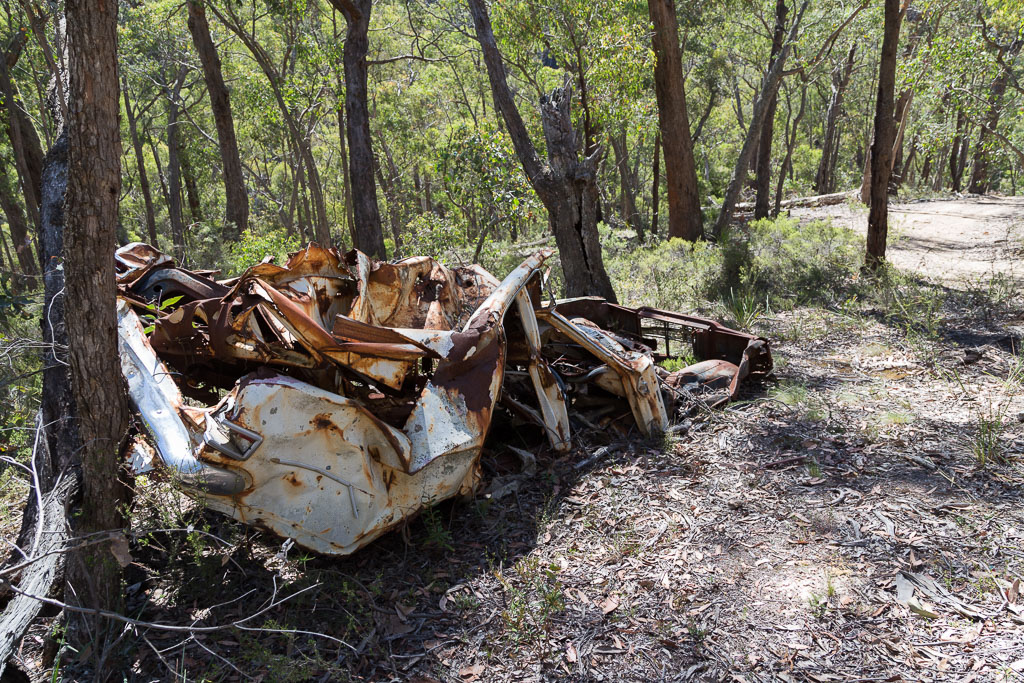
After a quick inspection, I noticed the engine could do with a recondition…
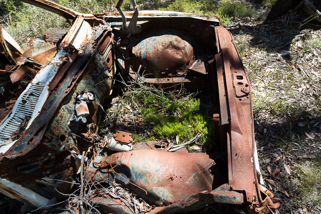
…before I moved on, leaving it behind.
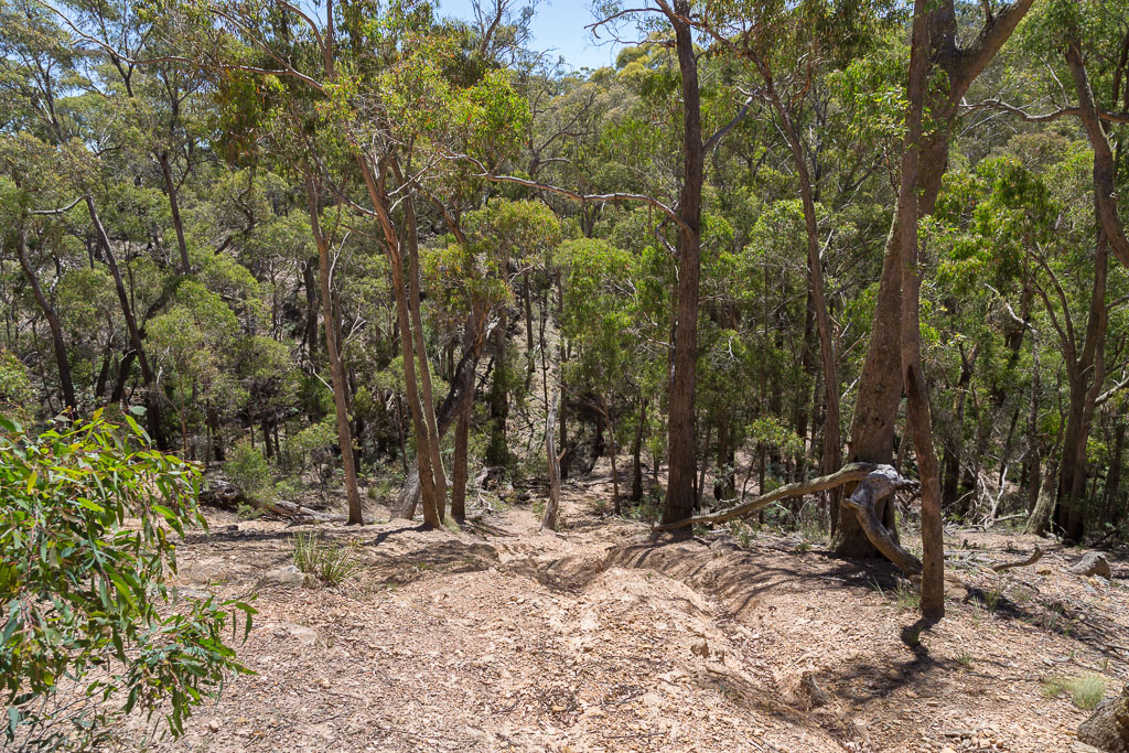
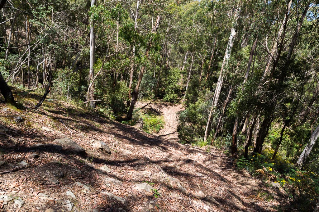
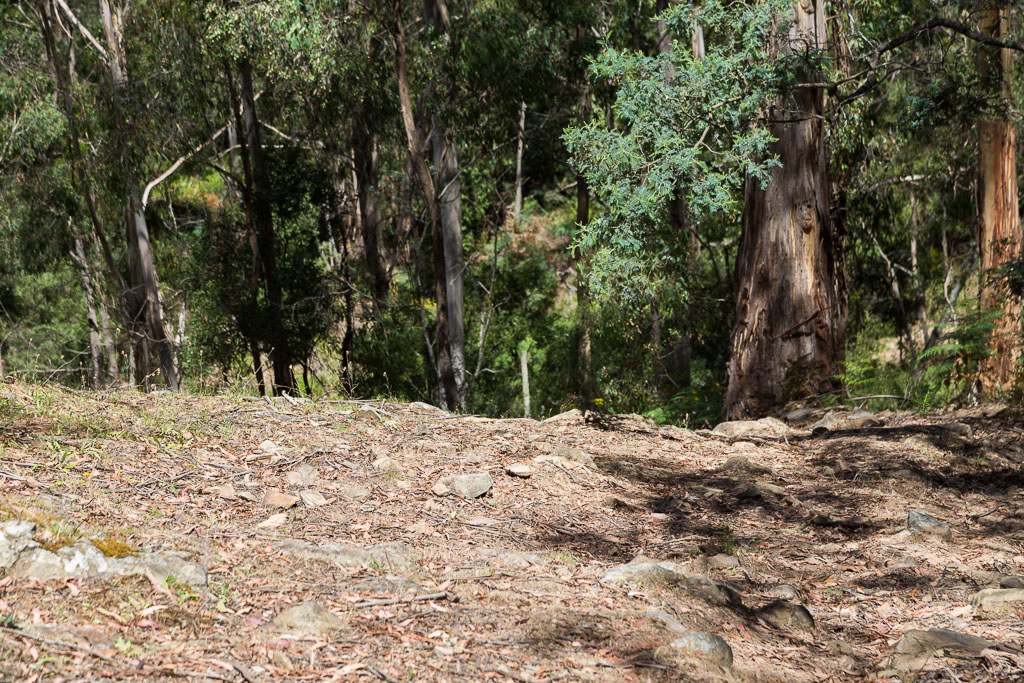
Another descent followed before I arrived at Clear Water Creek with a natural amphitheatre of trees surrounding it.
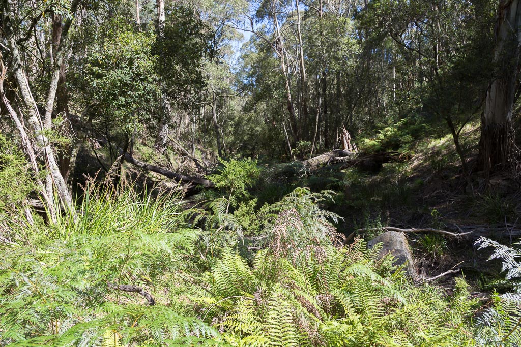
This is where the track walking would end, as I now had to follow Clear Water Creek back to Lerderderg River. I’d done a few of these walks before and I knew it would be slow going. Looking ahead, it was a matter of finding the best way forward through the undergrowth.
Clear Water Creek
It was pretty grim walking and there’s no need to show you overview photos of the creek, as it’s like all the others in the area. Fallen trees, slippery rocks and leg catching scrub. Standard fare.
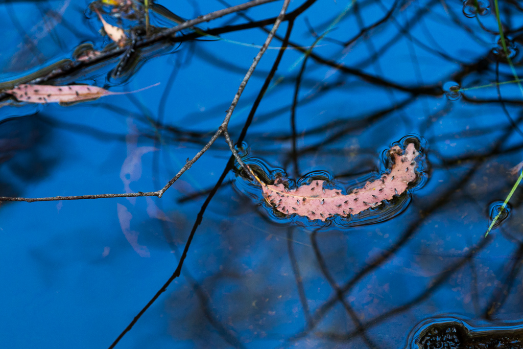
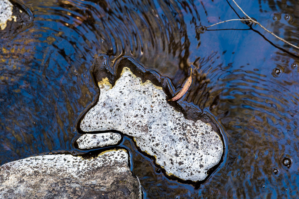
What did interest me was the small pools of water. The stinkin’ hot day was giving me a clear, blue sky and this was definitely a benefit for the photography. A mixture of leaves stood out against the reflected blue…
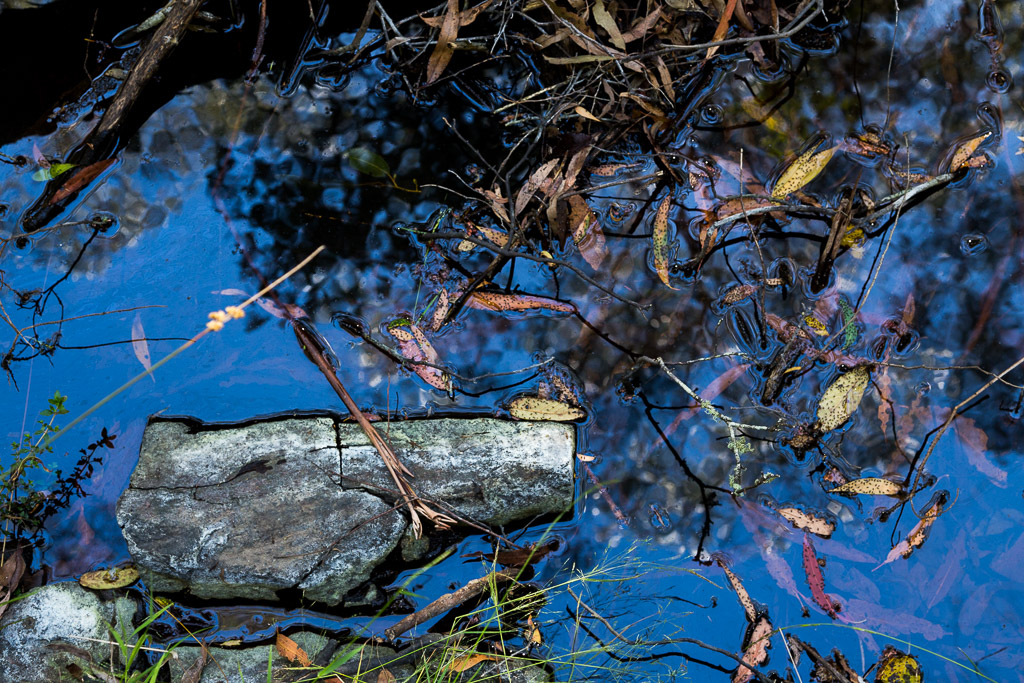
…with a number of bugs clinging to one particular leaf.
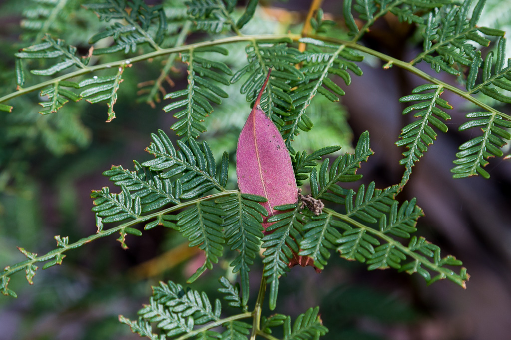
The fallen leaves in the water weren’t the only interest though. This one had speared a fern and its colour stood out in contrast to the green frond.
It had taken a while, but finally I’d found something that intrigued me enough to take multiple photos. In the end I couldn’t stop. The bright sun reflecting amongst the rocks.
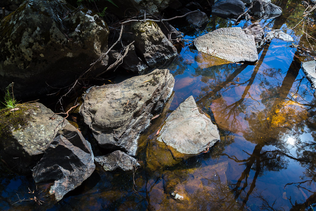
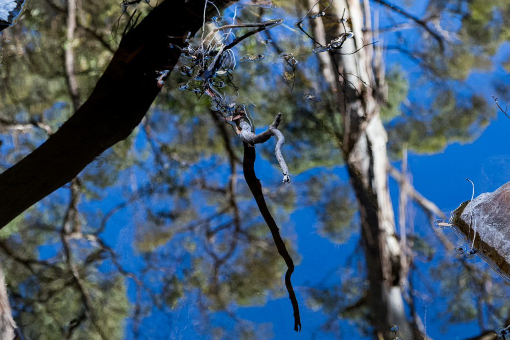
Water ripples from the languid flow…
…and a mirror-perfect reflection on offer.
It was tiring walking, so as I scaled this large fallen tree…
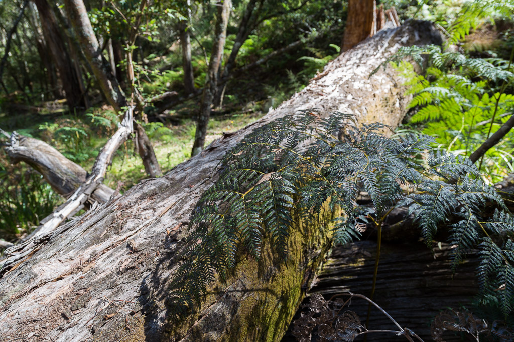
…I decided it was as good a spot as any to have a break.
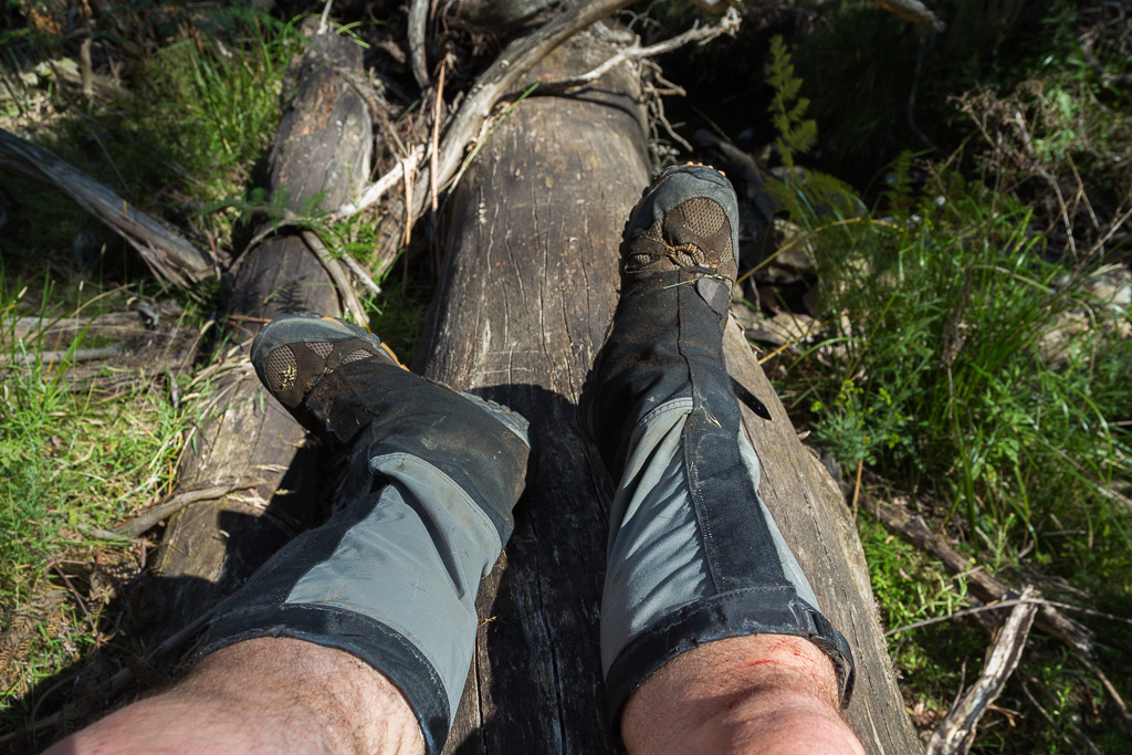
I probably lay there for about 20 minutes and prayed the tree would morph into a flying carpet and deposit me back at the car. Unfortunately my prayer didn’t work (I’ve heard this is a fairly common occurrence) and I was stuck cursing my un-magic log.
Wandering on, I could hear the shouts of people enjoying themselves near the Lerderderg River, so I homed in on them. I hoped to reach their location as soon as possible, as I knew the walking would be easier once I was at the river.
I did note though, they were having way too much fun and clearly I wasn’t. As I burst out of the bush, I quickly bypassed them, as I was concerned their jocularity would rub off on me and cramp my angst. I was fearful of turning from a sweating lunatic and then adding grinning to it. Quite a fearful combo and just the thought made me walk a bit faster.
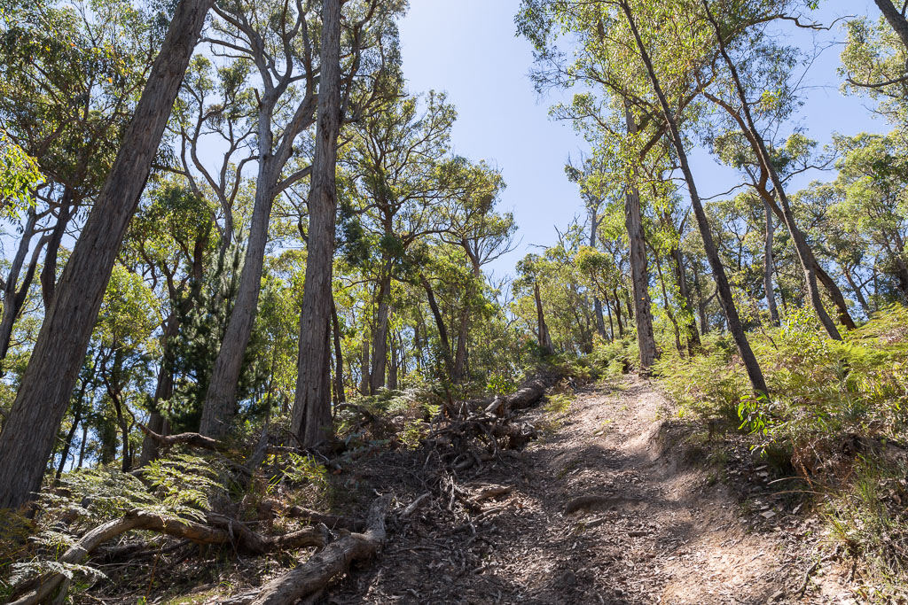
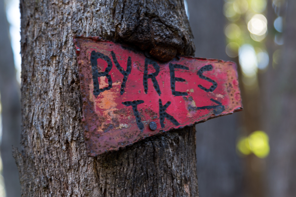
Then again, ‘faster’ wasn’t much more than snail pace. Following Lerderderg River seemed just more of the same, scrubby scrambling, so I was keen to bail out of the bush. Meeting Ambler Lane, I decided to head up it and follow Byers Back Track to the car, which would be a lot more casual. Once I’d climbed Ambler Lane though. Yet another hill that didn’t give me much excitement. As in none.
Ambler Lane
Once I reached Byers Back Track, it was smooth sailing. The level water-race was a breeze to walk on compared to everything previously. Soon I was passing an obligatory old sign…
…before descending the hills again and finally meeting my car. Wow. I was certainly glad it was over. If I think about all my Lerderderg walks, this is the one I hated the most. It might have been something to do with my potato infested body, but even on reflection I can’t think of anything within it, which would make me want to do it again.
Ah, but it was over and I could now tick it off. It was the last one I hadn’t done in this book, so now I could take it home and throw it as far as I could, before considering the next walking tome. Probably another GT one…?
So there you have it. Clear Water Creek, Lerderderg State Park might have been less than 10 km, but I found the whole thing to be a bit of a struggle. Actually, speaking of the Lerderderg area, I’ve got a few more up my sleeve I might write about one day. I know I’ve missed detailing the Whiskey Creek Circuit and I’ve done it twice, so really I should pull my finger out and get it done. Oh, maybe after the teeth post though, plus I’m in the process of changing the blog format again. I’m just letting you know in case you come here and the whole place has gone haywire.

Nice lead in picture. Did my head in for a while until I read the reflection bit.
You do some good walks glad to see the Lerderderg has not changed and the means all the noise at O’Briens Crossing.
Ahhh yes. The joys (or otherwise) of hiking in Lerderderg Gorge.
I recently power-walked from the river up Ambler Lane and back to O’Briens as my elderly mum had had a fall while rock hopping along the dry river bed. I had a new expletive for every time I turned a corner only to see another steep up stint.
Beautiful reflection and ripple photos – nice to have a bit of respite during another hard hot slog in Lerderderg! I was feeling your pain during your vivid account.
Thanks for more army memories. They always give me a chuckle. Having lived up Townsville way for a few years, I don’t understand how you could train in the humidity with a heavy pack and long sleeves. I can understand why the nightclubs were so popular…
I also think of movies sometimes on my solo walks. Unfortunately mine tend to be more along the lines of Picnic at Hanging Rock or Silence of the Lambs due to the creepiness and isolation of my surroundings! Not what I want to dwell on really. 🙂
Thanks for another entertaining read. I’m curious about the upcoming teeth one! 🙂
Yeah, in the photo I left the rocks at the right in the shot. Makes the eyes hurt a bit trying to work it out 🙂
I think Lerderderg is more or less the same as it’s been for years. Can be a bit of a grim and gritty affair at times. Mostly rewarding 🙂 Not sure about the O’Briens Crossing area in summer though. Not really my thing to be hemmed in against the river and surrounded by people.
Oh yeah, Ambler Lane is horrible 🙂 Mind you, every time I’ve done it, it’s been at the last half of a walk and I’m stuffed before even climbing it. Then again, I’d probably hate it if it was at the start of a walk as well 🙂
If it wasn’t for the reflection photos, I probably wouldn’t have bothered with writing this up. It would have been filed with ‘best forgotten’ walks 🙂
Townsville is horrible if you’re an active person! I’m not sure what it’s like these days, but air conditioning didn’t exist. The best we had were ceiling fans. Our clothing was rubbish as well. Old stock that went back to the early 1960’s. Sleeves always down on exercise etc. It’s different now. The uniforms are a better design and the barracks are a billion times better for living in. We were thoroughly shafted with what we put up with at the time, post Vietnam and all that.
See, I think of way different movies on my walks! On one walk though, I did formulate a post of how the first 20 minutes of the original Mad Max is a masterpiece of cinema action concerning timing and direction. Never did get around to writing it up though 🙂
Teeth. Oh yeah, I need to buy some before I can do the post!
Shooters Warehouse ?
A warehouse of shooters?
Townsville. The 80’s. The matchbooks. (See above).
I’m thinking it wasn’t as memorable as the name suggests. 🙂
Oh yeah, there’s always more. ‘Townsville. The 80’s. The matchboxes. The man sleeping with an enormous fish in his bed.’ It really needs its own post 🙂
Beautiful photos; I love how the reflection shots subvert your perspective of reality.
Thank you! Yes, as soon as I stood at an angle and saw that blue sky in the calm water, I knew it would make for some good photos 🙂 An overcast day wouldn’t have been the same!
I just happened onto your blog today, Wed 27th. The photos are lovely. I think I need to buy a new camera. Do you have a suggestion as to which to buy?
Cheers, Coral.
Thank you! Mm… I’ve only used DSLR’s, so I might not be the best to ask! A lot of smaller cameras take amazing photos. Depends what you’re prepared to carry around though. I’m used to bulk, but maybe I’m a bit of a dinosaur when it comes to cameras! Maybe I need to write a photo post…