Remember in the last post how it was May in September? I was writing up my May walks four months after the event? Well, that was then and this is now, as I’ve decided to change my mind and tackle something I only strolled a few weeks back.
Why the change? No idea really, other than this has become one of my favourite walks for a couple of reasons. Firstly, it was my first tilt at putting one foot in front of the other since a bit of a hiatus and secondly, it’s wonderfully bonkers in only the way a walk into Lerderderg Gorge can be. How so? Have a look at the walk profile off my GPS and you can see what I mean.
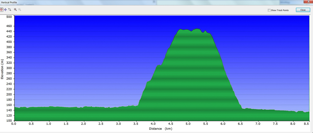
What the hell is going on with the bit in the middle? I’ll get to that later. The Southern Gorge Walk might have only taken four hours, but one couldn’t ask for more. River wading, snakes, a lung bursting incline, knee popping decline and rogue rubbish was all enough to make a man emotional. Even more so than when Wayne Gardner won the inaugural 500 cc race at Phillip Island in 1989. Oh, and the birth of my son. I better include that in the emotional list.
How did this come about? Well, the walk had sat on my Lerderderg Gorge ‘to do’ list for a while. Other than making up my own, I think I’m done with the place. The notes I followed were from the discontinued GT book, ‘Daywalks Around Melbourne‘. That publication is a bit long in the tooth, but it’s still a handy book, so it’s a pity it’s not around any more. Anyway, as the walk was less than 10 km I’d forgotten about it, until I noticed Anna had written about the same stroll in her blog post titled, ‘Lerderderg – Southern Gorge Walk’.
I knew what I was in for, as last year, during the conclusion of the Scenic Rim, I’d descended Link Track No.1 last year . Oh yeah, by the way, is there a duller named track in the history of mankind? I guess the track naming committee thought they were on a good thing, as to get to Link Track No.1 I’d have to ascend, yes, you guessed it, Link Track No.2. I think the committee was taking the piss or maybe they were just plain old pissed off their heads?
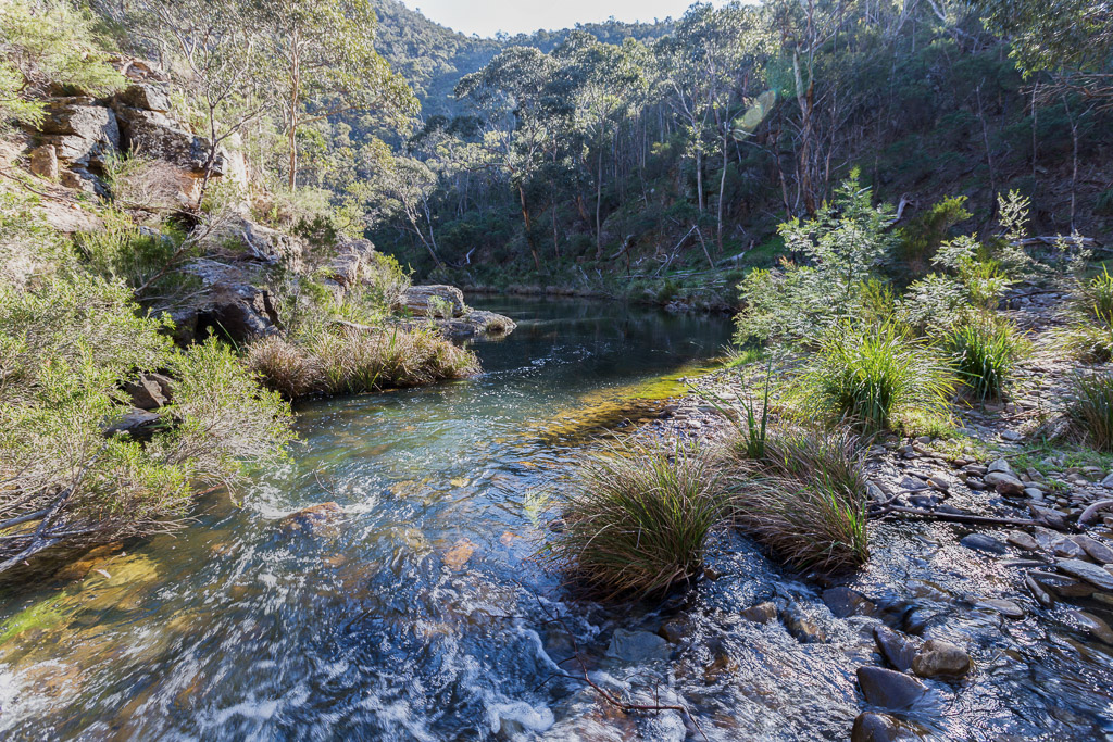
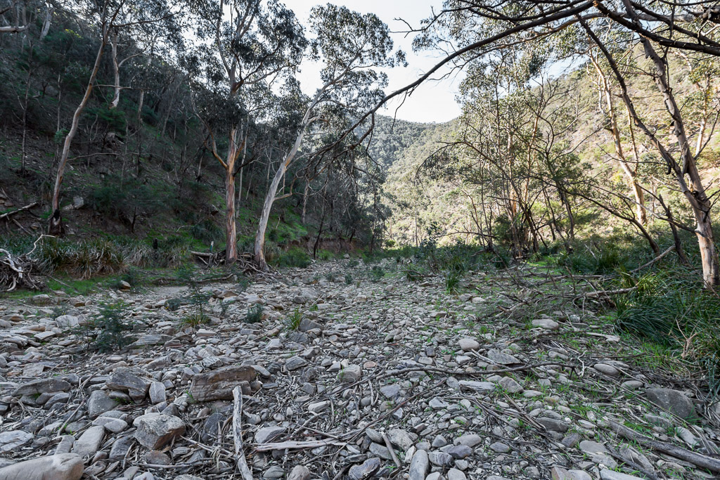
I hadn’t been to Lerderderg Gorge since May (how did you guess?) and on that occasion the river was dry as a chip, so it was nice to see it damp enough, post-Winter, as I arrived at Mackenzies Flat. I noticed in Anna’s post, she got a little waylaid along the river, so elected to do the walk in reverse order to the notes and ascend Link Track No.1. I knew how stiff the climb would be, as descending it was bad enough on my knees, so I elected to follow the track notes and leave No.1 for last. How do you think I went?
Setting off, the wander up to Grahams Dam is pretty standard fare, which I’d done quite a few times before. I did meet a couple coming the other way and had a brief chat to the LOUDEST TALKER IN THE SOUTHERN HEMISPHERE. Honestly, he could get a job as a fog horn. With ringing ears, I continued on, criss-crossing the river a few times. I even took some pictures.
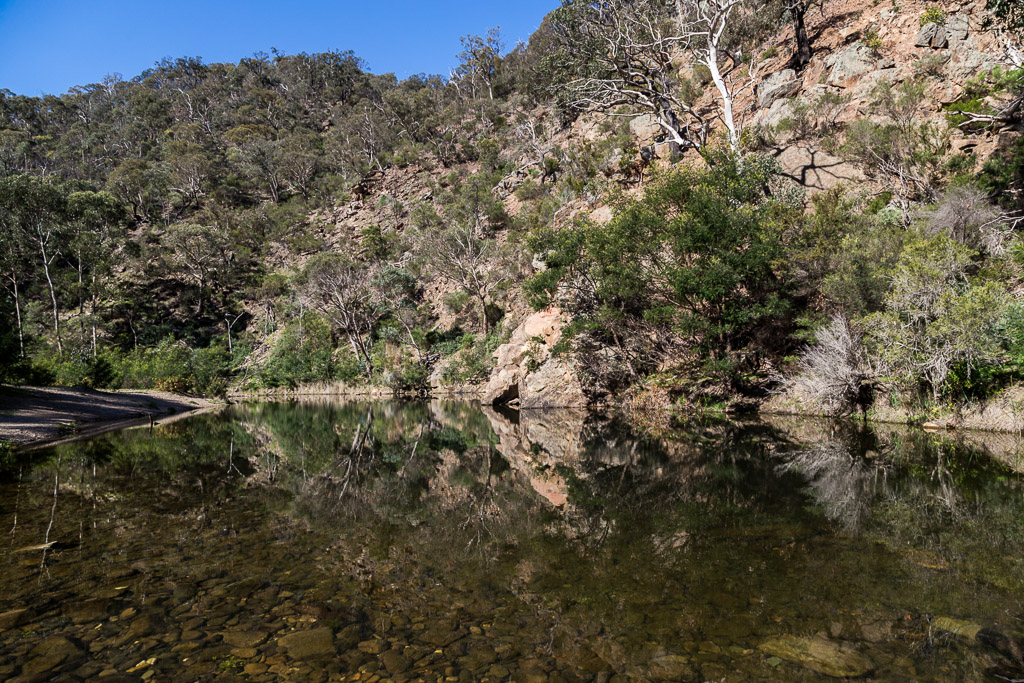
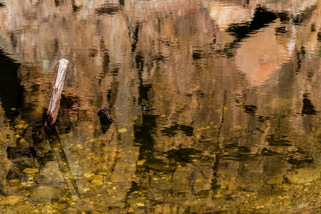
The rock pools were looking rather reflective on the clear, sunny day…
…and I included the photo above to show you why the protruding stick seemed to be surrounded by golden water in the next picture. I can’t help it if the orange coloured rocks reflect the way they do.
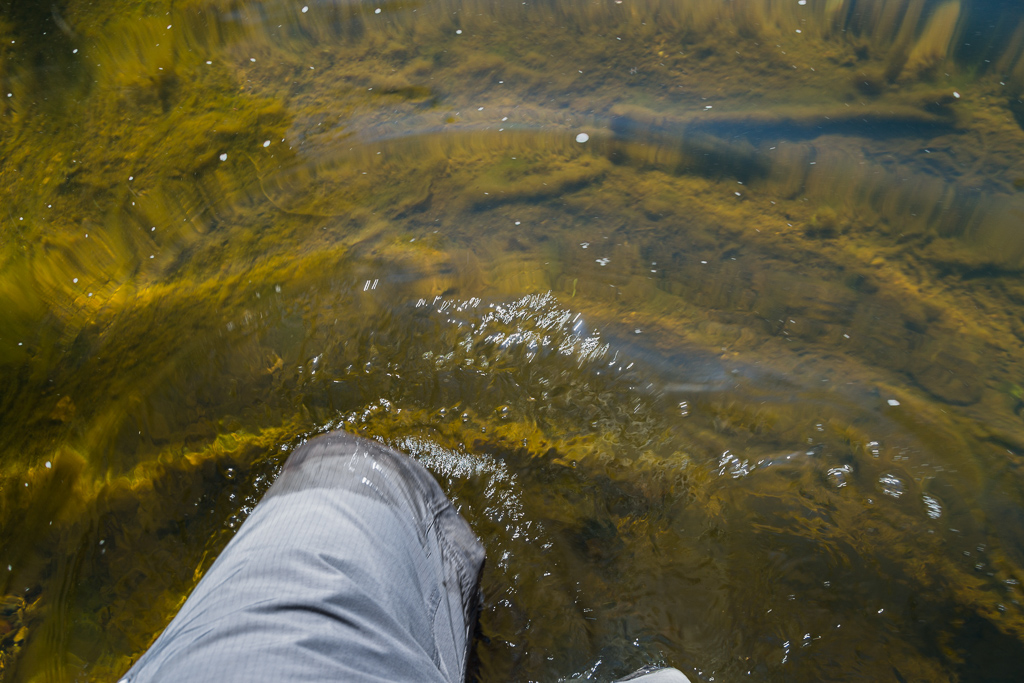
Things were going quite well and I was maintaining my traditional Lerderderg River concentration. Without fail, I’ll be strolling along and find my way blocked by a rock wall, necessitating a river crossing. Most times it was no more than knee deep and I’d long given up looking for some rocks to use to hop over. Straight through, boots and all is my only approach these days. Surely other walkers do the same? Does anyone actually stop and take their boots off or any of that palaver?
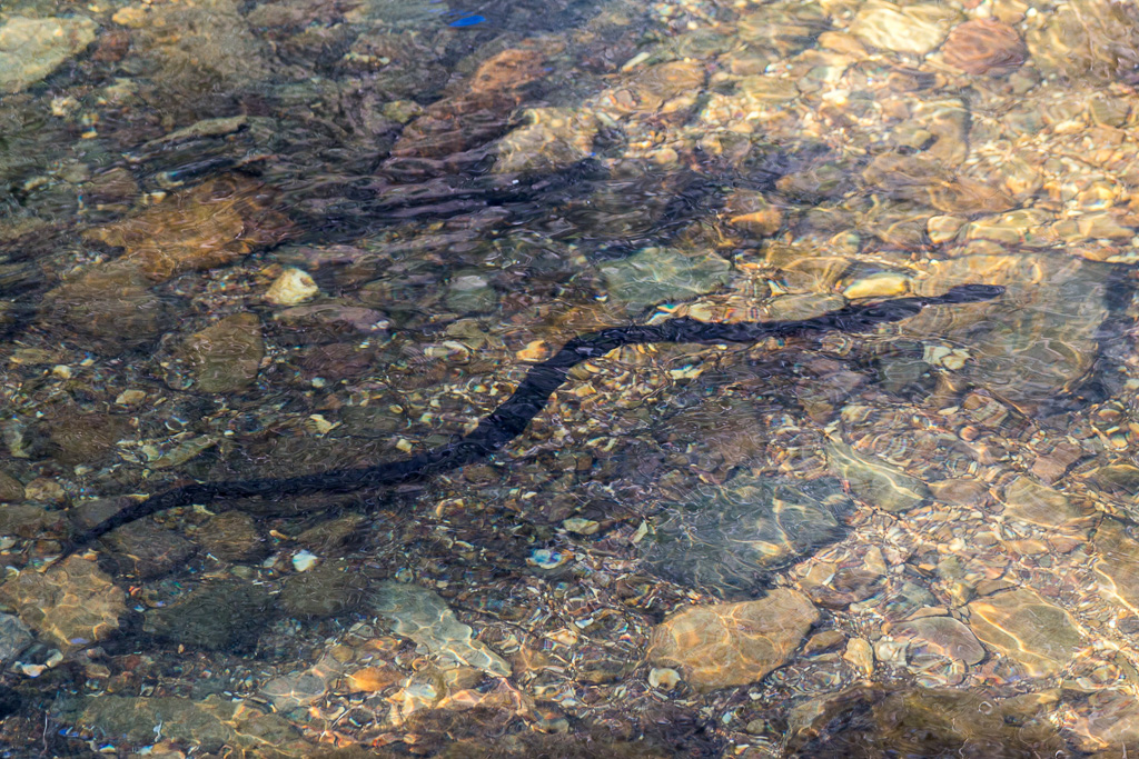
Okay, so crossing the river is standard fare, but what about another gorge tradition? Yep, it seems in the warmer months the place can be a bit of a snake pit. There I was stumbling over rocks, pushing through prickly bush and generally just trying to stay upright, when I spotted a snake, slumbering on the rocks and only about two steps away from having a size 48 to his guts. I’m not sure who crapped themselves more. I stopped mid-stride, cursing I wasn’t wearing a nappy and the snake went stage-right. Straight into the river.
It was a red bellied black and I must say, with some consternation seeing how I had done a few water crossings, they’re very fluent swimmers. Oh, none of this straight in and out business either. He went down under some rocks and snaked around them (because he’s a snake, he finds this easy) and then potted downstream for a while. I took the following picture during his casual swim.
No matter how many times I see a snake when walking, they always scare the crap out of me, partly because I never spot them from a distance. It’s always only a step away type of caper.
Recovering finally, I had the joy of another river crossing coming up and do you think I had a real ball, strolling through the water after that sighting? Actually, it was a real ball literally, as one of the river dawdles involved water lapping at my knackers. Really, if you’re having trouble waking up, then some snakes and shrinkage will get you jumping in no time.
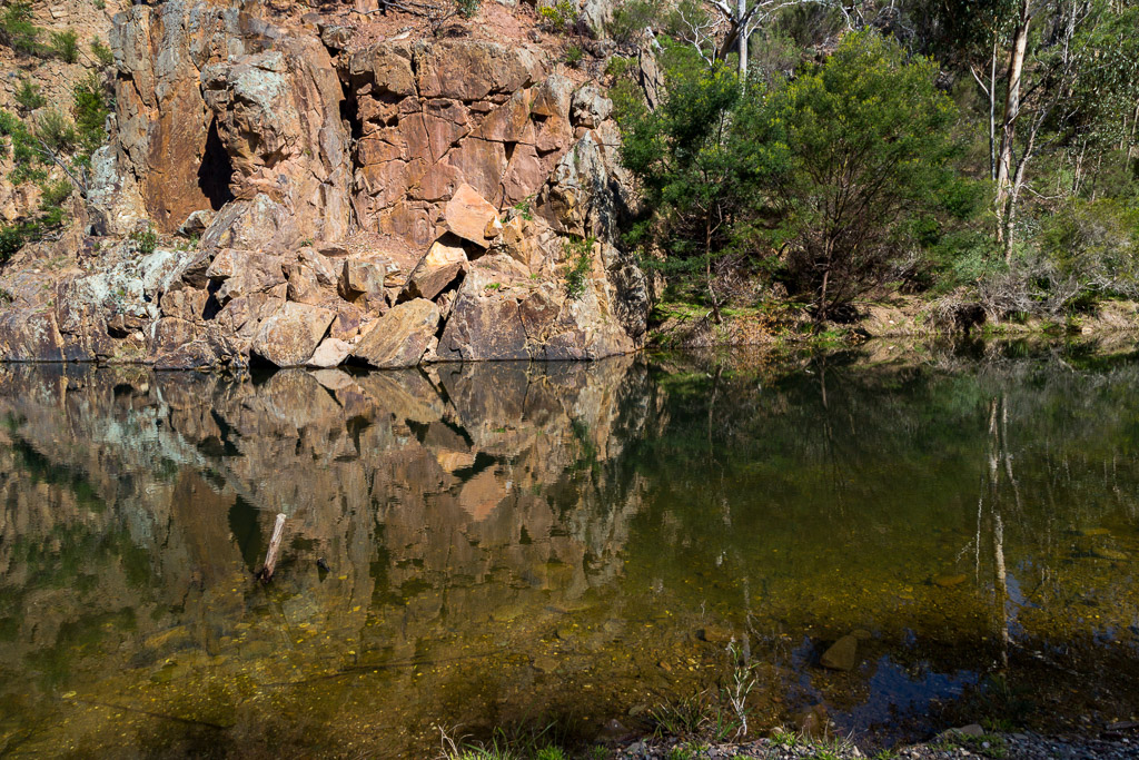
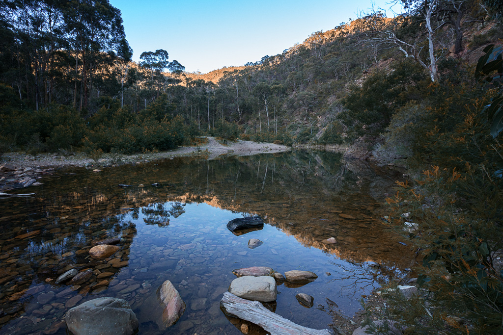
Plodding on, I found a lovely rock pool where I took a quick breather…
…and spotted an object in the water. It’s glowing colour had me thinking I’d come across a long missed, alluvial gold nugget, which just happened to be the size of my head. As I waded closer, my eyeballs were rotating dollar signs, until I realised it was something worth a lot less.
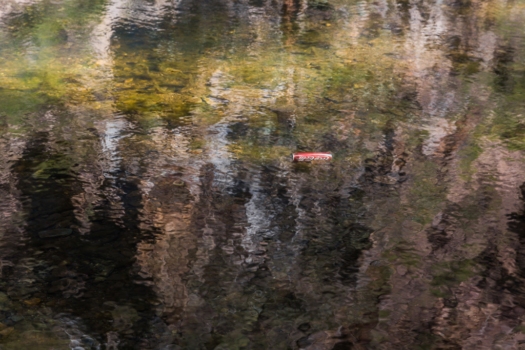
If you carry your stinkin’ can of coke in, then surely it’s not a problem to carry it out, as it will be light and can be crushed to miniature size? Really, there should be daily whippings of litterers. I’d even open a food stall to satiate the attending punters, which would offer ‘caning coffee’ or for a snack a few ‘flagellation flans’. Mm… I’m thinking on my feet about this and it’s not too bad an idea. Let me put some more thought into it.
Anyway, continuing on, a deceptively nice piece of casual walking…
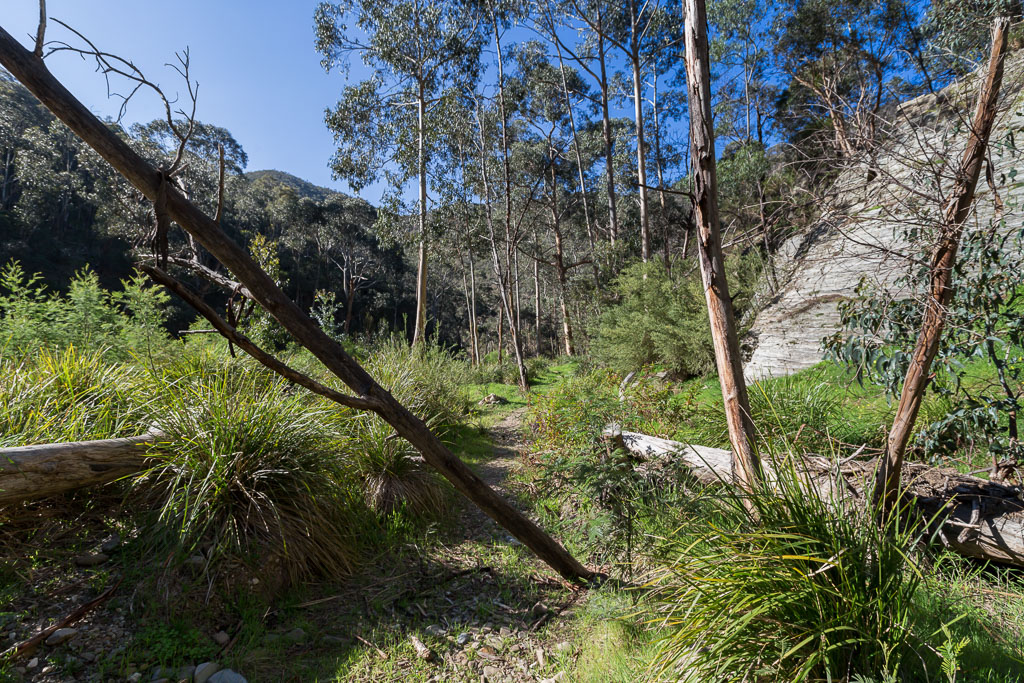
…led me to my trickiest piece of rock work for the day. A jumbled mass of rocks were in my way and a quick cross of the river to avoid it was discarded, as the water was deep and black. Even I’m not dumb enough to hop into water where I can’t see the bottom, so I commenced a creaky kneed assault on the boulders. I can tell you this. I wasn’t going to win any climbing style awards, as I clung onto little ledges like a bastard, really, really hoping my Vibram soles were adequate to the job. Actually, the following wide-angle photo is a little deceptive, as it looks like I’m a couple of inches off the ground, whereas everything to the left of the shot was quite some metres below…
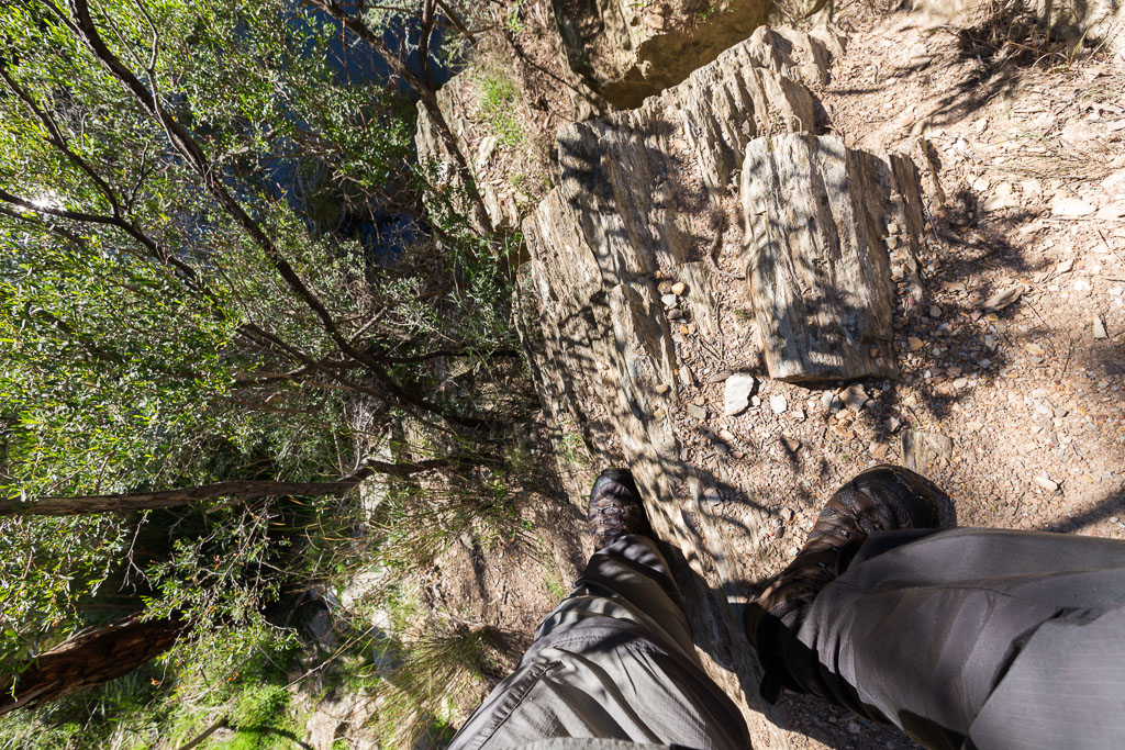
My dubious technique was successful, as I cleared the rocks and found a narrow gap in the water to stroll across and look back at the boulders I’d edged my way over.
It was plain sailing now, as a large section of dry riverbed made for some easy walking…
Okay, hang on. Things were looking great, but within seconds I was scratching my head. Have a look at the photo above. See the two trees on the left? There’s a track marker at the bottom and I almost missed it. Strolling up, I had a perusal. Yes, this is marking the start of Link Track No.2.
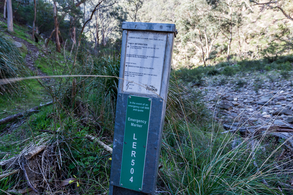
Why should I almost pass this by and suddenly be a little confused? That’s because it’s in the wrong place. Well, according to the map I was carrying, what my topographic map on my GPS indicated, GT’s notes and goddamn it, the official Parks Vic map of the area, Link Track No.2 does not start at Emergency Marker LER504. It’s meant to begin about 400 metres further up stream, around a distinct, broad bend in the river.
Was I on Candid Camera? Was Allen Funt about to hop out from behind a tree? Was my mother right all along? Are we really being controlled by the Royal Family for a lifetime of misery (damn that needs its own post)? Don’t worry people, I thoroughly analysed the marker and it says it’s Link Track No.2.
Oh well, I’m glad I brought all those maps and notes along, as they were a great help. I can only assume the track has been re-routed? Stuffed if I know, as I’m just the chump who does the walking. I considered wandering up to where my map says the track was meant to start, but I couldn’t see the point of doing an 800 metre round trip if it wasn’t the case. No.2 track here? I decided it’ll do and began climbing.
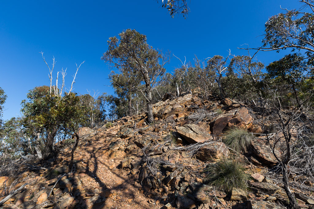
I must say, the gorge doesn’t muck around. It gains its height quickly, due to the, ‘one steep mofo’ principle.
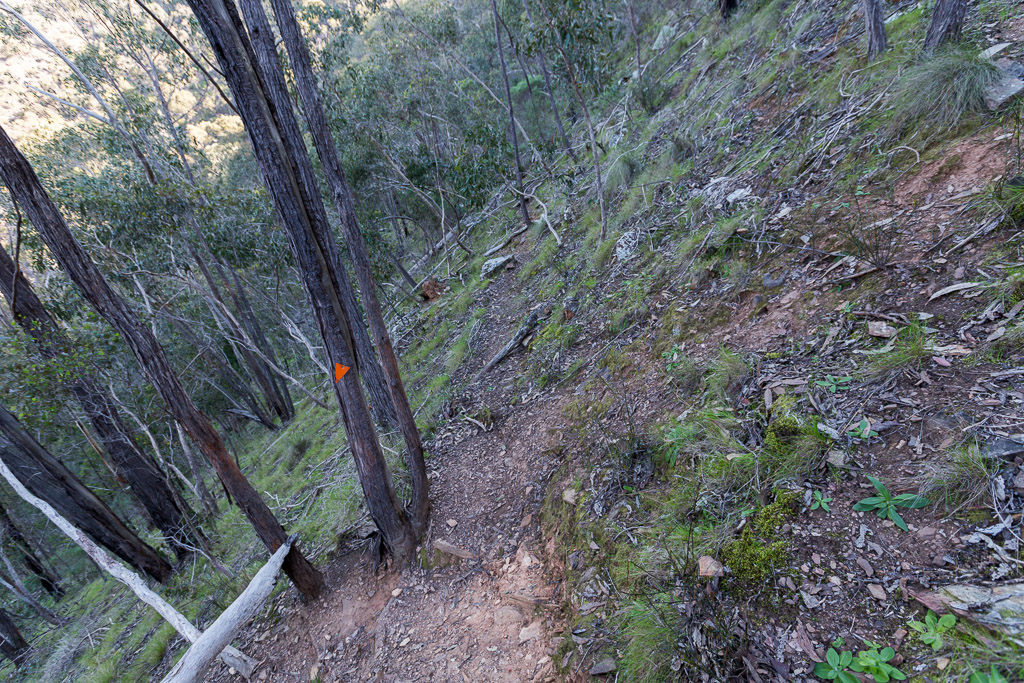
Wandering skywards, eventually I broke out of tree cover and spotted this.
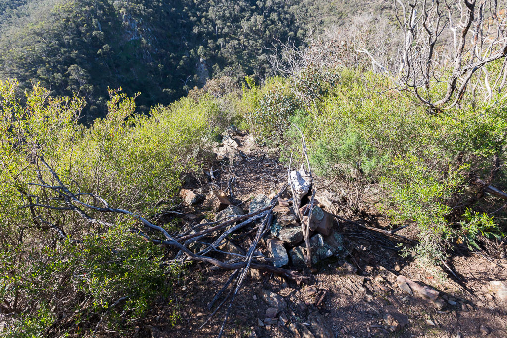
Yes, it appears to be where the old track went and a few token rocks and branches have been placed to indicate where the path has been blocked. Does this make sense? I hope so, as it’s the best I can come up with at this stage.
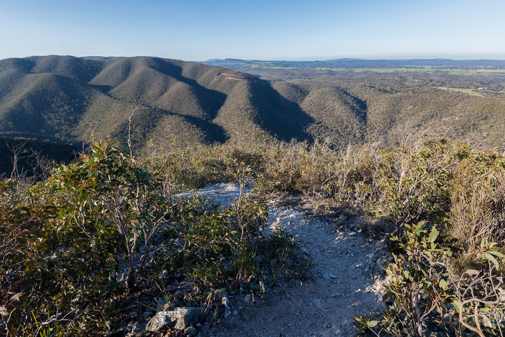
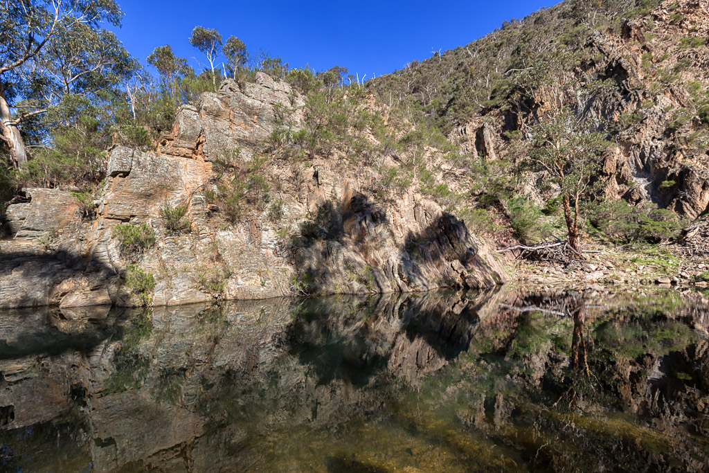
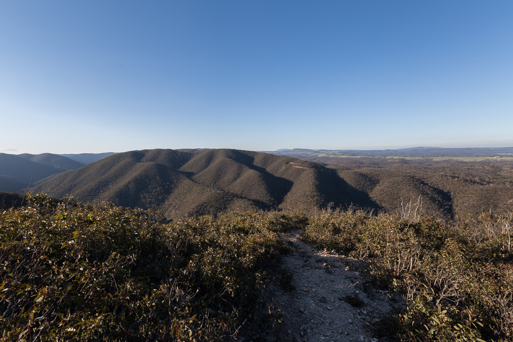
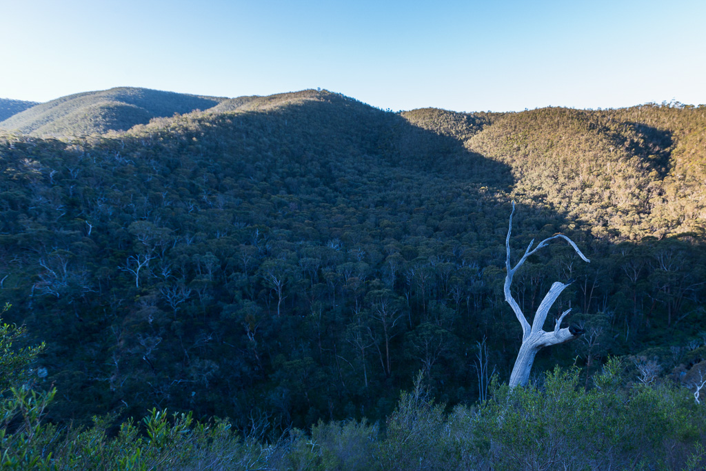
Anyway, once out of the trees, the entire gorge opens up and with the sun low in the sky, it can be quite a spectacular sight.
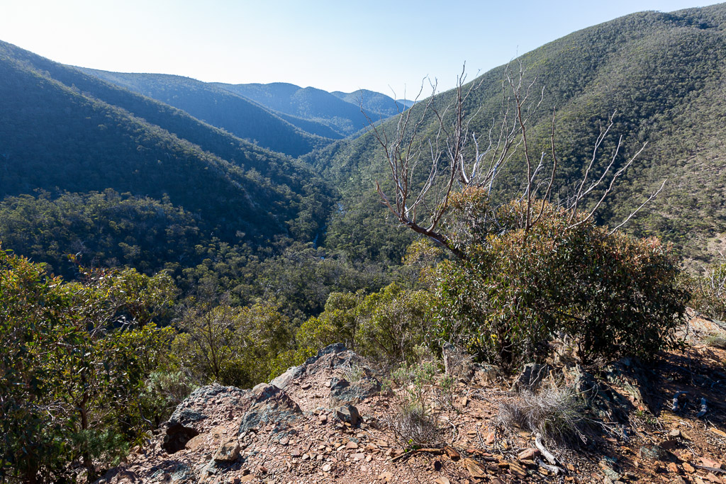
Near here, I sat down for about 20 minutes to soak in the views and some oxygen. Both were well received. Oh, there’s another common saying in this blog. It’s permanently ‘late afternoon’ and this post is no different. Being a night owl is always problematic for the morning person and without fail, I begin walking way too late in the day.
The views were great, but I still had some climbing to do. Turning to face the richly coloured rocks ahead, I continued on…
…pausing now and again to look back at where I’d come.
As you can see by the GPS profile I provided earlier, the climb is relentless, before finally popping out at a road along the top of the gorge.
I must say, some level walking is always appreciated, but it was only for a kilometre, before I’d head straight down to river level again on Link Track No.1. Yeah, I know what you’re thinking. Is this walk officially insane? River level, ascend to the heavens, stroll for about 10 minutes and then plummet back down to the river again. I think you’re correct. It’s nuts.
My legs had only just stopped wobbling from the climb when I now faced the rapidly descending Link Track No.1. It has its own nice views, but these aren’t appreciated by my knees.
Descending in the late afternoon, I was making reasonable time, utilising gravity as my friend. I paused briefly to capture the outstretched branches on this stark, white trunk which looked incongruous to the surrounding vegetation.
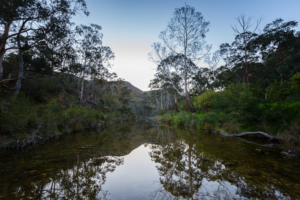
Before I knew it, the rollercoaster was over and I was back alongside the river, which was now in deep shadow. I now retraced my route back to Mackenzies Flat with a couple of casual water crossings along the way. Mind you, there was no rush, as late in the day, the light was lovely.
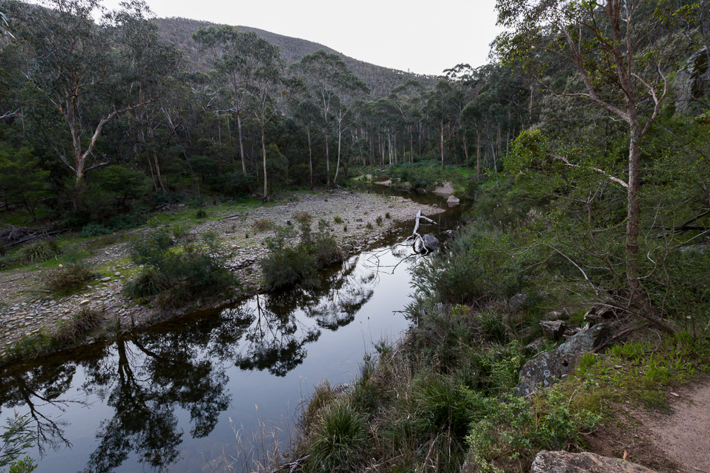
I think one of the most common Lerderderg River shots I’ve seen is taken from the following location. Just near Grahams Dam, a casual hop across the water on large rocks is undertaken and it’s hard not to stop mid-crossing to snap a picture. The light was in my favour and I’m afraid to say, this may be the best photo taken at this spot in the history of the universe. Well, until the next one is taken.
You know what? A quick scurry along the river…
…and I was back at my car. What to make of it all? Not a lot, but if you want to spend a few manic hours then I can thoroughly recommend this one. Oh, the traditional also applied to the time, as the walk notes say three hours and I did it in four. Blast.
Believe it or not, but at one stage I was considering going back and doing the whole thing in reverse, so I could follow the old Link Track No.2 down to the river. Then I thought, ‘what’s the point?’
So, there you go. A day out in Lerderderg didn’t disappoint. Now, what’s the next post? Don’t ask me, I’m only the one doing the writing.

Thanks for the link 🙂
Glad I didn't have to swim with the snakes 😮 😮
No worries! At least you got to follow the way all the notes and maps say in relation to Link Track 2 🙂
Snakes? I try to love them, but still find them creepy 🙂
I didn't notice we actually went the right way -ish. There's nothing that irritates me more than incorrect maps. Lucky I wasn't paying too much attention. I figure it's hard to get lost if all you do is go down to the river and then follow it back to the start… then of course a couple of weeks ago some people managed to get lost around there.
Well, you did go the right way according to the map, but not how they've marked the track 🙂
Yeah, I think the default setting for getting lost in Lerderderg is head to the river and sort it out from there 🙂
Easily one of my favorite places to visit as a kid. We spent countless summer days jumping off rocks into Grahams Dam. Sadly now its hardly worth taking my own kids there in summer due to the crowds. Oh, and also the fact that it is often very dry. Beautiful in spring though. Must re visit soon.
If only that was real gold lying in the water you'd be able to retire and become one of those rich travel writers! 🙂
Lately I've only had time for shorter walks so I like to choose ones that give me some diverse terrain and a bit of challenge/excitement. This one does look pretty bonkers with that steep gradient and the snakes! Perhaps I will try it one day when I feel like some torture. The water scenes look very peaceful. Much prettier than when it's dry.
I might have to invest in a new phone so I can use Strava or Garmin. I'm starting to feel a little too old-school these days and I am a bit directionally challenged so tend to get a little lost at times. I've heard these apps can be quite addictive once you start to use them. Oh well, one more addiction to add to the list! Thanks for the great info and the pics. Your blog is a great resource. 🙂
G – love your site. and the pics are incredible quality. I did this walk only on the 3 oct with my son! its become my fave. wrote to tell you. and others! that is is possible to walk all of the way from grahams dam to the link no 2 track, on the east side of the river with NO river crossings. the track was quite distinct once we commintted to it, and easy to cast around (generally away from the river a bit, the few times we thought we'd lost it). we just kept an eye on the other side of the river cos I remembered the last time (when we''d walked on the west, stoney riverbed side. which took AGES!) that the orange marker on the tree would come up plus the sign post. when we saw it we just crossed over at that bit or a tiny bit further along the river till it narrowed and there was a lovely crossing with stones and some logs. simple! thought you and other walkers might like to know. last time it was longer by having to walk on the stones and I also actually thought the east side track was nicer.
isnt the hill a killler. got kind of sore legs on the way down (later that night of course – not at the time dammit), my son and I thought we could go fast cos it was downhill. should have – paradoxically – gone a bit slower. heartrate was minimal but the leg muscles were really getting strains.
lucky you to see a snake – that's what I always want to see on walks, but I have seen wayyy more animals on mountain bike rides – snakes, lyrebirds, giant eagle close up flying etc etc. look forward to your next writeup!
Hi Mandy, I can imagine it would be quite crowded in summer? I didn't realise how many people went to these places until last weekend. I did a walk on the warmish Saturday in Werribee Gorge and it was full of people swimming, carrying stereos and drinking! Seeing how Werribee Gorge is a little harder to get into, I can only imagine Grahams Dam during a hot weekend.
I don't think Grahams Dam dries in summer? Then again…
I'm not sure why I didn't spot it was a can of Coke earlier. Before I waded over to it!
Short walks are fine and I reckon this has more than enough to keep one entertained. Who needs distance if there are hills?!
Yeah, I use a Garmin etrex 30 GPS, which gives me longer battery life. I do see people with phones using maps, but I can imagine they'd kill their battery in no time? Not to mention there barely seems to be any mobile coverage wherever I go 🙂 My favourite free walking GPS for the phone is Walkmeter. I use that if I'm wandering the streets. There could be better, but it seems to do the trick!
Hi Ian, thanks for your comment. I guess I should have looked a bit harder on the east side, but as soon as bush started spearing me, I decided to cross over! One day I'll do one of these walks with an earlier start, so I can take my time and plot my way up the river instead of crossing every few hundred metres or so 🙂
I think Link Track No 1 would be a harder climb than No 2. No 1 has that real severe steep section which I found a killer on my knees when descending. Mind you, I considered going back and doing it again in reverse, just to confirm if No 1 sucks as much as I think it would!
Honestly, in warmer weather, I can't remember a walk in Lerderderg where I haven't seen a snake! The one thing I wouldn't mind seeing is a wombat or two. Yeah, I know they're reclusive and nocturnal, but some of these walks where I'm finishing in the early evening should deliver me a wombat sooner or later!
Really? You can do this without River crossings? May be worth checking out when we're feeling particularly adventurous next – on a cool day, keeping an eye out for snakes…
????
actually Ive just remembered that we did have to cross to get on the east side of the river in the first place. that was just after grahams dam. I think I didnt remember it earlier because the crossing was a total walk on the rocks, and we wondered then if people had put them there because the line of rocks was so perfect and simple to cross. but then, yes all the rest of the way on that side till the marker visible on the other side, to go up link no 2 – and – dont you get a good view of the black dirt and much singletrack going up from the sign at 90 degrees! (joking). NB also we saw massive holes that I could only pretend to be knowledgeable to my son and say – they must be wombat holes! but if so they must be the most massive wombat holes under tree roots and banks etc. they couldnt be wild pigs could they?? again, lucky you. Ive only see tigers (at least 3 different colours), what I think was a copperhead but it was extremely fat, and kind of darkish green (could have been an escaped python?) and a couple of browns – would love to see a black snake but even more, the red belllly part. now how can one do that? Keep those snake pics coming!
yes you totally can. well, 2 crossings at most. and they were both on easy rocks, logs etc. you should go! when the water is higher, as it is now campared with my last trip, the sight of the river is just magical. it is so incredible. nowish, with so little rain we've had I can;t beleive the river is at the "medium" kind of height? even if it gets higher, the way I described (the east bank all the way, after grahams dam) would be fine as I dont remember that bit being low down enough to be affected by a small bit of flooding, I mean it seemed always a bit higher than the level of the river. as it is nowish. that river does seem to have deeper bits and wider, then very narrow and shallow bits so it seems always possible to cross at some suitable and shallow spot even if one had to go in mid calf.
The water is regulated by a weir upstream of this walk (you can see it on the 16km 'scenic rim walk') The water is always at a maximum level or lower and at maximum able to be crossed in the two places you need to complete this walk. Upstream, now that's a whole different story!
Hey Greg,
Great to see you are rekindling the Derg flame! I have recently completed my last hike there for a few months, just way too many snakes in the warmer months to be there! Last season was the worst I have ever experienced. Your comments about a snakes are spot on! I saw so many last year it really was scary. Ended up with a 'Tree Branch Snake Duster' out in front of me to scare them out of the way so I wouldn't step on them.
I would guess it's because of the rains, I saw plenty of tadpoles in pools and frogs were clearly audible in places I have never heard before. Feed them and they will come.
Great to read your always entertaining stories and look at some beautiful photos.
Dan.
These guys could have found a use for a map I would say;
http://www.theage.com.au/victoria/bushwalkers-tell-of-chilly-night-lost-in-lerderderg-park-20140908-10ds9s.html
Yeah, huge holes along there would most likely be wombat related. Pretty elusive animal, as I've only seen one in all my Lerderderg travels and quite a few I've finished in the dark when the nocturnals come out to play. I'm always hopeful of spying another though!
Hi Dayna, yes, apparently it's possible! I'm pretty slack though, as I don't bother. Getting wet just adds something else to the walk 🙂
Ian, I must have a wander mid-summer through there, as I've generally only seen the place with water. My May walk was a bit of a shock, as I really didn't expect to see the Tunnel essentially dry. I forget how much the place dries up during a few months of dry weather.
Daniel, yeah the whole gorge feels quite isolated until you come across that whopping big weir. It always takes me by surprise 🙂
Yeah, I did feel more comfortable with gaiters on when it gets warmer. Not great, but better than not having them! I've actually run out of walks in the place, as there's only one I haven't done. I guess I'm going to have to make up my own now!
When I did the Clearwater Creek walk I also saw a lot of tadpoles in the pools. Always interesting to see life clinging to those little pools of water. Always an intriguing place!
Thanks also for talking up the blog. Always appreciated!