It feels like I haven’t posted for a while. Has it been a week? Is a week too long? Who knows, but believe it or not, I’ve been out and about chalking up some walks. In fact, I’ve got so many ideas it’s become daunting and I’ve got no idea where to start.
So, I’ve decided to group a few together. This is the first of a back to back foray into Lerderderg Gorge. Actually, there’s all sorts of specials to write up. A Wilsons Promontory special, a Coimadai Creek special, an Aireys Inlet special, a Kinglake special, You Yangs special, Brisbane Ranges special, my father’s eulogy special, Maldon-Goldfields-some other joint special and a special on the special-specials. As you can see, there’s so many bloody specials it almost makes me want to down tools for a month and vegetate.
By the way, I’ve already seen a problem of doing back to back posts for the one area. The pictures are going to look the same! If nothing happens, the posts will be the same! Even the jokes will be the same! Anyway, that’s for you to endure. I’m all care, but no responsibility if you slump into a coma from boredom by the time you read the second Lerderderg post. Especially whilst smoking, as it’s bound to hit the carpet during your slumber and possibly set fire to your lounge-room.
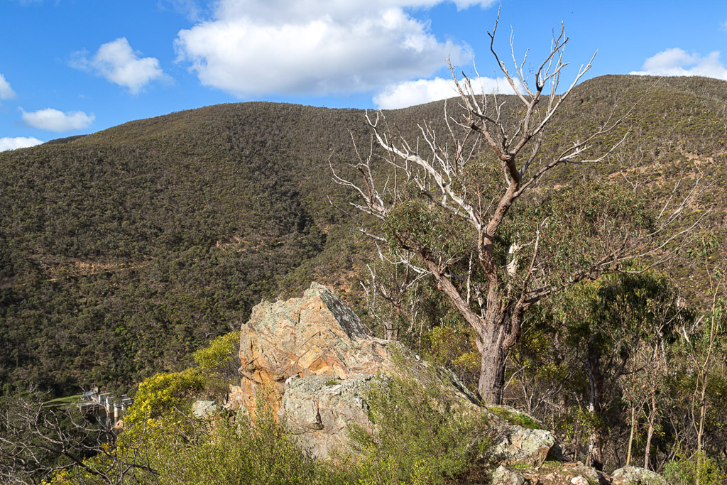
Now, Lerderderg Gorge has been well and truly neglected by myself over the years. I’ve been meaning to get there more often, but contemplating specials seems to distract me. There’s really no excuse for not walking in the gorge though, as the whole park is less than half an hour drive from my house.
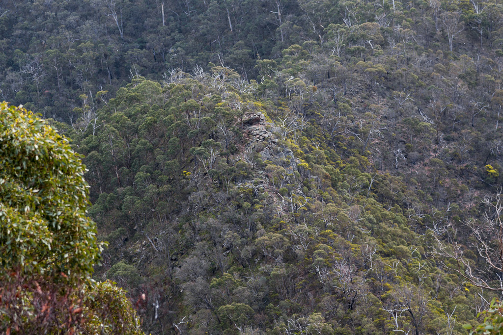
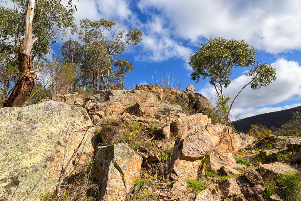
There’s a problem though. Gorge walking doesn’t really turn me on. My theory is all the crap from the top, ends up at the bottom and that refuse is what you’ve got to walk through for the day, plus there’s no real views for all the heartache and sweat that’s shed. They are rugged though, if you’re into that sort of thing. If they were art, a gorge would be classified as ‘brutalist’.
Okay, that’s my main beef about gorge walking, but when I mentioned this to a colleague at work, they had a different take to it.
They said, “Ooh, Lerderderg Gorge. That place is full of bodies.”
I said, “Huh? What do you mean?”
They said, “Have a think about it. It’s close to Melbourne, yet it’s rugged and has a lot of remote sections. If you wanted to get rid of a body, stick it in a hole in Lerderderg Gorge and you’ll never find it.”
I said, “Really? I never thought of it like that.”
They said, “Oh yeah. The joint is full of bodies. I can tell. The whole place is sinister. At night they’d be ghosts all over the place.”
So there you go. An interesting conversation and if you’re wondering, no, I don’t think the person I was talking to is a serial killer.
It was time to head into the corpse-filled gorge and find out what’s going on. I turned to another edition from Open Spaces Books, titled ‘Melbourne’s Western Gorges’. In this book I picked out the 15 km walk called Scenic Rim, Lerderderg State Park, as it sounded suitably ugly with a couple of steep climbs included. How do you think I went?
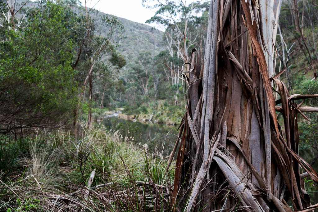
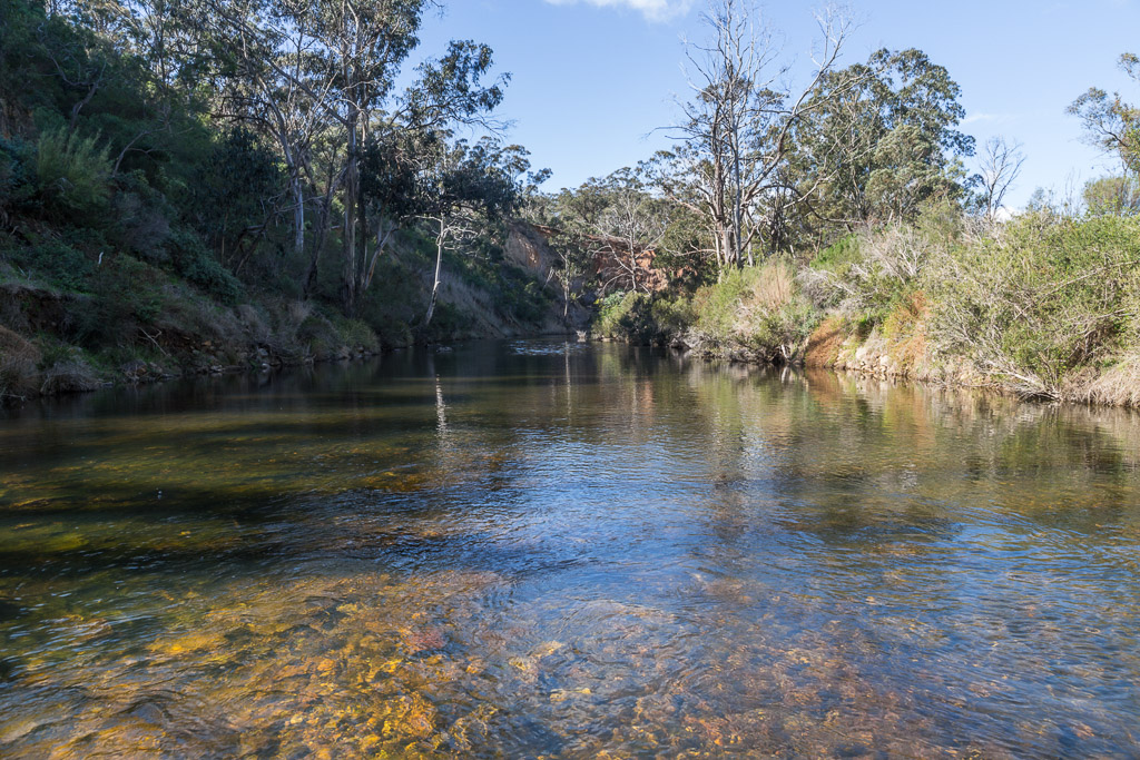
Guess what? I ventured into the gorge, but made the mistake of arriving too late to start. At 15 km long and an expected walk time of six hours, I needed to start earlier if I wanted to beat the early winter sunset. Unfortunately though, I hit the track at midday and after climbing a spur, which quite frankly sucked, heavy rain started to fall. As a result, I quit. I ended up drenched and had no real photos to show for it. Unless you want to see ones of rain on Lerderderg River. Such as this…
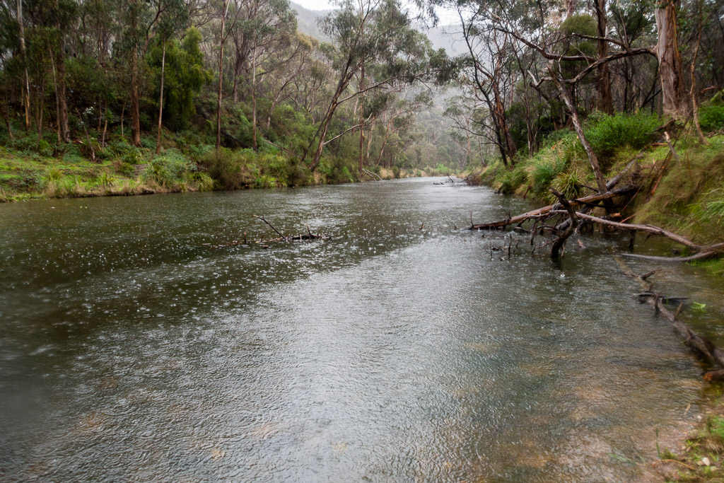
Heavy rain on Lerderderg River
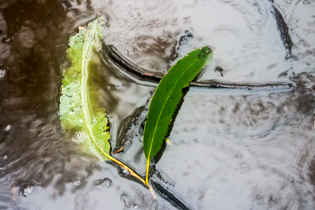
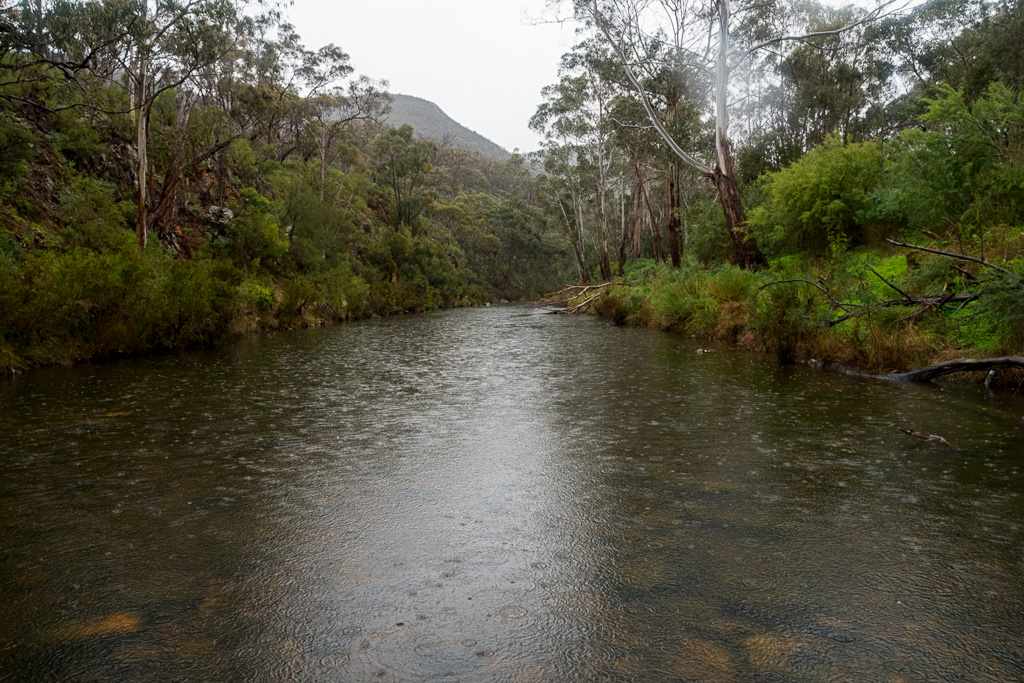
You do realise in summer, you can just stroll up the middle of the Lerderderg River, as generally it’s dry as a bone? There’s been a bit of rain around lately (I guess that happens in winter?) and the river certainly wasn’t strollable. The only other photos I liked for the day was this leaf in a puddle…
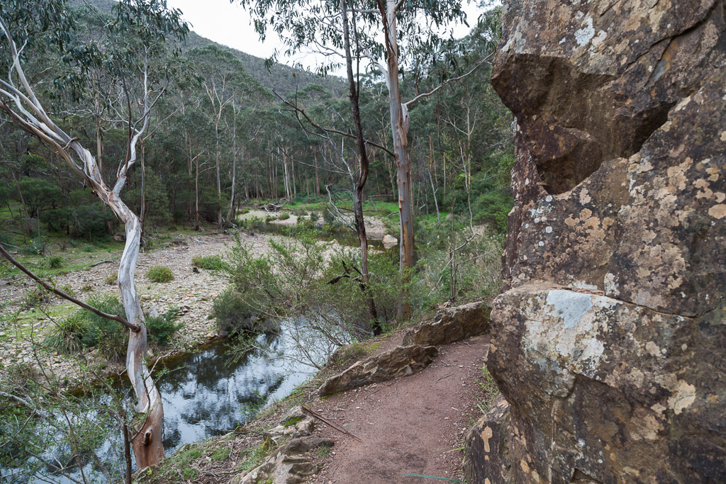
…and a view past a rock wall.
A nice tree…
…and the world’s smallest feather…
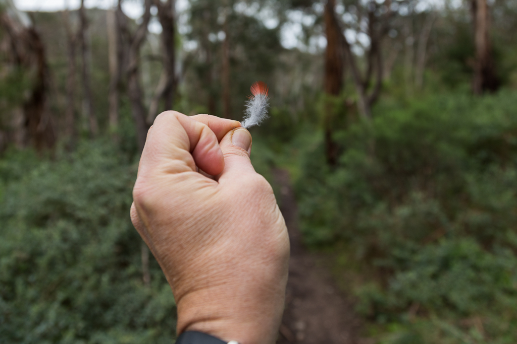
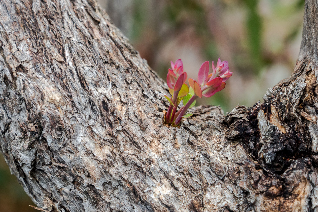
…which goes well with the world’s smallest regrowth…
…and if you didn’t realise, more rain. Here’s my last shot of this trip. Yes, I was standing in the water.
Okay. That’s the quickest trip report I’ve ever done. Don’t worry though, as I’m about to send you into a frenzy with the second tilt. In my downtime, I considered a new approach for this walk. One was a favourable weather forecast and secondly, start earlier.
A week later, the weater was looking good, but there had been a bit of rain since my first attempt, which might cause me some problems with the Lerderderg River. There was no way to find out though, other than go again.
I arrived at MacKenzies Flat Picnic Area, which is the walk start. My previous fiasco wasn’t helped by my midday late start. This time though, I was on the ball, as I looked at my watch. It was 11.30 am. Mm… Is starting 30 minutes earlier considered an ‘early start’?
No problems though, as I was pumped up. I had lots of stuff with me. Firstly a headlamp. Yeah okay, it’s power output is similar to a wet candle whilst concealed underwater beneath a rock. That’s okay though, as I had an LED Lenser torch as a back up, plus enough food and warm clothing if it got dark and had to spend a night under a bush. Obviously, this was an ‘average case scenario’ (if you’re wondering, a ‘worst case scenario’ is a heart attack).
Anyway, I kitted up and took off. To be met by a old-timer (anyone older than me can be classified as an old-timer) who popped out of nowhere carrying a backpack, trekking pole and a chatty nature. So far I’d covered approximately four metres and I could see idle banter was going to eat into my extra 30 minute allowance. We had the following conversation, which wasn’t great, but I was struggling to make it any better.
He said, “Where are you walking?”
Straight away, this was a problem, as I knew the route, but didn’t know the specific track names, so I said, “The rim. Yeah, I’m walking around the rim.”
He said, “Where’s that?
I knew he’d say that, so I said, “Umm… down the track. Up a hill, down and then up again. Umm… along and sort of back.”
It was a shocking answer and he gave me a look of pity mixed in with, “who’s this dickhead?”
He said, “I went up to Grahams Dam yesterday and couldn’t get through. A lot of rain around. If you’re going there, you’re not going to get through.”
This was a problematic answer, as Grahams Dam was a crossing in the river only a kilometre away, so it could be even more of a fiasco compared to my first tilt.
I said, “Really? Graham’s Dam? I’ll find a way.”
He said, “I doubt it. A lot of rain lately.”
Talk about winding me up. Surely it couldn’t be that bad? Then again, these gnarly looking old-timer bushwalkers are pretty tough blokes, so I was a little perturbed. If he couldn’t get across, how would a potato addicted bloke like me cross?
I said goodbye and noted I’d lost precious minutes talking crap. There were a couple of casual river crossings via rock steps, which were handy for taking a ‘Jesus photo’.
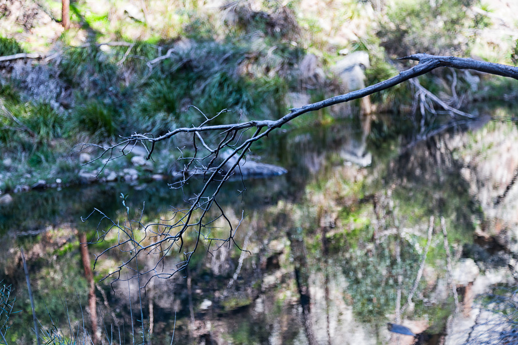
No problem so far, but Grahams Dam was rapidly approaching. Firstly though, there was a nice branch to look at with the river reflections.
Then I reached Grahams Dam and was confronted with this…
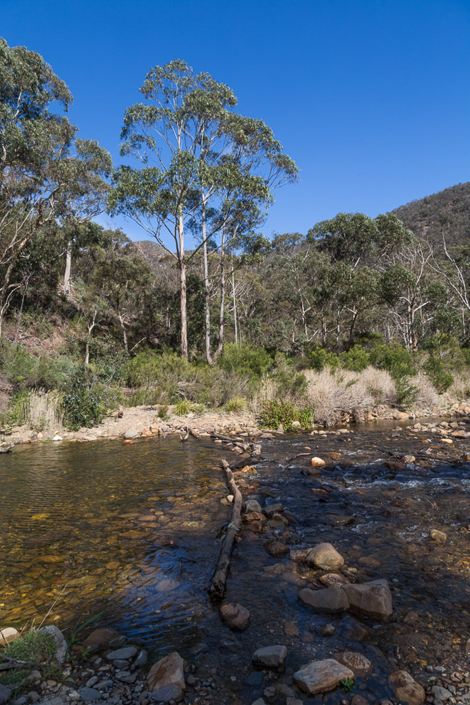
The fearsome Grahams Dam crossing.
There you go. Was that bloke kidding? I thought he was tough as nails? This was real marshmallow stuff, as I strolled across while barely getting the soles of my boots damp.
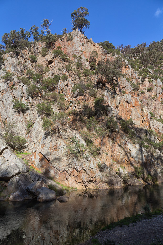
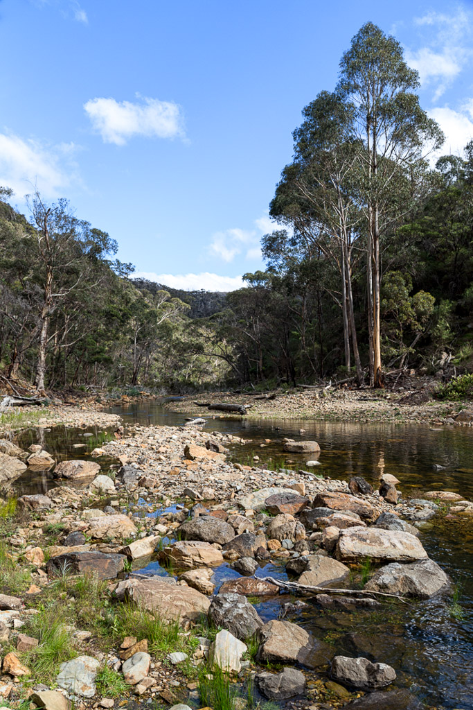
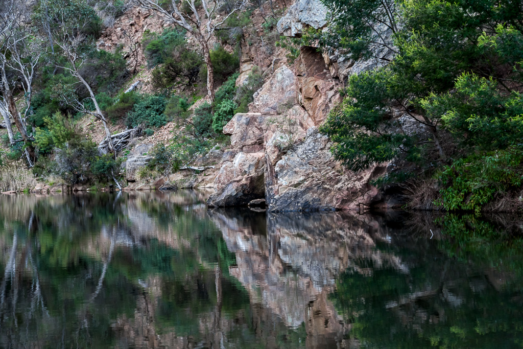
Well, no problem there. Apparently Grahams Dam makes for a nice swimming spot in summer. I can see why, as there’s a large pool beneath the cliffs, which probably has enough water in it all year round.
This is all a bit of fun and games, but from now on the walk turns a little nasty. Spur Track is reached and it heads skywards up a… spur. You know what? I took about five photos during the climb and they’re all rubbish. Here’s a picture and I’m not even going to try and jazz it up. Sun glare and all.
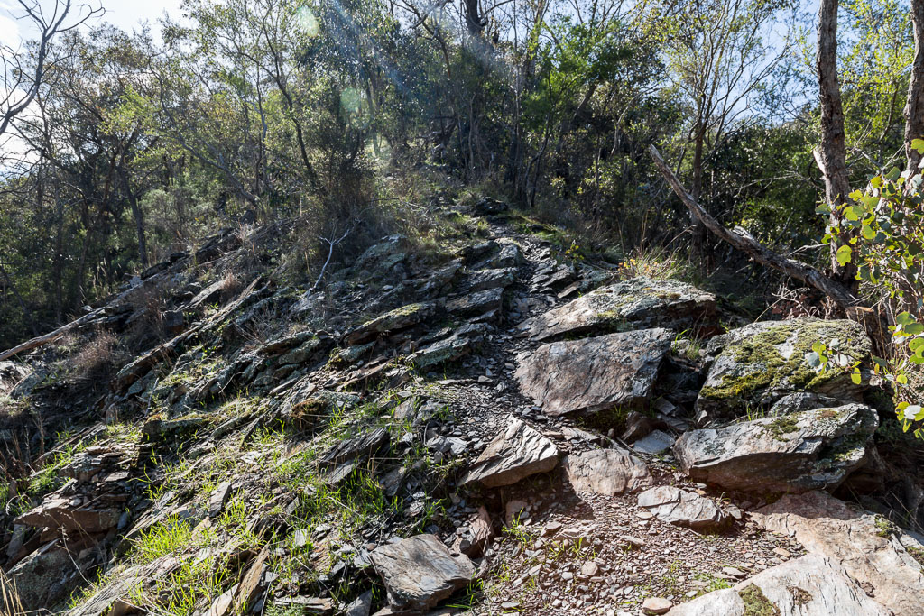
Spur Track
What’s worse about this climb, is I knew exactly what it was going to be like. I’d walked up it only a week earlier, so the pain was still fresh. All you need to know is it goes up, levels off a bit, so you can suck in a bit of oxygen and then tilts up again until reaching a road. There’s a sign at the bottom and it suggests one and a half hours to get it done. My time? 1 hour 15 minutes.
Upon reaching Lerderderg Tunnel Access Track, I dropped the backpack for a quick breather.
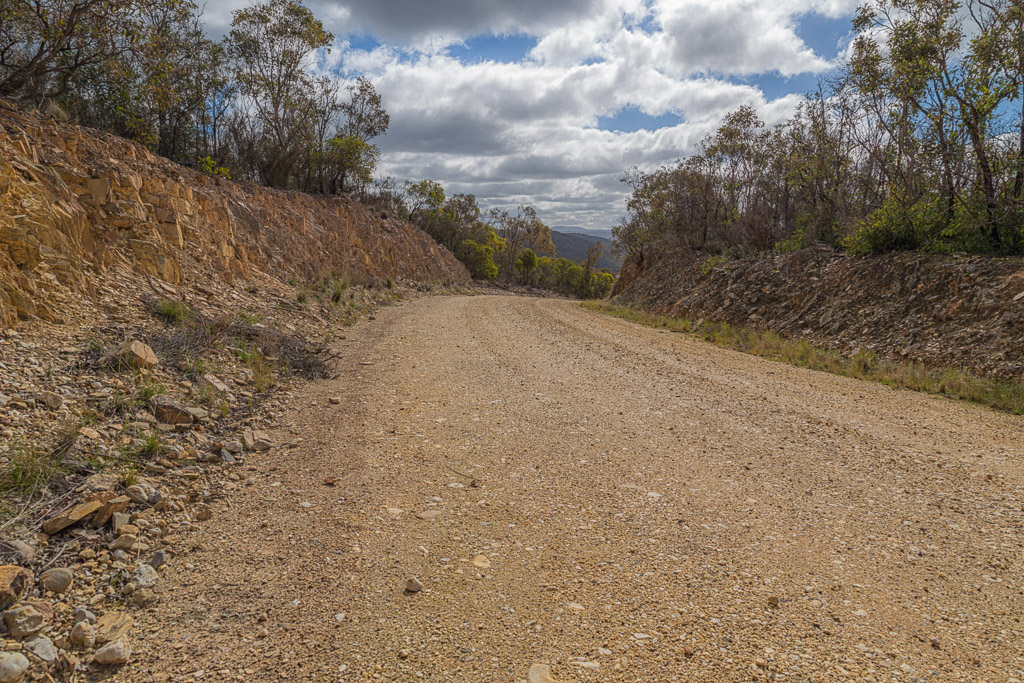
Lerderderg Tunnel Access Track
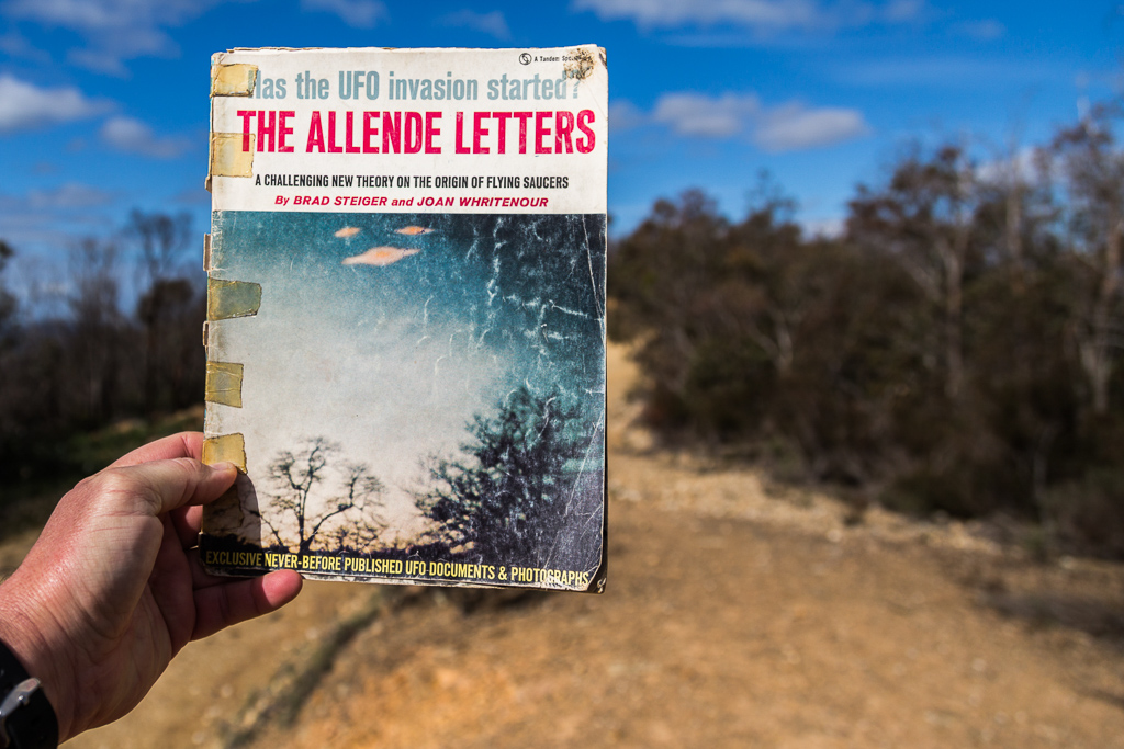
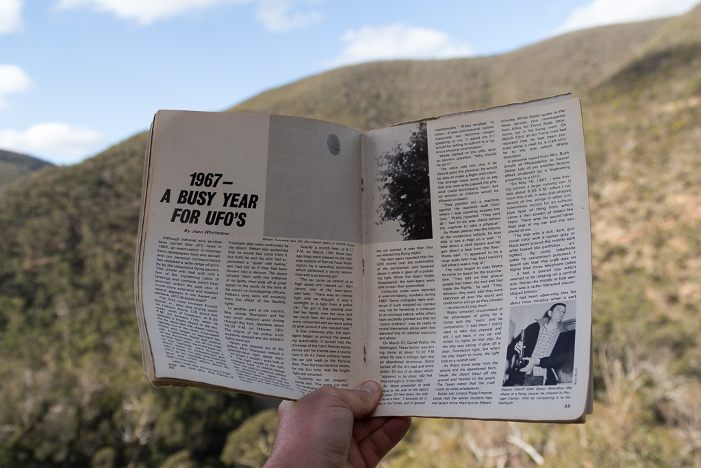
I may have been a little puffed, but what really concerned me was, ‘Has the UFO invasion started?’ I wondered this as I perused my 1968 magazine.
There was not enough time to ponder this though, as I kitted up and headed down the road towards Lerderderg weir. Yes, there’s a weir at the end of the road, which explains the highway-like nature of the ‘track’. There were plenty of curves as it descended…
…and although the views were nice, it was a little traumatic to think I was heading all the way back to river level. It seemed to make my previous hour slugging away, gaining some height to be a bit of a bummer. You know of course, as soon as I reached the river I’d have to climb another steep ridge, didn’t you? As I was strolling along, I began to look at the hills opposite for the upcoming ascent. In particular I spotted one spur, which seemed sufficiently vertical and ugly. I said to myself, “I bet the stinkin’ track goes straight up that spur.” Mm… I wonder if I was going to correct…?
Steep spur opposite. Is that the way up…?
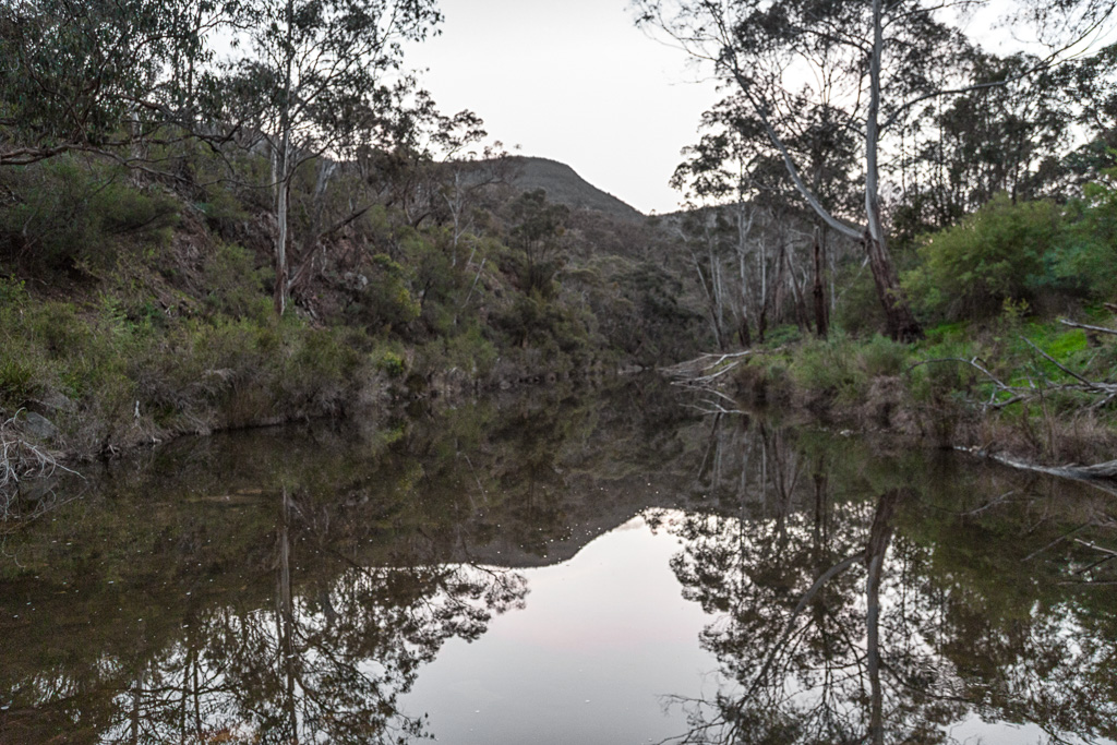
I took lots of photos of upcoming corners on the Lerderderg Tunnel Access Track, but I think you’ve seen enough to get the idea. The wide road did make for easy walking though, as I reached the bottom in no time at all. Now, what’s going on down here? Yes, there was the weir…
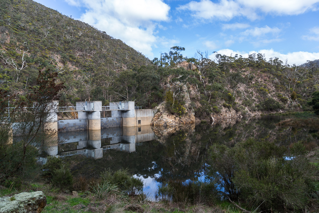
Lerderderg Weir
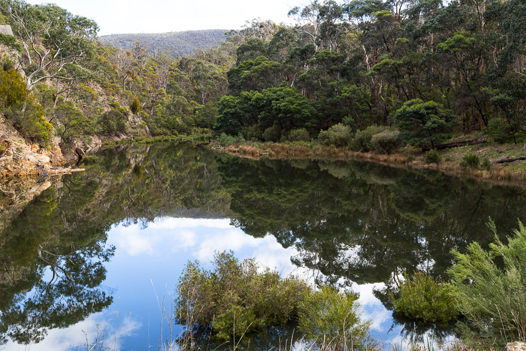
…and the river nearby was giving off some nice reflections.
I had a bit of a look around and just past the weir I spotted this clan…
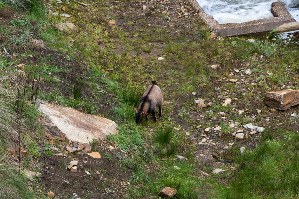
There was a large group of goats, all at varying ages, but as I tried to get closer, they took off up the hillside. It’s amazing how quickly they zipped up the steep embankment. They went up like, well, like goats.
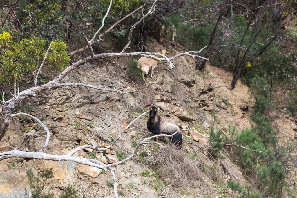
This is a nice spot if you can ignore the large, constructed weir, which was directly behind me in the next photo.
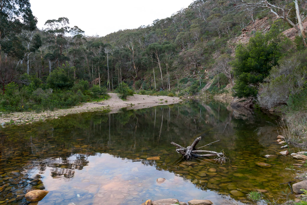
I now had to cross the river again and although it seemed to be fairly straightforward, I couldn’t really find a spot, which was guaranteed to keep my feet dry. I wandered downstream looking for a shallow area and this part looked pretty good…
Nice and shallow? Lots of rocks? Perfect.
So, I wandered across and guess what…?
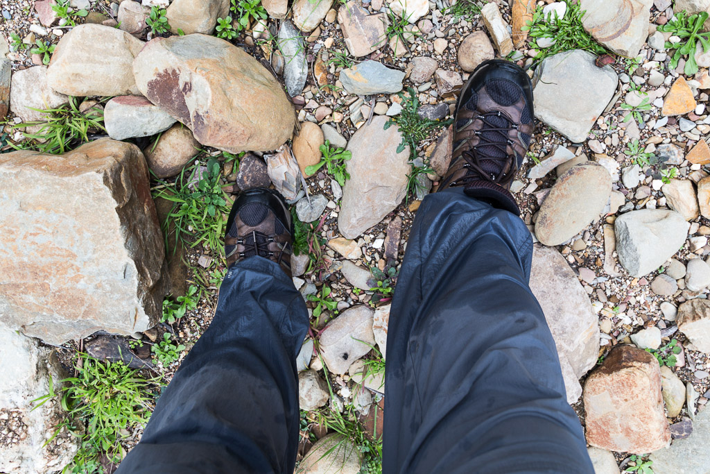
Well, it didn’t really go to plan, did it?
Yes, I know had boots full of water. Mind you, I was wearing a pair of Merrell’s boots, which weren’t too bad. A fair bit of water squelched out of them as I walked, which is a lot better than my leather boots. If I was wearing them, they’d still be drenched a week later.
Anyway, with wet boots, I now had to find the next uphill spur, which is called Long Point Track. Guess where I found it? Yep, the vertical thing I’d seen on my way down and in the photo earlier was the correct spur. Lovely.
I started slogging up and it’s not much fun…
Climbing Long Point Track
…until coming across a rocky outcrop. A lot of height is gained quickly and I was feeling slightly rooted, so I stopped for a breather. You know what? I didn’t realise 1967 was a busy year for UFO’s? I mean on the page in this magazine, there’s a clear photo of a UFO. Sure it either looks like something on the camera lens, or an amoeba, but I’m sure the photographer isn’t trying to stooge us.
Whilst contemplating the ’60’s, I did spend some time admiring the surroundings. There’s a good view from this outcrop and it’s surprising to see the weir so far away, so quickly. It seemed I’d only been there a little while ago. I guess it’s the result of a track, which embraces its verticalness in a short space of time?
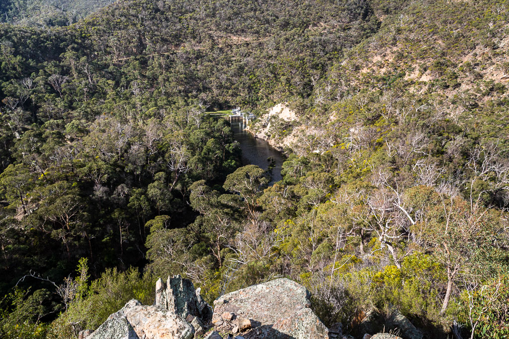
Lerderderg weir from Long Point Track
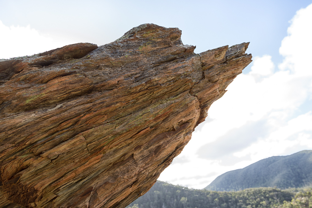
The rocks are interesting here as well. A jagged, rich orange colour is always photo-worthy.
The sign at the bottom gave a suggested time of one and a half hours to climb the 1.6 km Long Point Track. It seemed generous, but I was interested in how long it would take me. I took one last shot of the gorge below, as I moved off with the Lerderderg Tunnel Access Track, which I’d descended earlier, cutting across the hillside opposite…
Again, for this climb I took about five photos. They’re all rubbish and I think I only took them as an excuse to stop, in order to bring my breathing out of the red-zone. I really didn’t enjoy the climb and as it was only a few hours since my earlier ascent, my legs were slightly fried. I chipped away and from memory only swore once, which for me is pretty good going.
It did seem endless, but eventually I popped out onto level ground at Blackwood Ranges Track. I know what you’re dying to know though. How long did it take me to climb?? Well, how about one hour 25 minutes. Okay, I was talking up my speed earlier, but in the end, it was on target according to the sign.
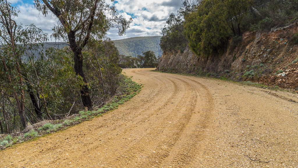
After a rough track, I was now on another highway. Blackwood Ranges Track undulates, but is pretty casual fare. It’s lined with trees, so there’s not a lot of views, but a decent puddle caught my eye and you know I never pass one without a picture.
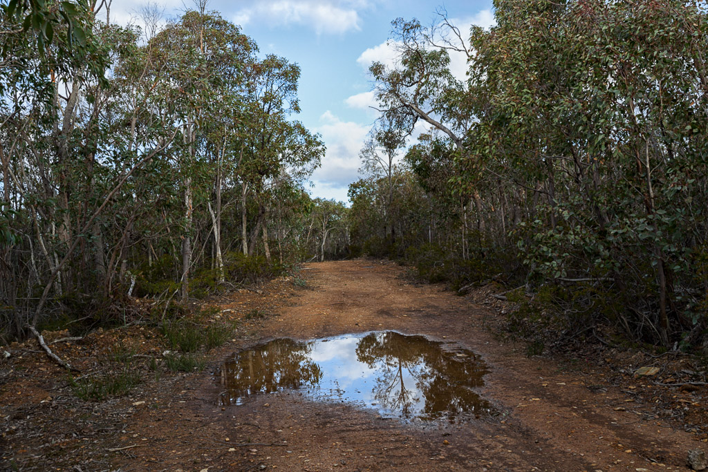
Blackwood Ranges Track
It was starting to get late in the day, but was now confident I’d nailed the walk and wouldn’t be finishing in the dark. I had good speed along this track and even had time to admire this sign, which appears to have been mounted under an atomic bomb test at some stage.
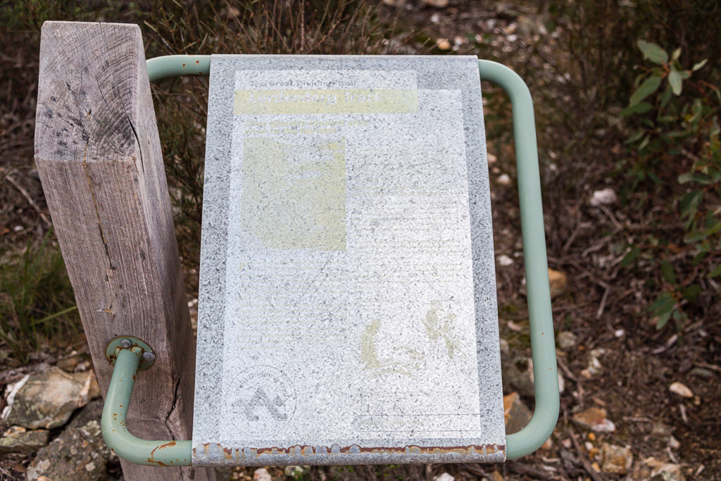
There’s a lot of interesting information on this sign.
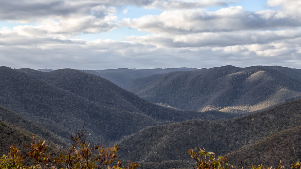
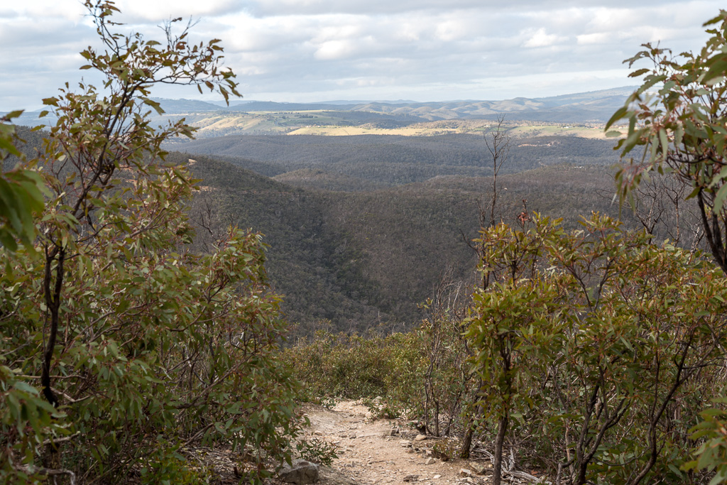
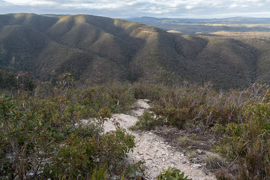
Powering on, I captured the gorge surrounds when there was a break in the trees…
…before reaching ‘Link Track No.1’ which you guessed it, would take me all the way back down to the river again. Actually, there wasn’t much chance of missing the turn-off…
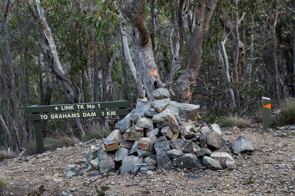
Is this Link Track No. 1 by any chance?
Okay, what can I say about this track. I knew it was a steep descent, but I didn’t expect the ground to just vanish as it plummeted down…
Heading down Link Track No 1.
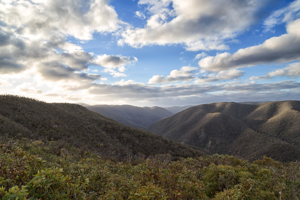
It’s really steep and traumatic for my knees, which are knackered at the best of times. In fact, my joints were totally smoked and found myself stopping more than on the ascent an hour earlier. At least the views are nice along here, whilst the sun was sinking in the sky.
The track is also loose, which put even more strain on my knees as I constantly had to brace each footstep…
Remember the, ‘only swearing once on Long Point Track ascent’? Well, I let rip down here. I was a walking tirade until suddenly I spotted this. What are these markings…?
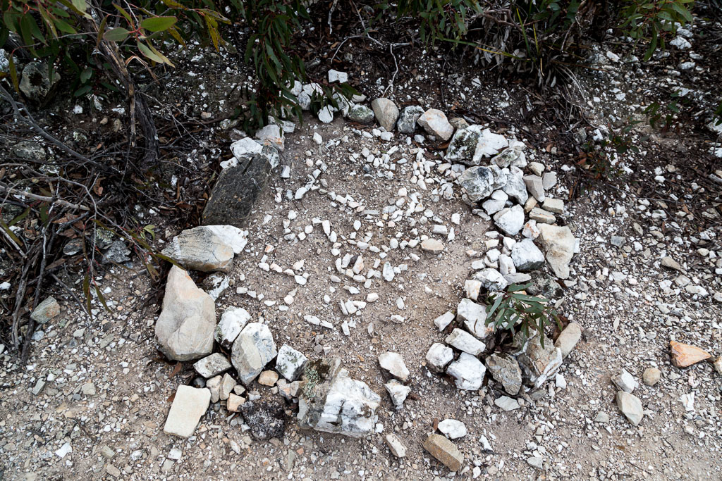
Is it the grave of one of the million people buried in Lerderderg Gorge? I wondered for a minute and then realised where I’d seen it before. I knew it. It was the goddamned language of space!
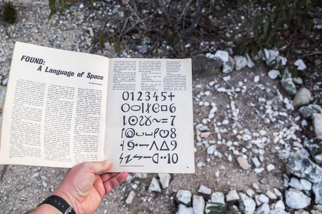
Phew. Amazing. 1967 was a busy year for UFO’s, but it’s got nothing on this place. In the end, I didn’t linger, as my ‘language find’ had me worried about being abducted by aliens. I didn’t even have my al-foil helmet for protection.
It was time to move on, as I captured this tree with his arms outstretched…
…before continuing to race down the spur, as fast as anyone whose knees were about to implode could go. Light was getting dim now, but eventually I popped out at Graham’s Dam (by the way. Who’s Graham?) on the river again. Photos were tricky now, so there’s not much to come. There were some nice reflections in the water though, which I couldn’t pass by…
You know what? Yes, I had to cross the river again and I really wanted another ‘Jesus photo’ from the middle of the water. There’s a lot of tricky balancing required when it’s almost dark and you really don’t want to fall over whilst carrying a DSLR…
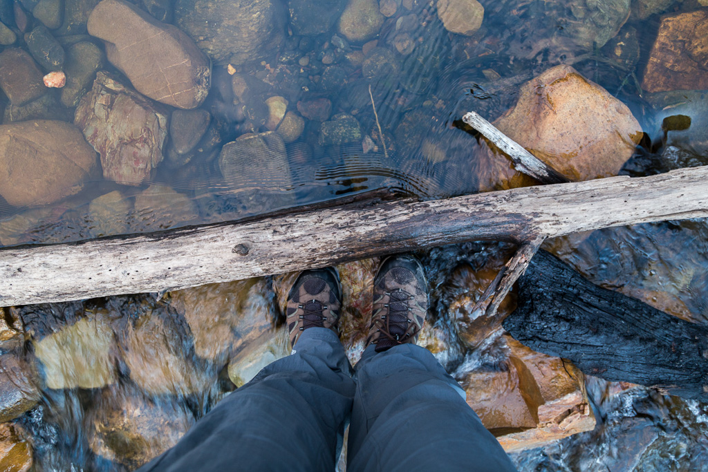
Balancing Act
I did get this photo though, but it wasn’t as great as I thought. I think all the effort in not falling over deserved something a bit better.
There was one more shot, as I headed up the embankment…
…and finally I was back at the car. Not a moment too soon, as light was more or less gone. Wow, what a roller-coaster of a day. How did I do? Well, the walk notes suggest six hours and I’d gone as fast as I could and still went over at six hours and thirty minutes. Is there a chance I’ll ever beat the suggested time on any of these walks.
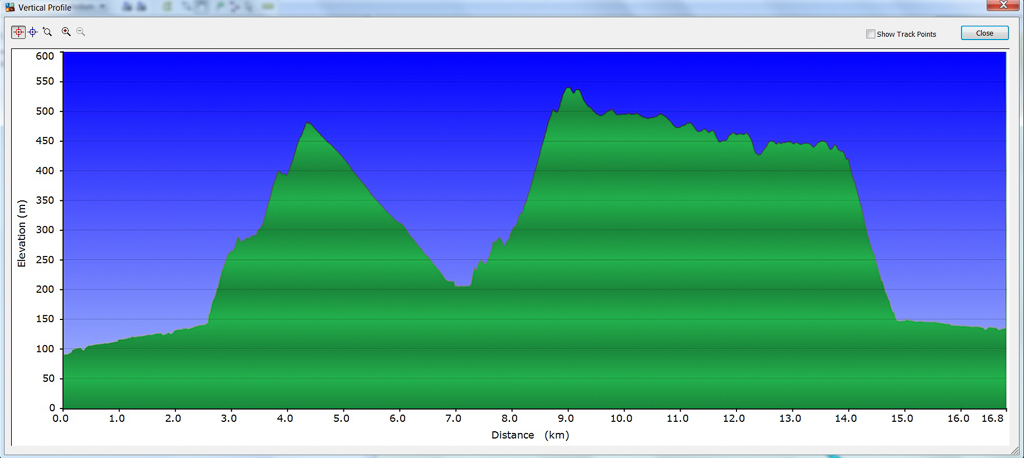
It was a painful sort of day as well. Looking at the GPS result, I can understand why it hurt. 16.79 km long, but the main problem was the lazy 888 metres of elevation climbed. Ouch. The GPS profile is quite wacky with its wild up and downs, concluding with the knee-snapping plummet down Link Track No.1.
Anyway, I’d finally got it done after a couple of attempts. Don’t laugh now though. I decided to tackle another Lerderderg Gorge walk, which was rated as ‘difficult’ in the notes. No problem, right? Sure, but I decided to hit it only a day after this one. I don’t want to give too much away, as it’s the next post. Remember. It’s the Lerderderg Gorge special!

I often consider the ease of hiding bodies in the bush. It makes you walk a bit faster.
Ah yes, that's an interesting thought! I often think I hear something behind me when walking. Footsteps etc. I think it's the result of growing up watching too many horror movies and reading crappy books, such as that UFO magazine!
Nice work Greg. Its one hell of a walk around the scenic rim, and only 15 mins up the road too!
Just near the dam, if you head downstream around 300 – 400 meters, there is one of the best campsites on the right hand bank that I've ever come across. Spent a night there last summer, and in my opinion, is the best way to do the scenic rim. Nice swimming hole there too.
Also, very suprised to see those rocks still in place on Link Spur 1. They were put there on rememberence day last November, when I did a quick circuit there up Link Spur 1 and down Link Spur 2. Alas.. no aliens I'm afraid. 😉
Thanks Ryan. I did read your post about the camp site. You definitely had the right idea by making it a two dayer. So much more relaxing that way! I'll keep that in mind when the weather begins to warm up.
Oh, now I know what those rocks are! 'Lest We Forget'! They're just a jumble now and there I was thinking I'd come across a new language from space 🙂
I did think of doing the shorter version including Link Spur 2, but the water is a bit high right now. Might look at it again in the dry season.
I went back to Lerderderg a couple of days after this one to do a walk down to the Ah Kow ruins. River definitely was active enough to keep me soaked for a fair bit of the time. That's the next post!
Ahhh, the Ahh Kow track is apparently a nightmare. I'm planning to go down that at some point soon, and up Bears Head. Or up from Mckenzies via the Spur Track and the weir to the camp below Beard Head, and back via the ranges.
Not sure yet. My winter appetite has put me out of action for a bit, gotta get back to the gym!
Not sure about Aliens and bodies in Lerderderg, but I know that there are some large creatures that like to run through campsites on the river at night. Was woken up at the weir by something running through the campsite. Thought it was going to run over the tent!!
Yes, I came up Ah Kow and initially it sucked! Steep and slippery, but I was surprised how quickly it became acceptable! As a comparison, I found Long Point Track harder, but maybe that's because I'd only done Spur Track an hour before? Not sure, as I'm still reflecting on the walk before making my mind up to what it was like! The river made life tricky. I wouldn't want the water much higher, as I had to cross quite a few times.
Yes, Beard Head is the next on my list. Apparently that's a nasty climb as well. I'm resigned to the fact all the climbs in Lerderderg Gorge are nasty 🙂
I might even contemplate my own walk in there somewhere and make it an overnighter as well. I might wait until it's a bit milder though. Freezing in there on Saturday, but I guess it kept everyone away, as I saw no one for the day!
I think what made Long Point hard is that the fun part at the start with all the scrambling was over real fast, then it was that long gradual boring uphill that never seemed to end. By the time I went over the side of that last knoll before you drop down into the small saddle then saw that there was one more climb, I dropped more than a few F bombs.
The downside to less water is that snakes love to bask on the rocks. If I were to walk along the river when its dry, I'd only do it with a decent pair of thick canvas gaiters, and a PLB. My last time on the river, I came about 2 milliseconds away from being bitten by a red belly black that I startled. Not sure what was worse, me screaming like a girl, or the fact I didn't bring a change of pants!
Yes, you're right. The never ending aspect of Long Point was the annoying part. Actually, Spur Track was a bit the same!
A good point about summer and snakes. Come to think of it, I prefer it when it's colder and there's water flowing. Walking next to the river through patches of thick grass made me think about snakes, so gaiters would be a good idea. I had something similar in Werribee Gorge in summer next to the river. Nearly stepped on a snake and it scared the crap out of me when it suddenly moved a foot or so ahead of me! I knew there was a reason I liked winter walking so much better 🙂
Great series of the beautiful pictures! nice post written very well……
I think this is my favorite hike you've done…really stunning area!
Cheers! Thanks for the comment.
Hi Samantha. I'm not sure if it's my favourite hike! Harder than I thought it would be. It's really close to Melbourne, so it's deceptive that way. I think it looks better when the river has water in it. I've seen photos in summer and it's a pretty dry, grim affair 🙂
Ah, so that's the route. We went up there once and thought we had to re-cross the river after Graham's Dam. The path seemed to run out so this idea had some merit. Unfortunately after a week of good rain the river wasn't looking very inviting further up so we threw in the towel.
Thanks Greg : )
Man, I envy the range of walking you have to choose from so close to home. But yeah, what was that Harbinger of Doom bloke on about? I've met those types before. On one day on the Appalachian Trail I once encountered two different old codgers who had set up semi-permanent camps in shelters because there was a little light rain and "I don't hike in the rain." And they said it like venturing out meant certain doom…
If you look at my first GPS route I stayed on the left heading upstream and came to a cliff, which left me scratching my head. I backtracked and crossed near the dam. I learnt my lesson the second time! Cross at Graham's Dam and re-cross about ten feet later and you're on your way.
Yes, I think at this time of the year, prepare to get a little damp 🙂
Goat, it's such a bizarre area. One minute you're in a rugged gorge and the feeling is complete isolation. Walk a few more kilometres and there's what looks like a housing estate nearby 🙂 I'm not sure how to describe the place, but as a genre, I'd label it 'grim'. It's all rough and tumble stuff, but the masochist in me hopes to get back there soon! Pity the days are still short, otherwise I'd sneak up there after work. Maybe in a few months I'll try that.
Yeah, that old bloke looked like he'd been around, so I was a little surprised to see how pissweak the river crossing was! Those AT blokes? I wonder how they came about wanting to hike as a hobby if they're were scared of light rain?! You know what? I'd love to do one of those walks in the States, as it sounds like there are lots of freaks to meet. We're severely lacking those freaks down here in bush 🙂
I finally got around to doing this hike, loved your write up of it lol did whiskey Creek last week and hoping to do Bears Head soon which you did a write up on ? love reading your blog, thank you
Thanks! I seem to remember this hike had big hills and steep descents. That’s about all I can remember! Bears Head is fun. Sort of 🙂