If you’ve never gone hiking before and are interested in starting, then I suggest you give this post a miss. Really, at the end of days like this, one can quite happily consider selling all their gear and retreating to the comfort of a couch. It was ten hours of ‘fun’, which didn’t know how to just end and put me out of my misery.
Where did it go wrong? It’s a little hard to write up, as online stories require brevity and this saga could really be an entire chapter of woe in a book. Anyway, I’ll aim for the main bits. Oh, just to rub it in, there aren’t a lot of photos to pad the post out either. Constantly being wet was taking a toll on the camera, so it spent a lot of time in the pack, in a fruitless attempt to dry it.
Anyway, best I start at the beginning. Wingan Inlet campsite. If there was anything standard about the trip so far, it was rain. Again, it poured for hours on end overnight and I woke to drenched surroundings. I must say, I did remain dry in my bivy, so I can confidently agree to the marketing, which says it’s waterproof. Thank god. Oh, condensation in a bivy can be a problem, but with a bit of trial and error over the trip, I’d mastered how much I could leave it unzipped and still stay dry from the constant deluge above.
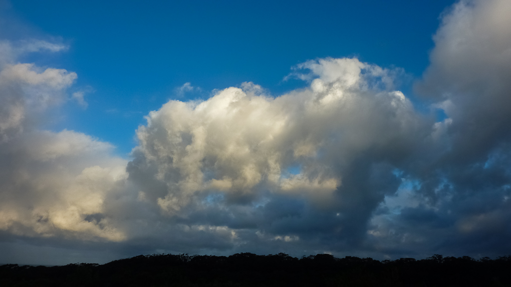
In the morning, the rain had broken up into the occasional heavy shower. In between these soakings, a blue sky beckoned and brought with it welcome interludes of the weak, winter sun. Standing under its rays didn’t bring any warmth though, as a strong wind carried an icy chill.
So, it was a cold start and was only going to get colder, as the first task for the day was to cross Wingan Inlet. Before starting the hike, I checked the tide times for this particular day and rolled my eyes when I found low tide was in the early afternoon. With the short day in winter, I couldn’t hang around to do the crossing, so I was prepared for a high tide saunter through the ocean or river.
That was also a problem, as I had no idea what the crossing looked like. During my pre-trip liaising with Parks Victoria, all they could tell me is, ‘you’ll be getting wet’. Okay, no problem, but I was keen to at least see a photo of the inlet, but do you think I could find one? As I’ve found with a few Australian walks, there’s absolutely nothing online.
Anyway, all I knew is there were two crossing options. Firstly, at the mouth to the ocean, which is shorter or go for a longer attempt, further in the inlet. These are tide dependant though, so I didn’t have a clue which option I’d take until I actually saw the crossing points.
Packing up, I made sure everything within the pack was within its appropriate dry bag. The most important thing I checked and rechecked was the sleeping bag, which was compressed into its own waterproof bag. Instead of its usual position low in the pack, I placed it in the centre, amongst another million dry bags. Oh, there are no pre-crossing photos either, as the camera was tucked away. I’m sorry you’ve got no pictures, but sometimes you can’t have it all.
Before setting off, I did have one sneaky plan up my sleeve. The two fishermen who I’d spoken to the previous evening. They had a boat, so how about I throw them $20 or so for a crossing to save me getting wet? I was hoping money would talk and it was looking promising when one of them dropped by to say hello.
After some probing questions, he told me they were leaving, as they weren’t impressed with the weather. They were under the impression it was going to be fine, so I asked him whether he got this impression from the weather bureau or the dodgy French fisherman I’d met the previous day. He had no idea what I was talking about, which is unusual.
I thought this was a perfect opportunity, so I said, “How about I give you some money to take me across the inlet?” The reply was something similar to, “Hope your hike goes okay. Good luck with it!” Um… Did he even answer my question? Essentially, I think he was saying ‘bad luck’. My conclusion was I’d make a crap salesman.
As he wandered off, I resigned myself to impending dampness. I headed off and psyched myself to just get the crossing over and done with. I backtracked to Fly Cove, but this time continued walking up to the end of beach where Wingan Inlet reached the sea.
The wind was gusting strongly, bringing with it the occasional heavy shower. The only bonus was the showers were brief, as they were being propelled across the sky in the breezy conditions.
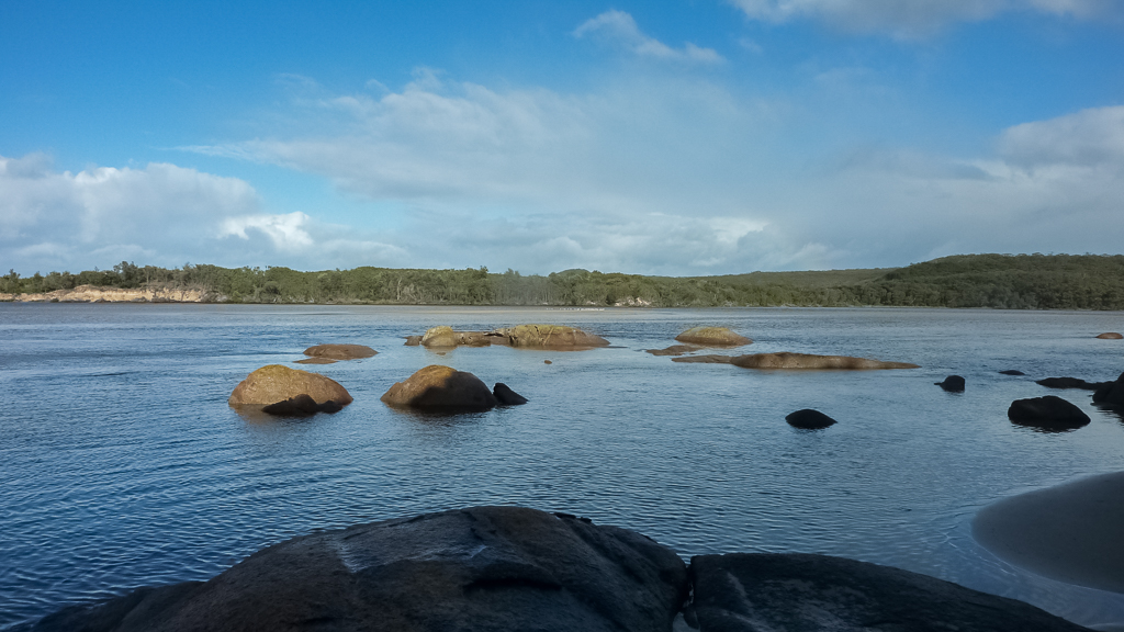
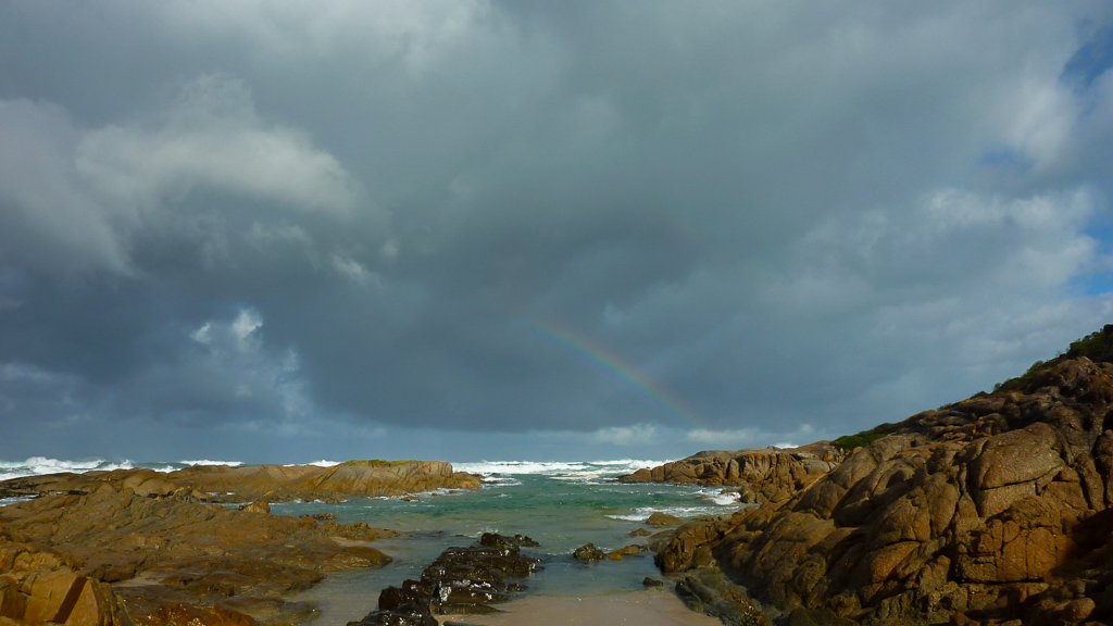
I reached the inlet and immediately had a jaw dropping moment. It was nothing like what I’d imagined in my head (based on nothing more than guesswork). I immediately saw my two options.
The opening to the sea was really short, with the opposite bank being no more than ten metres away, but the water was deep and moving quickly. I spent some time observing and the problem is too many scenarios went through my mind. What happens if I stuff up? What if I get dragged out into the ocean? I was going to cross in boxer shorts only, so what happens if I lose my pack? Do I just walk into Mallacoota in my jocks and just tell everyone I’m a German hiker? But without my pack, would they believe me? I can’t even speak German. Is that a problem?
This was a tricky scenario for sure, so I moved to my next option. I could see a track marker on the other side of the inlet, which is an aiming point for crossing away from the ocean entrance. What made me scratch my head though, was it appeared to be a million miles away, across a vast expanse of water. The only bonus I could see, was the water was calm. Um… That’s about it, as there were certainly some deep parts. An initial deep section, which led to a sandbar in the middle, then dropping again, before reaching the other side.
How was I going to do this? Well, I decided to go for the long approach. I’d initially planned to cross first without a pack to see how I went and then return to collect my things. Well, that idea went out the window. It was bloody freezing, so I elected to do one crossing only. I’d wear my pack with waist/chest strap undone and carry my boots and clothes in a garbage bag. If I dropped anything, at least I’d be able to retrieve it easily, unlike the ocean entrance.
I stripped off my gear and found that standing around in boxer shorts on a beach in winter is officially chilly. I reckon I dithered in fear for about five minutes, contemplating worst case scenarios, before the survivalist part of my brain told me to get going due to two things. One, I was dicing with hypothermia by standing around almost nude and secondly, it had been a while, so there was an opportunity to have a wash.
So, in I went and the water was quite ‘bracing’. Any bloke will tell you the most difficult part of entering cold water is when the water hits the nuts. This was no different and as I moved forward into deeper water, I suddenly sounded like I’d inhaled a dirigible of helium. “Keep moving!” was my thought as the water got deeper and deeper. Okay, it’s now above my waist. Right, now it’s up to my chest. Hang on? Now, it’s just under my chin. “Jump you bastard!” I was saying to myself, as I did a series of tip-toe jumps in the water to keep my head above the surface.
Finally I felt the water getting a little shallower, as I reached the sandbar in the middle. As my teeth chattered, I pondered how much fun I was having. All I wanted to do was reach the other side in the shortest possible time, so I entered the deeper water again. Thankfully it was a shorter distance than the start, but I was still resorting to the extreme tip-toe method. A quick clamber around some rocks and I’d reached my destination. I let out a high-pitched, “yeehaa” upon making it. Reflections? All I can say is it’s lucky I’m tall. If you look like Tom Thumb, well, you’ll be swimming. Mind you, if it’s low tide, then I’m sure it’s a whole new world.
Wingan Inlet crossing
Reaching the other side had one bonus for you. I could get the camera out again. There’s been a lot of writing so far, which hopefully hasn’t put you into a coma. This was my pre-DSLR era and all of the photos for this trip were on a Panasonic Lumix compact. Firing it up, I zoomed in on the outcrop called the Skerries. I could see masses of seals lounging around on the rocks.
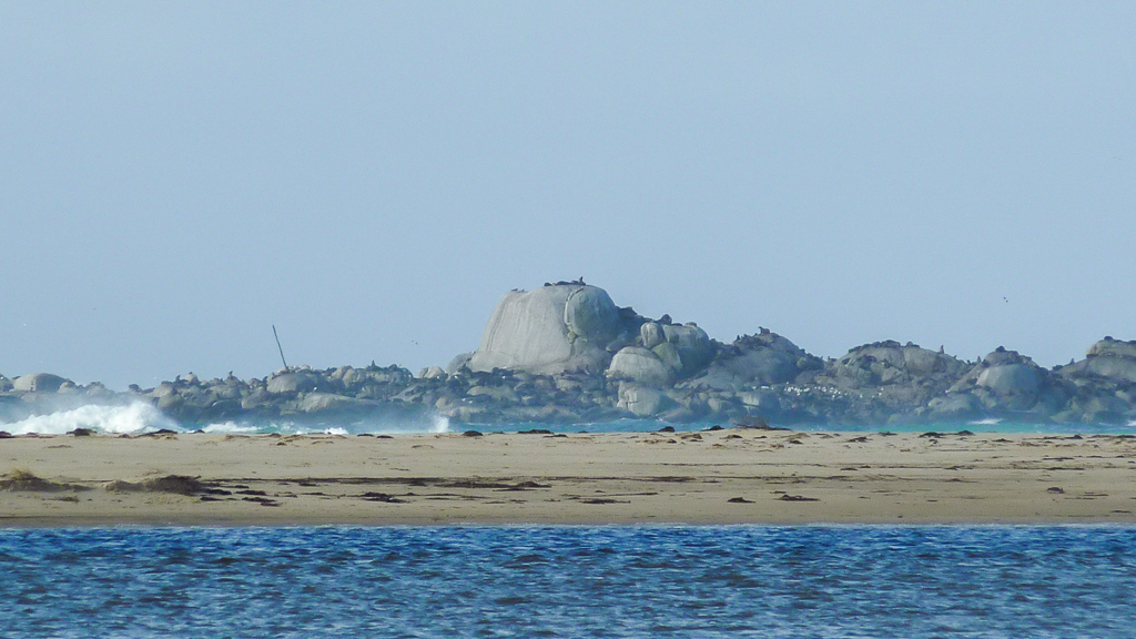
Seals on the Skerries – Croajingolong National Park
I also took some photos of the crossing. Where I started was on the beach in the distance.
Another spot, which I’d looked at, but didn’t really bother with, was directly opposite the river. At least where I started was on a beach. Across the inlet, I would have had to bush bash to get to it.
As I began to get dressed, a shower came through, so I gave up trying to towel myself dry and just threw my clothes on. The garbage bag system worked well and I don’t think I would have done it any differently. At one point, I considered holding my pack above my head, but that would been tricky once the water was hitting my chin. Oh well, the crossing was done!
Once dressed I headed off, following Easby Track, which was a short inland walk. The trees formed a tunnel through here, which looked quite nice.
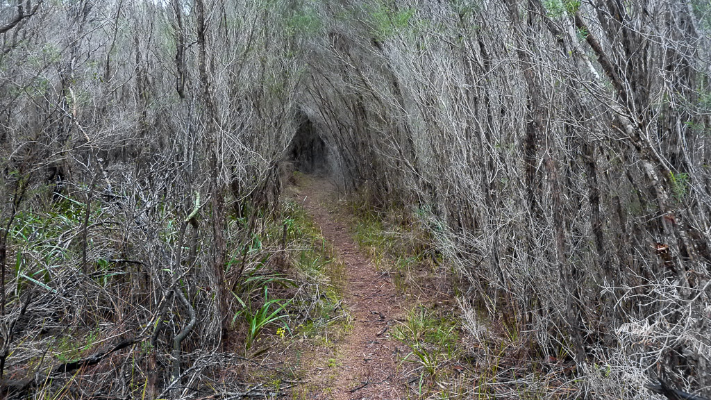
Easby Track
This led back to the beach with my next target for the day being the Red River Track. Easby Creek was nearby, but I had nothing to worry about, as it was only ankle deep across the beach.
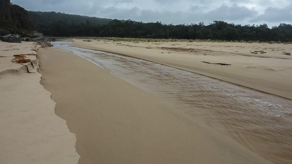
Easby Creek
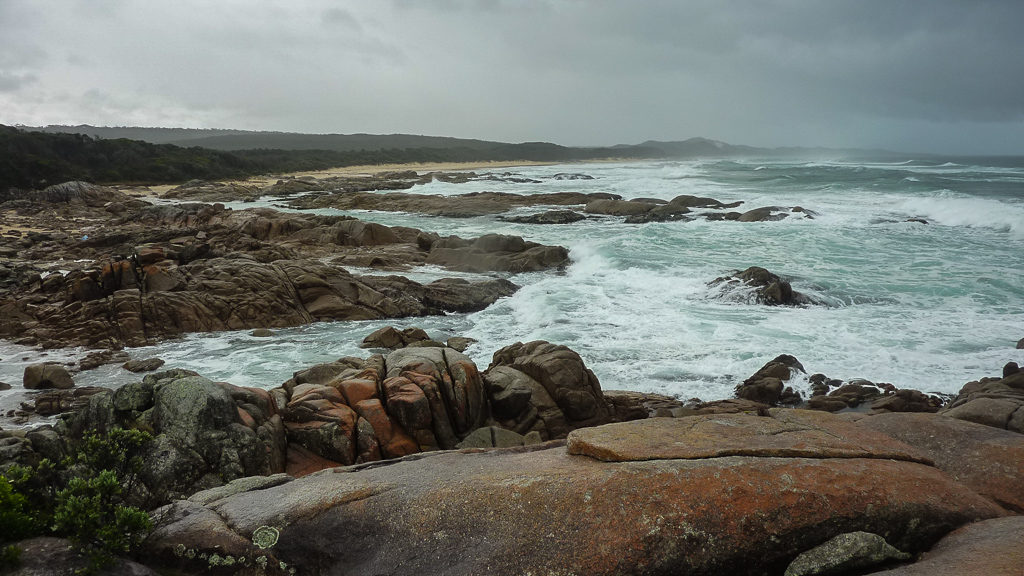
Although it was mainly beach walking to Red River, there were the odd rocky sections to negotiate. They weren’t a problem, other than slowing me down, as I found it really time consuming with a pack on. I’m not sure if there’s much difference between low and high tide, but as the next photo shows, I was confronted with a number of small gullies. The water would rush in and out, so in order to stay dry, I’d have to time my dashes as the water ebbed.
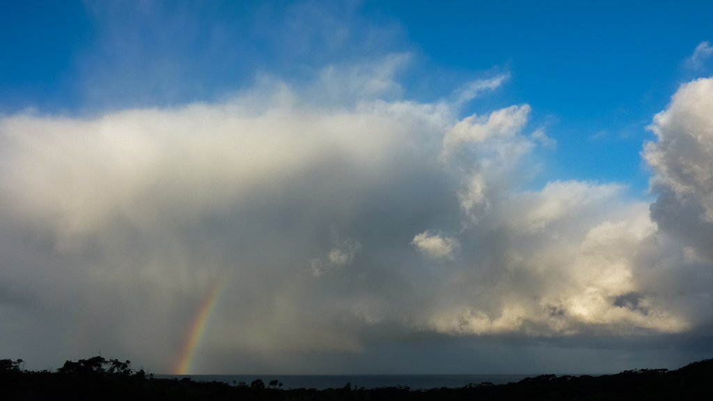
The weather wasn’t too bad, but the odd heavy shower meant I was walking with my rain jacket and overpants on the entire time. Now and again, during breaks in the rain, the sun would shine and a ubiquitous rainbow would appear.
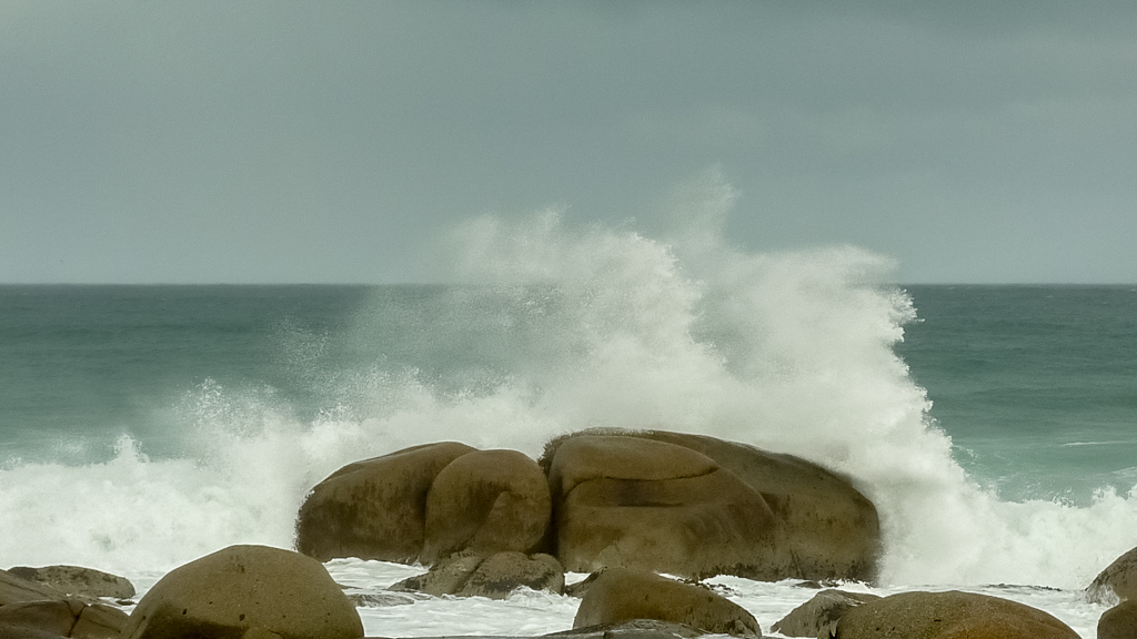
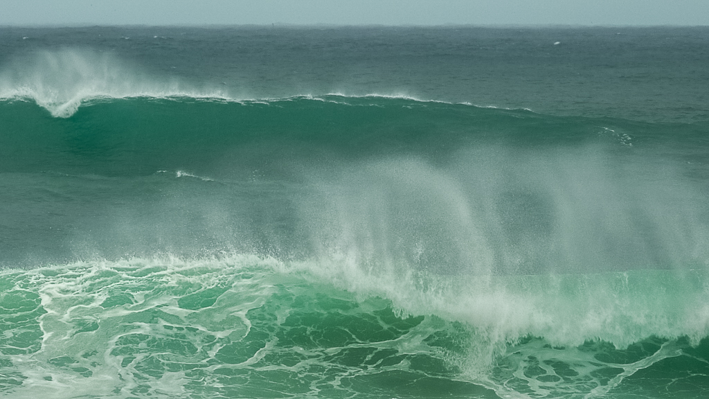
The sea was still quite rough and substantial waves would break on the rocks around me.
Strolling on, I eventually found the Red River Track. During my conversations with Parks Victoria before the walk, I was advised the tracks in the Sandpatch Wilderness Area were no longer maintained, so I wasn’t sure what to expect. It wasn’t too bad though, as although the Red River Track was overgrown, I could still find my way quite clearly. Initially, it rises and there are some nice views of Red River leading back to the ocean.
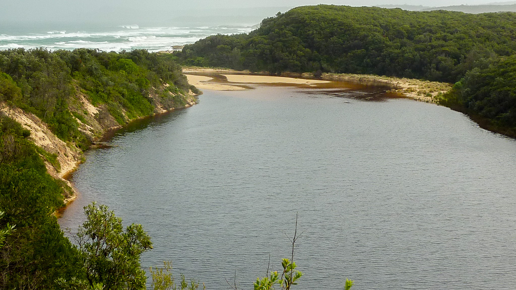
Red River
The topographic maps on my GPS were accurate in identifying the unmaintained tracks, as I climbed up past Red River camp. I continued on this muddy path, until finding the Sandpatch Track turn-off. The only annoying thing was this particular section was taking longer than I’d anticipated and it appeared to be further in distance from what my track notes indicated. Oh no! Is this correct? The distances are no longer in my favour? In fact they’re the opposite!
The Sandpatch Track left the forest behind and entered a section of long grass. The constant rain had waterlogged the path, as I sloshed my way onwards.
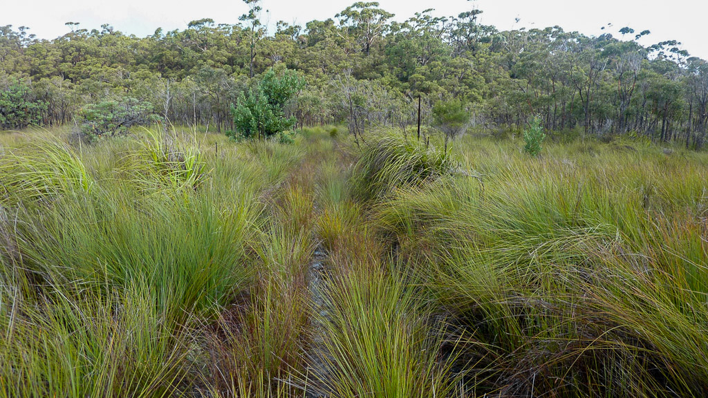
Sandpatch Track
My aim was Sandpatch Point, which was listed as a recommended camp site, although not in high seas. It was getting late in the day now, so I tried to move as fast as I could.
During this inland wander, I began to have problems with my camera. The autofocus was no longer working properly and I suspected a week of rain was starting to take its toll. I didn’t really have time to check it out properly, as I was keen to make camp before the light faded.
I finally left the bush behind and reached the beach at Sandpatch Point. The tide seemed quite high though, so I didn’t even consider it as a camping spot. In fact, the high tide mark appeared to cover most of the areas where one could camp.
I had an option though, as the notes mentioned another spot a bit further along. A sheltered area behind the sand dunes next to Benedore River. It was another half hour walk though and this where things started to unravel.
It was getting late, I was a bit tired and I was trying to keep moving as quickly as I could. You just know where this is going, don’t you? Between Sandpatch Point and Benedore River, there’s a rock section before rejoining the beach. Due to the tide, the rocks were a lot trickier than any I’d faced on the hike so far. The water was high, so I was forced up against a cliff to continue on. This of course meant I was quite high off the ground, as I kept searching for some height away from the oncoming waves.
I reached spots where the only way forward was by crawling under thick tea-tree, as the rocks below were impassable. Judging by the marks on the surface, I wasn’t the first hiker to have used this technique.
I successfully crawled a fairly long section and then found a spot where I could get back down to the rocks again. I was in two minds though. Sticking to the cliffs was a simple, dry option, but it was slow going, as most of the time I had to crouch or crawl through the bush, which made a habit of pulling on my pack every step.
There was another option though, which would be a bit dicey, but if I could pull it off, it would be twice as fast. Go back down to the rocks and brave the numerous gullies, where water would come rushing in with some force and the only chance of moving forward was to make a dash before the next wave appeared. Guess what I did? It was late and light was fading fast. I needed to get moving, so I opted for the rocks approach. Edging my way down, I now had to do some concentrating.
Having done many a similar dash on the hike so far, I guess it was inevitable I’d come a cropper eventually. I reached a spot, which was a bit wider than the sprints I’d done before. This one took some timing, if I didn’t want to get wet between oncoming waves. I watched for minute or two and then began my dash as the water receded. Unfortunately for me, my dash may have been the world’s slowest sprint.
I thought I’d successfully made it, until I stepped on an angled, wet rock as waves came rushing in. The angled rock had done me in and the show was over. I lost balance and fell backwards, my left leg pointed towards the sky and arms generally doing nothing other than waving around. Not the ideal position for a recovery, as I landed backwards into the onrushing water. Yes, with pack on.
I felt the joy of being totally underwater. Ten seconds prior, I was worried about getting my feet wet, so whilst submerged I pondered that previous thought as being a bit silly. As the wave rushed out, I struggled to my feet in swirling white water to be met by the next wave coming in, which was over waist high and I was knocked off my feet again.
By now I was feeling slightly dazed (and damp), but aware enough to observe my walking poles disappear into the water, along with a nice pair of $50 sunglasses. They were all dragged into a small rock pool and before being dragged out to Tasmania I had to make a decision to save something. Walking poles or sunglasses? Well, the poles won and I managed to get them one at a time, whilst the sunglasses were dragged under a wave and never resurfaced.
I stumbled to the safety of a rock, now feeling 100% drenched to the bone and slightly brain rattled. I was lucky to always secure my GPS and Personal Locater Beacon (PLB) to my chest strap with care, as I’m paranoid about losing them. They were still there and now I urgently wanted to clear the rocks and get to camp, but the stupidity wasn’t over just yet.
Considering what had happened, I didn’t think I could risk another drowning, so I made my way to the top of the cliffs again. I was shivering from my soaking, but I returned to crawling and bashing through tea-tree until I reached a point where it was no longer passable.
I’d run into thick scrub on the cliff and I was now quite high from the rocks below. In the dim light, I was frozen and sore, so I was worried that a wrong move could lead to a fall. I had no other option, other than to head back down again. The trouble was the only route I found was a near vertical drop with a mud embankment to get down.
It was about ten metres to the rocks and I worked out a way I could get down. It was a steep descent though and I felt I needed all of my balance to get down safely. I didn’t think I could achieve this whilst wearing my heavy pack, so I had an idea to lower it down in stages.
I spotted a ledge with an overhanging tree a few metres below me, which I thought I could lower my pack to. If I could do that, I could then slide down to rejoin it, before continuing to ease it down to the rocks. At the time it seemed a doable plan, so with its heavy mass in one hand, I stretched down as far as I could and then released it. The pack slowly slid down as I intended, but upon stopping tipped over. Its momentum hit the small tree, which bizarrely acted as a catapult. I couldn’t believe what I was seeing, as the pack lifted into the air. My last sight was its blue shape tumbling gracefully through the air towards the rocks ten metres below. I could no longer see it, but I quite clearly heard an uncomfortable sounding thud.
I was now officially about to have a mental meltdown, as I thought about the packs condition. For no apparent reason other than frustration, I decided to hurl my hiking poles to the rocks as well, which resulted in quite a loud clank. It’s an audible delight if you go hiking with me.
Now I had to get down and check out the damage. The only safe way I found was to slide down the embankment on my bum, past the pack tossing tree and then continue the same technique all the way down to the rocks on another muddy slope.
I made it in one constantly profanity exclaiming piece and approached the pack with some apprehension. Unbelievably it was looking pretty good. It may have been a little out of shape, but after pushing it around a little it seemed to be fine. Full marks to the One Planet Strezlecki, as it survived quite a tumble with no visible cuts or bruises. Even my trekking poles were okay, which was an added bonus.
Is the pain over now? Almost. There was no more physical agony, but there some mental anguish left before the day was done. I covered the last of the rocks and finally made it back onto the beach. I had to stop to re-group and make sure my brain was in one piece. I looked at the topographic map on the GPS and it informed me that I was in Canberra. Huh?!
Okay, I was completely frazzled, but still aware enough to know I wasn’t 600 kilometres away in Canberra. I turned it off and back on to reveal Canberra was still the place to be. I did a quick bit of dismantling, by removing the batteries and memory card, before putting it all back together to find I was still in the nations capital.
Suddenly, the low wattage light bulb in my brain flickered into life and I worked out what might be wrong. I pressed the zoom buttons on the GPS, which revealed I was actually in the right location, but it was reading the map as if I was 200 kilometres above the spot I was in, instead of 200 metres. I guess the ocean swim had shaken it up.
Next, I checked my camera, as I had a feeling dunking it in salt water might not be ideal. It was already starting to play up, so apprehensively I removed it from its now soaking wet case and switched it on. It briefly made a sound like a groaning wild animal, before falling into silence. It was officially dead.
Besides freezing, I was now officially pissed off, but I still hadn’t got to the camp. With the wind blowing, I couldn’t stop shivering and I legged it quickly to the outlet across the beach of Benedore River. My notes had suggested a camp site was next to the river behind some sand dunes. I found a spot out of the wind, but I’ve no idea if I was in the right location.
As I was setting up, it was more or less dark. I was feeling pretty hungry as well, so I quickly heated some food, whilst noting my cooking pot was a nice oval shape instead of being round. It obviously didn’t take the ten metre pack fall too well. I pushed it into some sort of roundness and went to bed, still shivering. I guess I was lucky all the dry bags in my pack had done their job.
I went to bed wearing everything I had to try and warm up, but I spent the night shivering and thinking to myself how at times, hiking can be a crap way to spend the holidays. Was it the worst day of my hiking life? Just about. The only positive I could think of was I didn’t drown. That’s about it. In the end, the theme of the day was to stay wet, as it started and ended in the same way.
After the Wingan Inlet swim, it’d been a hard slog over the next 15 km to my camp behind the dunes at Benedore River, Sandpatch Wilderness Area.
I may have been shivering, but it was still nice to lie back in my cocoon of a bivy and put on the iPod. I listened to the ‘Flight of the Conchords’ soundtrack to try and put me in the mood for a laugh. What a day…

Beautiful place, amazing photos Greg!
Thanks Ben! Back for more next year maybe 🙂
Great story. Big day. Well done. Loved the photography. I was googling for some images of Wingan Inlet and the seals on the skerries and came across this but enjoyed the read. Thankyou
Hey there. Thanks for the comment to this post which seems to have been neglected in the online world! It's a pity as this was one of my hardest hiking days mentally I'd done! Too much went on in this day for sure.
I really hoped to get a close up of the seals on the Skerries, but I had to have my camera packed away for the Inlet crossing, so that stuffed me up in that regard. They really were visible from the beach before I crossed the inlet. Oh well.
Sorry for the slow reply, but I've been away the last couple of weeks!
This walk must rank as a serious contender for the Bearz Greggz adventure…i could feel your pain 😉 But the trade off are some breathtaking photos. Love the Big surf, Easby track and rainbows.
Hi Ivy, thanks for dropping by my older posts. You're a bloggers dream!
This particular day is easily the most brutal day of walking I can remember! I guess being on my own with so many stupid things going on made it more intense. I needed someone with me to share the pain with!
This entire hike is easily my most unforgettable. The weather, the struggle with heavy pack on soft sand and the bizarre things that went on make this a one off. I could never replicate this hike!
Thanks regarding the photos. In those days I just carried a compact camera. If I had my DSLR back then I would have come back with some incredible shots. As long as I didn't drown it!
Well your posts are currently my preferred bedtime reading…vs 50 shades of grey that's such a chore to read just to figure what the fuss is about. Sorry…but your pain is more appealing 😉
50 Shades? You're probably better off with my '50 Shades of Che' post?! I'm glad my pain has an appealing aspect! 🙂
good description of wingan inlet. parks Vic tracknotes mention a boat may be required but this blog gives u a sense of the crossing without a boat! sounds like you had a rough trip but you're right those are the most memorable escapades! Congrats on pitting urself against the elements and getting through it! R
Mm… If I can get across at high tide in winter, then I reckon anyone can get over without being swept out to sea! I never factored needing a boat at Wingan Inlet. Lucky, as it would have been something else to worry about in the planning stage!
The hike was fine until the non-stop rain, but even then I was going okay. It was this particular day, which took the cake. So much was going on. I was spent by the end of it and went to bed never wanting to hike ever again! Even now, I find it hard to believe I went to the Walls and Overland only a week after this hike. I was a glutton for punishment back then!
Thanks for dropping by and taking the time to comment! Always appreciated.
“I was spent by the end of it and went to bed never wanting to hike ever again!” How often have you said that, Greg? 🙂
I thoroughly enjoyed reading about your punishing walk from the comfort of my armchair. Yes, you are a glutton for punishment. I admire your tenacity though!
The pictures are gorgeous. Sorry that the camera died though. That probably would have upset me the most, as well as nearly drowning of course… 🙂
If I think about it, I’ve said the same words a few times! Cape Liptrap, Wilsons Prom etc 🙂
In my current unhealthy, unfit state, I find it hard I even did this hike, as it was quite arduous, just with pack weight alone. Oh well, this year has been a hiking fizzer, so there’s always next year to look forward to 🙂
Yeah, that was a bummer, as that camera was my trusty Panasonic Lumix TZ-7, which I used to carry everywhere and on many a walk. It served me well and it was a shame to drown it. Better it than me drowning though I guess 🙂
Sounds like quite the experience! I’ve really been enjoying these entries, you paint the picture vividly. Hope you’re doing well and looking forward to the next Fortress installment 😉
This post was a blast from the past! Hands down, it’s one of my most arduous days walking. I can still feel the trauma after all these years. Oh yeah, the Fortress! I must get around to that. Actually, I must get around to blogging full stop!
Wow Greg, I know the area. I lived in Orbost for a while. Winghan is known for its tics, hope you didn’t get bitten, some people have been bitten unknowingly and over the years their health has declined for “unknown reasons”. Happened to me.
I must say, I had no problems with ticks for this entire hike. A few years later I did the stretch from Mallacoota to Wonbyn and was besieged by ticks! I guess I was just lucky on this occasion.