Things move slowly in this place, as here’s a post I’ve been intending to write for about two years. Between Daylesford and Castlemaine, this walk along Tarilta Creek, Upper Loddon State Forest has been a favourite since I first wandered it in 2014.
In the last entry I mentioned I was going to finish writing up the Fortress Circuit. As is the way though, I’ve changed my mind. I’ll get around to it, but it’s always a bit of a burden when absolutely nothing happened on both the days after the initial slog on day one. The Fortress Circuit was all action at the start, but it petered out near the end, so that saps the writing mojo.
Anyway, before I get into this one, some background information is required. When I first ventured to Tarilta Creek, I followed the walk notes from the Glenn Tempest book, ‘Victoria’s Goldfield Walks’. It was late December and the creek was a sun-baked affair. Actually, I remember two things from that day. Firstly, it was stinking hot and secondly, I was walking through knee-high grass and as I stepped over a rather large, misshapen, fallen tree, I spied a huge snake underneath it. I quickly backtracked and took a photo. Unfortunately, it’s completely out of focus. I blame the failure of my camera skills on a rather rare sport from the Middle Ages. ‘Filling thine hosen with crapola”.
Mm… What else? Besides those ‘standouts’ a leisurely day was to be had. Most of the walk is off-track, but with large, grassy flats it’s an easy wander. Sure, the creek needs to be crossed numerous times, but in all my visits there’s barely being a puddle in it, let alone flowing water. This all sounds quite good, but I actually missed the boat by a few years. My first visit was after a fire in March 2012. The blaze occurred a few days before heavy rain, which then washed silt and top soil from the steep, surrounding slopes, before depositing them in the creek itself.
Oh, should I mention one important fact regarding the fire? It was started by the Department of Sustainability and Environment (DSE) as a fuel reduction burn. If you’re interested in the whole story, ‘Friends of the Box-Ironbark Forests’ have a number of posts regarding the circumstances. Including a reply from the DSE who in answer to the question, “…what was the ecological reason for the burn?”, replied, “‘Apart from several small bush fires, the burn area has no known fire history. The ecological objective of the burn was to introduce fire into the long unburnt forest.”. Interesting. To say the FOBIF are still pissed off is an understatement.
Okay, but with the fire five years ago and my last visit a couple, it would be intriguing to see if there were any noticeable signs of recovery. Well, visually anyway, as I have no idea how much different the creek looked 10 years ago. Judging by what happened, it appears I missed out on seeing a number of large trees, which were incinerated in the conflagration.
So, I geared up for another Tarilta Creek tilt. This time though, instead of repeating my previous visits, I had a new set of track notes up my sleeve. A while ago, I came across these from the 2015 Federation Walks program. Upon discovery, I was pumped. Although some were crossovers of ones I’d done before, quite a few were new to me. I was so excited by this revelation, I went out and did the lot. Should I write about all of them? Even I think that’s insane, so maybe I’ll just pick out the ones I enjoyed the most. If someone requests a certain walk, then I guess I can whip up a report.
Oh, should I mention that some I ended up doing multiple times? As you already know, geographically embarrassed is my default setting and some of these trips tested my patience. I’ve got the following observation about the Victorian Goldfields area. What’s on the map, what’s on the GPS, what’s on Google Earth does not necessarily mean what’s on the ground. Quite a few times I was left scratching my head, whilst standing on a spot my map said was a road. My GPS said likewise, yet I was actually in the middle of the bush.
You should have been there, as there were some wild scenes. One of them, I was so bamboozled I ended up coming across a bunch of hippies living in the bush. By the way. I’m not talking about Brunswick-style, 3RRR sticker and Greens sticker on their Datsun types who are having a toke on a Friday night. No, these were the real deal. Off the grid, living in tepees, packing serious dreadlocks and accompanied with bib and brace overalls type of hippies. I wonder if they’re paying their rates?
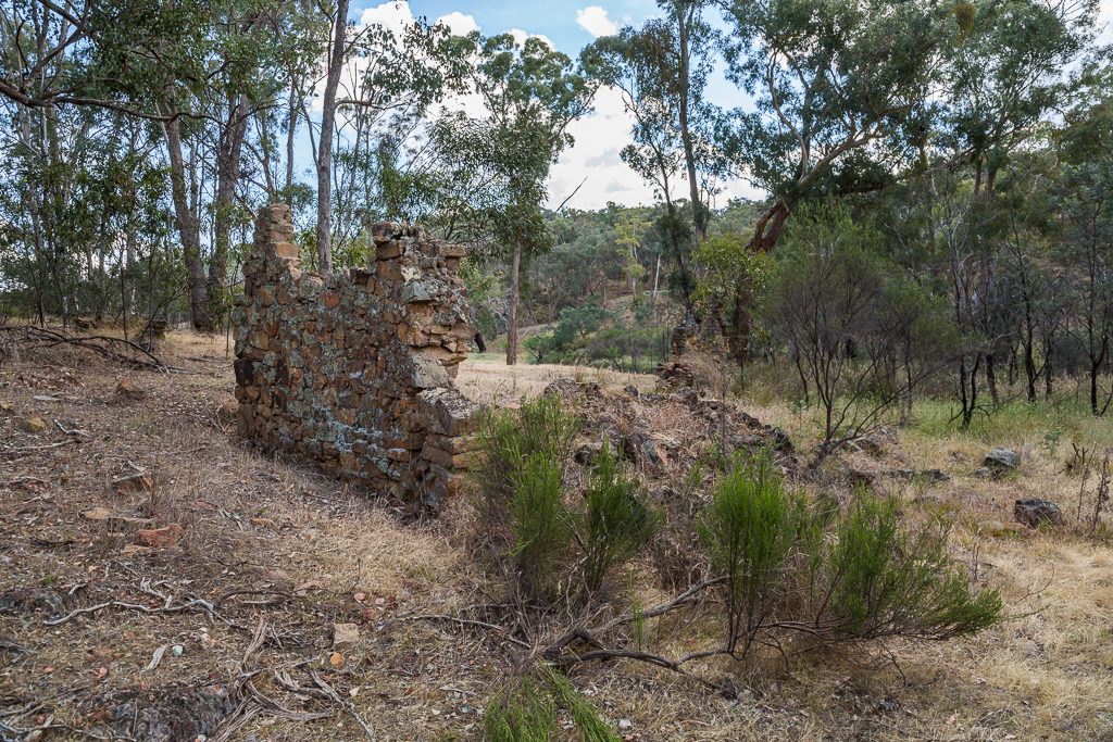
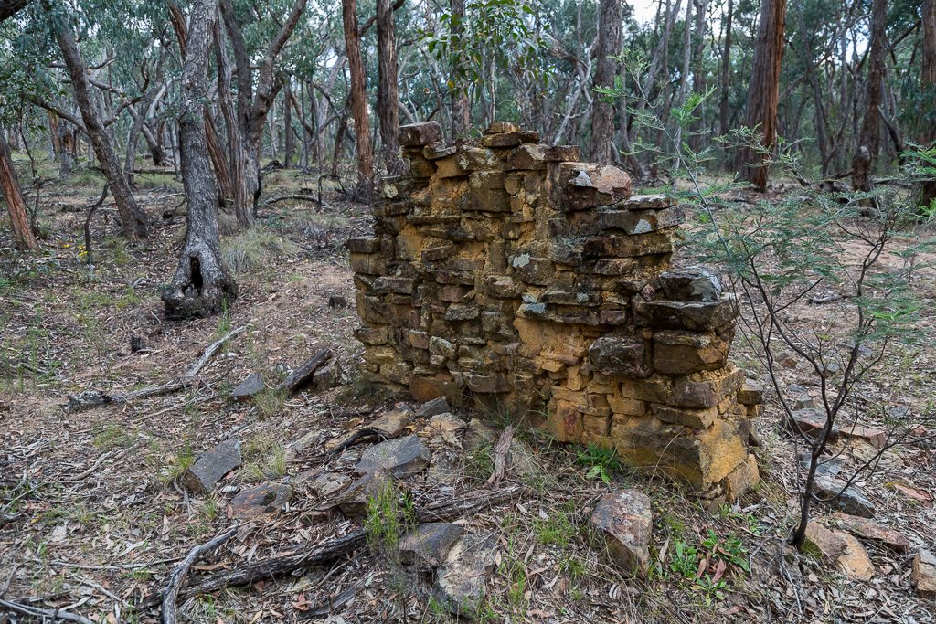
Anyway, back to this walk. The notes outline a more expansive route than I’d done in the area before. After an initial foray in the Upper Loddon State Forest, it loops back to the start through the Castlemaine Diggings National Heritage Park. It also comes with a twist. Tarilta Creek is the main aim, but there were the additional attractions of finding an old ruin, plus six chimneys. Mm…
Some of those remnants of chimneys are easy to find, as they’re right next to the Dry Diggings Track that links Daylesford to Castlemaine. Others though, are in the bush and you’d never see them if you stick to the track. I’d tracked down one called ‘Mr Hunts Chimney’, but a couple of others would be a bit of a challenge.
Hang on, what about the ruin? The notes say it’s the remains of an old Cobb & Co horse change post. I’d never heard of it before, let alone visited the location. Just to make it interesting, there is no mention of what I was supposed to see. Were walls still standing? I had no idea and purposely did no research before heading out. Extensively Googling about a walk can be a fizzer. I prefer to go in with no idea and hopefully be pleasantly surprised. Usually though, upon doing the trip, ‘pleasantly’ is not the feeling I end up getting. The result is similar to, ‘why the hell am I doing this?’
Alright, seeing how we’re a 1000 words in already, I better get to the walk, as it’s a humdinger. Amongst the off-track shenanigans, I’d picked the ideal day to be walking next to a dry creek. It was hot and storms were forecast late in the day, leading to unsettled weather that carried some solid humidity with it. Oh well, what can you do? It is Australia I suppose, so I can’t complain about the heat of summer. As you know, my preferred operating temperature is 15° C and below. The trouble is, if I stick to that, then I won’t walk for about 8 months of the year. You’ll be proud to realise I’ve made concessions and now allow walks up to 30° C. Sure, they suck more than usual, but as long as I take a skip of water with me, I’ll survive.
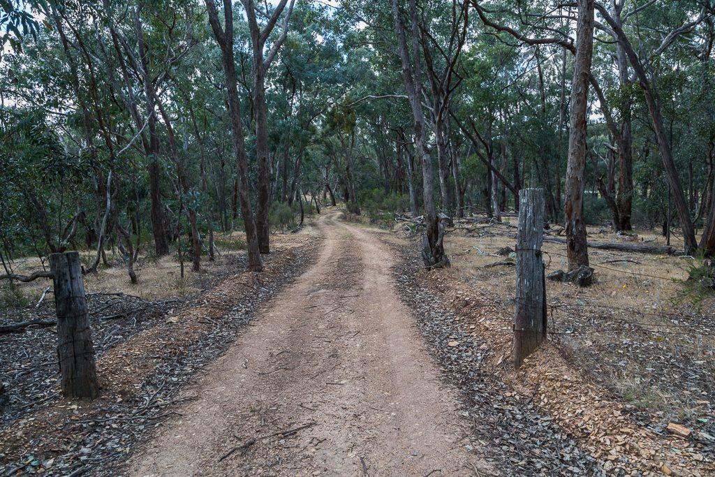
Anyway, for this walk, I followed the notes and parked near Loop Track, which is along Porcupine Ridge Road. Writing Porcupine Ridge Road is a pain in the arse, so the purposes of this post, it’ll now be referred to as PRR. A large portion of PRR (see how easy that is?) is gravel and a couple of years ago I found it to be a bit rough and ready on my low-slung car. This time though, it was like a highway and I motored along easily. The obligatory requirement of gravel driving is to be sideways at least once and this trip was no exception. Unfortunately, front wheel drive slides are incredibly disappointing, so I may have to reassess this driving technique in the future.
The area can be a bit of a pain on the weekends, as motorbikes tend to be about. They’re no problem really, but their ear splitting sound can dampen the bushwalking mojo if you’re out expecting a day of audible isolation. What day did I do this on? Well, it was Sunday of course.
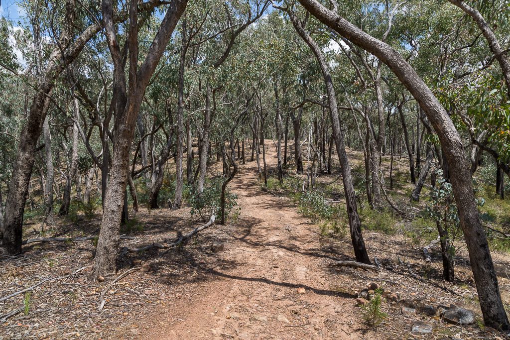
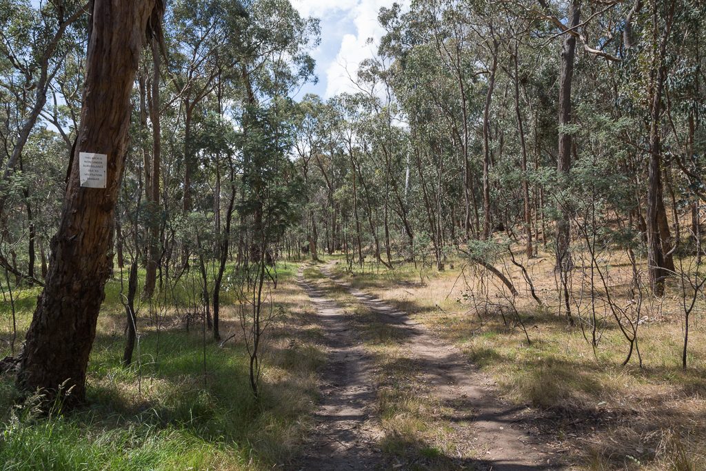
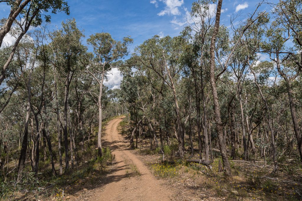
After parking, the pack went on and I was off and racing. At 3 kph. If there’s one thing I’ve learned, it’s my body prefers to pace itself. There hasn’t been a photo for a while, but don’t complain, as there are going to be a zillion within the rest of the post. As I ‘motored’ along the Dry Diggings Track, I had one thought. It’s dry.
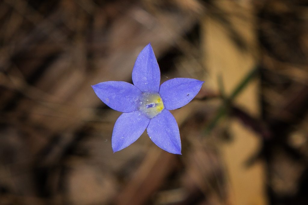
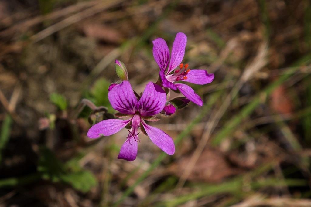
Amongst the generally baked, ‘is anything alive?’ landscape, there were the occasional flower. This could be an annual blue bell. Then again, there’s a possibility its name is Blue Flower flore caeruleo. I’ve long given up plant research.
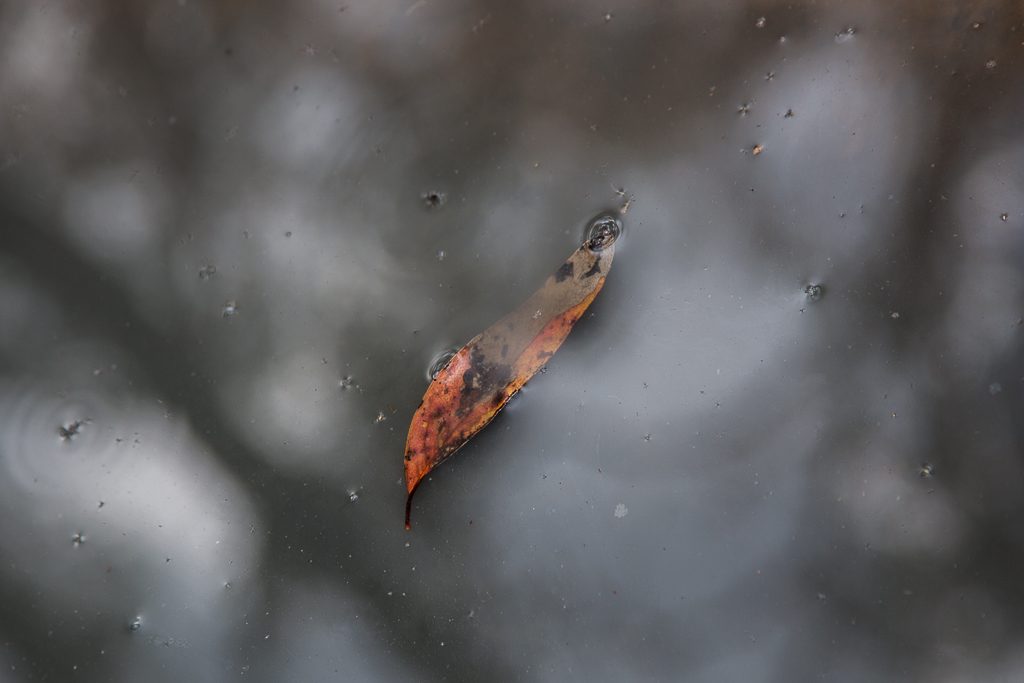
As anyone who’s been here knows. I’m a sucker for a floating leaf and preferably, the water allows a blue sky reflection. Unfortunately, any leaves I saw tended to be in the cargo of the Exxon Valdez.
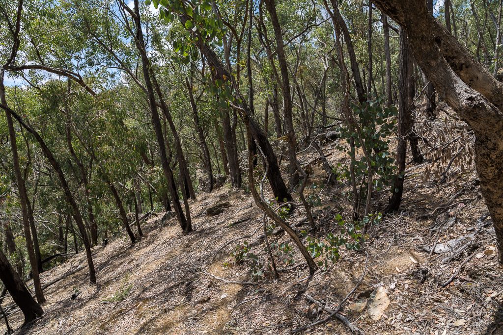
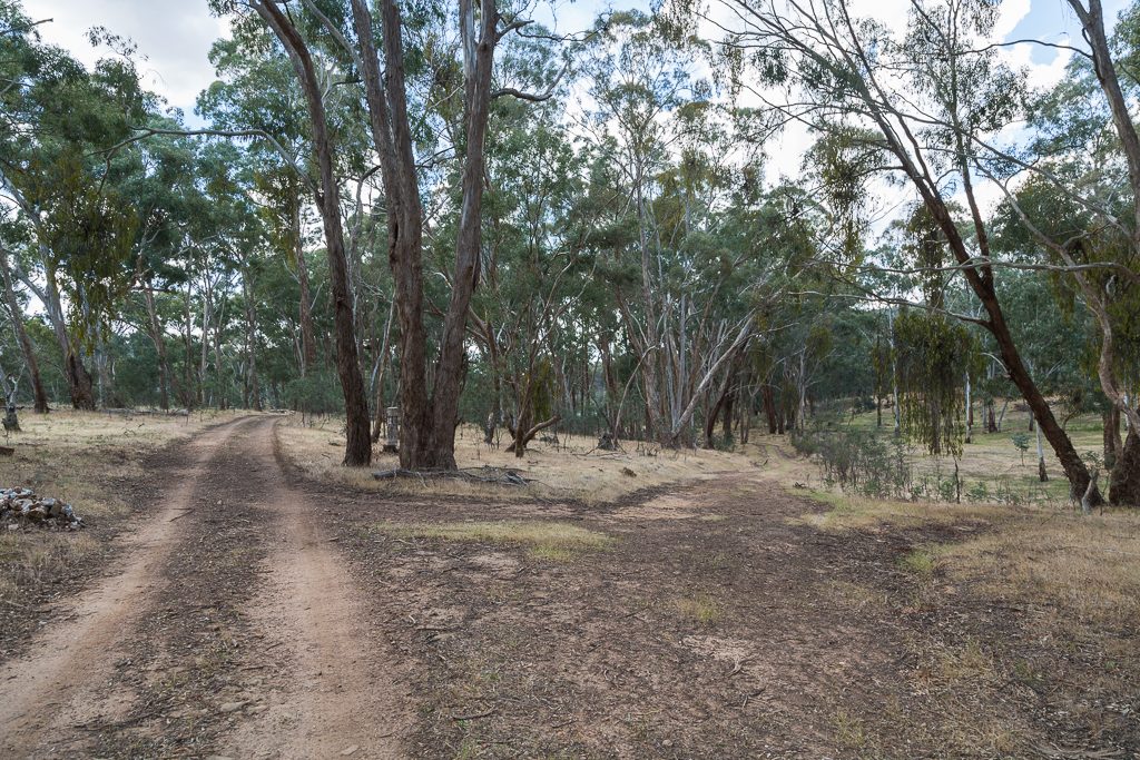
Now, in the Tempest notes, he joins Tarilta Creek a bit further south-west from where this walk does. He also gets there via tracks, but in this one, it’s off into the bush. The question was, where to leave the Dry Diggings Track? After scanning the map though, it’s all quite logical. Tarilta Creek loops at a point, where it’s only about 400 metres from the Dry Diggings Track. Reaching that area, I was considering spots to head bush. Then I saw this. A patch of ground appeared to have been walked before and for future reference, a piece of rusting steel marked the spot.
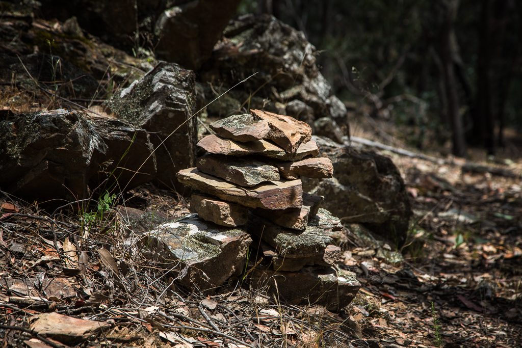
Although there was a track that faded in and out, I wasn’t too sure if some were animal-made. Any thoughts I was in the wrong area were soon dispelled…
… as a cairn in a random location is a bit of a giveaway.
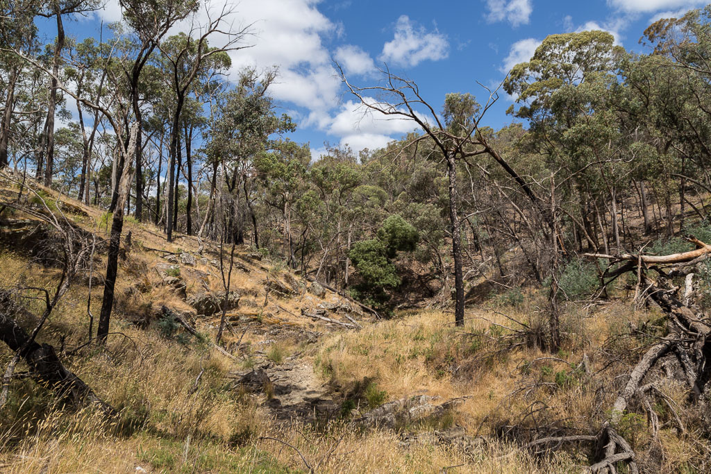
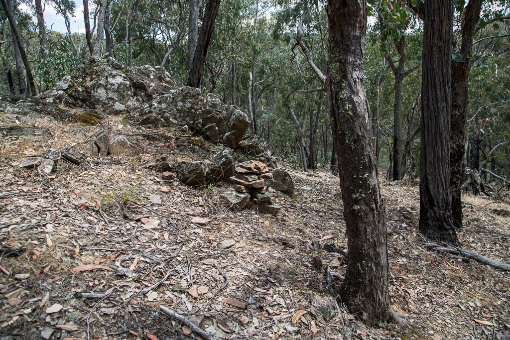
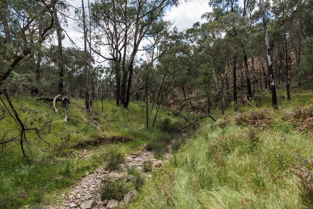
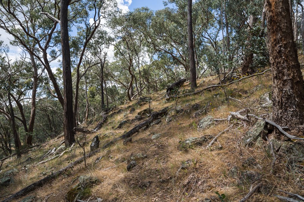
There are many steep slopes leading down to the creek…
…and I assume this is the reason why it’s also called ‘Tarilta Creek Gorge’. I’m not sure about you, but I don’t thing it’s a gorge. Well, not in a Lerderderg Gorge type of sense. Maybe I’ll consult the word ‘gorge’ in my Funk and Wagnalls.
Anyway, soon the terrain levelled out and as I passed this fallen tree…
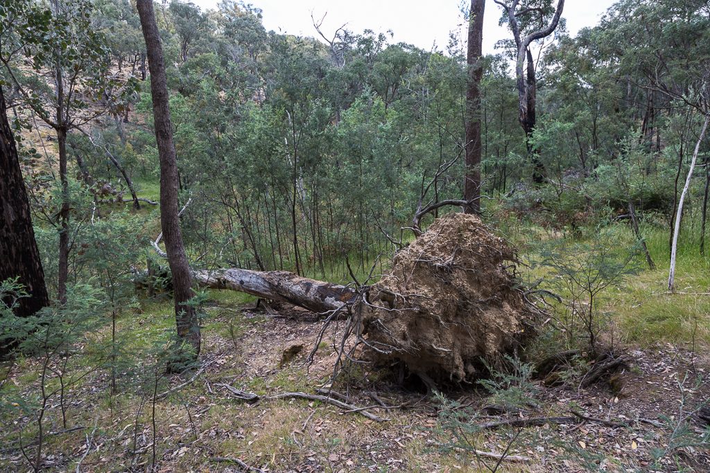
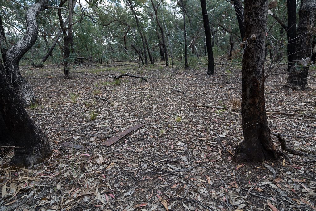
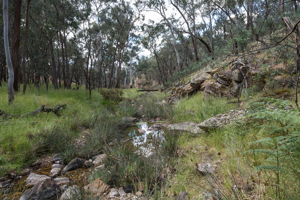
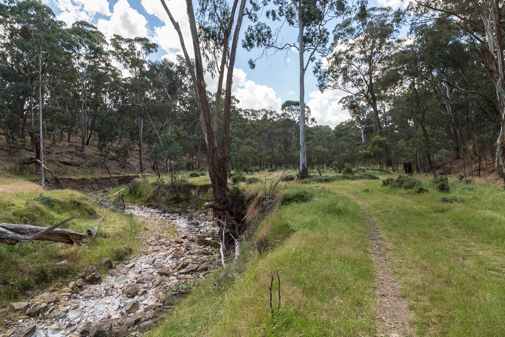
…I arrived at Tarilta Creek itself.
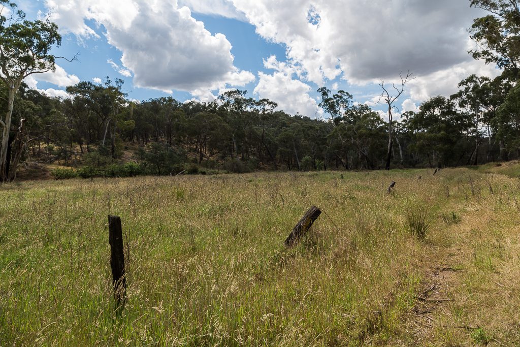
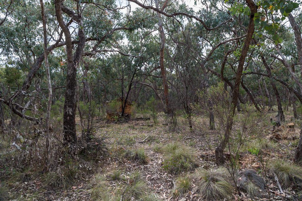
Tarilta Creek, Upper Loddon State Forest
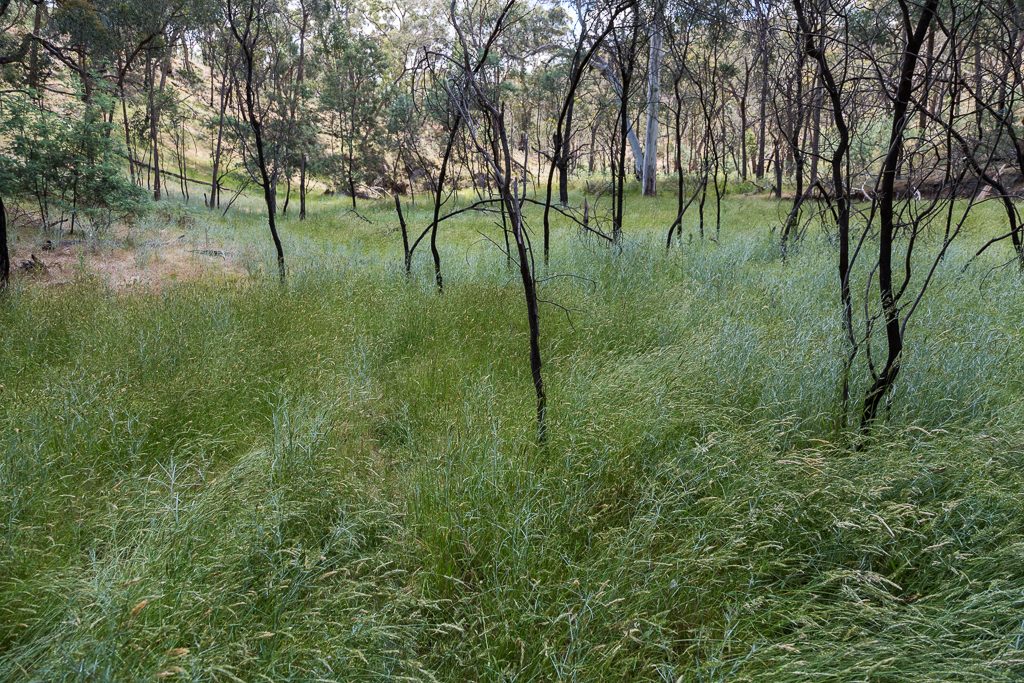
Mm… First impressions were it looked a lot like it did five years ago. Evidence of fire is well and truly still there. Even on the trees as I began to wander along some of the grassy flats that line the creek. This is gaiters or long trousers territory. Not unless you enjoy a billion grass seeds in your shoes? I haven’t checked, but there’s probably a group on FetLife who do.
Even though it was the weekend, I was soon reminded of what this area is like. It’s quiet. A couple of times I stopped for about five minutes or so and literally, I couldn’t hear any man-made sound. Oh, besides my heart. That was thumping similar to about 10 minutes into Jon Bonham’s Moby Dick drum solo from The Song Remains the Same. Maybe the steep surrounds of the creek lessen any noise from above?
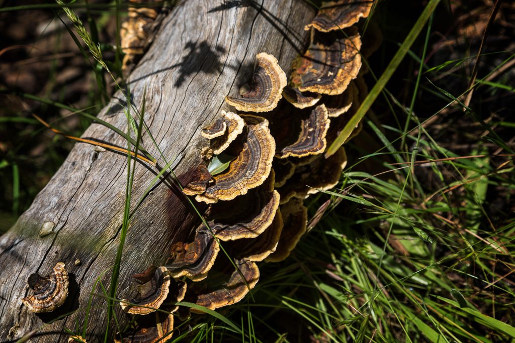
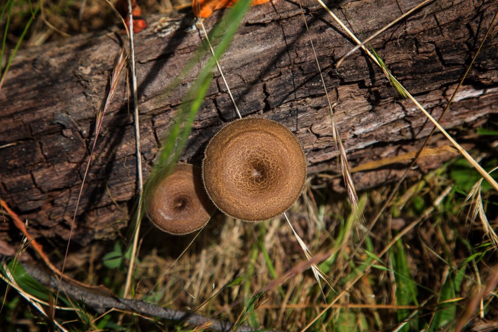
During my slow dawdle, I spotted a few things of interest. On a hot day, the last thing I expected to see was fungi. These though, weren’t of the succulent variety. They were dry as a pack of expired Doritos. Would you get poisoned if you ate them like chips?
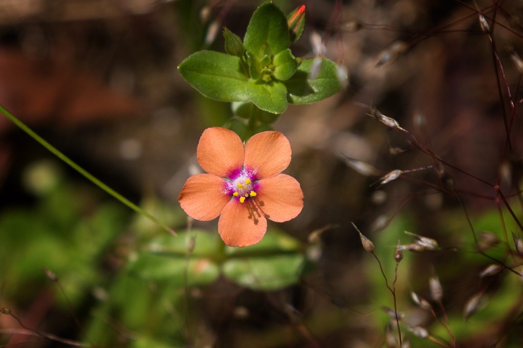
Oh, there were the occasional flowers as well. These appeared here and there. I’ve named them, ‘orange flowers with some purple in them’ or aliquid purpurei in floribus aurantiorumr.
The crunchy fungi continued…

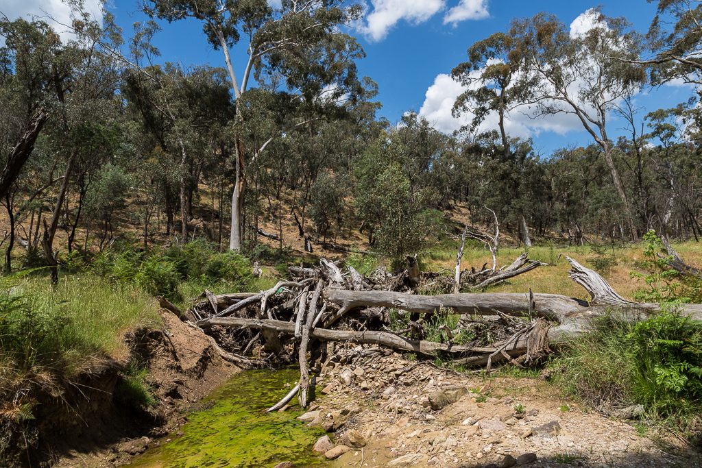
…and surprisingly, there were even the occasional pools of water in the creek.
Sure, it always seems to be dry, but I assume the occasional torrent livens things up now and again. The water must have been pumping to create this logjam.
Actually, something has just hit me. Do you think blogging is easy? How’s this. I’ve officially hit the wall and suddenly have nothing else to talk about regarding Tarilta Creek. Sure, it’s a nice spot to meander, but I can’t go on and on with every little aspect of its winding, twisting nature. Plus, I’ve got ruins to locate and SIX GODDAMNED CHIMNEYS TO FIND YET. The pressure is on.
As it is, crossing the creek repeatedly is easy and there are limited obstacles to negotiate. Hey, Lerderderg River. I’m looking at you. It’s a cinch to get past fallen trees like this one…
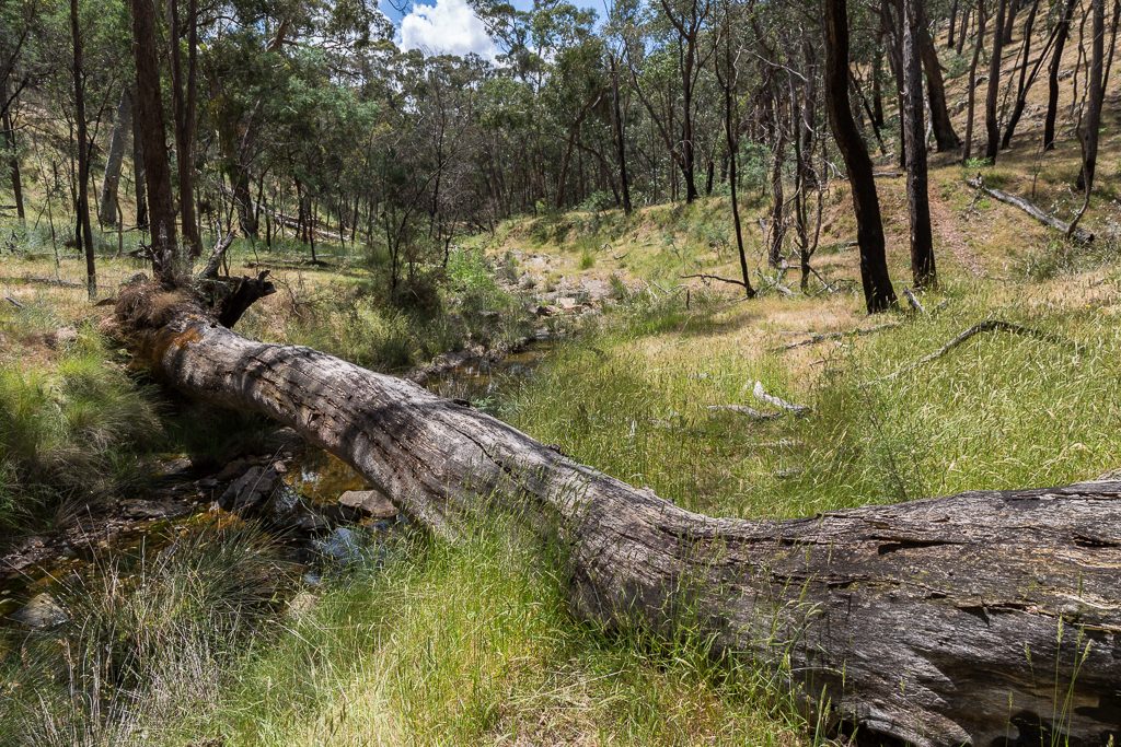
…as the grassy flats lining the creek are wide. What else? Oh, there were more flowers. The formal name for this one is, Purple Flower biggus dickus.
Oh, the surprisingly hardy fungi continued to crop up…
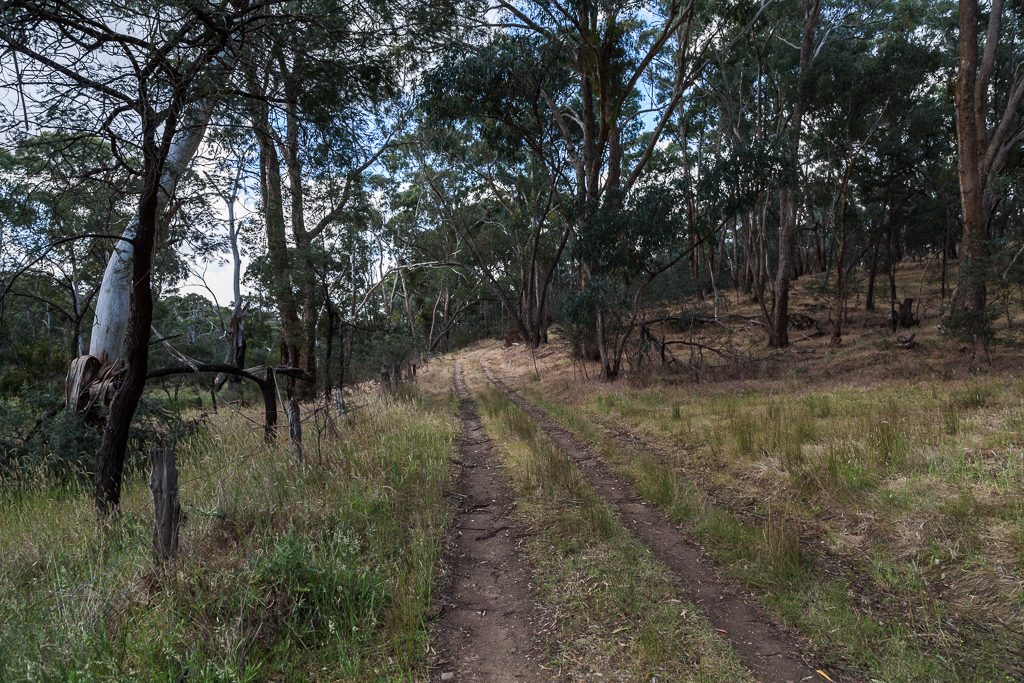
…and then it was over. I’d reached Lancaster Track and it was time to bid farewell to the creek-side rambling. What’s weird is I’d allowed a stack of time to get the creek done, but it had barely taken any time at all. Not to mention I was still full of energy. So much so, I didn’t just walk onto Lancaster Track, but I hit it like two Titans (sorry Ice-T. I had to use that line sooner or later). What now? Well, it was time to go and track down the ruins of the Ye olde Cobb & Co station.
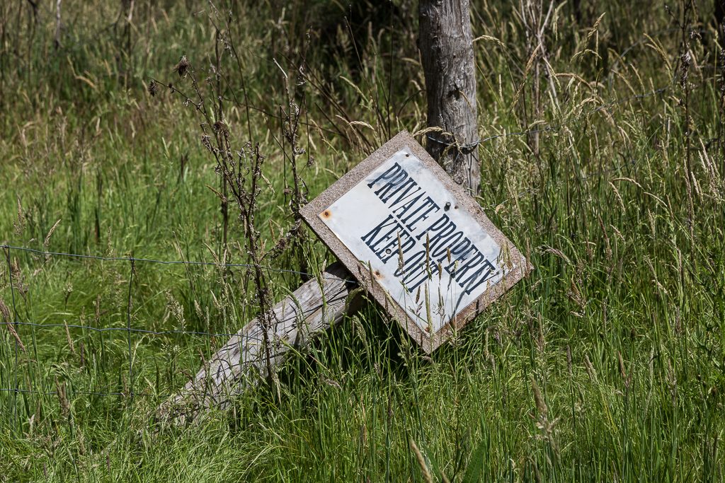
First of all, off the creek, my exploration began a little weird. What’s on the tree?
Okay.
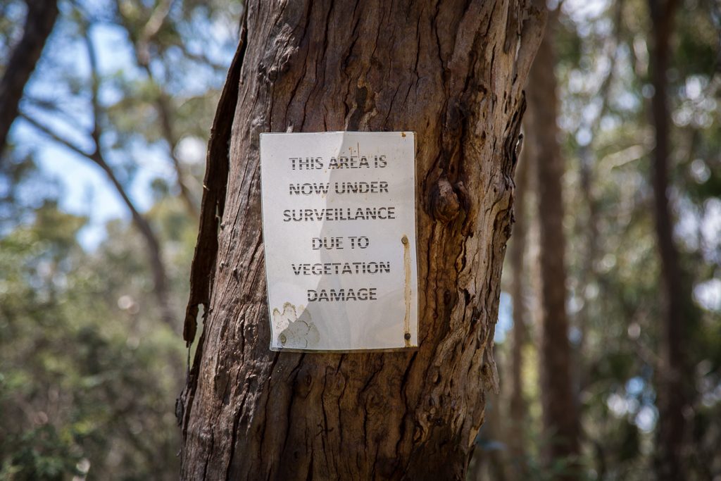
I was tempted to syphon the python under the notice, just in case it was actually being filmed. You know, provide some comedy for all the surveillance family.
Potentially, I may have been surrounded by cameras and people hiding in the bushes (pants optional), so after pausing briefly, I wandered further. Along a well driven track…
…before coming to a dead end. Continuing to head north though, I ambled up this hill…
…and arrived at what I think is Lancaster Road.
Who knows? There’s Lancaster Track and Road. I assume they’re the same. Or not.
It had been a few hours, but now I was seeing the first signs of civilisation. Yeah yeah, I know I’m on a road, so technically I was standing on a sign of civilisation. What I meant was things like this.
Northward bound, I came across this intersection…
…and veered right. Does the area look dry? Actually, what I should be asking is, ‘when doesn’t this place look dry?’ It seems to look the same, no matter what the season.
Moving on, I noted whoever did this fencing should be sacked…
…and as the road continued…
…I began to wonder, ‘what the hell am I looking for?’ Oh yeah, remember way back at the start? The bit about not researching a particular item on a walk, as I like to have a surprise? With the sun cooking my oversized hat, I began to wonder if this ‘no enquiry beforehand’ system sucked. I was sort of in the area for the ruins, but I had no idea if I had to explore off-track or they’d be flagrantly staring at me in any moment. There I was, considering extending my middle finger to the surrounding landscape when I glanced to my right.
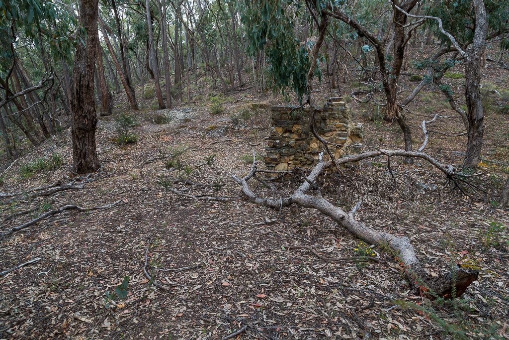
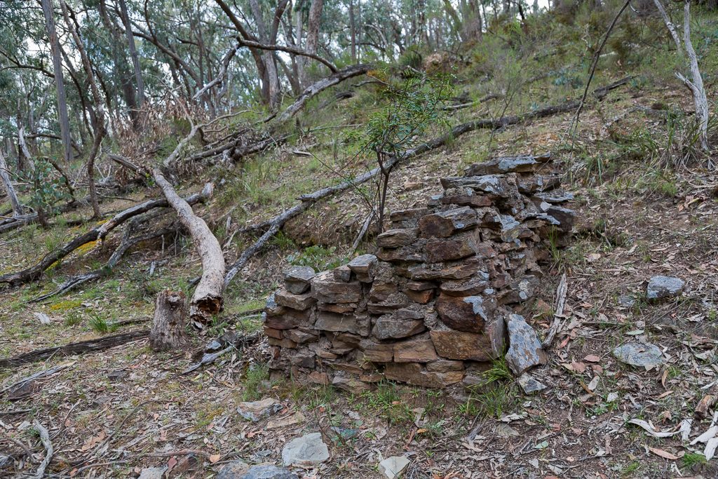
Aha, that looks promising…
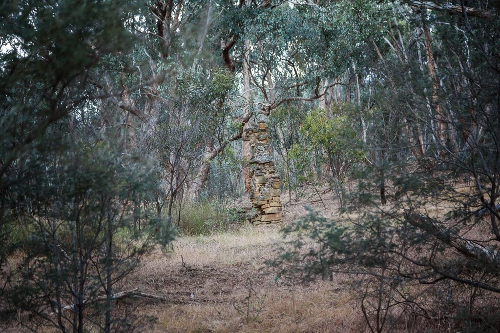
…and if I didn’t know better, these are the ruins of the Cobb & Co, horse change post in Glenlyon.
The aims for the day were going well. Tarilta Creek was negotiated without me stepping on any snakes and the Lancaster Track ruins were located. Now, I had to focus my attention on the chimneys. Sure, this isn’t exactly uncovering Pompeii for the first time, but it’s the best I’ve got right now.
It was time to leave the heady surroundings of Glenlyon bush and make my way to the Castlemaine Diggings National Heritage Park. Actually, has there been a longer park name in the history of mankind? Try and say that quickly ten times. While rubbing your stomach and patting your head, whilst someone is feeding you fairy floss at the same time.
Heading off, I went off-track again. Looking at the map, you can follow roads, but doing so adds a few kilometres to the total. Instead, I powered east, uphill, until I met…
…Moran Track. As I wasn’t wearing my glasses, I read it on the map as ‘Moron Track’. Considering some of these place names, I thought it could have been its actual title. Once, I had Hubble telescope style vision. Now, without my glasses I can’t see crap. It’s like the time I was following a car and it had a bumper sticker, which I swore said, “Farmer Fred Ottie”. I spent about ten minutes thinking, “Who the hell is Farmer Fred Ottie? A half-baked celebrity of some sort?” Alas, when I put on my proper glasses, it actually said, ‘Farmers Feed Cities’. Mm…
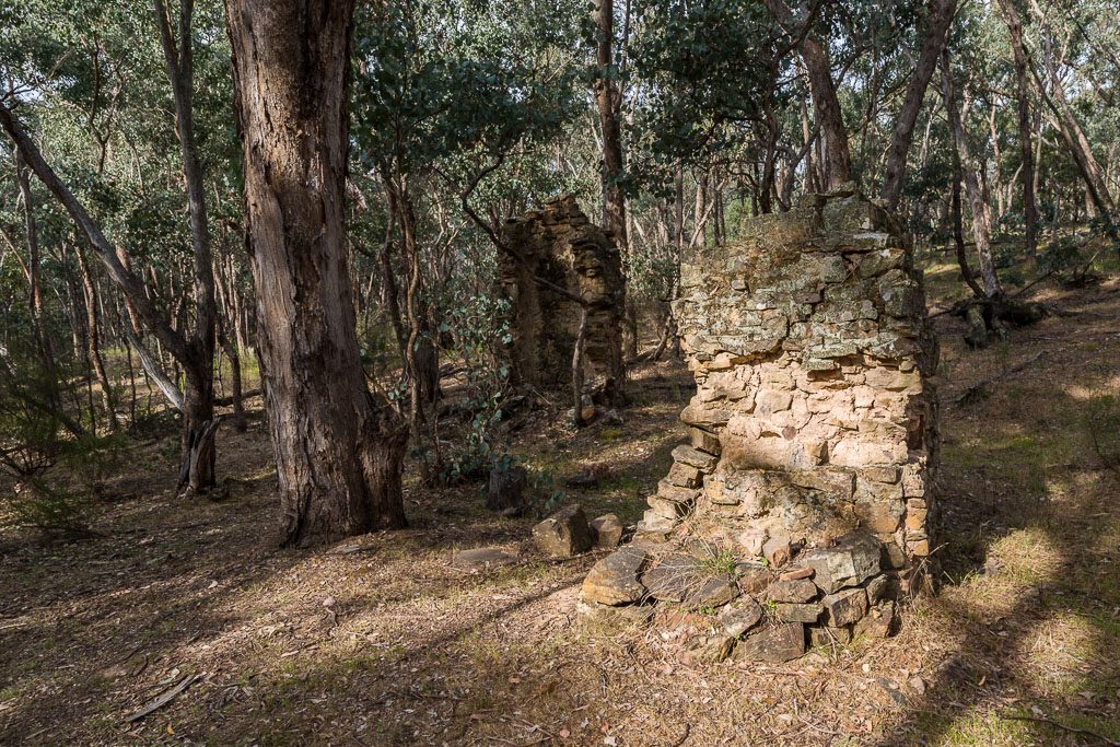
Continuing on, I shuffled uphill and then crossed PRR before entering the bush for a bit of a shortcut to Wewak Track. Actually, Garmin was playing tricks with me, as instead of Wewak, they call it Sebastopol Track. Soon, I was homing in on my first chimney, which is an easy find. I’d seen this one…
…a few times before. Along with the next, which is close by.
Those bricks can blend in with the bush though. Leaving the last one behind…
…I was now on the Dry Diggings Track and slogging uphill. My next target was ‘Mr Hunts Chimney’. Remember, if you’re talking to someone about it, don’t do a spoonerism and reverse the ‘h’ with the ‘c’. It might be a bit embarrassing.
Anyway, this one is in the bush, but luckily I’d been there before and marked its location. Leaving the track, I headed straight for it and this my friends, is ‘Mr Hunts Chimney’. Proudly standing approximately five feet into the sky.
What am I up to? Three chimneys? We’re flying. Oh, I’d watch where you’re standing in this area. Within a few metres there’s this uncovered mine shaft…
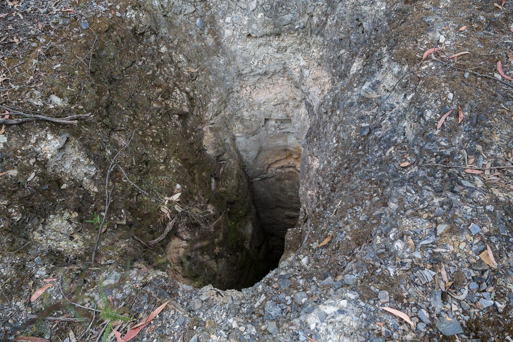
…which is seriously deep. I threw a rock in and I think it’s still falling. I’d be concerned if I was sleeping in Mr Hunts house and needed to go outside for a leak in the middle of the night. Besides tumbling for about ten minutes before hitting the bottom, you’d also accidentally piss on yourself.
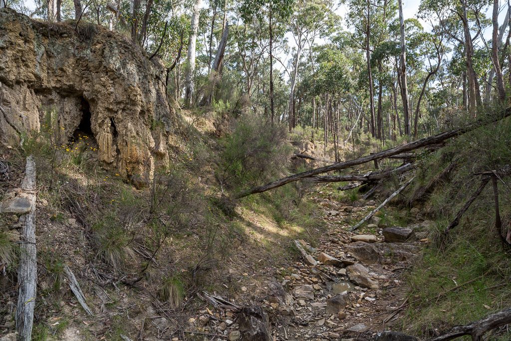
Now I was continuing to head south off-track, through the old mine, which looks like a WW1 trench system.
Besides more uncovered mine shafts, there were pieces of rusting steel…
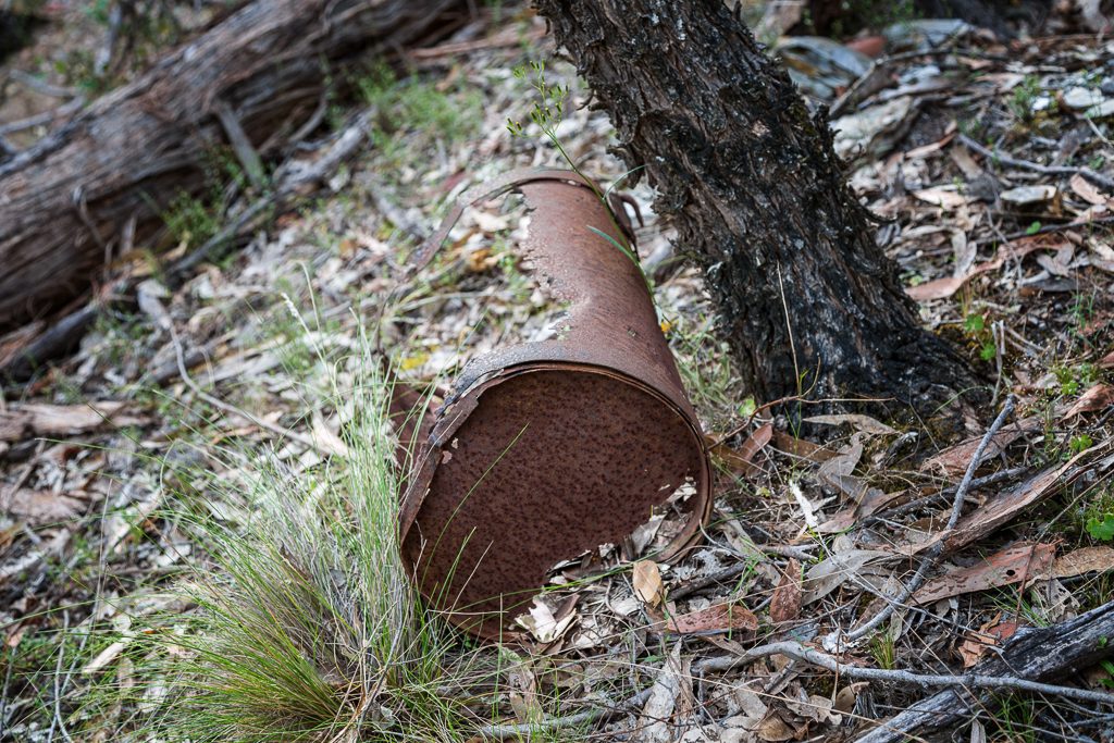
…and this.
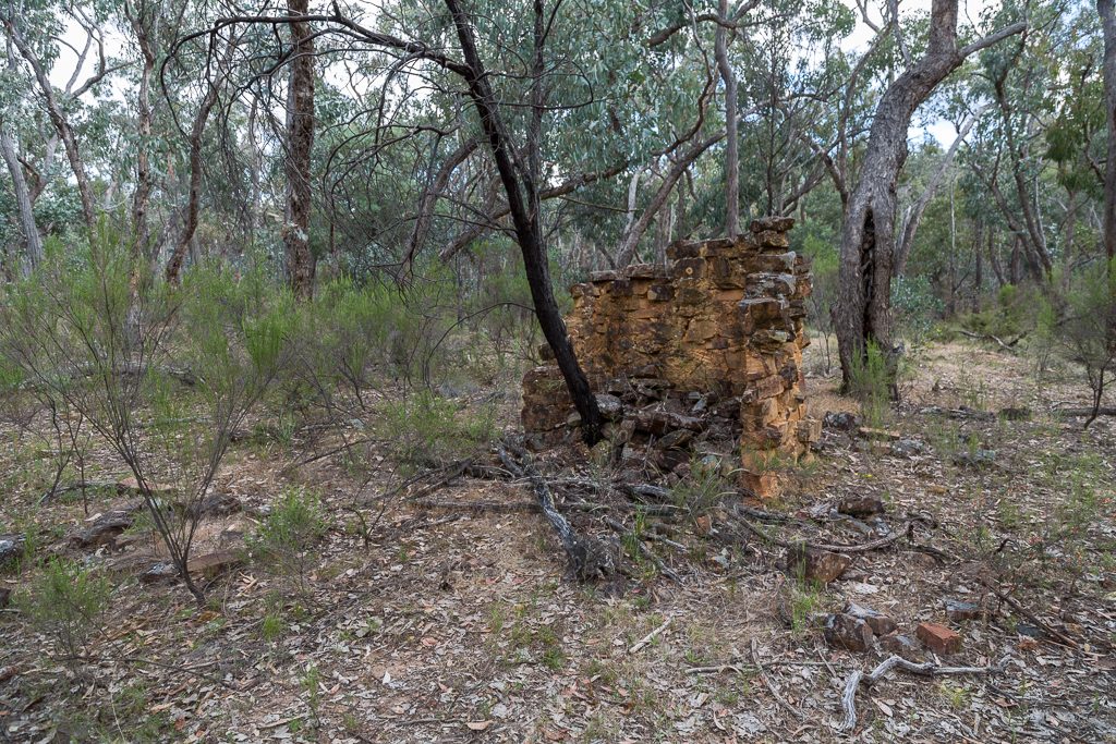
Hang on. Is it a chimney? Does it count? No, I think it’s a wall. Mind you, I’m counting it if I can’t find the others. It’s an interesting area. Back then, the system seemed to consist of turning the ground upside down. Then when done, just head off. Rehabilitation? No, they wouldn’t have done any. Surely not?
After heading south, I then swung east with a plan to remeet the Dry Diggings Track. As I was stumbling over upturned rocks, I saw this bottle…
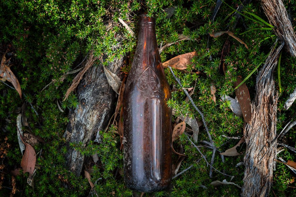
…and noted its logo.
![]()
Here you go. It’s an MBVC beer bottle from the 1930’s.
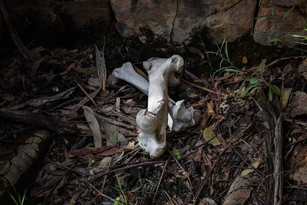
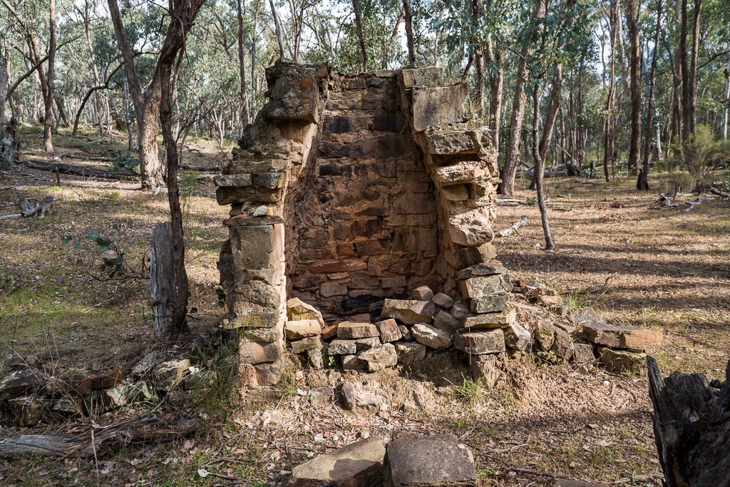
Still heading east I then tripped over the next chimney. This one was new to me and considering its size, I thought I’d have read about it before. It’s quite substantial…
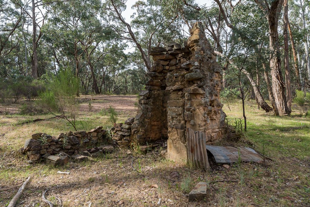
…and within the fireplace it even contains the remains of a previous hiker who’d been cooked and eaten by the Diggings Decimator. A little known serial killer.
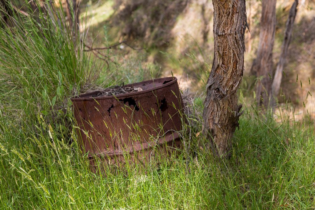
Now I was homing in on the Dry Diggings Track again. The thing is though, as I passed more Goldfields detritus…
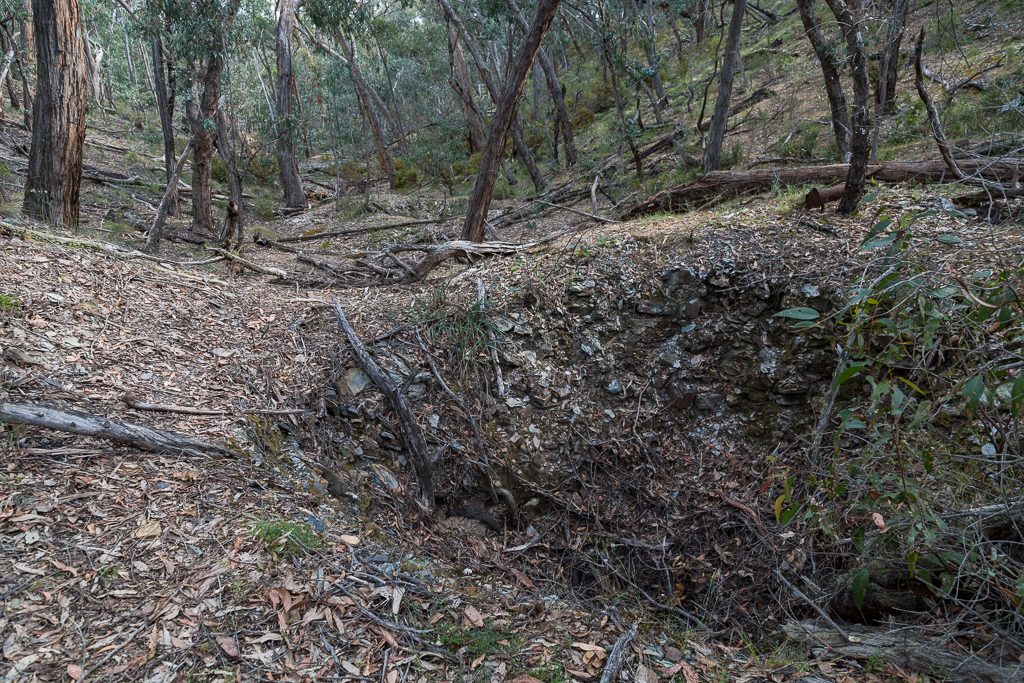
…I had to drop down into a dry creek and clamber up…
…the other side without going arse up. Some of these sluiced creeks are unbelievable. Erosion has made some creek walls at least 10 metres high and they can be a slipping and sliding affair to scale. Judging by my usual technique, do you think I fell over? Let it be said now. NO, I DIDN’T.
Once on flat ground, I soon passed some discarded clothing…
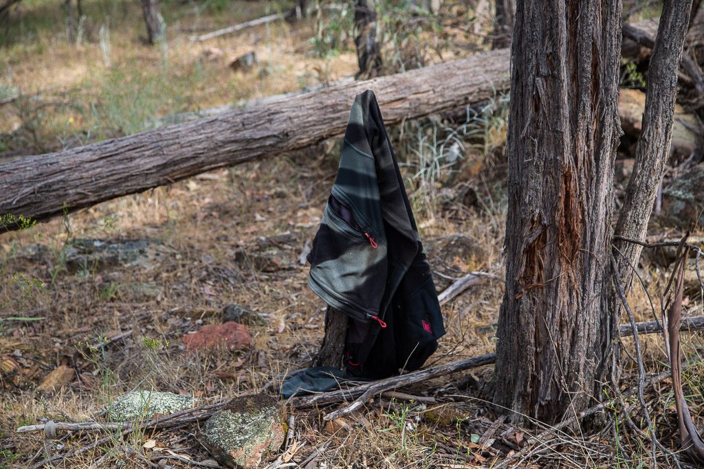
…that belonged to some terrified punter who was being chased by the Diggings Decimator. Oh, if you don’t know, his moniker was either ‘D²’ or ‘Double D’, as he was known for his large chest.
Finally, I reached Dry Diggings Track and was relieved there were only a few kilometres to go. It might look like all beer and skittles, but it had been hot and humid the entire day. Officially, I was beginning to wilt. There were two chimneys to go and they would only get a cursory inspection, as I was losing my zip. It was no problem though, as I’d seen this one…
…and the next…
…on previous walks. How many is that? I couldn’t be stuffed recounting, but I reckon I’ve found the lot. Oh, plus the other wall/chimney which was a freebie to make up the numbers.
What now? Nothing, as I powered the final leg, bursting out of the bush and onto PRR and then greeted by my awaiting car. I was certainly glad to see it, as I was feeling sapped. It felt like rain was in the air, so I thought my timing was pretty good.
What do you think of the walk? I reckon it’s a beauty. For the area anyway. Sure, there are no grand vistas like you’re standing on a mountain, but it’s full of abandoned history. I was knackered walking it, let alone the poor bastards working there a 150 years ago. Hot and dry in summer and freezing and dry in winter. Does that sound appealing?
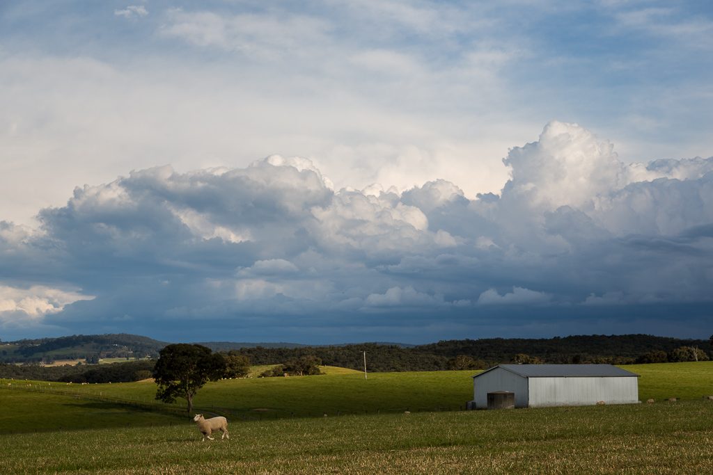
Anyway, it was time to head home and a few final visuals were on offer. Driving along PRR, huge storms appeared ahead. Even the sheep were running.
Clearly there was a deluge happening across Melbourne and I thought I was in for a soaking. Considering the next photo, you’d think I was driving right into it. Guess what?
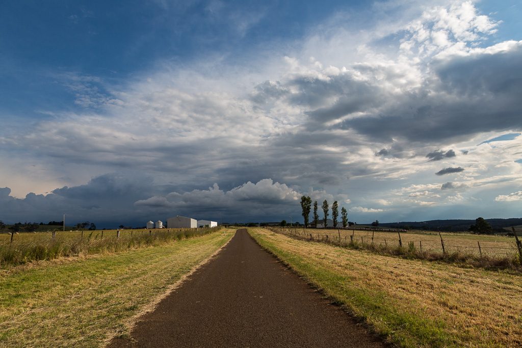
I didn’t receive a drop. Oh well. What’s next? No idea, but considering this took about a week to put together, it’ll be a few weeks at least.
Ho-ho!

Any walking blog that can get in a John Bonham reference has to be good in my books……
Thanks for the quality offerings, I’m already looking forward to next years misadventures;)
Stay safe and have a great Xmas and New Year.
I love the flower, fungi and leaf shots (especially the leaf!)!! The two moody storm shots in the end are glorious too. You are so brave for walking through an area like this and in the humidity. After coming across 2 venomous snakes this year I am a little spooked haha and my personal limit is that I generally don’t hike/walk in temps over 25 for comfort but mainly because I am a failure when it comes to completely avoiding sunburn as a pale person :’). Have a wonderful Christmas and a Happy New Year! Mikki
Haha… Yeah, I forgot about mid ’70’s Led Zep. The drum solos go for so long the rest of the band grab a cigarette and leave to go backstage while Bonhom keeps drumming for about another 2 hours 🙂
The worse thing about those Federation Walks is there are another 20 for the Grampians and the same again for the Warburton area. If I was closer to either, I’d be doing all those as well. As it is, I’ll pick out a few, but really, a proper long walk is overdue in this joint.
Merry Xmas and New Years to you as well.
Thank you! I’d prefer to only walk when it’s cooler, but I think I’m in the wrong country for that 🙂 Yeah, I’m aware that snakes are more scared of us, but upon sighting one, I always jump! Even though I grew up in the sun, I refuse to get sunburnt any more. When I walk, I’m so covered up I look like the Mummy. There’s no way sun is striking my skin 🙂 Merry Xmas and a Happy New Year to you as well!
Looks like a very interesting walk to me with all those relics! Once again a great read and beautiful pictures. As you know, I struggle with the heat and sun sensitivity too. The humidity up here kills me the most. Oh, and the fear of ticks is always there. I’m still deciding on the perfect place to live. Does one exist?! Anyway, I especially enjoyed the flowers, fungi and storm shots and your posts always give me a smile. Wishing you a Merry Christmas and many special memories in 2018. J.
Yeah, I really enjoyed this walk, even though the conditions weren’t ideal regarding the heat. I’m always conflicted, as I do long the long hours of daylight in summer! Always tricky doing long day walks when it’s dark at 6 pm 🙂 I’ve no idea where the ideal walking location is. I think any in the world would be compromise at some point 🙂 Merry Christmas to you as well!
Another epic write up Greg with some great photography along the way. I take it you didn’t indulge in the “chip” fungi as you returned to write this although that could explain the worrying sign that you were under surveillance in the middle of the bush! Maybe they are concerned about people gathering these fungi for their own indulgence. As you mentioned the reference to Led Zep I was thinking that the treck was taking on its own reference to Lyrnyrd Skynyrds Free Bird with the number of endings in sight but no wait theres still another chimney to find yet.
If I had some of the chip fungi, I reckon this post would have been my epitaph! What’s worse is since I wrote this, I keep coming across more chimneys that I didn’t know about. I might need an Excel spreadsheet to keep track of them all 🙂 Speaking of Lynyrd Skynyrd, I still can’t get over the story of the indestructible Artimus Pyle. First he survives the plane crash and then gets shot by a farmer as he sought help. I bet that’s a combo he didn’t foresee when he woke up that morning.
Good To See Another Post. Fotos always exceptional. (Talking about exceptional, see that some people are now even tagging themselves as ‘Stable Genius!’ – Not sure where that leaves the rest of us??! ) .
I worked in the Daylesford area for 10 years back in the mid 80s to 90s and had to travel to these ‘remote ‘ areas, like Tarilta. At that stage, three of the States most wanted were ‘holed up’ in these forests and the Denver areas. The end game for one of the three, ended up in a shoot out reminiscent of ‘gunfight at the OK corral’. So the area hasnt always been so benign, as it now seems. Happy 2018
‘Hurricane Hans’
Yeah, you’ve made a very good point about the most wanted living in those neck of the woods a decade ago! I’m confident I know their names as well. Now I know the area better, it doesn’t feel like the spot to hide? Way too open and not at all remote! It wouldn’t be my first choice for disappearing off the grid 🙂
Very enjoyable read. A humorous, historical hiker hitting the nail on the head! A long, dry walk much like your tongue! Great post. I will read more!
Thanks! It certainly was warm and humid day. I might revisit in July and see what the experience is like then 🙂
Just did this walk yesterday. Couldn’t find chumney 4 and then stumbled atraight our at 5 and 6 after crossing the canyon..creek. can you give a little more insight into chimney 4 location. Hillside..flat land right beside main creek or closer to the very deep gully. I think next time i might do in reverse and take a compass direction from 5 and 6. Great adventure using all skills..also had made a gpx file to generally follow from google maps, your info, bushwalking vic and topo map.
I’d say this is my favourite walk of all the Goldfield walks. A bit off the beaten track, which adds to the adventure. Chimney 4? I can’t even remember which one that was? I assume it’s the big one with the bones in the fireplace? It’s just before the deep gully, a few hundred metres before rejoining the Dry Diggings Track. It’s a bit hard to describe, but I took waypoints along the the way and I’m 99% sure it’s at this location. S37 13.028 E144 13.302 Enter those numbers as they’re written into Google Maps and that’s the spot. Well, as I said, 99% sure, so it’s all care and no responsibility 🙂 Yeah, I have a gpx file for the walk I did also, so happy to pass it on if you’re interested, or anyone else reading this and wondering where all the things are.
Thanks for the reply. I am going to do the walk again as i loved it and this time in reverse to spend time looking for chimney 4. Literally stumbed across 5 and 6 by spotting a yellow DDt marker and crossing the creek bed at a less cliff like location and there they were.
Thanks for the coordinates.
Yeah, going in reverse will work well. Just have to pick the right spot to leave Tarilta Creek. I’ve been further along in both directions and some extra exploring can be interesting 🙂
Such a beautiful photos of the wonderful nature. If got chance in the life to travel over Londdon definitely walkover this charming forest.
This walk is a favourite. Always worth doing.
Hi, have recently stumbled across your blog and am loving it!
Just wondering if you’re still able to post gpx file for this hike? Im keen to find all of these ruins and live locally. In particular the second to last one!
Thanks
Thanks! Glad you’ve got some entertainment. Yeah, I’m pretty sure I’ve still got the gpx for this walk if you need it. Send me an email & I’ll dig it out.
Hi Greg, what an inspirational and entertaining blog. Those chimneys are like a magnet and the scenery magnificent. I’d like to replicate your walk if possible. Could you please share your GPX file? Thanks again, Michael
No problem!