Here’s an original posting technique. I began writing it, but after a few days of toil, I suddenly realised it was about 4000 words. Huh? Clearly this is insane, so I’ve decided to split it into two parts. I need to hire an editor.
Actually, have you noticed in the past couple of years, I’ve proclaimed, “I’m back!”, but then not written anything? Well, what can you do. Like most bloggers, there’s a point where you’re ready to give up. Actually, that’s my default setting. I was ready to throw in the towel about five years ago. Somehow though I reappear. Like a stalker hiding in the bushes outside your bedroom window.
Anyway, this time I’ve got a valid reason for sporadic posting. Firstly, I’ve had to get the blog retweaked again. Sure, I had a complete makeover, but now I’ve had a makeover of the makeover. Are you confused? Make that two of us. Although the blog appeared to be all shiny and new, there was a rotten core, hidden beneath the bling. Sort of like clothing. Sure, I look respectable with a shirt on, but if I take it off, there’s every possibility you’ll vomit. It’s got so bad, I’ve installed curtains on my mirrors.
So, I couldn’t really continue blogging until the engine room was tuned up. Luckily I came across a bloke who did it for me. I’d mention his name and link to him, but he’s been a bit shady about that sort of potential exposure. I’m starting to think he’s actually on the lam, hiding out in a hotel with Jimmy Hoffa and Elvis. Until I get further instructions, he’ll simply be known as the Western Victorian Colossus (WVC).
There are a couple of display glitches here and there, but I can fix them over time. Overall though, I think the blog service has come out really well, although I’m frightened by the massive size of images now. Every flaw is on display and it’s really going to force me to lift my game. Oh well, from now on, before reading a post, just get your partner to hit you across the head with a rolling pin. If done correctly, your vision should be blurred enough to not notice any photo noise or dust spots.
Also, I moved my computer into another room and I’ve found the horizons of my images look a little different. As in they’re not horizontal. It probably says something about how level my floors are. Oh, if you subscribed via email in the old days, you’ll have to resubscribe yourself.
Now my administration duties are out of the way, what’s going on with this post? Ah, it’s a beauty. Remember the last post where I mentioned doing walks that aren’t in books or barely online? Well, over the past few months, I’ve embraced that philosophy by doing a few that don’t seem to exist. Certainly not in walking books anyway.
In the end, it took a few of these wanders to find out why they’re so anonymous. That’s because a large percentage are shithouse. Really. Okay, maybe this is a little harsh, so instead, I’ll use a Spanish phrase that’s less brutal. ‘El Shithousio’. Over time, I might jot down my thoughts of these ‘walks’. As long as I stock up on anti-depressants beforehand, as they’re a real mixed bag.
Planning the walk
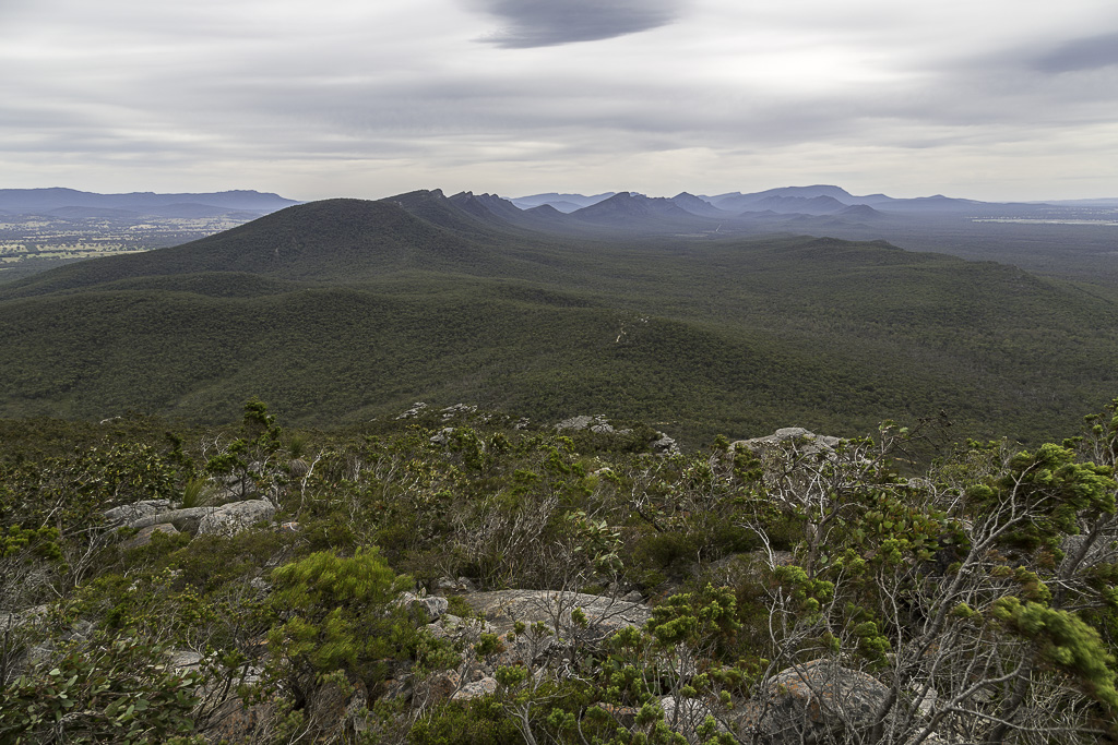
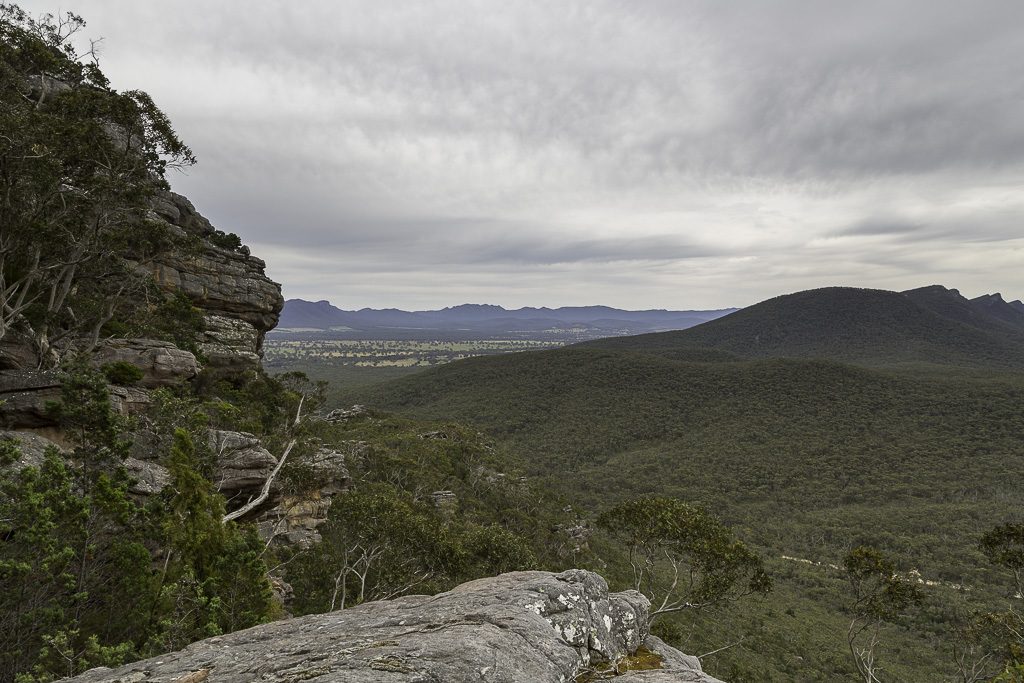
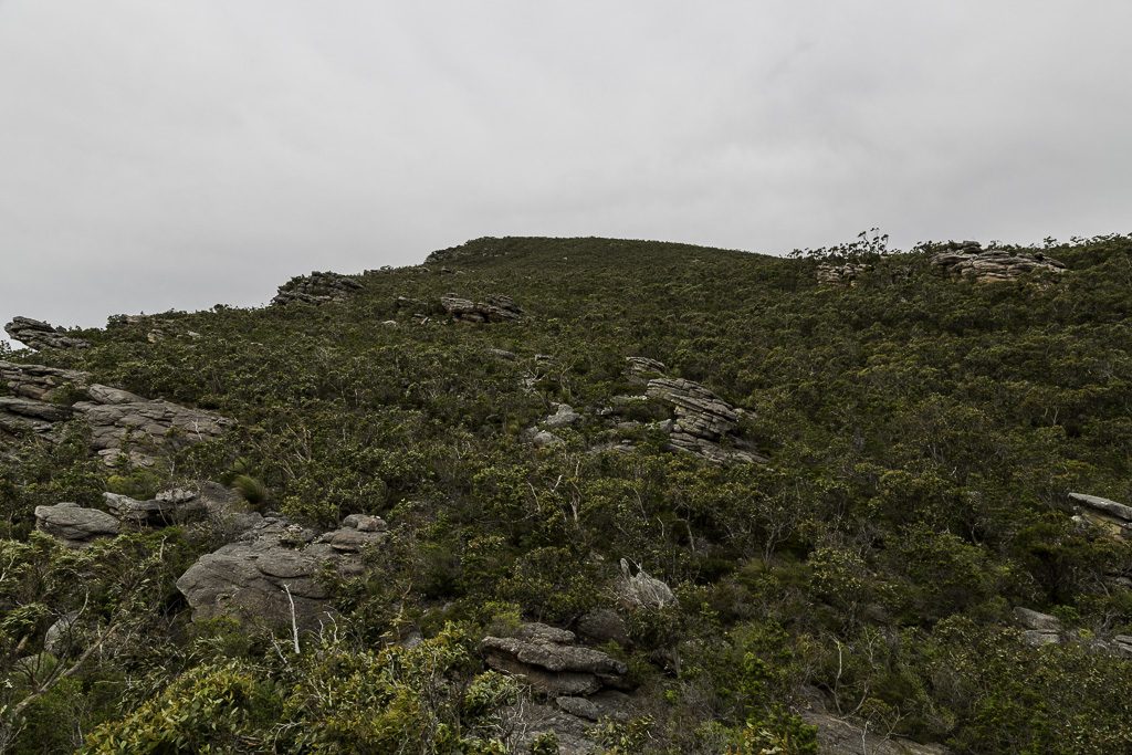
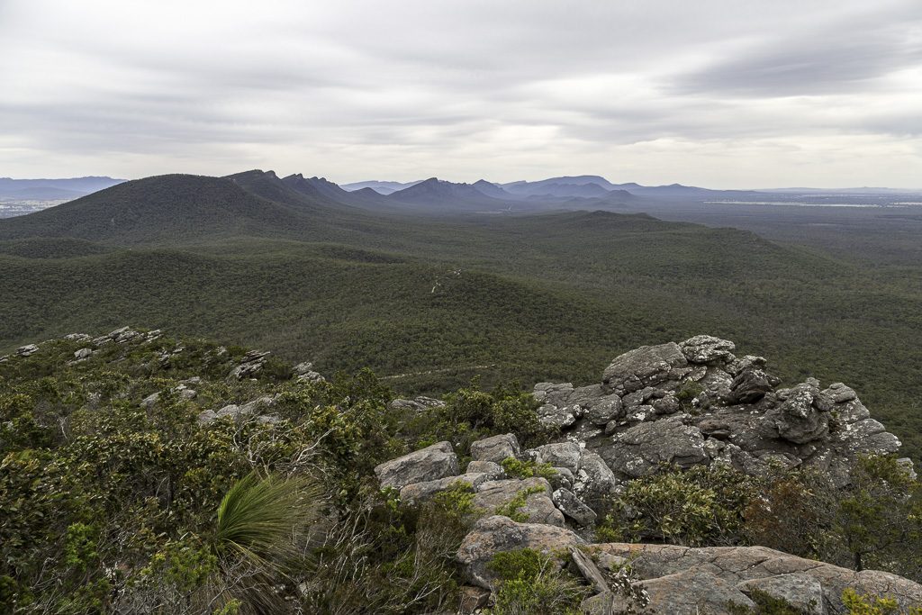
Signal Peak, Grampians National Park is 750 metres in height and is situated at the southern end of the Serra Range. Actually, the height is a guess. I can’t find the official figure online. Some diligent Googling will probably find it, but I’m way too busy for that right now. Regarding the height, all I did was look at my GPS route and that’s the maximum height for the walk, so 750 metres will do.
As per usual, there’s some background info to the walk, as I have to explain all things Signal Peak. Starting off, there are a million photos of it. I’m not even joking. Do some image Googling yourself and see what I mean. When you do, I’d say 99% of the photos look like this.
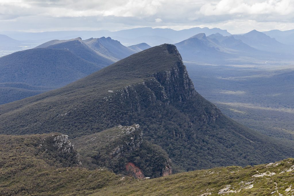
The reason being is it’s the most dominant thing you see when climbing Mt Abrupt, which of course just happens to sit next door to Signal Peak. Abrupt has a recognised trail to its summit and is a popular place for a stroll. Look, I even joined the masses and did it myself.
The thing is, when I climbed Mt Abrupt, I spent my time looking at Signal Peak and thinking, “Hang on, I want to walk up that one!” As is the way though, it’s not that simple. Firstly, it’s all off-track, although in places there are some rough and ready routes created by intrepid lunatics over the years. It all got a bit difficult, so it was placed on the backburner. Even more so when I found out a proper track is going to be built, as it’s going to be part of the Grampians Peak Trail. Before attempting a tilt, I figured I’d wait until the route is clear. Until I found out the GPT appears to have a construction timetable of roughly 300 years.
After staring at my ceiling for a few years, I figured I might as well do it now. No doubt I’ll be long dead before the track is built and surely it’s more entertaining in its current ‘natural’ state. Research was then undertaken. With very little result. The only scraps I could find were more or less the same. Most people seem to approach from the southern side of Signal Peak. Firstly, wander up the Mt Abrupt track and then roughly half-way, peel off for a bush-bash to the top of Signal, before returning on the same route.
Well, that sounded a bit dull, as an out and back aren’t my favourite type of walk. Pondering a different approach, the ‘ol’ up and over’ to the other side had potential. Even more so, as there’s a road on the other side. Cassidy Gap Road sits to the north of Signal Peak and seemed a logical place to head to once the summit tilt was done. Ah, but there was the whole car shuffle business. Also, was it easy to get down the northern side of Signal Peak? Finally, a solution appeared.
Over the past few years I’ve been in contact with The Zed Man (TZM). Essentially, he’s Mr Grampians. Armed with a swag of books containing old, forgotten routes and with a million maps of the area, he’s the bloke for all Grampians guff. Actually, he’s so immersed in the topography, he literally sweats contour lines. If low on fibre, he gets stuck trying to pass Mt Difficult in the Gents. Anyway, he’d walked up Signal Peak from the northern side and being a good bloke, he even recorded it on the GPS.
It all began to fall into place. TZM had done an up and back from Cassidy Gap Road. I planned to start from the Mt Abrupt track. Head to the top of Signal Peak and then continue down the northern side, with the route TZM took as a guide. It got a bit tricky though, as there was mention of, ‘descending might be difficult, as you’ve got to find a certain spot to get down’. Mm… So, it made sense to start from the north instead and end up at the south. Easy huh? Oh, wait on. It’s not a loop walk, so how do I get back to my car? Again, the solution was easy, as another victim was willing to give it a go and a car shuffle was organised.
Who else would ‘volunteer’ for such a task? Well, none other than the Smuffin of course. Mind you, that’s not all. Lady Smuffin, who’s the usual ‘pick us up’ and ‘sandwich maker’ elected to come as well. Her first walk with us would be an off-track number in the Grampians. What could possibly go wrong?
We headed up and established base camp at the local caravan park. Whilst surrounded by dips and salami, a pre-walk pow-wow was undertaken. I like to have options and Signal Peak was one of three choices up my sleeve. All were bush bashes and Smuffin proclaimed that Signal Peak was the one to attempt. The reason? It was the shortest. Somehow though, he seems to think he had nothing to do with the choice and it was all my fault. Clearly, he’s using some ‘alternative facts’.
Overblown intros are my speciality, but this one is getting ridiculous. I’ve already tipped over 1400 words and I haven’t even got out of the caravan park, let alone do the walk. Best I get moving.
Cassidy Gap Road
The next day we headed off in two cars, with the aim to leave one at Mt Abrupt carpark, which would be the end of our walk. Once out of Halls Gap, the landscape is fairly standard fare, but it certainly livens up as Abrupt is approached.
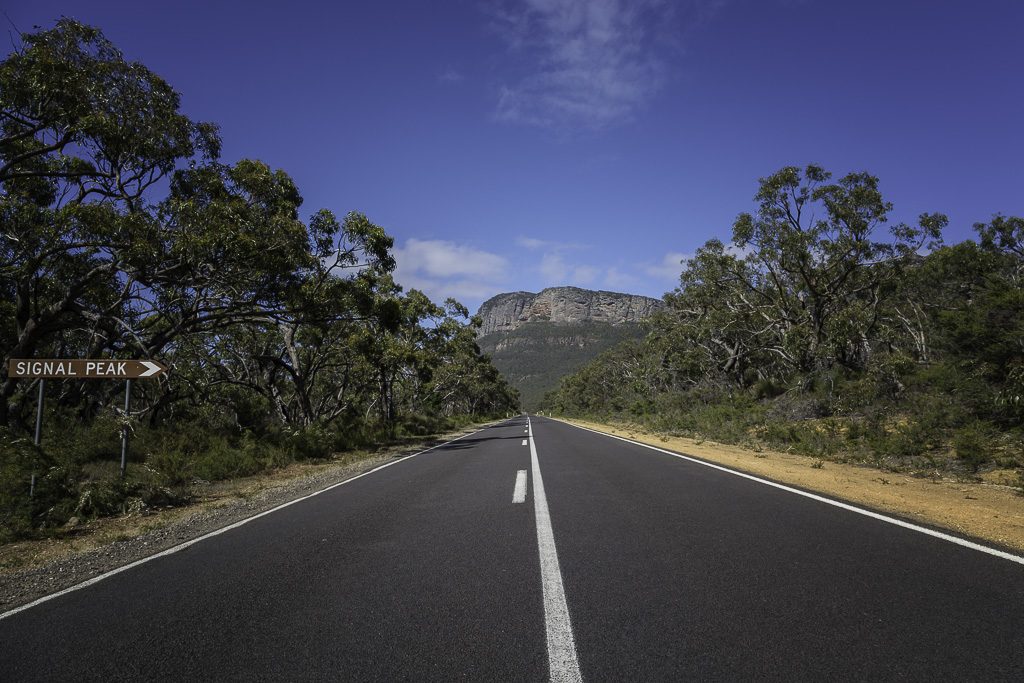
Oh, do you think Signal Peak might be some half-baked little sibling of Abrupt? Surely not. I say this, as it has its own sign. Clearly this means someone thought it was significant. I think.
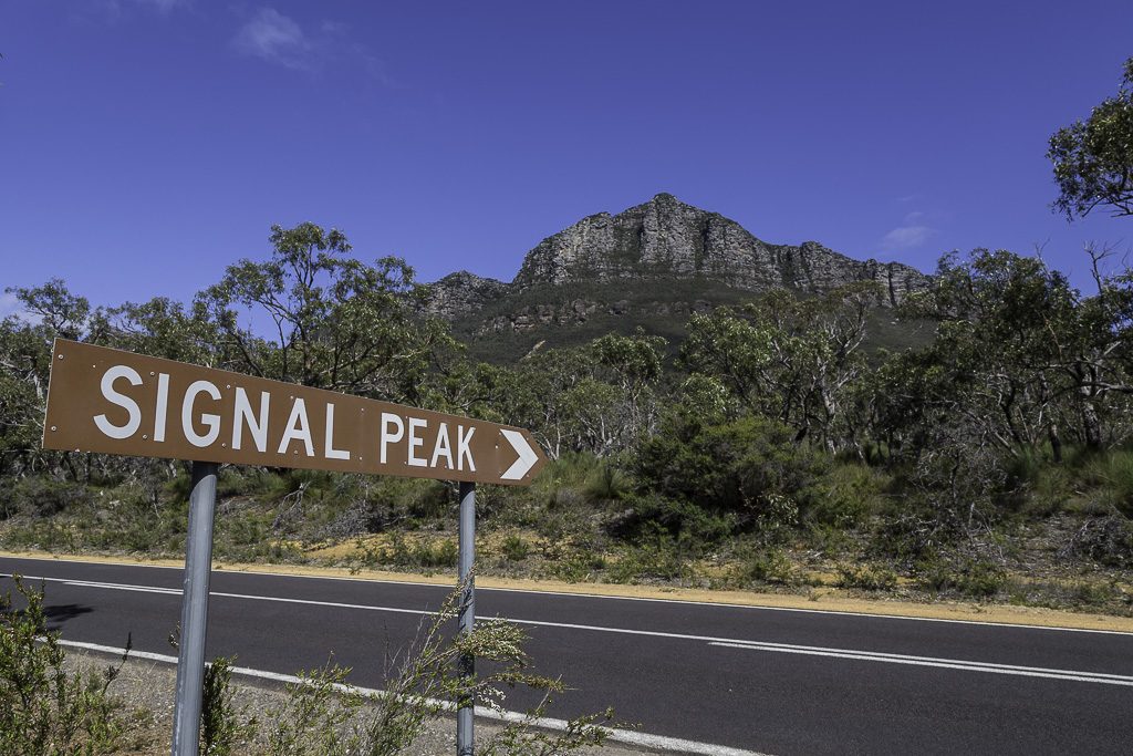
Okay, the last photo looks a little weird. No, the sign isn’t pointing vertically. It’s just the whole, ‘camera distortion and I can’t be bothered to correct it’ trick. There’s every chance this phenomenon may reoccur.
The word ‘looming’ gets a little overused, but I think it’s the most appropriate term for Abrupt hogging the field of view.
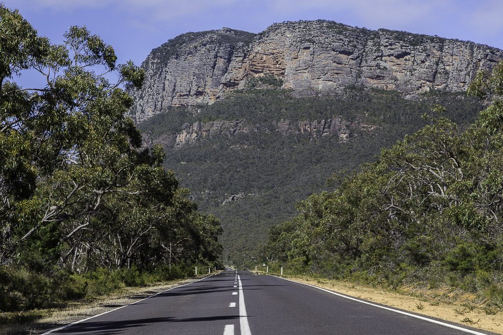
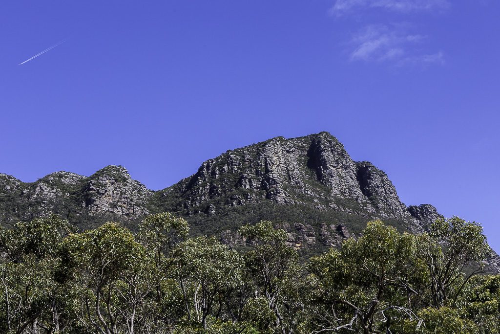
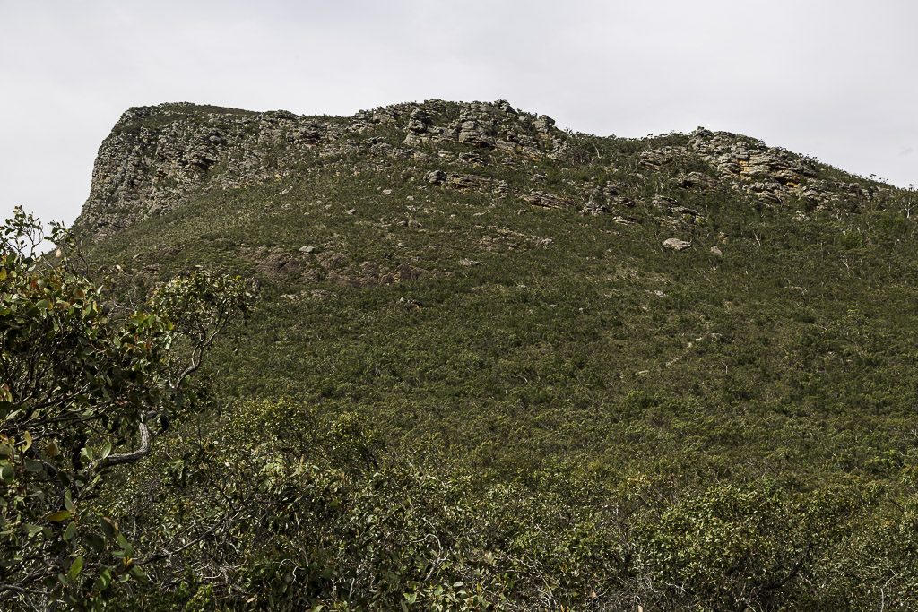
Signal Peak has a bit going for it though. At first glance, the eastern side looks appropriately impenetrable.
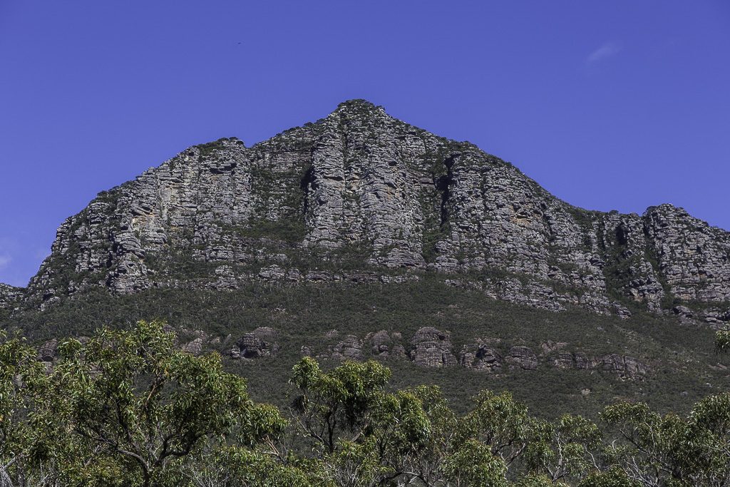
From the road, it does look impressive. Then again, if only there was a jet contrail going by. It could really add to the photo. Oh, that’s lucky. There is one.
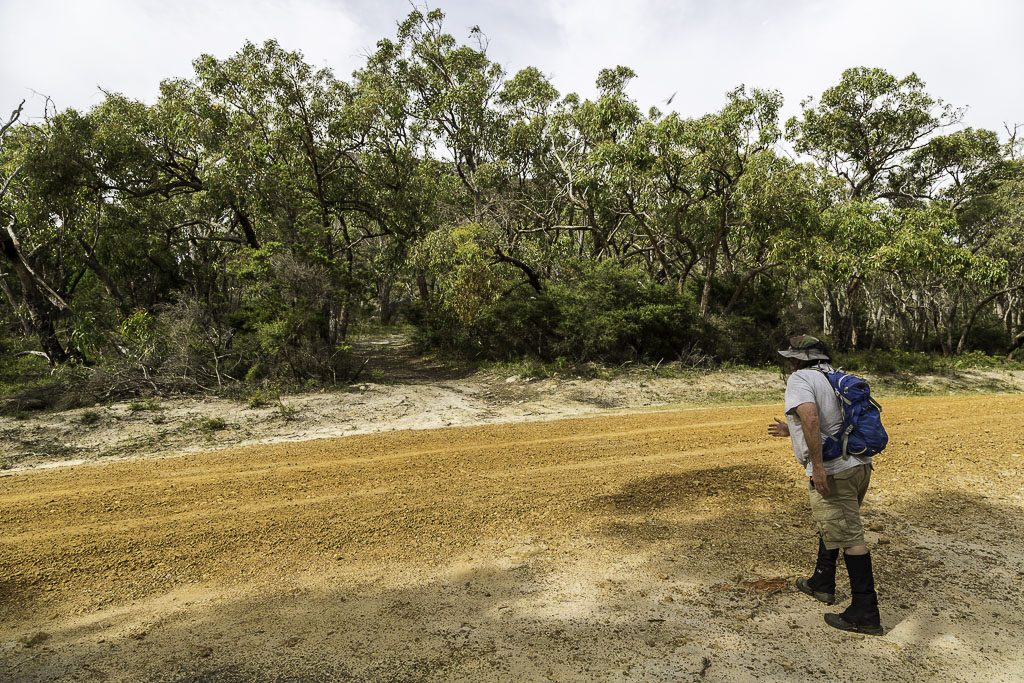
With one car dropped off, we headed up to the starting point on Cassidy Gap Road. I better mention one thing now. Some photo trickery has been going on. All those sunny shots were taken on the day after the walk. I aimed to take them all on the same day, but I was too ROOTED to even lift my arms, let alone admire the surrounding landscape. No, the day of the walk was a photographers nightmare. Overcast to the horizon meant the light looked dull. Oh well, I can’t pick the weather, so that’s all you’re going to get.
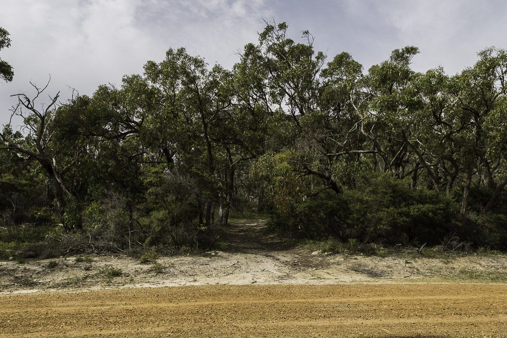
On Cassidy Gap Road, we had our eyes peeled for a rough track that would be our starting point. I thought it might be a ‘blink and miss it’ type of thing, but in the end it was pretty obvious.
Getting out of the car, it was a matter of fine tuning the gear. In a plastic bag I had a swag of TZM’s finest. A series of maps and some notes he’d forwarded to me. Sure, some of the information was a little vague.
“…kinda hard to write those notes sometimes, u can’t really say turn left at the Rock and right at the tree , cause they are fucking everywhere…”
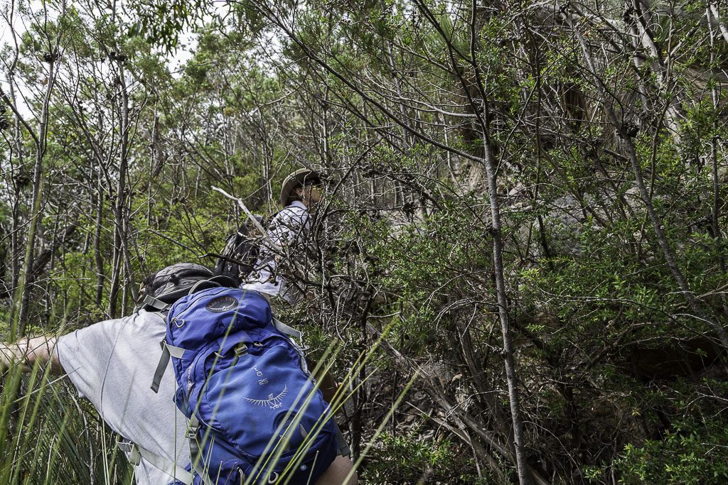
I guess it was better than nothing though. With maps sorted, it was time to adjust the full protective gear for upcoming Grampians scrub. Gaiters were standard, but I had some other bits of clothing that I wanted to try out. Well, that was the blokes anyway. Lady Smuffin had no regard for gaiters or any of that claptrap. Women are usually tougher anyway. Understandable I guess, as they spend a lifetime putting up with crap from men.
There was a minor dispute over my previous photo. Apparently it was lacking action, so Smuffin was captured at full throttle, heading into the wild. Actually, I have three of the same picture, so it’s safe to say he’s not moving at all.
Wandering on, the route was remarkably clear. So clear, there was tape, marking the way.
The climbing begins
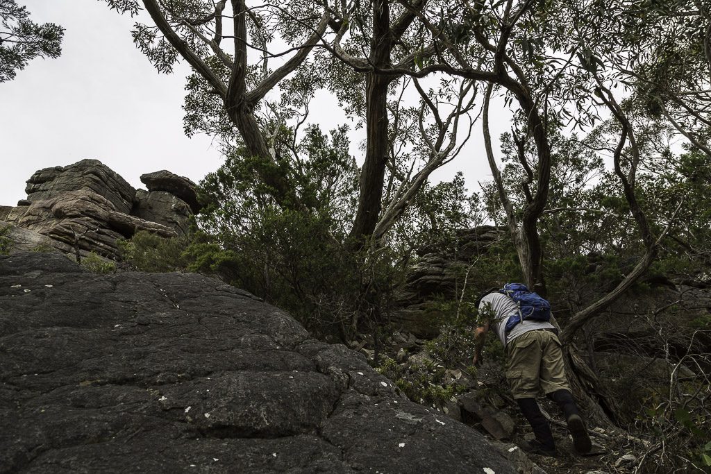
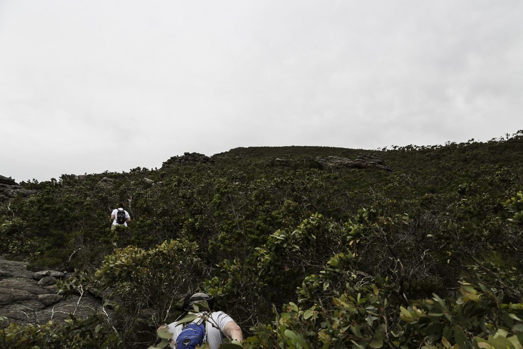
After walking south for a few hundred metres, we reached a rock outcrop. I knew this location was the cue to head west for Signal Peak itself. It also meant we were out of the tree cover and in the distance there was signs of a track angling across the hillside. Hang on? Where’s all the standard, gnarly Grampians business? So far it looked like a straightforward stroll.
Sure, it was a steady climb, but so far there were no demons. Scanning back, we began to gain some height.
Things were going to plan. Until I lost the makeshift track and ended up leading everyone into the scrub. Hey, don’t get angry with me. It’s my job. If I kept to manicured tracks, then how boring would this entire blog be? Anyway, it was the first chance to confront some traditional Grampians fare, which is immortalised in the quote.
Take nothing but memories, leave nothing but all of your skin behind
Some mild cursing and bush shaking was utilised and although the way wasn’t exactly clear, we adhered to a fail safe method. If you don’t know where you’re going, just keep heading up. It’s an old favourite and with a cliff base coming into view, it made sense to head straight for it.
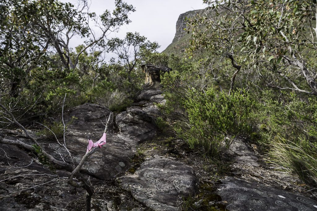
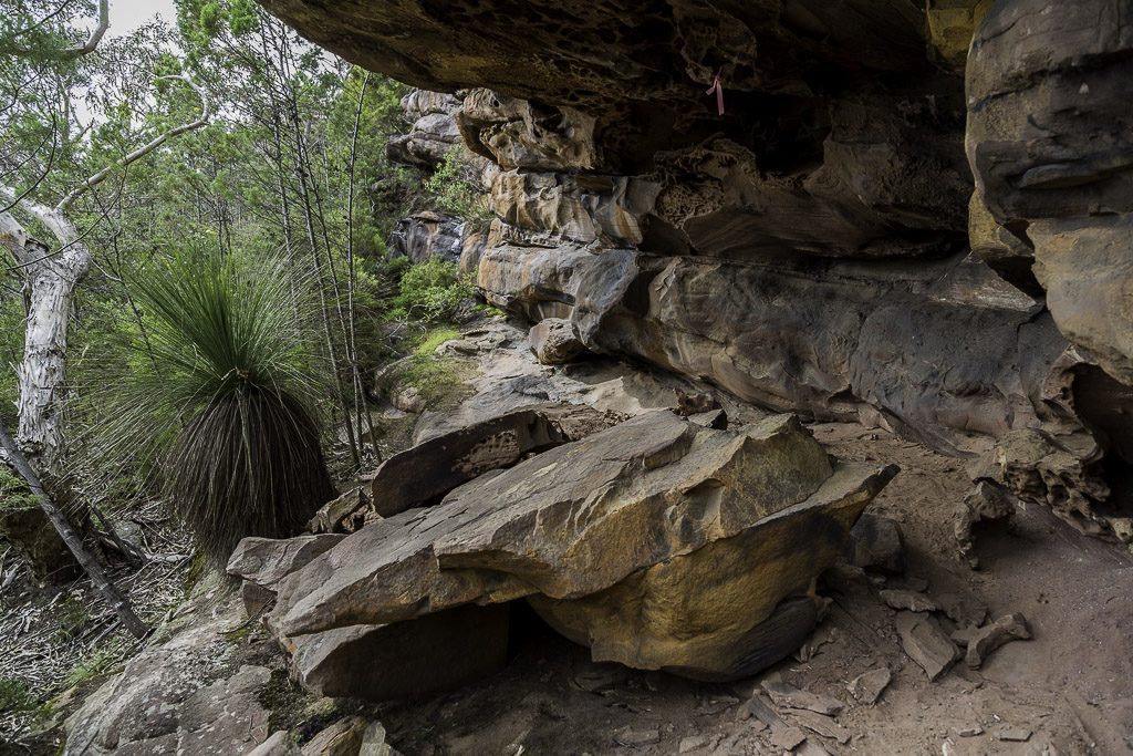
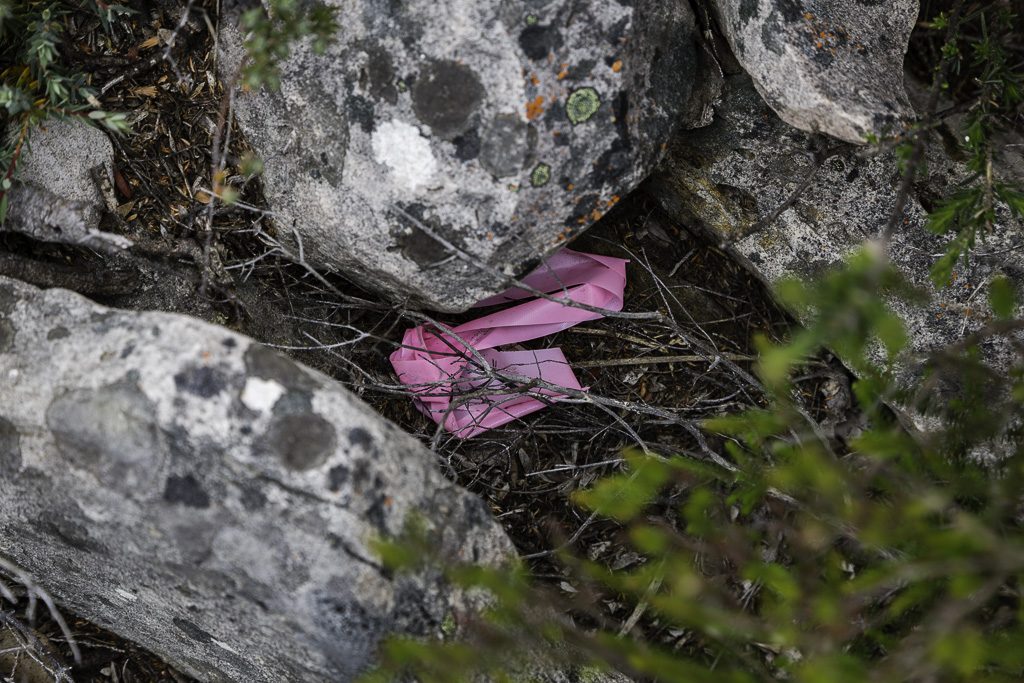
Before long, we were sans scrub and standing beneath a huge rock wall. Complete with pink ribbon to keep us company. We did stop for a while and I even sat on that flat rock in the photo. Until realising my seat had fallen from the roof above. Sure, another collapse might only occur every few hundred years, but knowing my track record, I preferred clear sky above my head, rather than the Serra Range.
Wandering on, it all became a bit of hit and miss. The clearest area for walking was near the enormous cliff edge, but this added a bit of a fear factor. In the end, we stumbled across a gully and made our way up. Looking back at some of the trees we’d negotiated.
As we neared the top of the gully, the way ahead looked quite clear…
…before reaching large, open areas of rock. When I see pictures like this, I wish the sky had a bit of colour in it.
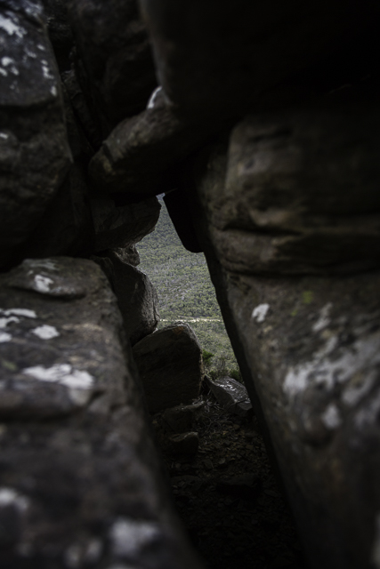
Looking at the east side of Signal Peak from Cassidy Gap Road, we could see a rock arch near the cliff edge. It was a handy guide, as I knew we had to pass it when we were higher. It also looked worthwhile to examine. Reaching it though, I became a little confused. At the base it looked quite large, but in reality…
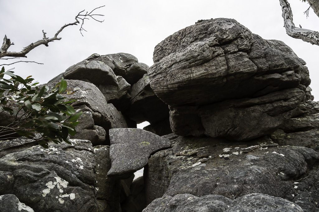
…the gap was no larger than an oversized pumpkin. Or my head. The choice is yours.
Map Madness
Then again, maybe it was the wrong arch? It’s possible, as it was around this point I discovered something. Actually, discovered is probably the wrong word. In my pocket, the maps and notes, lovingly curated from TZM, were folded neatly inside a plastic bag. Well, they were, but not anymore. Some deep pocket rummaging revealed I was now officially map-less.
I wondered how this news would be greeted by my companions. It was a hard topic to broach, so I adopted the ‘jaunty’ method.
I said, “Hey! Guess what I can’t find!” If this was a text, there would definitely have been a smiley face at the end of that sentence.
Smuffin replied,” No. What?”
I said, “The maps!” (Smiley face)
Smuffin said, “Haha… Pretty funny. Tell me you’re not serious?”
I said, “I am! They’re gone!” (Smiley face)
Smuffin said, “You fuckwit!” (Sort of smiley face)
I was then lectured by Lady Smuffin, “At what point did you think a plastic bag in your pocket would stay there?” As you can see. It was a wild scene as Smuffin² ganged up on me.
In the end I managed to placate them by saying the route to get to the top was hit and miss anyway. Remember the earlier system? Yep, just keep going up until there was no ‘up’ anymore. I think this explanation was well received, which was lucky, as I’d totally made the whole thing up.
Another easy explanation is it’s a new ultralight hiking method. Maps? Who needs them? They’re weight! Oh, they’re still out there somewhere. If you attempt the same walk, have a good look around. If you find them, then you’ll know how to get to the top. Treat it like a piss-weak treasure hunt.
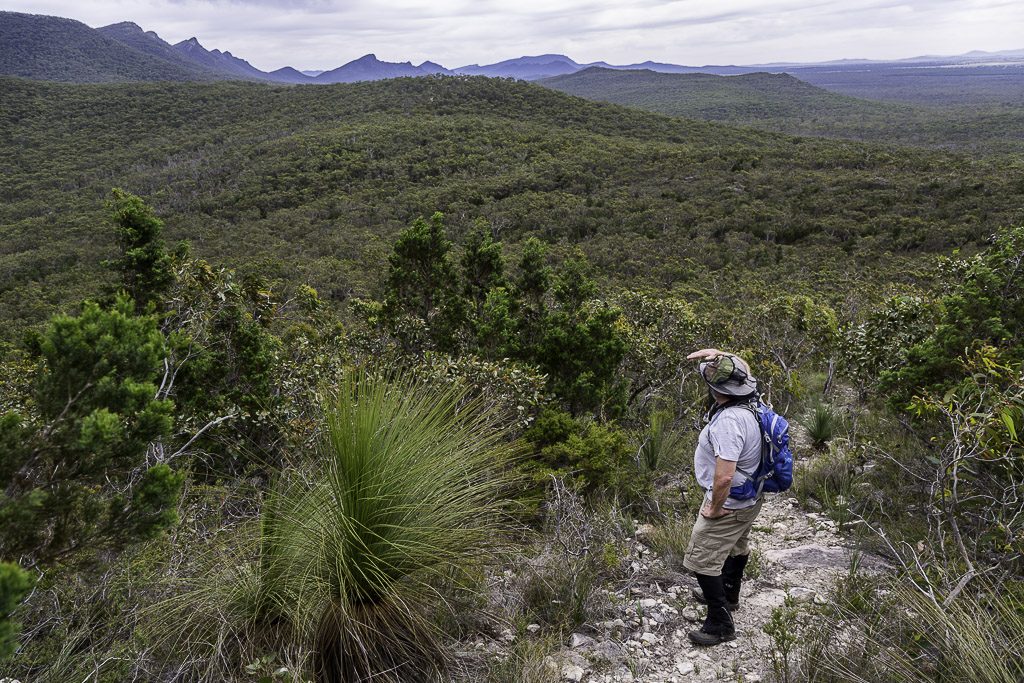
Changing the subject was the best I could do in the circumstances, so some height ogling was undertaken. Cassidy Gap Road and the rock outcrop where we’d turned west were clearly visible.
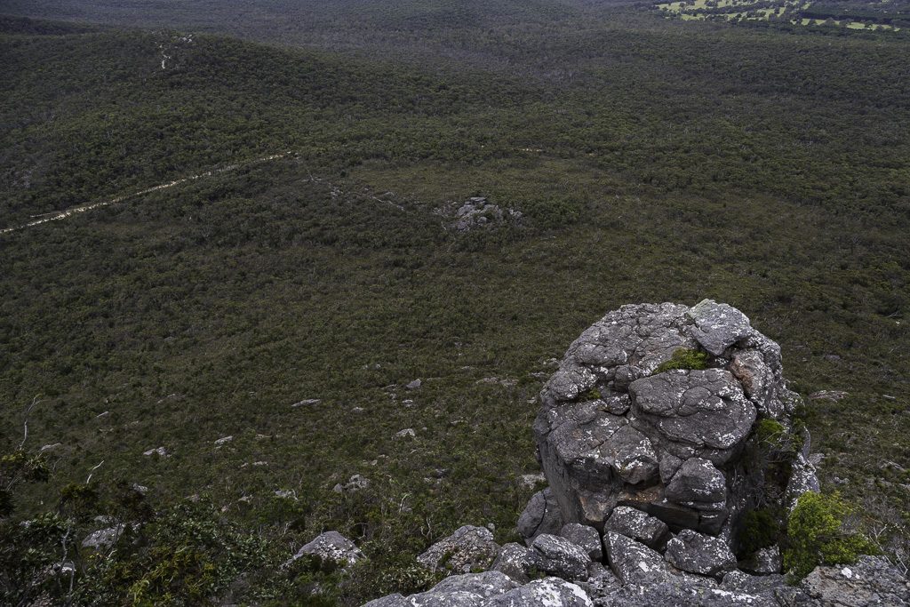
More interestingly though was what lay ahead.
In patches a rough route would appear, before vanishing into the head high scrub.
Surprisingly though, the pink ribbon continued to appear in places, although some had bitten the dust. I’m not sure who laid this tape, but maybe they’re initial markings for the mythical Grampians Peak Trail, which is opening in 3025?
This all looks quite straightforward, but there was plenty of things going on behind the scenes. Firstly, it was stinking hot. You know those sort of days? 30 °C and overcast with an annoyingly strong, northerly wind continually buffeting us. Smuffin wasn’t impressed with the breezy conditions and believed if he was under 100 metres from the vertical eastern face, he’d be blown off. I did take a video of the wind, but it’s only 14 seconds and isn’t much use to show the conditions. I’m not sure why I didn’t take a proper one? I think the heat was one reason, as I was started to feel the first signs of being sapped.
Oh, whilst the wind did come up for discussion, we resolved whether to continue or not by slinging some profanity at each other. This was beneficial for all of us. Questions of masculinity were raised, but Smuffin and I were both struggling with this for one reason. We both had fly-nets and Lady Smuffin didn’t. She thought they were stupid and scolded us for having ‘hair nets’. Very harsh, but it was mildly valid considering us ‘men’ had to pause every ten feet to remove branches from our hats. Here. I’ll show you what I mean.
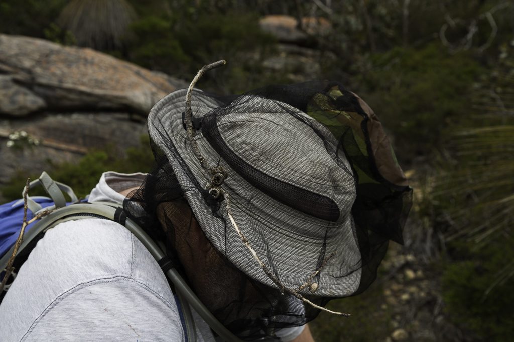
At one point a branch snagged my fly-net. Thinking it would free itself, I continued walking. Unfortunately it didn’t and I found my legs approximately 12 feet in front of my head. I’m awaiting verification as to setting the world limbo record.
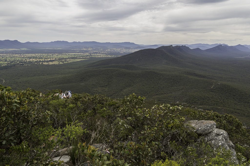
Behind us, the Serra Range was stretching itself out…
…but it wasn’t all about sweeping vistas.
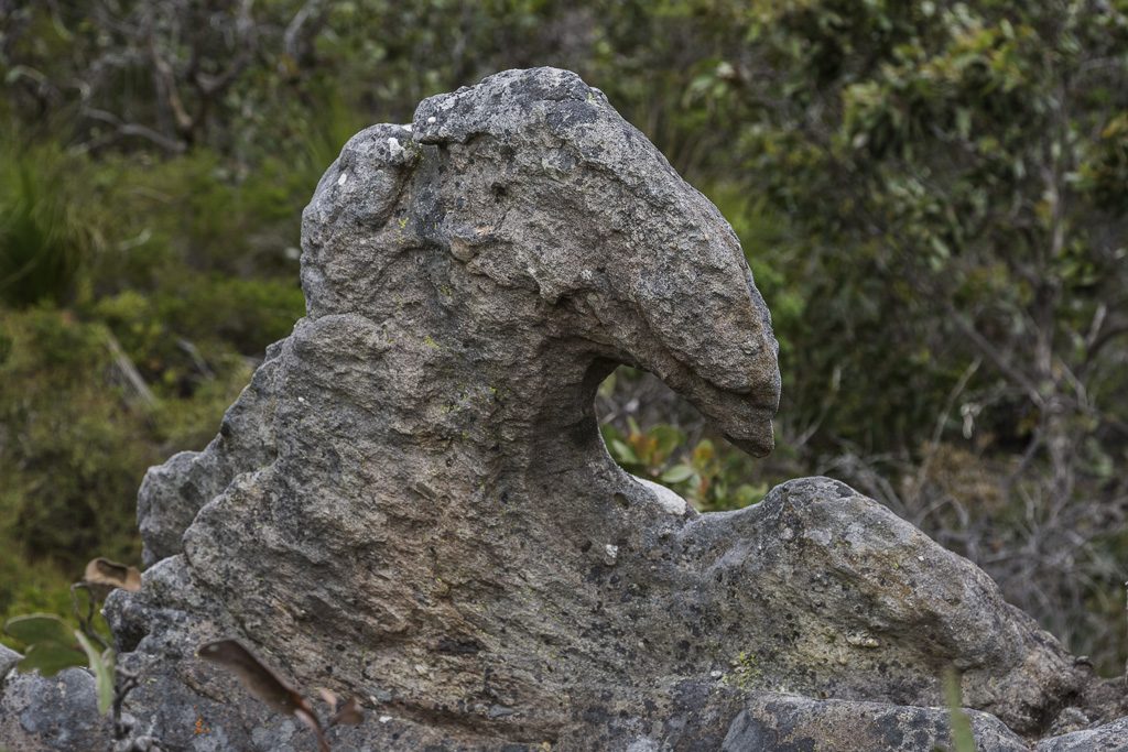
This rock caught my eye. A couple of years before I was born, the Grampians were lined by oceans. I just learnt this whilst reading the Grampians Wikipedia article. Does this mean one of the waves from these oceans just turned into a rock one day? You know, ocean in the morning and then rock by afternoon? Where’s Erich von Däniken when you need him? Oh, did you notice one of the images in that article? Yes, it’s another version of Signal Peak from the same Mt Abrupt angle! You didn’t believe me when I said that earlier, did you? Were there really five questions in this paragraph? Actually, make it six now.
Anyway, this post is really dragging on, so I better finish this first instalment off pronto. The climbing continued…
…until finally we could feel it levelling off. This is where I leave you for now. Reaching the top, followed by a short descent should make for a brief concluding post for this walk. I can assure though. That’s not the case at all.

Greg, Wonderfull. You really are back and another very interesting bushwalk although the cut off of the first installment has left me feeling like I’m hanging over the precipice. No comment at this stage regarding how Mrs Smuffin is faring without gaiters….a scary proposition in that Grampians scrub.
Thanks Neil. Yeah, I had more or less written the whole thing, but it was reaching insane territory size-wise! Thought it best to chop it in half, which is for the better, as I don’t have to rush the downhill section 🙂 Oh yeah, the ‘additional protective equipment’ will get a spiel in the second half! Thanks for dropping by.
I’ve been looking forward to another crazy Greg and Smuffin suffer-fest and now Lady Smuffin has joined the team to add some true feminine grit. Bonus! The dialogue is one of my favourite parts of these group walks!
I love the new layout and think your excellent photographs can handle intense scrutiny. I’m pleased to see them much bigger on my pathetic little laptop screen. The rugged scenery of the Grampians looks very impressive and somewhat intimidating. I can’t say I’ve done anything that insane for a while. 🙂
Great! My partner is always losing things from out of his pocket. Hats mostly. He always says the same thing; “Oh I mustn’t have put in properly”. Looking forward to part two.
Loved it.
Nice to see you’re on WordPress… or maybe that’s old news and I’ve forgotten. You’re not the only sporadic one. It’s only thanks to Mildly Extreme Jane that I noticed you’d posted this!
Signal Peak.
I saw your photo and thought – is that mine? Ha!! I wonder how many others will, too! ; )
So you made it then? I recall you took that wrong turn on your way up Mt Abrupt a few years back and nearly headed up there… the day we not-exactly met you at the summit – I don’t expect you to remember us; you had just been chatted at for about half of the walk up by a local(?) lady so talkative that we could have sworn there was a bus load of tourists coming up behind us. The worrying part was that they were making good time!
Anyway, looking forward to part 2 and a few more thousand words. ?
Yeah, the new layout seems to be working well! Sure, I can’t say I’ve gone back through old posts to see if there any glitches, but so far it looks great. On this walk, all those stunning vistas would have looked amazing with the blue skies the following day. Oh well…
Oh, I’ve lost a few maps over the years, but I did lose a hat once also! My solution to that was to redo the hike the following day and find the lost hat. I was successful, although I barely wore the hat again. It was the principle though 🙂
Thanks! Yeah, I have been on WP for over a year though 🙂 Different themes and a stack of glitches later, I think it’s working okay.
You’re right about Signal Peak. Anyone who climbs Abrupt will have that same photo of Signal Peak! It’s the most obvious and impressive thing whilst heading up Abrupt! It made me laugh when I looked at the Wikipedia page on the Grampians and the same viewpoint was pictured 🙂
Yeah, of course I remember you! I was accompanied by that woman I found in the bush. I took a wrong turn going to Abrupt, but she REALLY took a wrong turn. No idea what was going on there, but she was well and truly in the trees 🙂
Hey hey its great to have Mr Fiasco back, having the internet without a regular Fiasco post is a bit like Playboy without nudity, thankfully all is normal in the world again:) With Jane and Dayna commenting you’ve even got the band back together again, come to think of it you’ve almost had as many comebacks as Farnsy!
Hmmm, first walk off track in the Grampians, what could possibly go wrong. Looking forward to part 2, going down hill should be easy…..right? Seriously though I love walking the sandstone in the Grampians, there are so many opportunities for self flagellation up there I could be happy for the rest of my walking life I think.
Good to hear your happy with your site now (it looks pretty good to my eyes), incidentally if you had your time again would you still go WordPress or would of you stayed on Blogger?
No worries, thanks Kevin. Yeah, I do have that old book, which I think has a 100 Grampians walks? Quite insane really. I’d like to give at least 20 a go that aren’t well known! The trouble is, I’m not sure if I’ve got enough skin for such a task 🙂 It’s pretty brutal stuff at times!
Regarding the new looks, thanks! Then again, I did nothing. WVC did all the work. Oh, if I think about it, I wouldn’t have changed from Blogger to WP. Blogger is maligned for some reason, but I was flying when on there. It’s no problem starting on either and sticking to it. It’s the change that’s a bit of a pain 🙂 Also, Blogger is way cheaper!
Hey Greg, when are you coming back down man! You’ve been up there a long time 🙂
Haha… Yeah I’m a little slow lately! In the middle of moving house. When done and set up, I’ll come back to this saga 🙂
Hi Greg, Hurricane Hans From Hanover here again. I’m eagerly awaiting the concluding volumes of your Signal Peak walk blog. I only caught up with it yesterday and at the end felt like back in the old days when I used to read Mad Magazine and they would say an article was continued on page 85. Trouble was there were only72 pages in the magazine!
Did get back to the Hidden Beach a month ago near Ryans Den on GOW. The ancient carvings there, are well over 130 years old but deteriorating rapidly. Check out Bendigo Bushwalking club latest newsletter for pics. Regards Hans
Hi HHH, Yeah, I’ve been off this site for ages, but I have a perfectly legitimate excuse. I’ve had no internet for the past 6 weeks! All in all, quite a painful NBN experience, which reminds me. I need to get the second part of this post done before there’s a riot!
No, sorry, I haven’t got back to the GOW yet. It’s on the backburner, like a lot of these things!