If you asked me four years ago where Mt Alexander was, I’d have directed you to the road with the same name which runs through Moonee Ponds. Don’t forget though, I came from a background where all I believed a bloke needed in life was a fast car and hot chicken.
Anyway, once I realised it was an actual mountain, I’d been meaning to get up there and take a look. Even then it’s taken me a couple of years to organise a day hike to the place, but once I did, I liked it so much I’ve been there twice. Once on a steaming hot summers day and the other last week on a balmy autumn day. In fact, the weather has been so mild in Melbourne I don’t think there was much of a temperature difference between the two trips!
There were also a couple of things I missed on my first trip which left me keen for a second look. How about not even being on the actual summit? Huh? I assume when you climb a mountain and get to the top where lookouts and massive television towers are, that’d be the top? Um… No, it’s not. There was also an old granite cottage tucked away in the bush, which I’d missed on my first trip, so that was something which needed to be inspected.
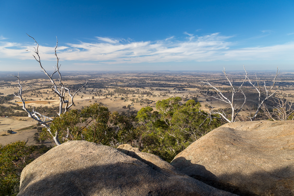
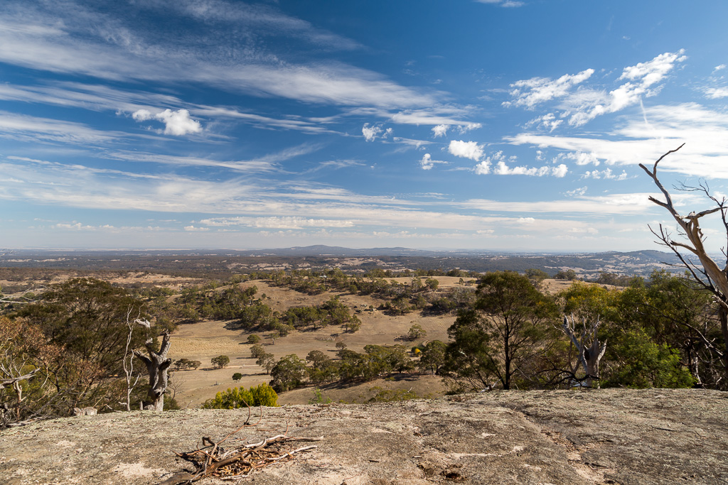
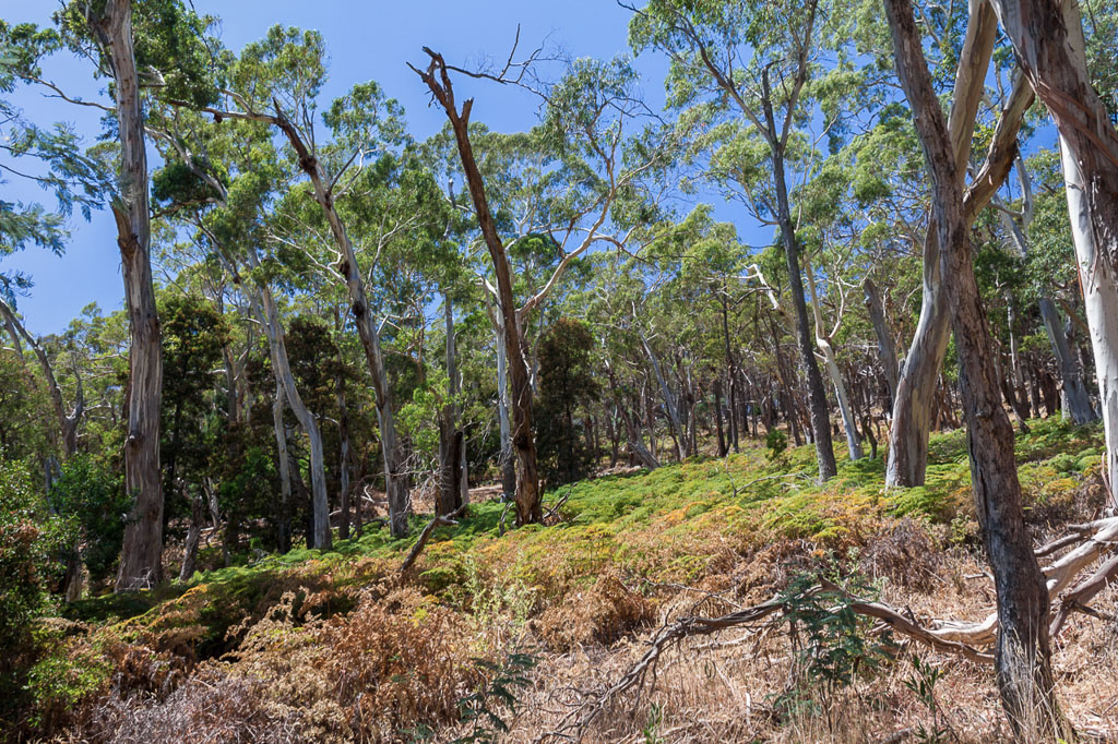
So, what you’ll find in this post is a combo of photos from both trips and although it’s been one hell of an overblown intro, it’s over and I’ve started walking. There’s one noticeable thing about this area. It’s dry as a chip and on both trips, there’s not a lot of greenery. Talk about a lack of rain. On that note, I read the long term forecast for the next three months is warmer than average. This isn’t good for a bloke whose maximum output efficiency is achieved in temperatures below 15 °C. Anything over and you’ll find me flaked out on the couch.
The start. From McQillans Road.
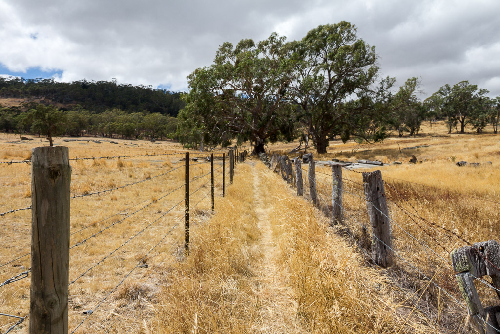
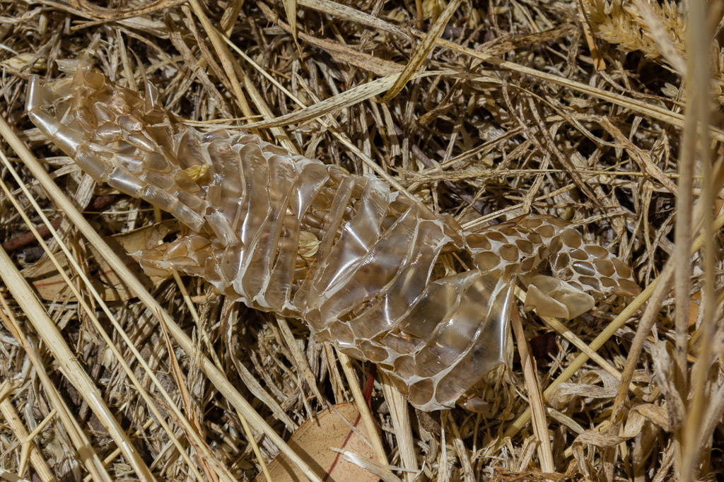
On the stroll up between the fences I did notice something of interest. A discarded skin lay among the grass which I assume was from a snake?
Following the skin sighting I was now watching every step through the grass, as the track headed uphill. As I’ve always said before, there aren’t many walks where there’s a casual intro. This was the same and the initial climb had me cursing I wasn’t carrying a defibrillator with me. Then suddenly a structure appeared, which had been delivered by the hiking gods. A chair.
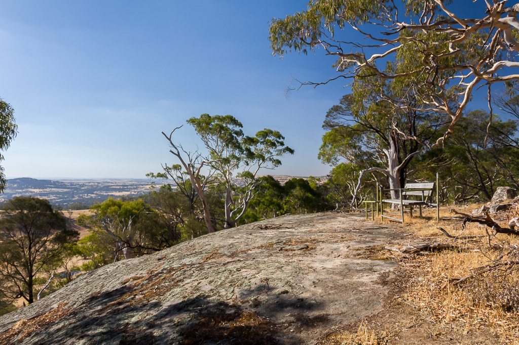
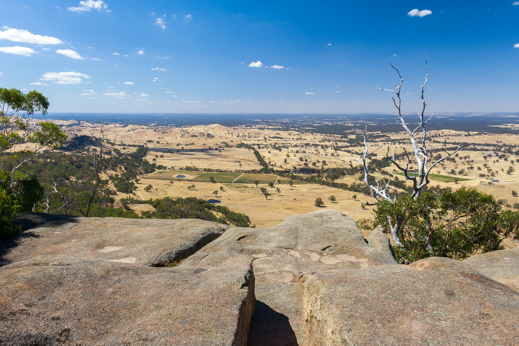
I collapsed onto the seat and noted two things. My heart was racing so fast I couldn’t keep count of the beats and the view is fantastic. In fact, the vista is so good, it took my mind off an impending stroke.
Chair view
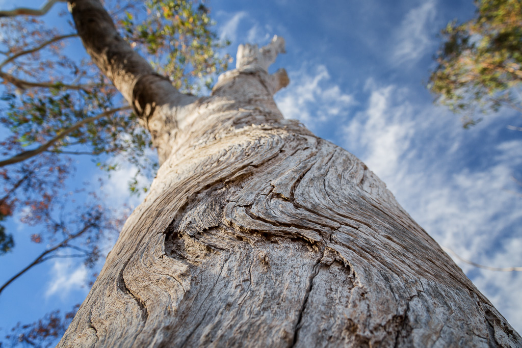
There’s a lot of walking to come, so I couldn’t stay seated for too long. The track winds it’s way up, passing some nice, curved bark trees…
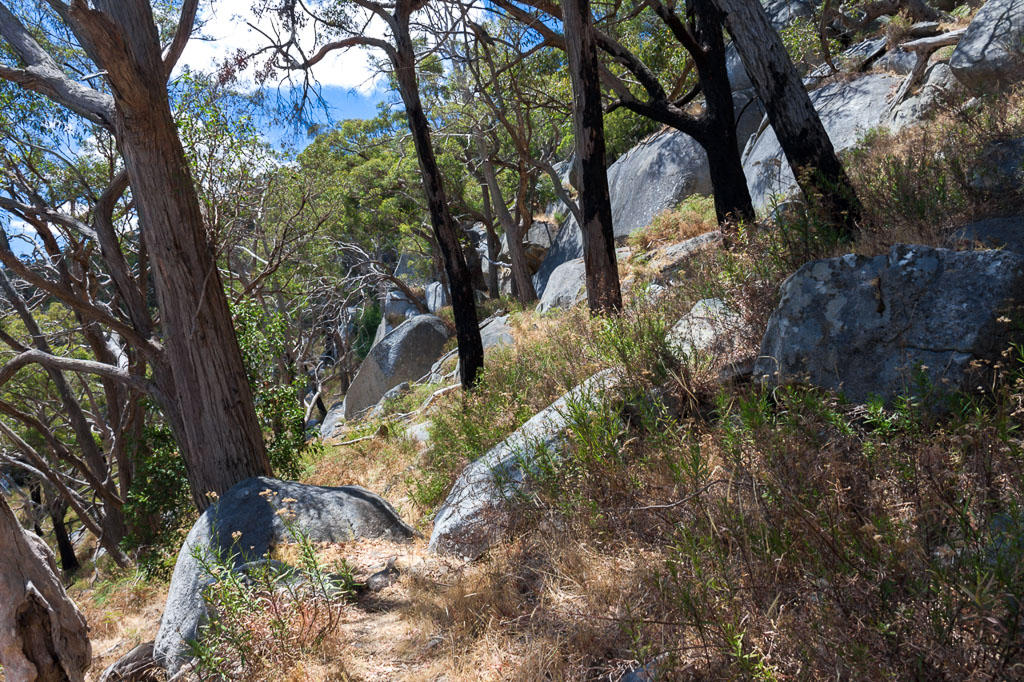
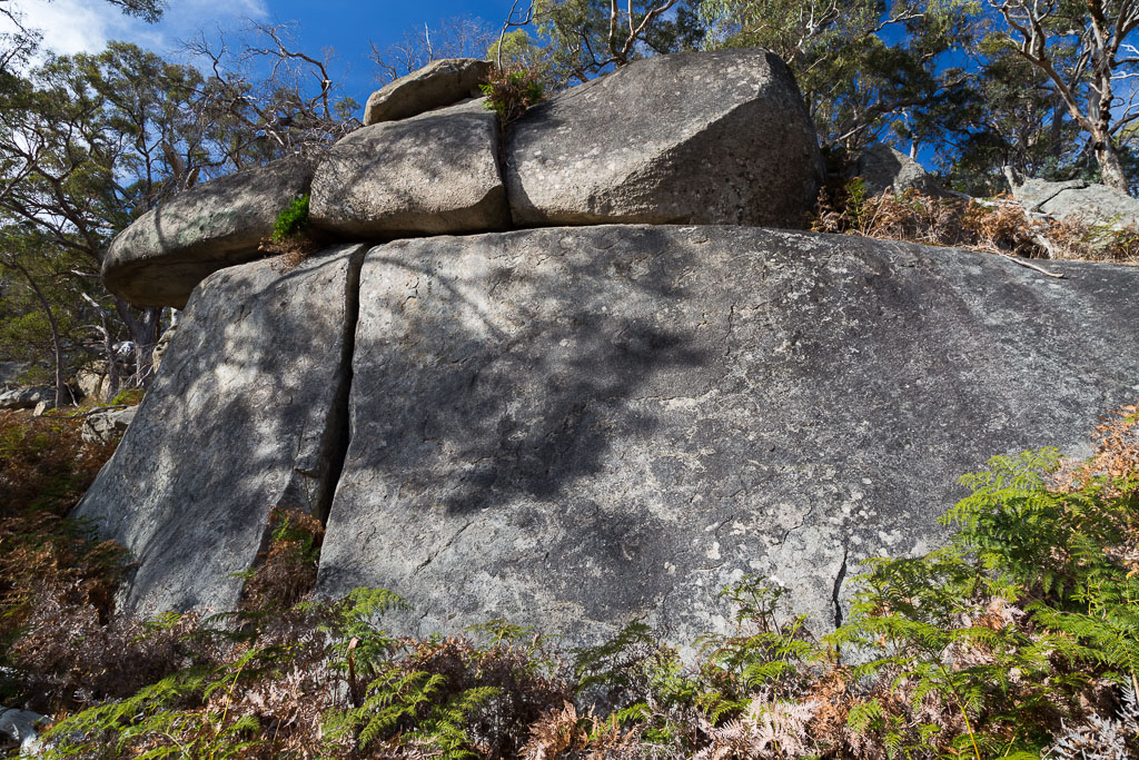
…before reaching a spot called ‘Dog Rocks’. As you can probably guess, there’s lots of rocks here. Not just any rocks though, but massive ones.
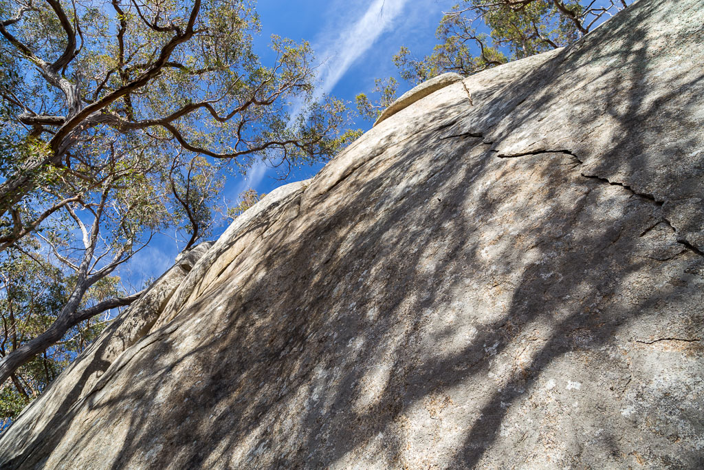
It’s a great spot and judging by the remains of the odd fireplace, other people think so as well. Camping amongst these huge rocks would be quite an enjoyable night out, but there’s no water here. Actually, is there any water any where lately?
The occasional tree has grown around these boulders.
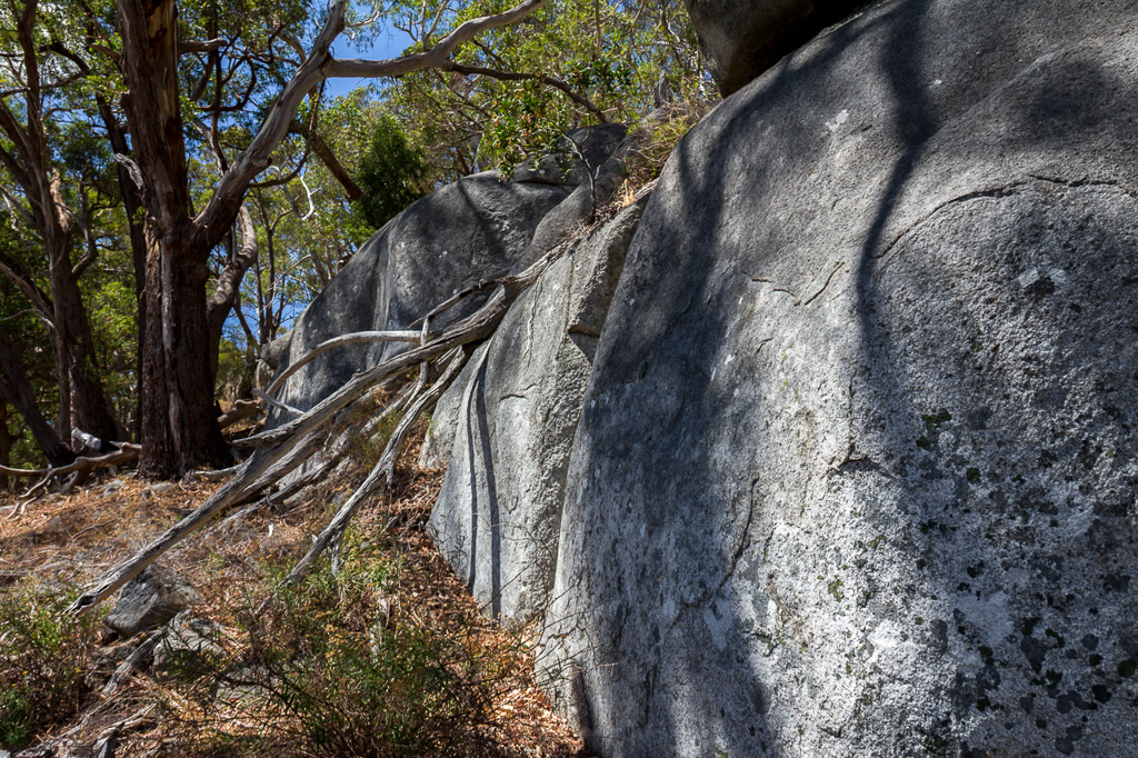
One can’t stop though, as the fearsomely named ‘West Ridge Walking Track’ has to be tackled. I’m not really sure what happened next, as it’s only 2.7 km from Dog Rocks to the top of Mount Alexander, but it took me decades to walk that piddly distance. It’s uphill, but I think the undulating terrain weaving up amongst rocks was the cause of my sloth-like speed. It has plenty of sights though and incongruously, tree ferns appear in this parched landscape.
The hillside is also steep at times…
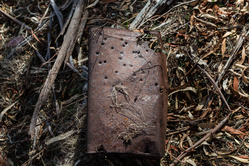
…but, it’s not always nature along here. I spotted a ‘ye olde’ steel tin lying amongst the grass. Was it a relic from the days of the goldrush in the surrounding area? I couldn’t really tell though, as upon closer inspection it was full of bullet holes.
On my summer trip I stumbled across an echidna at the side of the track, but unfortunately didn’t spot him until the last minute, so my biblically loud foot-stomps had him burying himself as I arrived. His face was well hidden for protection.
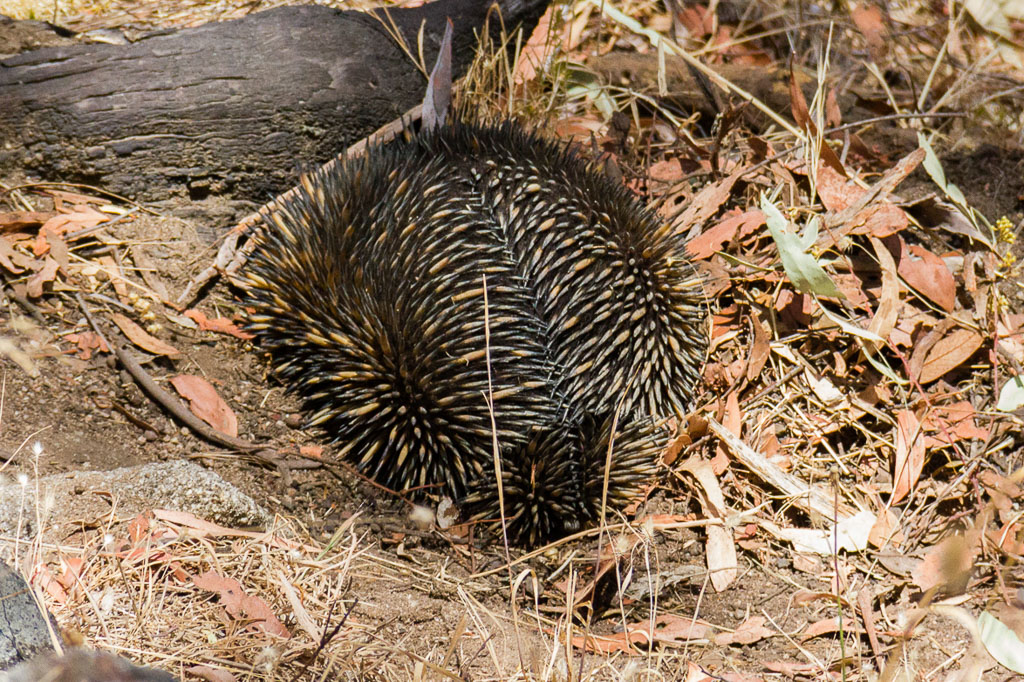
Armour deployed
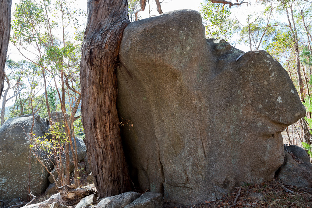
The track continued up, passing the boulders of ‘Scorpion Rocks’…
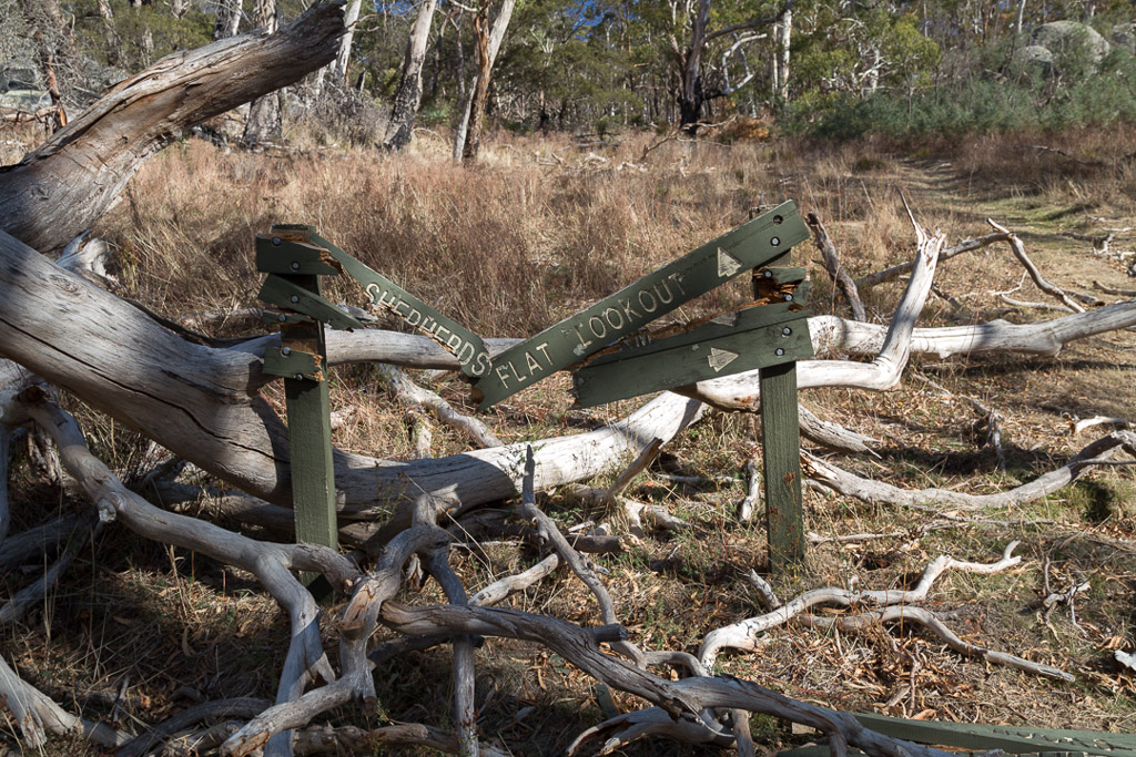
…before the landscape opened out near the top. There’s one thing about this park though, which shows Parks Victoria don’t have two cents to rub together. This obliterated sign was untouched on both trips and I’m pretty sure it’ll remain this way for the next 200 years. Yes, 200.
I could hear the buzzing sound of a generator, so I knew the top was close. Unfortunately this is another mountain covered in enormous masts. I’ve no idea what they service, but no doubt it’s for something important?
Anyway, stumbling onto flat ground at last, I located ‘Langs Lookout’ via guess work…
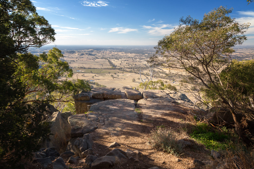
… and descended to the large flat rocks for a much needed rest. It’s not a bad spot for a breather either.
Langs Lookout
On both occasions, I spent well over half an hour lying on warm rocks, with the wonderful thought it’s all downhill from here.
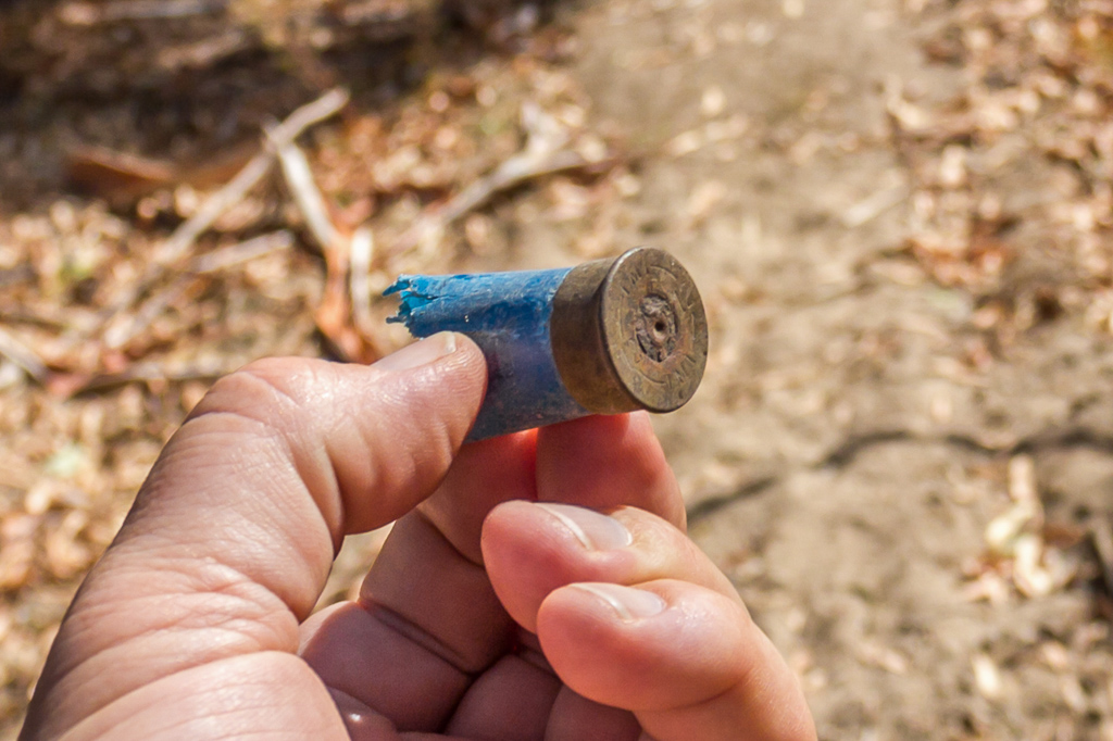
Well, maybe. After leaving the lookout, my walking notes throw in a tricky doosra. The descent veers off the Joseph Young Drive which leads to the top of the mountain and instead plummets down the ‘Goldfields Track’ for a while. This is nice, but there’s a catch. After steeply descending, it rises back up an old 4WD track to the road again. On my summer jaunt, I followed this method and found myself almost vomiting from the sudden drop in height, which is then regained in about ten feet. I didn’t really find much to look at either. Unless you’re into shotgun shells.
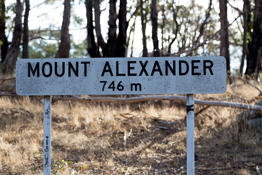
This also created a reason for the second visit. I hadn’t been to the top of Mount Alexander at all. I assumed by getting to Langs Lookout I’d summited, but the highest point is actually next to the road a short distance away. I’m not going though horror without bagging the summit, so the autumn tilt had me avoiding the Goldfields Track and instead following the road down.
It’s far nicer walking for the lungs as well, and as road bashes go, it’s not bad. On both occasions I barely saw a car, so it’s quite comfortable, but best of all, it’s downhill! Actually, the summit was insanely easy to reach, as it’s right next to the road. The sign indicates the lofty heights I was standing at…
…and a short distance away is the summit cairn, which is a peculiar beast. Part chimney looking and part something, the peak was successfully bagged.
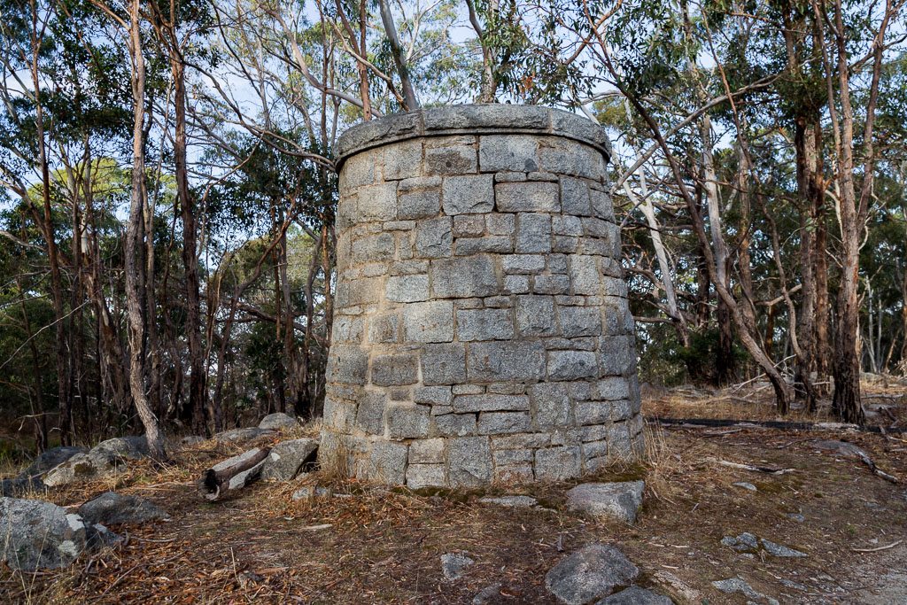
Cairn – Mt Alexander
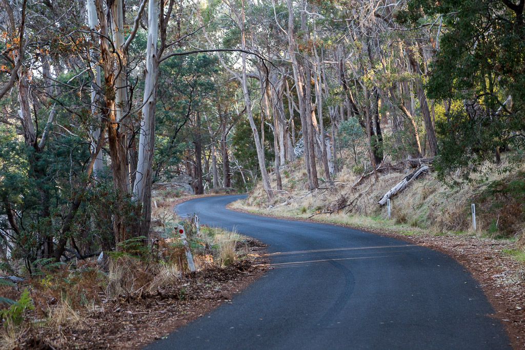
With one of the attractions I missed out on in the first trip completed, I continued down the road. There’s plenty of curves for photo opportunities…
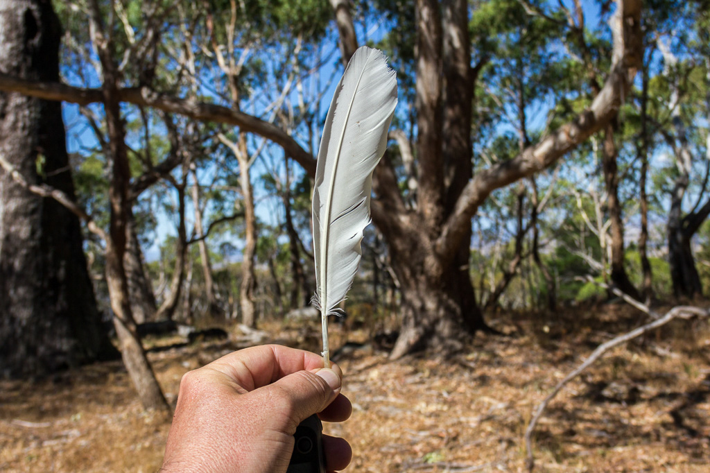
…the odd feather…
…and friendly wallabies who wave as you pass by.
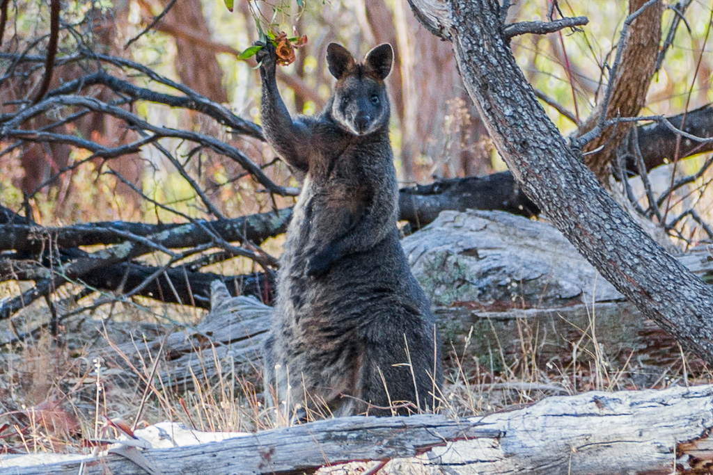
Hi!
Next up was the old granite cottage. On the summer visit I was intending to track it down, but found myself thoroughly wrecked from the heat, so abandoned the idea. The ruins sit off the road and tracks, so a bit of work is required to find it. For some reason it’s not even mentioned on the Parks Victoria blurb for the area…?
Anyway, after descending I headed off the road at a point where I thought it was nearby. It was actually quite easy to find, as it appeared through the trees.
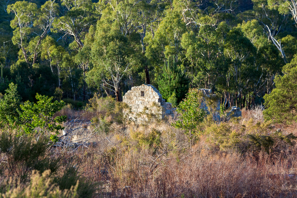
I guess it’s because the ruins sit near an old track, which although marked on the Parks Victoria map, appears to have vanished? What confused me more was earlier in the day I walked on the west side of the mountain on West Ridge Walking Track. Now on the east side there’s the track which has now vanished and it’s also called the West Ridge Walking Track. Mm… Tricky.
Anyway, after a bit of perusing online, I found the following information. It’s listed on the Victorian Heritage Register (VHR), number H1348, as the Mount Alexander Silk Worm Farm. Essentially it was established in 1872, but closed in 1878. It’s significance is,
‘…historically important for its association with a relatively obscure nineteenth century industry and with the role of women in nineteenth century industry…’
If you’re interested, I got the history from this Victorian Heritage Database Report and this ABC report has a similar spiel, although I think it’s a direct lift from the report.
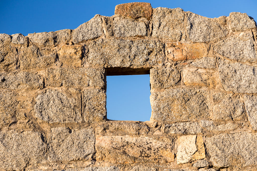
There you go. After seeing it up close, it seems tiny for a ‘factory’. It was late in the day on my autumn trip, so the low sun was creating a nice golden glow through the old window…
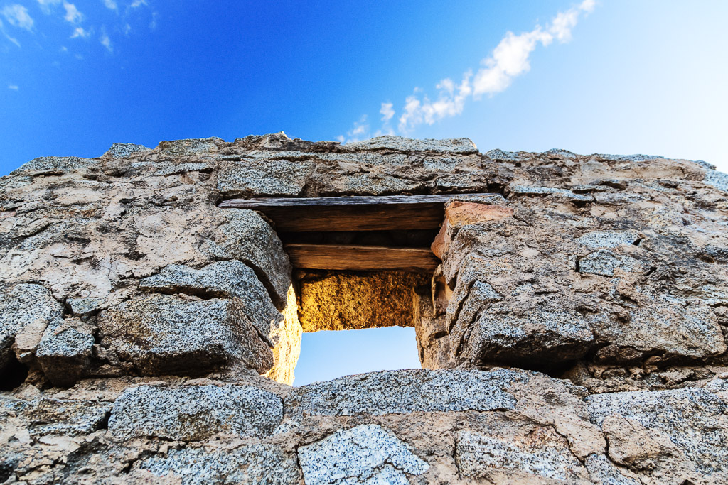
I’m not sure what made it collapse over the years, but I assume it was cannibalized at some point?
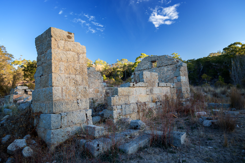
Former Mount Alexander Silk Worm Farm.
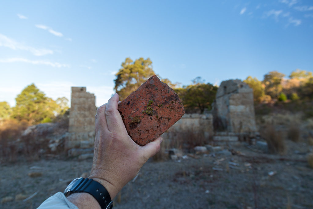
A number of old red bricks also lie around the area.
With one last shot taken from the other side of the window, I left leaving the ruins behind…
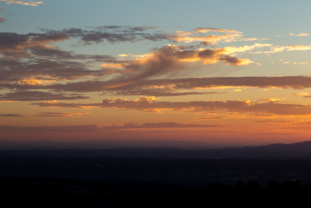
…and made my way back to the road and track which joins up with the trail I’d followed earlier in the day. Light was really fading now, as I reached the chair from the hiking gods. A blazing red sky…
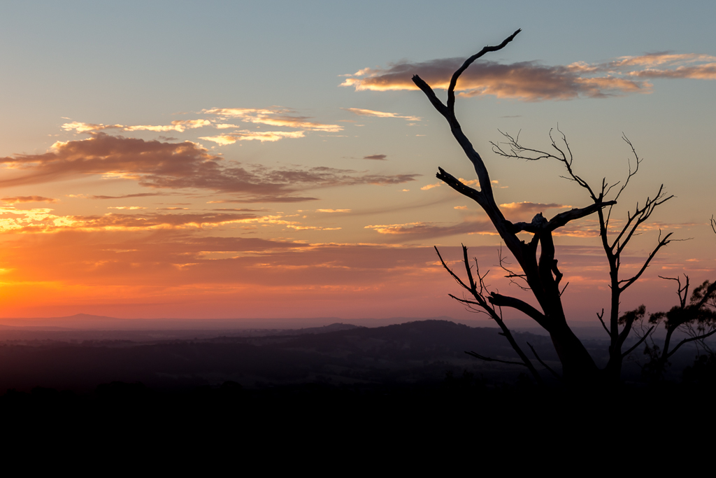
…had me wanting to wait until the sun vanished though.
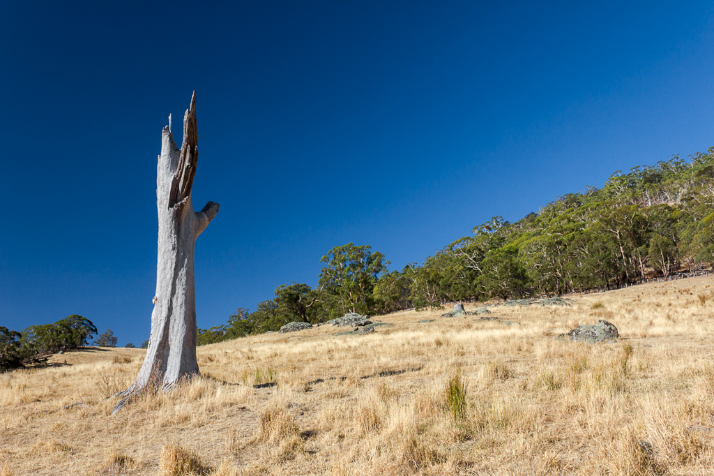
The only trouble was it was almost dark and I was still half-way up the mountain. Luckily with about half an hour of light left I zipped down the hillside. In autumn I reached the car in almost complete darkness. How about summer though? Oh yeah, it was a complete difference. The sun was still blazing as I passed this old tree…
…and guitar. Guitar? Yes, of course, a guitar.
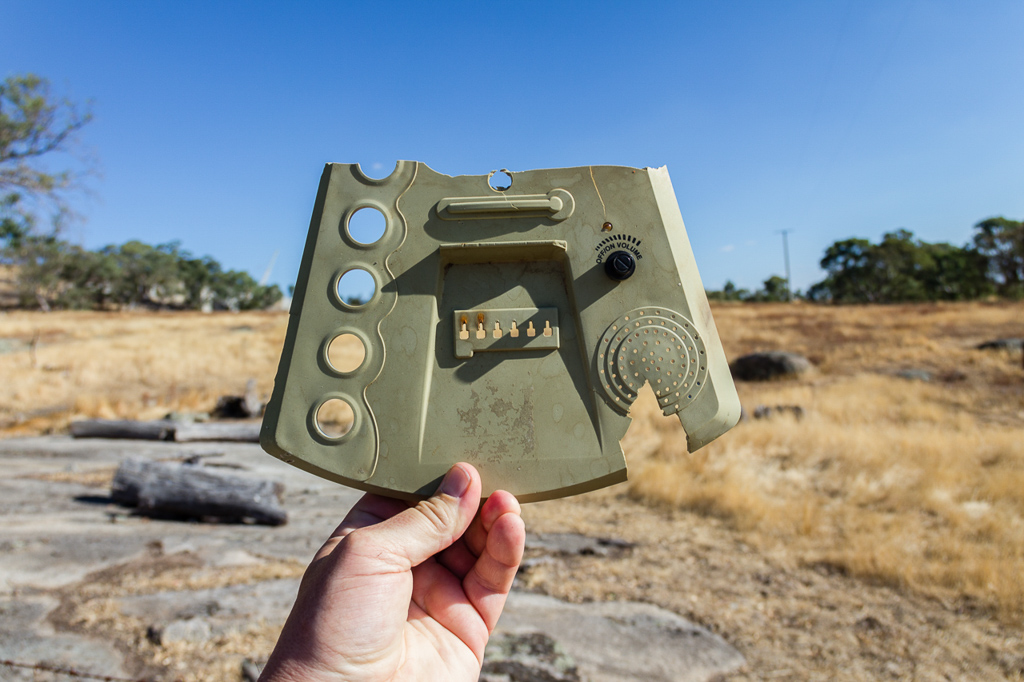
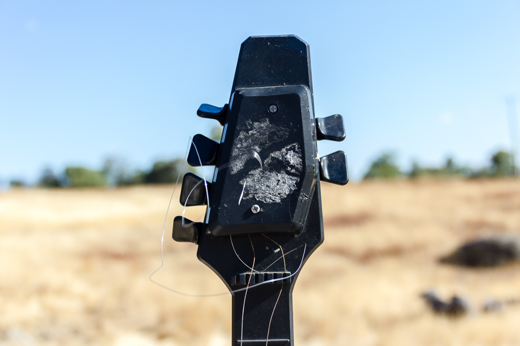
I find some crap on walks, but I can’t say I’ve seen any musical instruments before.
In autumn I drove away with the headlights on, but in summer I motored on with the smell of smoke in the air. Smelling smoke in summer whilst out bush is a hikers nightmare, but even in the car it was disconcerting, especially as it seemed to be getting stronger.
I dropped my speed and as I climbed a hill the sky was full of smoke. A grass fire was speeding across the paddocks next to me…
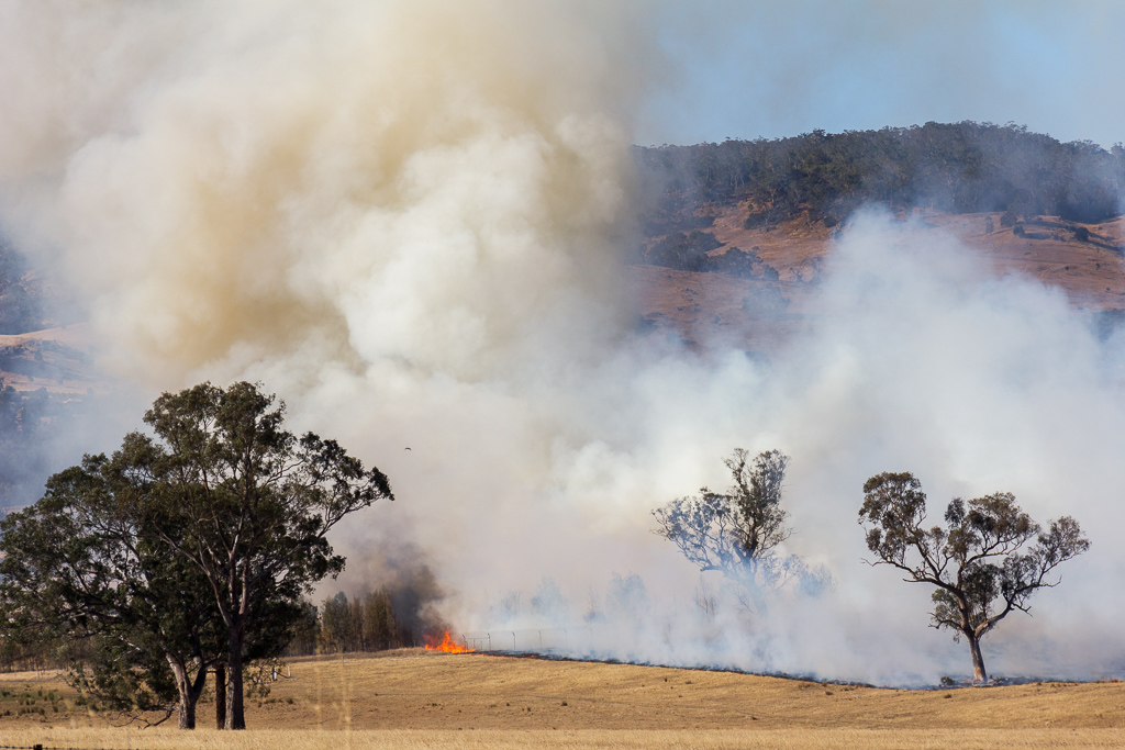
…and sirens of the fire brigade were ringing from all directions. I found out later this fire was accidently started by a local using some machinery. The flames were heading away from me, but it was amazing how fast they were moving…
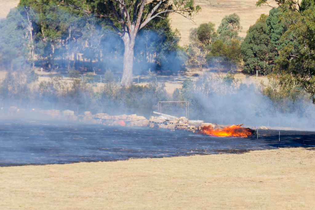
It reached the nearby Calder Highway, but I don’t think it jumped the road.
Since the Black Saturday bushfires, I try to avoid hiking on a hot, windy day, as this little grass fire reinforced. Flames being fanned move insanely quick, so I don’t want to be anywhere near them. Not unless you want a new blog, ‘Burnt Arse Fiasco’ to start up?
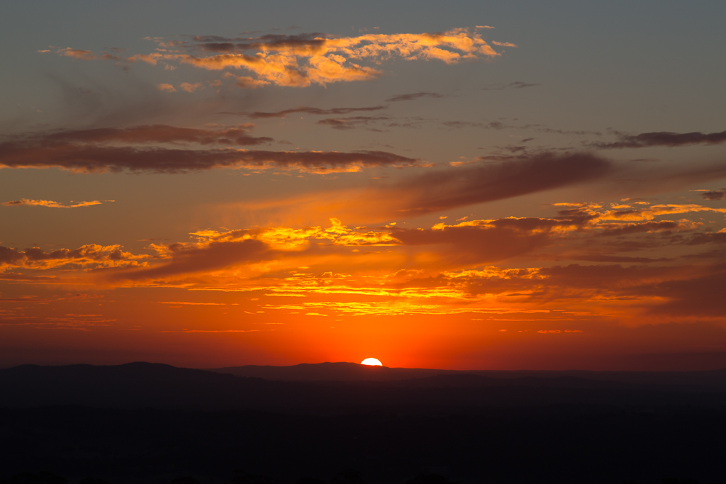
If you ask me now where Mount Alexander is, I’ll no longer direct you to Moonee Ponds, but instead to just outside Castlemaine. I suppose I should leave with another sunset photo…?

Beautiful shots Greg! Another good read too.
Ha ha..love the little waving wallaby!! Really enjoyed this post, Greg. Nice photos. and the joys of climbing a mountain!
Thanks Darren! It's a lovely walk, so it's hard to stuff up the pictures on this one!
Hi Christina, thanks! That wallaby was a little weird, as I saw it from some distance with its paw up. At first I thought his paw was a branch behind, as I kept walking closer and he didn't seem to move. Unlike most wallabies up there, they tend to take off once I got closer. This one stayed in that position for quite some time though! Only when I got really close did he take off. Great photo opportunity.
Thanks for dropping by and taking the time to comment!
Looks like a beautiful hike, alright. And a VERY weird place to put a silk factory – I can see why it didn't thrive!
I think it would be a good practice that you stick to your first blog, Greg.
It's a unique view you have from Mount Alexander. Hopefully the temperature maintained during the 15 degrees.
Lovely story and beautiful pictures.
All the best
Hanna
Yes, the "what the hell is it doing half-way up a mountain?" did come to mind! Maybe it was the location of the Australian silkworm…? Or not!
Hi Hanna, yes, I'll stick to this blog, but the alternative could be entertaining…?
Mount Alexander is a lovely place and I've wondered what it will be like when it's freezing with possible low cloud around. There's always the possibility of a another trip!
This week has been hovering around 15 C. It's been perfect!
Having lived east of Melbourne, my walking focus was always in that area, your recent entries have highlighted that there so much to see on the other side as well. The dry grass in the paddocks is so typically Australian, as is the grassfire. Your photos are excellent as always and the friendly wallaby well all I can say is "Skippy gets even" http://www.youtube.com/watch?v=bd165_YTXZQ
Thanks
Yes, I spent a lot of time growing up out east as well and I never really thought much about the west at all. As it is, all of those walks out Warburton way I've neglected, as they seem so tiresome to get to when driving! Out this way, there's plenty to do and I've barely been to any really. Lerderderg Gorge is less than an hour away, but I've only been there once! I guess I've never found any joy in gorge walking, which is part of the problem? One day I hope to try out a few more walks there.
Wouldn't it be good if the animals had a chance to shoot back now and again? 🙂
Thanks for this post. My wife and I parked at mcquillans road yesterday and climbed to the summit and back. Had your post open all the way…very helpful companion to the maps. Fantastic over 4.5 hours. Couple of things to update 1) we are in late October and the mountain is incredibly green, 2) between parks Victoria and the goldfields walk group the signage is now excellent with clear guide posts and distance markers.
That’s great! Glad the blog helped, although it seems as if the new signage was probably all you needed? That was always hit and miss up there, so good to hear they’ve added some. I might have to go up there and look around myself, as I haven’t been there for a while now. Did you get down to the old factory?
We didn’t make it to the factory unfortunately as once we summited we went back the same route – we will be back though, for a mountain its a real hidden gem of a place! Certainly the new posts and distance markers helped, but particularly along the western ridge from Dog Rocks through to the Shepherds Flat lookout the extra commentary and photo’s helped with what is the longest stretch that we questioned a couple of times whether we’d ever go up!
Found this you tube video mapping pretty much the exact walk as well – https://www.youtube.com/watch?v=QK5dv4_PmbA
Thanks Greg, really pleased to have come across your blog site.
Yeah, the factory is a bit of a sidetrack on the way back. Not a lot is written about it? The only reason I knew of it was the old Glenn Tempest book. I’m intrigued now, as I some of the trip is a little vague in my memory. I might have to get up there in the next few months for another look. That’s a good video! I might have to look at making my own, but then again, I can see myself wasting more time on it 🙂
I am planning to go on this walk soon and found your blog and the other comments really helpful. Thank you Greg, I have followed your blogs as i do a lot of hiking alone. Keep up the good work and thank you once again all.
Thank you! I love the Mt Alexander walk. One day I might get back to the blog, but lately all I seem to do is the same walks, so there doesn’t seem much point writing. Maybe one day 🙂
Greg what a hilarious blog! I’m a local of Harcourt and was searching the web for a book published about the Silk Worm Farm… cut a long story short, your blog appeared and made for an entertaining read. I’ve lost count of how many times I’ve walked over the Mt, each and every time discovering another great view.. or a piece of ‘crap’ from yesteryear! Loved your pics, loved your humour… thank you 🙂
P.s. autumn mornings are absolutely the best time to walk the Mt, great views are replaced with an eerie fog which will smother you… it’s awesome! Kristy
Thank you! Yeah, I love this walk. I can’t say I’ve done it for a while though. Now I’m living in the Ballarat area I really should pull my finger out and give it another go. As long as we’re allowed out again at some point 🙂
Great blog Greg – that photo of he wallaby is such a classic – was expected the sidekick of Mick Dundee to pop up from behind the log holding a fake skippy waving to the tourists! Have never been up Mt Alexander, but want to go up now. I am checking out Mt Beckworth, a bit further over near Clunes at the moment – have you been up there?
Oh yeah, I love that Mt Alexander walk and have done it a few times. Mind you, not for over a year, so I really should give it a revisit soon. Mt Beckworth is a funny one. Not bad, but some of the tracks have been long forgotten about! Great views from the top though and the Lollipop Tree is suitably huge 🙂