Well, this is quite a speedy post seeing how I only visited the Langi Ghiran State Park last weekend. Usually it takes me weeks to write something up, but I thought I should tackle this entry whilst the pain is still fresh! Mind you, I’ve decided this will be my biggest post ever. How did I come up with this idea? Well, none really, other than I’m testing the the concentration span of people reading things online. My study is extremely rudimentary (that means none) but it’ll be interesting to see if anyone can survive a blog post more than 1000 words. Don’t worry, I’ll include photos as well, so you don’t have to go running to the oven to put your head in just yet.
Anyway, the start of any post is a great opportunity to crap on and this one’s no different (but on a much larger scale). I picked out this walk from the recent book ‘Daywalks Around Victoria‘ quite a while ago, but with time being the enemy it’s taken me at least eight months to actually get it done. There’s a few things to take into account though (isn’t there always?)
At the park, information signs at the Langi Ghiran State Park visitor area tell of a straight up and back approach to the 949 metre Mt Langi Ghiran. Bah! I’m a circuit man myself, so how do I get around that? Well, we turn to the ‘Temple of Tempest‘ as the walk described in his book I’ve just mentioned is a circuit, but with a little flavour.
Actually, the walk has ‘traditional Tempest’ written all over it. A casual somnambulant stroll for a few hours, which is interspersed with some off-track anarchy in which there’s a struggle to survive for a few hours and then back to a gliding finish, as if you’re being carried by a dozen half-naked women whilst wearing a toga and being fed grapes. There were potential problems though, but before I get into them I think I need a picture.
Do you remember my 150th post which exhausted me in creating? Well, it was brought to my attention by hundreds and thousands of my adoring fans (one) that a few things were missing in the picture. Well, for the 152nd post, it’s now been fixed.
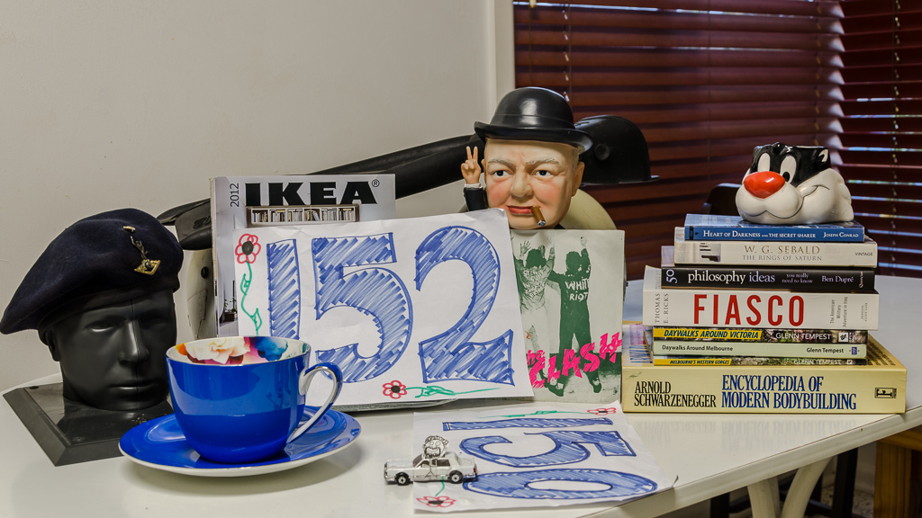
Fixed
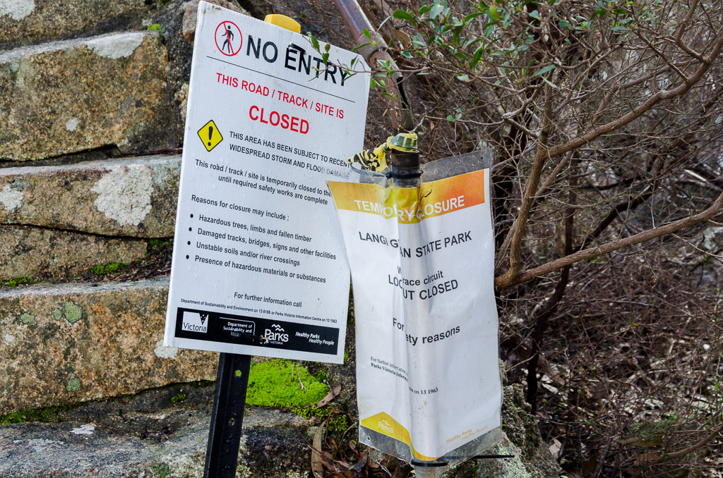
Now, back to the walk and its problems. Do you realise Parks Victoria have decided a large portion of this walk is closed? They’ve said both Hidden Lagoon Track and Link Track are closed due to ‘storm damage’. Mm… After finding this out a month ago, I actually put the walk off. I’m not sure why, as I’ve learned one thing and that’s a closed walk takes an eternity to reopen. Bloody hell, I’ve been eyeing off a day hike which has been closed for a minimum of 18 months! In fact, one begins to wonder if a walk closed that long will ever reopen? Actually, I don’t really blame Parks Victoria, as they’re both cash and staff strapped.
In my Dandenongs walk I came across a closed track and out of interest I emailed Parks Victoria to find out if there’s an actual offence of walking on a signposted closed track. Guess what? They never replied, so I’ve gone for the wild man/irresponsible approach from now on. I’ll walk the tracks, but have a contingency plan to turn back if it gets too brutal. The trouble is I’ve never seen a closed track that isn’t easily negotiable on foot. I think the only obstacle that would stop me walking would be an unexpected lava field combined with a random meteorite strike at the same time.
So, parts were closed. What next? Oh yeah, the walking notes indicate this stroll would take seven hours. Now, I’ve been a little suspicious of the times since Smuffin and I did the Mt Buller hike from the same book. That day hike was listed at seven hours and it took us twelve. Yes, twelve hours. I had a vision I’d be stumbling along on my own (yes, this was a solo affair) with the headlamp blazing in unfamiliar terrain.
So, in true ‘fiasco style’ I decided to give myself an option of staying out overnight. Yes, I was taking a full pack complete with five litres of water (no water up there). If I was getting hard up for time on the short winter day, at least I could pull up stumps somewhere and sleep out. I was officially the most well equipped day hiker in existence. Should I just get to the walk now…?
Okay, I arrived at the Langi Ghiran State Park visitor area in good time to find it deserted. The forecast was pretty good, but since my Mount Difficult drenching I decided to double my dry bags just in case. I was carrying a lot of stuff, but guess what? I was intending to try out a new pair of boots, but I forgot to bring a thick pair of socks. Feeling a surge of potential ‘blister terror’ coming on, I chickened out and elected to wear my day to day strolling shoes which are a pair of Ahnu Elkridge shoes. These are nice walking shoes and I’ve put a lot of miles on them, but only up and down Bourke Street to get lunch. Mm… What could go wrong?
Oh yeah, I also forgot my first aid kit and heaven forbid, the polariser. What?! I’d brought a neutral density filter instead of the polariser, as the ND one was in the polariser box.
Which tool put it in there? Oh, okay, it was me. So, besides forgetting socks, polariser and the first aid kit, there was the final hiccup. Upon arrival I leapt out the car in a fearsome athletic fashion, to be greeted by the sharp crack of the sound barrier being broken by a button being blown off. Unfortunately, this button is handy, as it holds my pants up. It was a pretty scary experience, as I almost lost an eye.
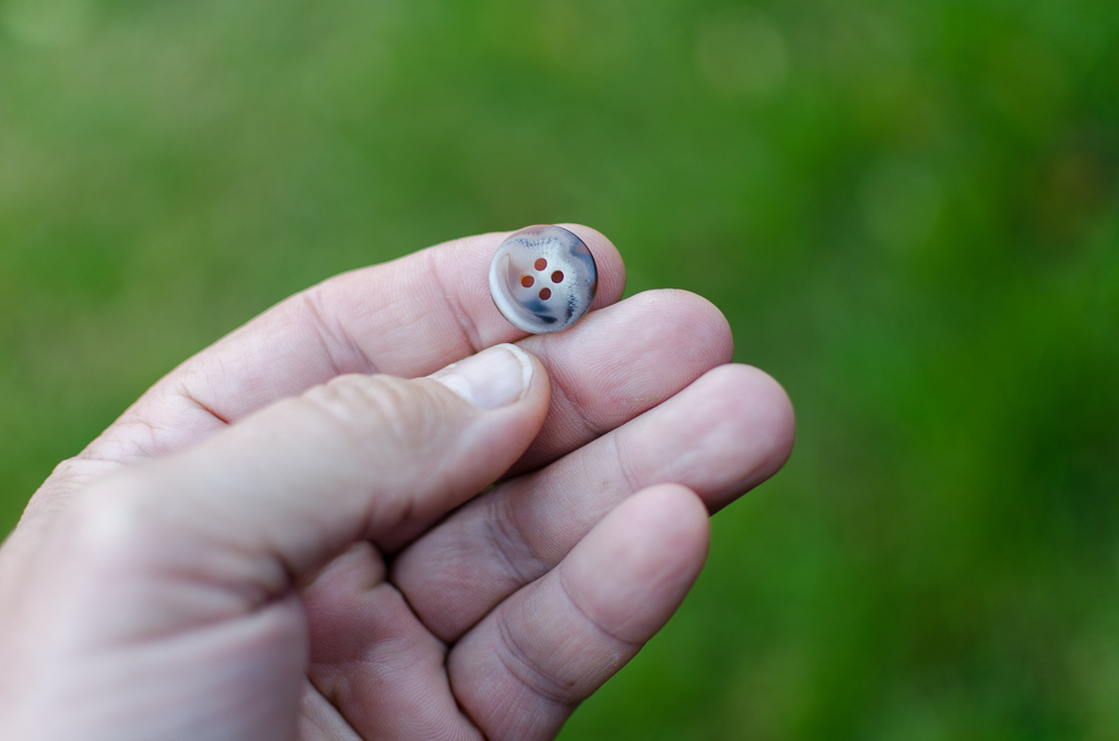
FatManButtonPoppers.com
So, I guess the bottom line is I should lose some weight? How’s this for a story? I visited my long suffering doctor the other day to get blood test results for cholesterol. Even this visit wasn’t simple, as he scanned the results and said, “Oh, I forgot to request for a cholesterol check.” Huh?! He did throw in, “You’re kidneys are fine though!”
As he was writing out another blood test request, he decided to throw in the traditional, “How much do you weigh?” to which I replied, “Stacks”. He then pointed to corner of the room and I sighed. With shoulders slumped and head bowed I shuffled to the place no generous sized gent should go and that’s onto the scales in the doctors office.
With the needle on the scales spinning wildly, it settled around 117 kg. The good doctor then went for the, “Okay, I’ll just check on the computer what you should be according to the Body Mass Index (BMI)”. The BMI is of course the most absurd formula ever invented, so I started waving my arms around and shouting, “Are you nuts?! It’ll say I’m meant to be 90 kgs!”
He pondered in front of the computer screen and then quite cheerfully announced. “90? No, you’re meant to be 85! So, you have to lose about 30 kg!” I’ve been down this road before, as the last time I dipped under 100 kg was in 1999 and that’s because I was lying in hospital. Since then I’ve become a permanent member of the ‘100 club’ and he’s kidding if a man addicted to potatoes is suddenly going to drop 30 kg.
I’ve actually been motoring quite well lately, as I’m attempting to walk home from work at least once a week. It’s quite a commitment to do a 20 km urban stroll after spending a day polishing my trousers in the office. So far my best time has been 3 hrs 21 mins which I think is okay. Ha! I’m flying! Who needs to lose weight?! Then again, imagine how much faster I’d go if I didn’t weigh as much as a small sedan?
Right, the walk. Um… No, not yet, as there’s one more thing. I noticed there’s barely anything written about Mt Langi Ghiran online. I mean, it doesn’t even have a Wikipedia page! Egads! In fact, the only thing you’re really going to find on Google is the nearby winery with the same name. Oh well, I guess this post might have to be the definitive one to read, plus you get the bonus of reading about my pants exploding.
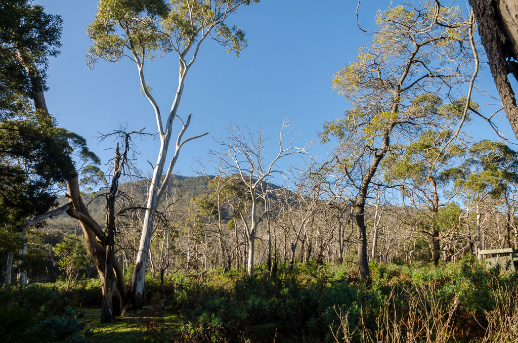
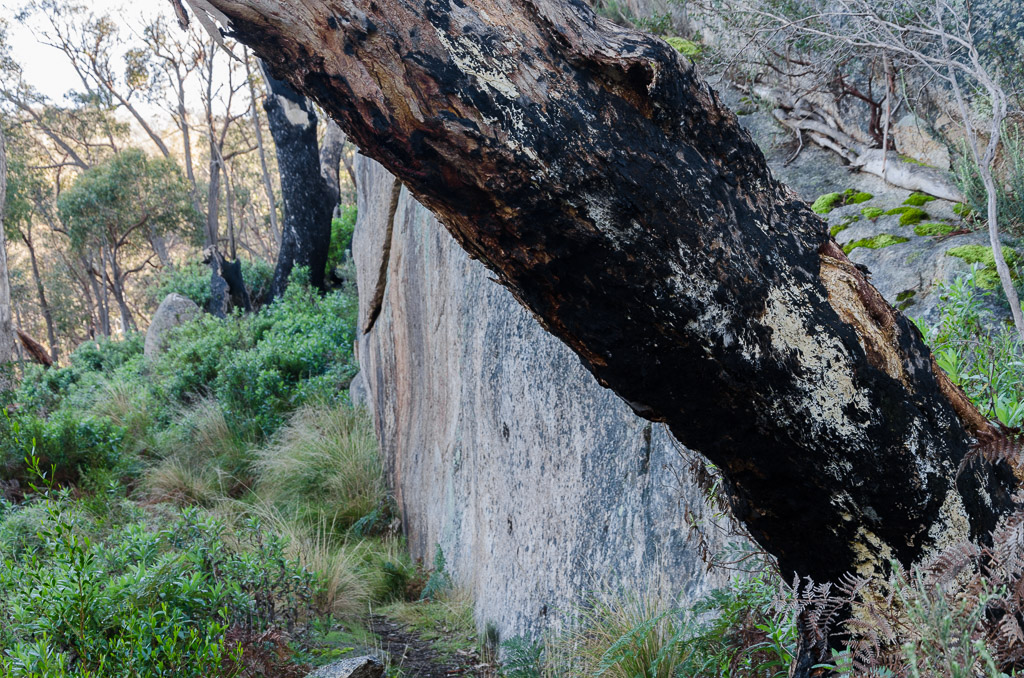
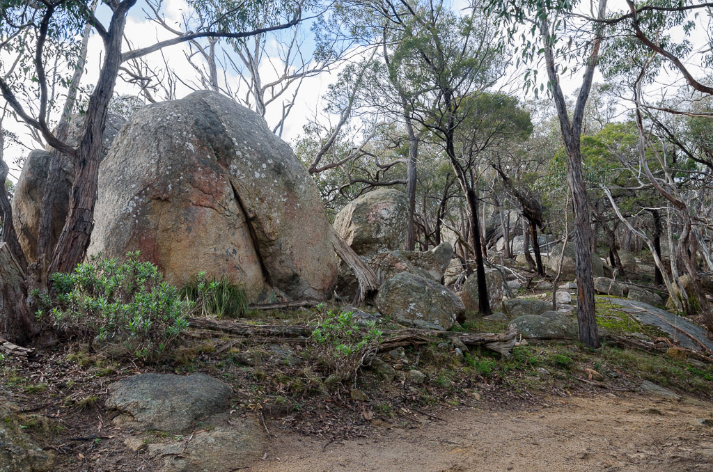
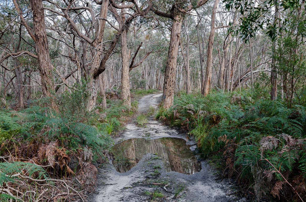
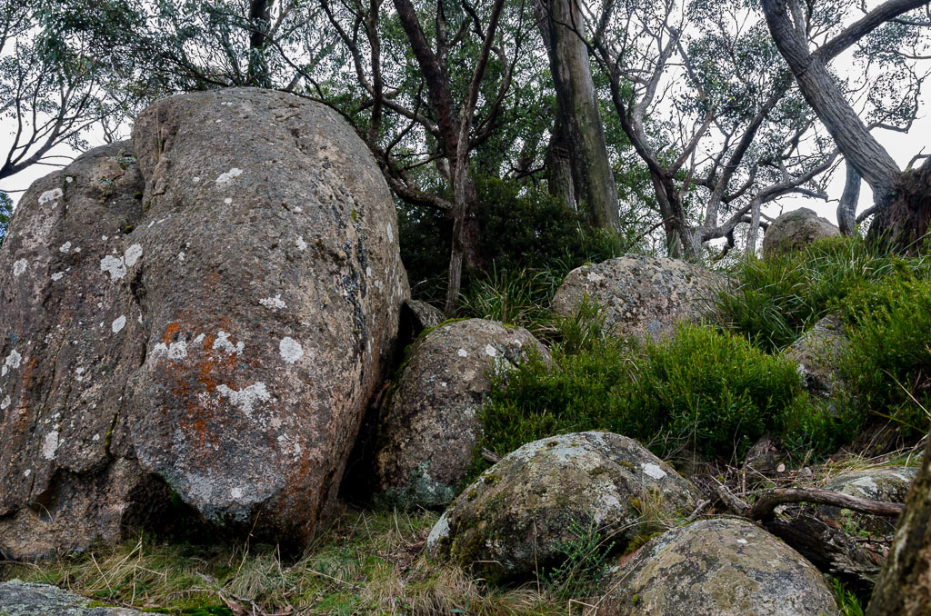
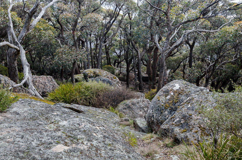
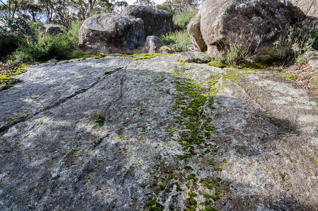
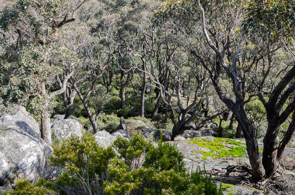
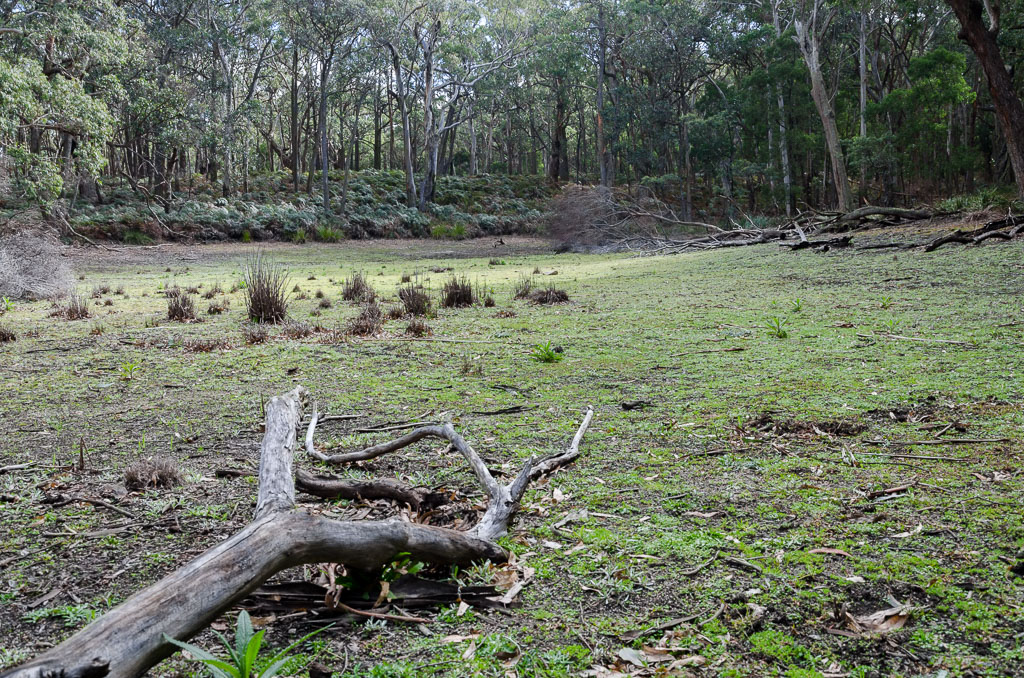
Okay, I headed off and the start is very casual, but it was quite early on that I noticed something. I cruised around some huge granite boulders which dominate this area…
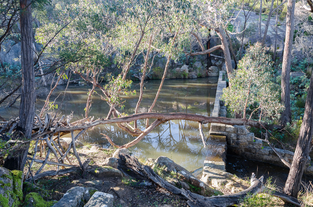
…and then passed this small reservoir.
As I was doing so, I came to the conclusion my Ahnu shoes, whilst lovely for walking, were actually completely crap on wet surfaces. In fact, the first damp granite rocks I walked across became quite a tricky affair. The soles seem to have been built with discarded banana peels. I had my arms out horizontal whilst my feet were sliding on any wet surface I stepped on.
This was a concern, as the walking notes state “…don’t attempt this walk in wet weather as the rocks and slabs can become very slippery…” It may have been sunny, but being winter meant that the cold nights had left the whole area wet with dew. So, what did I do? Well, I ignored the problem and kept walking. What sort of crap post would this be if I turned around now and went back to the car?
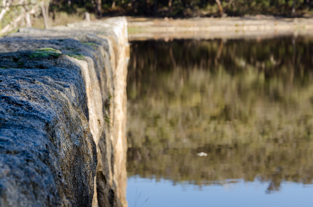
I continued sliding on and then I reached the much larger Langi Ghiran Reservoir…
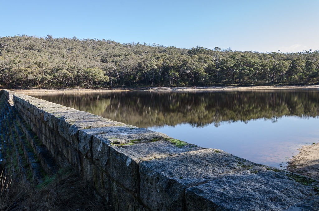
…which looked quite nice under the blue skies, but where was the polariser when I needed it..?
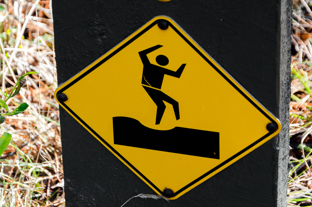
It was around this point I looked at the signs nearby and became slightly scared. Let’s have a look at this one for starters…
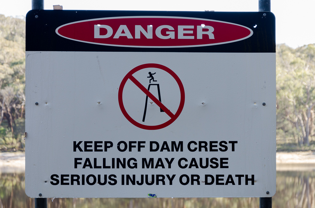
…but a series of others were really over the top. I could just show you a couple, but for the sake of the world’s largest post I’m going to show you the lot. The first one is quite obvious I guess…
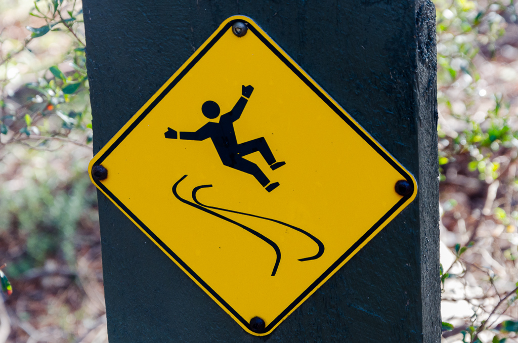
…and then there was one which seemed to have been created to warn me about my banana skin soles. I did admire his falling over élan though, which looks more like fun than anything else…
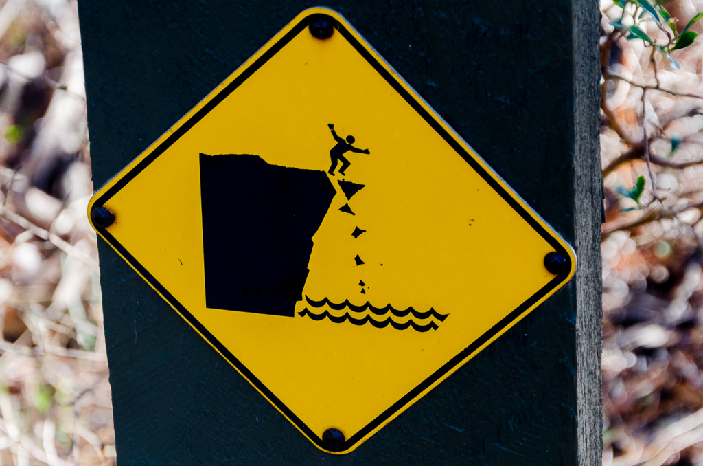
…but hang on, what’s going on in the next one?
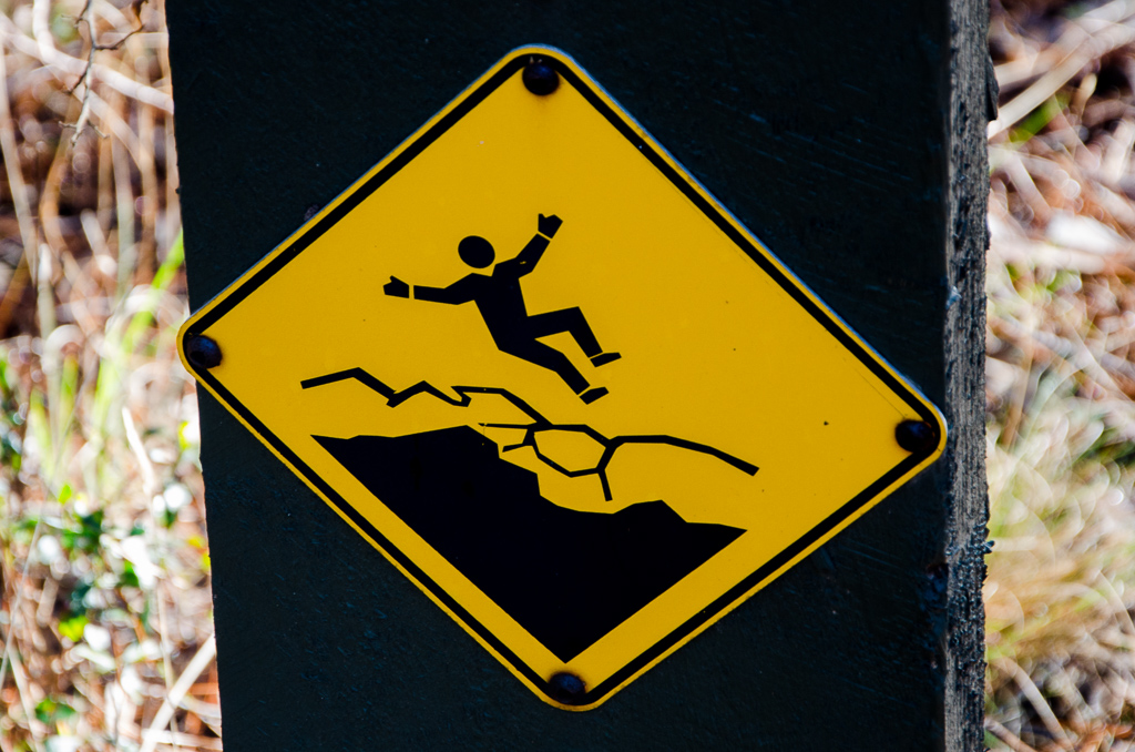
He’s replicated the skilful fall, but what’s the sign warning me of? Beware of earthquakes?
When it came to the last one though I’d given up, as it’s either warning me to beware of slight depressions in the ground or don’t go bustin’ your best disco moves in the area as your waist will split.
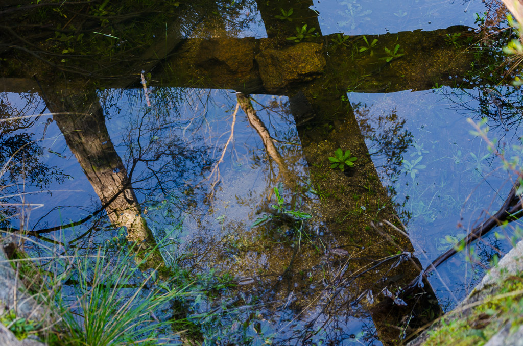
I continued on, following an old water race with the still wet vegetation giving me the ‘shining balls of light’ look…
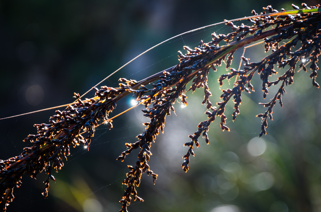
…and the occasional reflection in the pools of water lying around.
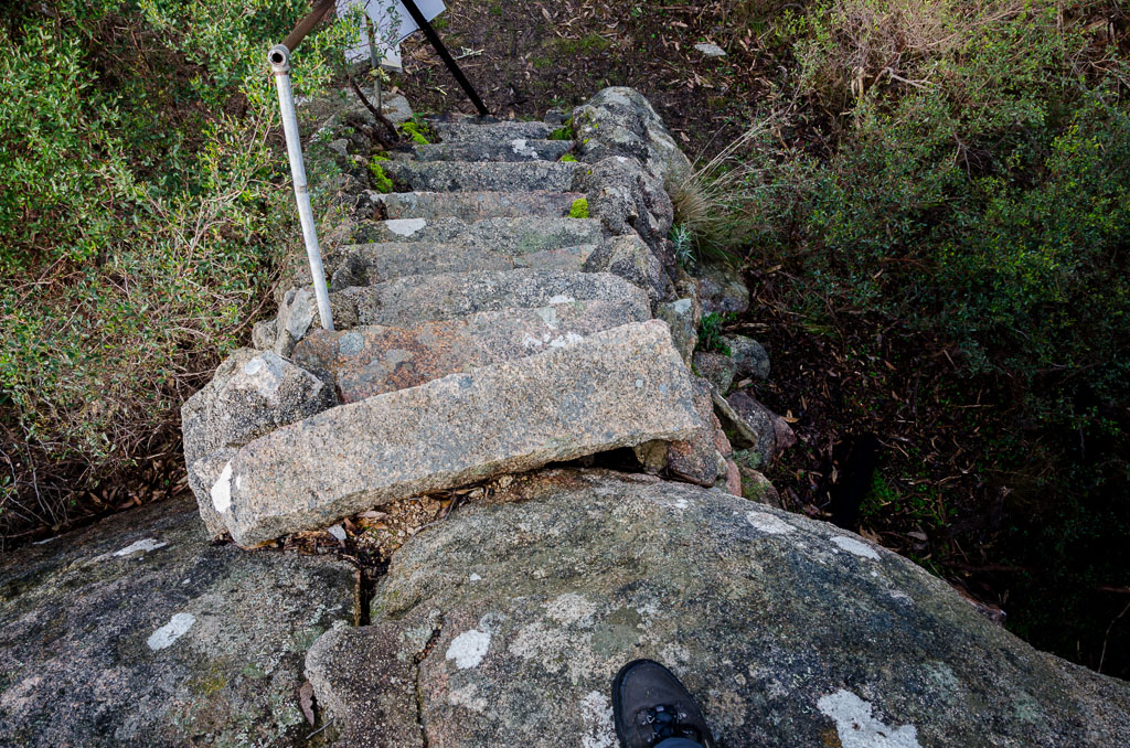
There was a steady climb to a spot called the Pipeline Lookout. What’s that you ask? Well, there’s a pipeline coming out of the ground next to a boulder, that’s been hacked and smashed into a lookout platform, but guess what? In keeping with the theme of the area, it was closed.
You do know this platform will never ever reopen again, don’t you? Well, I looked at it and as it only appeared to be about my height in total, I decided to brave the climb. All ten steps of it.
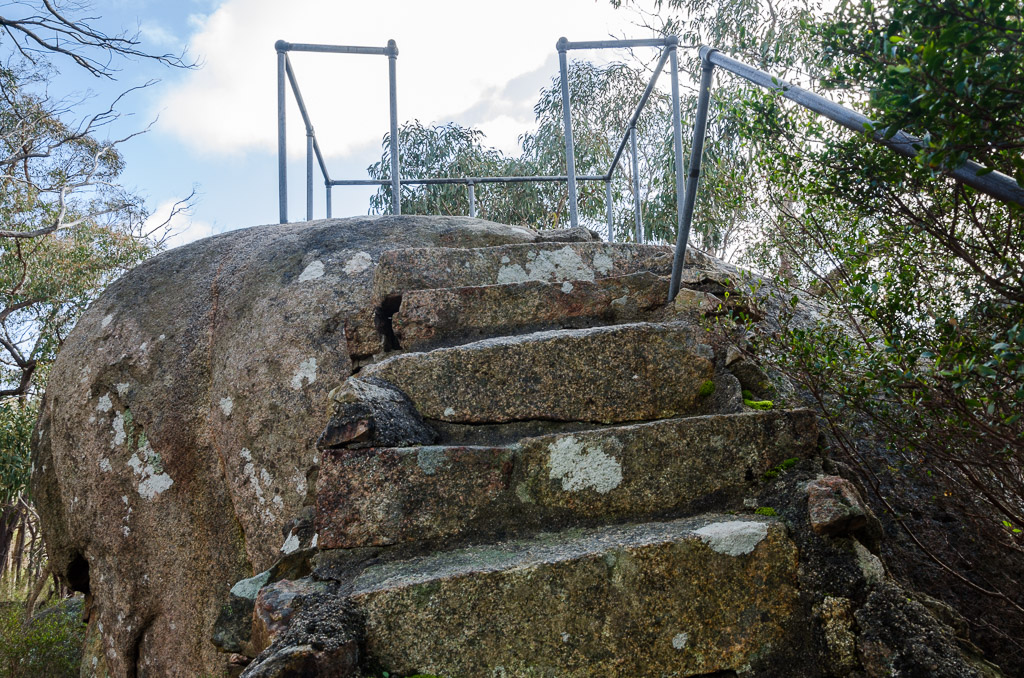
I reached the top unscathed and surveyed the area. It then dawned on me it might have been shut, due to the fact it failed in its job description of a ‘lookout’. Surely it was false advertising?
The view from Pipeline Lookout
Then it was time to descend the heady heights of the lookout, but with a bit of care, due to my super slippery shoes.
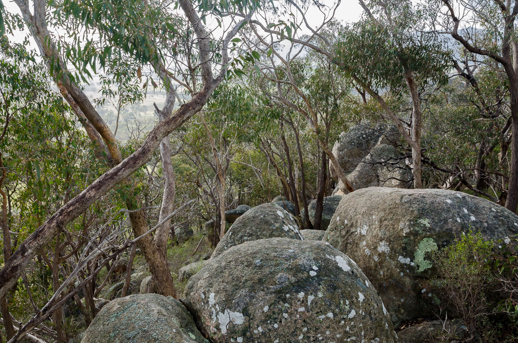
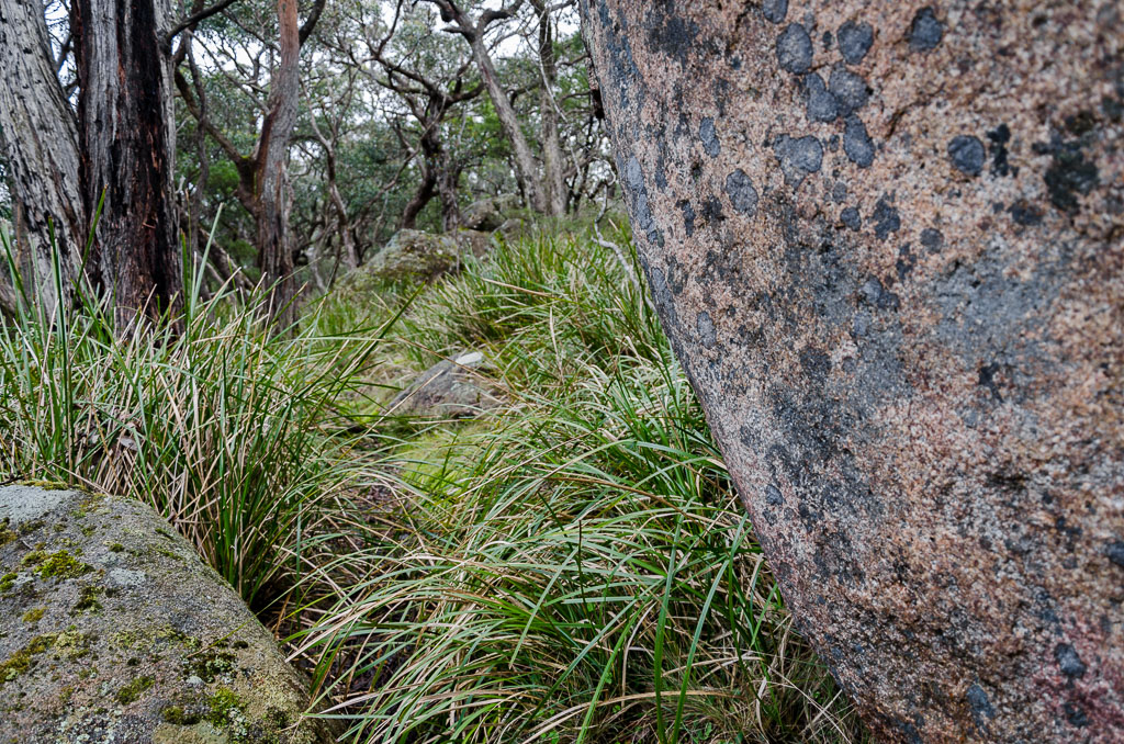
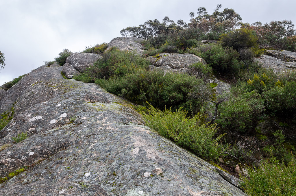
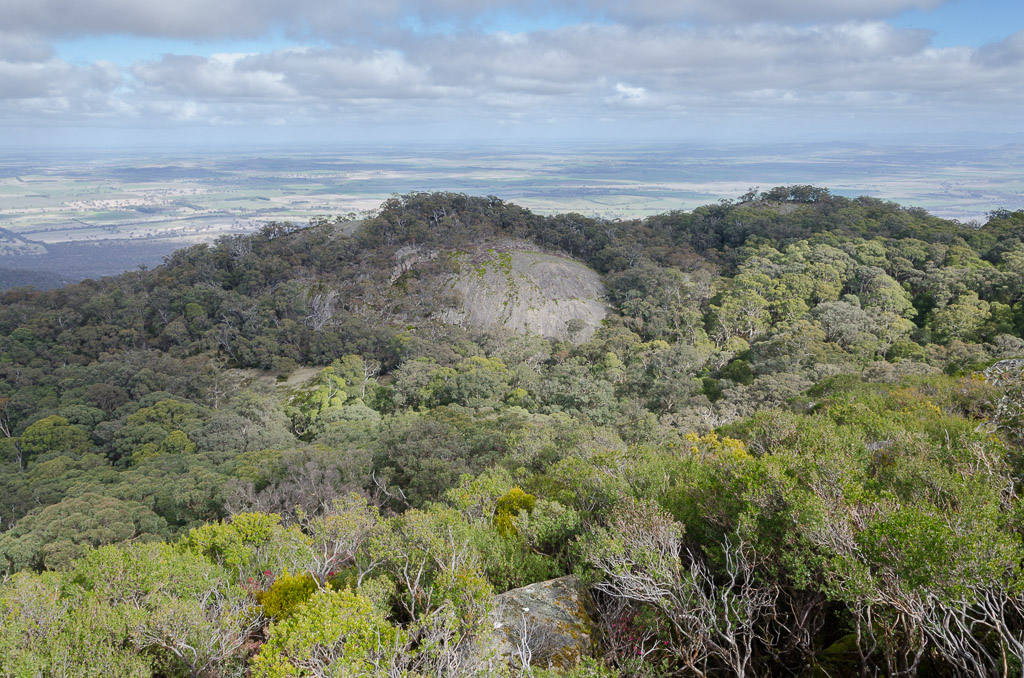
I made it down alive. Just. Continuing on, the area was dotted with huge granite boulders…
…as I strolled along a nice wide track.
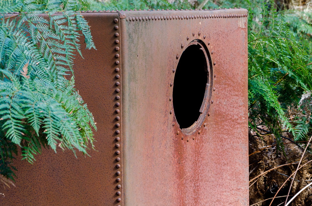
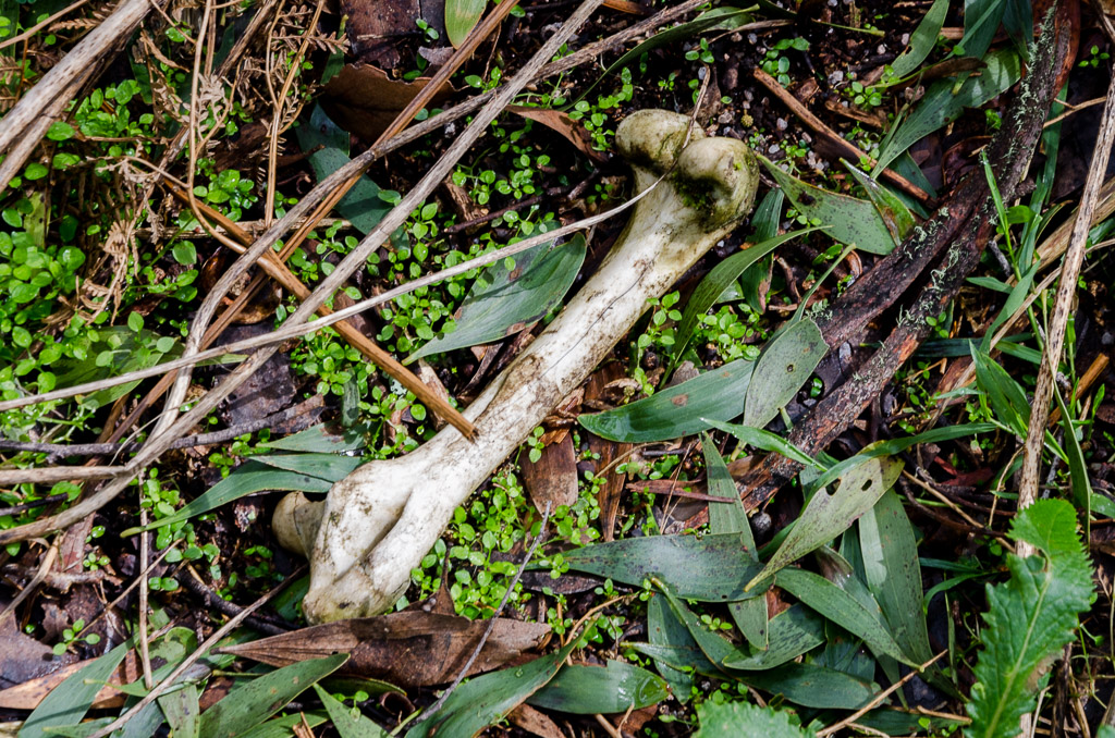
It then began to climb steeply and I shuffled along until reaching a rock cairn, which indicated it was time to head bush for the final climb to the summit. I’m not sure what this is, but there was a metal ‘thing’ lying near the turn-off.
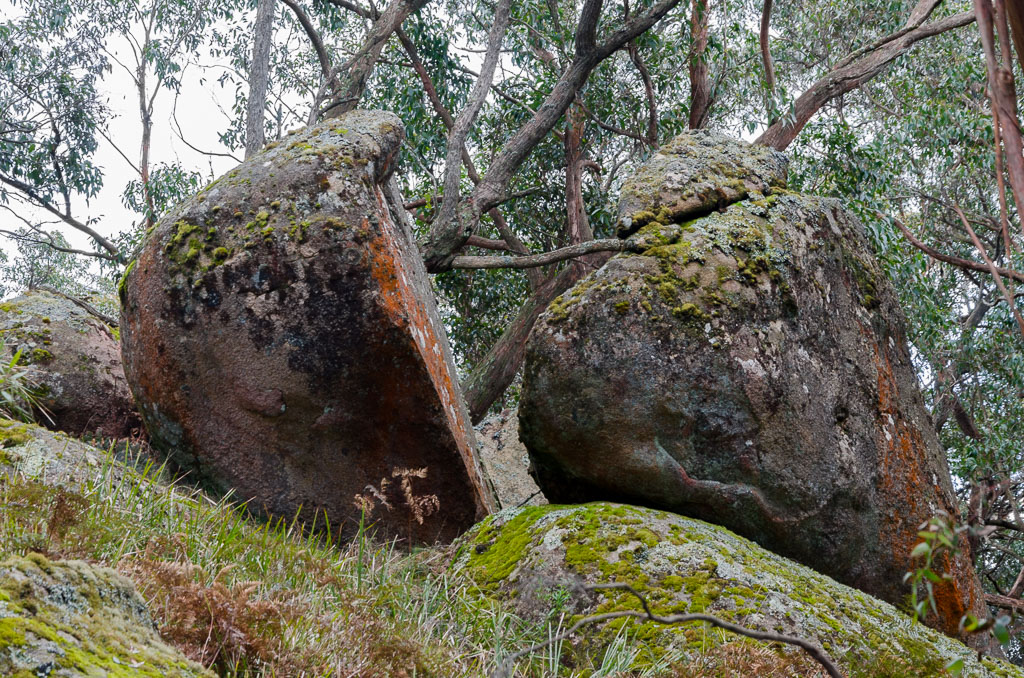
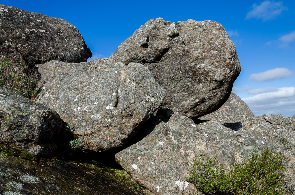
There’s roughly 500 metres of off-track walking to the summit, which weaves around the ubiquitous granite boulders…
…of which some were split into segments.
Although there was no track, the way ahead was pretty clear…
…as I kept to a simple, summit formula which was head for the highest point and don’t go near the vertical drops! Actually, I was going slowly along here, as my banana skin soles refused to grip to anything that was remotely on an angle. Don’t laugh, but I considered taking the shoes off and heading for the top in either socks or bare feet.
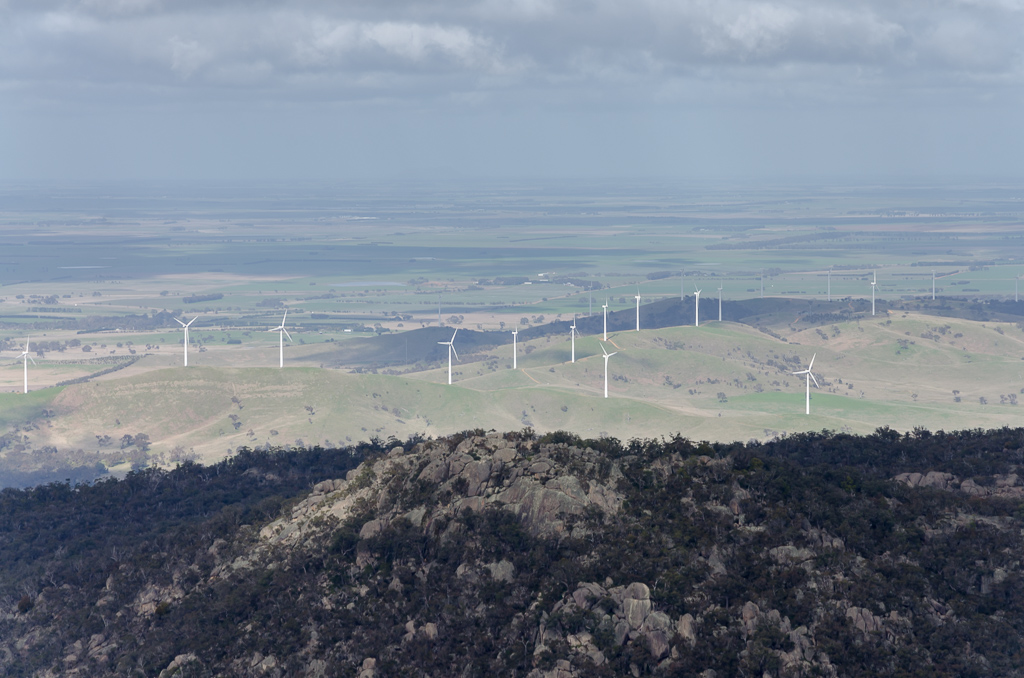
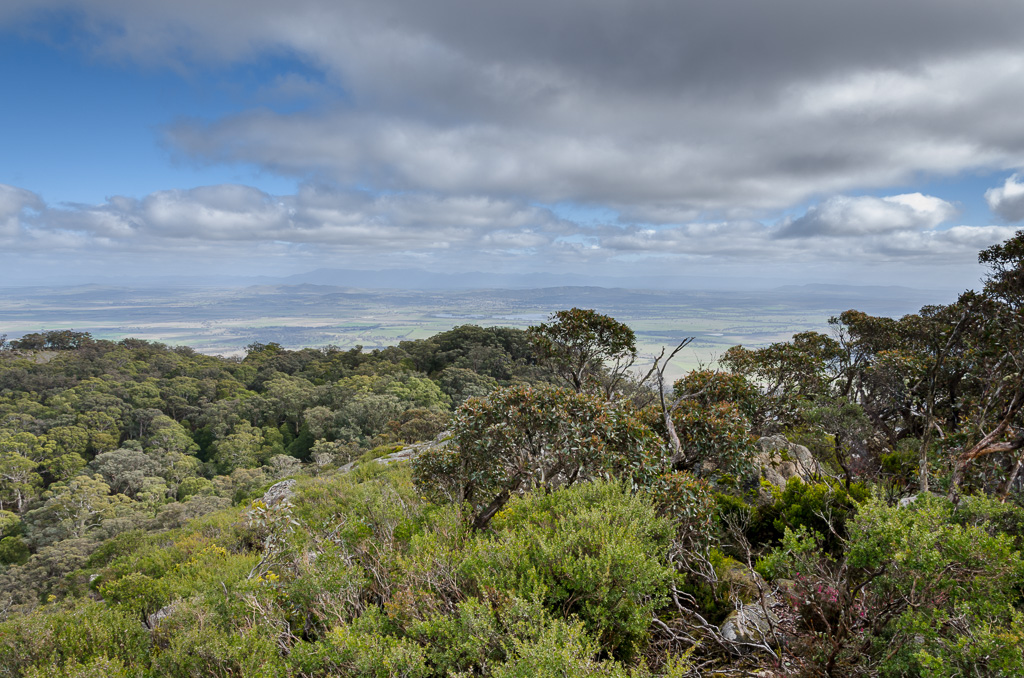
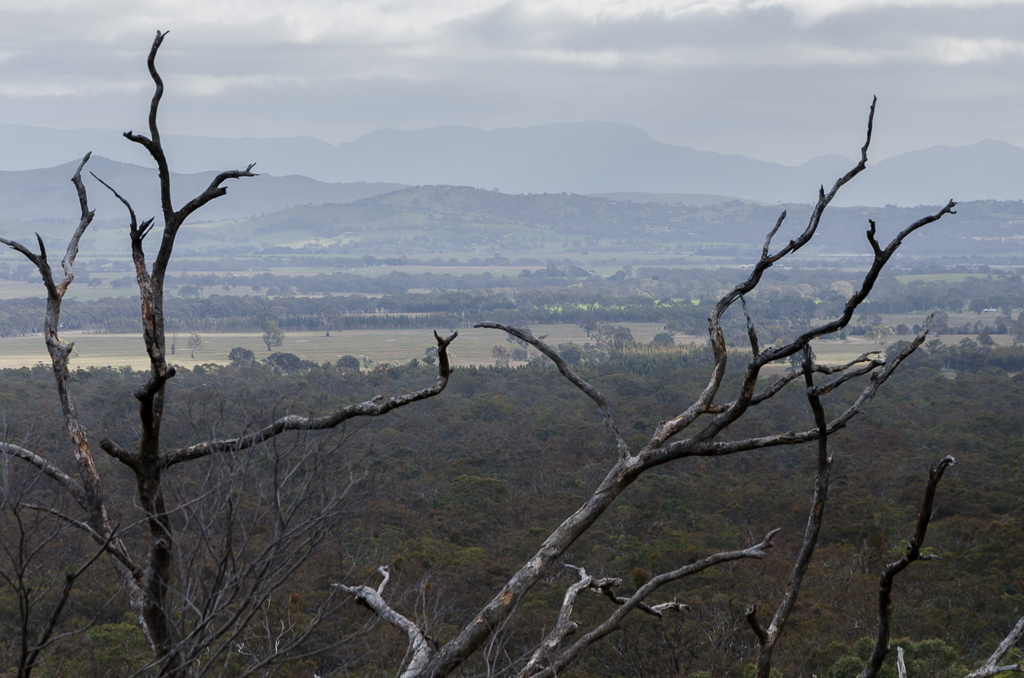
The slow going did give me a chance to enjoy the view behind me now, as I’d left the majority of trees behind…
…and the Challicum Hills Wind Farm was clearly visible.
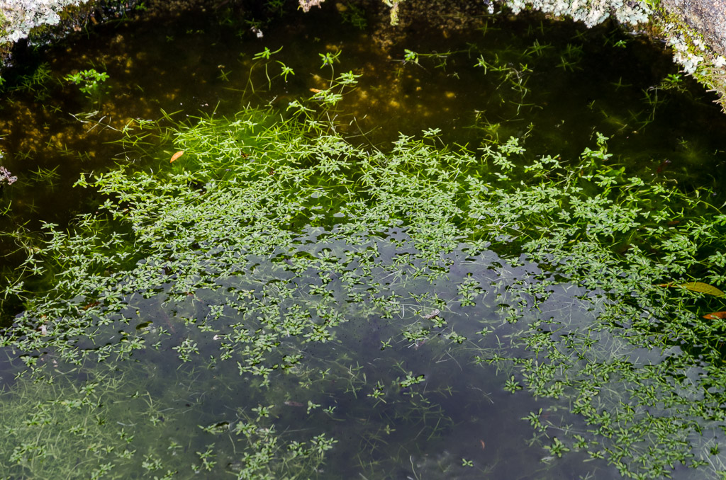
There were the occasional pools of water amongst the rocks, which were full of ‘pond plants’. Actually, I couldn’t be bothered looking up what these plants are, so you’ll have to do with ‘pond plants’ as a description.
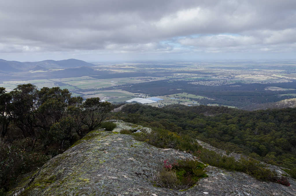
I finally reached what seemed like the top and climbed one last noticeable boulder, higher than anything else and that was that. I can say the view is pretty spectacular, but I didn’t seem to take many photos? I did do a video, but for the life of me it won’t upload to Vimeo, so you’ll have to make do with… well… not much.
There were two things I noticed though. The first is I was feeling mildly suicidal for not having the polariser with me and the other was it was insanely quiet on top. Truly, ‘hear a pin drop’ sort of stuff and at first it was quite unnerving, until I started eating my lunch on top of the boulder and the sound of my jaw created a bit of noise.
I guess I spent half an hour on my rock before thinking about moving on. The walk was now heading into the spicy part of the day though, as another off-track section was coming up. This part looked a little dramatic though.
The idea was to head over the top of the mountain and down the other side to link up with another track. What made me ponder though, was the notes which said, “…only 300 metres down the West Ridge to the saddle…scrambling involved…awkward route finding…allow at least an hour to descend to the saddle…”
Mm… Okay. An hour to go 300 metres? How hard can it be? Well people, read on and let me enlighten you. The GPS route for this walk is available at the Open Spaces Books website and I’d downloaded it. The thing is though, I didn’t want to be just staring at the GPS trying to replicate the exact route, as I always find things harder that way. I like to get the idea of direction and then look ahead at the lie of the land to work out the easiest way, without constantly staring at a little GPS screen. Mostly.
Anyway, off I strolled and the way ahead consisted of avoiding a few cliffs here and there and weaving around enormous boulders whilst inching down.
Descending Langi Ghiran
Things were going fine until the ‘Hiking Fiasco’ curse began to kick in and it actually goes all the way back to the start of the day, when I elected to wear my banana skin soled Ahnu shoes. Firstly, no photos can do justice to the size and slipperiness of the huge granite boulders.
I was taking it easy until I reached the top of a long, sloping piece of rock that was wet, but I thought if I could hug the sides I’d be able to shuffle down. I was being cautious to the point I’d even put my cameras away in fear of potential damage. My brain was ticking over saying, “Be careful here. Whatever you do, don’t slip and fall.” As a result of this thought I then fell.
In fact I had a cartoon style fall where both feet slipped out (actually a bit like that bloke falling over in the signs earlier) and I landed on my arse and then proceeded to slide down the entire length of the sloping rock with my arms waving in the air as if I was on a roller coaster. Can I inform you now. Sliding with your bum on a granite rock isn’t very comfortable. In fact it was truly a ‘brutal buttock bashing’ (BBB).
I slid until I reached the bottom and found myself lying on my back wondering if I was still alive. There was a fair bit of pain in roughly 99.7 % of my body, so I thought it was best to just lie there and stare at the sky for a few mintues to regroup.
You know what though? It was a wise move, because as I lay there in total silence an enormous eagle appeared and stopped directly above, no more than 10 metres away. Langi Ghiran does have eagles and I can’t say I’ve ever seen one so close before. He was magnificent, but by the same token I thought to myself, “Does he think I’m dead? Am I possibly the largest piece of food he has ever seen? All 117 kgs of tucker?”
I’d put the cameras away, so I couldn’t capture him, but I was also thinking I should just ‘enjoy’ the moment without trying to record it. Sometimes it pays to look at stuff, instead of trying to validate the experience by taking a photograph. He remained stationary for quite some time before swooping away. I guess he realised I was alive after all?
I stood up and began to count the cost. Firstly here’s the rock and it really doesn’t look that bad does it? Well, actually it is, as I fell from the top in the middle of the rocks where the grass is.
Arse busting good times
I had a compact camera in my pocket which was not the wisest place for it to be, but at least I’d put the DSLR in the backpack for maximum protection. As a result the compact had a bit of battle damage…
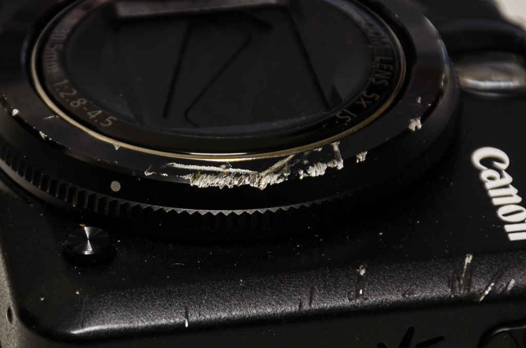
… but considering my hands were bouncing off granite I was very impressed by such little amount of blood.
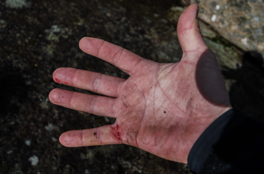
Only a bit of dirt and blood? No problem!
I know what you’re wondering though. “What about the fiasco man’s arse?” Well, fabric and granite don’t mix, as my favourite pants were now air-conditioned. From the back.
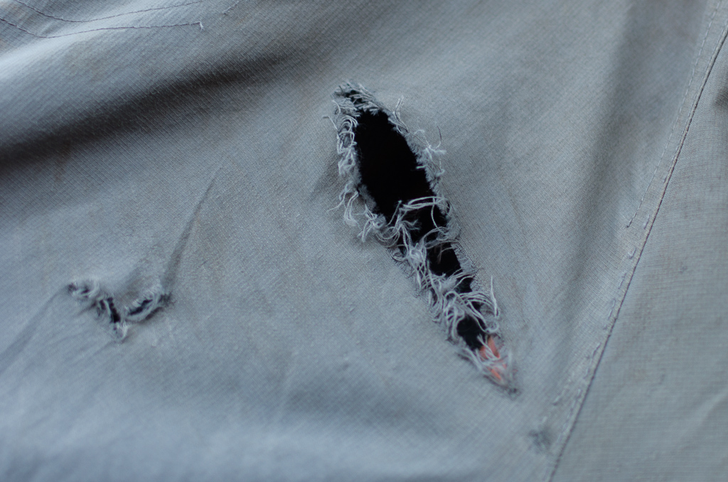
BustaRippingPantDemolition.com
What can I say? Those bloody slippery Ahnu shoes finally got me in the end. Checking the time, I’d descended in a lot less than an hour. It’s a method you might be interested in if you seek a quicker descent, as I found falling to be an effective way to get down faster. I now continued down with my breezy pants keeping me a little bit cooler than normal.
Still descending
There were some nice rocks to look at on the way.
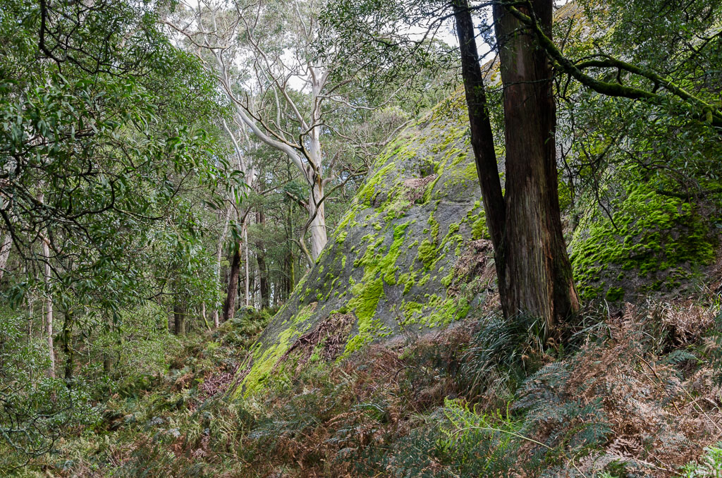
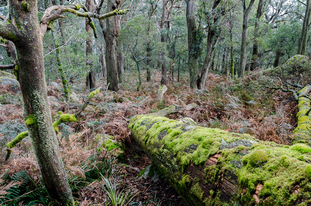
Finally I reached a more comfortable, level area, but this side of the mountain was looking a little different. The terrain was now ferns and fallen trees with plenty of moss around on display.
There were also some enormous boulders hidden amongst the trees, I was glad I didn’t slide down this particular one. If I did, I’d still be going.
I mentioned in my last post how off-track walking is an acquired taste. I seem to spend most of my time on the edge of falling over. Tree roots pull at my legs and it certainly didn’t help with a sea of ferns, in which I couldn’t see where I was putting my feet at all. I stumbled on and came across the remains of the last off-track hiker who’d attempted to walk through here.
He came, he saw, he didn’t make it
There’s supposedly a rough track marked with tape in places, but I’d be buggered if I could find it. I more or less elected to head south and make my way through ferns which at times were chest high…
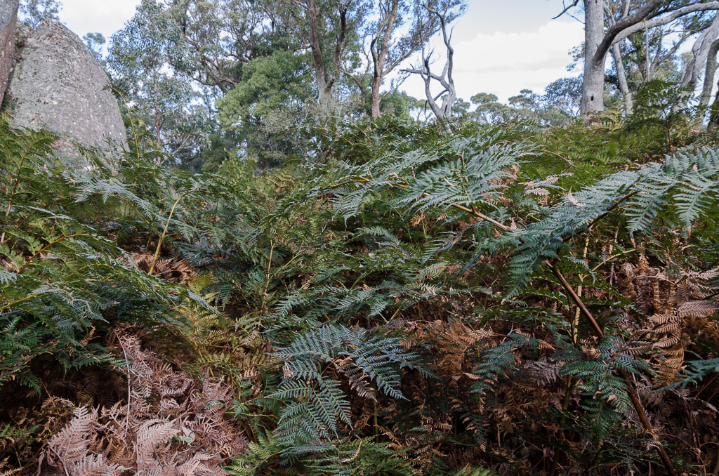
Fern frenzy
… whilst gradually descending the whole time. I’ve no idea how I didn’t fall over again whilst wading through the wet undergrowth.
Remember that business I just mentioned about a taped track? Look! I found it! All one of them!
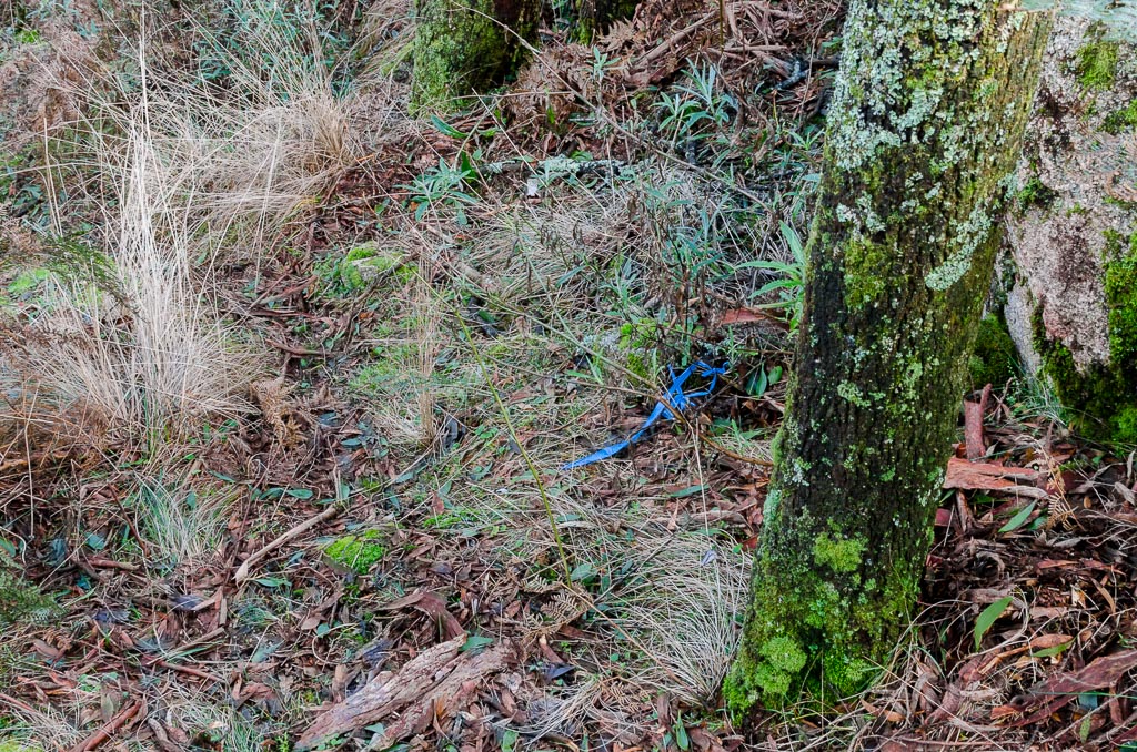
Actually, that solitary piece of blue tape was the only one I saw during the entire off-track section, which possibly means I was wildly lost. As before, I tried not to become a total slave to the GPS, as I looked for the easiest way down whilst still heading in a sort of southerly direction.
I continued bumbling along until suddenly Lagoon Track appeared and I was back to normality. Well, how much fun was that?! There’s a place called ‘Hidden Lagoon’, which I considered I’d set-up for the night if I was running late in the day. The thing is though I wasn’t and with time in hand, I kept moving on until finding the turn-off to the lagoon.
I’ve seen pictures of Hidden Lagoon filled with water and I thought we’d had plenty of rain lately to fill it. I guess not in this area, as it was completely dry.
Hidden Lagoon
What to do? Well, I ended up just changing my mind. I was pretty sore from the fall and my back had a twinge happening. Instead of a tent, I thought it best to have a bed overnight, so I continued on. Actually, there were some nice views as the tracks continued to descend.
You know what though? Whilst strolling down Link Track, I must say it has a section which is one of the steepest of formed tracks I’ve walked on for some time. Again, photos didn’t indicate, but it drops off quickly. In fact an easier way of showing it is the elevation of the walk which I downloaded from the GPS. The section between 10 and 12 kms is what you should be looking at, as it absolutely plummets.
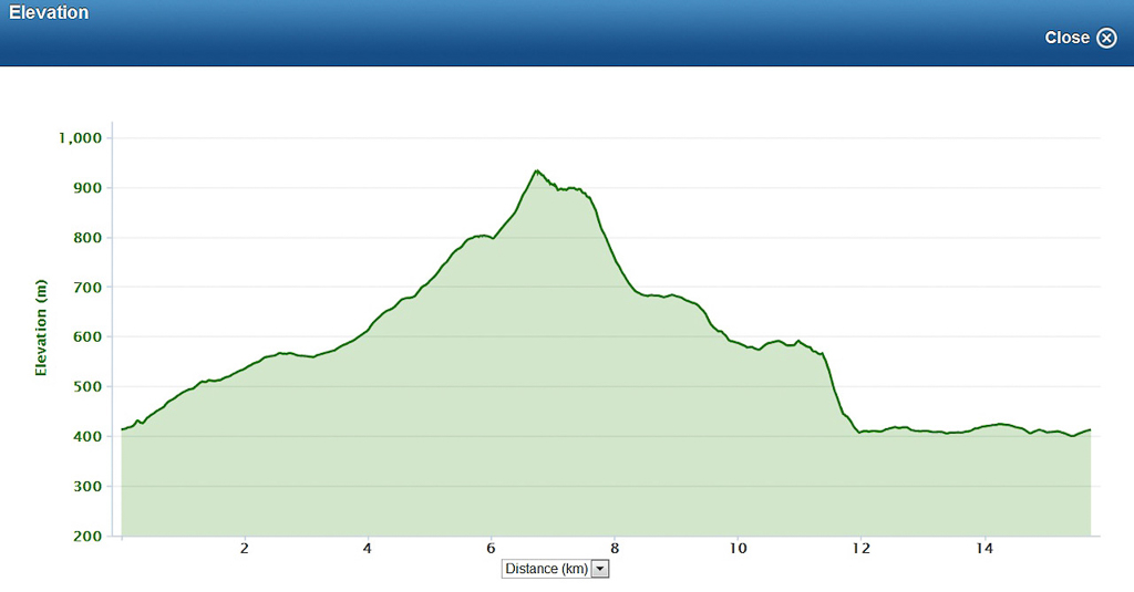
In fact, do you know how steep it was? My knees ache on downhill sections and if the terrain is too steep I tend to find the only relief is to walk backwards. I can’t say I’ve done that for a while, but on this track I reverted to reverse, as it was the only way I could get down without my knees detonating.
Once that was done I reached the very casual Langi Ghiran Track which was a relief for my legs.
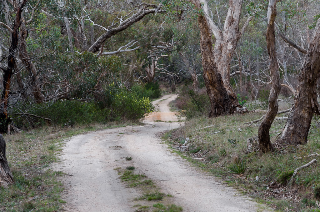
There were about four kilometres of walking along this section, but it suited me to finish off in comfort and before I knew it, the car was in sight. Wow. Quite a day!
Now, what do I make of it all? Well, firstly I didn’t see any signs at the closed tracks telling me I shouldn’t be there. Oh yeah, they might be tricky in a car, but they’re a cinch to walk on and in fact I’ve no idea why the Parks Victoria website says they’re shut? No idea, but yet again my ‘closed track’ theory about accessibility was correct. Again.
Do you remember my carry-on at the start of the post about camping out as I might run out of time? Well, I’m not sure what I was thinking, as the seven hour walk only took me six and a half. Where’s my doctor?! I must be fitter than I thought.
I guess it was time to head back home and count the cost of the days activities. My duds were dead, but I was lucky to find another pair on sale this week (who pays full price for hiking gear? The stuff just doesn’t last) and I’m back in action. I do know I’ll never be wearing the Ahnu Elkridge shoes again if there’s tricky terrain. They are great to walk in, but sorry, the grip on the soles are absolute crap. In fact, I’ve mentioned them so often, I think it’s best to see them at the end of another nightmarish interesting hike.
Banana skin soles

Man – first time I've ever heard (or rather read) someone talk (or rather write) about Langi Ghiran! I'll tell you something: this is the very random park where I spent my only New Year's Eve in the bush.
Unfortunately because there had been a lot of drinking (goon… because we were broke) and eating (foie gras… because we were still French) going on that night, we didn't get up to much walking the next day. I can't remember which tracks we followed, but we never got to the nice view at the summit. We did see the reservoirs and the "lookout" (yeah, right).
It was a nice little park though, and I distinctly remember waking up on the 1st day of 2009 to a kookaburra laughing its heart out, and the screech of cockatoos. What a great way to kick off another year, heh? The wildlife was quite good in the park too, we spotted wallabies, echidnas and a lone koala.
As a footnote – I've recently bought Ahnu shoes (Montaras) for everyday walking in the city. I hear you. They are slippery. Which is probably a bigger problem here in New Zealand than in Australia! Ah, well.
Great story! I also always find myself worrying about the potential slipperyness of my shoes and boots, but I've only bummed out once in recent history. I can't remember the make of my hiking boots offhand, and although I took my Merrels to WA recently, I still wore my rubbed-soled RM Williams boots into the limestone caves and felt more secure in them than the Merrels!
Don't worry too much about waffling on – I do so much of it when I write about places. The pictures help break it up and keep it entertaining.
I may just suggest to my partner that we do our next walk out at Mr Langi Ghiran!
Nice work, and happy walking!
Ha, ha another funny entertaining post! (And yes I made it through the entire story and am still around to tell about it!) Reminds me of the time I got almost lost in the wet underbrush near Mt. Hood, except I didn't tear my pants.
Thanks for another great story.
Hey there, yes, there's nothing online about Langi Ghiran is there? The most common stuff is the winery with the same name!
I like the story of your visit and I can only imagine the raucous sound of those cockatoos first thing in the morning. They are pretty vocal! Koala? I should have looked up more, as I didn't see much other than the eagle, and that's only because I was lying flat on my back! I reckon I may have missed him if I was upright!
The park is nice though, but the best bit for me was the summit. The thing is though that summit track doesn't lead right to it. I had to hop off the track and head up for about 500 metres to get to the top. The view is pretty spectacular though, as you can get well and truly above the trees at that height. I was impressed! Although the quietness up top was a bit weird at first. I have the video and if I can ever get it onto Vimeo I might upload it later.
Yeah, as a shoe the Ahnu's are comfortable, but they were beyond slippery. I'm glad to see that it's not just me with the problem!
The last couple of years I've considered a New Year's Eve on top of a mountain somewhere. My aim has always been Mount Bogong. If you want to be on a hill at midnight, might as well make it the highest point in Victoria, right?! Maybe this year…
Thanks for taking the time to drop by and comment. It's always appreciated!
Hey there, thanks for dropping by! Yes, the soles of shoes are something I worry about as well and as this walk shows for good reason! You know, the best grip I've found are with Vibram soles, but even then a moss covered wet rock really beats them! I guess there's other stuff out there, but I can't try them all out. I'm a 'sale bloke' when it comes to hiking gear and I try and make do with what I can afford at the time. What about standard runners like an Asics etc? They probably have better grip than what I had on this walk!
RM William boots in caves? What can I say, but stylish!
Don't encourage me to waffle, as that's giving me a green light to crap on for eternity! There's a kind of unwritten rule about blogging posts to keep them under 1000 words, but I feel like breaking out now and again! The ultimate test would be a long post, but without photos. Wow, I wonder if it's possible to pull that one off?!
Yes, Langi Ghiran doesn't disappoint and I'd think a summit view at either sunset or sunrise would be unbelievable on a clearish day with the 360 degree view. There's the problem of being up there in the dark though and you saw my skills in daylight! Actually, I still think it's doable as one could wild camp below the summit. Maybe…
Thanks for dropping by and commenting !
Hey Linda, well done for hanging around until the finish! It was a long haul even for myself and I wrote it! Actually, last night when I was writing, I'd had enough and just pressed publish, as I was kinda over it. I may have to recheck it for any grammar disasters!
You know what? I really did just run through my brain about concentrating on not falling when I did! All of my torn pants trips have involved falls, so if I can stay on my feet I'm usually okay. Actually, I hadn't had a good fall for a while, so I was overdue! Glad you didn't wreck your pants, as the repurchasing is expensive. Lucky I came across a good sale this week 🙂
Thanks for dropping by!
Excellent photos and an entertaining report, yeah I have had a few BBB in my time. In a time way past I did climb Langi Ghiran, but I had forgotten how wonderful the view was before wind turbines. BTW I have researched all footwear and found no matter what I wear, I will slip and I may tear clothing and it is all part of the fun, I keep telling myself.
Thank you for taking the time to reply to all these comments!
From your description, I think we may have been attempting the summit and just never got anywhere due to the track stopping. I do remember it being steep, so we were definitely on our way up to… somewhere… ah, well. There's always next time.
Regarding the koala, I think that's just about the only time I had ever seen a koala elsewhere than along the southern coast (Great Ocean Road vicinity). We only saw the one.
Mount Bogong would be a brilliant place for NYE, although in true Hiking Fiasco style I'm guessing you may cop the mother of all summer thunderstorms up there! But man, regardless, what a great idea. This is making me want to go spend NYE in the bush again too – wonder if I can come up with a location that's as cool, not to mention trick the girlfriend into it? Mmm… lots of evil master planning to do…
Thanks Roger! Yes, the view is lovely and I was surprised just how good it was. Pretty spectacular and my summit photos don't really do it justice. Yeah, the correct footwear is an endless struggle for me! I've never been totally satisfied with my shoes, but that might always be the case?! I seem to have compromises for most occasions! I will have to bite the bullet at some point and try out the Inov-8 shoes. That's one brand I've never tried…
Comments? No worries! Actually, I've moaned about this before, but my pet hate is bloggers who don't reply to people who've gone to the trouble in leaving a comment on their blog. Comments are always appreciated here, as sometimes it feels like I'm talking to myself! If I comment on a blog and get no reply back I tend to sack them! 'Take no prisoner blogging method' is my modus operandi!
Yeah, by the sounds of it you followed the track I was on. It did seem a little weird not to indicate a turn-off to the summit when the walk is sign posted quite a few times earlier on. Either have the signs or none maybe? Anyway, there's an obvious rock cairn at the spot to head off-track now. Maybe that wasn't the case when you were there? After that it's just a matter of heading uphill until there's no more hill!
Yes, you're right there about the koala. Cape Otway is dripping in them, but other places it's a bit trickier. On some walks I've heard their distinctive growling in a tree somewhere, but I've never been able to find them, so your sighting at Langi Ghiran was a good one for sure!
Well, Mount Bogong on NYE has been my idea for a few years now. I reckon quite a few people would have the same idea though? I'm not sure, but I'll report back if I manage to get it done! Oh yeah, you're right about the chances of me hitting rubbish weather. My only visit to Mount Bogong was in summer and we got hit with torrential rain for hours! It was one of the more mental days I've had walking, but it was memorable! The write up is on the blog and there was a price to pay for that trip which was a $400 repair bill for my waterlogged camera!
Other NYE spots? Places like Wilsons Prom would be good if they weren't overrun by people in summer! I guess it would have to be a big hill after all…? I did climb Mt Feathertop on Christmas Day a few years ago and was expecting no other fool to be walking, but there were dozens! So, you never know where people might be on those big days of the year!
Well, that was a saga but I made it all the way through! Nice way to kill half an hour "working" at my desk.
I'm not very fond of off-track walking either, particularly in Australia. One thing I'll say about small countries like Korea is that I'm far less concerned about bush-bashing my way down a mountain. I know if I persist, I'll reach some sign of humanity before very long.
Thanks for the custard tart mention, you tease!
Truthfully, it would be wonderful to have a NYE in the outback, but of course temperature-wise it would be suicide. What a shame! I reckon Tassie might have some good hills for the New Year too. Mmm… so much to think about…
Sighting the koala was quite lucky, he was a little way off-track and after a few minutes quickly climbed up a tree, never to be seen again. What was less lucky is that at the time I was using a fairly old & crappy compact camera. In one of my own fiascos, I had actually broken my SLR on the very day we were supposed to leave for that particular roadtrip. How? Because I thought the awesome scenery of the Alps justified buying a bigger memory card at the last minute, and when I changed it, like the clumsy brute I am, I broke the holding pins on the camera body… It had to be sent out for repairs, which took about 1 month, i.e. the exact duration of the trip. Of course.
Funny enough, we went up to Mount Bogong a few days later. That was actually the place where not having the SLR was the most frustrating, as amazing views and landscape aside, we also ran into gorgeous pairs of Gang-gang cockatoos. Ah. Well. Next time again!
Sorry for rambling on, but a 1000-word post is too good an excuse for me to indulge in my love of pointless babble 😉
Great reading. I love your posts. 1000 words is excellent, keep up good work.
There's nothing better than combining a bit of blog reading and writing whilst at work. I don't know about you, but I think it'll be the only time I get paid to blog!
Yes, I don't know what the off-track appeal is. Ben HATES it, as every time we've done it there's been a disaster about to happen! He was traumatised by the day we spent in the Never Never in Tasmania a few years ago and hasn't recovered mentally! I find it an acquired taste, but maybe you're right, in a different country it might have more appeal? Over here, most of the time I'm getting assaulted by vegetation. It might be different in those UK looking areas where trees are banned?!
Oh yeah, sorry about the custard tart. I forgot you're starved of them in Korea. They might have great internet, but no custard tarts? What's going on over there????
Is that the one and only Lady Smuffin??! Thanks for the kind words, but I think we're overdue for 'King Smuffin' in a post aren't we? We might have to wheel him out for another session out bush? I've got a couple of beauties for him to consider next month if he's fired up!
Yeah, I know what you mean by the NYE in some place like the Northern Territory. The whole landscape up there lives and breathes to a different beat to anything else. I'm well and truly overdue for a hike up there, but it'll be next year now due to what you mentioned. It's so hot!! I've had my eyes on the Larapinta Trail or even the Jatbula for ages. I will get it done, but I make it harder for myself by leaving it for another year!
Oh no. The broken memory card pin. I know what that means as I did it once myself. I damaged the pin with a CF card which I wasn't really familiar with. Such a simple stuff up and it just turns the camera into a paperweight instantly! I was so depressed when I did it and I can only imagine the grief you felt when it took a month to fix!
Yeah, Mount Bogong is such a beast to get up, it's not a place to quickly get the camera fixed and then whip back up the top! I've only done the climb once, but I'm getting ready to bite the bullet and do it again before the end of the year. Did you have views on Mount Bogong? Lucky you, as I couldn't see a thing due to cloud and it was in February! I can imagine the view would be amazing on a clear day…
No, don't worry about rambling. I love it. I've built the entire blog around waffling, so feel free to do as much as you want 🙂
Thanks again Greg for another piss-your-pants funny post. I've lived in Melbourne my whole life and I had never heard of the Mt Langi Ghiran walk. Now I'll have to check it out.
Not wrong about off-track walking in Victoria. When I was young and foolish I took the girlfriend to Errinundra NP to attempt an off-track hike in the rainforest to a waterfall (First creek falls). Six hours of bush bashing trough treeferns, slippery logs, wet bush and leeches saw us travel about 1 km! We gave up after the blood suckers were up around our jumpers.
Funny thing is she married me even after that torture.
Hey, welcome back! You know I'd only ever seen the turn-off to Langi Ghiran State Park whilst doing 100 kph when going to the Grampians?! It's that sort of place, as I think it gets ignored and the Grampians takes all the glory. It's an interesting place though and what I didn't do up there (which warrants a revisit I think) is go to the short walk which leads to some Aboriginal rock art. I think that's quite rare for Victoria?
Like I said in the earlier comments. I see blogs where blokes are 'off-track' walking in the UK and the ground is totally open without a tree or bush to be seen for a million miles. That sort of 'off-track' walking would be a breeze! Oh yeah, it's probably wet as crap, but at least the whole difficulty of route finding wouldn't be there.
The old 'off-track to the waterfall' trick? I reckon you're not the first bloke to fall for that one, but in your case you took a victim with you! Actually, I've got a 'Wild' magazine somewhere in which this bloke walked off-track to a waterfall in Victoria and decided to take a short cut back to the road which was I think 700 metres away? The trouble is it took him 12 hours! Now that's beyond any fiasco I've had!
You know she married you? All of my bush horror stories don't sound so bad as time goes by. On reflection I wonder what I was complaining about at the time!
Thanks for dropping by!
I had tears running down my face from laughing so much; especially your explanations of the yellow danger signs. I've never seen a sign warning against dangerous disco moves before.
Hi Dianne. I'm glad to give you a laugh! Then again, it wasn't really me, it was the totally over the top sign! I'm not sure how many ways they can tell you you're at risk of falling over?
Thanks for dropping by!
Whoa, what a marathon! And I'm NOT talking about your hike, although I see you've inadvertently adopted one of my secret 'unfit walker' strategies. The ar*e is SO underrated as a hiking weapon … I too struggle with brevity – so I adopted another blogging strategy to ensure the evolutionary underdeveloped readers with minuscule concentration spans don't tune out! Yes, it's as simple as interspersing long posts with short! Win-win!! Of course the downside of having read this lengthy (and yet highly amusing and informative) post is that I have no time for the two I haven't read yet …
Hi Red! Yes, I pushed the limits with this post, but sometimes one has to throw caution to the wind and just go for the monster entry! Blogging is about a mix of pictures and writing though isn't it? I haven't been brave enough to attempt a post with just text only. That might be pushing the friendship a little!
Don't worry, any steep descent and I've definitely adopted the arse method! Tough on pants, but if I didn't I reckon I'd be dead by now as my balance can be a bit dodgy at times!
Hi Greg, nice blog. It inspired me to follow in your footsteps. What was uncanny was to what extend I would follow. First, I too have had the Tempest experience of spending an extra 3 hours on one of his older hikes. These days I think he has adjusted his expectations to us mortals. Secondly, I took a 2 day pack with tent etc to stay at the Hidden Lagoon, just in case. However, like you it decided to finish it on the day – all the while wondering why I'm carrying all this extra weight. Bashing my way through the undergrowth after the saddle I could not find any signs of a trail nor markers. The funny thing was I stepped on the same (I think) marker you photographed and came across your slippery slide too. It was a good hike overall, but due to the finish along link trail and the last 4 km, I only give it a 3 out of 5 stars. Thanks for the blog. Cheers, Xavier
Hi Xavier. Thanks for dropping by. Don't follow in my footsteps too much otherwise you'll end up injured 🙂
Glenn Tempest times can be a bit weird. On his Mt Buller hike we went five hours over his suggestion! I thought this walk would be the same, but somehow I finished up earlier than his time suggested. No idea, as I'm not any fitter.
Your trip is identical to mine! I had the full kit with intentions of staying at Hidden Lagoon, so I'd like to re-do this walk with just a day pack. I think the descent would be a bit more enjoyable!
Apparently there's an old camp in the bush on the descent? I've no idea where that was. It was all ferns as far as I could see! Not sure where I was going either other than down and to the left!
Yeah, it's a kinda weird walk. The whole thing was made worthwhile once heading off-track to reach the summit and the zany descent down to the track near hidden lagoon. The rest of it is pretty average fare isn't it? That road to end off seemed to go forever and I even contemplated dumping my pack and just picking it up in the car afterwards! Oh well, it's done now. It'd be interesting having another look if a cold snap puts some snow up there. Can't imagine it'd stay for long at that height, but I'm contemplating another look some stage.
I have been told the big square 'thing' is a kind of antique shipping container for delicate fabrics etc. The opening seems too small though, so did they use very small monkeys to pack the materials – or were they actually for storing liquids like water for long voyages?
Barrels are not very space efficient are they?
Hey Din, antique shipping container? Okay, I'll go with you on that one, as I've no idea.
Well, it was old, so maybe the opening was sufficient for the people who were smaller then? I guess an entire species who are no larger than Tom Thumb would be able to fill the big box?
Yeah, barrels are only good for port, Can't see them being of much use stacked in a ship. Unless they're all full of port!
Just wandered across your blog – thanks for the laugh. I was actually searching on "plants of Mt Langi Ghiri". You'll perhaps be interested to learn that your can't be bothered naming them pond plants made page 1 of a Google search (what a pity they weren't the ones I was searching for, but wtg on the search term!). Anyway, off to consult an actual book for my plants now. Appreciate the heads up on why there was so many signs warning of falls too 🙂
Well, sorry about that! Langi Ghiran has nothing online other than this post and the nearby winery with the same name, so any mention of the place must get snapped up by Google!
I've tried to be clever before, by naming plants I've taken pictures of. The trouble is I keep finding websites, which state, 'enter the name of your plant and we'll tell you all about it'. This is always problematic when I'm looking at their site, as I don't know the bloody name of the plant in question!
Anyway, hopefully you had some more luck than being given the bum steer by this joint. Thanks for dropping by!