As of now I’m not officially mentioning any walks I’ve planned for the year. It seems after mentioning them in this infernal blog, something comes up and the intended hike is cancelled. I should be in Tasmania right now, but the plans for that fell through. Okay, I’ve got a couple of weeks leave, so I’d like to make the most of it and come up with some hikes off the top of my head.
I’m usually tackling some sort of Glenn Tempest walk, but the guru of multi-day walks in Australia seems to be John Chapman. I picked up a copy of his book, ‘Bushwalking in Australia’ which is full of good walks and the Razor-Viking hike caught my eye.
Actually, are there any places Chapman hasn’t walked in Australia? Maybe the Western suburbs of Melbourne? Would that be it? Try doing a traverse of Sunshine with a $50 note sticking out your top pocket and see if you survive the day.
Well, I managed to talk myself into doing the Viking circuit, but I think I needed a side-kick. Wilderness walking in bushfire regrowth needs a companion I feel, so I recruited Smuffin to come along. He agreed without knowing what was in store (bonus) and it was all systems go. I mean, he was so keen, he even managed to get a pair of long pants, which is a rarity for such a dedicated shorts wearer. They may have been his wife’s pants, but that’s not important.
So, there I was all packed ready to go when the dreaded phone call arrived on the day before departure. He told me he’d injured his hip, plus not one, but both calf muscles and was pulling out. How could someone cause so much damage in one hit?
Well, the answer is cooking of course. What? Run that by me again please? Yes, cooking. Apparently he put in a long session at the griller without orthotics in his slip-on shoes, which caused both of his legs to implode. Is this even possible? I guess it’s so bizarre it would be true, as I couldn’t see how anyone could make it up.
So, with Smuffin benched I considered some extremely last minute options. I thought of doing the Viking circuit on my own, but something didn’t sit too well mentally as a solo walk. I guess I could go to the same area and do the Crosscut Saw out to Mt Speculation?
I’d been there before, but it was such a traumatic experience I haven’t written it up on the blog, A demented bush bash with MK through fire regrowth, without knowing which spur we were on, before a fateful decision was made to head straight for the top of the Crosscut Saw ridge line from way down below. I’m still affected by the reaction of my lungs hanging out my mouth that I don’t want to relive it as a post.
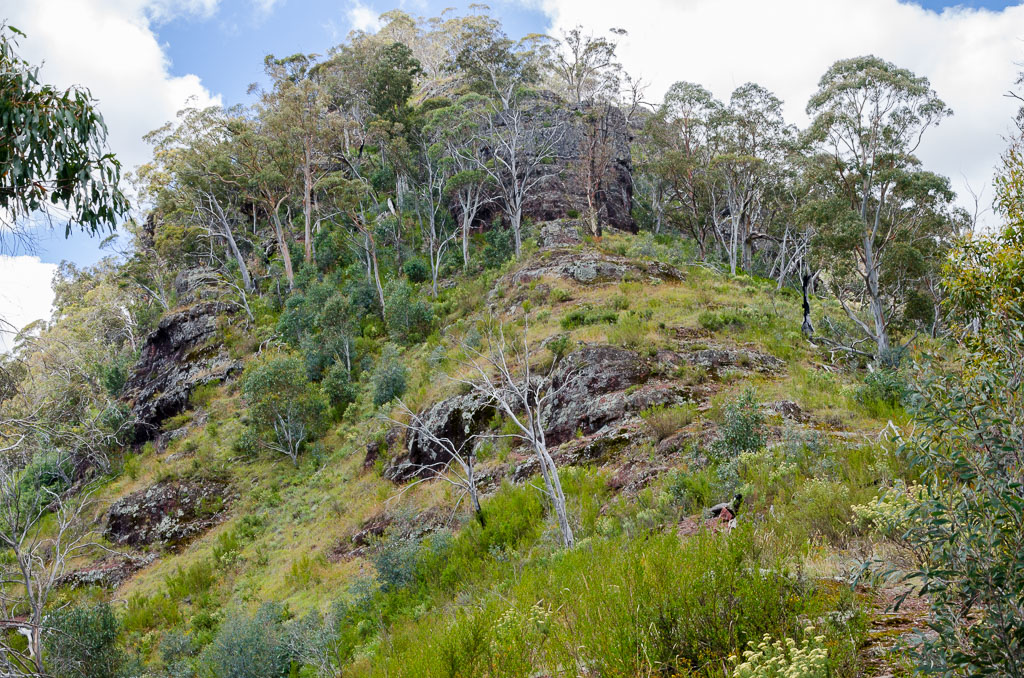
I guess I wasn’t sure which walk I wanted to do, but if I was going to do any, I’d have to start from the Upper Howqua Camping Area. That’s about the only place I feel comfortable getting my low slung Japanese car to in one piece.
I headed up with four days worth of food in the pack and I figured I’d work something out when I got there. The dirt roads leading up past Mt Stirling are slow going in my car, but with a bit of patience I finally made it. The final section of gravel along Bindaree Road was the worst, but being dry I managed to inch down to the camping area without putting a hole in my sump.
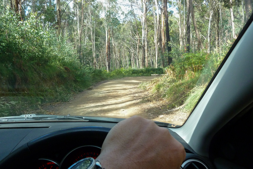
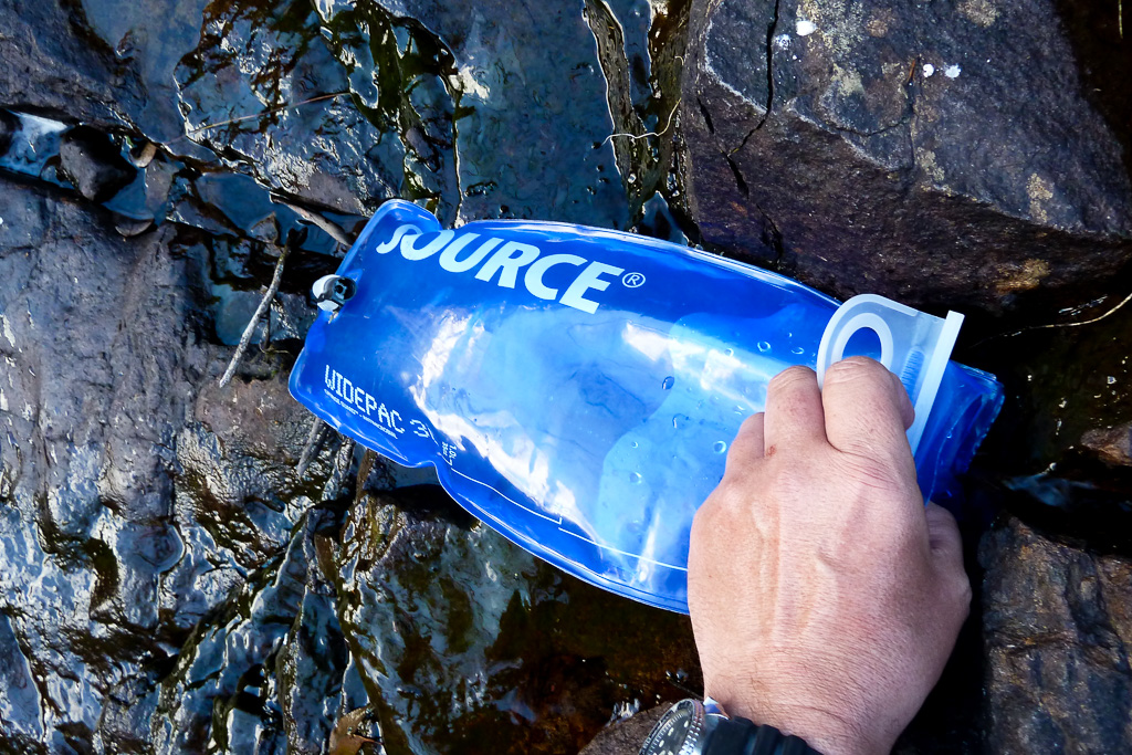
Driving down Bindaree Road.
Actually, if you look at the photo above you’ll notice my Seiko watch which I’ve mentioned on about 35 previous occasions in posts. You’ll be pleased to know it’s just celebrated its 28th birthday. Now that’s some good watch endurance right there I believe.
Well, I was there and it was pretty quiet with only one other car parked nearby. It was late afternoon, so I thought I’d set up for the night and head off the following morning if I could think of a walk to do. I was putting the tent together when some random bloke came walking along with a pack on. He said hello and kept strolling. I’ve no idea where he was going or what he was up to, but I just tinkered around with the tent until it was dark enough to go to bed.
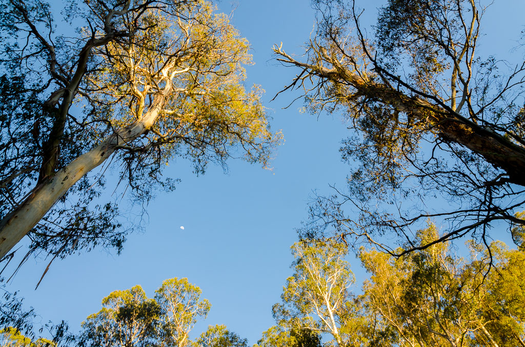
The next morning it was clear and sunny with the moon still visible in the sky. Always a good photo opportunity.
I was casually packing up when the mystery bloke from the previous day came past again. I found out he belonged to the other car parked nearby, but I couldn’t work out where he went for the evening. He camped somewhere, but while I was in an area about a football field in size, he must have thought he was cramping my style and wanted to be alone. Anyway, we got talking and he told me how he’d gone up Helicopter Spur the previous day, kind of lost his way a bit, but made it to the top where he’d camped the night and then headed down another spur the following day.
Okay, this is where Glenn Tempest comes in again as he has a walk in his latest book, ‘Daywalks Around Victoria’ which includes this hike. It’s called ‘Howitt and the High Country’, but what caught my eye was the line,
…”Helicopter Spur, the route used to reach the treeline, is one of the steepest and most challenging climbs in the region…”
Mm… Sounds entertaining and I hate reading things like that, as all it makes me want to do is see and try it out. How hard can it be? Well, all this hiking stuff can be subjective and I was up for it enough to try out the walk. The difference being is I was going to do it over two days instead of the books suggested one. I’d fallen for that trap before on the Mt Buller Traverse I did with Smuffin a few months back. Somehow we spent five hours more than the suggested walk time and finished at 10.30 pm with my headlamp fading. I’m not falling for that trick again.
So, I headed off with enough food for four days with the thought that if I enjoyed myself enough up top, then I’ll do a few days walking.
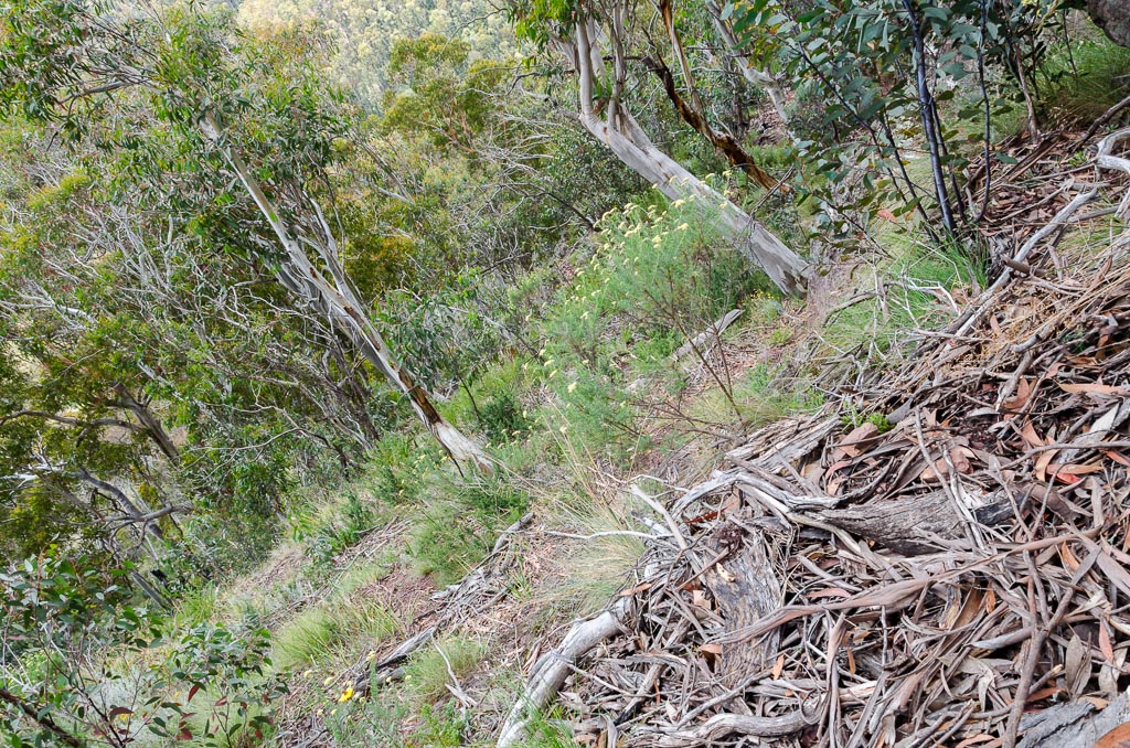
First of all though, get up the Helicopter Spur in one piece. The spur has three rock bands to negotiate and without seeing them before, it’s hard to know how hard they will be, but I was sufficiently intrigued.
Heading off, the beginning is tranquil enough with an old vehicle track being the first few kilometres of walking. It was steadily climbing and I did note I went from pristine to sweating heavily in about 25 seconds. It’s amazing how this always happens and I think I’d make a good, male sweating model, which I can imagine would be in high demand somewhere. Being wary of this fluid loss I set off with four litres of water, which I was confident would last me all day. The pack was bloody heavy though as a result.
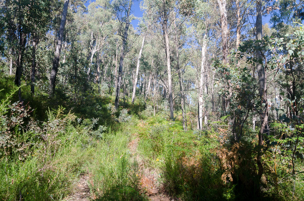
Old vehicle track on Helicopter Spur.
I chugged along until the track came to an end. Whilst surrounded by trees there’s no real way of seeing what pain there is to come. I followed a track that faded quickly, but the route was pretty obvious. ‘Head up’ is all you need to know regarding directions. The walking was still rising steadily, but without any dramas.
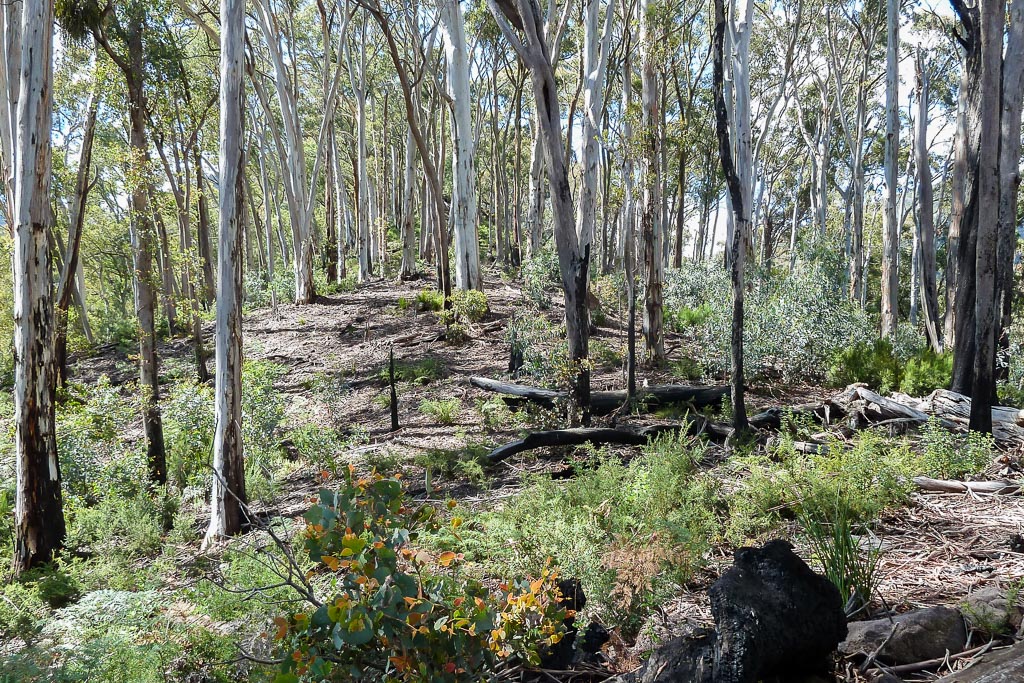
On the lower slopes of Helicopter Spur.
The spur began to narrow and I reached my first obstacle of the day. A small group of rocks were blocking the path, but they seemed pretty straightforward.
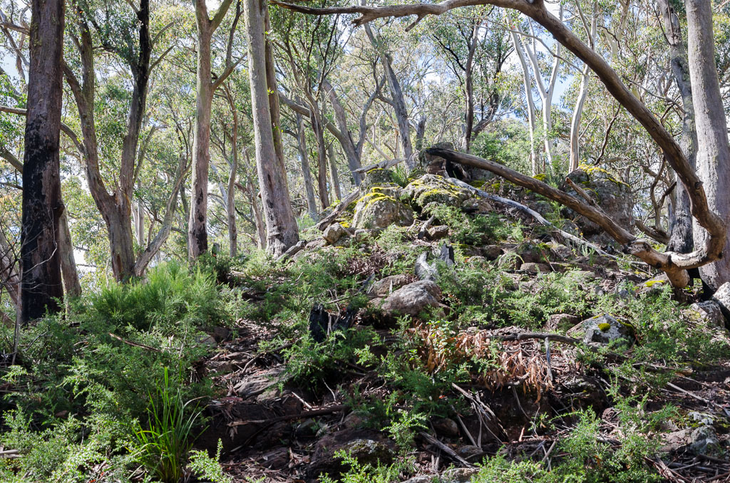
First rocky obstacle of the day.
I could see marks where other suckers hikers had clambered up the side and that seemed to be the easiest way up. It was pretty steep and a bit of a slog with the pack on, but I inched up in one piece.
I clambered up whilst thinking to myself, “How easy is this business?” I was feeling pretty confident at this stage and I even began to wonder what all the fuss was about. You just know that’s not the thing to be thinking whilst hiking, don’t you?
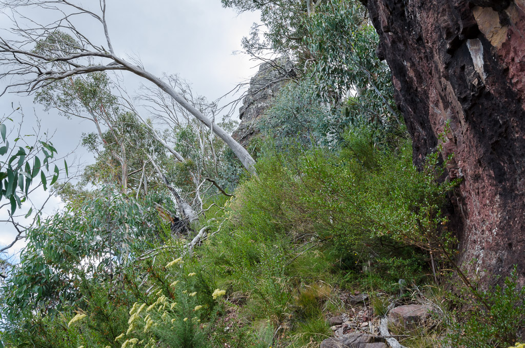
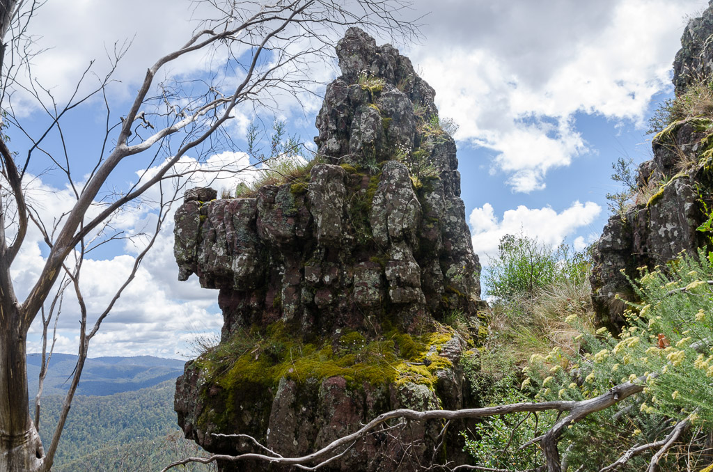
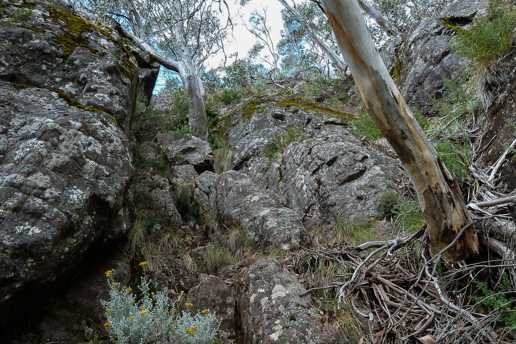
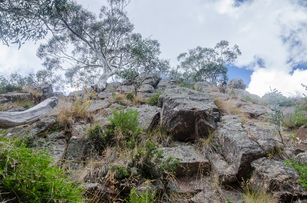
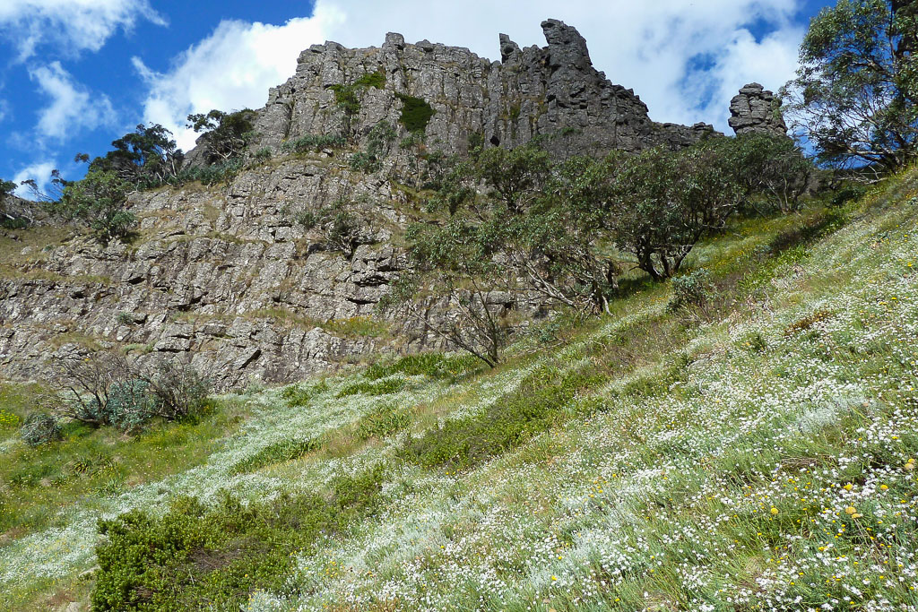
Whilst following what seemed to be the most logical way up I crossed a small knoll and suddenly I saw it looming through the trees. Yes, a dirty, great, vertical looking lump of rock was straight ahead. Umm… Is this the first rock band?
The first rock band through the trees.
As I cleared the trees, I was no longer looking where my feet were being placed. My eyeballs were on stalks staring straight ahead and I noted my jaw was roughly around my ankles. My mind was thinking “that’s hair-raising”, but my mouth was uttering uncontrollably “Fuck!!!!”.
Once out in the open I had to stop and just stare at the imposing obstacle for a few minutes. It was definitely one of those hiking moments where you stand there looking, whilst scratching your head wondering, “How the hell am I going to get up there?” It looked like a tricky climb without a pack, let alone with the small car I was carrying on my back. I remembered some notes mentioned, ‘head left’. Okay, but I also thought to myself, “Do not balls this up. Concentrate here”.
I began to head left from the base looking for some sort of track made by others. Photos drop off a little through this section I’m afraid, as I was crapping myself too much to think of the camera. What made the base entertaining was a scree slope held together loosely by scrub, which I negotiated carefully as slipping here is not a good idea. It’s steep, but not a ‘fall and you die’ spot, more like a ‘fall and lose most of your skin’ area.
Base of the first rock band.
I was keeping an eye on the left of a huge rock wall, but I made a mistake of going left too early. I reached a rocky ledge which had odds of 50/50 in clambering up with the pack pulling me backwards. Not making it would definitely mean falling and then rolling down the scree slope discarding most of my limbs on the way.
What made it even more difficult was the rocks in the area were doing a crap effort as per their job description. These are rocks right? I thought rocks were meant to be strong and secure. Not these ones, every time I reached for a substantial sized boulder whilst bracing myself, the rock would just lift up in my hand. Huh? They felt like those rocks you see in movies, which blokes can just lift up and throw one handed.
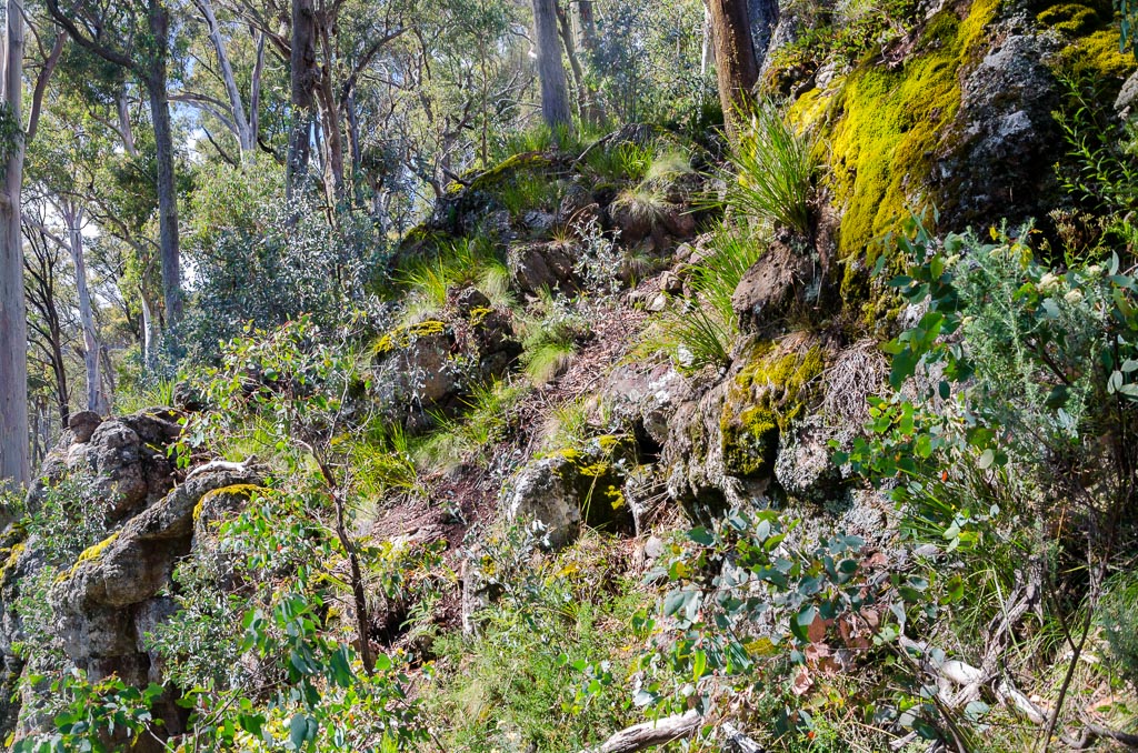
So, I went into retreat mode and looked for another way up. I eventually saw some scratchings in the ground from previous victims and decided to follow them. In the end it was good as could be and I slowly inched up.
The correct route up.
Instead of trees and rocks, I could see daylight at the top through the gully which confirmed I was on the correct ‘path’. I was disappointed though in grabbing the odd bit of vegetation to haul myself up and being rewarded with a million little needles sticking into my skin. I’m not sure what sort of plant does that, but it’s not very friendly.
The top is in sight.
I stopped a few times to get a breather and whilst doing so snapped the odd photo looking back. Not very many though.
Looking back down.
On any loose scree section I ditched dignity and just crawled up on hands and knees. Finally it began to level out slightly and I had time to take stock of what was going on around me.
Nice looking rocks on the way up.
I ended up stopping to have a rest and psych myself up for the next two rock bands to come.
Looking down from the top of the first rock band.
It may have been a bit mentally challenging, but there were now some great views back towards Mt Buller.
Mt Buller in the distance.
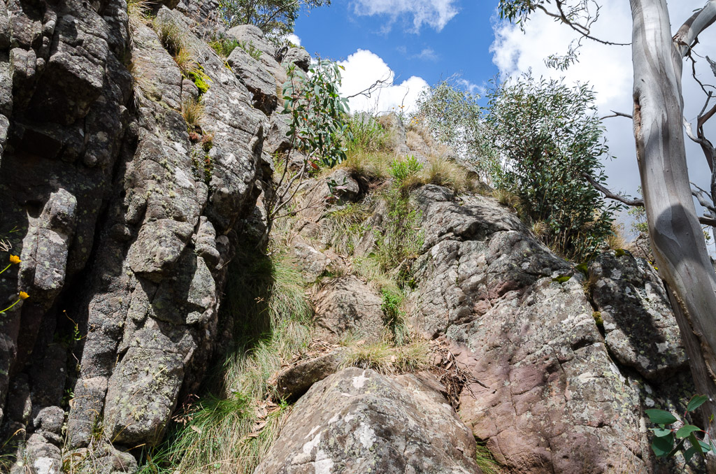
Okay, now what? Well, on to the next rock band, which of course wasn’t too far away and it was the same story as before. Wandering up a steep hillside to be greeted by another lump of rock through the trees. At first glance this looked worse than the first.
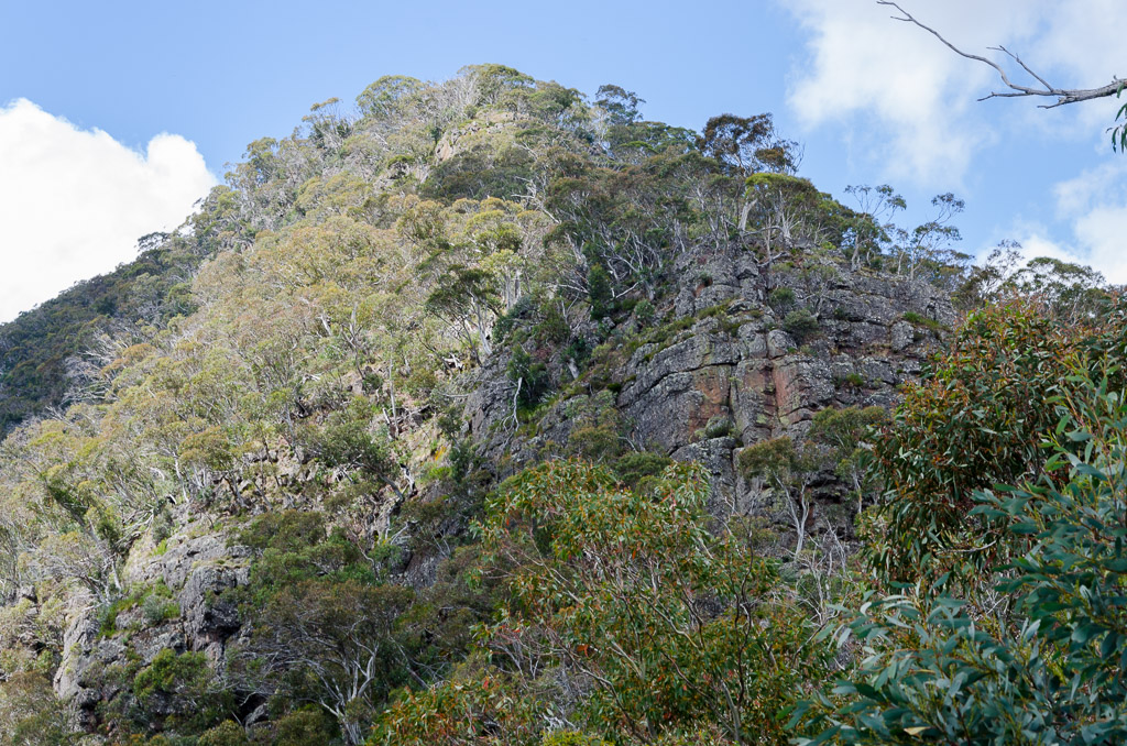
Second rock band – Helicopter Spur
The same rules applied though in that I was to look left for some sort of scratchings made by others. Sure enough I could see a steep climb in a gully between two towering cliffs. Mm… Here we go again. There was a steep approach to the base of cliffs which gave me a chance to get my head together.
Slope beneath second rock band. Yes, the camera is level.
Unlike the first rock band, once I reached the base of the cliff I could easily see the best way up. A narrow, rocky, tree strewn gully was the go and I set off inching my way up. I was being mega careful, as there seemed to be plenty of movement no matter where I placed my feet. Luckily, there were some substantial trees to grab hold of, for extra pulling power.
The way up.
Up I went and again it was important to be careful with the small motorcar on my back leaving me unbalanced at times. I even went for a little radical photo action whilst standing on a ledge half way up.
Some ledge work.
Now as I reached the top I was aware of something that was beginning to drive me nuts. There was a constant swarm of March flies in front of my face and landing on my legs.
Now, I have a particular hatred towards them since I was bitten on my back when I was about seven years old. For years afterwards, I’d get sudden pain in the same spot I was bitten. I have no idea what that fly did, but it could have been anything as it appears they have a miniature chainsaw on the front of their face.
What gets me is the ones in front of my face were a particularly stupid variety, as they kept landing on my camera instead of me. There was no blood to be sucked out of the Nikon, but their constant presence was working up my temper. They also didn’t know how to give up. I’d swat one away from the front of my face and next second it would return. One even lodged near my ear and it sounded like a Chinook helicopter was flying into my brain.
Okay, that’s it. Off went the pack and I got out my trusty 40% Deet insect spray and proceeded to coat myself. Now I don’t know how this works, but they weren’t even bothered by the Deet and I was left sucking on insecticide as it dripped down my face.
How much can one take? Not a lot, as I slipped into ‘march fly whoop-arse’ time. I reckon I spent 20 minutes at the top of the second rock band smashing the bejesus out of dozens of buzzing flies. There were corpses piling up around me as they’re not the fastest movers. In fact I returned to medieval times and skewered one on a stick and left it as a warning to others.
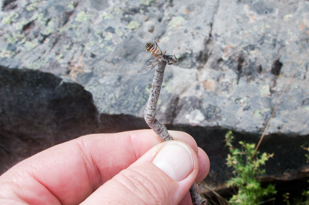
Hey fly! You didn’t expect that, did you!
The longer I kept slaughtering, fewer buzzing hordes were available for smashing. The core group bothering me were wiped out and I could successfully proclaim the top of the second rock band ‘march fly free’.
Okay, back to walking. I only had one rock band to go and I knew it was smaller than the others, so I was well on my way. It was still a slog to get there though, as the steep terrain didn’t let up.
Third rock band – Helicopter Spur
I reached the wall of rocks and found a nice little route up the right hand side. This last one was pretty much plain sailing.
The route up the third rock band.
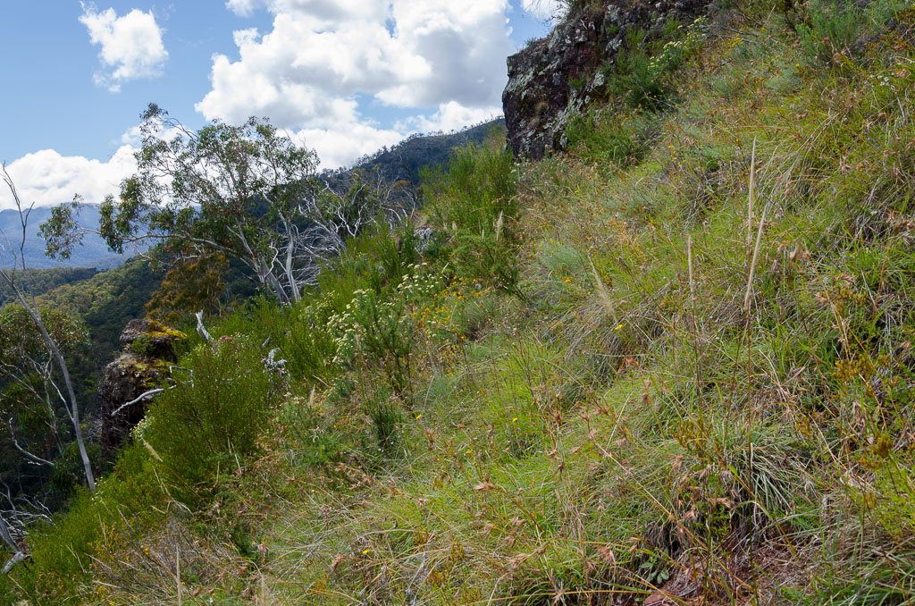
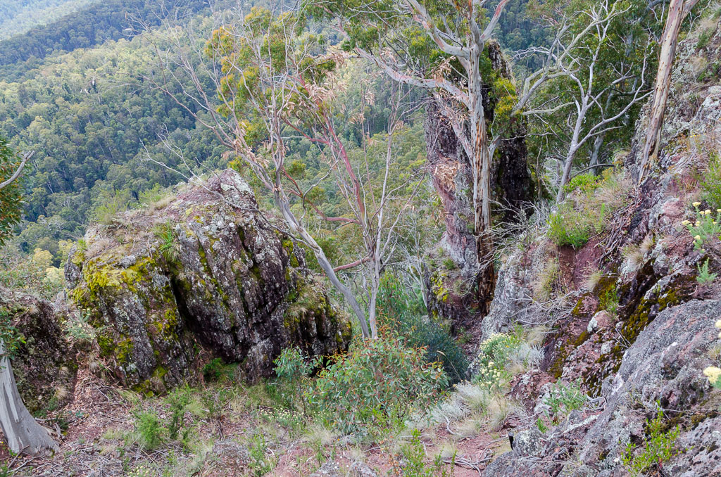
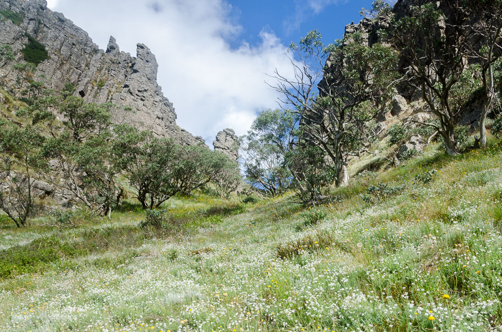
Wow, that was ‘fun’. I was certainly glad to have made it up in one piece as the slope began to ease and I entered what looked like a vast field, full of summer flowers. Now, this is more like it.
The top of Helicopter Spur.
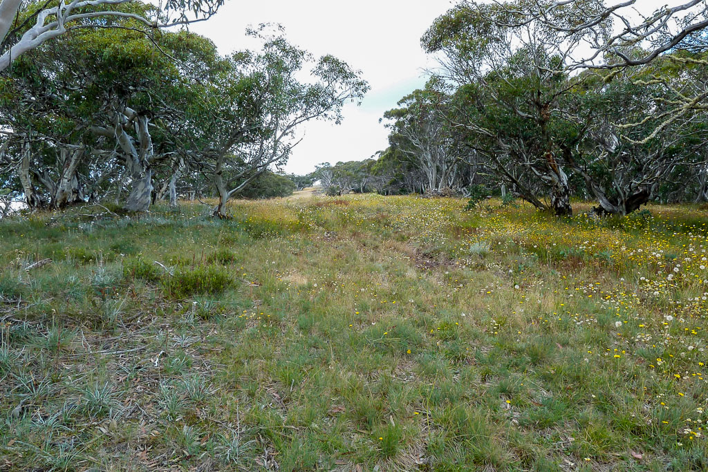
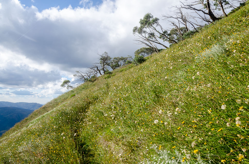
I was on my way now heading towards the Australian Alpine Walking Track (AAWT) which passes through the area. First of all, there’s an undulating stroll along Bluff Track. It was nice to be on a formed track after the previous hours shenanigans.
Bluff Track
I located the AAWT track and turned off. At the rate I’d been going, I decided not to be too ambitious, so I elected to find a grassy saddle near Hells Window and I’d stay the night there. I was a little disturbed though to suck on my hydration tube and find I was out of water. How could I have drunk so much? That was annoying, so I thought it was best to get to camp. There’s supposedly water available in a nearby creek all year round, which I was counting on otherwise I was in a bit of bother. There was still a bit of climbing to do, as the track approached Mount Magdala.
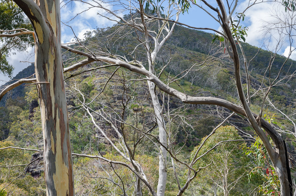
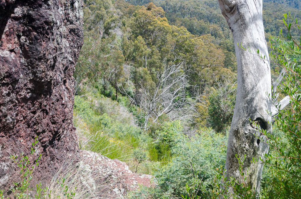
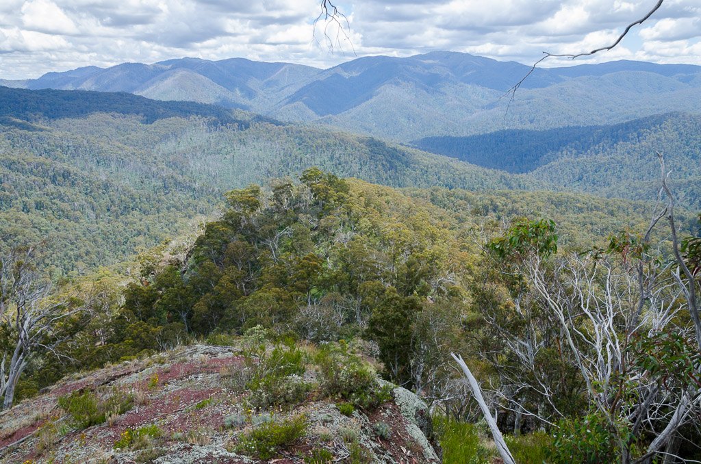
You know what happened when I reached the Mount Magdala turn off? I piked out, as I was feeling pretty dehydrated and elected to follow the path which travels beneath the mountain. It’s still good value though, as the track has a vast valley on one side and the cliffs of Mount Magdala on the other with Hells Window at the side.
Actually, I can’t think of a more stunning view on any of the walks I’ve done recently. It was freakishly good and the photos don’t do the ‘scene’ I was looking at any justice.
Below Hells Window.
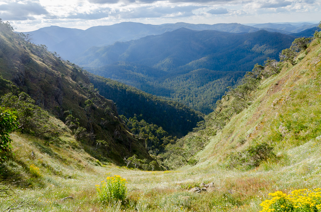
Beneath Hells Window.
Looking up at Hells Window.
This is an amazing spot and I could imagine propping a tent up near Hells Window, just for the views of dawn and dusk which would be unbelievable. Mm… Maybe one day, but right now I was feeling thirsty. The track continued on as it weaved through fields of wild-flowers.
After another twenty minutes of walking, I came across a nice flat area surrounded by trees. The grass had been flattened in spots and I was pretty confident this was the place to camp.
Now, water. Apparently Hellfire Creek (what’s with these crazy names?) is a short distance away. So, I dumped the pack and set off down quite a steep embankment. From a distance it wasn’t promising, but as I got closer I could see there was enough water flowing for me to fill up. Phew!
It’s not Niagara Falls, but it’ll do.
I struggled back up the hill and lay down feeling absolutely wrecked. What’s with these torture test walks? I was correct in thinking there’s no way I could have done this as a day walk. In fact I had only got half way by the end of the day!
The GPS reading helps explain why I was feeling knackered. From Helicopter Spur to Hells Window, the distance was only 12.31 km, but the total elevation climbed for the day was 1,073 metres. Throw in a bit of rough spur walking and a group of zany rock bands with a full pack and there’s no wonder I needed a good nights sleep. What’s to come? When I went to bed, I wasn’t sure how much I wanted to walk the next day…

I intended to mock you for hiking to areas with names like HELL's window, then I realized we have hikes planned in Savage River state park (incidentally, near a town called Accident).
Absolutely gorgeous walk..we have mud and snow, so I'm extra jealous.
Wow, sounds like an ordeal! But the nice scenery at the top look worth it. (At least I hope you thought so!)
Hi Samantha. Sounds like you're still in hibernation over there?! Yes, that entire alpine area is full of crazy names and I don't want to spoil it by writing them all down now. Hopefully I can get back there for some more exploring.
How did a town get to be called Accident? Living there is just asking for trouble.
Hi Linda! I'm not sure what to make of that walk just now. Give it a few weeks when the pain has been forgotten and I'll end up saying I loved it! There's always a bit of a price in getting to a nice view. Spectacular area though which I really should attempt to get to more often!
March Flies!……Ugh. Give me a broken Coccyx any day.
Hi Darren. Oh yeah, those flies are an annoyance! I'm sure they have their place in nature, but there's no mercy if they start landing on me. I don't just swat them, I pulverize them with my boot once they hit the ground!
Sounds like you had fun! I came down Helicopter Spur in the 90's with my brother and our wives. I remember trying to prise my wife's arms off a snow gum so that I could take her pack from her. The tree was perched on the edge of a cliff, so she wasn't letting go. We had walked in from the valley up Stanley's Name Spur and sat out some poor weather at Mac Springs, returning via the route described above but in reverse. No March flies though. Thanks for reviving the memory!
Hi Darren, thanks for dropping by. I can imagine a bit of apprehension going down the Helicopter Spur as it would be horrible! Certainly doable (everything is doable, right?!) but not ideal. I was glad to be going up although my lungs didn't enjoy it 🙂 Next time I'd like to come into the area via Mac Springs. Give the legs a bit of a rest that way!
Awesome walk + clambering!
I hate march flies, too, having encountered them only the once – and I hope never to again – on Wilsons Prom beach about 16 years ago. They devoured my legs and I, foolishly, ignored them for a while, until my brother said,"Why is there blood all down your legs?" I was done walking that day!
Bummer about Tassie 🙁
Hi Oanh. The spur is just sitting there waiting for you to have a go at it! Even though it wasn't much fun at the time, I'm glad I did it.
How did you ignore those flies biting you? It feels like a hot needle getting inserted into the skin. If they're around I go nuts jumping up and down to ward them off. What was weird is that the flies were only in one part of the walk and that was the second rock band. Further up there weren't any at all, so I'm not sure what the attraction was to that spot.
Tassie? Grrr….
Wow Greg – what's with the mediaeval torture questing thrown in with your day walk?? What is it about John Chapman – was he bitten by a radioactive spider (or March Fly perhaps?!) so that he can leap tall rock bands in a high speed bound?!! Mind you, the view to Hells Gate across the wildflowers justified the pain (for the reader anyway). Great post, Greg! Looking forward to Day 2…
Hi Julie! I wouldn't blame John Chapman too much as the walk I ended up doing was a Glenn Tempest special. Plenty of pain lovers those two 🙂
Yes, it was hard to get a photo that showed how incredible that view was below Hells Window. It has to be the best scene I've seen in a long time especially with it being late in the day with a nice glow in the sky from the low sun. Such great spots to be in, but there's the pain getting there!
Re: Your partner's bailout excuse: By chance I watched an episode of 'The Office' the other night in which the boss claimed disability status after burning his foot while trying to grill bacon from his bed. So it sounds feasible to me…
That is an amazing piece of Australiana. The trees and flowers look superb – I think I saw that rock outcrop in 'Avatar'! Good on you for doing it alone. As for the flies, they really sting, but yes, easy to kill, and so satisfying. I only believe in killing beasts that have bitten me first!
But for me nothing beats the damned no-see-'ums that plagued me on some sections of the Appalachian Trail. Those BASTARDS hover in front of your eyes ALL DAY and then inevitably CHARGE RIGHT INTO YOUR EYEBALL. What possible benefit would evolution give some critters by having them dive into other critters' eyeballs?
Almost enough to have me believe in a crazed God…
Hey Goat, that excuse in The Office is a good one! When someone says they've injured their legs cooking I guess it has to be believed just because it's such a bizarre story!
I'll have to check out 'Avatar'! You know what it reminded me of when I first looked up at those rocks? I thought of the first blokes who would have walked up to Hanging Rock. Rocks everywhere and which way up is the safest? It looked impenetrable at first glance, but the way up made sense the longer I looked at it.
Yes, good philosophy. Kill the stuff that bites first! You know what? I've always noted that the mesh on my tents is called 'no-see-um mesh'. Now I know what they're talking about! I just thought it was a mesh that was 'hard to see' as it was too fine. I really should get out more I reckon…
I don't really recall, but I am fairly accustomed to being bitten by creatures, so unless it's a leech or a tick, I'm not very bothered. March flies are now added to the list of things to react to…
Good to know they are in only one part of the walk!
Actually, everything you just named are on my list of 'disagreeable creatures'. Ticks are really annoying! The beauty of the March fly is the ease that one can squash them. They really are slow moving which makes me wonder how they've evolved into such slowness 🙂
Hi Greg,
My partner and I tackled the Razor/Viking in Jan 2012 not knowing what hell was about to present. It left an indelible scar….we coined it "Monster Cock"; it now acts as the bench mark against which all other hikes are measured. Shame you didn't blog about it. We essentially spent 2 days inching through eucalypt re-growth up the Viking, bashing our way down to the wonangatta river (no track, second guessing if we were on the right ridge?) then slogging it back in one final push to the car park (? distance but frickin' baking hot and no water left). Top it all off I had hamstring strain which meant every knee flexion was agony. Was definitely in the 'hiking fiasco' category.
Hi, your trip does sound fantastic for this blog! I'm sorry to say, but I've got to the Viking yet. A few cancelled trips doesn't help in that regard. What's funny is most of my trips in the high country were done a few years ago. Back in the days I walked, but didn't even take a camera. Yeah, I know, that's absolutely absurd now when you think about it! So, I've never bothered to write them up without pictures, as I don't think it's possible to pull off a post like that!
Anyway, I hope to get up and see what this Viking business is all about later this year. What gets me is I've never read anywhere of someone enjoying the second part of the trip? Down the ridge to Wonnangatta River and then back up again? It sounds kind of pointless, so I've actually considered doing the Cross Cut to Mt Spec and on to the Viking and turning around. Go back the way I came across the Cross Cut! Yeah, it's the same route, but the Cross Cut is so great I reckon I could handle it twice. Then backtracking from the Viking might be absurd if re-growth is still thick.
I've heard the re-growth has been cut back a bit to the Viking, but still horrible heading down to the river? Mm… Makes me want to stay high. Then again, availability of water comes into it! Who knows? I guess I'll make my mind up after winter!
Thanks for dropping by!
Hi Greg,
Yeah, I recon hike out to the Viking and camp on the saddle overnight(cant remember distance?). There is water there in a small gully, you'll find it. That way you could smash up the Viking without your pack the next morning, enjoy the sensational views then hike back to the car park that same day/way (again cant remember the distance but from memory this would be doable). The cross cut saw is awesome as you well know. If the re-growth has been cut back, then all the better (although Smuffin would need leg protection resembling the pant variety…).
Thanks for your hilarious blog. Glad I found it. I recon we will do the great SW hike but will miss cape liptrap (pissed myself laughing at that post, particularly since we've all had many of the 'where the f*&k is the f*&king end of this f*&king hike???!! moments.
We just did Jatbula hike in NT. You should do this one, although it is hot, which I know is not your fav. awesome swimming. You might have been up this way in your army days?
Cheers,
Eva
Hi Eva,
That sounds like a good plan, although part of me wants to see how awful the descent to Wonnangatta River is and the subsequent climb out! I really should ditch the suffering aspect, but it seems to be in my DNA 🙂 I have some time off in November, so it might be on the cards then. It's something I've needed to do for quite some time, as it seems to be one of those 'signature' high country walks.
Thanks regarding the blog. It keeps me entertained, so it makes me happy others like it as well 🙂 Cape Liptrap is alright. Just don't do it in reverse whilst it's stinking hot like we did! I think it would make a nice winter walk with a bit of dramatic ocean and plenty of water. It literally took me two weeks to recover after being so dehydrated on that walk!
South West Walk was a lot of fun. I'm a coastal nut, so it was always going to appeal, but it's such a well put together walk with water tanks, shelters etc that I'm surprised it has such a low profile. I'd do it again. Obviously in winter though!
Jatbula is a hike I looked at, but little did I know you've got to book within a day of the bookings opening! I called up in January and they said it was booked for the year! Definitely is one I want to do, so I'm eyeing off the day when the bookings open for next year. I think it's the start of October or November when bookings can be made? I'll put that in the diary for sure! It looks like a fantastic walk and the swimming is a great incentive at the end of each day!
No, when I was in the Army I was stuck in Townsville and the surrounds. I did do a trip to the top of Cape York and over to Thursday Island, but unfortunately (then again, lucky!) never got to the NT. I think hiking might be nicer there than doing army work!
Thanks for dropping by and taking the time to comment!
Great write up, thanks for sharing!
Thanks for dropping by!
This was a little while ago, but it's nice to look back at some of the older stuff, as it brings back a few memories. I love Helicopter Spur, but only in hindsight! At the time I seem to remember it a bit hellish and the flies certainly didn't help 🙂
I must say, I've some fond memories of that wander below Hells Window with the sun getting low in the sky and covering the area in a golden glow. I was glad I took that route rather than across the top of Magdala, although part of me missed the peak bagging 🙂
Great blog, thanks, we used it as a guide on our trip last weekend up Helicopter Spur. Very informative. I wrote a blog on our trip, if you want a read. thewaz19.blogspot.com. The only thing different now than when you did the walk is that the track up the spur is very well defined, cant miss it. Keep up the good work.
Hi Waz, Thanks! Glad it went well and glad also my post actually helped you out a little. I'll check out your post tonight. I seem to remember the only rock band where it wasn't clear was the first one. After that it was more straightforward. Maybe I'll get back up there one day for another look!
Man, is it possible for you to go on a hike without all the DRAMA??? Maybe I can suggest you visit the Botanical Gardens some time, hopefully you will not have to encounter these type of obstacles (Cliff hanger style) there 🙂 Anyway, heading off NOV 1 to emulate you once again. Going up Helicopter, on to Mount Speculation then Mount Cobbler/Lake and circuit return. Wish me Luck 😉 Cheers, Xavier
Well, it's called Hiking Fiasco, not 'Hiking Like I'm on a Comfortable Couch'. I actually think if you gave me the option of climbing Helicopter Spur or lying on a blanket under a tree in dappled sunlight, reading a book in the Botanical Gardens, then I think I'd lean towards the latter 🙂
Sounds like a good walk! Hopefully you're not overrun by all of the other long weekend hordes in the high country. I reckon the Cross Cut will need traffic lights to regulate the traffic:)
I stumbled across this blog. Thanks for sharing your experiences.
I have vivid memories of hiking up the Helicopter Spur ~30 years ago. It sounds like little has changed in the intervening years. Scrounging for signs of a trail, concerns with gravity's pull on packs while climbing the rock bands… As a member of a group of six teenagers, we formed a human chain to pass packs up on the middle rock band.
Certainly worth the journey once you reach the top. I think we took the high road over Magdala, but my memory could be a little out based on the ravages of time.
I think it's the sort of place, which will be much the same in another 30 years! I must admit, it was intimidating to look at, but once underneath each rock band, it made a lot more sense and wasn't too bad. Still, it's not the place to take a spill half-way up 🙂
I was a little torn with Magdala. It would have made sense to go over and bag it, but that track through what looked like a flower filled meadow swayed me to go low. I loved it, as the lower sun bathed the entire area in a beautiful glow. Certainly one of the more memorable days of walking I've had, even if I didn't have any peaks to say I'd claimed!
Thanks for dropping by!
Hi Greg,
I am considering tackling Helicopter spur this Green season 2015/16 but part of me says that is just insane. Perhaps I should start at Mac. Springs and maybe do a long day walk to Hell’s window and back or camp near Hellfire creek ?.
No, you’ll be okay.
As I found, I reckon it’s more intimidating upon first sighting! Mind you, I wouldn’t want to tackle it on a wet and windy day 🙂
Hi Greg,
Thank you for the post – helped a lot when planning my recent trip to the area. The second rock band is pretty tough with an overnight pack! Luckily there were some campers at the top that gave me some ice cold water. Especially as Hellfire creek was dry! I camped there anyway and made it to Mac Springs on 1 cup of water… Heat, flies, thirst, gotta love bushwalking 🙂
Hi Andy, glad I could help! Yeah, I agree about the second rock band! Pretty intimidating from a distance, but it all made sense once I was under it. I was also carrying a heavy pack with five days of stuff, as I’d planned a big trip up there, but realised I was overstretched after Helicopter Spur. I suitably abandoned 🙂
Wow, Hellfire Creek was dry? It guess it sums up the weather the past few months. There was a trickle when I was there and it was a lot later in the season than now. I would have been pretty disappointed to find it dry, as I’d have had no mojo to head down lower looking for water. Glad to hear you made it though! I was spent and had nothing in the tank physically to keep moving all the way to Mac Springs. Probably sums up my general fitness though 🙂
Oh yeah, flies. Hopefully you didn’t get molested on the rock bands by march flies like I was 🙂
Hi Greg and others. I went down Helicopter Spur one Easter some years ago (1998! I think) with my 12 yr old son after we had come over Crosscut Saw, Howitt and Big Hill and camped in the saddle above Hellfire Creek. Quite a drop off from the ridge down Helicopter Spur and a bit dangerous…..my son….. ‘What are you doing on your hands and knees dad?’…me…’Making sure I don’t fall and break my leg, so I can carry you out!!!’. Took a few hrs and got lost at the bottom but eventually found our way out to the camping area on the Howqua.
Hi. That’s a good story! Sounds like quite the trip? I’m not sure, but if I went to Helicopter Spur again, I’d prefer to be going up it like last time. I can only see myself coming to grief if I was going downhill like you were 🙂
Do you have a GPX map for this walk Greg?
Yes, pretty sure I still have it. Send me an email if you’re after it. Thanks.