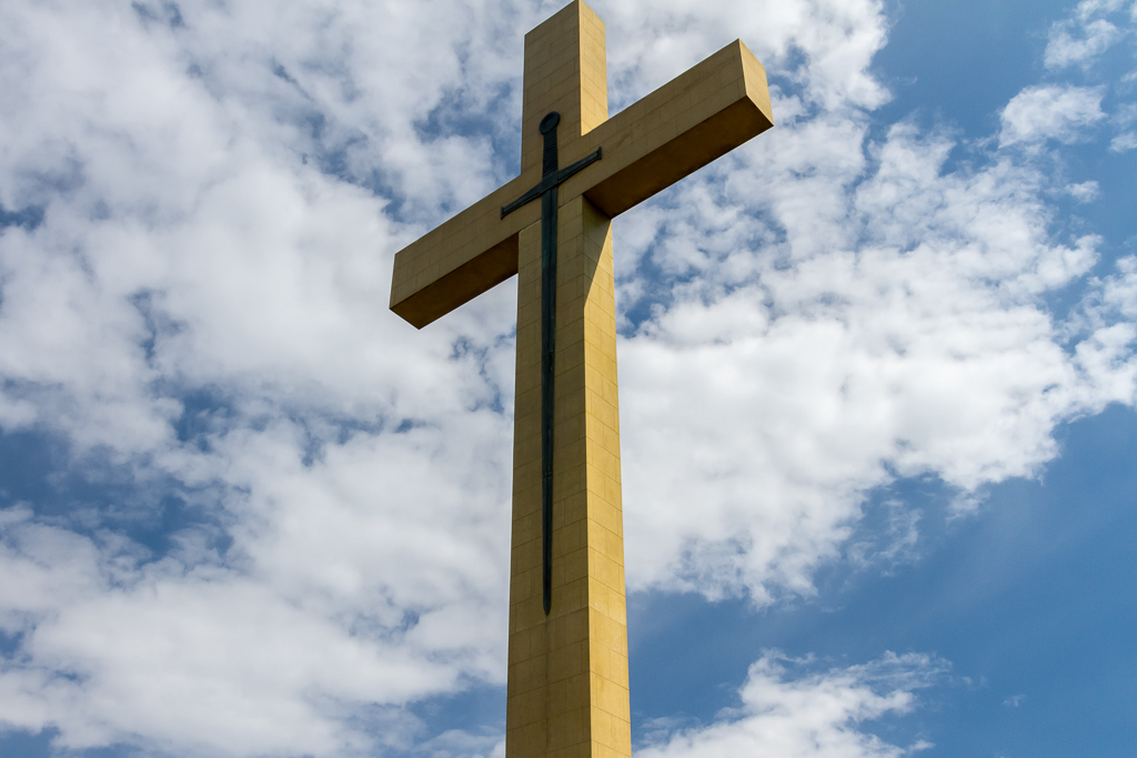
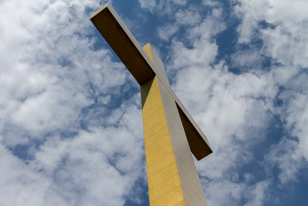
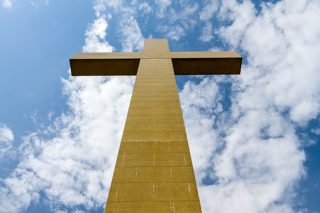
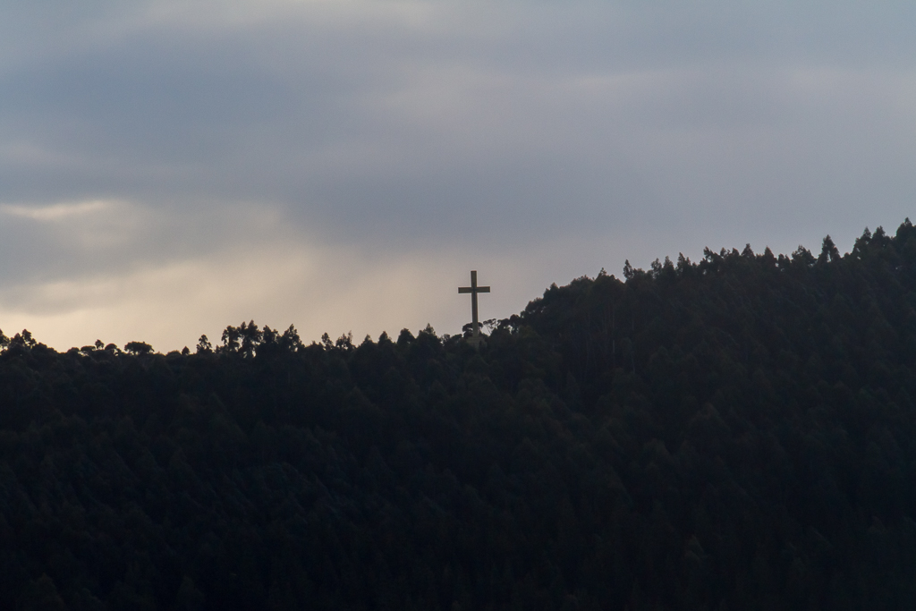
Now, anyone who’s followed this blog will look at the photo above and say, “Hang on, I’ve seen that cross before.” Guess what? You’re right, as I had a go at the full circuit of the 19 km Macedon Ranges Trail earlier in the year, but as you’ll find in this report, I only got half of it done due to running out of daylight.
So, I’ve been meaning to re-do it for a while. It was also time to do something a bit longer than my usual day hikes. As I’ve written about this walk before, I’ll just skip through the initial parts and get to the interesting stuff. Such as the bits I missed previously and some bloke screaming from within a comfort station.
[fusion_builder_container hundred_percent=”yes” overflow=”visible” margin_top=”4px” margin_bottom=”4px” background_color=”rgba(255,255,255,0)”][fusion_builder_row][fusion_builder_column type=”1_1″ background_position=”left top” background_color=”” border_size=”” border_color=”” border_style=”solid” spacing=”yes” background_image=”” background_repeat=”no-repeat” padding=”” margin_top=”0px” margin_bottom=”0px” class=”” id=”” animation_type=”” animation_speed=”0.3″ animation_direction=”left” hide_on_mobile=”no” center_content=”no” min_height=”none”][fusion_separator style_type=”none” sep_color=”” border_size=”” icon=”” icon_circle=”” icon_circle_color=”” width=”” alignment=”center” class=”” id=””/]
[fusion_builder_container hundred_percent=”yes” overflow=”visible” margin_top=”4px” margin_bottom=”4px” background_color=”rgba(255,255,255,0)”][fusion_builder_row][fusion_builder_column type=”1_1″ background_position=”left top” background_color=”” border_size=”” border_color=”” border_style=”solid” spacing=”yes” background_image=”” background_repeat=”no-repeat” padding=”” margin_top=”0px” margin_bottom=”0px” class=”” id=”” animation_type=”” animation_speed=”0.3″ animation_direction=”left” hide_on_mobile=”no” center_content=”no” min_height=”none”][fusion_separator style_type=”none” sep_color=”” border_size=”” icon=”” icon_circle=”” icon_circle_color=”” width=”” alignment=”center” class=”” id=””/]
I replicated my intentions from my previous visit by notes from Glenn Tempest’s book ‘Daywalks Around Melbourne’.
Actually, I’m kind of sick of writing his name. I wish he had something a little shorter? Maybe like one I heard the other name, which is written as ‘L-R’. Do you want to know how to say that? Believe it or not, but it’s pronounced as ‘Ledasher’. I kid you not.
If I think about it, I wish my name was Guillemet Solidus. How easy would it be to write the guillemet solidus symbols? Well, I’d do it now, but the blog HTML turns it into gibberish. More for you to research.
Okay, back to the walk. I parked my car opposite the ‘Mt Macedon Trading Post’ shop and began walking with a day pack full of water and snacks.
I must say. For a generous sized gent, the initial part is a bit of a ball breaker. Firstly, a steady climb up Douglas Road. Then a track leads off into the bush and so begins the slog to the top of Mt Macedon. I was feeling okay though, as I began the slow chug up the hillside with a number of short stops on the way.
There were a few people going up and down. Instead of them seeing me barely moving, I’d stop and make out I wasn’t stuffed, but actually only pausing to take some photographs. It’s an old trick, but I’m not sure if I convinced anyone.
[fusion_builder_container hundred_percent=”yes” overflow=”visible” margin_top=”4px” margin_bottom=”4px” background_color=”rgba(255,255,255,0)”][fusion_builder_row][fusion_builder_column type=”1_1″ background_position=”left top” background_color=”” border_size=”” border_color=”” border_style=”solid” spacing=”yes” background_image=”” background_repeat=”no-repeat” padding=”” margin_top=”0px” margin_bottom=”0px” class=”” id=”” animation_type=”” animation_speed=”0.3″ animation_direction=”left” hide_on_mobile=”no” center_content=”no” min_height=”none”][fusion_separator style_type=”none” sep_color=”” border_size=”” icon=”” icon_circle=”” icon_circle_color=”” width=”” alignment=”center” class=”” id=””/]
[fusion_builder_container hundred_percent=”yes” overflow=”visible” margin_top=”4px” margin_bottom=”4px” background_color=”rgba(255,255,255,0)”][fusion_builder_row][fusion_builder_column type=”1_1″ background_position=”left top” background_color=”” border_size=”” border_color=”” border_style=”solid” spacing=”yes” background_image=”” background_repeat=”no-repeat” padding=”” margin_top=”0px” margin_bottom=”0px” class=”” id=”” animation_type=”” animation_speed=”0.3″ animation_direction=”left” hide_on_mobile=”no” center_content=”no” min_height=”none”][fusion_separator style_type=”none” sep_color=”” border_size=”” icon=”” icon_circle=”” icon_circle_color=”” width=”” alignment=”center” class=”” id=””/]
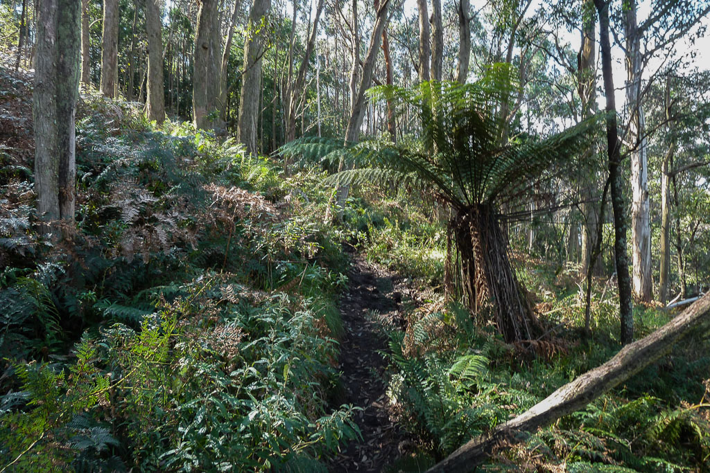
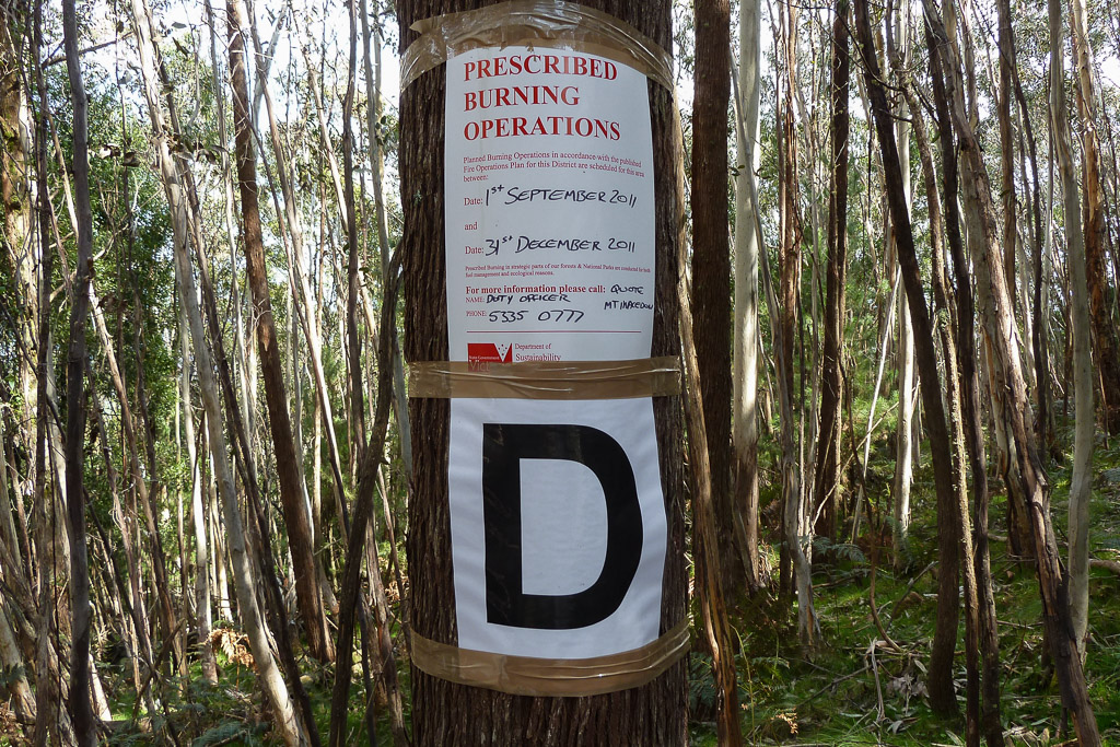
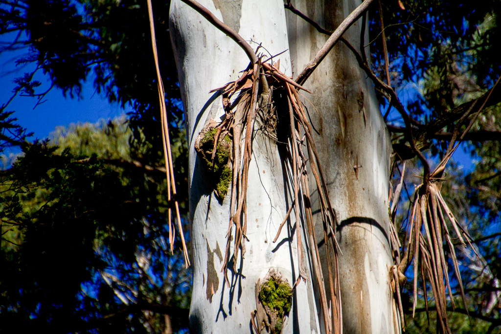
As I climbed, huge ferns began to appear and their thick cover provided plenty of shade. Considering the signs on some trees, it appeared I was doing it at the right time.
[fusion_builder_container hundred_percent=”yes” overflow=”visible” margin_top=”4px” margin_bottom=”4px” background_color=”rgba(255,255,255,0)”][fusion_builder_row][fusion_builder_column type=”1_1″ background_position=”left top” background_color=”” border_size=”” border_color=”” border_style=”solid” spacing=”yes” background_image=”” background_repeat=”no-repeat” padding=”” margin_top=”0px” margin_bottom=”0px” class=”” id=”” animation_type=”” animation_speed=”0.3″ animation_direction=”left” hide_on_mobile=”no” center_content=”no” min_height=”none”][fusion_separator style_type=”none” sep_color=”” border_size=”” icon=”” icon_circle=”” icon_circle_color=”” width=”” alignment=”center” class=”” id=””/]
[fusion_builder_container hundred_percent=”yes” overflow=”visible” margin_top=”4px” margin_bottom=”4px” background_color=”rgba(255,255,255,0)”][fusion_builder_row][fusion_builder_column type=”1_1″ background_position=”left top” background_color=”” border_size=”” border_color=”” border_style=”solid” spacing=”yes” background_image=”” background_repeat=”no-repeat” padding=”” margin_top=”0px” margin_bottom=”0px” class=”” id=”” animation_type=”” animation_speed=”0.3″ animation_direction=”left” hide_on_mobile=”no” center_content=”no” min_height=”none”][fusion_separator style_type=”none” sep_color=”” border_size=”” icon=”” icon_circle=”” icon_circle_color=”” width=”” alignment=”center” class=”” id=””/]
Nothing like a bit of a burn off to dampen the scenery. This place is risky during the fire danger period though and the area was burnt extensively in the 1983 Ash Wednesday fires.
[fusion_builder_container hundred_percent=”yes” overflow=”visible” margin_top=”4px” margin_bottom=”4px” background_color=”rgba(255,255,255,0)”][fusion_builder_row][fusion_builder_column type=”1_1″ background_position=”left top” background_color=”” border_size=”” border_color=”” border_style=”solid” spacing=”yes” background_image=”” background_repeat=”no-repeat” padding=”” margin_top=”0px” margin_bottom=”0px” class=”” id=”” animation_type=”” animation_speed=”0.3″ animation_direction=”left” hide_on_mobile=”no” center_content=”no” min_height=”none”][fusion_separator style_type=”none” sep_color=”” border_size=”” icon=”” icon_circle=”” icon_circle_color=”” width=”” alignment=”center” class=”” id=””/]
[fusion_builder_container hundred_percent=”yes” overflow=”visible” margin_top=”4px” margin_bottom=”4px” background_color=”rgba(255,255,255,0)”][fusion_builder_row][fusion_builder_column type=”1_1″ background_position=”left top” background_color=”” border_size=”” border_color=”” border_style=”solid” spacing=”yes” background_image=”” background_repeat=”no-repeat” padding=”” margin_top=”0px” margin_bottom=”0px” class=”” id=”” animation_type=”” animation_speed=”0.3″ animation_direction=”left” hide_on_mobile=”no” center_content=”no” min_height=”none”][fusion_separator style_type=”none” sep_color=”” border_size=”” icon=”” icon_circle=”” icon_circle_color=”” width=”” alignment=”center” class=”” id=””/]
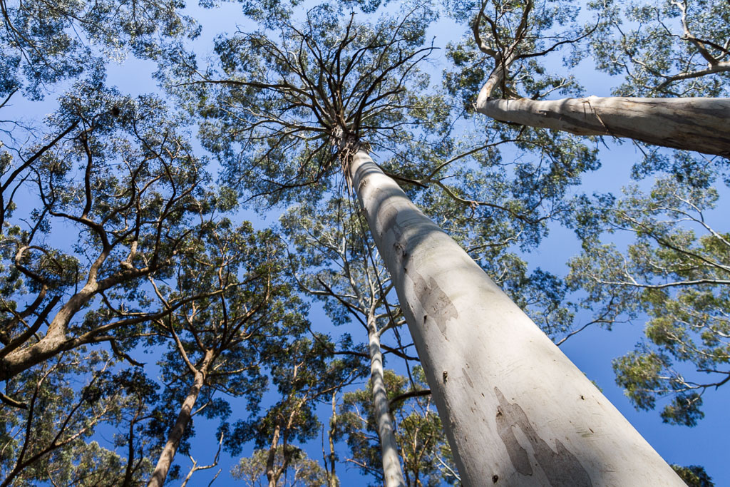
Anyway, I reached the top and it’s not too bad a climb I guess. Although with 400 metres of elevation gained in about 3.5 km, it’s enough to get the sweat going. I stopped to take the obligatory shots, such as the ones below of the Mt Macedon Memorial Cross.
[fusion_builder_container hundred_percent=”yes” overflow=”visible” margin_top=”4px” margin_bottom=”4px” background_color=”rgba(255,255,255,0)”][fusion_builder_row][fusion_builder_column type=”1_1″ background_position=”left top” background_color=”” border_size=”” border_color=”” border_style=”solid” spacing=”yes” background_image=”” background_repeat=”no-repeat” padding=”” margin_top=”0px” margin_bottom=”0px” class=”” id=”” animation_type=”” animation_speed=”0.3″ animation_direction=”left” hide_on_mobile=”no” center_content=”no” min_height=”none”][fusion_separator style_type=”none” sep_color=”” border_size=”” icon=”” icon_circle=”” icon_circle_color=”” width=”” alignment=”center” class=”” id=””/]
[fusion_builder_container hundred_percent=”yes” overflow=”visible” margin_top=”9px” margin_bottom=”9px” background_color=”rgba(255,255,255,0)”][fusion_builder_row][fusion_builder_column type=”1_1″ background_position=”left top” background_color=”” border_size=”” border_color=”” border_style=”solid” spacing=”yes” background_image=”” background_repeat=”no-repeat” padding=”” margin_top=”0px” margin_bottom=”0px” class=”” id=”” animation_type=”” animation_speed=”0.3″ animation_direction=”left” hide_on_mobile=”no” center_content=”no” min_height=”none”][fusion_separator style_type=”none” sep_color=”” border_size=”” icon=”” icon_circle=”” icon_circle_color=”” width=”” alignment=”center” class=”” id=””/]
[fusion_builder_container hundred_percent=”yes” overflow=”visible” margin_top=”4px” margin_bottom=”4px” background_color=”rgba(255,255,255,0)”][fusion_builder_row][fusion_builder_column type=”1_1″ background_position=”left top” background_color=”” border_size=”” border_color=”” border_style=”solid” spacing=”yes” background_image=”” background_repeat=”no-repeat” padding=”” margin_top=”0px” margin_bottom=”0px” class=”” id=”” animation_type=”” animation_speed=”0.3″ animation_direction=”left” hide_on_mobile=”no” center_content=”no” min_height=”none”][fusion_separator style_type=”none” sep_color=”” border_size=”” icon=”” icon_circle=”” icon_circle_color=”” width=”” alignment=”center” class=”” id=””/]
There you go, a few standard pictures and I was off again. My next stop would be the lookout atop ‘Camels Hump’. At 1011 mt, it’s the highest point on the Macedon Ranges. The track was well formed, so I was moving along a pretty good pace for a fat bastard. When beefy, it’s all about getting up to speed and then momentum takes care of the rest.
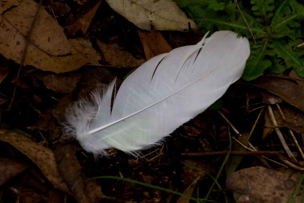
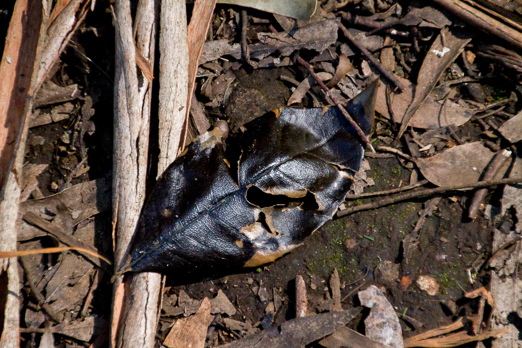
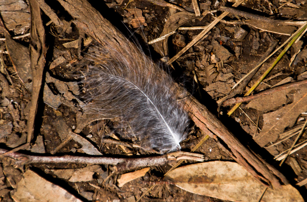
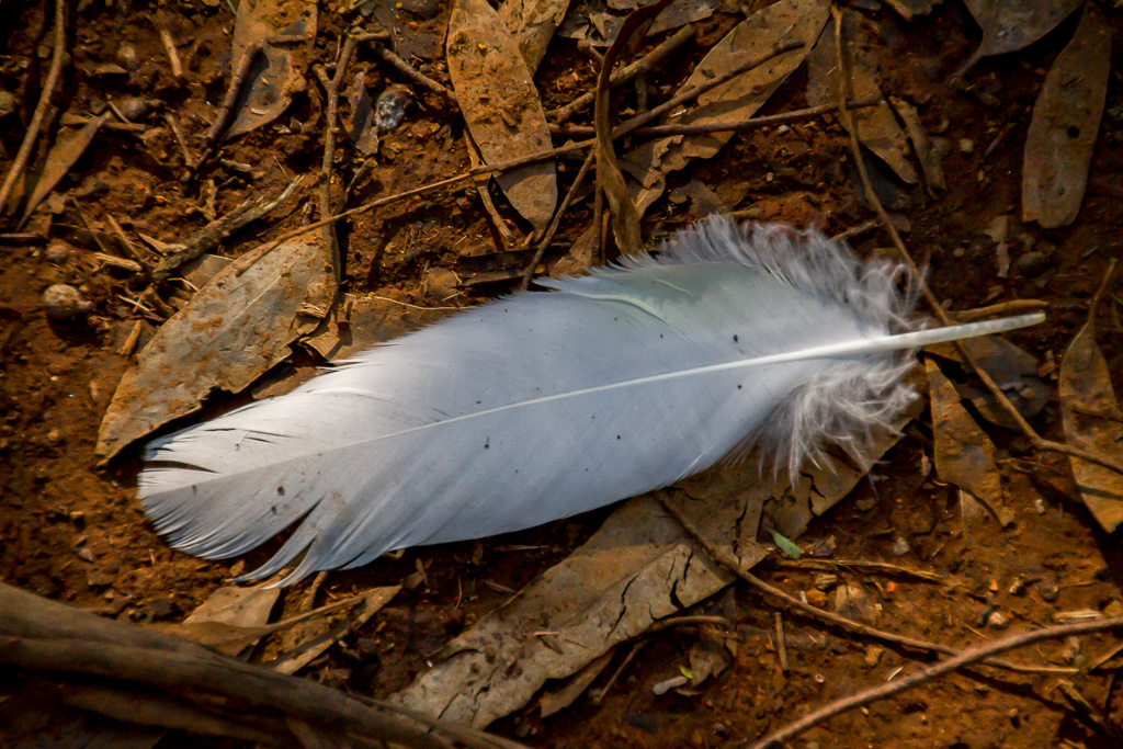
At times, there were a few pauses here and there for photo taking. Fallen leaves and stray feathers are always of interest to me. Sure, there could be juicier fetishes, but you can’t complain about this place not being PG rated. I was keeping my eyes peeled for likely subjects.
[fusion_builder_container hundred_percent=”yes” overflow=”visible” margin_top=”4px” margin_bottom=”4px” background_color=”rgba(255,255,255,0)”][fusion_builder_row][fusion_builder_column type=”1_1″ background_position=”left top” background_color=”” border_size=”” border_color=”” border_style=”solid” spacing=”yes” background_image=”” background_repeat=”no-repeat” padding=”” margin_top=”0px” margin_bottom=”0px” class=”” id=”” animation_type=”” animation_speed=”0.3″ animation_direction=”left” hide_on_mobile=”no” center_content=”no” min_height=”none”][fusion_separator style_type=”none” sep_color=”” border_size=”” icon=”” icon_circle=”” icon_circle_color=”” width=”” alignment=”center” class=”” id=””/]
[fusion_builder_container hundred_percent=”yes” overflow=”visible” margin_top=”9px” margin_bottom=”9px” background_color=”rgba(255,255,255,0)”][fusion_builder_row][fusion_builder_column type=”1_1″ background_position=”left top” background_color=”” border_size=”” border_color=”” border_style=”solid” spacing=”yes” background_image=”” background_repeat=”no-repeat” padding=”” margin_top=”0px” margin_bottom=”0px” class=”” id=”” animation_type=”” animation_speed=”0.3″ animation_direction=”left” hide_on_mobile=”no” center_content=”no” min_height=”none”][fusion_separator style_type=”none” sep_color=”” border_size=”” icon=”” icon_circle=”” icon_circle_color=”” width=”” alignment=”center” class=”” id=””/]
[fusion_builder_container hundred_percent=”yes” overflow=”visible” margin_top=”4px” margin_bottom=”4px” background_color=”rgba(255,255,255,0)”][fusion_builder_row][fusion_builder_column type=”1_1″ background_position=”left top” background_color=”” border_size=”” border_color=”” border_style=”solid” spacing=”yes” background_image=”” background_repeat=”no-repeat” padding=”” margin_top=”0px” margin_bottom=”0px” class=”” id=”” animation_type=”” animation_speed=”0.3″ animation_direction=”left” hide_on_mobile=”no” center_content=”no” min_height=”none”][fusion_separator style_type=”none” sep_color=”” border_size=”” icon=”” icon_circle=”” icon_circle_color=”” width=”” alignment=”center” class=”” id=””/]
Reaching McGregors Picnic Ground in good time, I decided to have a short rest. The picnic area is an attractive, open area, so I put my feet up on a park bench for a while. It also seemed a nice place to inhale a muesli bar or five.
It was relaxing, but I was soon feeling a chill, as I cooled down from the previous walking. Camels Hump was less than kilometre away, so I decided to get moving. On the way, I spied a familiar building and decided it was a good time to utilise the picnic ground comfort station. After being greeted by a drop toilet, I firstly checked no one else was around. With the area deserted, I was able to relax and sing a few sea shanties at the same time.
After taking a few decades, I casually opened the door and suddenly found myself face to face with some bloke. He took me by surprise a little, as I heard no footsteps creeping up outside. Then again, maybe all that singing blocked out the sound of his approach? Either that or he was the little known Macedon Ninja.
I wandered off, but I’d only covered about 30 metres, when suddenly I heard screaming and hollering. It was coming from deep within the comfort station. This was a little confusing and I stopped for a second to wonder if he needed ‘help’. I gave it about 1.6 seconds before moving on, as I quickly decided there’s no way I could offer any assistance to a man inside a bush cubicle.
I’m not sure what had happened? I’ve thought of a few theories though. It’s a drop toilet, so he might fallen in? Maybe he accidentally dropped the seat and it lopped off his wanger? You know, in true French Revolution style? Then again, he could have made the fatal mistake of actually looking down. Staring into the abyss and the contents of a drop toilet. Mm… As you can imagine, they’re all scary propositions.
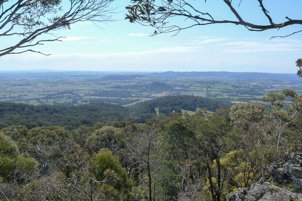
Leaving ‘down in the dumps’ bloke behind, I made my way on an uphill track to the top of the Camels Hump. The last time I was here it was hazy and I could barely see a thing. On this occasion, it was clear and sunny with good views across to Hanging Rock. There are a few snow gums near the lookout, which must be the minimal height for them to survive. Including one wrapped around a large rock.
[fusion_builder_container hundred_percent=”yes” overflow=”visible” margin_top=”4px” margin_bottom=”4px” background_color=”rgba(255,255,255,0)”][fusion_builder_row][fusion_builder_column type=”1_1″ background_position=”left top” background_color=”” border_size=”” border_color=”” border_style=”solid” spacing=”yes” background_image=”” background_repeat=”no-repeat” padding=”” margin_top=”0px” margin_bottom=”0px” class=”” id=”” animation_type=”” animation_speed=”0.3″ animation_direction=”left” hide_on_mobile=”no” center_content=”no” min_height=”none”][fusion_separator style_type=”none” sep_color=”” border_size=”” icon=”” icon_circle=”” icon_circle_color=”” width=”” alignment=”center” class=”” id=””/]
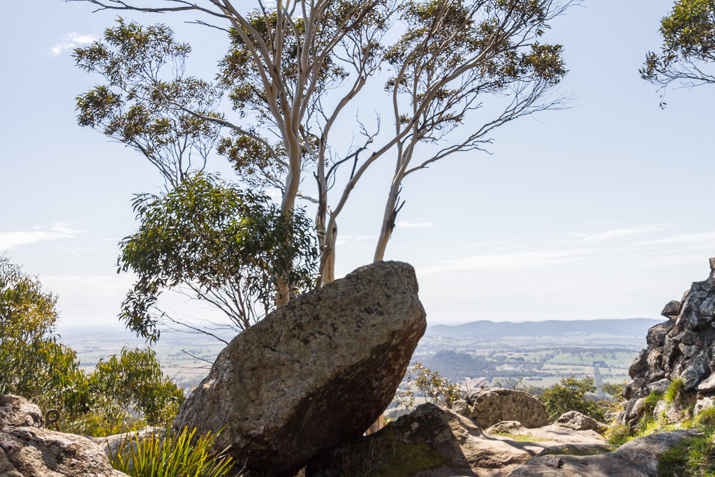
Camels Hump
[fusion_separator style_type=”none” top_margin=”4″ bottom_margin=”4″ sep_color=”” border_size=”” icon=”” icon_circle=”” icon_circle_color=”” width=”” alignment=”center” class=”” id=””/]
[fusion_separator style_type=”none” top_margin=”9″ bottom_margin=”9″ sep_color=”” border_size=”” icon=”” icon_circle=”” icon_circle_color=”” width=”” alignment=”center” class=”” id=””/]
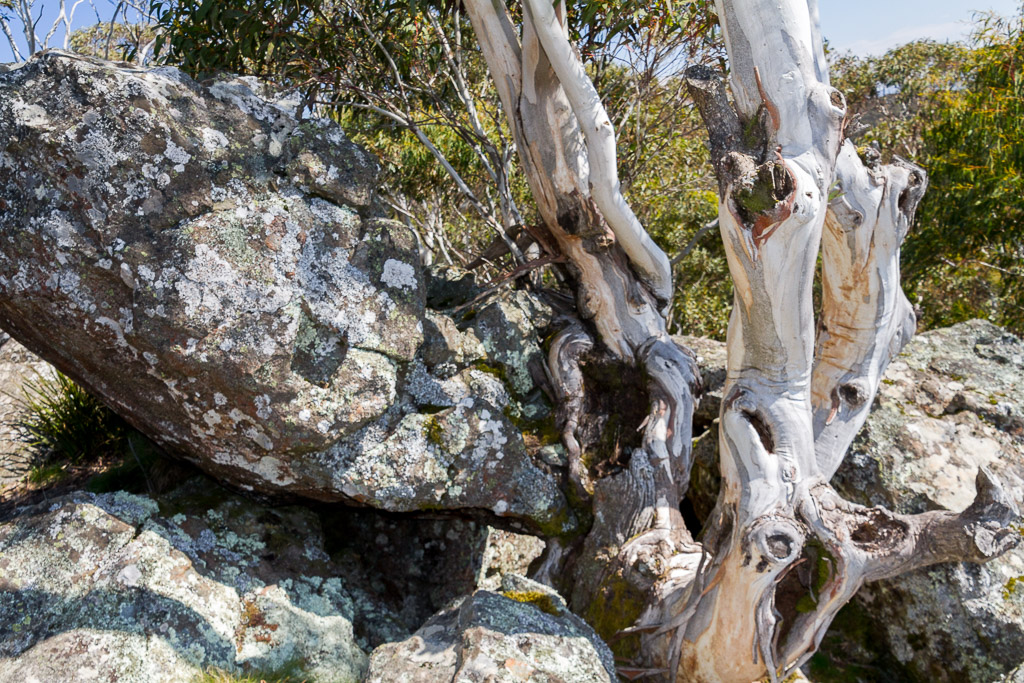
Snow gum at Camels Hump
[fusion_separator style_type=”none” top_margin=”4″ bottom_margin=”4″ sep_color=”” border_size=”” icon=”” icon_circle=”” icon_circle_color=”” width=”” alignment=”center” class=”” id=””/]
It a perfect place for another rest, but like the picnic ground earlier, a solid breeze, combined with my sweat dampened shirt, left me feeling cold. Setting off, an old bloke came stumbling up to the lookout and he appeared knackered. It was a good effort, as although the car park was only 600 metres away, it’s still up a reasonable hill. Especially when you’re 165 years old.
I thought I’d go for the friendly hiker approach by letting rip with a powerful ‘hello’. It didn’t really work though, as I noticed a pair of industrial strength hearing aids in his ears. With a bemused look, all he replied was, “Hey?!”, “What’s that?!” It was like I was talking to my dad, so all I could do was smile and race off down the hill as fast as I could.
Now, at this spot it’s a little interesting. When reaching Camels Hump car park, you can turn left into Cameron Drive. Then turn left again at Mount Macedon Road. If you walk a few hundred metres, you’ll come across the next track as it crosses Mount Macedon Road. This is the track required to continue the walk. Ah, but that’s not what the notes say.
It’s a fairly simple manoeuvre with no climbing, but according to Glenn Tempest, his notes slip into Tony Montana mode. Instead of that short road wander, the notes sent me back in the direction I’d come from. Down a track, around the bottom of the Camels Hump and then a climb back to Mount Macedon Road. All in all I ended up up only a few hundred metres from the car park I’d been 20 minutes earlier.
It’s a case of, “I have my short cuts and my balls, and I don’t share them with anyone.” I took the long way, but if you’re feeling tired, just follow the road, as it’s literally only a few hundred metres and it avoids a bit of a hill slog.
[fusion_separator style_type=”none” top_margin=”4″ bottom_margin=”4″ sep_color=”” border_size=”” icon=”” icon_circle=”” icon_circle_color=”” width=”” alignment=”center” class=”” id=””/]
[fusion_separator style_type=”none” top_margin=”4″ bottom_margin=”4″ sep_color=”” border_size=”” icon=”” icon_circle=”” icon_circle_color=”” width=”” alignment=”center” class=”” id=””/]
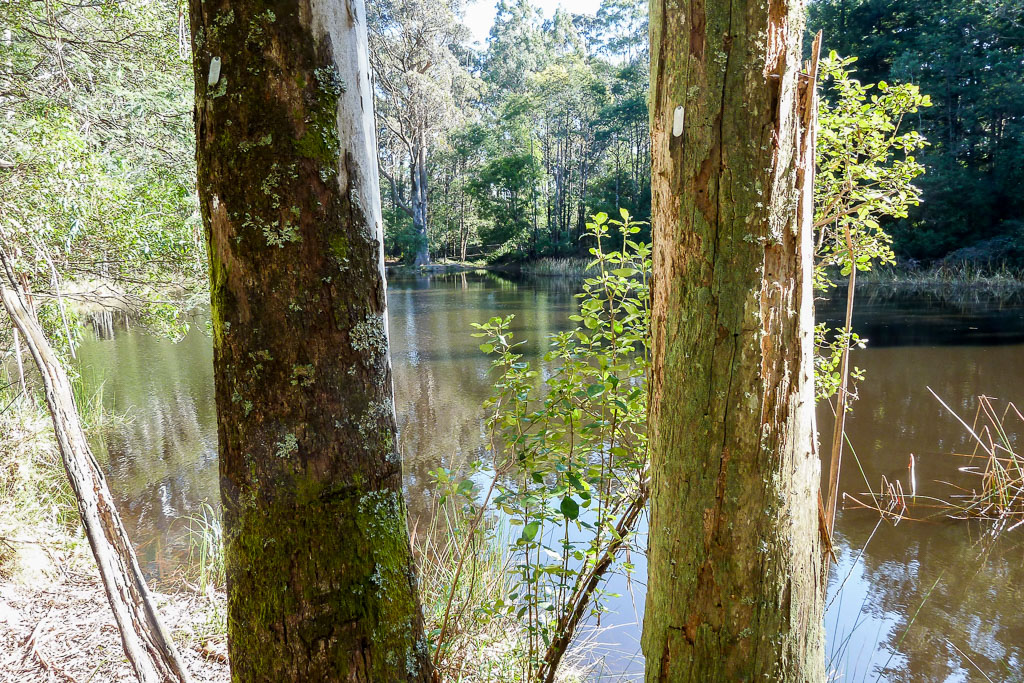
As I crossed the bitumen, this was the point I reached last time before cutting the walk short and returning via the road. It was all new ground for me and my next stop was Sanatorium Lake. It was built in 1899 to supply water to a tuberculosis sanatorium several kilometres away.
The trouble is that every time I thought of the word ‘sanatorium’ I had a vision of ‘sanitarium’, which consequently meant I was thinking about Corn Flakes. All a bit weird, but the mind can wander on a long walk I guess.
[fusion_separator style_type=”none” top_margin=”4″ bottom_margin=”4″ sep_color=”” border_size=”” icon=”” icon_circle=”” icon_circle_color=”” width=”” alignment=”center” class=”” id=””/]
[fusion_separator style_type=”none” top_margin=”4″ bottom_margin=”4″ sep_color=”” border_size=”” icon=”” icon_circle=”” icon_circle_color=”” width=”” alignment=”center” class=”” id=””/]
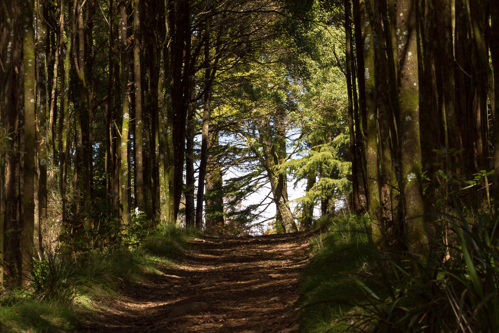
I continued on, passing through Days Picnic Ground, which then led to the Eco-Tourism Walking Trail. This is a nice track through ferns and a number of interpretive signs along the way before it arrives at the lake.
There was no one around when I arrived, so I took the opportunity to walk a slow lap. This was pretty easy, as whilst it’s pretty, it may be one of the smallest lakes I’ve ever seen. A lap took me about three minutes, whilst stopping to take some photos along the way.
[fusion_separator style_type=”none” top_margin=”4″ bottom_margin=”4″ sep_color=”” border_size=”” icon=”” icon_circle=”” icon_circle_color=”” width=”” alignment=”center” class=”” id=””/]
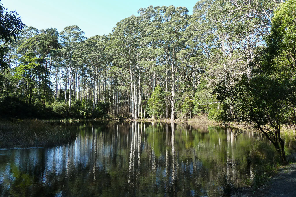
Sanatorium Lake
[fusion_separator style_type=”none” top_margin=”4″ bottom_margin=”4″ sep_color=”” border_size=”” icon=”” icon_circle=”” icon_circle_color=”” width=”” alignment=”center” class=”” id=””/]
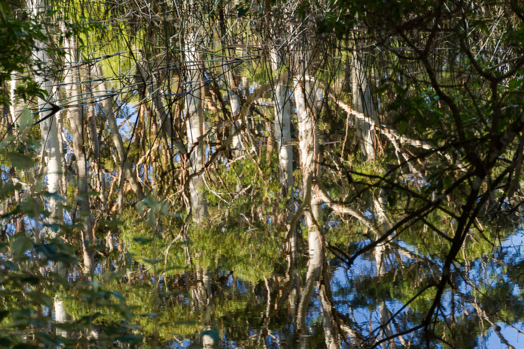
Reflections
[fusion_separator style_type=”none” top_margin=”4″ bottom_margin=”4″ sep_color=”” border_size=”” icon=”” icon_circle=”” icon_circle_color=”” width=”” alignment=”center” class=”” id=””/]
There are a number of nice trees that line the lake and it’s a pity visitors over the years have shown their appreciation by carving their names into the bark.
All of the trees in one section have crap engraved on them and I had a vision of getting hold of the offenders and engraving my initials which is, ‘Big Greg from the western suburbs of Melbourne’ into their chests with a blunt pencil. Is that a bit harsh? Maybe dab the bleeding pencil marks with nail polish remover instead? Would that be more humane?
[fusion_separator style_type=”none” top_margin=”4″ bottom_margin=”4″ sep_color=”” border_size=”” icon=”” icon_circle=”” icon_circle_color=”” width=”” alignment=”center” class=”” id=””/]
About the only two non-engraved trees I could find.
[fusion_separator style_type=”none” top_margin=”2″ bottom_margin=”2″ sep_color=”” border_size=”” icon=”” icon_circle=”” icon_circle_color=”” width=”” alignment=”center” class=”” id=””/]
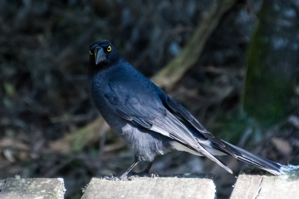
It’s a nice peaceful spot and although no one was around, I was eyed off by some feathered friends.
[fusion_separator style_type=”none” top_margin=”4″ bottom_margin=”4″ sep_color=”” border_size=”” icon=”” icon_circle=”” icon_circle_color=”” width=”” alignment=”center” class=”” id=””/]
[fusion_separator style_type=”none” top_margin=”4″ bottom_margin=”4″ sep_color=”” border_size=”” icon=”” icon_circle=”” icon_circle_color=”” width=”” alignment=”center” class=”” id=””/]
After about 15 minutes of relaxing, I headed off and this time I was walking towards the Sanatorium Picnic Ground. There are a zillion picnic grounds on this circuit and they’re all great by the way. A nice spot to spend a sunny spring day is to head up into the Mount Macedon area and break out a nice sourdough with some olives, brie cheese, dips, dolmades, prosciutto and smoked salmon whilst washing it all down with a nice sparkling mineral water.
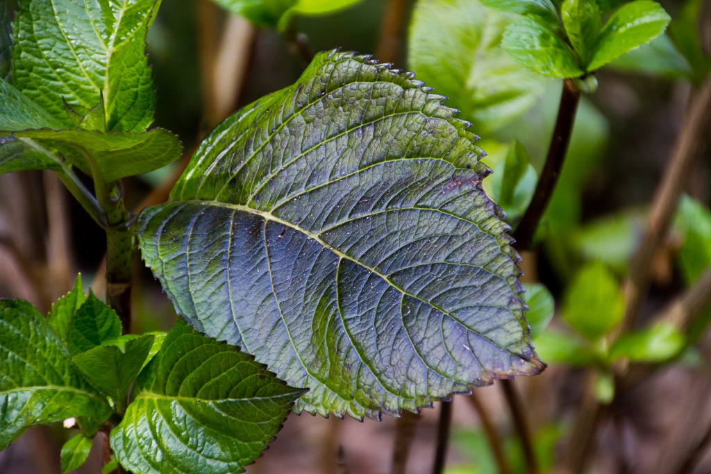
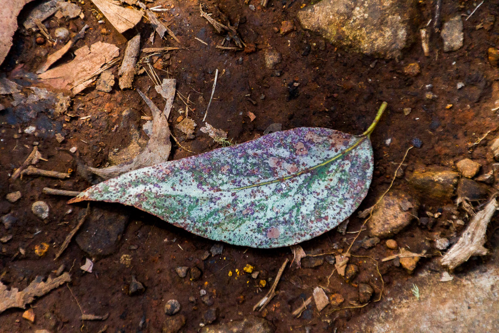
By the way, remind me to never write blog entries whilst feeling hungry ever again. During all of this walking I neglected to post the various leaves and feathers on the way, so let’s look at some, whilst I raid the fridge to get something to eat.
[fusion_separator style_type=”none” top_margin=”4″ bottom_margin=”4″ sep_color=”” border_size=”” icon=”” icon_circle=”” icon_circle_color=”” width=”” alignment=”center” class=”” id=””/]
[fusion_separator style_type=”none” top_margin=”9″ bottom_margin=”9″ sep_color=”” border_size=”” icon=”” icon_circle=”” icon_circle_color=”” width=”” alignment=”center” class=”” id=””/]
[fusion_separator style_type=”none” top_margin=”4″ bottom_margin=”4″ sep_color=”” border_size=”” icon=”” icon_circle=”” icon_circle_color=”” width=”” alignment=”center” class=”” id=””/]
I must do some shopping, as all I could find in the fridge were some carrots from 1952 and about a kilo of lemon slice. Anyway, I passed through my last picnic ground for the day and was now heading down Zig Zag Track. Have a guess what it did? Yes, you got it. It zigged and zagged on a steady descent.
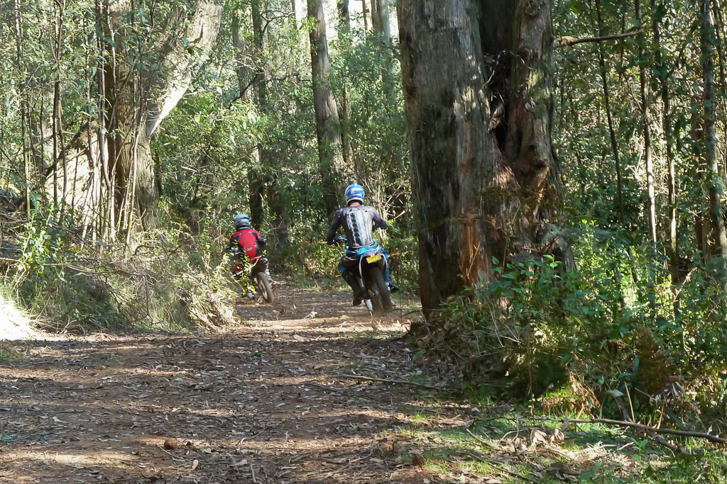
It might have been easy going, but there was something noisy in the bush somewhere. It was the dreaded sound of a two-stroke motorcycle. Not the most relaxing sound in the world and I’ve whinged about them before.
As I was slowly strolling along the noise got louder and louder until suddenly two motorbikes came whizzing by leaving a trail of petrol fumes and dust in their wake. Nothing beats a bit of dust chewing whilst walking.
Then again, it wasn’t as bad as the time I was cycling along a road one windy day and a rubbish truck passed me. No problem right? Yes, it was a problem. The truck had a lot of water in whatever rubbish it was carrying and a fine film of mist drifted out as it passed and coated my face in tasty rubbish juice.
It’s quite an experience to have sweat and the juices of waste mixed together whilst huffing and puffing on a bicycle. In fact I can thoroughly recommend it for the ultimate ‘character building’.
[fusion_separator style_type=”none” top_margin=”4″ bottom_margin=”4″ sep_color=”” border_size=”” icon=”” icon_circle=”” icon_circle_color=”” width=”” alignment=”center” class=”” id=””/]
[fusion_separator style_type=”none” top_margin=”4″ bottom_margin=”4″ sep_color=”” border_size=”” icon=”” icon_circle=”” icon_circle_color=”” width=”” alignment=”center” class=”” id=””/]
I continued descending as the noise receded, but guess what? After about 6.3 seconds of peace and quiet the noise started getting louder again. It was my lucky day for sure, as the same two bikes came whizzing by me again and I had to get a second dose of dust munching. I should feel honoured to be so lucky and just to reward myself I took a photo of them disappearing in the distance, so I can look back in a few years time and fondly remember them.
[fusion_separator style_type=”none” top_margin=”4″ bottom_margin=”4″ sep_color=”” border_size=”” icon=”” icon_circle=”” icon_circle_color=”” width=”” alignment=”center” class=”” id=””/]
[fusion_separator style_type=”none” top_margin=”4″ bottom_margin=”4″ sep_color=”” border_size=”” icon=”” icon_circle=”” icon_circle_color=”” width=”” alignment=”center” class=”” id=””/]
What’s next? It should be obvious, as there was a few more feathers for the photographic taking.
[fusion_separator style_type=”none” top_margin=”4″ bottom_margin=”4″ sep_color=”” border_size=”” icon=”” icon_circle=”” icon_circle_color=”” width=”” alignment=”center” class=”” id=””/]
[fusion_separator style_type=”none” top_margin=”4″ bottom_margin=”4″ sep_color=”” border_size=”” icon=”” icon_circle=”” icon_circle_color=”” width=”” alignment=”center” class=”” id=””/]
It was peaceful again as I turned left onto Hemphills Track and began walking towards my final piece of interest for the day. The ‘summit’ of Mt Towrong. Although at 805 metres, supplemental oxygen is not required.
It was still ‘gentleman’s’ style walking though on a descending track, which made the going pretty easy. Coming across the sign to Mt Towrong, I was ready to head up hill again. Actually, it was only on this I walk where I realised it’s spelled Mt Towrong and not Tworong. It only took me a couple of years to work that out.
Anyway, after a longish day, I appreciated the gentle incline through the forest and soon the summit rock cairn was ahead. It was a chance to have the last of my water for the day. I’d have stayed longer, but there were no views, as it’s solid forest across the top of the mountain.
[fusion_separator style_type=”none” top_margin=”4″ bottom_margin=”4″ sep_color=”” border_size=”” icon=”” icon_circle=”” icon_circle_color=”” width=”” alignment=”center” class=”” id=””/]
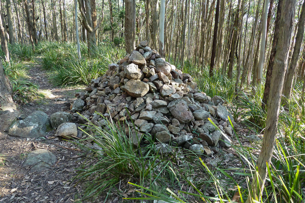
Well people, that’s the summit of Mt Towrong.
[fusion_separator style_type=”none” top_margin=”1″ bottom_margin=”1″ sep_color=”” border_size=”” icon=”” icon_circle=”” icon_circle_color=”” width=”” alignment=”center” class=”” id=””/]
Within the forest, I checked my GPS and was surprised to read my car was only a kilometre away (parked. It wasn’t moving). I didn’t think I was that close to finishing, but with the end so near I thought I should power along and finish.
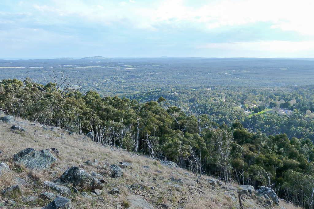
The track leaves the forest and comes out onto an open hillside. This allows some great views across the valley towards the Macedon area. I could clearly see the Mt Macedon Memorial Cross, which I’d been to earlier in the day.
[fusion_separator style_type=”none” top_margin=”4″ bottom_margin=”4″ sep_color=”” border_size=”” icon=”” icon_circle=”” icon_circle_color=”” width=”” alignment=”center” class=”” id=””/]
[fusion_separator style_type=”none” top_margin=”4″ bottom_margin=”4″ sep_color=”” border_size=”” icon=”” icon_circle=”” icon_circle_color=”” width=”” alignment=”center” class=”” id=””/]
It was now a quite steep descent across open ground before entering a small section of forest again. I could have used a trekking pole at this point to save my knees, as I was really feeling it in the legs.
[fusion_separator style_type=”none” top_margin=”4″ bottom_margin=”4″ sep_color=”” border_size=”” icon=”” icon_circle=”” icon_circle_color=”” width=”” alignment=”center” class=”” id=””/]
[fusion_separator style_type=”none” top_margin=”4″ bottom_margin=”4″ sep_color=”” border_size=”” icon=”” icon_circle=”” icon_circle_color=”” width=”” alignment=”center” class=”” id=””/]
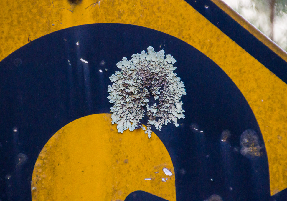
A little bit more walking and I was almost done. Reaching Anzac Road there was only a short stroll back to my car. There were always a few more chances of photos though (isn’t there always?). From a distance I thought this sign had a shotgun mark on it. In the end, it was something a little more natural.
[fusion_separator style_type=”none” top_margin=”4″ bottom_margin=”4″ sep_color=”” border_size=”” icon=”” icon_circle=”” icon_circle_color=”” width=”” alignment=”center” class=”” id=””/]
[fusion_separator style_type=”none” top_margin=”4″ bottom_margin=”4″ sep_color=”” border_size=”” icon=”” icon_circle=”” icon_circle_color=”” width=”” alignment=”center” class=”” id=””/]
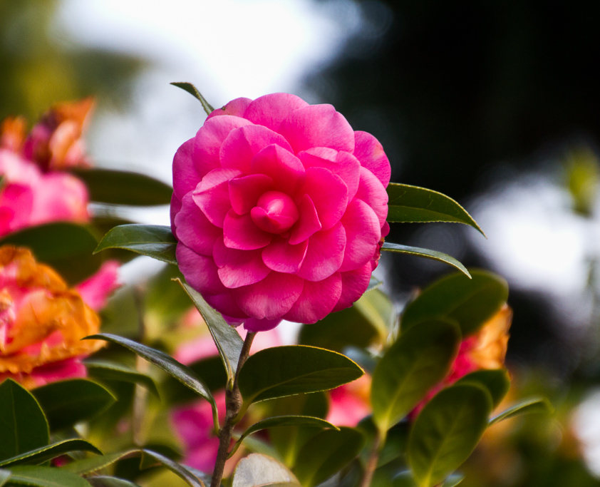
What’s left? Well, there are beautiful gardens along the main road and this flower caught my eye just before reaching the car.
[fusion_separator style_type=”none” top_margin=”4″ bottom_margin=”4″ sep_color=”” border_size=”” icon=”” icon_circle=”” icon_circle_color=”” width=”” alignment=”center” class=”” id=””/]
[fusion_separator style_type=”none” top_margin=”4″ bottom_margin=”4″ sep_color=”” border_size=”” icon=”” icon_circle=”” icon_circle_color=”” width=”” alignment=”center” class=”” id=””/]
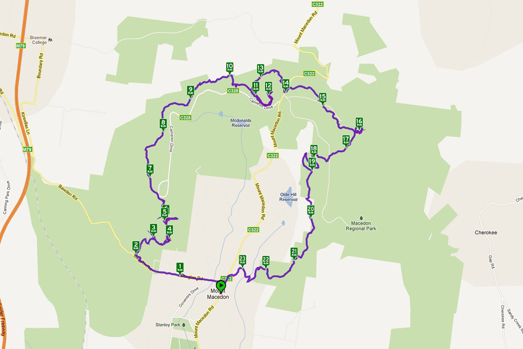
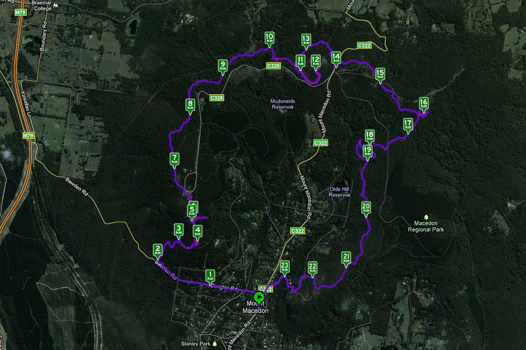
That’s it then. I’d done the full circuit and here are some screenshots from the GPS. All in all, it was 19.46 km. More than enough for a day walk.
[fusion_separator style_type=”none” top_margin=”4″ bottom_margin=”4″ sep_color=”” border_size=”” icon=”” icon_circle=”” icon_circle_color=”” width=”” alignment=”center” class=”” id=””/]
[fusion_separator style_type=”none” top_margin=”9″ bottom_margin=”9″ sep_color=”” border_size=”” icon=”” icon_circle=”” icon_circle_color=”” width=”” alignment=”center” class=”” id=””/]
[fusion_separator style_type=”none” top_margin=”4″ bottom_margin=”4″ sep_color=”” border_size=”” icon=”” icon_circle=”” icon_circle_color=”” width=”” alignment=”center” class=”” id=””/]
Well, that’s the end of a great day hike and the well formed tracks made for some relaxed walking.
I’ll leave you now until next time!
[fusion_separator style_type=”none” top_margin=”4″ bottom_margin=”4″ sep_color=”” border_size=”” icon=”” icon_circle=”” icon_circle_color=”” width=”” alignment=”center” class=”” id=””/]
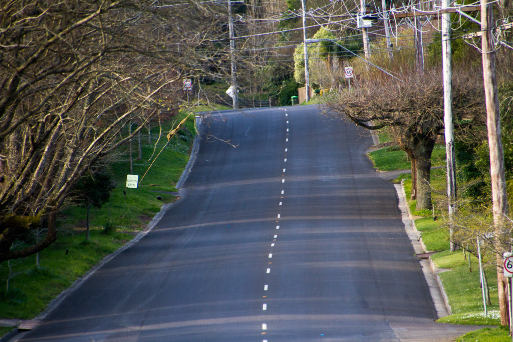
The easy way up Mt Macedon, via the road…
[fusion_separator style_type=”none” top_margin=”4″ bottom_margin=”4″ sep_color=”” border_size=”” icon=”” icon_circle=”” icon_circle_color=”” width=”” alignment=”center” class=”” id=””/]

The biggest fear in using a drop toilet – car keys tumbling from pocket and landing with a soft squelch. That would make you scream.
PS Love your photos – special;y the closeups.
Thanks for the nice comments Ian. That's a good point about the car keys and I would be quite traumatised if that happened! Hopefully you're not talking from personal experience? 🙂
Any kind of motorized noise gives me Great Rage while I'm hiking…plus, where I live (in the middle of nowhere) we have a large amount of ATV tracks. Dear God, the noise.
I'm probably warped for this, but Sanatorium Lake cracks me UP. What a name!!!
Love love love the distance shots.
Greg, I share the fear of the commenter above and make sure I put anything that can be dropped on the ground before venturing in. And yes, DON'T LOOK DOWN is the golden rule. I've seen some terrible things in privies (to use the southern U.S.) over the years. I sometimes think I'd rather just go behind a tree.
Your mention of Hanging Rock takes me back to the iconic Aust movie of the 70s which I'm sure you, being of similar vintage, also saw. It still gives me shivers thinking about it – I actually blame it for the eerie feeling I sometimes get in the Aust bush when hiking alone. Have you hiked there? If not, there's a blog idea – don't forget the pan pipes!
Hi Goat, yeah, I'm a little cautious in that situation, especially with sunglasses that I tend to put in my shirt pocket. Even though they cost a few dollars I'm not sure if I'm that desperate to fish them out if they disappear into the 'drop'!
Now, I better start wearing my alfoil helmet more often as it appears you've read my mind! Hanging Rock is on the agenda in the next week or so as I haven't been there for at least 10 years. Way too long for such a spooky place! I'm just waiting for a sunny day so I can get some polarizer abuse happening 🙂
The thing about that movie is we all know it's a novel, but sometimes the Australian bush feels like that was non-fiction instead! I've definitely had some weird feelings over the years and this is coming from a sceptic! I know now though why Aborigines are spiritual people which I'm sure you'll understand as another rambler…
Hey Samantha, thanks for the comment! I guess I can say I'm 'lucky' as I haven't had any close encounters with ATV's on walks just yet! Actually, if I think of ATV's, I imagine that scene with one in the movie 'Napoleon Dynamite' and anyone who has seen it will know what I mean!
Oh yeah, Sanatorium Lake gave me a chuckle as well!
Thanks for loving the photos! You can see what my latest favourite photo technique is and that's using spot metering a lot! Plus, I quite like the photo taken at maximum zoom right now 🙂
FYI – I made a post about walking this trail. It's on my other blog, which is known inside my head as "Our Blog" (as opposed to the blog to which my name is linked which is known inside me head, astoundingly, as My Blog.)
Link here in case you're interested: http://nnonews.wordpress.com/2011/10/24/macedon-ranges/
More walk notes and photos will probably go onto that blog, rather than My Blog.
There are photos of echidnas. 🙂
Hey Oanh, thanks for the link! You've got multiple blog syndrome?! I'll go over and check it out…
Thanks for this article: just what my mate and I need to take on Mt Macedon. Hopefully, we won't get lost like we did at the Fraser national park… and you had a few funny lines in there too!
Hi Maze. Thanks for dropping by and taking the time to comment! I'm going out on a limb here and saying that this is one of the best day walks I've ever done. Once up high enough it's pretty simple fare for the rest of the day. Nice track, not too many people and my aim is to try and do it again when snow falls up there for a totally different look. It's a bit tricky though when snow only falls about once a year at that height. It's all in the timing though!
Don't forget that the blog is more 'gonzo goes bush' rather than a strict write up on walks. If I did a strict spiel on track notes for the whole post, I think I'd end up with my head in the oven by the end of the entry 🙂
I don't think there's a chance of getting lost on this one? Then again, if you do I can sympathise as I got lost once about 300 metres from a car park and road 🙂 If I managed to do that, then Fraser National Park would wipe me out 🙂
If you do get up to Mount Macedon let me know how you went and whether you liked it!