Here we go again. Before getting into this post, here’s brief update. A few weeks back I set off for an overnight hike. My intentions were to complete the Cathedral Range Circuit, as a 21 km overnight hike, but of course things didn’t go to plan. Do they ever? Firstly, I set off from Cooks Mill campground, made my way up to Sugarloaf Peak and then followed the Cathedral Range via the Razorback Track before stopping for the night at the Farmyard.
Sounds fine so far, but unfortunately en route I had a mega tumble from some rocks on the ridge that left me sore. Then overnight the heavens opened and icy conditions ensured the second day of my plans were scotched. Low cloud, rain and signs of snow weren’t a great mix, so I abandoned the walk and headed home. If you’re really interested in all the gritty details, here’s a link to a previous post. ‘The Plan, Cathedral Range Circuit, Victoria’ includes details of where to find the full story of that gnarly saga.
Now, my aim was to finish all the bits I missed out on a few weeks back. Essentially, a northern circuit, Cathedral Range would include Cathedral Peak, Little Cathedral, Neds Peak and the North Jawbone. As you can see, everything north of the Farmyard would be new ground for me. Also, instead of an overnighter, I planned to do the missing section as a day walk. I also wanted to do it now, rather than later before the weather gets too cold.
As you know, when I failed to finish the circuit due to crap weather, I was fully aware my effort was classified as a ‘did not finish’ (DNF) which has an inference ‘I could have done better'(WIMP). So, to ensure I reclaim some of my masculinity and prove I do have testicles, I thought I should get this walk over and done with.
Overall, I think it worked out okay, other than a distracting ailment I picked up during the walk. Splinters are annoying, aren’t they? How about having seven in one hand and three in one knee? An impressive effort? Well, I thought so and it was just one of the walk highlights.
My aim was to walk all of the northern section of the Cathedral Range by starting from the Jawbone Carpark. You can read the entire saga from the start, or maybe you just want to skip everything until the point I get the splinters?
Also, I had a cunning plan. By doing all the easy stuff first, I’d be well and truly warmed up, before heading into the hills. This meant the first four or so kilometres would be flat, which was a nice way to get the joints in order. I began on St Bernards Track which led to Little River Track.
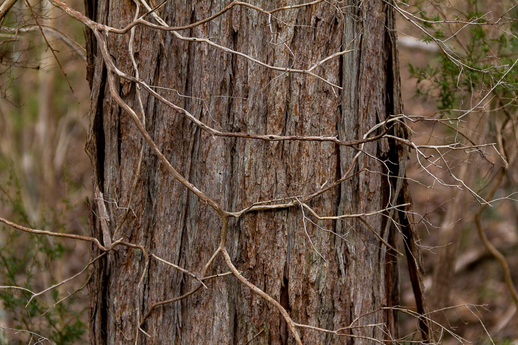
Beginning, the temperature was a brisk 3 °C and it was heavily overcast. The cold was bearable, but the bleak sky meant there would be no camera polariser action for the day. Heading off, I was cruising along until I reached Cooks Mill campground and noticed at least 30 school kids camped there. Mm… I thought to myself if I’d see them again. I should never have done this though, as now it’d turn out to be a certainty. Reaching Little River Track, I’m thinking its name could be abbreviated to ‘River Track’. Certainly it was damp in places.
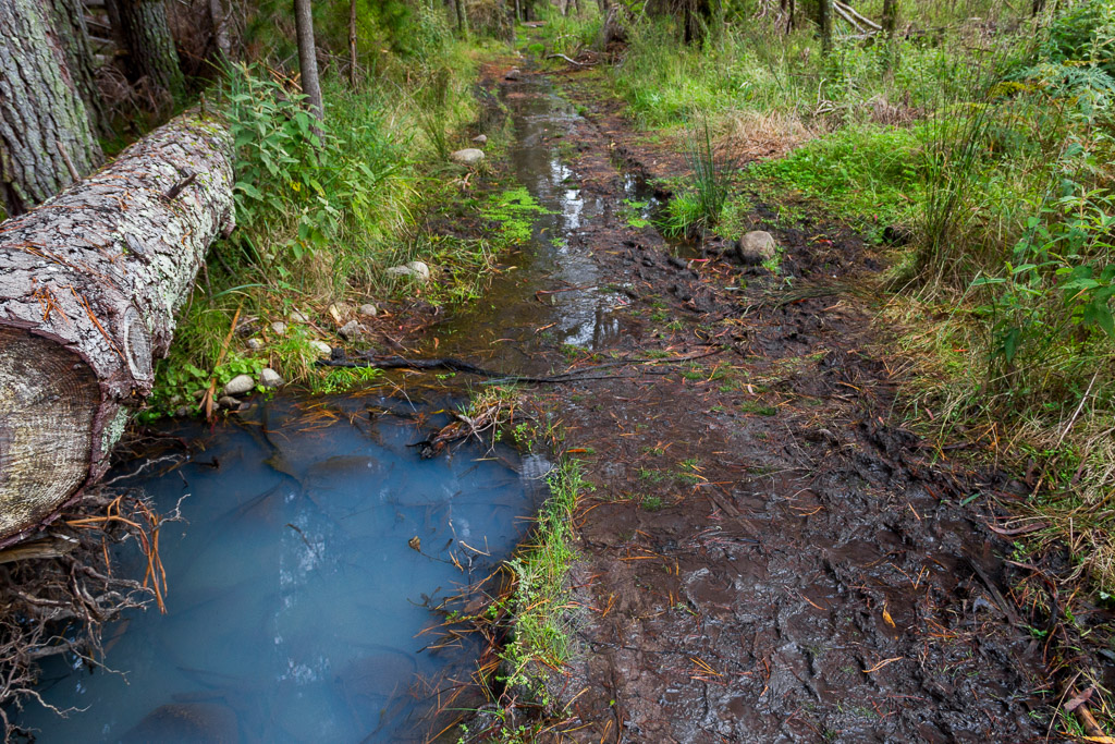
Little River Track
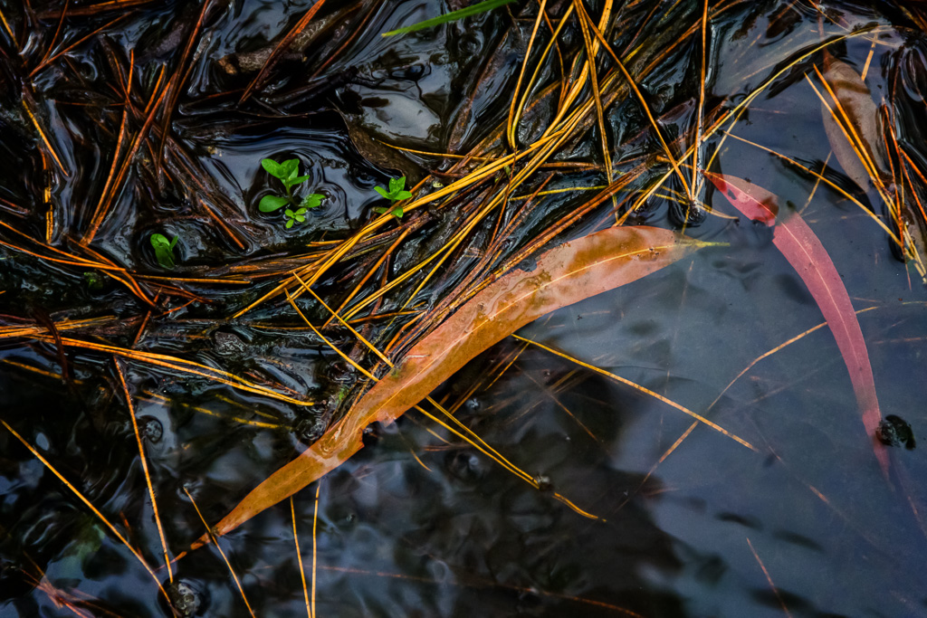
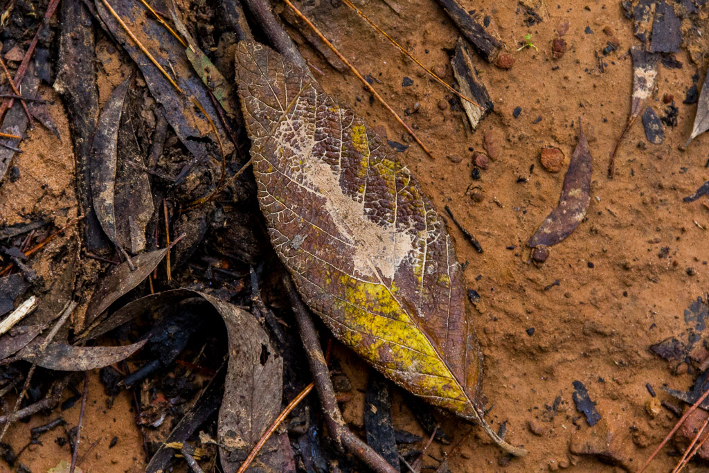
As I plodded through the water it did give me an opportunity to get some snaps of leaves in tannin darkened water, which I’ve decided is my trademark image. How good is this blogging business? As I get to write whatever I feel like, I can be the ‘leaf trademark specialist’ now. Then next week I could upgrade myself to the Great Southern Leaf Machine (GSLM).
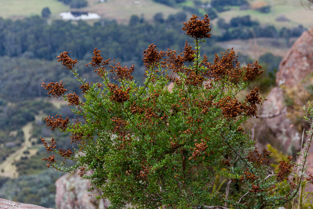
The grey sky would make landscape shots look pretty plain, so I opted for surrounding detail instead. There were a number of eye-popping, colourful fungi around, which proved photogenic.
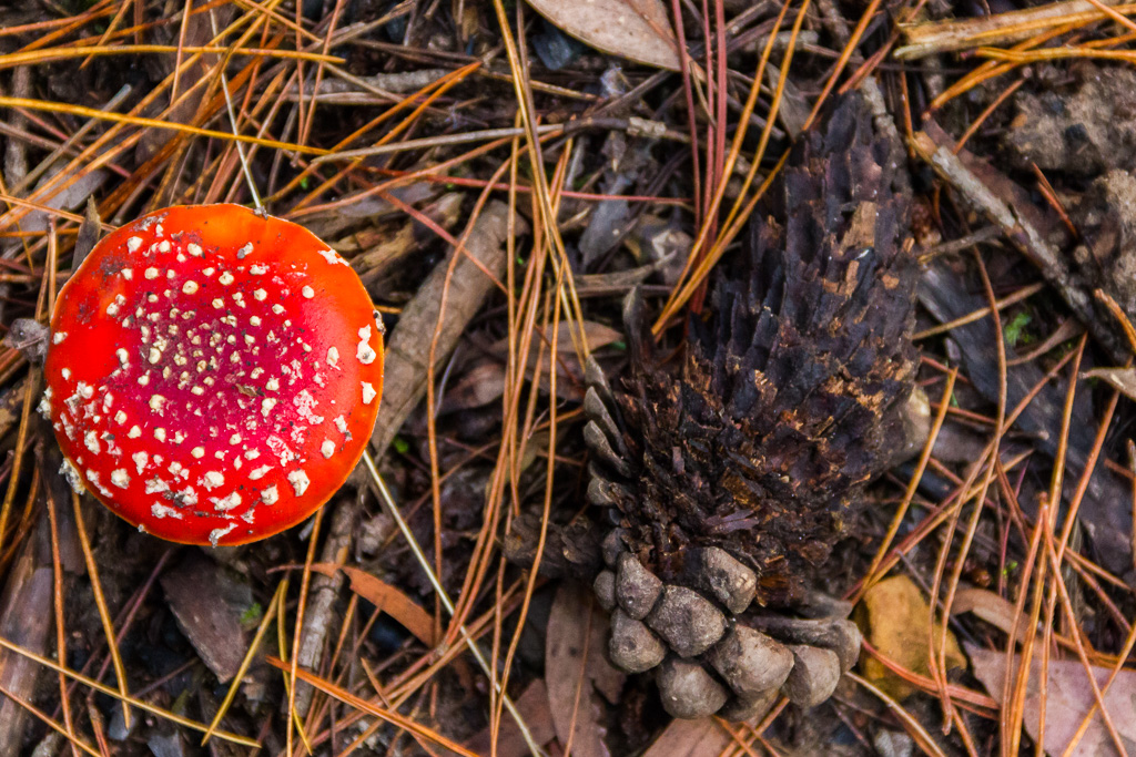
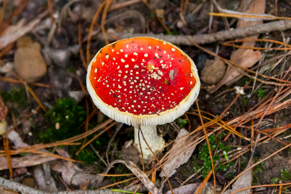
Go colourful or go home
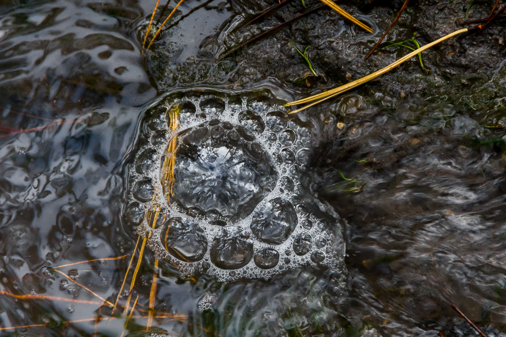
Even better in a stream (AKA track) I noticed a bubble forming in the water. What’s weird is if you zoom in on the main bubble you can see reflections of the surrounding trees and myself taking the picture. Luckily it’s not too detailed. Otherwise you’d see what I look like, which is problematic as I don’t actually exist.
It was thrill a minute on the Little River Track, as the leaves kept coming and I was struggling to contain myself, which meant I was already going way too slow for what was going to be quite a long day walk.
Suddenly though, during this freestyle leaf admiration I heard the voices of a thousand people approaching. Yep, it was the horde of kids I saw earlier, rampaging along.
I reached the intersection of Neds Gully Track, which was my intended route to the top of the ridge. I wasn’t sure what route the kids were going to take and I couldn’t even really see them. Their noise was getting louder though. It was a sound, similar to being high on life and too much helium. I continued to head up, hoping to stay ahead. This wasn’t the most relaxing method of peaceful bush walking though, especially as my top speed isn’t much faster than a Yowie moonwalking.
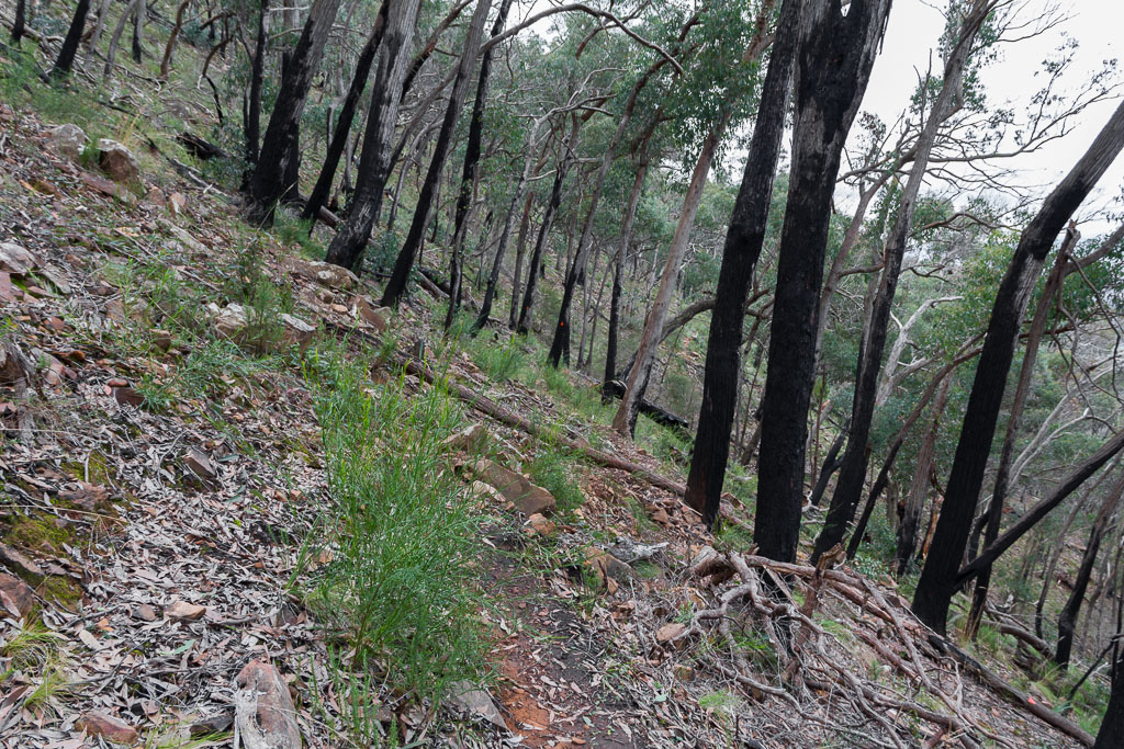
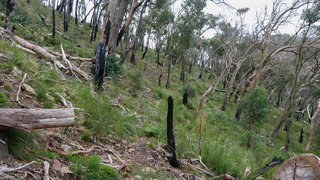
Neds Gully Track is a simple affair, with a gradual rise in an area which appears to have been spared the bushfires of a few years ago. I was liking it until I heard that roar of a thousand voices again. Oh no! They’re heading my way! Yes, the rampaging volume of youth was rapidly approaching, so I went for a plan of genius. I’d wait and let them pass.
Give it ten minutes or so whilst having a snack and they should be miles ahead by the time I got going again. Dropping the pack, I sat down to inhale a fistful of muesli bars, whilst the masses flew by, leaving a cloud of dust behind them.
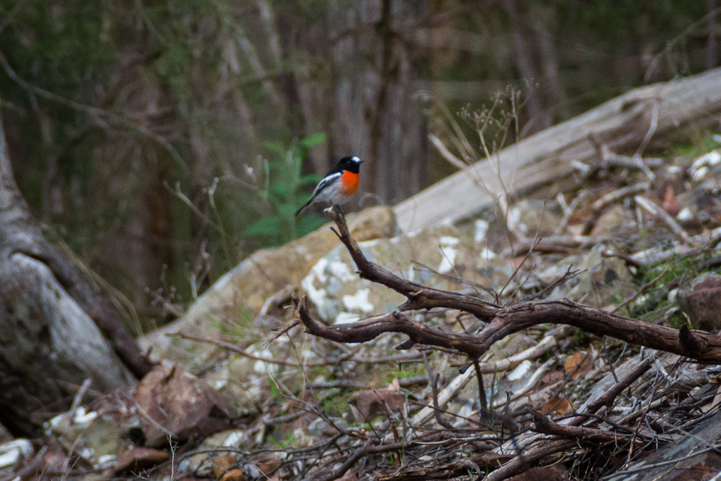
In between swallowing muesli bars whole, I took a few photos to pass the time. A Scarlet Robin appeared nearby and it was dying for a bigger zoom lens. By cracking out your portable electron microscope, you should be able to see him. (He’s in the middle of the photo standing on the stick. Yeah, he also has wings and is sort of orange looking).
Anyway, when I was packing up, my crowd avoidance plan started to unravel, as another group began to pass. They were spaced out though, so it took about 15 minutes before they all passed by and even then the stragglers kept stopping. I spent so long waiting for the corpses of the stragglers that by the time I climbed Neds Gully Track I was barely puffing, which would be a first when it comes to uphill walks. In the end they stopped at a spot called ‘Ten Fathom Ridge’ which sounded quite interesting, but don’t think for a minute I’d stop as well.
It was so busy there it was worse than the peak hour Sydenham train in Melbourne, especially when there’s no standing room and a bloke hops on with a widescreen TV above his head, but that’s a tragic story for another time when I’ve got a new prescription of Valium.
I opted to go a short distance further and climb up Neds Peak which is a 15 minute walk off the main track. I slipped into locomotive mode and chugged up the track. Making it to the top, I was greeted with, well, not much. I’m not sure who Ned was, but he mustn’t have been too popular as his peak is rather, um…crap? A bit harsh? Was Ned some fat bloke who was beaten by all the fitter blokes to the top of the mountain, so he got left with the off-cuts of hills to name? Who knows, but I’ll let you be the judge.
Neds Peak
There’s no view to speak of as it’s surrounded by trees. In fact I did a bit of walking around to see if I’d actually found the ‘peak’ and not accidently stumbled onto something else. Nope, this was it, so I drank some water and tried to look through trees at the view that was out there somewhere.
View from Neds Peak
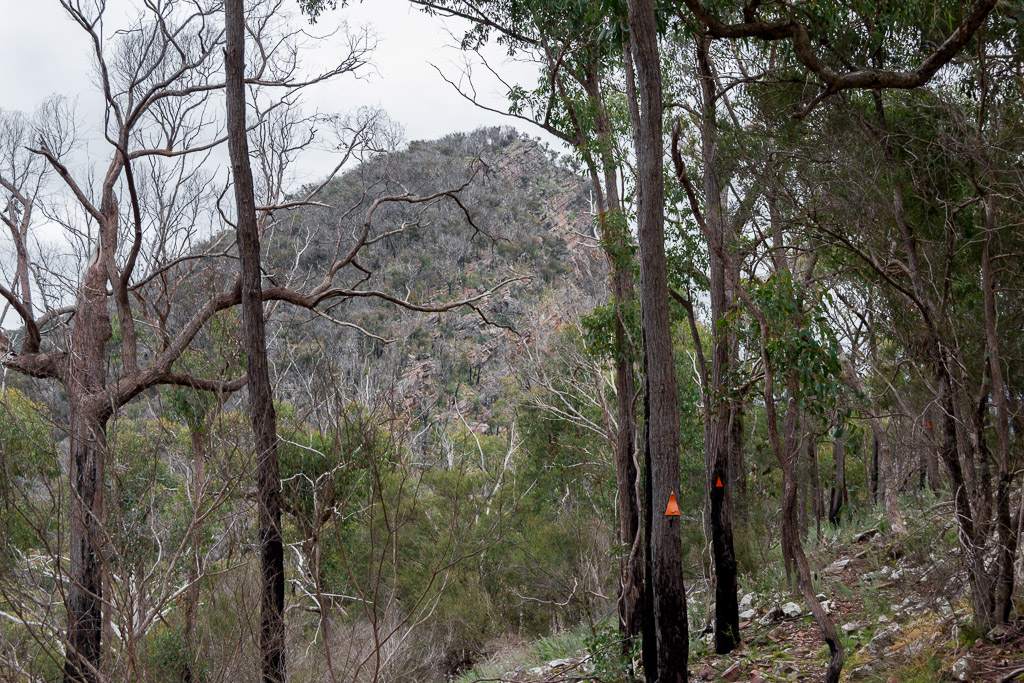
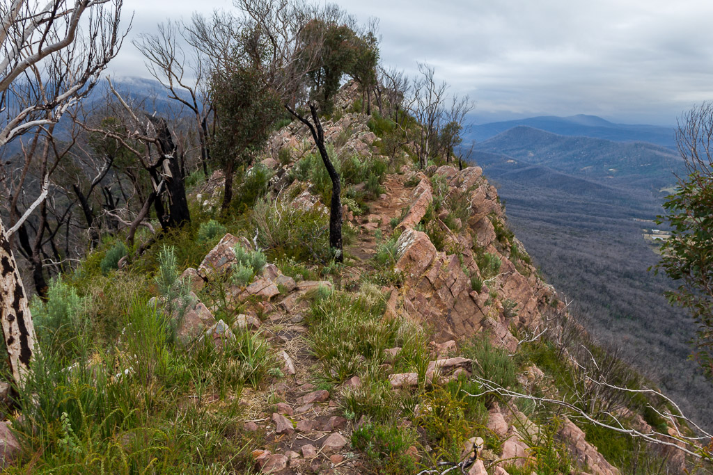
At least I could say I’d ‘bagged’ another peak, although it’s not something I’m going to tell anyone about. Other than in here of course. So, I headed down and found the track to my next target for the day. Little Cathedral. The route was a little rocky and uneven and it’s not surprising, seeing how it’s cut out of an enormous slope. I didn’t want to fall over here, as I reckon I’d roll for a few hundred metres before stopping.
Track to Little Cathedral. Yes, the camera is level.
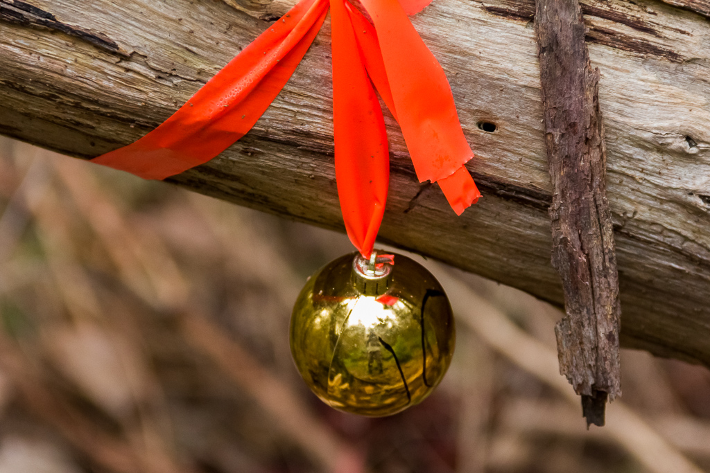
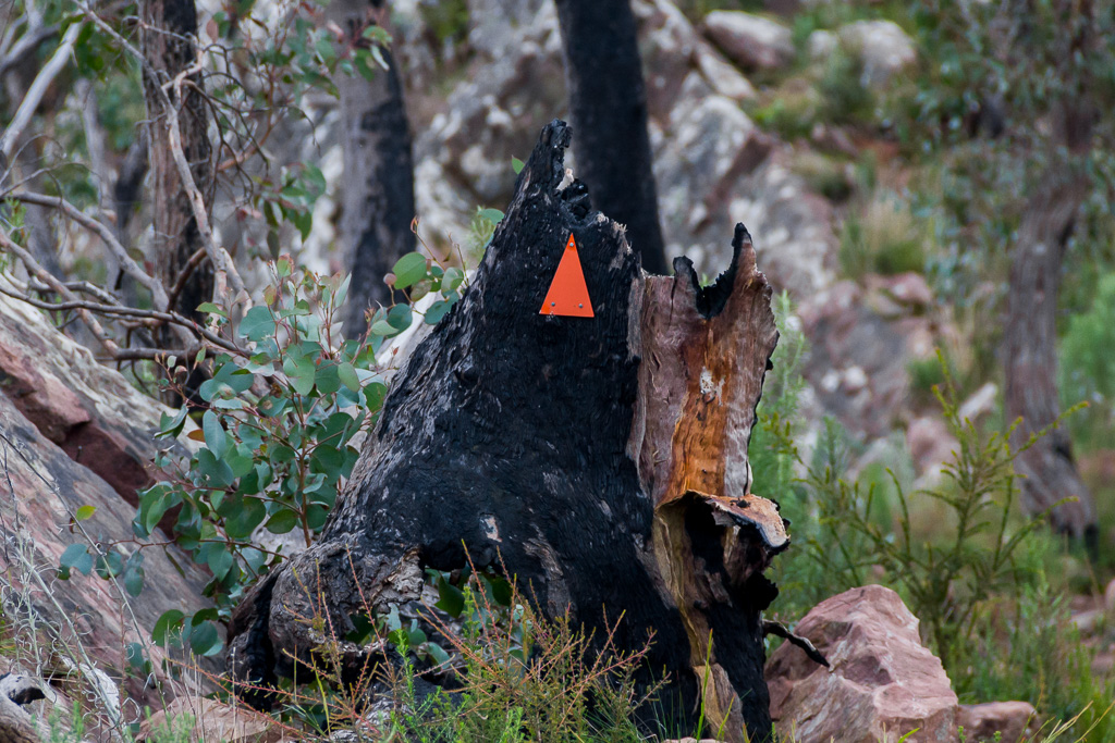
There are plenty of new orange triangles on the trees throughout the park. I assume they’ve replaced all the ones burnt in the fires. In fact, I’ve never seen so many triangles, which made navigating a breeze and a map almost worthless. In places there were ribbons on trees as well. That can be common, but I don’t think I’ve ever seen Christmas decorations as well.
Again, if you look closely you can see the reflection of me taking the photo, but remember I don’t exist, so there’s no point looking too hard. Actually, wouldn’t it be cool if I got home and when processing the photo, saw a reflection of someone else behind me? Just as I was taking the photo? You know, someone holding a meat cleaver or something?
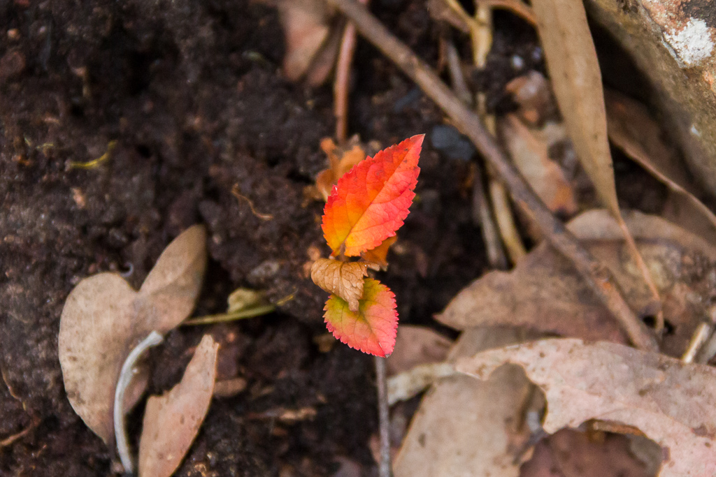
Oh yeah, during all this I wasn’t neglecting the leaves along the way. I was still finding the odd one here and there to get photos. This re-affirmed my standing as the Leaf Observation Specialist for Eternal Recording (LOSER) Hang on, can you run that acronym by me again?
The track continued on the enormous slope, which was a little hard on the knees and it’s also a little disappointing I’m doing this sort of walking now, instead of 20 years ago. It would have been so much easier back then when I was lean and mean, instead of currently being fat and friendly.
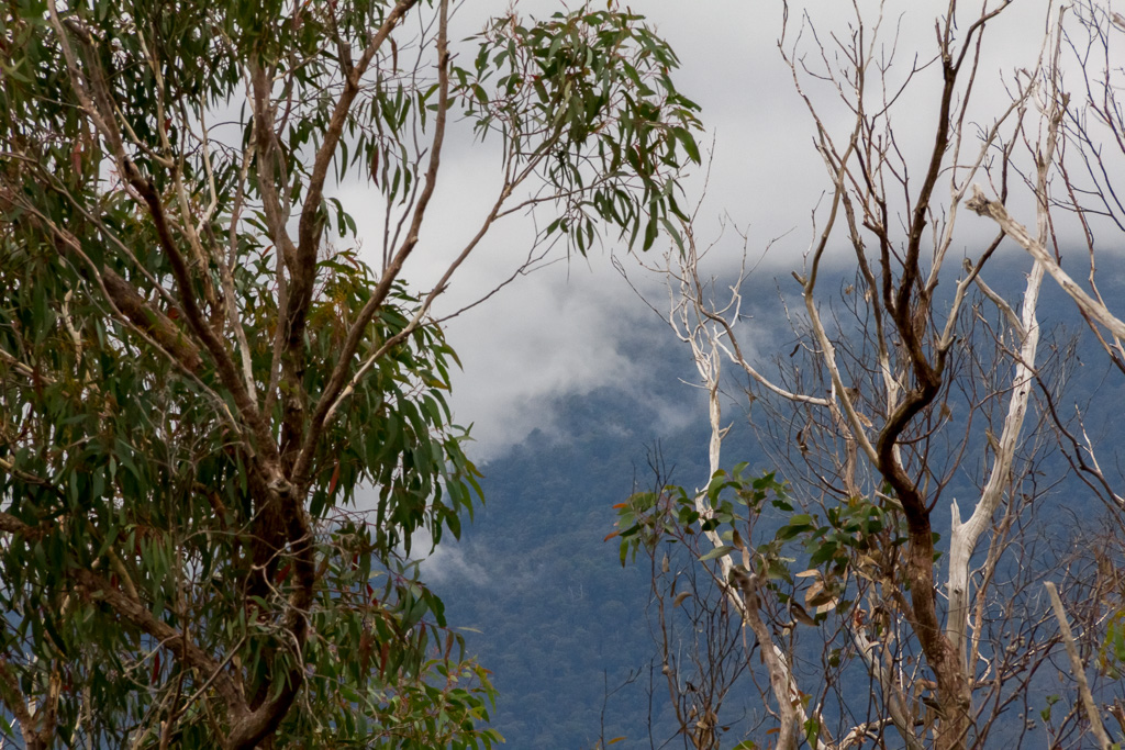
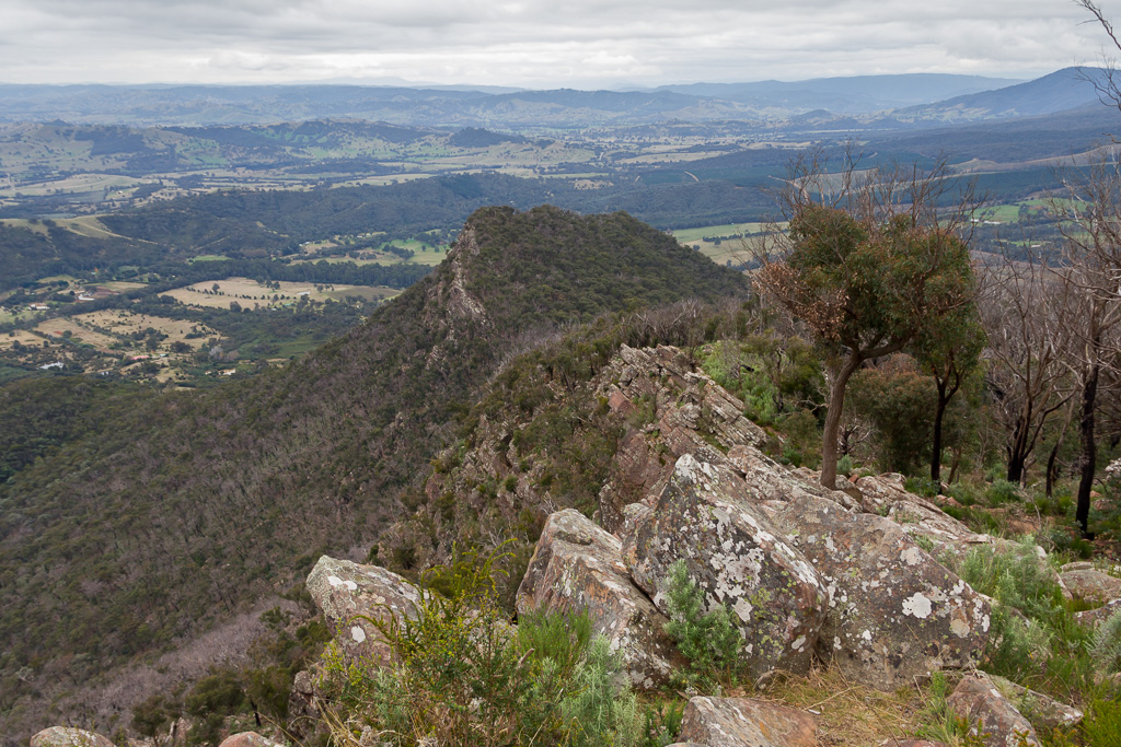
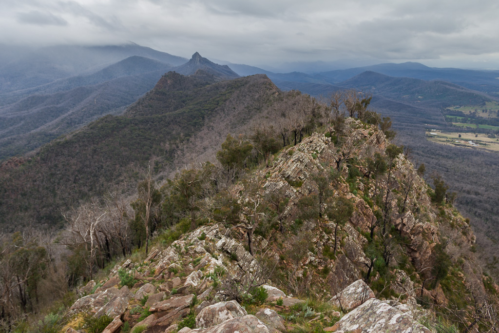
I eventually reached an intersection with a sign telling me Little Cathedral was another 20 minutes away. I made my way to the peak which is at the most northern end of the park. It was a lovely view down to the valley below, but I’m so addicted to the polariser I was cursing the bleak skies. I think I’m starting to suffer polariser withdrawals, which is very similar to heroin addiction I believe.
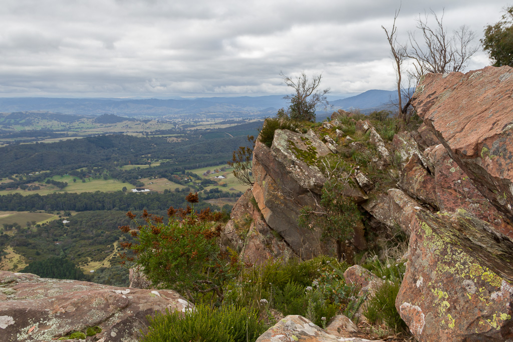
Atop Little Cathedral
Views from Little Cathedral
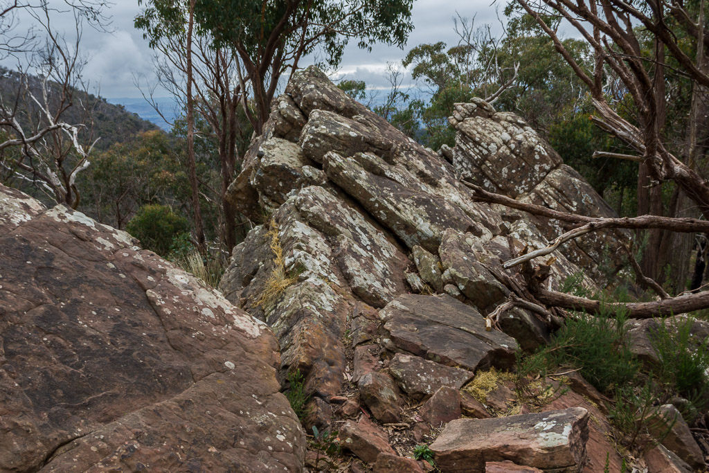
Some of rocks near the edge had an, ‘about to fall’ look about them, especially this jumble below. They stood haphazardly, with plenty of daylight between them that reached out hundreds of feet to the valley below. Keeping well clear was a priority, as any blog called ‘HikingFiasco’ is fraught with danger when it comes to these sorts of things.
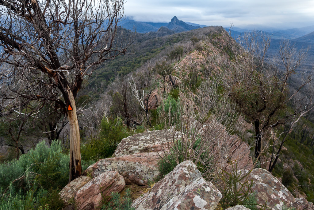
I spent quite some time at Little Cathedral. I didn’t want to rush things, as I observed the next part of the walk and frankly, it looked horrible. A short distance away was a hillside, which looked brutally steep. I could more or less see the intended route, as the brand new orange track markers stood out on the trees. It appeared they were going straight up to what I assumed was Cathedral North. With some trepidation, I finally decided to face the pain and headed off.
Hang on. Do I have to walk up the hill over there?
Well, as could be expected it sucked. I’d slipped into locomotive mode again. This time though, the stoker was on his lunch break, as I rapidly began to run out of puff. It was real, inch at a time type of stuff. There was an occasional view here and there, but I was surprised to see the photos turned out a bit blurry and definitely not blog worthy. I guess it’s because my heart had actually popped out of my chest. It kept beating, but as it was a foot in front of me, the vibration went right through my body causing my hands to shake.
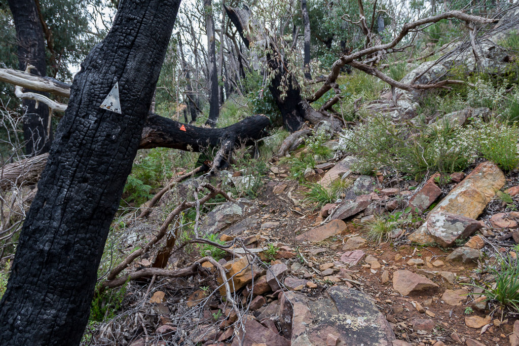
On the way, there was an abundance of new triangles nailed to trees, clearly marking the track. This was handy, as I couldn’t see properly from all the tears as I blubbered upwards.
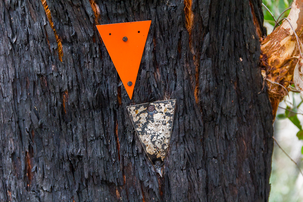
Old and new
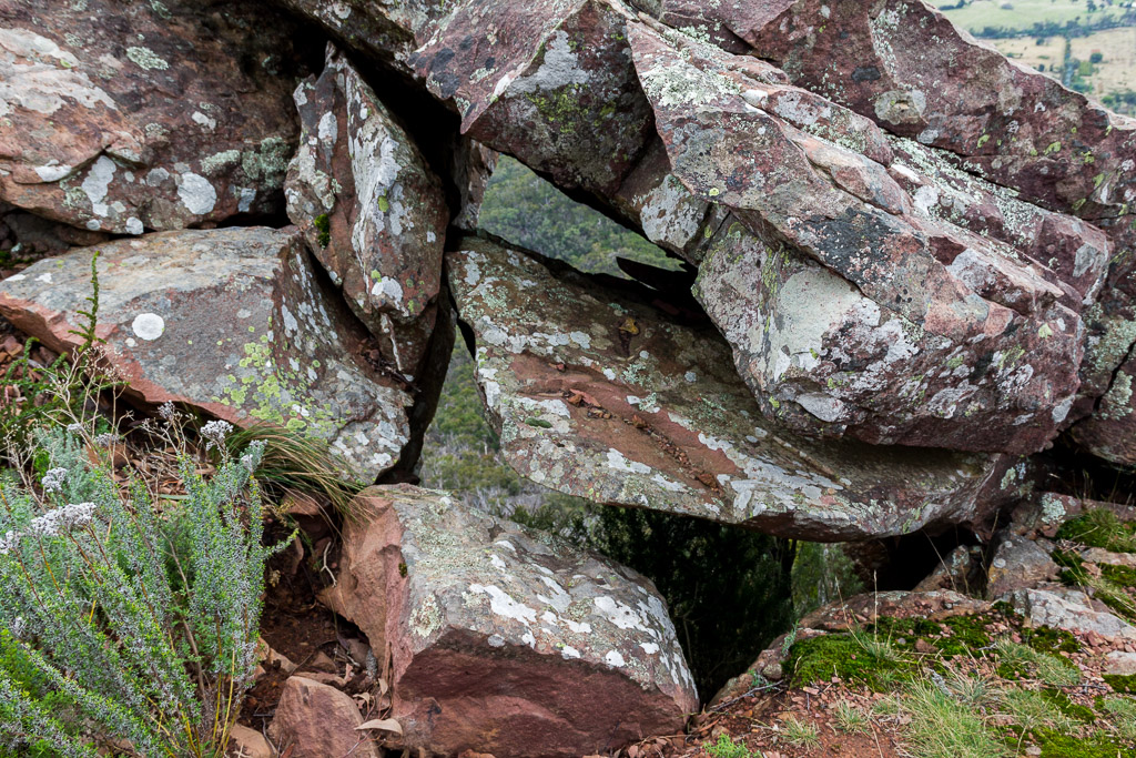
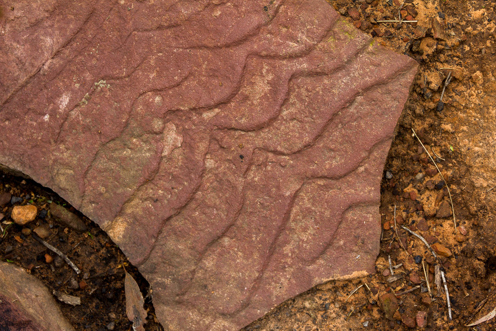
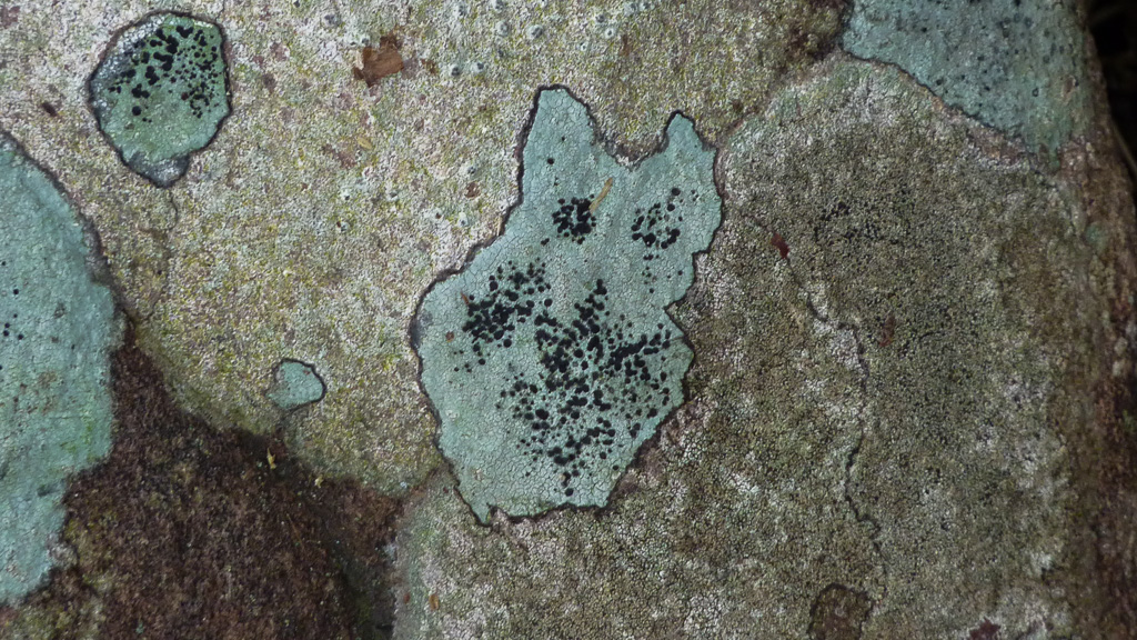
Okay, grab your cup of tea, adjust your cravat and sit back for a bit of history. The range is about 400 million years old, which makes it marginally older than my dad. Anyway, apparently it was originally a seabed. This makes sense when I started seeing rocks like the one below. It reminded me of some rocks I saw at Kings Canyon in the Northern Territory, which also have the same seabed look about them. Okay, I’m not a geologist so don’t start getting technical on me, but the rocks certainly looked like sand on a beach.
I finally made it to the top and dumped the pack, so I could sit for a while and wait for my heart to return to my chest cavity. I was sweating a lot, but upon stopping I quickly felt the chill in the air, as it was starting to get a little late in the day now.
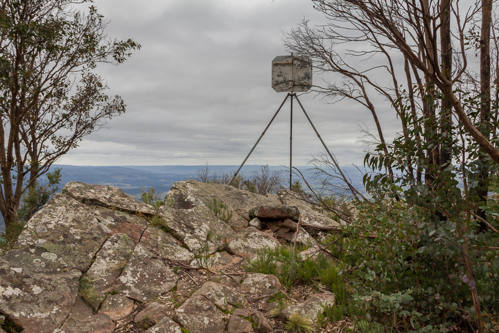
Cathedral North isn’t a classic looking point, but I was pretty sure I was on top of it. This was a bit of a hint.
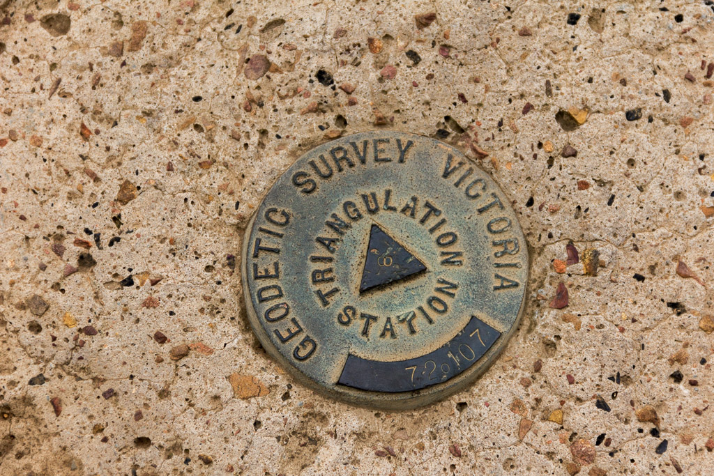
Oh, the trig point gave it away also.
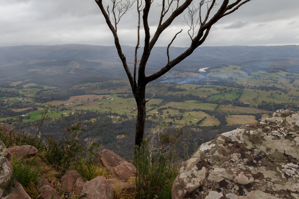
Little Cathedral from Cathedral North
At this stage I was starting to wonder how much daylight was left, as it’s traditional for me to be caught out by the shorter winter day. Yeah, I know it’s not winter right now, but you get the idea. My walking speed had been painfully slow. The uneven track and rocks constantly required a test of balance to negotiate, so concentrating on not falling slowed me even more. I needed to get a move on though, as I didn’t want to get caught out on the ridge-line as it got dark.
It stands to reason then. The one moment I tried to speed up, I came to grief. It wasn’t a classic humdinger tumble, like my usual style, but still, it was quite painful. Whilst negotiating another bloody rock, my left leg slipped down which caused me to fall forwards. My right leg buckled until my knee drove into a rock, which wasn’t the softest. Then my hands went from a rollercoaster mode of swinging around trying to balance myself, before grabbing hold of some sort of vegetation.
Well, it wasn’t a tree I grabbed, but whatever it was gave me some terrific splinters. Well, in the moment, it took my mind off the knee pain, but what I didn’t know was all the rock propelling had somehow embedded another stack of splinters into my knee.
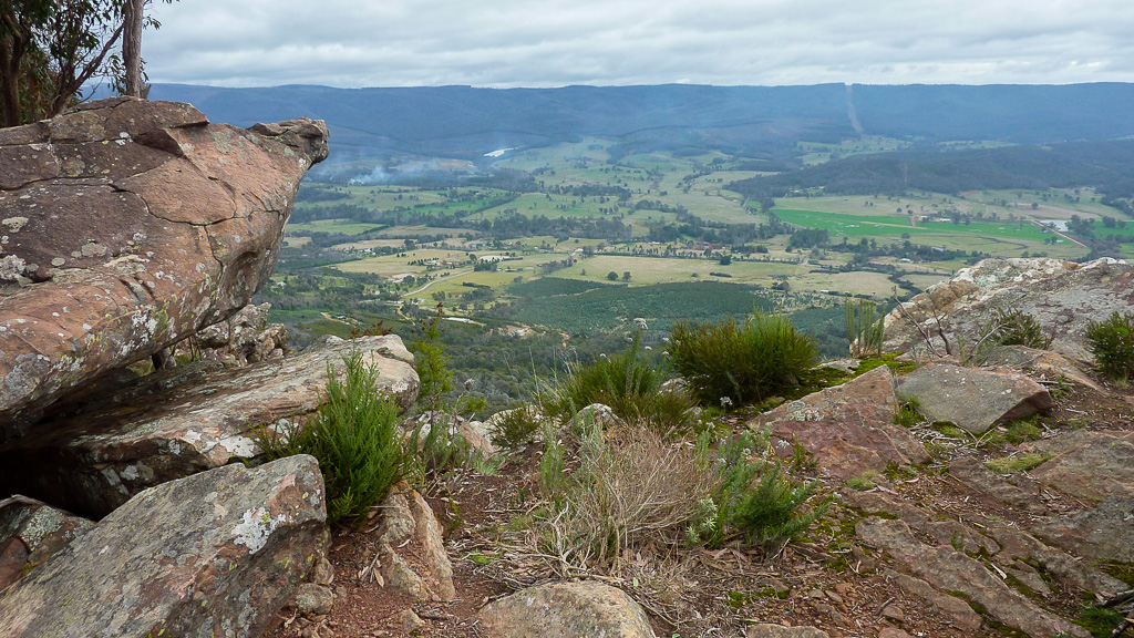
Mentally, I was officially over this walk and pondered my walk notes for the day, which said, “…the trail…becomes very rocky in places…” Actually, I’m not sure what areas weren’t rocky, as I hobbled to the next hill called ‘The Cathedral’ which was the last peak for the day.
View from the Cathedral
There was no marking I could see to say I’d reached the top of The Cathedral. I just went by what my GPS was telling me and there didn’t appear to be anything higher near me. Will that do? I was confident though I was at the right spot. It stands at 840 metres, which isn’t exactly K2, but it’ll do for the time being. I guess the three ‘peaks’ are all close enough to get variations of ‘cathedral’.
I was done with the peaks for the day. Now it was time to get the hell out of the place, as it light was starting to dim. My next target was campground called the Farmyard. It was familiar territory, as I’d been there a few weeks earlier and I knew the terrain would be more forgiving. If it got dark there, then it wouldn’t be a problem, as the path down the mountain is quite easy to follow with a headlamp on.
I would miss one more peak I wanted to climb though, which was the North Jawbone, but one can’t have it all as I’d done enough for one day. So, I continued to stumble along a stretch of ridgeline that was ‘quite rocky in places’.
During this rock stumbling, I did come across one more highlight for the day. Some moss that was in the shape of a cat. Now I have a photo of Kat Moss. You better find this funny, as it’s taken me about 10 minutes to come up with that joke.
Kat Moss
Finally the path became a little more civilised and I was thankful I could speed up a little. There were still some great views across the ridge towards Sugarloaf Peak and it’s a pity there wasn’t a bit more light to enjoy it, but I was feeling sore though and I’d lost my Cathedrals mojo for the day.
Light had really dimmed when I came across a sign, informing me I’d reached the path to the Jawbone carpark. Now whilst descending this track, it officially became pitch black. The headlamp was now de rigueur.
As a final piece of goodwill it decided to rain quite heavily. So, I put my camera away and trotted along keeping an eye out for the orange triangles on the trees. As a bonus, luckily they’re reflective. In the dark, one last item of interest was a rail. Placed across a rock, I assume it’s for grabbing hold of as one walks over it. I did this and found it wobbled so much, I almost fell over. I’m not sure if the rail was installed by Candid Camera, but it did its job I guess.
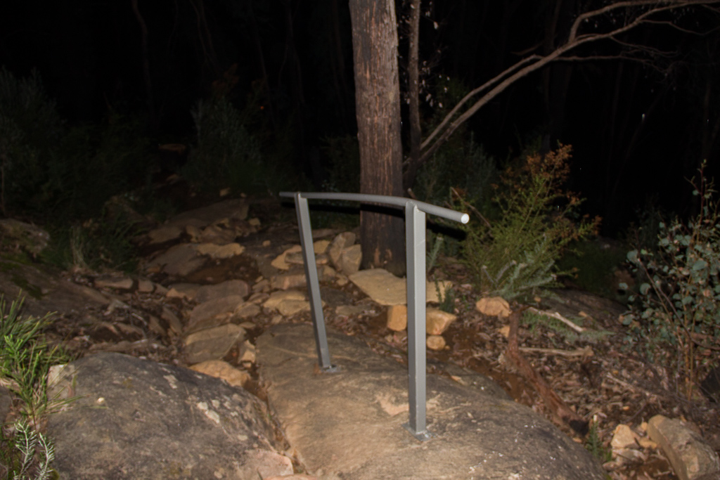
Grab the rail at your peril
It was another half hour or so and suddenly I was back at the car. I can say I was quite excited to see it, as the rain was bucketing down and my knees were reaching seizure mode.
So, the end of a solid day. Okay, I did miss the North Jawbone, but one can’t do them all. It’s just a matter of living with the guilt of not doing them all! It was time to head home and do a bit of splinter removal which is always a hoot, plus the necessity of multiple anti-inflammatory drugs.
NB – 2015: Considering this post a few years later, I’ve now realised there has been some renaming of the peaks (I think). The Cathedral (840 metres) is now named Cathedral Peak. What about Cathedral North (814 metres)? No idea, as it appears to have been removed from the Parks Vic maps. I assume it hasn’t been taken away and stored in a warehouse somewhere. Maybe I need to redo this walk to find out? Here’s a link to the Parks Victoria map which hopefully make more sense than what I’ve just written.
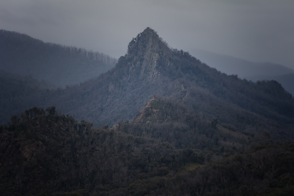
Cathedral Range

Even with a few clouds, the views off Little Cathedral are really nice. I've been in the lowlands too long (not tough when the closest 'peaks' are 720'/220m) and need a little altitude for the attitude. As always, a great story.
Thanks for the comment Jim. I feel for you if 220 metres is all you have to play with nearby! I've always been a bit of a coastal bloke, but lately the hills are the place to be, even though my joints are telling me otherwise 🙂
… and since the fire the cursed spiky Cathedral wattle has grown lots. A thorny little beast, it is best avoided.
I climbed South Jawbones on Friday morning for a non-view. Nice walk though. The ripple rock is indeed from the time when the range was sand under the ocean. Amazing really.
Thanks for visiting and the comments Ian! We just missed each other as I did this walk last Wednesday, at least you avoided the midweek crowds! Yeah, thanks for giving me the name of that thorny bush I seemed to keep running into 🙂
Have enjoyed your Catherdral posts and your Cat Moss joke. Great detail photos. Looking forward to more hiking fiascoes!
Thanks for the comment WV. Glad you like the joke as I put a bit of work into that one 🙂
haha, love this comment "my knees were reaching seizure mode". That descent does the same for me everytime.
Love your posts, keep it up!
Thanks for the comment A! Oh yeah, there's nothing like a solid descent to test out those dodgy knees 🙂
Um, Greg? Now I have to save up for a trip to Australia. Absolutely amazing terrain… Excellent photo and blog!
Thanks for visiting and the nice comment Jobiwan! I guess I take our terrain for granted having walked around it for so long! I like the look of your pics in Vermont as well. Everything seems so green!