Yeah, okay, I know what you’re thinking. “What sort of hiking blog has a write up on a bridge?” Well, this one I’m afraid. There’s more to it though. The plan was to head out on a Saturday afternoon for a walk at Werribee Gorge. I picked out a circuit from my trusty Glenn Tempest book, ‘Daywalks Around Melbourne’. The stroll was about 10 km and I felt comfortable leaving in the afternoon, as Werribee Gorge isn’t too far from my place.
There was one slight problem though. I can’t say I’d examined the map too well regarding the start of the walk. Do you know where this is going? As we set out, I opened the book on the Werribee Gorge page and gave it to Ben, whilst saying, “Take me there. Follow those instructions.” I vaguely waved over the page as we took off.
We made good time and turned off at Bacchus Marsh, which is the closest town to the gorge. Ben was nailing the instructions with skill. “Right at the roundabout. Right at this road, right again, dirt road coming up and first right over the railway line” Hey? How easy’s this?
As I was powering along a dirt road, I began to think why there were no signs helping me out. Where are all of the, ‘This way to Werribee Gorge’ signs? Well, I guess I should have wondered a little harder, as without fail there had to be something wrong. It wasn’t long before we saw a turn off to a small car park which Ben told me stop at. I was aimlessly looking out the window at the first Parks sign I’d seen and it said, ‘Falcons Lookout’. It was at this point Ben calmly said, “Hey, this is the spot for Falcons Lookout.” Only then did I realise what had happened.
Falcons Lookout was a separate walk within Werribee Gorge, but absolutely not the spot I wanted to be in. I needed to be quite a few kilometres away in another car park. What had gone wrong? I grabbed the book and realised when we set out, I’d told him to give me directions, which were on the page I pointed out. Well, the page I showed to him was page 59, when in fact the walk I wanted was on page 61. Bloody hell. Okay, attention to detail was lacking a little.
What do we do now? The answer is go to the correct location! In distance terms the car park we needed was not far away, but there was a problem. It was on the other side of the gorge, which meant the roads went on a convoluted route all over the place before we found the right spot.
Upon arrival, I looked at my watch and it was after 3 pm. Dark clouds were about and after a bit of hesitation we decided to abandon the walk. Why? Well, I didn’t want to be rushing on the track, as I had a roast to cook. If we’d found the correct car park at the start, we could have done the walk and still had time to get home and put the roast on. The plan was to come back the next day and try again. Definitely a 100% balls up.
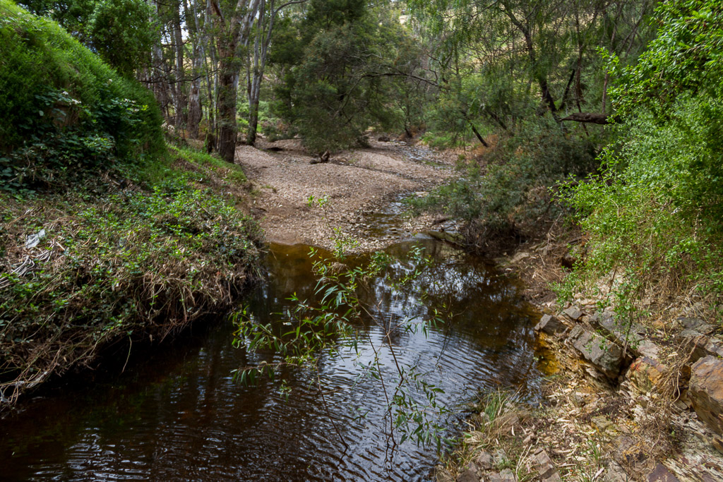
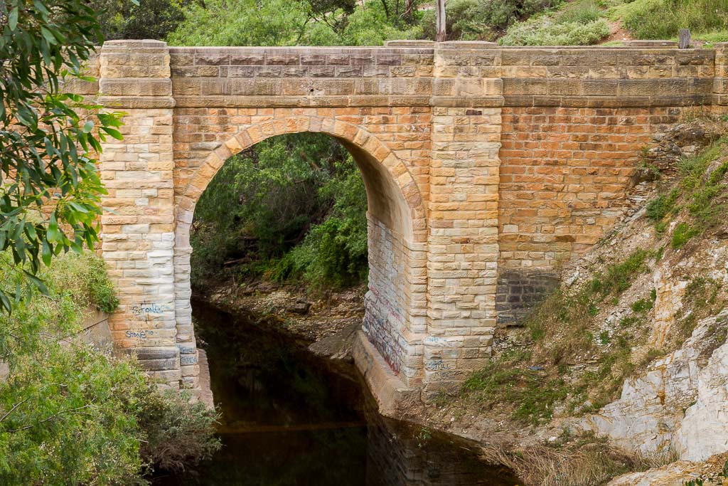
Djerriwarrh Creek, Bacchus Marsh
Oh well, it stands to reason it didn’t go to plan, as most of my outings have some sort of stuff up. The drive back consisted of standard highway travel, but I did have something left up my sleeve. I’d always noticed an old bridge off the Western Highway, on which we were travelling. It seemed to be have been left behind in time and was probably originally on the road before it was upgraded and now bypassed.
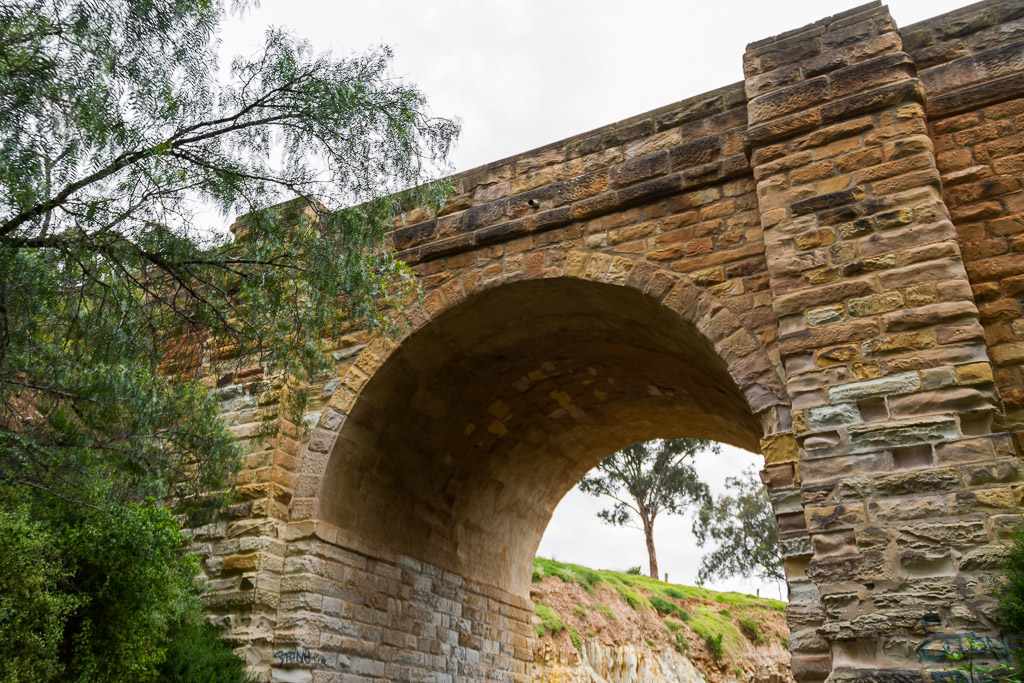
Then again, maybe on the original road back in 1900, as it’s about 2 metres wide and it really does have a ‘ye olde’ look about it. Whilst beetling along the Western Highway, I think the whole world has glanced at it bridge and thought, “That looks old. Keep the foot down.” Well, today was different. I was stopping to have a look.
I turned off at a track, which I thought would take me to the bridge, but was incorrect and I was actually in the drive-way of ‘Gavs’ place. We had no interest in saying hello to Gav, so I did a u-turn and headed back out on the highway and eventually found the right spot. Yep, found it.
I wish I had read the blurb on the National Trust Register, as I found out the following when I got back.
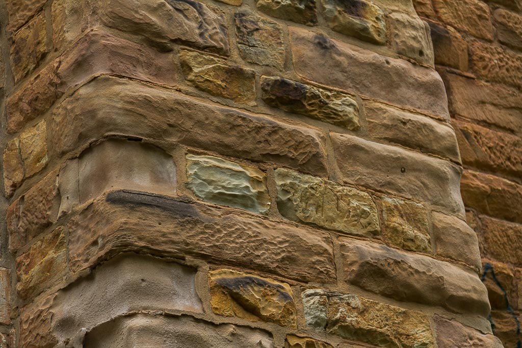
“…Sandstone bridge constructed over the Djerriwarrh Creek in 1858-1859…single arched structure has piers framing the opening and substantial abutments constructed in a plinth, all in rusticated masonry. There is a string course at pavement level and the piers elaborate the balustrade. Djerriwarrh Creek Bridge, Western Highway, Bacchus Marsh, is an early surviving stone bridge distinctive for its single arched design and construction in sandstone…“
How’s that then? You came here for hiking information, but instead you’re now having a history lesson. When I’ve run out of ideas in this infernal blog, I could just resort to history lectures instead. What I definitely know now, is there’s a bloody old bridge in Bacchus Marsh. I’m thinking 1858 is pretty old and it’s a lot older than I imagined.
Check out the 1858 sandstone
I didn’t really take in the ‘plinth in rusticated masonry’ whilst looking at it, but Ben thinks I’m the one with the substantial abutment. Tough world this one.
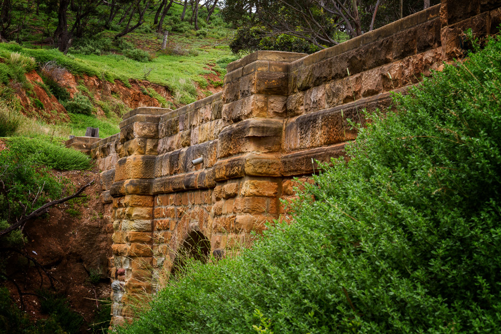
We climbed down to have a closer look and found the locals don’t seem to be happy with the piers elaborating the balustrade. So unhappy, they’ve decided to spray paint all over it. I couldn’t get the ‘old world’ feel, whilst staring at blue spray paint. I did consider it would be quite entertaining finding the people who did the spray painting, and then introducing the front of their face to the unique sandstone. Preferably at high speed.
Oh well. We had a look around and admired the debris of a small creek next to a major highway. A lot of litter, consisting of fast food wrappers, beer bottles and whatever else that can be hurled out of a car at speed. I mean, why would one take rubbish home when it can be thrown at 100 kph into the creek? Quite logical I would have thought. We both decided to get a little zany and try to navigate the centre of the bridge above the water on a small ledge. It reminded me of something from ‘Tomb Raider’.
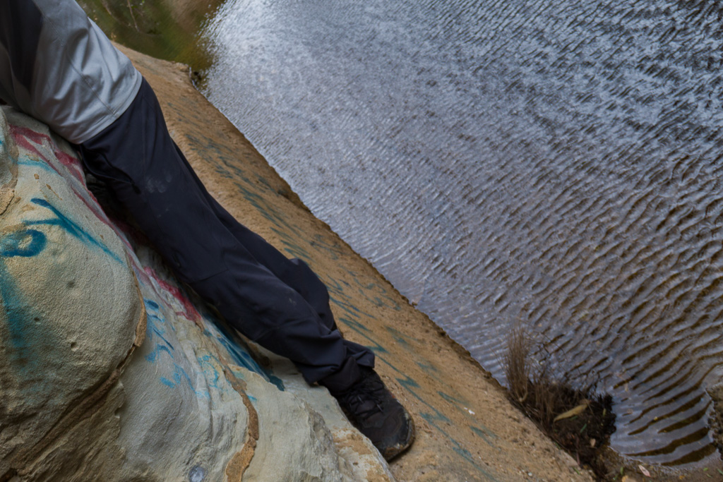
Working the ledge
We continue to peruse the bridge, but there’s only so much observing to do, so it came time to head home. Remember, I had to put the roast on. I did notice some weird behaviour before leaving though.
A 4WD drove onto the bridge and then proceeded down a heavily rutted track to the edge of the creek. A bloke hopped out for about 3.2 seconds and then got back in, before driving all the way back up and then continued onto the highway. I reckon he spent 20 minutes trying to negotiate the dirt track, when he could have done what we did. Park the car and walk about 50 metres. I guess 50 metres doesn’t have to be walked, if one can drive though can it? Silly me. Then again he may have been about to dump a body, but upon seeing us, decided to leave.
Lastly, there’s a spot on top of the bridge where a plaque had obviously sat. Well, no more. It had successfully being pried off and either chucked into bushes or taken home as a souvenir. So there you go. I bet you didn’t expect to read and get a quick history lesson about the Djerriwarrh Creek Bridge, Bacchus Marsh that was built in 1868. History has to end somewhere though, otherwise you could repeat it. Whatever that saying is. It’s a lot easier to remember if you’re not hungry and we had to get going. Cooking was required. Oh yeah, hopefully the next walk will be planned a little better. I reckon the total distance walked on this ‘hike’ was about 250 metres. How easy is this hiking business…?


Great blog with brilliant pics.Love it.
Thanks for visiting and the nice comment Runa!
I know this comment is a bit late given that your visit was back in December but did you realise how close you were to some other good walks? The turnoff to the Long Forest Nature Conservation Reserve is back about 350 metres where there are several good walks which take in both the Djerriwarrh Creek and the Coimadai Creek. Glenn Tempest's book shows one at Walk 27 but a better book (in my view) for this area (and Werribee Gorge and Lerderderg Gorge walks) is Jack's Track Notes by Jack Myers (the road you take to go to the Werribee Gorge Circuit Walk is called Myers Road and is named after Jack, a Bacchus Marsh resident who walked these areas his whole life). Sorry to prattle on a bit. Love the blog and your quirky writing.
Thanks for dropping by Jando! Thanks for the tips about walks in this area. I've always been fond of the Djerriwarrh Creek bridge since I was a kid when we used to drive past at 100 km/h 🙂 I think on this trip was the first time in my life I'd actually stopped to have a proper look at it!
Jack's Tracks Notes? Never heard of him which is the beauty of this blogging stuff. You've given me something to check out! Thanks for the local info which is always handy to have which means a re-visit might be coming up.
Prattling on? I think you kept it nice and concise! Just check out some of my long winded replies recently. Thanks also for the kind words about my blog 🙂
Hi nice work & pictures, I have been trying to work out how to get to this bridge. Would you mind giving me some instructions on how to get there, Leaving from Melbourne do I go past Bacchus Marsh? Thank you!!
Hi. It used to be easier, as it was next to the freeway, but the freeway has been re-routed, so it's a bit tricker to explain!
I'm sure there's a slightly easier way, but the one I know now with the new road is this. From Melbourne, follow the Western Freeway and before the Bacchus Marsh exit, take the exit to Hopetoun Park Road. Turn right and follow for about a kilometre, until reaching a major intersection with Brooklyn Road. Turn right onto Brooklyn Road. This is the old highway. Continue for about another kilometre or so and keep your eye out, as the Djerriwarrh Bridge is on the left. The main road passes over Djerriwarrh Creek, so if you pass by the creek you've gone too far! The old bridge is fairly easy to see, as it's close to the main road. I know these directions sound confusing, but if you look at Google Maps the names will hopefully make sense! I was surprised though, the Google Maps only show the new section of Western Highway as an overlay, when it's actually been up and running for well over a year now.
If you have any problems, just send me an email and I can give you some screenshots to help you out 🙂
Thanks for dropping by!
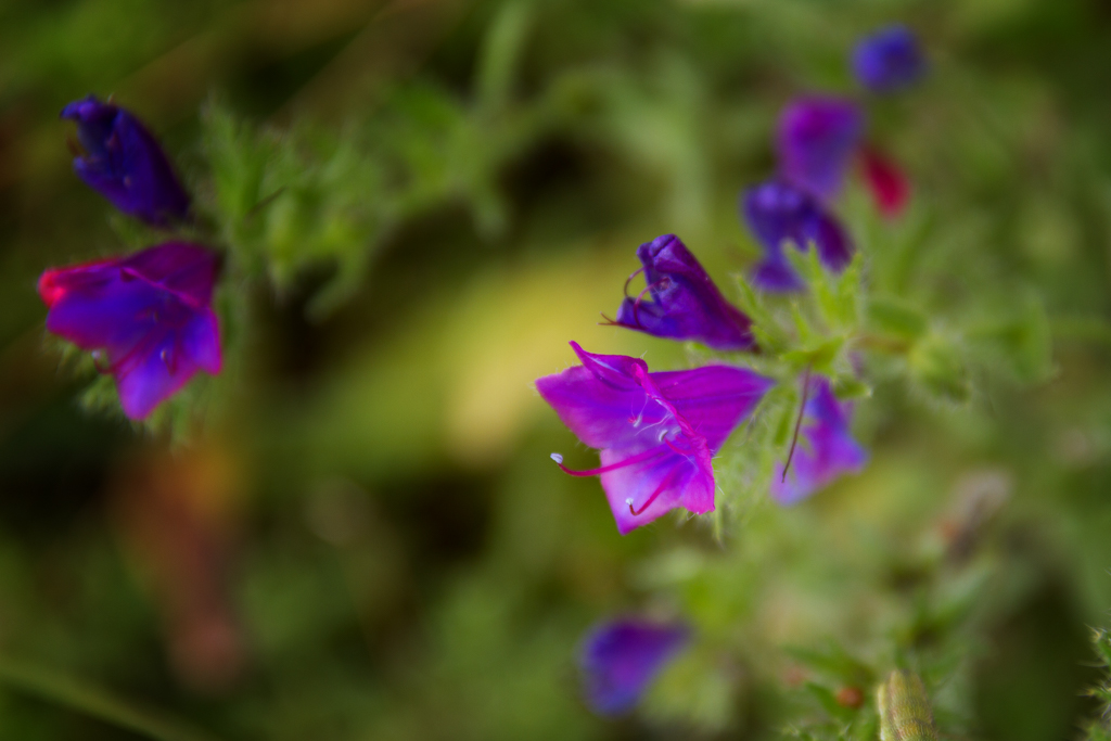
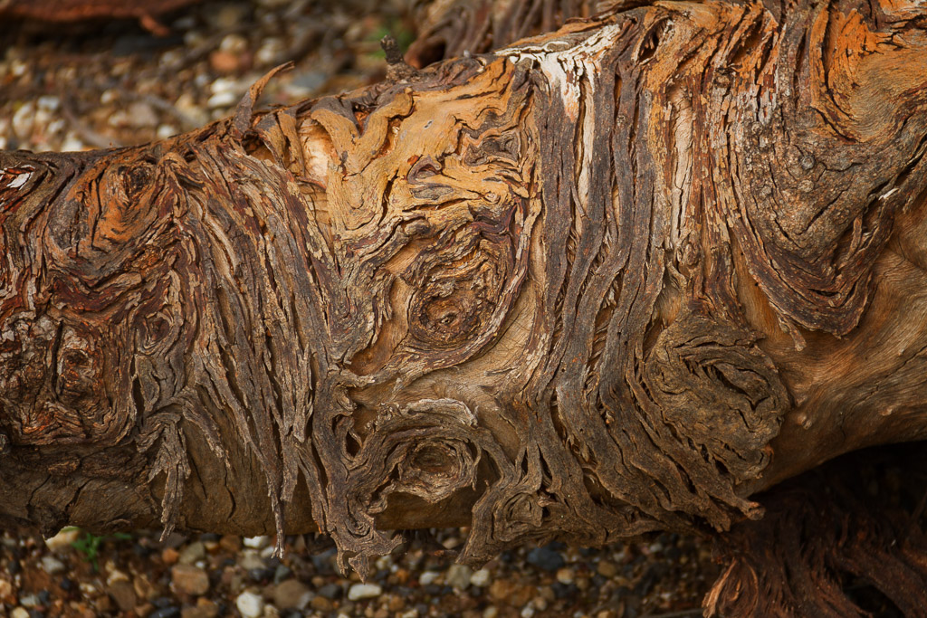
That header picture (looking through the arch of the bridge) is gorgeous. Also the purple flowers and bark swirly pattern are nice and artsy. Who doesn’t love a nice old bridge? 🙂
I love this bridge! I think I showed it as best as I could though. There’s a ton of rubbish around it! Someone sent me an email once about taking wedding photos there, but when they checked it out, they said the place was stuffed 🙂 Reminds me, I was meant to go back there for another look, as the highway next to it has been re-routed. It might be better. Or not 🙂